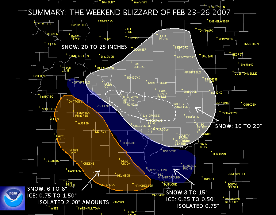
Public impacts over the weekend:
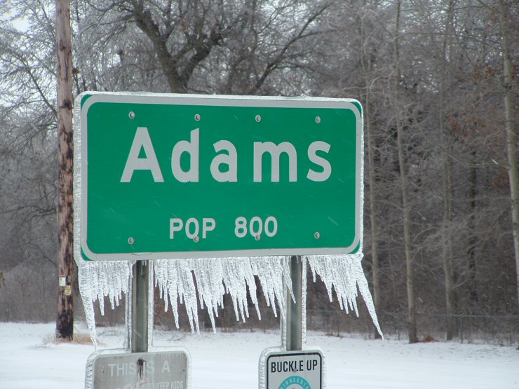
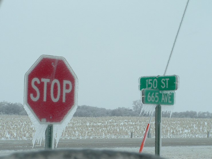
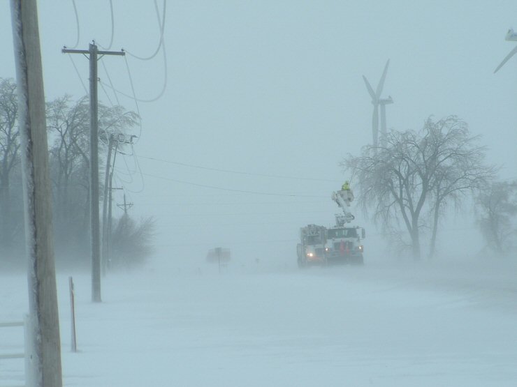
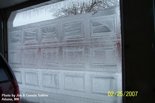
Northeast Iowa: Widespread power outages and tree damage from icing. Many power outages were still reported Monday, especially in the rural areas...roads still had downed power lines across them. Thousands of power poles were downed. Water to cattle is becoming an increasing concern. Travel was dangerous or impossible this weekend.
Mississippi River and northeast: Crippling snow amounts with winds causing 4 to 5 foot drifts. Many schools closed Monday. Travel dangerous or impossible. Power outages were isolated.
Southeast Minnesota: Combination of heavy snow totals along the Mississippi River, and further west ice accumulations and snow, closed roads and produced power outages. Travel dangerous or impossible.
| Were You, or Those You Know, Prepared? | |
| If not, NOAA Weather Radios and the NWS websites will help. Spread the word!! | |
 |
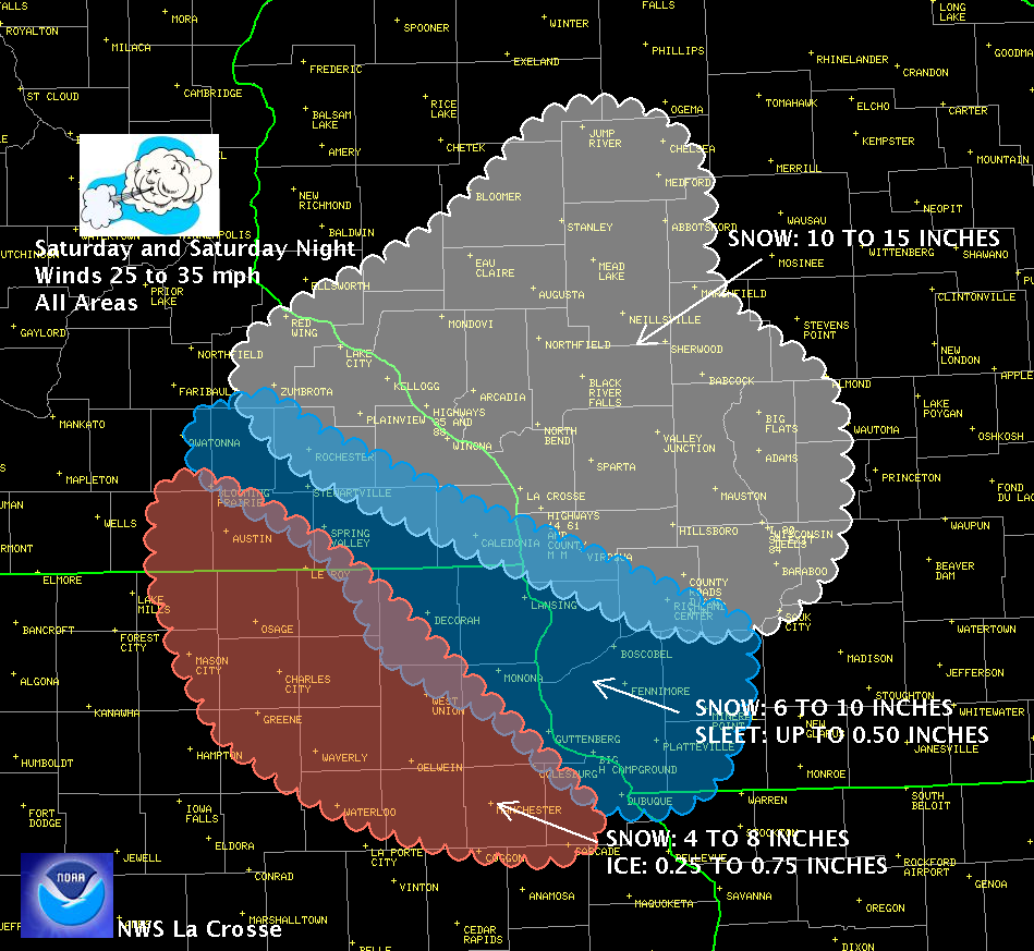 |
| Summary of the Winter Storm | Our Weekend Forecast: Posted 3 pm Friday Feb 23 |
|
Detailed Warning Statement from |
|
| Detailed Storm Amount Listings: | |
| 3-day Storm Total Snowfall | Graphic |
| Storm Total Ice Accumulation | |
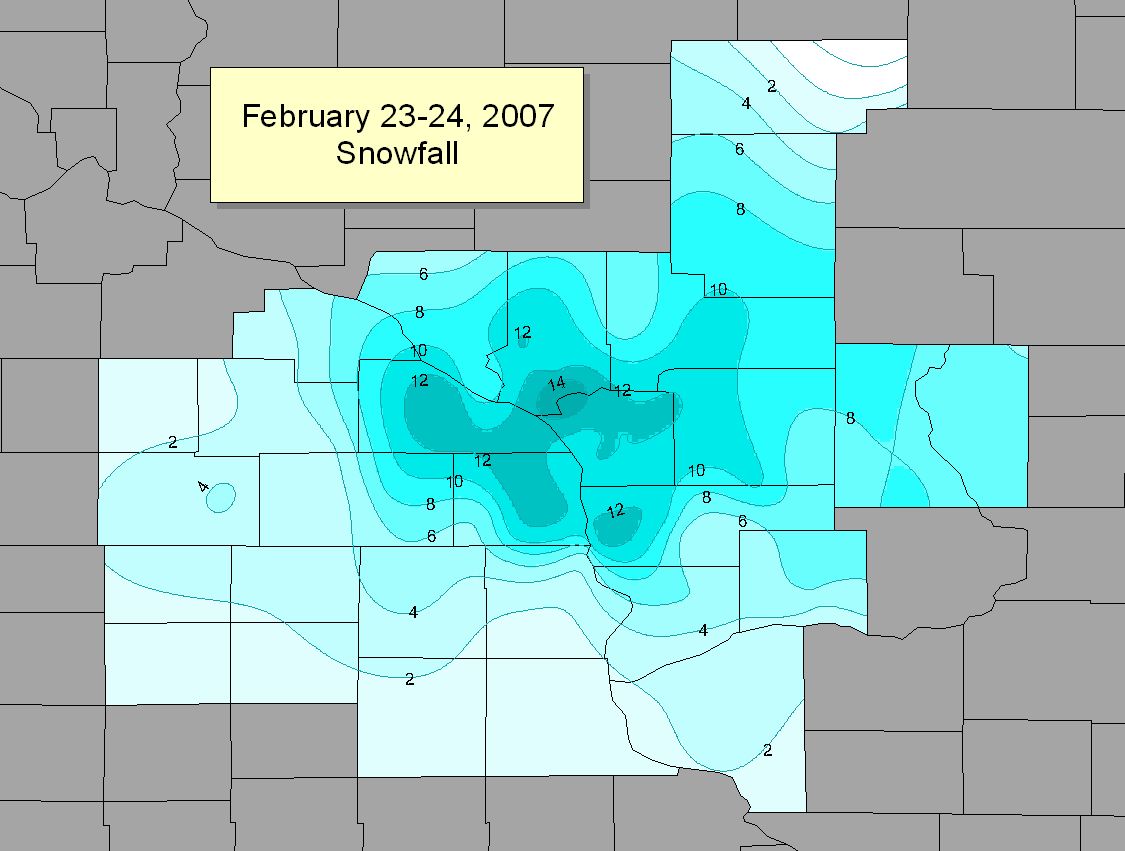
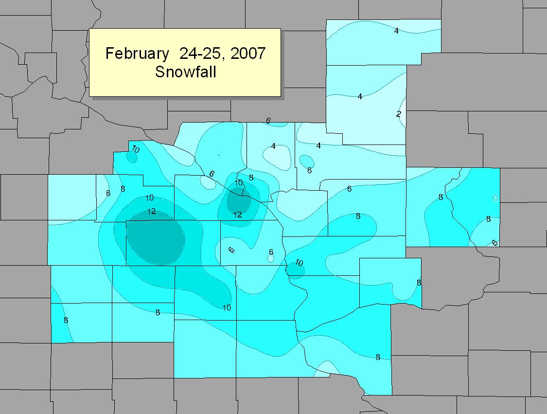
| Snowfall: 24-hours Ending Saturday Morning | Graphic |
| Snowfall: 24-hours Ending Sunday Morning | Graphic |
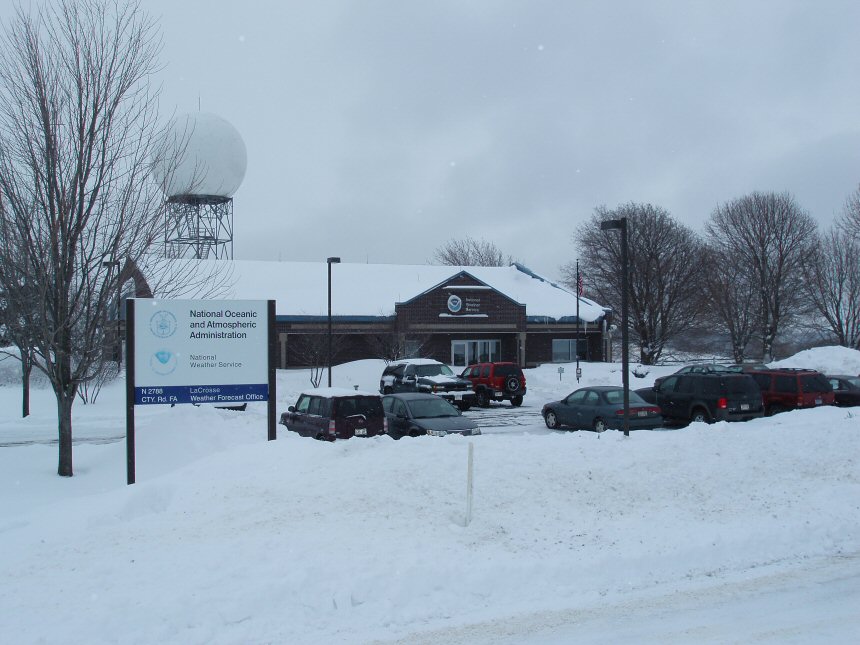
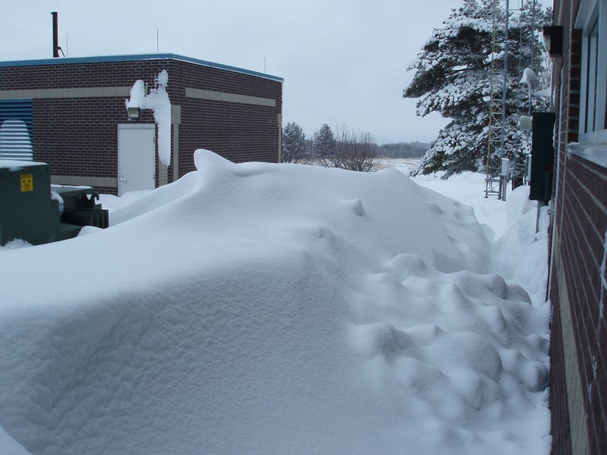
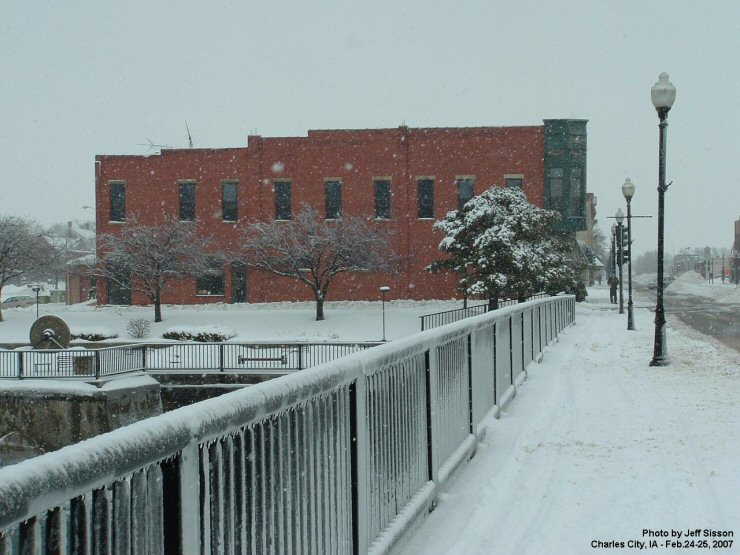
Images from the storm - (click on link below to see picture)


 Weather Story
 Weather Map
 Local Radar
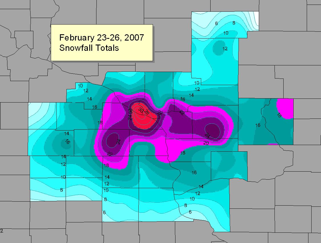