| When looking back at this event, only surface data was available. On the morning of August 21, 1883, no weather observations in the Upper Mississippi River Valley made it on to the daily weather map. In addition, Rochester, Minnesota did not report any weather conditions at this time. However there was high temperature data available from several sites around the region. It is shown in the table below: | 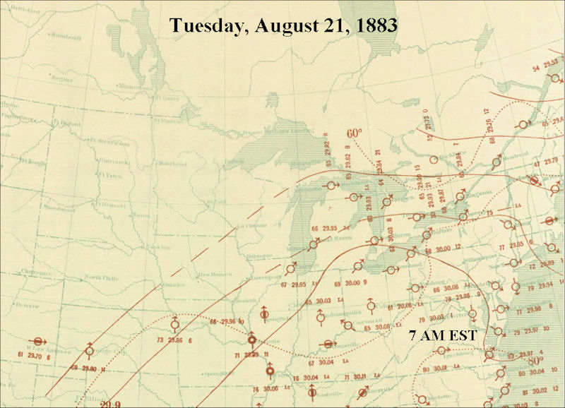 |
| Location | High Temperature |
| Chicago, IL | 79 F |
| Des Moines, IA | 91 F |
| Duluth, MN | 71 F |
| La Crosse, WI | 84 F |
| Moorehead, MN | 83 F |
| St. Paul, MN | 88 F |
| Springfield, IL | 86 F |
| The August 1883 Monthly Weather Review did have a map which illustrated the track of surface lows across the eastern half of the United States during the month. It showed that the surface low moved across central Minnesota during the afternoon and early evening of August 21st, and northwest Wisconsin and western Upper Michigan during the early morning hours of August 22nd. | 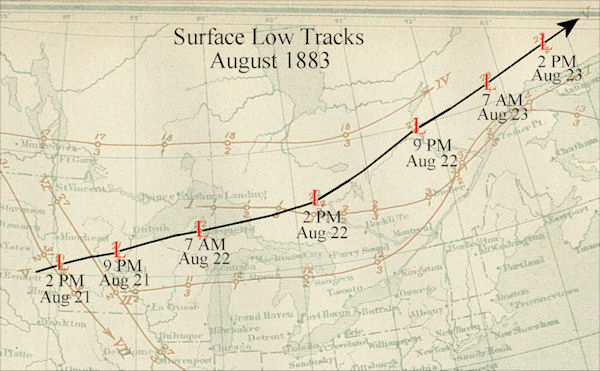 |
| The daily weather map at 7 AM EST showed that this low had a surface pressure of 29.42 inches near Marquette, Michigan. This is an abnormally deep low pressure system for this time of year. As a result, we can assume that this low was already either exceptionally deep or it was strengthening as it moved through the region. This would help to increase the wind shear (either winds strengthening with height, changing direction with height, or a combination of both) across the region. |  |
This was supported by several eyewitness reports that said that the clouds at different levels were moving in different directions. Wind shear is essential for the development of thunderstorms which produce strong tornadoes such as what occurred during the late afternoon and evening of August 21st across southeast Minnesota.


 Weather Story
 Weather Map
 Local Radar