The National Weather Service (NWS) conducted a storm survey on the tornadoes that affected parts of Chickasaw, Fayette, and Winneshiek counties in northeast Iowa on Wednesday, August 19th. Three distinct, small tornadoes were identified during this survey. A fourth small tornado was identified via use of aerial crop imagery in rural Howard County, IA. Information on these tornadoes is noted below.
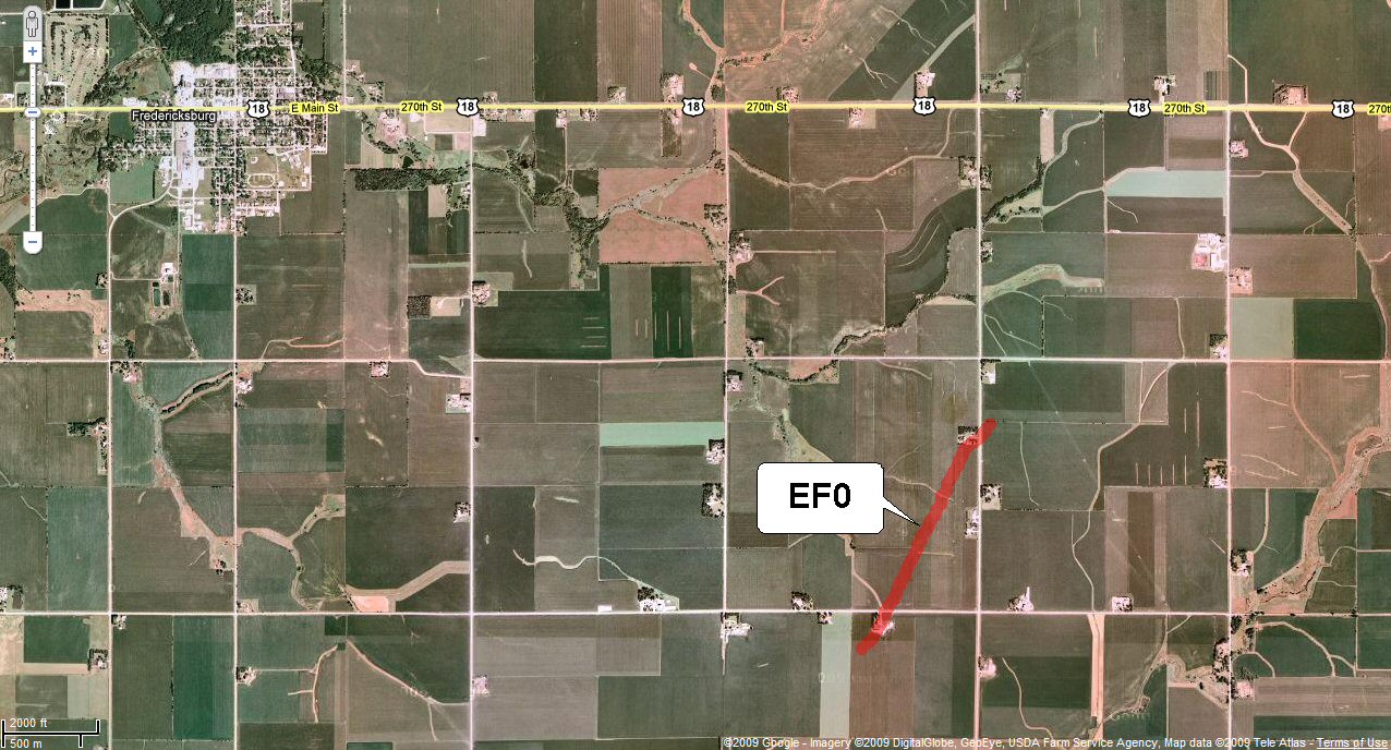
Tornado near Fredericksburg, IA (Chickasaw County)...
- This tornado touched down between 3:09 pm and 3:14 pm approximately 3 miles southeast of Fredericksburg.
- Path of the tornado was southwest to northeast and covered about a half mile.
- The width of the tornado was approximately 40 yards wide.
- Strength of the tornado was rated as EF0.
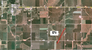 |
| Damage path of tornado near Fredericksburg, IA (click on image to enlarge) |
Some damage which was caused by this tornado, included: (click on images below to enlarge)
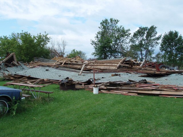
- damage to an attached garage
- brief path (with signs of rotation) in nearby corn field
- damage to an old barn with minimal debris noted
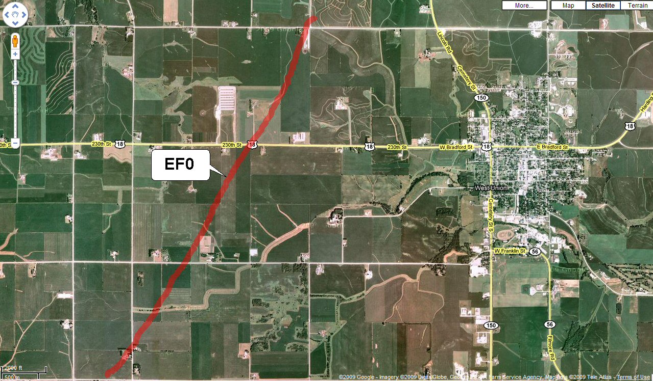
Tornado near West Union, IA (Fayette County)...
- This tornado touched down between 3:50 pm and 4:00 pm approximately 2 miles west-southwest of West Union.
- Path of the tornado was southwest to northeast and began approximately 1.7 miles south of State Highway 18 on Neon Road.
- The width of the tornado was approximately 40 yards wide.
- This tornado was rated an EF0.
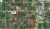 |
| Damage path of tornado near West Union, IA (click on image to enlarge) |
Some damage which was caused by this tornado, included: (click on images below to enlarge)
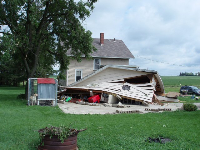
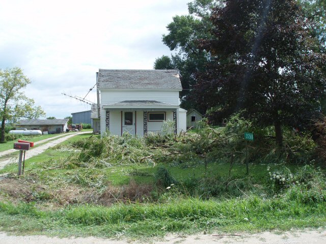
- some tree damage at residences about 1.7 miles south of Highway 18 on Neon Road
- semi-continuous path of damage in corn field near Neon Road and crossing Highway 18 west of West Union
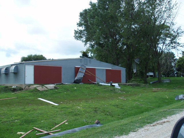
- roof damage to an empty poultry barn just northwest of West Union with debris thrown about half mile to the north
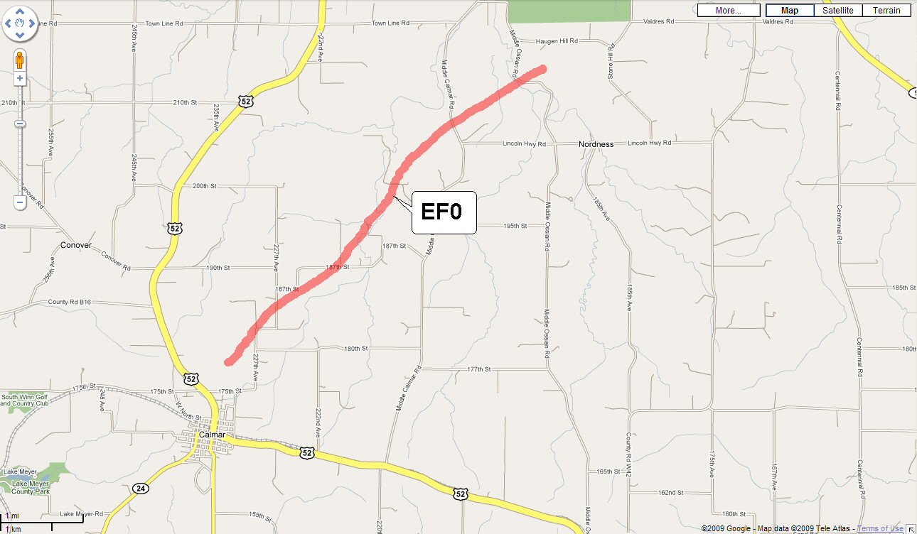
Tornado near Calmar, IA (Winneshiek County)...
- This tornado touched down at approximately 4:00 pm about 1 mile northeast of Calmar.
- The tornado path ended about 1 mile northwest of Nordness, occasionally touching down along a 4 mile southwest to northeast track.
- The width of the tornado was very narrow...approximately 20-30 yards at most.
- Strength of the tornado was rated EF0.
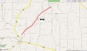 |
| Damage path of tornado near Calmar, IA (click on image to enlarge) |
Some damage which was caused by this tornado, included: (click on image below to enlarge)
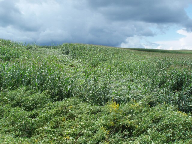
- very distinct and narrow tornadic damage path about 20 yards wide in a corn field near 187th Street and 227th Avenue
- occasional tree damage
- other minor damage, including a path in corn fields, was noted along Skyline View Road and Middle Ossian Road
Tornado north of Elma, IA (Howard County)...
- This tornado touched down briefly at approximately 3:50 p.m. about 6 miles north-northeast of Elma.
- The tornado touched down in the center of a corn field; path and width were very short.
- Strength of the tornado was rated EF0.
The National Weather Service would like to thank Emergency Management directors and those public citizens who were interviewed about the storms and damage.


 Weather Story
 Weather Map
 Local Radar