
Heat expands across the Desert Southwest, Plains, Mississippi Valley and Midwest into Monday. Fire weather concerns continue for portions of the Intermountain West. Active monsoonal moisture fuels thunderstorms over the Southwest with possible flash flooding. Tropical cyclone Fausto in the Pacific, should weaken as it approaches Hawaii; Dangerous surf, swells and rip currents are expected. Read More >
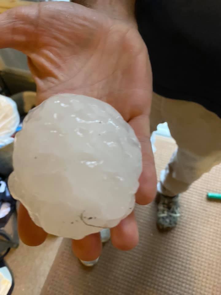 |
| Large hail near Pactola Reservoir August 8, 2020 Photo by T Kammerer |
To help you prepare for the upcoming severe weather season, we’re providing two virtual severe weather safety presentations. We’ll give you valuable information on what do before severe thunderstorms, tornadoes, and flash floods develop and how to protect yourself during storms.
Registration is required! You must register for the session before it starts by clicking on the link below.
**The 2024 presentations are over. Check back next year!**
After you register, you will receive a confirmation email with a link to join the webinar, which only you can use and cannot be shared with others. Do not click on that link until 5-10 minutes before the presentation is scheduled to start. The presentation will last 30 to 45 minutes. We will notify you if the class is cancelled if we're busy dealing with weather conditions.

