Record setting heat is expected over the next several days from the Intermountain West through the northern Plains. Furthermore, fire weather concerns increase with dry and breezy conditions. Meanwhile, heavy rainfall and severe thunderstorm threats for the Ohio/Tennessee Valleys, central Appalachians and Southeast today. The threat shifts to central Gulf Coast and across central Texas this week. Read More >
![]()
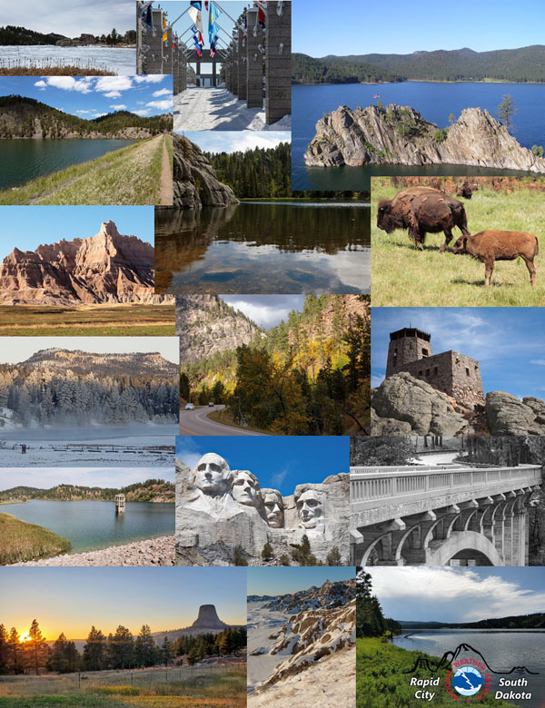 Crazy Horse Memorial
Devils Tower National Monument
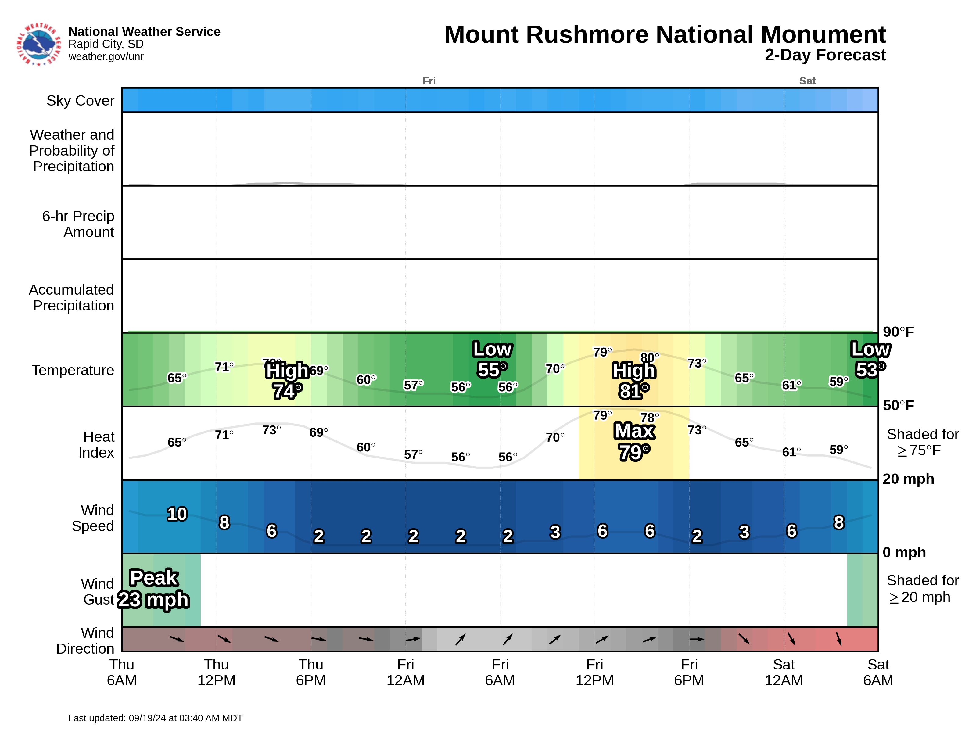
Mount Rushmore National Memorial
Spearfish Canyon Scenic Byway (near the Spearfish entrance)
Badlands National Park (Interior entrance)
Custer State Park
Wind Cave National Park
Angostura Reservoir
Belle Fourche Reservoir
Cold Brook Reservoir
Deerfield Reservoir
Keyhole Reservoir
Pactola Reservoir
Shadehill Reservoir
We'd like to know how you use this forecast. Please send a note to our Warning Coordination Meteorologist, Aaron Woodward. Thanks!
982
SXUS43 KUNR 192002
RECUNR

Evening Hot Air Balloon Forecast
National Weather Service Rapid City SD
201 PM MDT Sun Jul 19 2026

This forecast is information to assist pilots and aircrews for flight planning
and is not to be considered as a sole source of information to meet all
preflight actions. Pilots should receive a complete preflight briefing from a
Flight Service Station (1-800-WXBRIEF) or online via 1800wxbrief.com.

...HERE IS THE EVENING HOT AIR BALLOON FORECAST
FOR THE HOT SPRINGS MUNICIPAL AIRPORT...

...HEAT ADVISORY UNTIL 9 PM MDT THIS EVENING...

.THIS EVENING...
    Sunset:                          830 PM.

    Surface Wind Forecast:           5 PM...130/10G20 mph.
                                     7 PM...050/10G17 mph.

    Boundary Layer Wind:             5 PM...080/18 mph. Depth 7600 ft.
                                     7 PM...080/17 mph. Depth 2800 ft.

    RAP Winds (approx. 6 PM):              250ft...160/03 mph.
                                           500ft...160/04 mph.
                                          1000ft...160/03 mph.
                                          2000ft...160/02 mph.
                                          3000ft...170/01 mph.

    Surface Lifted Index:            4 PM...-4.
                                     7 PM...-2.

    Density Altitude:                5 PM...7099 ft.
                                     7 PM...6814 ft.

    Additional Weather Info:         clear below 12000 feet AGL,
                                     unrestricted visibilities,
                                     30 percent chance of precipitation,
                                      hot--reduced buoyancy.


.OUTLOOK FOR TOMORROW MORNING...
    Sunrise:        528 AM.
    Weather:        clear below 12000 feet AGL,
                    unrestricted visibilities.
    Surface Wind:   5 AM...010/06 mph.
                    7 AM...350/08 mph.
    Boundary Wind:  5 AM...020/09 mph. Depth 500 ft.
                    7 AM...030/14 mph. Depth 400 ft.

    RAP Winds (approx. 5 AM):  250ft...010/04 mph.
                               500ft...330/07 mph.
                              1000ft...290/11 mph.
                              2000ft...280/12 mph.
                              3000ft...280/11 mph.

This forecast is not routinely updated or amended outside of any scheduled
issuances.

&&

Additional aviation observations and forecasts are available at
aviationweather.gov. You can also read the local aviation forecast discussion
at https://www.aviationweather.gov/fcstdisc.

$$

WFO UNR
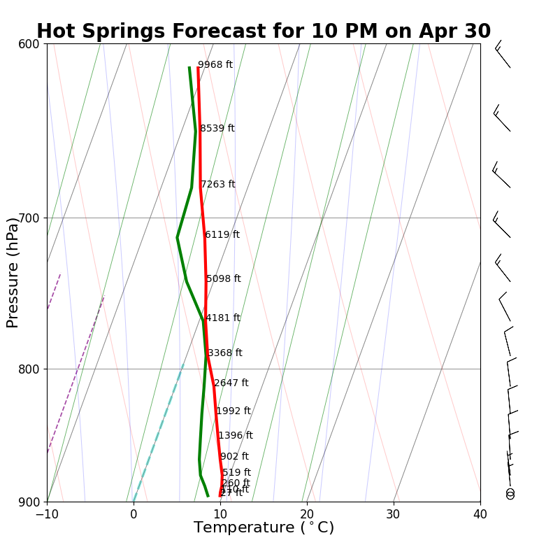
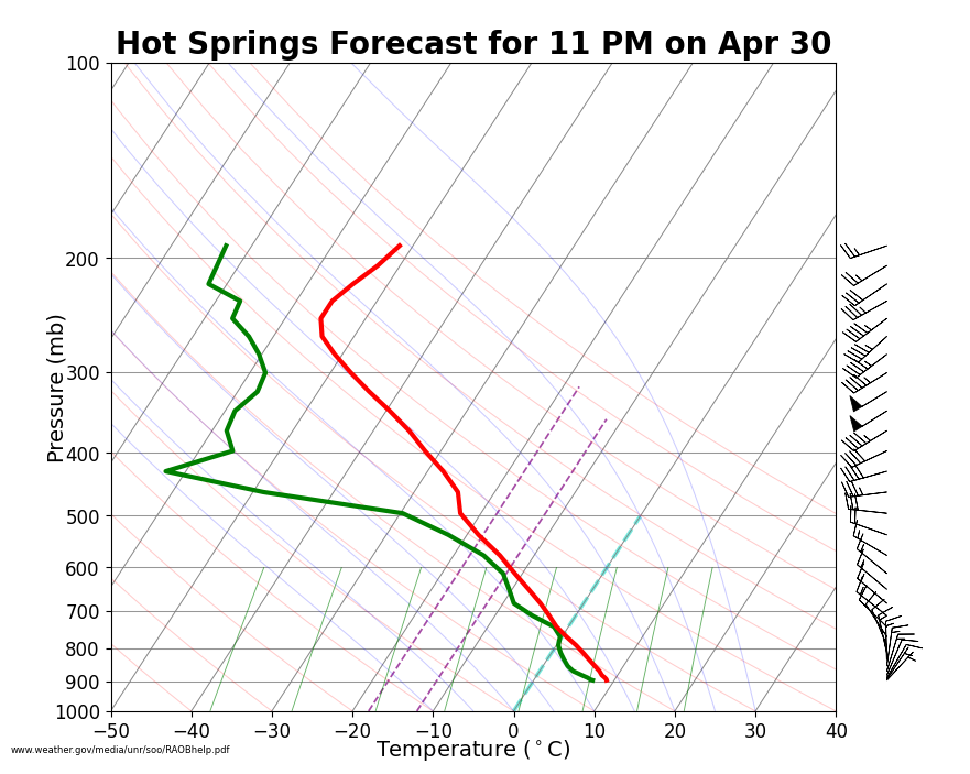
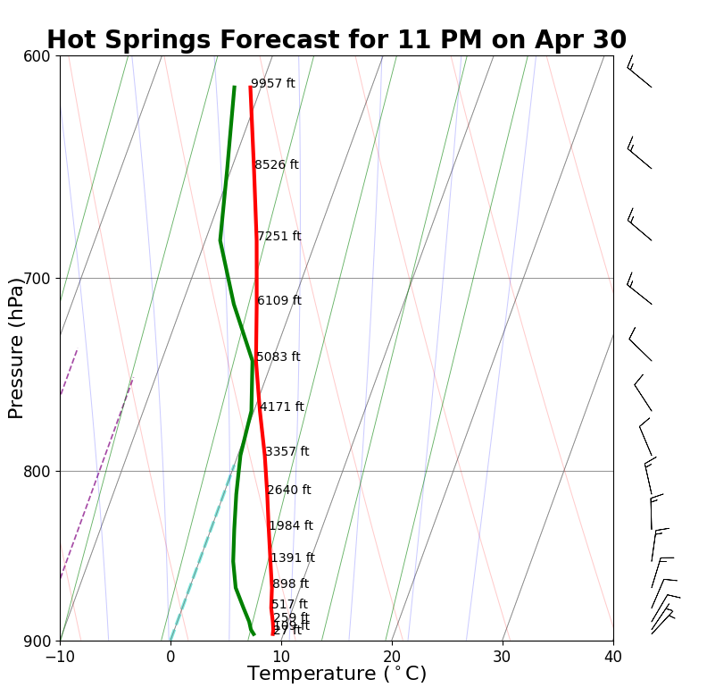
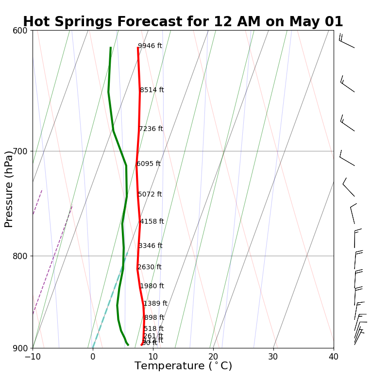
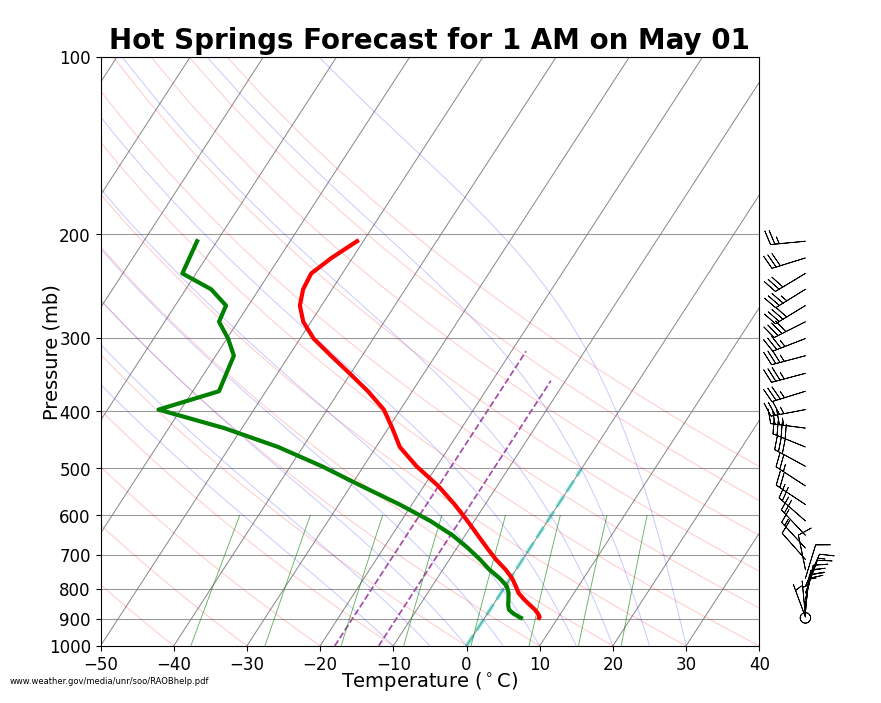
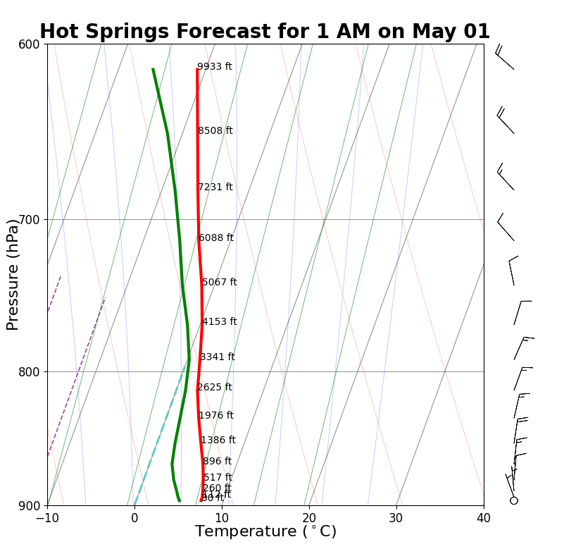
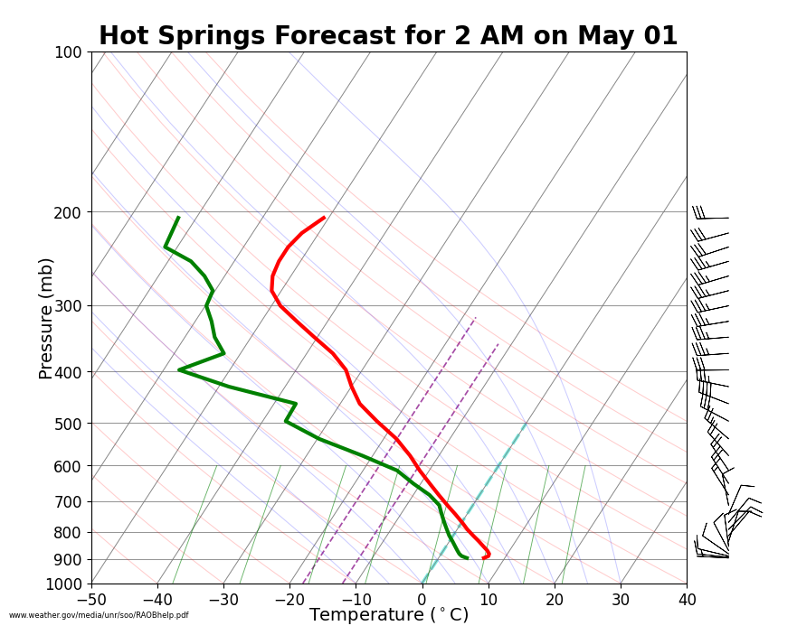
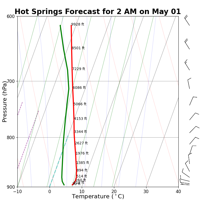
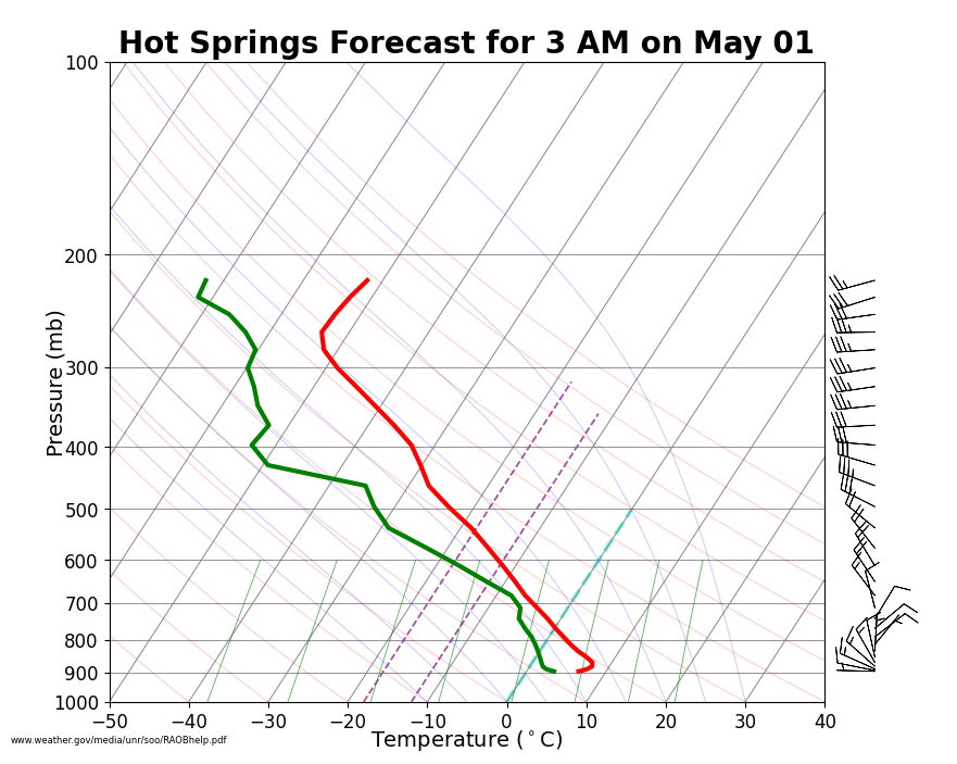
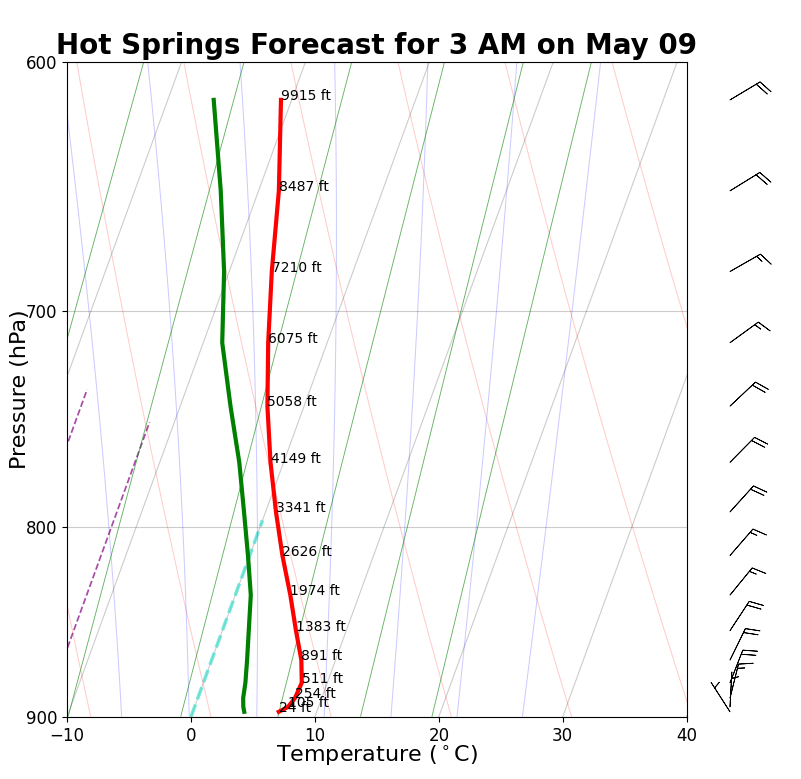
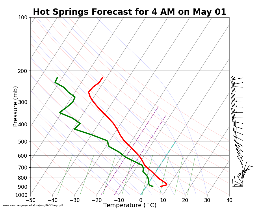
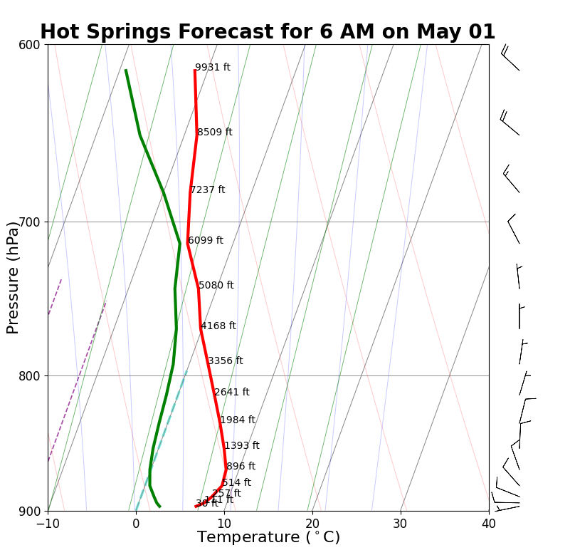
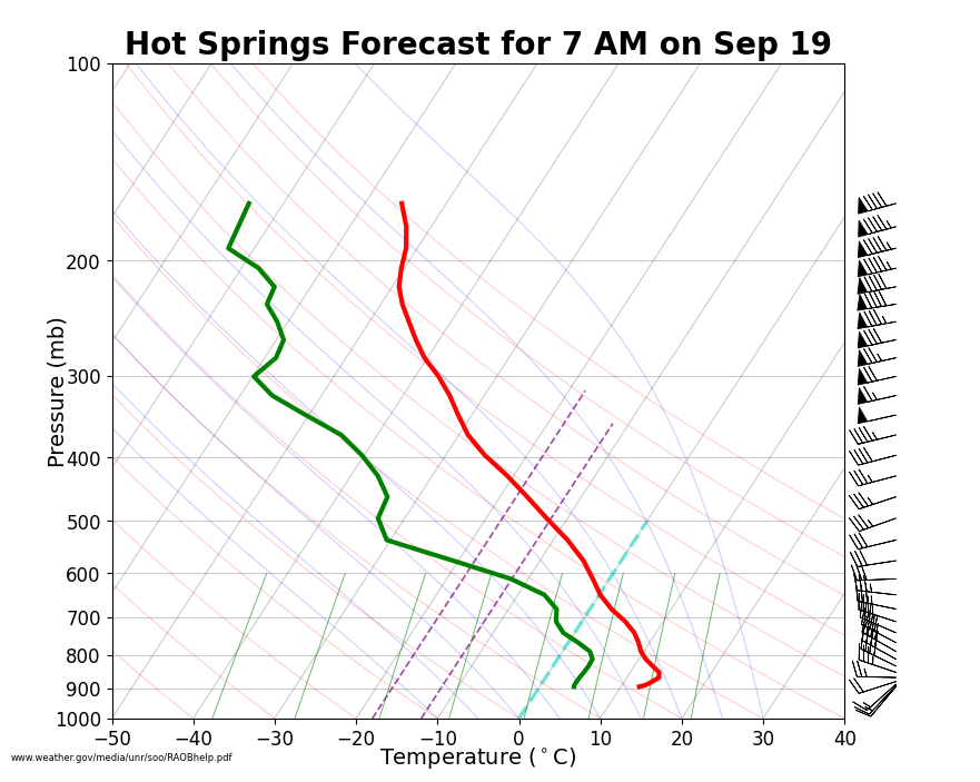
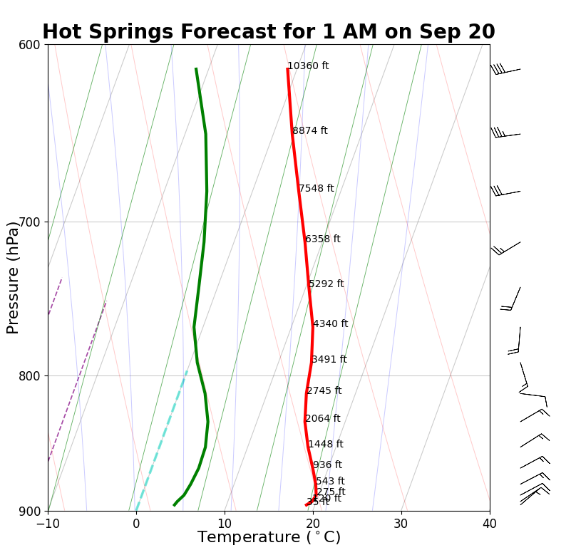
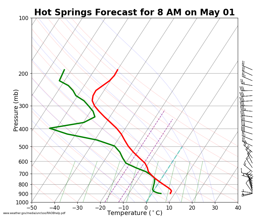
Note: "Boundary layer" above refers to the planetary boundary layer, or the layer within which the effects of friction are significant (courtesy of the NWS Glossary). The depth of this layer will vary throughout the day, typically reaching its maximum depth in the afternoon and minimum depth overnight.
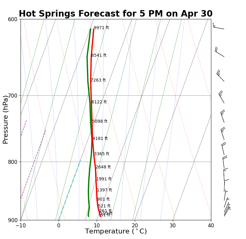
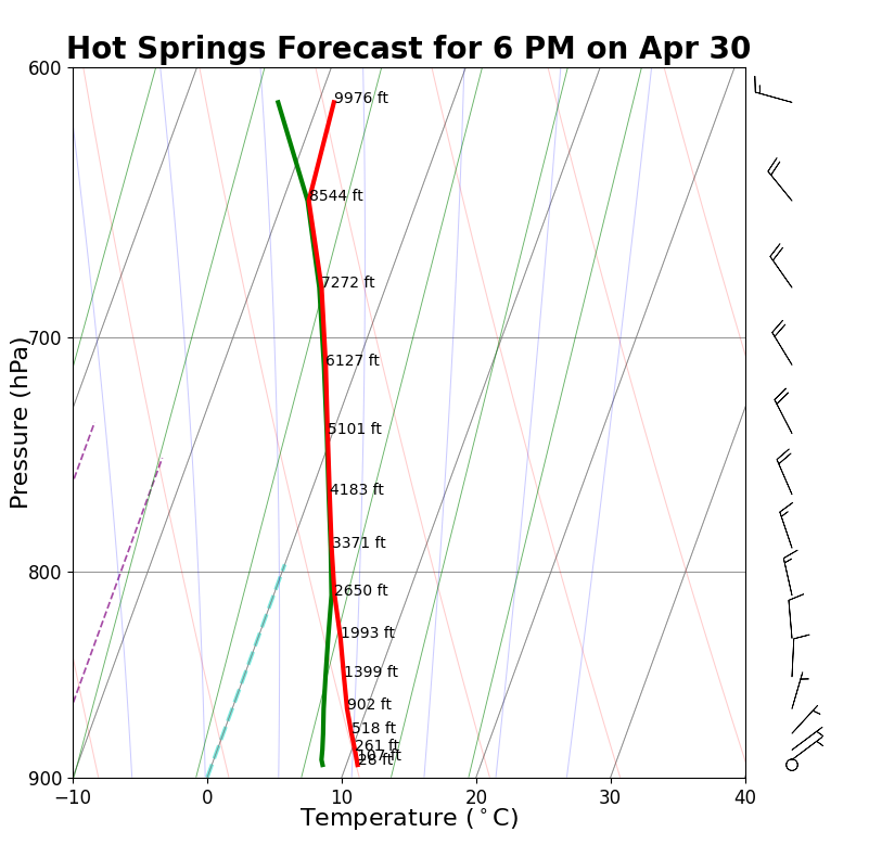
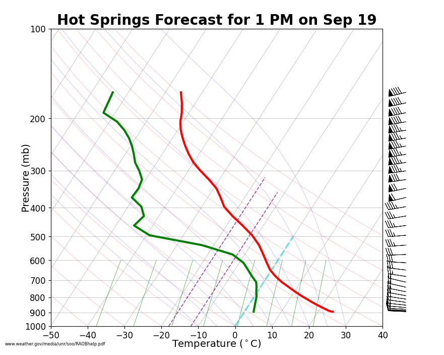
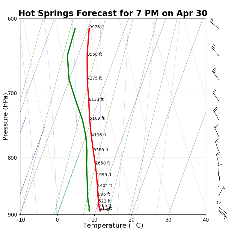
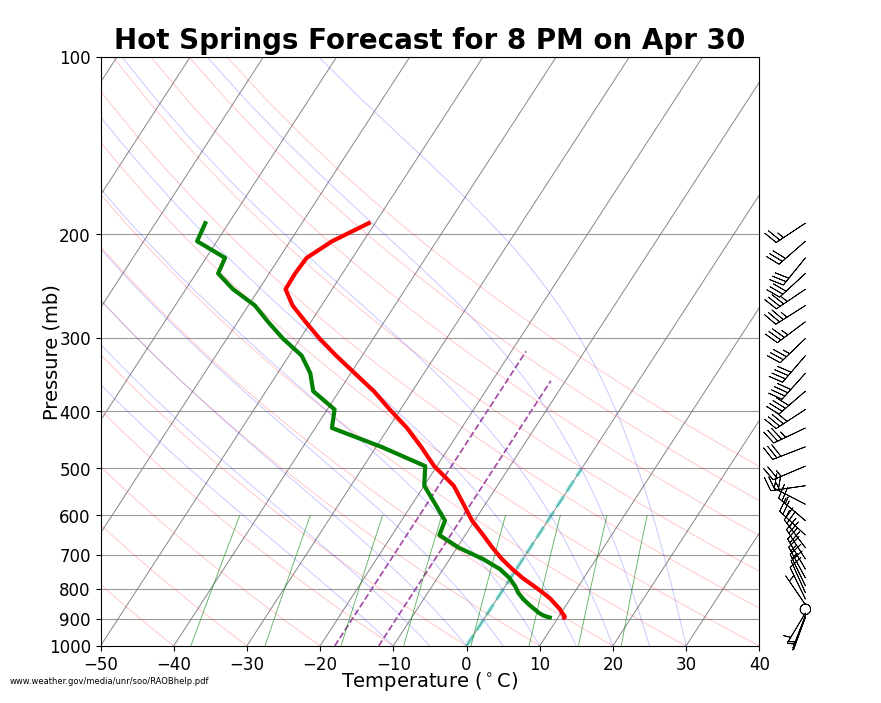
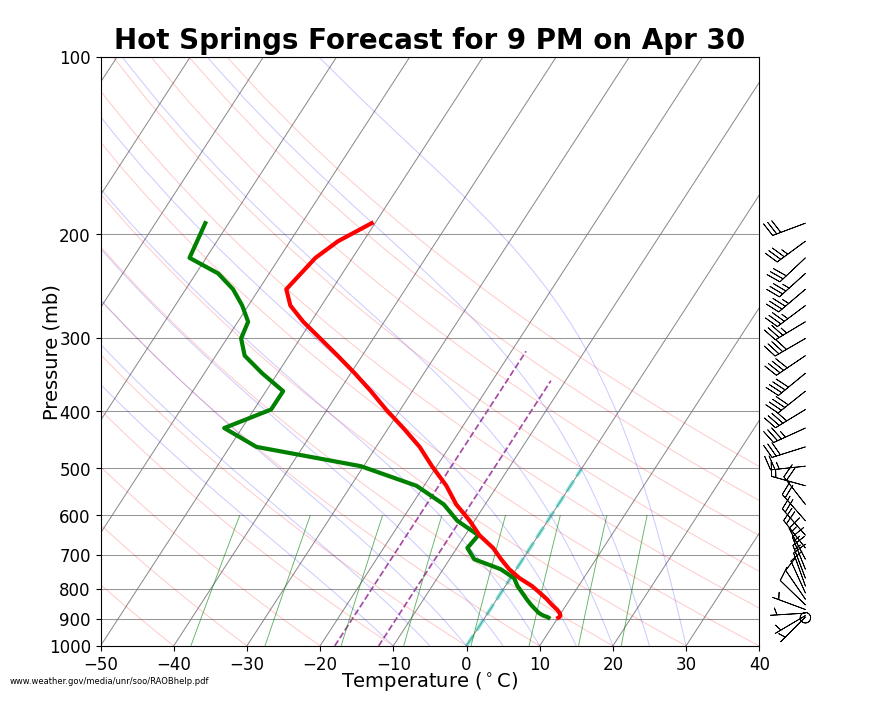
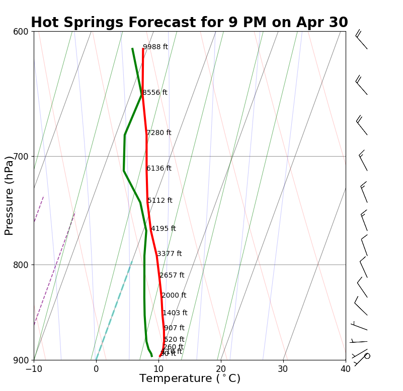
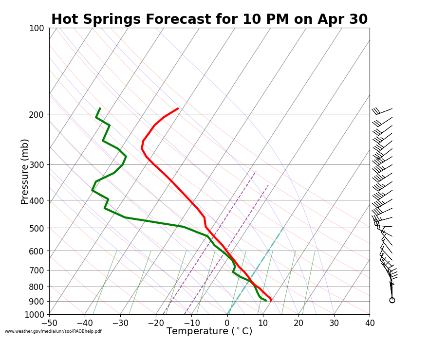
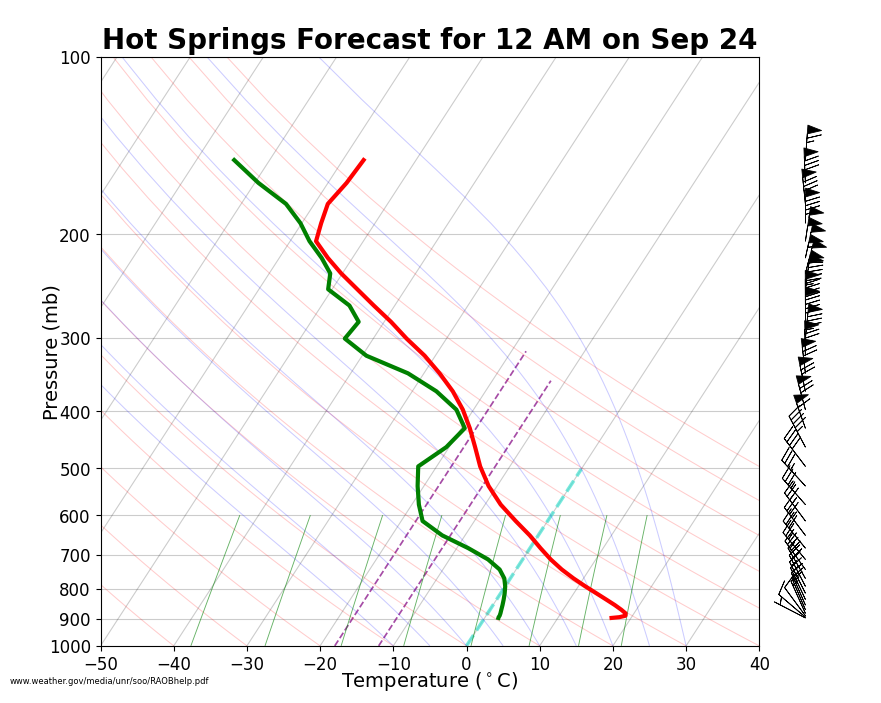
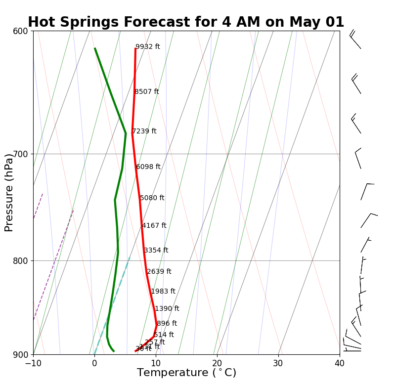
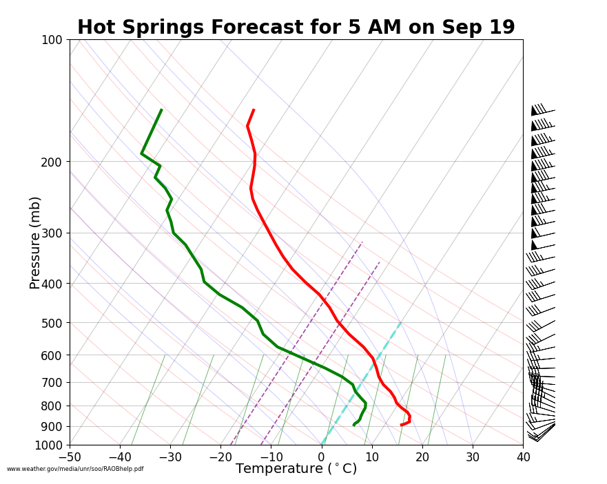
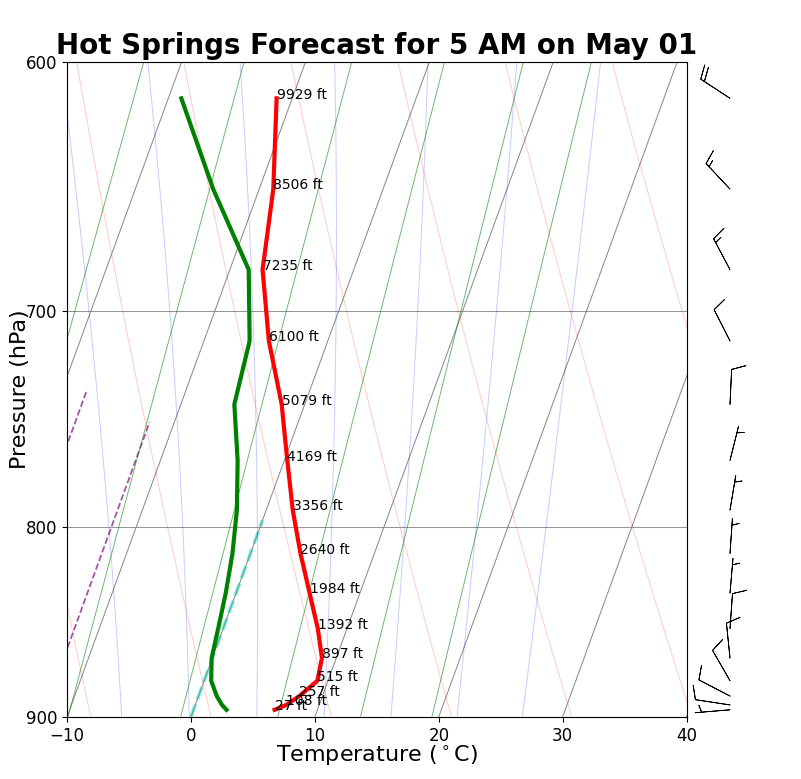
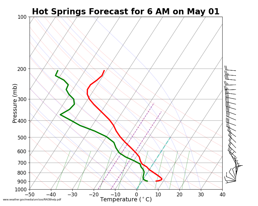
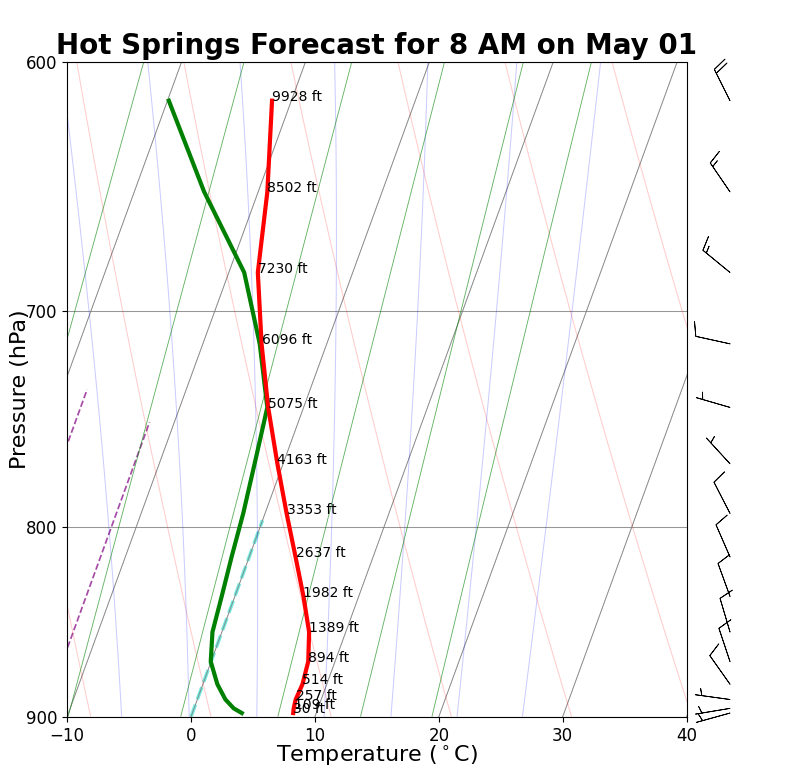
The soundings below show temperature (in red) and dew point (in green) at decreasing pressures (increasing heights) throughout the atmosphere. Latest Observed Sounding from Rapid City (courtesy NSF National Center for Atmospheric Research)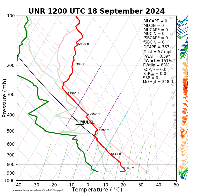 |
|||
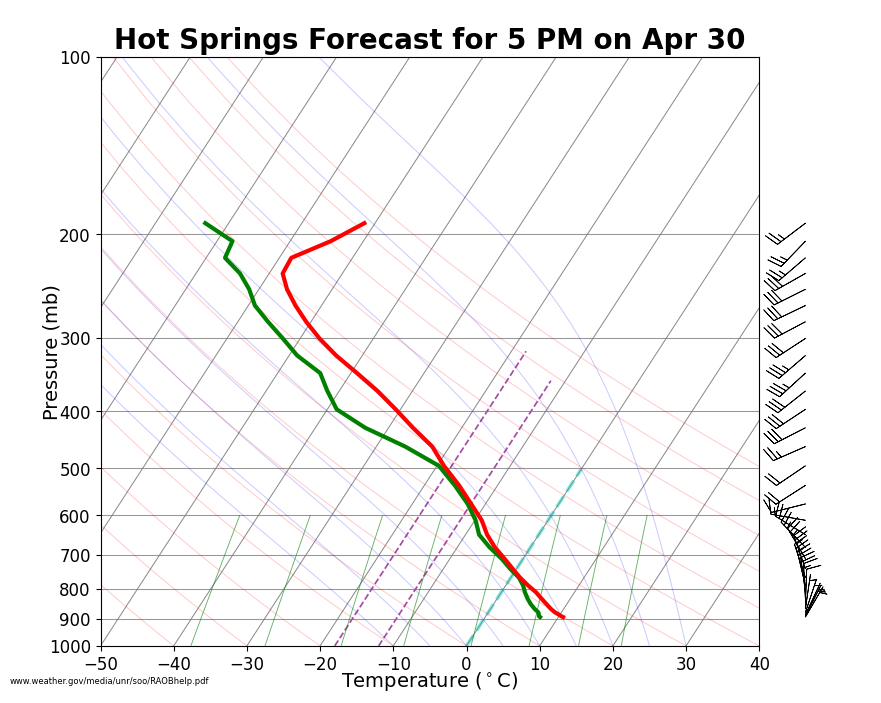
Forecast Soundings for the Hot Springs Municipal Airport (click to zoom) |
|||
 |
 |
||
 |
 |
||
 |
 |
||
 |
 |
||
 |
 |
||
 |
 |
||
 |
 |
||
 |
 |
||
 |
 |
||
 |
 |
||
 |
 |
||
 |
 |
||
 |
 |
||
 |
 |
||
 |
 |
||
 |
 |
||
|
|
|||
|
|
|||