
Heavy rainfall from scattered thunderstorms is expected across the Southwest, Intermountain West, and Plains. Isolated dry thunderstorms may initiate additional fires across the west. The coastal Carolinas may experience flash floods in the coming days due to repeated thunderstorms. Additionally, a wave of intense summer heat will hit the Southern Plains and central Gulf Coast States this week. Read More >
Rapid City, SD
Weather Forecast Office
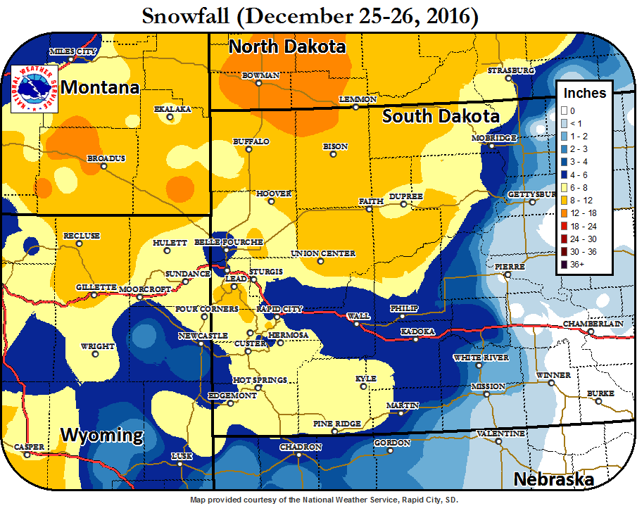
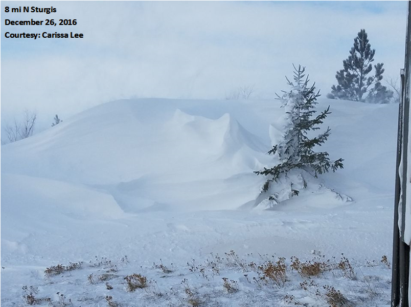
A strong low-pressure system brought heavy snow and very gusty winds to northeastern Wyoming and western South Dakota Christmas Day of 2016. Before the snow, some areas experienced freezing rain and sleet, creating a layer of icing. Generally, 4 to 12 inches of snow fell across the forecast area, with the highest amounts across northwestern SD, northeastern WY, and the Black Hills. Strong winds up to 72 mph created blowing snow, resulting in blizzard conditions, even after the snow stopped falling. Many places had drifts several feet high. Interstate 90 was closed for a time west of Gillette.
Additional Details: December 25-26, 2016
US Dept of Commerce
National Oceanic and Atmospheric Administration
National Weather Service
Rapid City, SD
300 East Signal Drive
Rapid City, SD 57701-3800
605-341-9271
Comments? Questions? Please Contact Us.

