
Tropical Depression Two is expected to gradually strengthen and could bring tropical storm conditions to the Florida Panhandle beginning late Monday. Areas of flash flooding will be possible through Thursday along the eastern and central Gulf Coast. Severe thunderstorms will develop and move along a cold front crossing the Upper Midwest Monday, and through the Ohio Valley/Mid-Atlantic on Tuesday. Read More >
Rapid City, SD
Weather Forecast Office
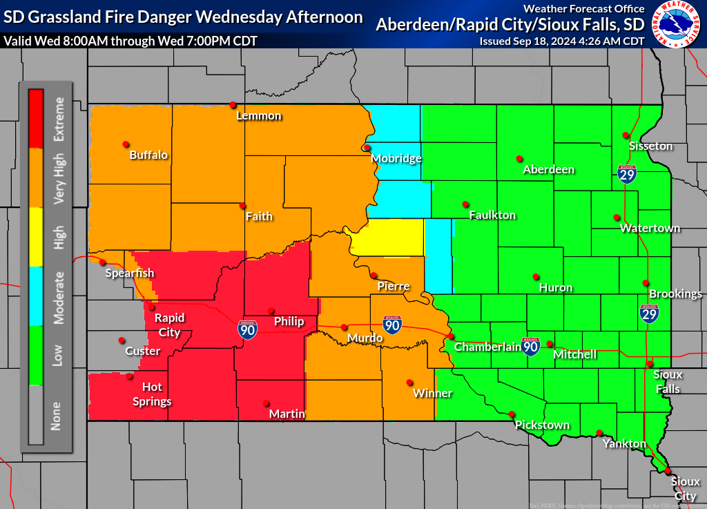
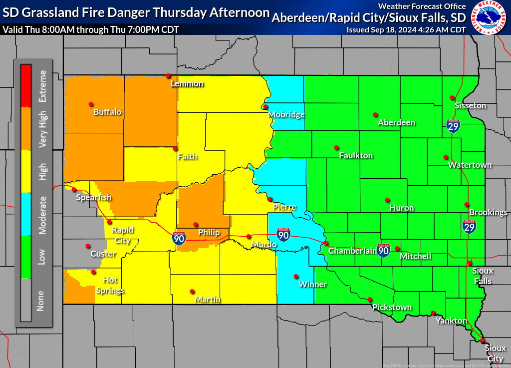
Please use the South Dakota Grassland Fire Danger Map in conjunction with the text products above to assess the Grassland Fire Danger for South Dakota. Please note that text products will be issued daily by 5:00 AM during the fire-weather season or when high, very high, or extreme grassland fire danger is forecast.
What is the Grassland Fire Danger Index?
US Dept of Commerce
National Oceanic and Atmospheric Administration
National Weather Service
Rapid City, SD
300 East Signal Drive
Rapid City, SD 57701-3800
605-341-9271
Comments? Questions? Please Contact Us.

