
Tropical Depression Two is expected to gradually strengthen and could bring tropical storm conditions to the Florida Panhandle beginning late Monday. Areas of flash flooding will be possible through Thursday along the eastern and central Gulf Coast. Severe thunderstorms will develop and move along a cold front crossing the Upper Midwest Monday, and through the Ohio Valley/Mid-Atlantic on Tuesday. Read More >
Overview
May of 2019 rewrote the record books across western South Dakota and northeastern Wyoming. Continuing the cold and wet trend of early spring, May was characterized by repeated bouts with well below normal temperatures and heavy snow, including snow on some days in late May for the first time on record. Rapid snowmelt and heavy rain late in the month also contributed to widespread flooding issues, including record crests on portions of the Cheyenne and White rivers in western South Dakota.
Here, we provide statistics on the monthly average temperatures and precipitation totals for downtown Rapid City and several cooperative observer sites across the area, including where May 2019 ranks in the record books. On the other tabs, we provide lists of all daily temperature and precipitation records set at these sites throughout May and a list of the preliminary record river crests during the month.
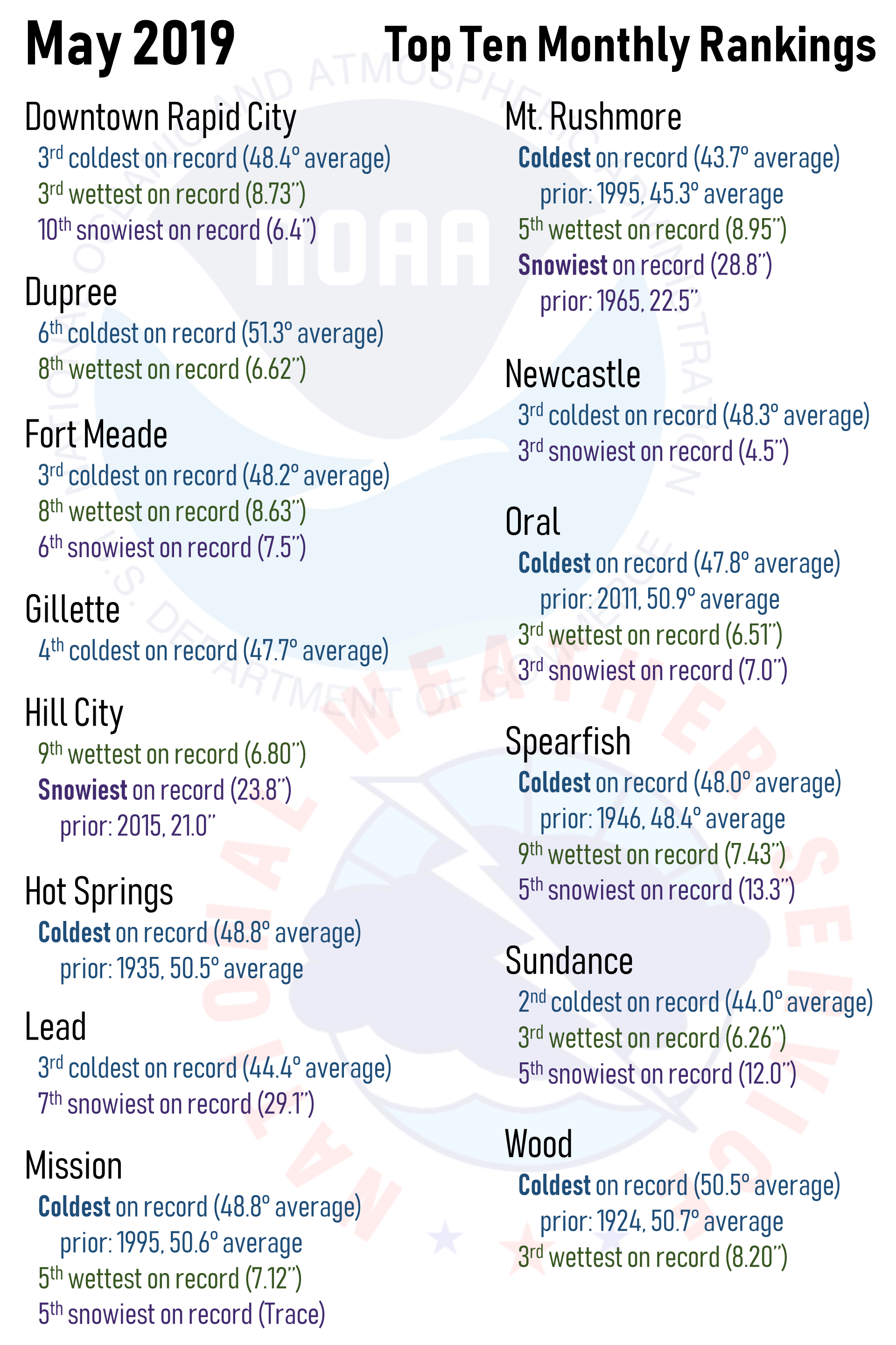 |
| May 2019 monthly rankings compared to records for numerous sites across western South Dakota and northeastern Wyoming Note: A prior version of this graphic had incorrect values for Hill City. We apologize for any inconvenience. |
 |
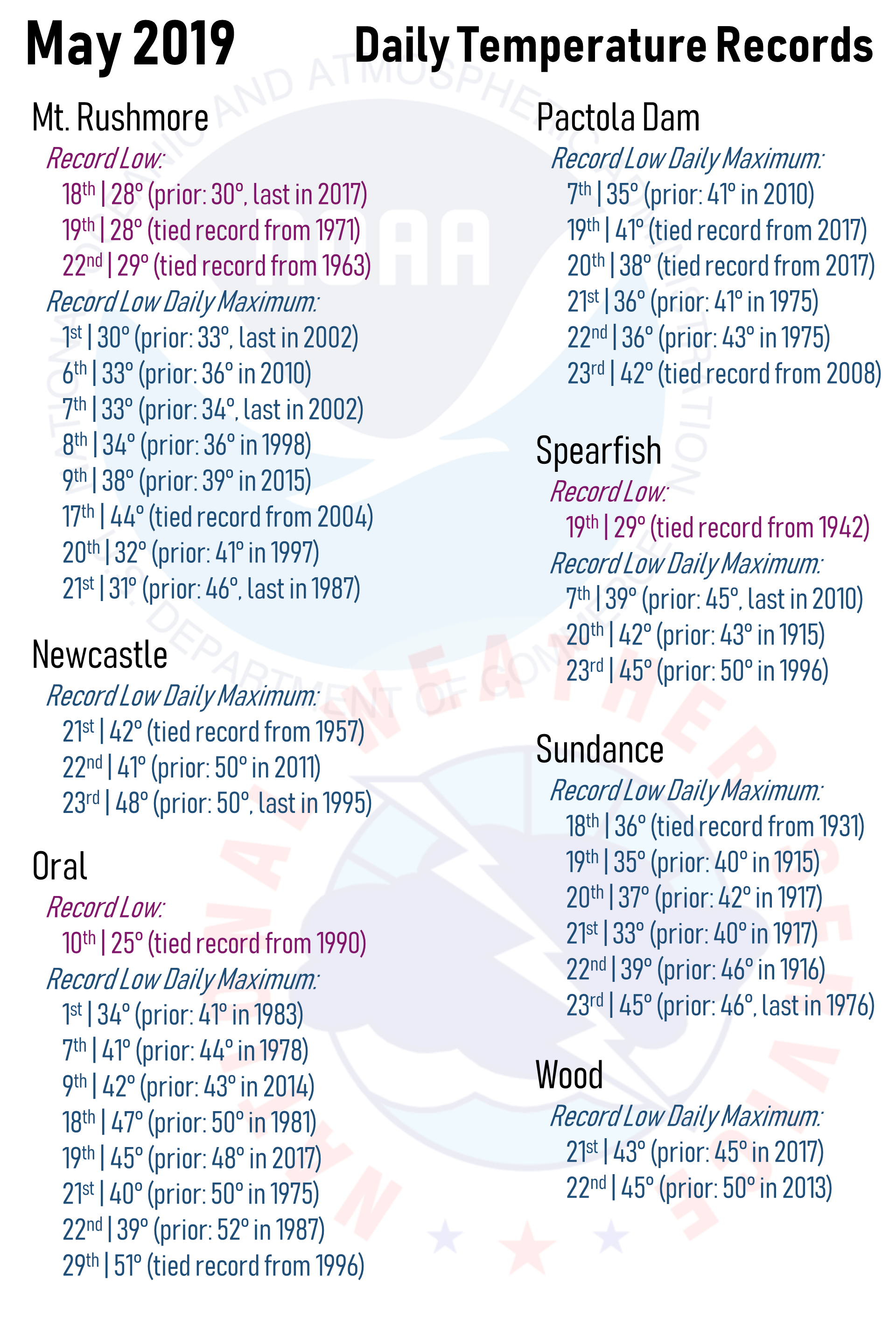 |
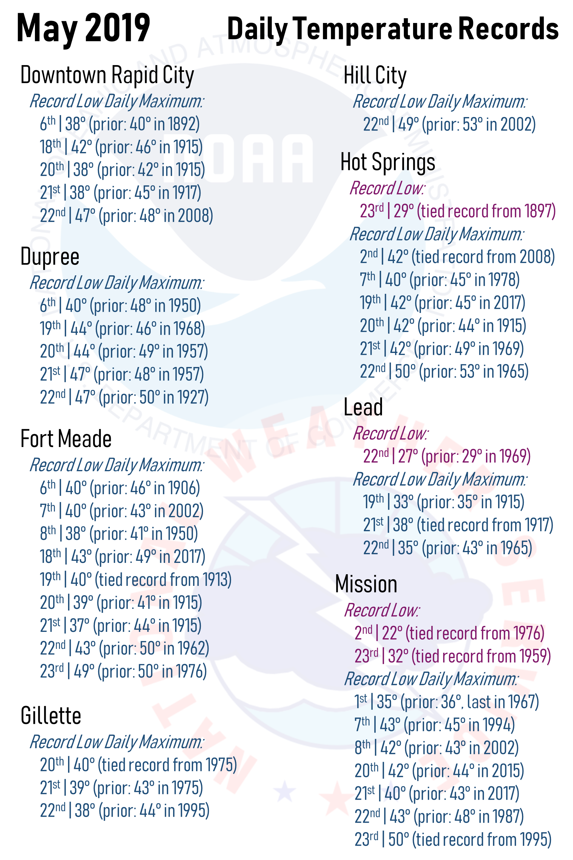
| May 2019 daily temperature records for numerous sites across western South Dakota and northeastern Wyoming | |
 |
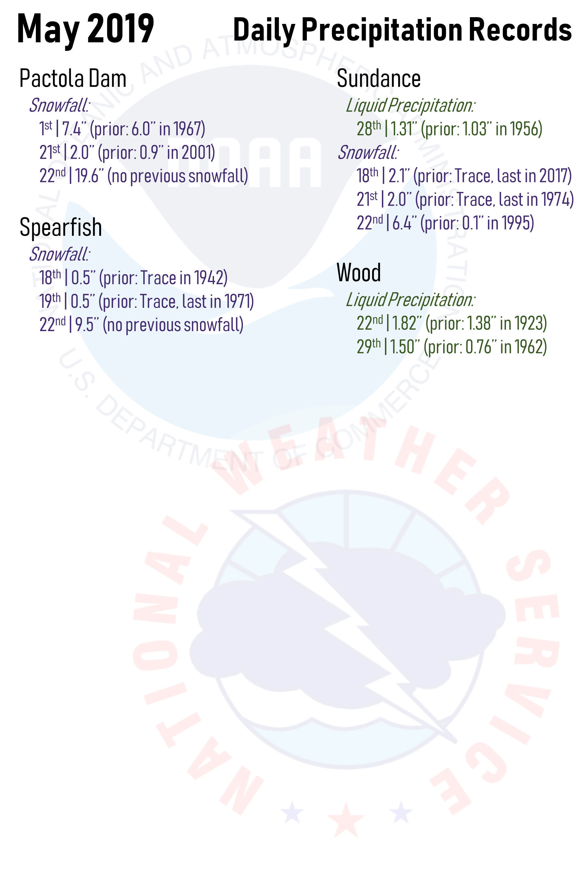 |
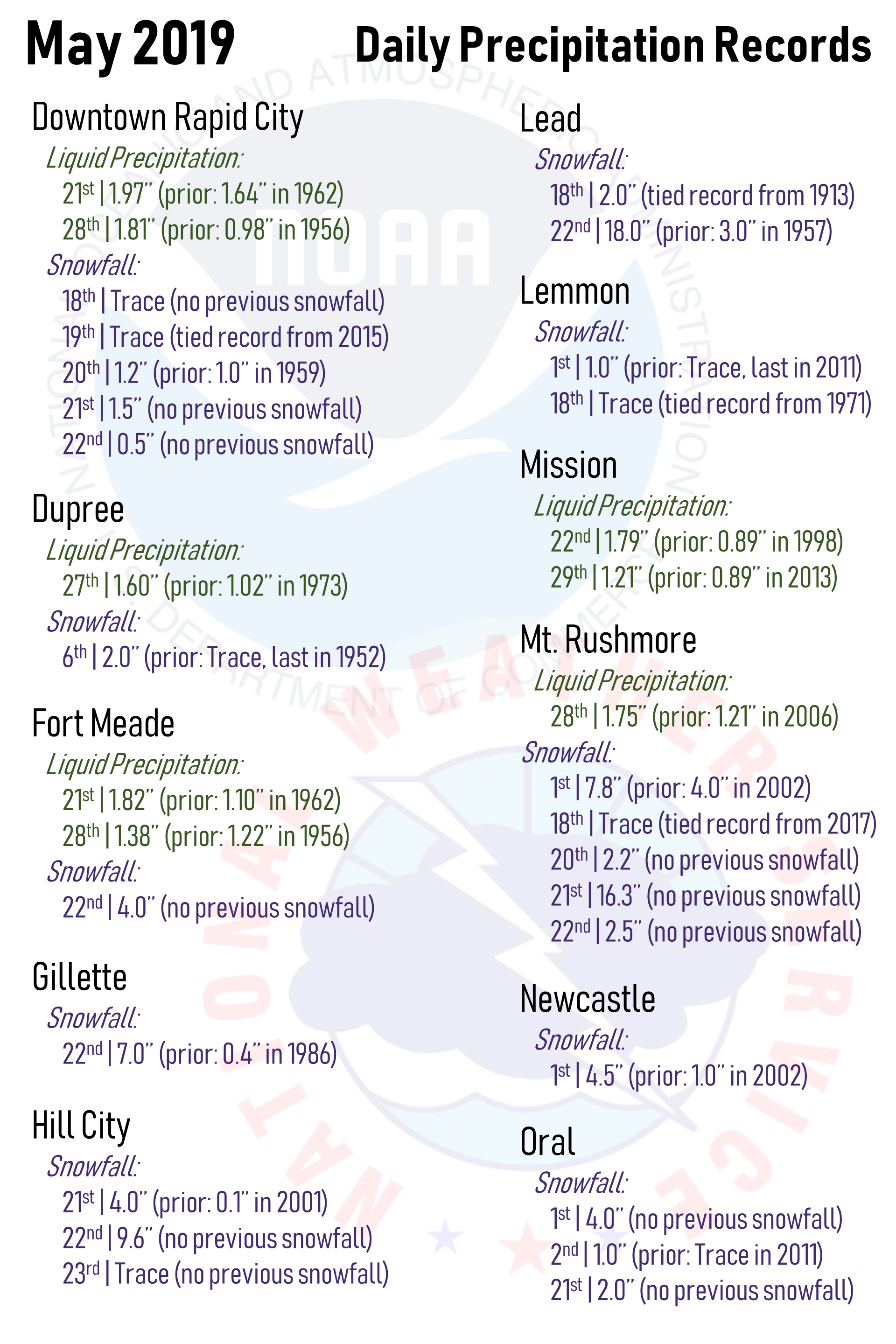
| May 2019 daily precipitation records for numerous sites across western South Dakota and northeastern Wyoming | |
 |
| May 2019 record river crests across the area |
 |
Media use of NWS Web News Stories is encouraged! Please acknowledge the NWS as the source of any news information accessed from this site. |
|

