
Heavy rainfall from scattered thunderstorms is expected across the Southwest, Intermountain West, and Plains. Isolated dry thunderstorms may initiate additional fires across the west. The coastal Carolinas may experience flash floods in the coming days due to repeated thunderstorms. Additionally, a wave of intense summer heat will hit the Southern Plains and central Gulf Coast States this week. Read More >
Rapid City, SD
Weather Forecast Office
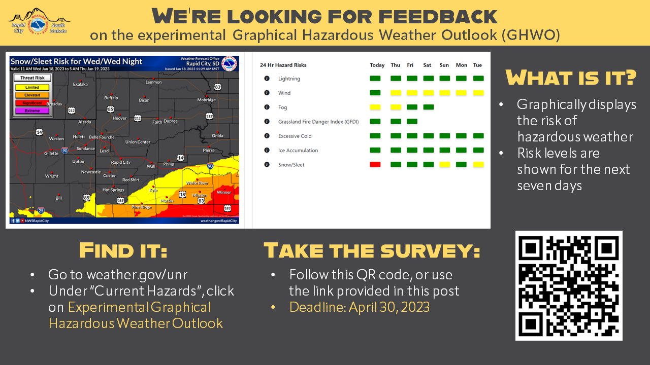
The National Weather Service is taking comments on the experimental Graphical Hazardous Weather Outlook (GWHO) through April 30. The GHWO is a convenient method to assess potential weather hazards that could affect your work or the safety of residents and employees. The web page (https://www.weather.gov/erh/ghwo?wfo=unr) shows seasonal hazards on a map and in a table with clickable buttons. The buttons are colored for the highest risk associated with that hazard across our forecast area for the next seven days; clicking on a button will display the forecast area map for that day.
To provide comments take the survey at https://www.surveymonkey.com/r/Exp_GHWO_2022_23
Additional details are included in the Product Description Document at: https://nws.weather.gov/products/PDD/PDD_GHWO_ExpExt2022.pdf
At the end of the comment period, if feedback is favorable, the product will be evaluated for continuation or operational implementation.
US Dept of Commerce
National Oceanic and Atmospheric Administration
National Weather Service
Rapid City, SD
300 East Signal Drive
Rapid City, SD 57701-3800
605-341-9271
Comments? Questions? Please Contact Us.

