
Heavy rainfall from scattered thunderstorms is expected across the Southwest, Intermountain West, and Plains. Isolated dry thunderstorms may initiate additional fires across the west. The coastal Carolinas may experience flash floods in the coming days due to repeated thunderstorms. Additionally, a wave of intense summer heat will hit the Southern Plains and central Gulf Coast States this week. Read More >
Rapid City, SD
Weather Forecast Office
Effective January 15, 2020, the National Weather Service (NWS) in Rapid City, SD will change the flood category stages for the White River near Kadoka (KDKS2).
All NWS flood warnings, flood statements, flood advisories, flood watches, probability outlooks, and NWS hydrographs on the Advanced Hydrologic Prediction Service (AHPS) will reference the new category levels. This change is part of a recent evaluation of the levels based on high water, flood events, and impacts this past year.
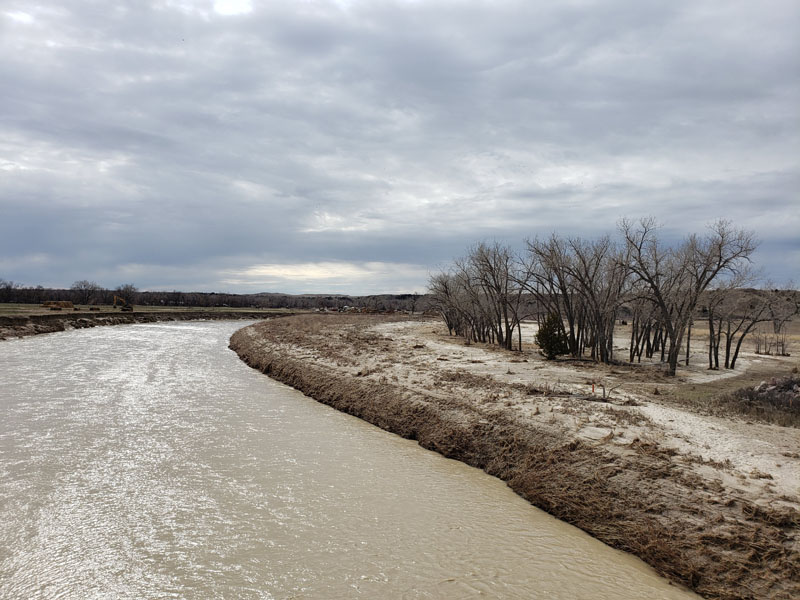
During the flooding of March 2019, the river gage was washed out and the stream channel was significantly changed. A new gage was installed and captured additional flooding and high water events in May, July, and August. The photo on the right was taken April 9, 2019.
Based on the new information, we are proposing to raise the flood stage, the action stage, and the moderate flood stage. Here is a summary of the changes:
New Flood Levels
Action Stage: 14 ft
Flood Stage: 15 ft
Moderate Flood Stage: 16 ft
Major Flood Stage: 19 ft
The National Weather Service welcomes public feedback. If you have any questions or comments on this change, please contact:
Melissa Smith
Service Hydrologist
(605) 341-9271 ext 493
melissa.smith@noaa.gov
National Weather Service
300 East Signal Drive
Rapid City SD 57701
US Dept of Commerce
National Oceanic and Atmospheric Administration
National Weather Service
Rapid City, SD
300 East Signal Drive
Rapid City, SD 57701-3800
605-341-9271
Comments? Questions? Please Contact Us.

