
Tropical Depression Two is expected to gradually strengthen and could bring tropical storm conditions to the Florida Panhandle beginning late Monday. Areas of flash flooding will be possible through Thursday along the eastern and central Gulf Coast. Severe thunderstorms will develop and move along a cold front crossing the Upper Midwest Monday, and through the Ohio Valley/Mid-Atlantic on Tuesday. Read More >
|
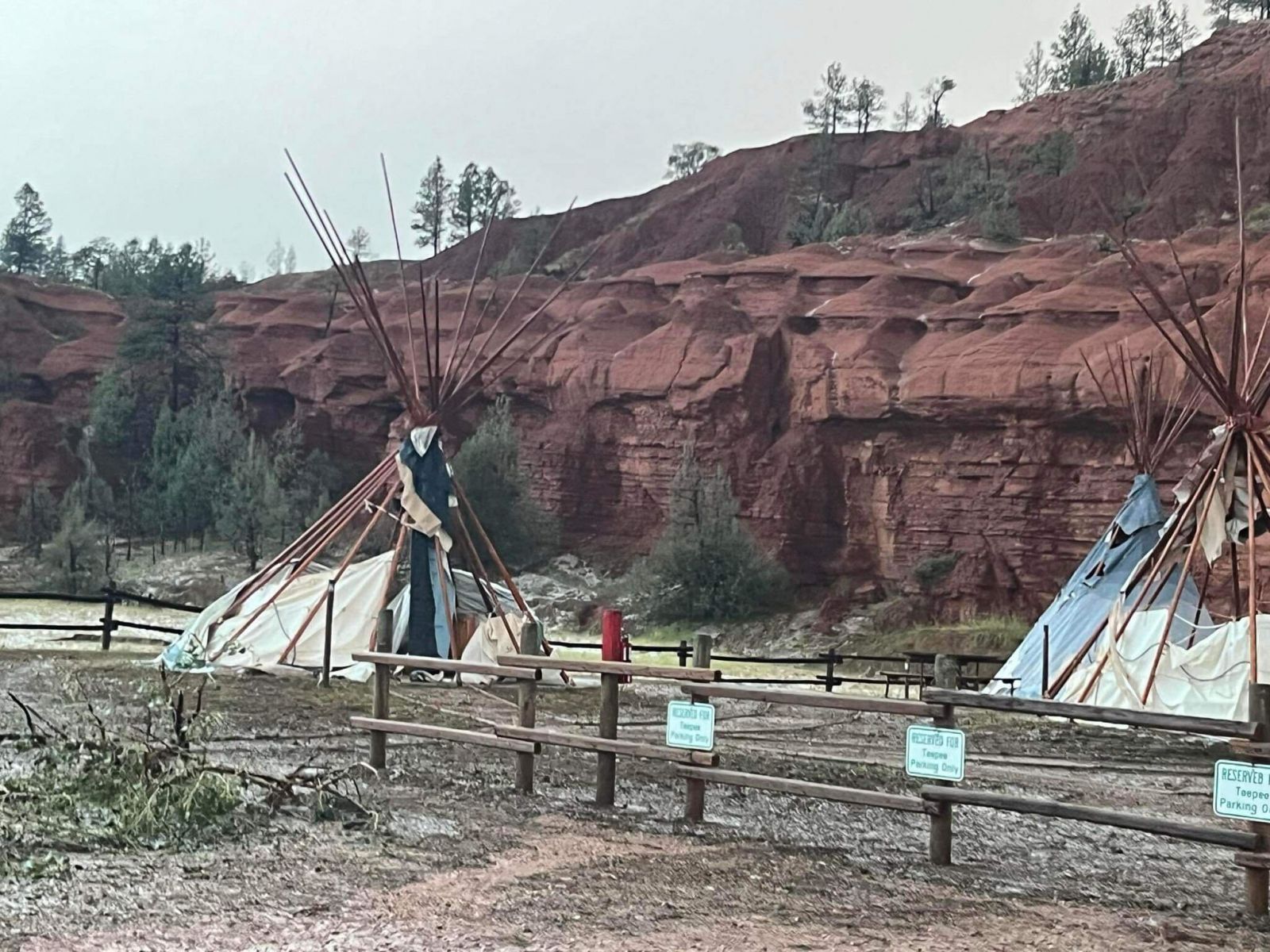
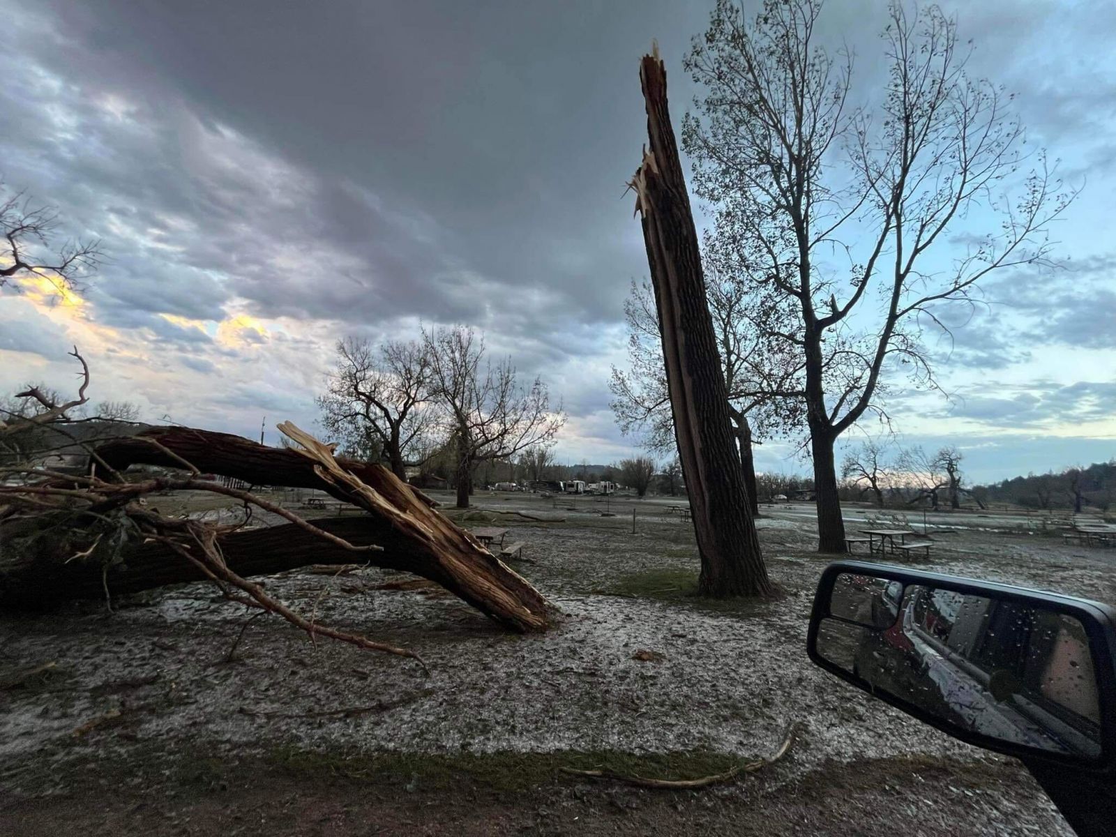
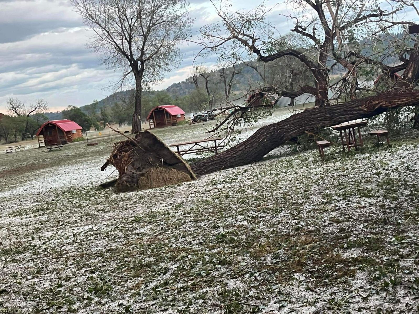
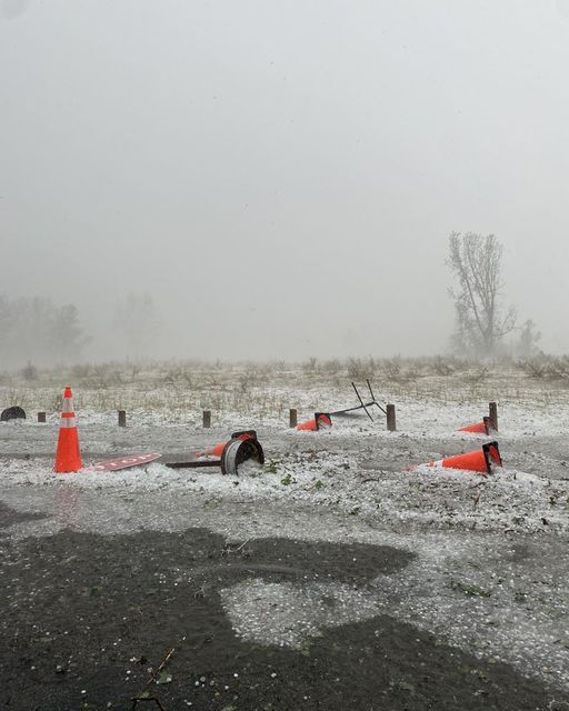
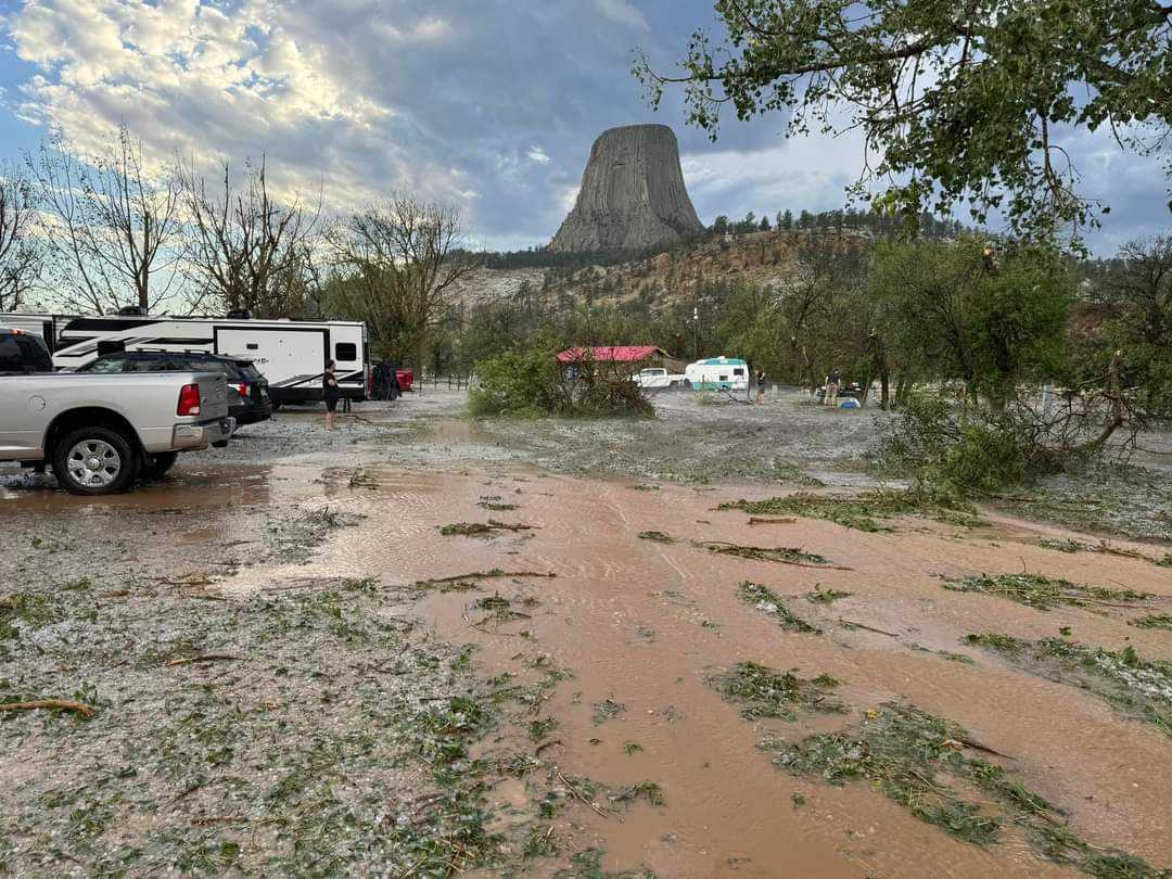
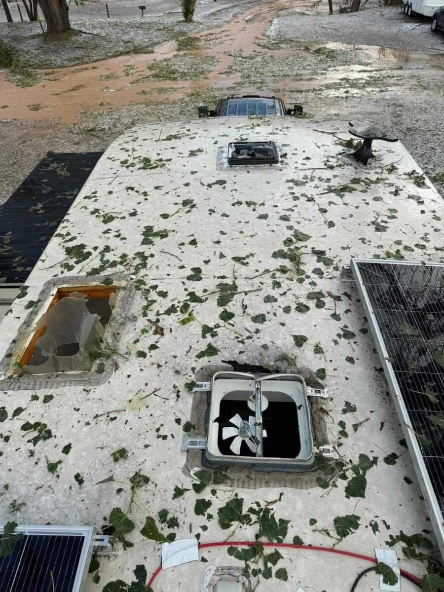
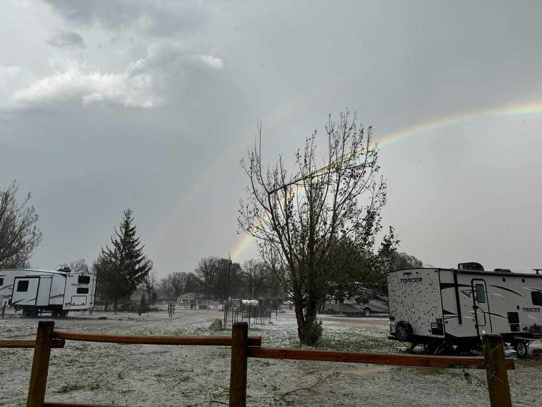
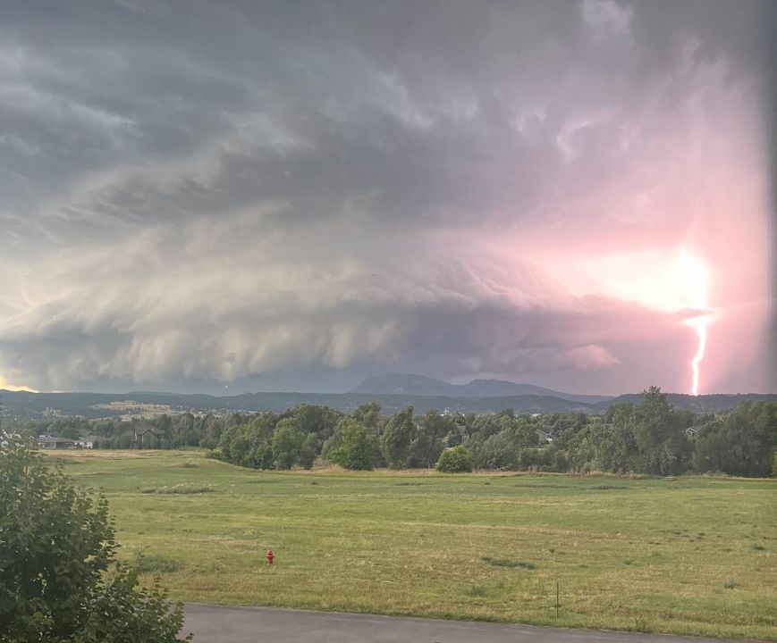
Overview During the late afternoon of August 19th, a supercell developed across northeast Wyoming and tracked directly over Devils Tower, where it caused extensive damage to trees, buildings, campers, and vehicles. The National Park Service closed Devils Tower due to the severe storm damage. The supercell then tracked eastward through the Northern Black Hills and onto the plains of western South Dakota, and continued to produce large hail, strong winds, and heavy rain, before dissipating later in the evening. |
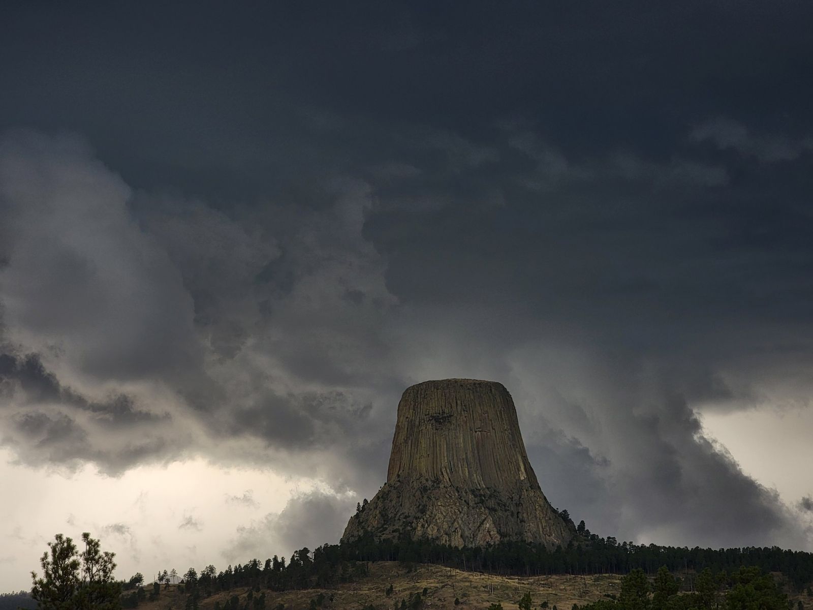 Devils Tower Courtesy of Thomas Winesett |
 |
 |
 |
| Devils Tower Courtesy of Jodi Havener |
Devils Tower Courtesy of Jodi Havener |
Devils Tower Courtesy of Jodi Havener |
 |
 |
 |
| Devils Tower Courtesy of NPS |
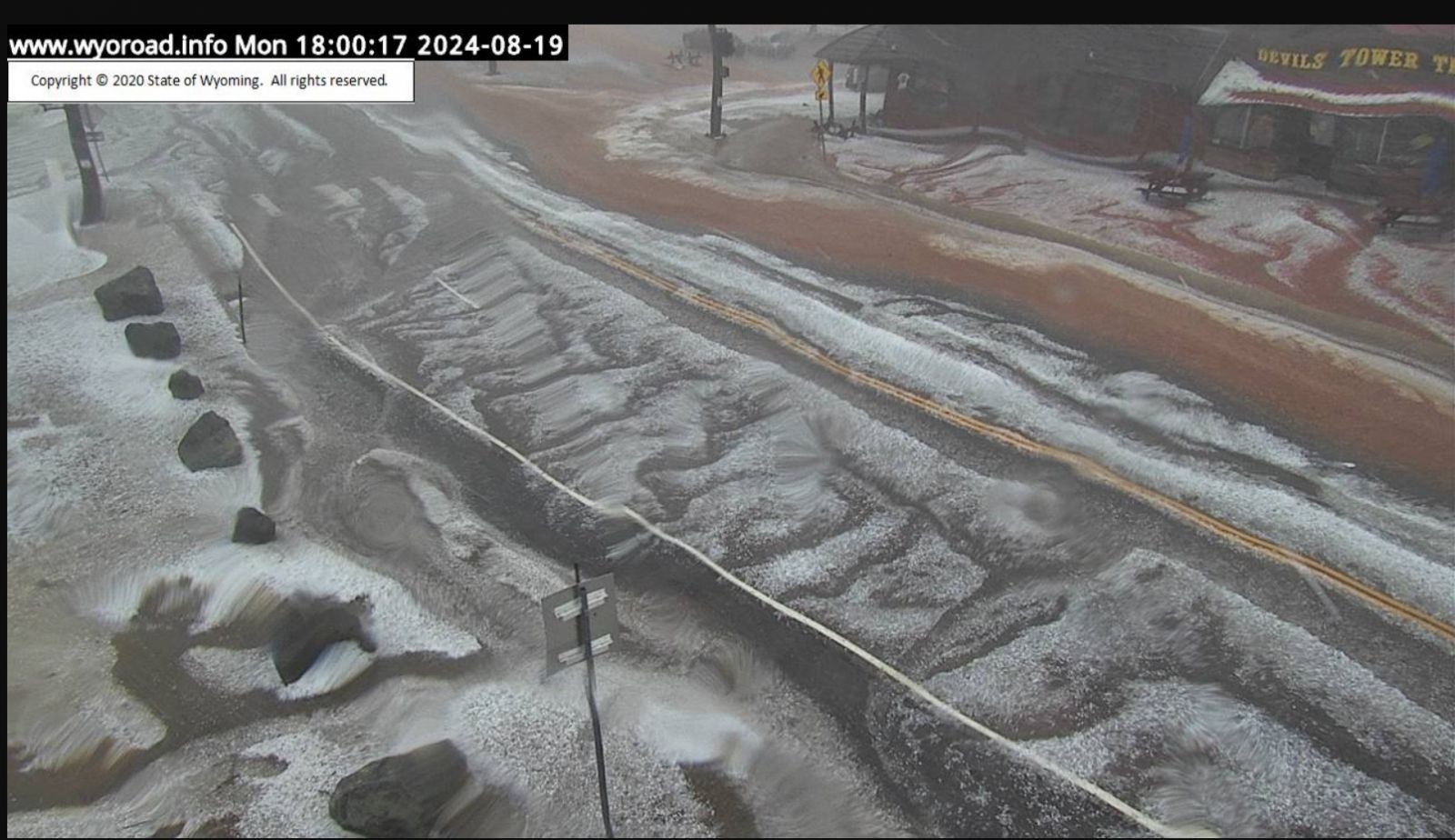
Devils Tower Courtesy of State of Wyoming |
Devils Tower Courtesy of Ken Nutter |
 |
 |
 |
| Devils Tower Courtesy of Ken Nutter |
Devils Tower Courtesy of Ken Nutter |
Spearfish, SD Courtesy of Janice Wolfe |
Radar
Storm Reports
...PRELIMINARY RAINFALL TOTALS SORTED BY MAGNITUDE...

LOCATION                      TOTAL RAIN  COMMENTS

Deadwood SD                    3.50        200 PM 8/20/2024
Lead SD                        2.85        900 AM 8/20/2024
12 WSW Hereford SD             2.50       1130 PM 8/19/2024
1 E Lead SD                    2.46        800 AM 8/20/2024
4 SSW Saint Onge SD            2.05        600 AM 8/20/2024
3 SE Spearfish SD              2.03        800 AM 8/20/2024
Sundance WY                    1.90        805 AM 8/20/2024
2 NW Central City SD           1.84        826 AM 8/20/2024
1 NNW Dwtn Spearfish SD        1.68       1000 AM 8/20/2024
1 SSE Dwtn Spearfish SD        1.67        800 AM 8/20/2024
1 SSW Sturgis SD               1.53        700 AM 8/20/2024
Dwtn Spearfish SD              1.52       1053 PM 8/19/2024
2 WNW Dwtn Spearfish SD        1.52        818 AM 8/20/2024
4 NNW Tilford SD               1.46        800 AM 8/20/2024
1 NNW Nisland SD               1.41        800 AM 8/20/2024
7 NNE Ellsworth AFB SD         1.41        700 AM 8/20/2024
2 E Sturgis SD                 1.37       1120 PM 8/19/2024
Tilford SD                     1.20        700 AM 8/20/2024
4 NNW Elm Springs SD           1.19        600 AM 8/20/2024
Devils Tower WY                1.05       1041 PM 8/19/2024
1 S Devils Tower WY            1.05        800 AM 8/20/2024
3 SE Nisland SD                1.02        800 AM 8/20/2024
6 NNW Dwtn Spearfish SD        1.00        700 AM 8/20/2024
3 SE Saint Onge SD             0.99        600 AM 8/20/2024
7 E Sturgis SD                 0.97        800 AM 8/20/2024
12 WNW Philip SD               0.94        800 AM 8/20/2024
7 N Kirley SD                  0.93        700 AM 8/20/2024
9 NNE Sturgis SD               0.91        629 AM 8/20/2024
2 NW Sundance WY               0.91        645 AM 8/20/2024
4 NNW Sturgis SD               0.86        700 AM 8/20/2024
9 SE Kirley SD                 0.82        800 AM 8/20/2024
Union Center SD                0.82        800 AM 8/20/2024
1 WSW South Eagle Butte SD     0.77        800 AM 8/20/2024
2 E Vale SD                    0.72        630 AM 8/20/2024
1 S Belle Fourche SD           0.72        700 AM 8/20/2024
9 N Kirley SD                  0.66        800 AM 8/20/2024
3 E Philip SD                  0.66        800 AM 8/20/2024
6 WNW Union Center SD          0.65        700 AM 8/20/2024
6 NE Summerset SD              0.62        800 AM 8/20/2024
Wasta SD                       0.58        800 AM 8/20/2024
6 SW Beulah WY                 0.55        800 AM 8/20/2024
9 WSW Red Elm SD               0.50        700 AM 8/20/2024
2 E Cottonwood SD              0.47        200 PM 8/20/2024
2 E Cottonwood SD              0.41        800 AM 8/20/2024
3 SE Philip SD                 0.38        639 AM 8/20/2024
6 SSW Fairpoint SD             0.36        609 AM 8/20/2024
Wall SD                        0.35        800 AM 8/20/2024
4 NNE Summerset SD             0.32        600 AM 8/20/2024
4 WNW Cedar Butte SD           0.28        800 AM 8/20/2024
2 N Summerset SD               0.28        800 AM 8/20/2024
19 NNE Creighton SD            0.27        700 AM 8/20/2024
1 N Red Owl SD                 0.25        700 AM 8/20/2024
3 WNW Milesville SD            0.23        700 AM 8/20/2024
8 ENE Alva WY                  0.22        700 AM 8/20/2024
3 ESE Cheyenne Crossing SD     0.21        700 AM 8/20/2024
6 WSW Opal SD                  0.19        700 AM 8/20/2024
3 WNW Kadoka SD                0.17        500 AM 8/20/2024
3 E Midland SD                 0.16        700 AM 8/20/2024
12 NNW White River SD          0.15        700 AM 8/20/2024
11 W Milesville SD             0.13        800 AM 8/20/2024
8 S Wall SD                    0.13        800 AM 8/20/2024
17 SW Milesville SD            0.13        800 AM 8/20/2024
9 N Cedar Butte SD             0.13        600 AM 8/20/2024
2 W Hamill SD                  0.13        800 AM 8/20/2024
3 ENE Kyle SD                  0.08        700 AM 8/20/2024
Wright WY                      0.08        700 AM 8/20/2024
1 NNE Faith SD                 0.08        800 AM 8/20/2024
12 SSE Milesville SD           0.08        700 AM 8/20/2024
5 W Ellsworth AFB SD           0.07        700 AM 8/20/2024
1 NNW Piedmont SD              0.07        800 AM 8/20/2024
2 SSE Ideal SD                 0.07        600 AM 8/20/2024
1 S White River SD             0.07        800 AM 8/20/2024
1 ESE Pactola Resv SD          0.06        900 AM 8/20/2024
6 N Hamill SD                  0.06        600 AM 8/20/2024
10 W Reva SD                   0.05        800 AM 8/20/2024
3 W Scenic SD                  0.05        700 AM 8/20/2024
12 S Quinn SD                  0.05        800 AM 8/20/2024
Nemo SD                        0.05        800 AM 8/20/2024
Piedmont SD                    0.05        700 AM 8/20/2024
1 NE Winner SD                 0.04        800 AM 8/20/2024
3 NE Hisega SD                 0.04        700 AM 8/20/2024
11 NNE Weston WY               0.04        700 AM 8/20/2024
4 NW Dwtn Rapid City SD        0.04        700 AM 8/20/2024
5 NE Porcupine SD              0.04        800 AM 8/20/2024
7 N Wood SD                    0.03        600 AM 8/20/2024
3 NNE Johnson Siding SD        0.03        700 AM 8/20/2024
1 N Buffalo SD                 0.03        800 AM 8/20/2024
4 NW Parmelee SD               0.03        700 AM 8/20/2024
1 N Hisega SD                  0.02        700 AM 8/20/2024
8 SE Mud Butte SD              0.02        800 AM 8/20/2024
4 NNE Johnson Siding SD        0.02        800 AM 8/20/2024
2 SSW Custer SD                0.01        800 AM 8/20/2024
6 W Rochford SD                0.01        800 AM 8/20/2024
1 NE Dwtn Rapid City SD        0.01        600 AM 8/20/2024

...MAXIMUM OBSERVED WINDS SORTED BY MAGNITUDE...

LOCATION                      MAX WIND    COMMENTS

9 NE Tilford SD                  80       1000 PM 8/19/2024
12 WSW Hereford SD               60        935 PM 8/19/2024
14 SSE Hereford SD               60       1025 PM 8/19/2024
3 NW Wasta SD                    60       1106 PM 8/19/2024
1 S Devils Tower WY              54        545 PM 8/19/2024
5 SW Aladdin WY                  51        640 PM 8/19/2024

...MAXIMUM HAIL SIZE SORTED BY MAGNITUDE...

LOCATION                      MAX SIZE    COMMENTS

Devils Tower WY                2.75        550 PM 8/19/2024
Brownsville SD                 2.00        801 PM 8/19/2024
3 ESE Cheyenne Crossing SD     2.00        745 PM 8/19/2024
2 SW Galena SD                 1.75        800 PM 8/19/2024
9 NE Tilford SD                1.75       1000 PM 8/19/2024
Deadwood SD                    1.75        745 PM 8/19/2024
8 NNE Sundance WY              1.50        630 PM 8/19/2024
Tilford SD                     1.25        838 PM 8/19/2024
Box Elder SD                   1.00       1050 PM 8/19/2024
3 W Galena SD                  1.00        915 PM 8/19/2024
Dwtn Spearfish SD              1.00        732 PM 8/19/2024
 |
Media use of NWS Web News Stories is encouraged! Please acknowledge the NWS as the source of any news information accessed from this site. |
|

