
Heat expands across the Desert Southwest, Plains, Mississippi Valley and Midwest into Monday. Fire weather concerns continue for portions of the Intermountain West. Active monsoonal moisture fuels thunderstorms over the Southwest with possible flash flooding. Tropical cyclone Fausto in the Pacific, should weaken as it approaches Hawaii; Dangerous surf, swells and rip currents are expected. Read More >
|
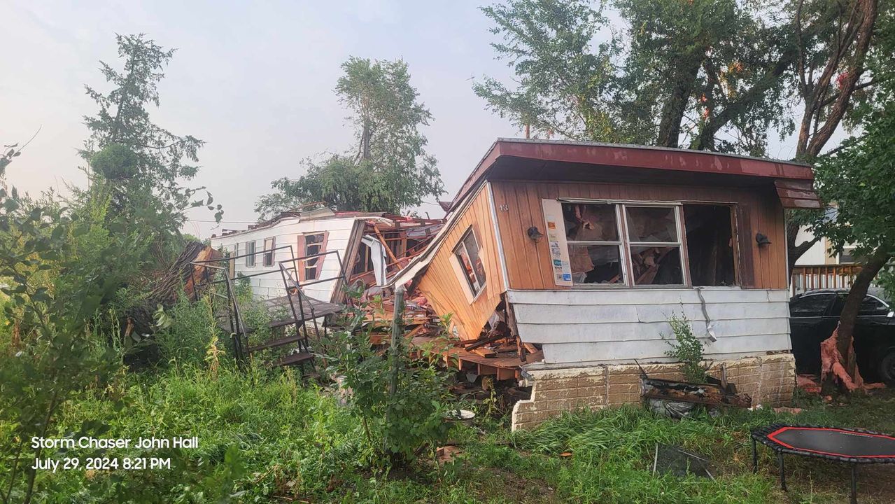
Overview During the afternoon of July 29th a supercell developed north of Kadoka, moved east along Interstate 90 toward Murdo, then turned southeast into Mellette and Tripp counties. The storm moved over the town of Winner, where it did extensive damage with winds exceeding 80 mph. Shortly thereafter, the storm quickly dissipated. |
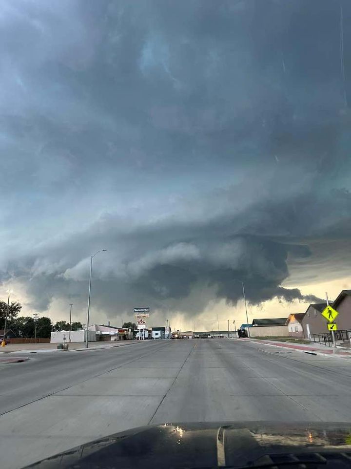 Winner, SD Courtesy of Alan Klein |
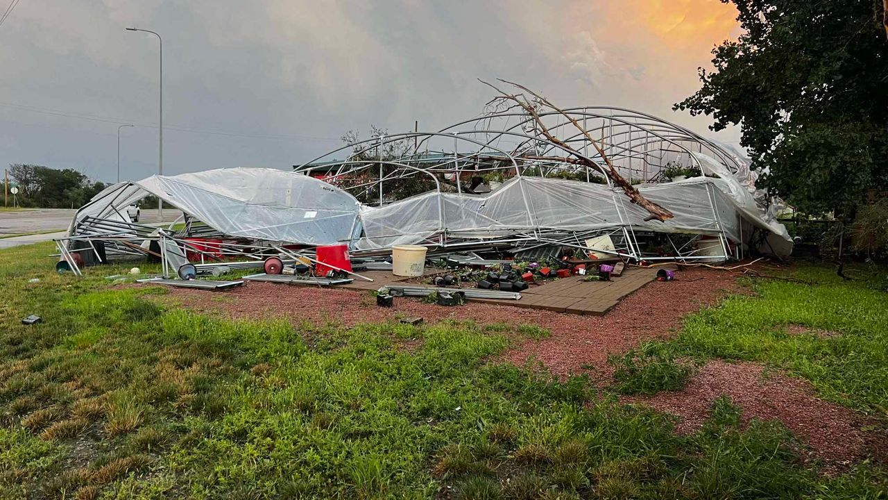
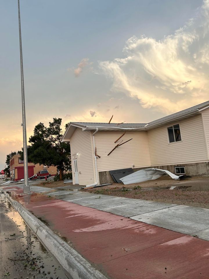
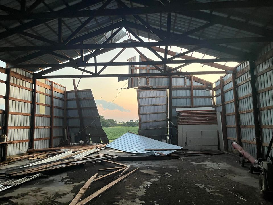
Wind
 |
 |
 |
 |
| Winner, SD Courtesy of John Hall |
Winner, SD Courtesy of Alan Klein |
Winner, SD Courtesy of Brody Stengler |
Winner, SD Courtesy John Hall |
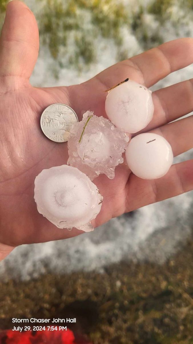
Hail
 |
|||
| Winner, SD Courtesy of John Hall |
Radar
Storm Reports
...MAXIMUM OBSERVED WINDS SORTED BY MAGNITUDE...

LOCATION                      MAX WIND    COMMENTS
                               MPH

10 WNW Philip SD                 65        632 PM 7/30/2024
3 E Philip SD                    63        656 PM 7/30/2024
11 W Milesville SD               60        545 PM 7/30/2024
9 SE Mud Butte SD                57        315 PM 7/30/2024
3 W Lemmon SD                    55        344 PM 7/30/2024
2 SW Bridger SD                  51        552 PM 7/30/2024


...MAXIMUM HAIL SIZE SORTED BY MAGNITUDE...

LOCATION                      MAX SIZE    COMMENTS
                               IN/S/

8 ESE Saint Francis SD         1.75        430 PM 7/30/2024
12 S Faith SD                  1.75        449 PM 7/30/2024
10 WNW Philip SD               1.50        632 PM 7/30/2024
7 SE Saint Francis SD          1.25        433 PM 7/30/2024
 |
Media use of NWS Web News Stories is encouraged! Please acknowledge the NWS as the source of any news information accessed from this site. |
|

