
Tropical Depression Two is expected to gradually strengthen and could bring tropical storm conditions to the Florida Panhandle beginning late Monday. Areas of flash flooding will be possible through Thursday along the eastern and central Gulf Coast. Severe thunderstorms will develop and move along a cold front crossing the Upper Midwest Monday, and through the Ohio Valley/Mid-Atlantic on Tuesday. Read More >
Overview
|
During the evening of July 13, 2024, a cluster of supercells moving southeastward out of Montana merged into a line of significantly severe thunderstorms that brought destructive winds to much of western and central South Dakota. Widespread measured wind gusts of 80 mph or greater were recorded from near the Montana/South Dakota state line eastward to near the Missouri River, with the highest gusts of over 100 mph observed in Butte County. The Storm Prediction Center classified this line of storms as a "derecho", a term reserved for especially widespread, long-lived, and significant wind storms. |
 Wind damage from 7 miles west of Redig, SD (courtesy Ashley Secrest) |
Wind Reports
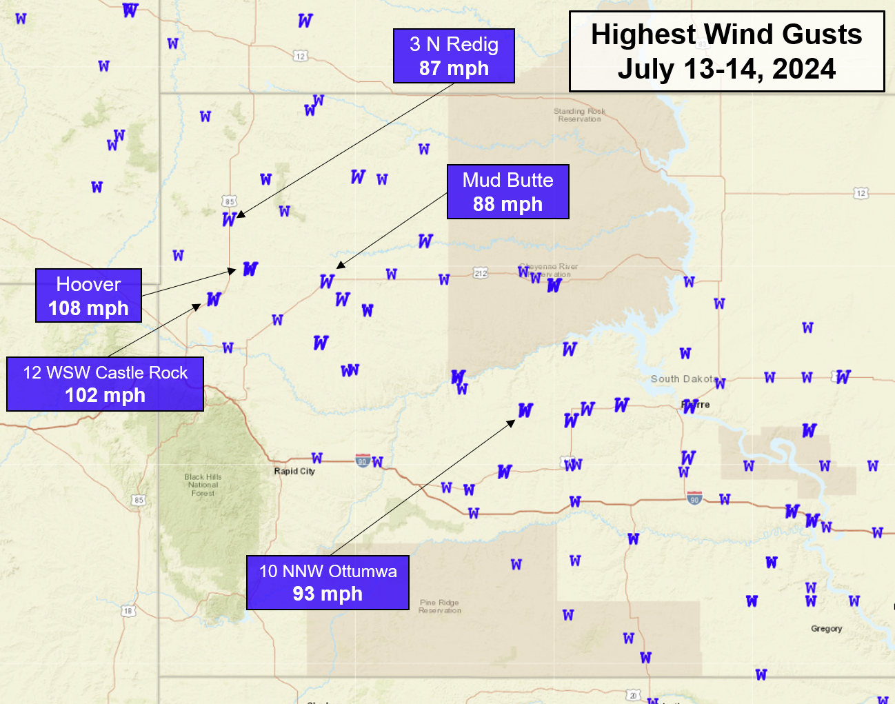 |
| Map of severe (58 mph or greater) wind gust reports (blue "W"s) and significant severe (74 mph or greater) wind gust reports (blue, italic "W"s) from July 13, 2024 to the morning of July 14, 2024. Strongest measured wind gusts are annotated. |
...MAXIMUM OBSERVED WINDS SORTED BY MAGNITUDE...

LOCATION                      MAX WIND    COMMENTS
                               MPH

7 WSW Hoover SD                 108        954 PM 7/13/2024
12 WSW Castle Rock SD           102        955 PM 7/13/2024
10 NNW Ottumwa SD                93       1139 PM 7/13/2024
7 E Redig SD                     90        945 PM 7/13/2024
1 ENE Mud Butte SD               88       1015 PM 7/13/2024
3 N Redig SD                     87        940 PM 7/13/2024
2 SW Bridger SD                  85       1114 PM 7/13/2024
6 WSW Fairpoint SD               84       1025 PM 7/13/2024
9 SE Mud Butte SD                83       1030 PM 7/13/2024
3 E Philip SD                    81       1150 PM 7/13/2024
Usta SD                          78       1047 PM 7/13/2024
1 WSW South Eagle Butte SD       78       1150 PM 7/13/2024
8 E Prairie City SD              76       1012 PM 7/13/2024
10 W Reva SD                     74        955 PM 7/13/2024
7 NNE Ralph SD                   74        947 PM 7/13/2024
6 WSW Opal SD                    71       1040 PM 7/13/2024
6 W Parmelee SD                  71        105 AM 7/14/2024
3 ENE Midland SD                 71       1215 AM 7/14/2024
13 SSW Reva SD                   70        956 PM 7/13/2024
13 NE Newell SD                  70       1004 PM 7/13/2024
11 W Milesville SD               70       1120 PM 7/13/2024
1 ESE Ladner SD                  70        915 PM 7/13/2024
7 ESE Rosebud SD                 69        105 AM 7/14/2024
1 NE Winner SD                   68        245 AM 7/14/2024
2 W Hamill SD                    67        120 AM 7/14/2024
Union Center SD                  67       1040 PM 7/13/2024
7 S Shadehill SD                 66       1025 PM 7/13/2024
3 W Union Center SD              66       1051 PM 7/13/2024
27 WNW Castle Rock SD            66        956 PM 7/13/2024
10 NNE White River SD            65       1243 AM 7/14/2024
17 SW Usta SD                    65       1040 PM 7/13/2024
Wewela SD                        62        139 AM 7/14/2024
7 E Wanblee SD                   61       1228 AM 7/14/2024
14 WNW Lodgepole SD              61        945 PM 7/13/2024
9 ENE Belvidere SD               60       1237 AM 7/14/2024
Bison SD                         60       1020 PM 7/13/2024
15 SSE Mission SD                60        119 AM 7/14/2024
4 WNW Cedar Butte SD             59       1230 AM 7/14/2024
4 E Cactus Flat SD               59       1159 PM 7/13/2024
2 E Cottonwood SD                59       1205 AM 7/14/2024
6 W Cottonwood SD                59       1155 PM 7/13/2024
1 NE Midland SD                  58       1241 AM 7/14/2024
5 WNW New Underwood SD           58       1104 PM 7/13/2024
1 NNW Nisland SD                 58       1015 PM 7/13/2024
3 NW Wasta SD                    58       1124 PM 7/13/2024
4 SSE Witten SD                  57        133 AM 7/14/2024
11 SW Parmelee SD                57       1252 AM 7/14/2024
7 E Sturgis SD                   56       1040 PM 7/13/2024
1 S White River SD               55       1235 AM 7/14/2024
Photos
 |
 |
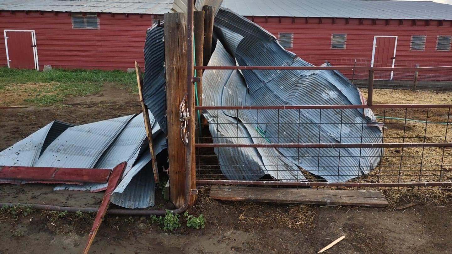 |
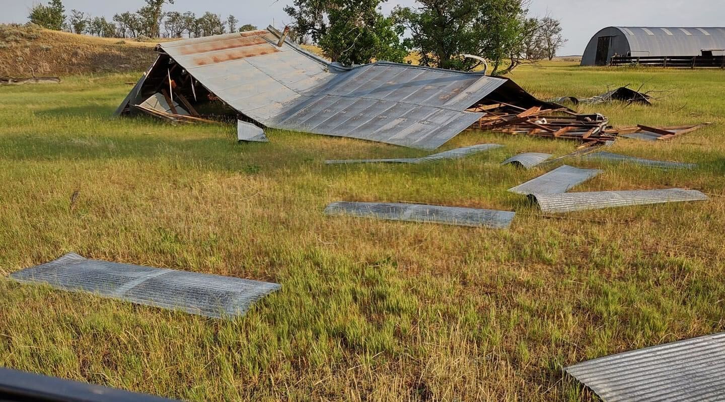
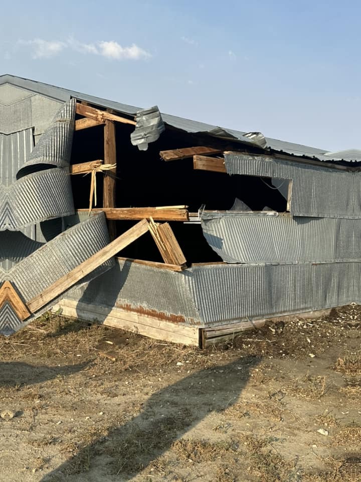
| 7 miles west of Redig (courtesy Ashley Secrest) |
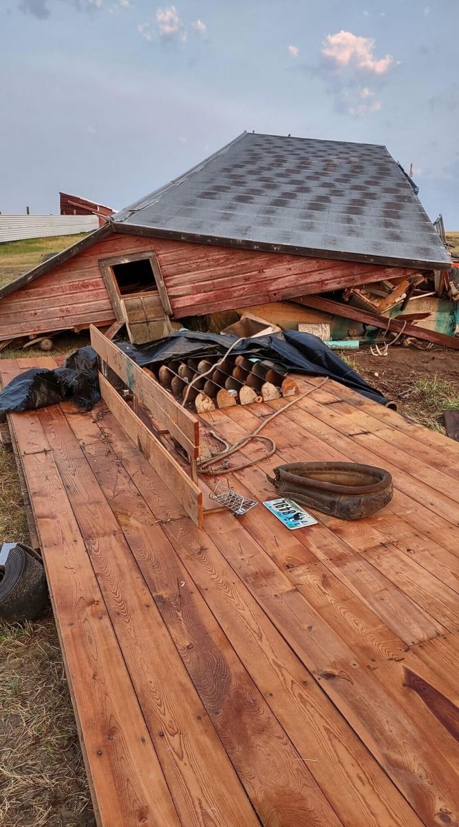
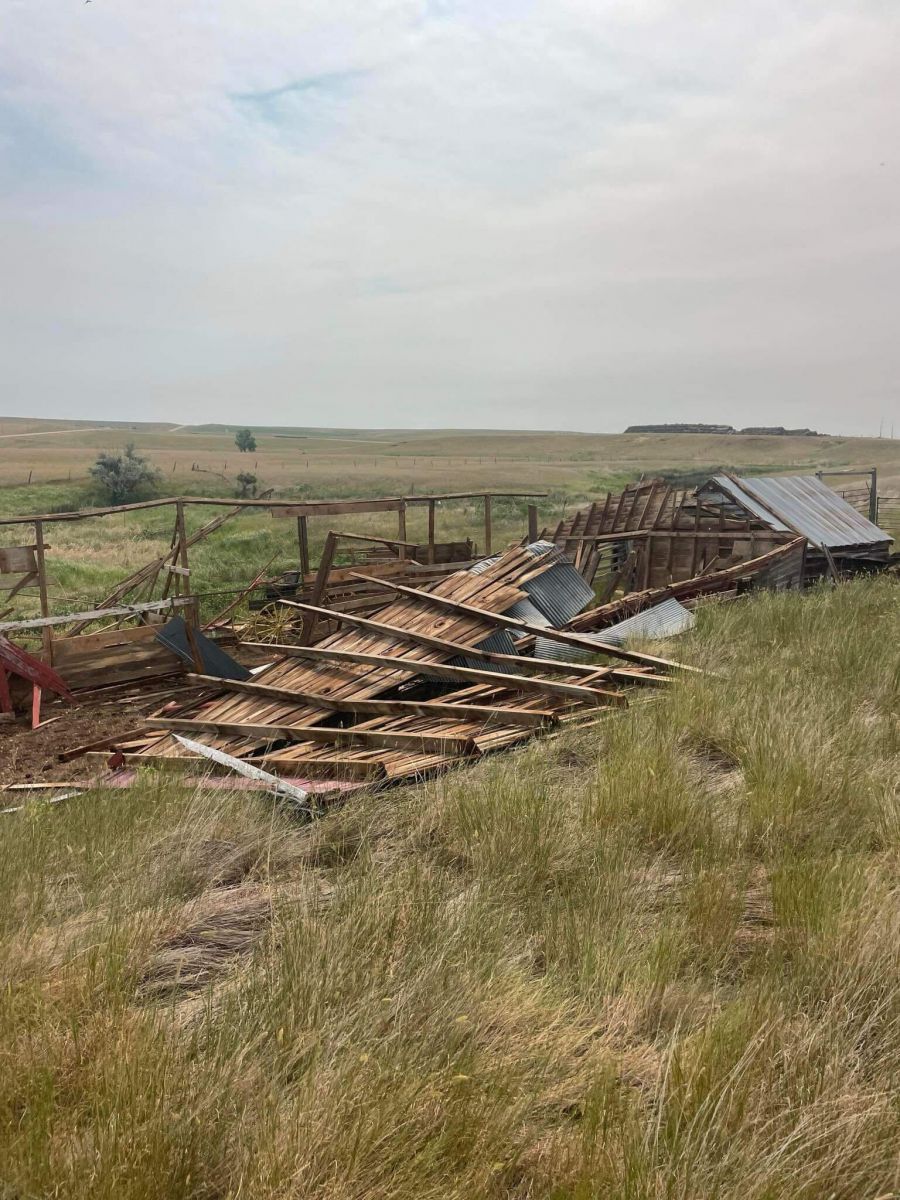
Harding (courtesy Carmen Gilbert) |
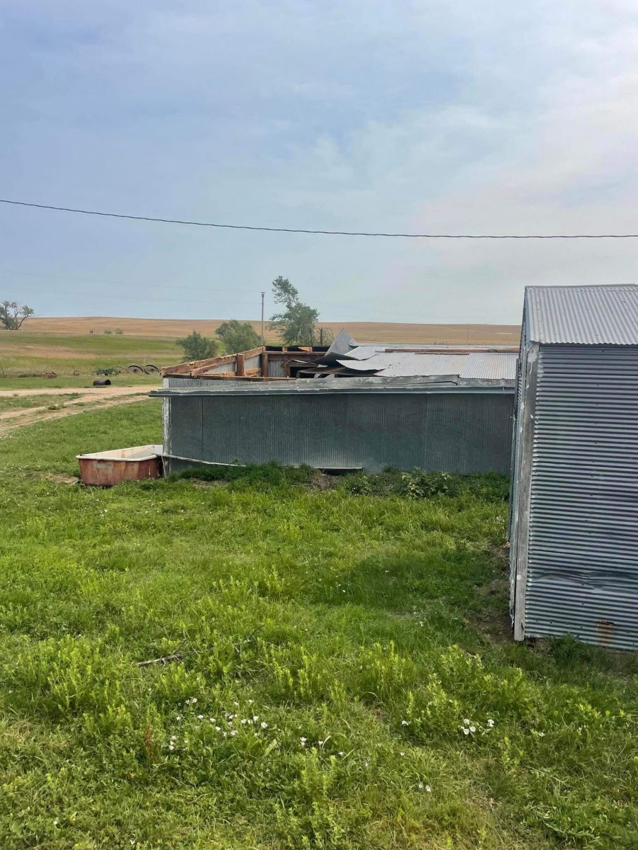
7 miles west of Redig (courtesy Ashley Secrest) |
 |
 |
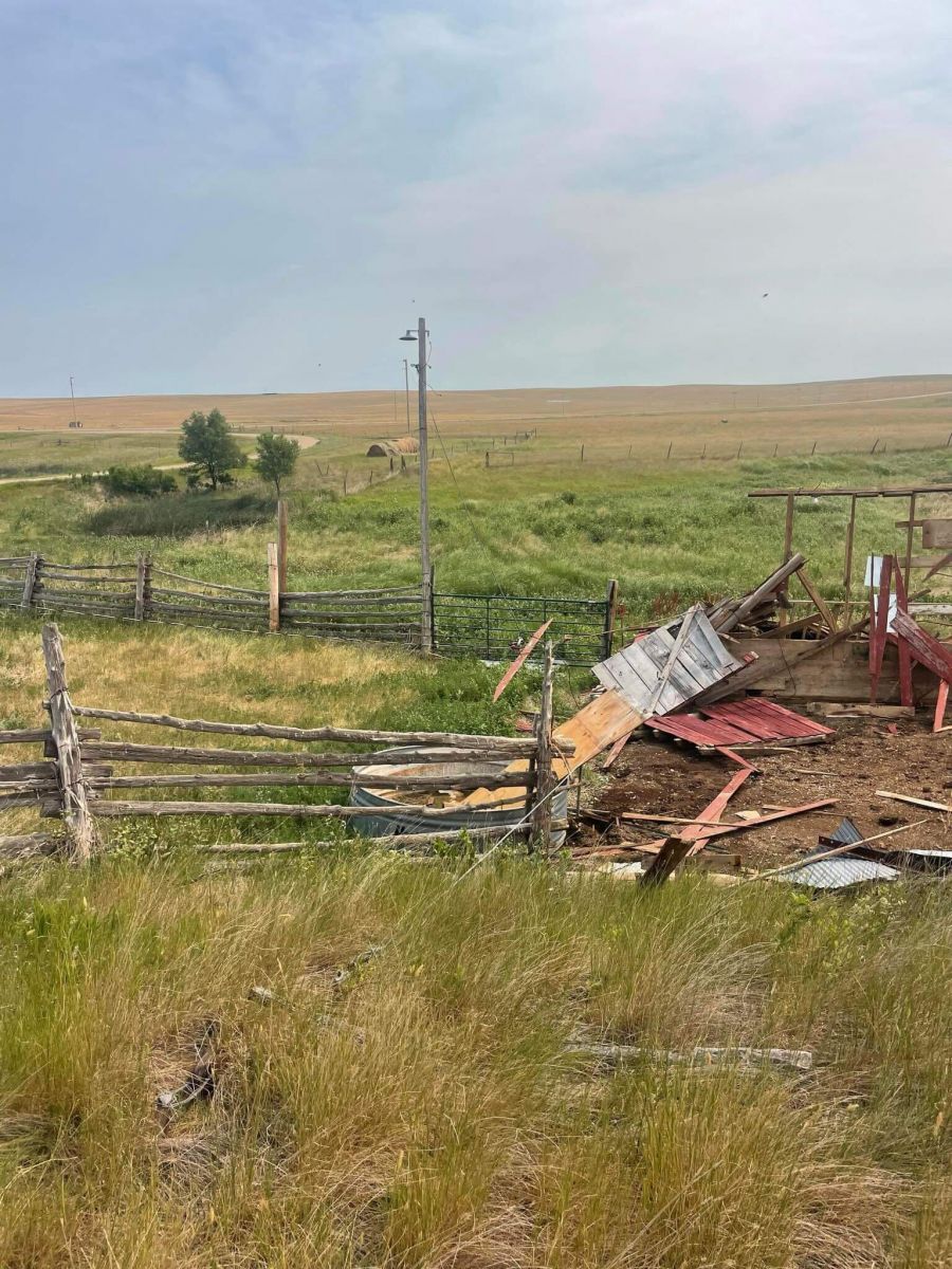 |
| Plainview (courtesy Glen King) |
||
Radar
 |
Media use of NWS Web News Stories is encouraged! Please acknowledge the NWS as the source of any news information accessed from this site. |
|

