
Tropical Depression Two is expected to gradually strengthen and could bring tropical storm conditions to the Florida Panhandle beginning late Monday. Areas of flash flooding will be possible through Thursday along the eastern and central Gulf Coast. Severe thunderstorms will develop and move along a cold front crossing the Upper Midwest Monday, and through the Ohio Valley/Mid-Atlantic on Tuesday. Read More >
Overview
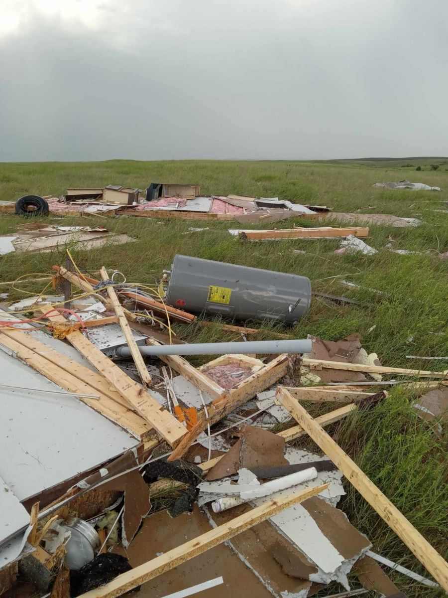
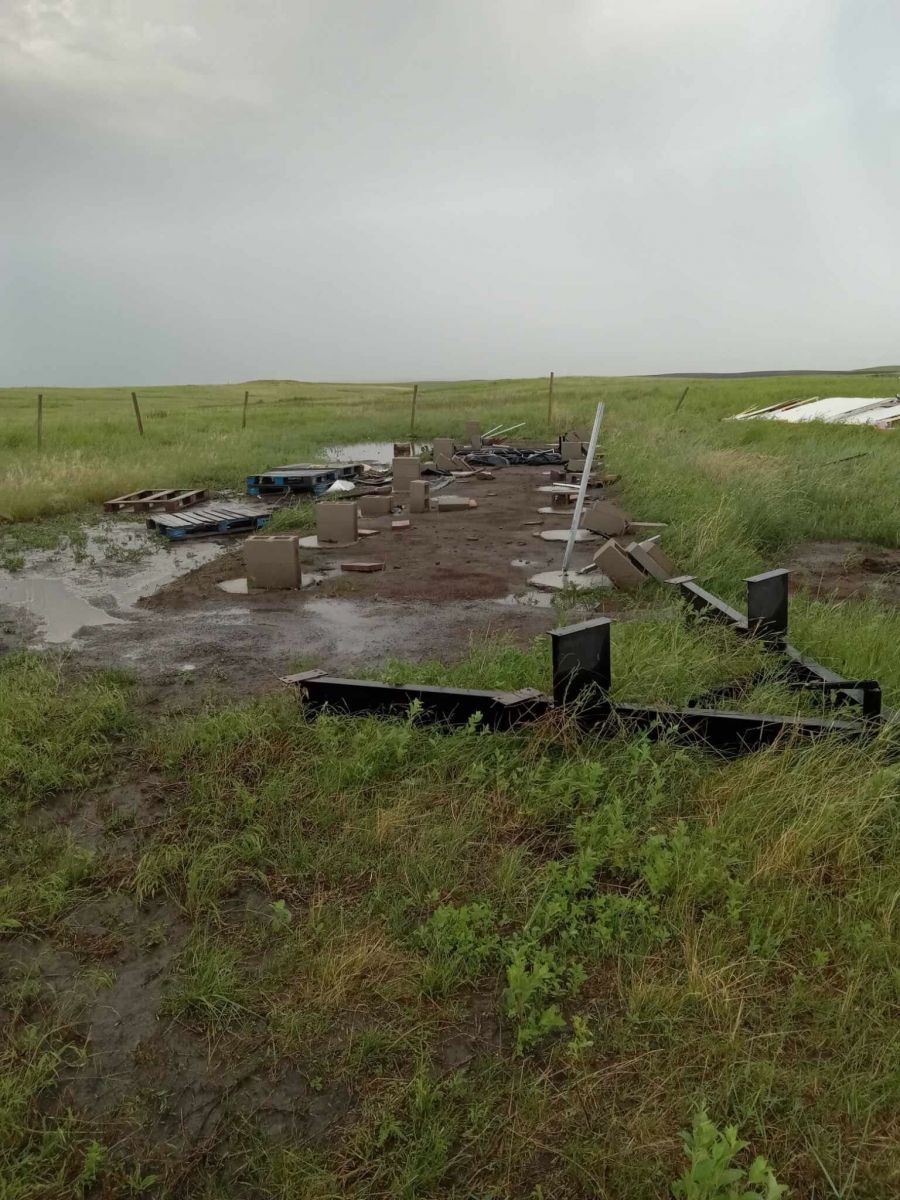
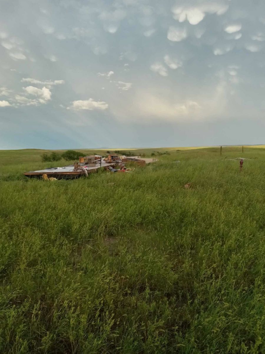
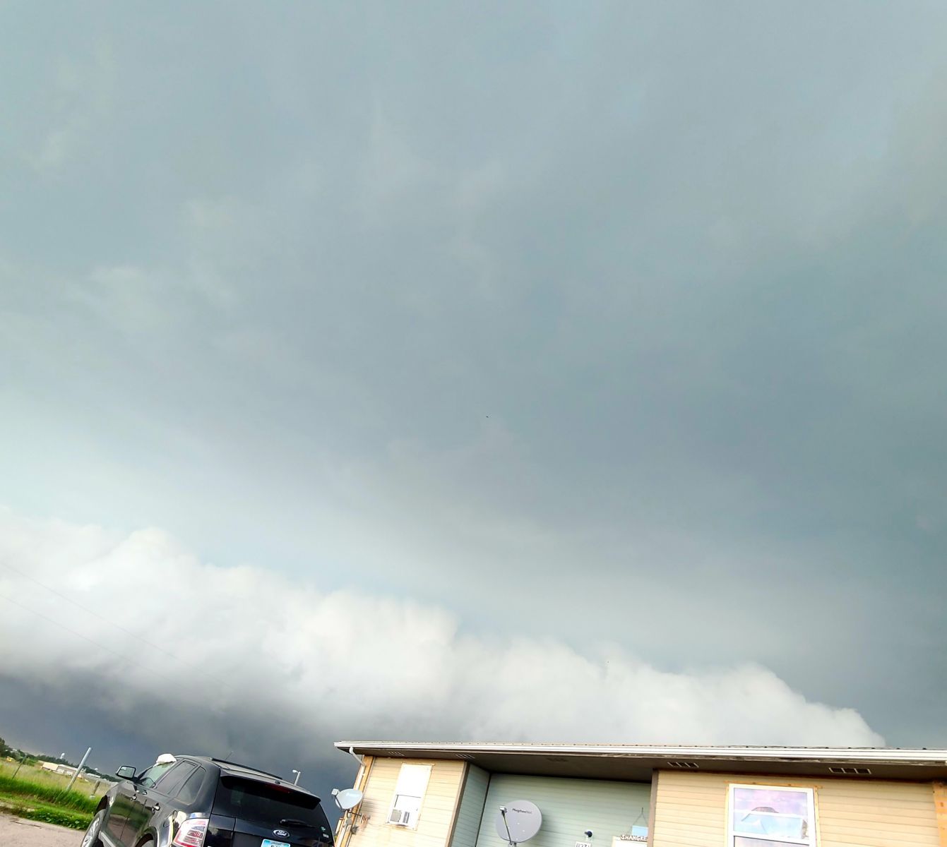
Storms began developing across northwestern SD on the afternoon of Tuesday, June 25. They moved southeastward and strengthened as they approached south central South Dakota. Very strong straight-line winds caused significant damage in Potato Creek in Jackson County. Even more damaged was caused as the storm moved into Bennett County, where it produced baseball sized hail. The storms then moved into Nebraska Tuesday evening.
Photos
 |
 |
 |
 |
| Potato Creek (Robert Gotherage) |
Potato Creek (Robert Gotherage) |
Potato Creek (Robert Gotherage) |
Potato Creek (Robert Gotherage) |
 |
 |
 |
 |
| 1.5E Martin, SD (Paula Witt) |
1.5E Martin, SD (Paula Witt) |
1.5E Martin, SD (Paula Witt) |
1.5E Martin, SD (Paula Witt) |
Radar
Storm Reports
Public Information Statement
National Weather Service Rapid City SD
949 AM MDT Wed Jun 26 2024

The following are unofficial observations taken from the afternoon
and evening of Tuesday, June 25, 2024

***********24 HOUR RAINFALL (AT LEAST 0.50 INCH)************

LOCATION              24 HOUR      TIME/DATE  COMMENTS
                     RAINFALL       MEASURED
                     (inches)

SOUTH DAKOTA

...Bennett County...
  8 E Martin             0.70   700 AM  6/26  Co-Op Observer

...Jackson County...
  11 SE Potato Creek     1.22   700 AM  6/26  CoCoRaHS
  7 ESE Potato Creek     0.95   700 AM  6/26  CoCoRaHS

...Todd County...
  7 ESE Rosebud          0.67   800 AM  6/26  Mesonet
  Parmlee                0.50   800 AM  6/26  Mesonet


**************PEAK WIND GUST (AT LEAST 50 MPH)**************

LOCATION             MAX WIND      TIME/DATE  COMMENTS
                         GUST       MEASURED
                        (mph)

SOUTH DAKOTA

...Bennett County...
  1 ESE Martin             71   620 PM  6/25  Mesonet

...Jackson County...
  9 SSE Potato Creek       70   555 PM  6/25  Trained Spotter
  4 E Cactus Flat          67   541 PM  6/25  Mesonet

...Meade County...
  1 SE Union Center        60   327 PM  6/25  Trained Spotter
  1 N Hereford             60   344 PM  6/25  Trained Spotter

...Pennington County...
  1 NNW Creighton          70   409 PM  6/25  Trained Spotter
  4 NW Creighton           60   410 PM  6/25  Trained Spotter
  3 NW Wasta               54   426 PM  6/25  Mesonet

...Todd County...
  7 ESE Rosebud            77   740 PM  6/25  Mesonet
  6 W Parmelee             75   728 PM  6/25  Mesonet
  11 SW Parmelee           69   711 PM  6/25  Mesonet
  15 SSE Mission           67   744 PM  6/25  Mesonet

...Tripp County...
  Wewela                   52   834 PM  6/25  Mesonet


***********MAXIMUM HAIL SIZE (AT LEAST 0.50 MPH)************

LOCATION                 HAIL      TIME/DATE  COMMENTS
                         SIZE       MEASURED
                     (inches)

SOUTH DAKOTA

...Bennett County...
  1 E Martin             2.75   630 PM  6/25  Trained Spotter
  3 N Martin             1.75   629 PM  6/25  mPING report

...Jackson County...
  4 NNE Long Valley      1.75   633 PM  6/25  Public
  9 SSE Potato Creek     1.00   555 PM  6/25  Trained Spotter

...Pennington County...
  10 NNE Wall            2.00   415 PM  6/25  Lasted 10 minutes
  1 NNW Creighton        1.75   409 PM  6/25  Trained Spotter
  4 S Dwtn Rapid City    1.50   502 PM  6/25  NWS Employee
  5 SW Dwtn Rapid City   1.25   506 PM  6/25  mPING report
  1 NNW Hisega           1.25   447 PM  6/25  Public
  6 SSW Dwtn Rapid Cit   1.00   503 PM  6/25  mPING report
  7 SW Rapid City Arpt   1.00   516 PM  6/25  NWS Employee
  4 SSW Dwtn RAPID CIT   1.00   505 PM  6/25  NWS Employee


...PRELIMINARY RAINFALL TOTALS (AT LEAST 0.50 INCH) SORTED BY MAGNITUDE...

LOCATION                      TOTAL RAIN  COMMENTS
                               IN/S/

11 SE Potato Creek SD          1.22        700 AM 6/26/2024
7 ESE Potato Creek SD          0.95        700 AM 6/26/2024
8 E Martin SD                  0.70        700 AM 6/26/2024
7 ESE Rosebud SD               0.67        800 AM 6/26/2024
Parmlee SD                     0.50        800 AM 6/26/2024


...MAXIMUM OBSERVED WINDS (AT LEAST 50 MPH) SORTED BY MAGNITUDE...

LOCATION                      MAX WIND    COMMENTS
                               MPH

7 ESE Rosebud SD                 77        740 PM 6/25/2024
6 W Parmelee SD                  75        728 PM 6/25/2024
1 ESE Martin SD                  71        620 PM 6/25/2024
9 SSE Potato Creek SD            70        555 PM 6/25/2024
1 NNW Creighton SD               70        409 PM 6/25/2024
11 SW Parmelee SD                69        711 PM 6/25/2024
4 E Cactus Flat SD               67        541 PM 6/25/2024
15 SSE Mission SD                67        744 PM 6/25/2024
1 SE Union Center SD             60        327 PM 6/25/2024
1 N Hereford SD                  60        344 PM 6/25/2024
4 NW Creighton SD                60        410 PM 6/25/2024
3 NW Wasta SD                    54        426 PM 6/25/2024
Wewela SD                        52        834 PM 6/25/2024


...MAXIMUM HAIL SIZE (AT LEAST 0.50 INCH) SORTED BY MAGNITUDE...

LOCATION                      MAX SIZE    COMMENTS
                               IN/S/

1 E Martin SD                  2.75        630 PM 6/25/2024
10 NNE Wall SD                 2.00        415 PM 6/25/2024
1 NNW Creighton SD             1.75        409 PM 6/25/2024
4 NNE Long Valley SD           1.75        633 PM 6/25/2024
3 N Martin SD                  1.75        629 PM 6/25/2024
4 S Dwtn Rapid City SD         1.50        502 PM 6/25/2024
5 SW Dwtn Rapid City SD        1.25        506 PM 6/25/2024
1 NNW Hisega SD                1.25        447 PM 6/25/2024
6 SSW Dwtn Rapid City SD       1.00        503 PM 6/25/2024
7 SW Rapid City Arpt SD        1.00        516 PM 6/25/2024
9 SSE Potato Creek SD          1.00        555 PM 6/25/2024
4 SSW Dwtn RAPID CITY SD       1.00        505 PM 6/25/2024
 |
Media use of NWS Web News Stories is encouraged! Please acknowledge the NWS as the source of any news information accessed from this site. |
|

