
Tropical Depression Two is expected to gradually strengthen and could bring tropical storm conditions to the Florida Panhandle beginning late Monday. Areas of flash flooding will be possible through Thursday along the eastern and central Gulf Coast. Severe thunderstorms will develop and move along a cold front crossing the Upper Midwest Monday, and through the Ohio Valley/Mid-Atlantic on Tuesday. Read More >
Overview
|
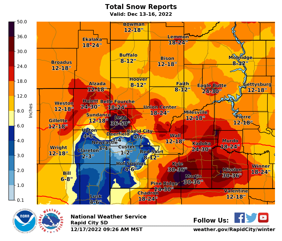
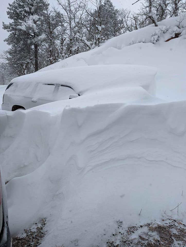
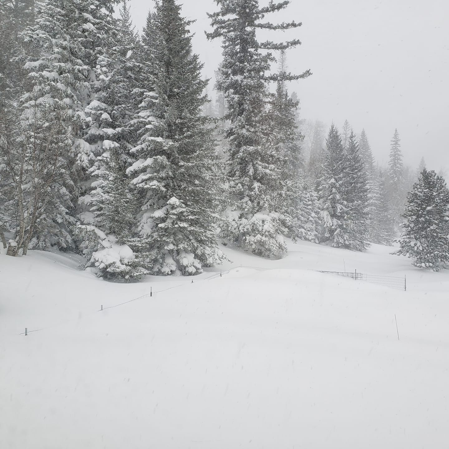
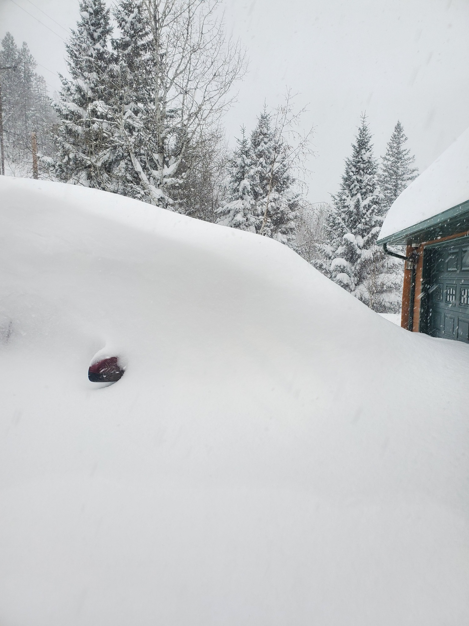
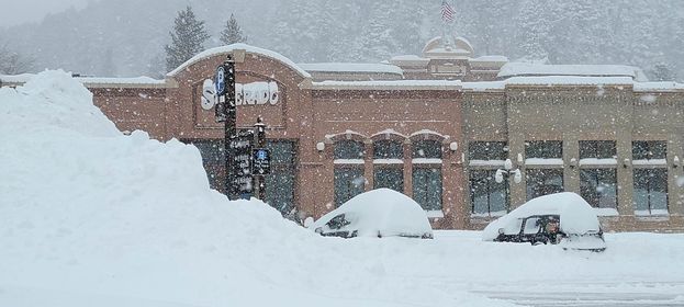
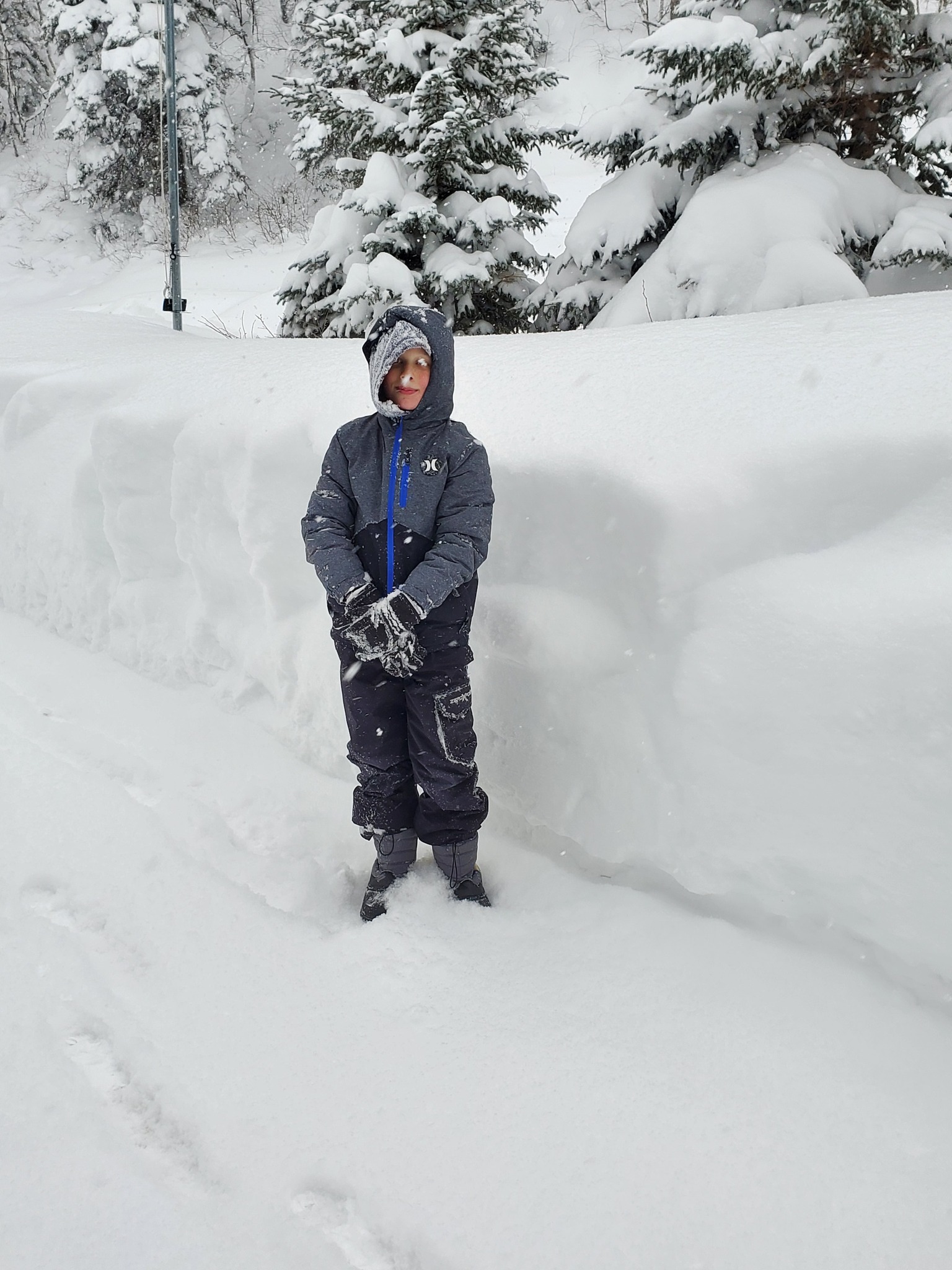
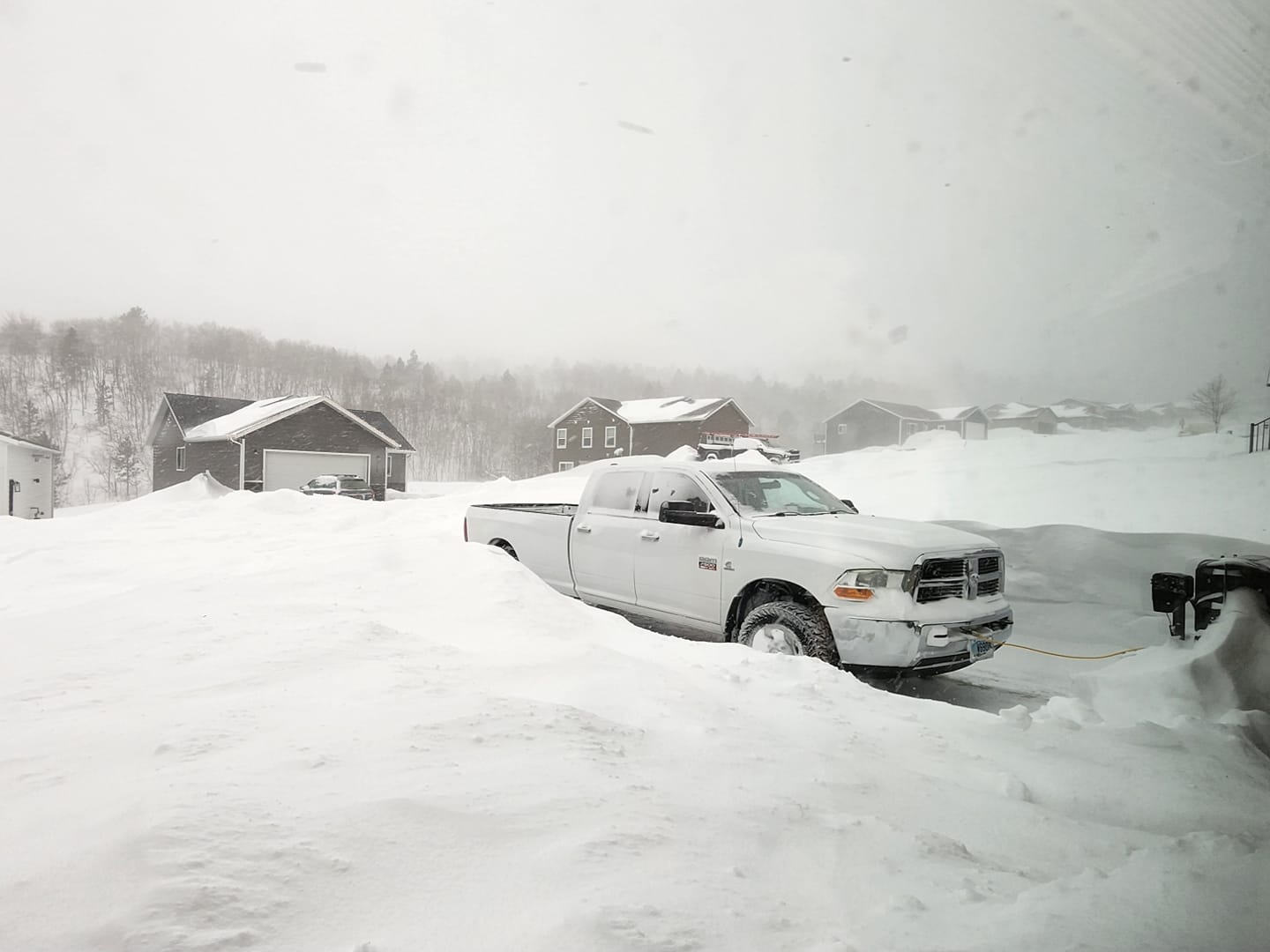
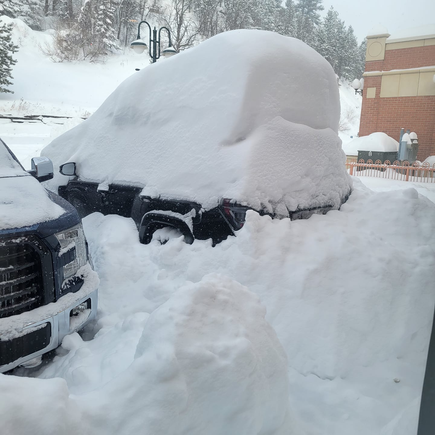
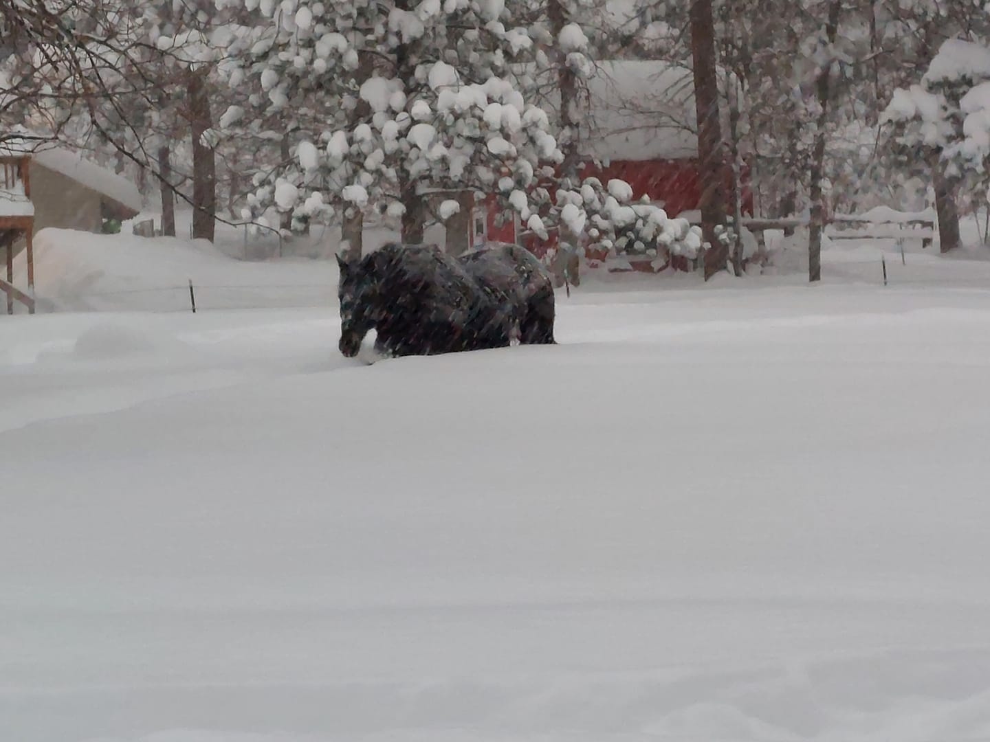
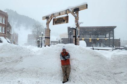
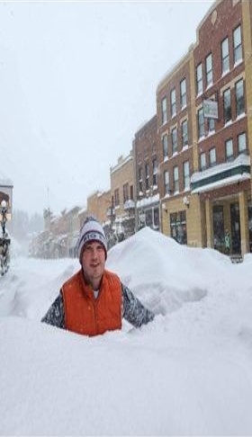
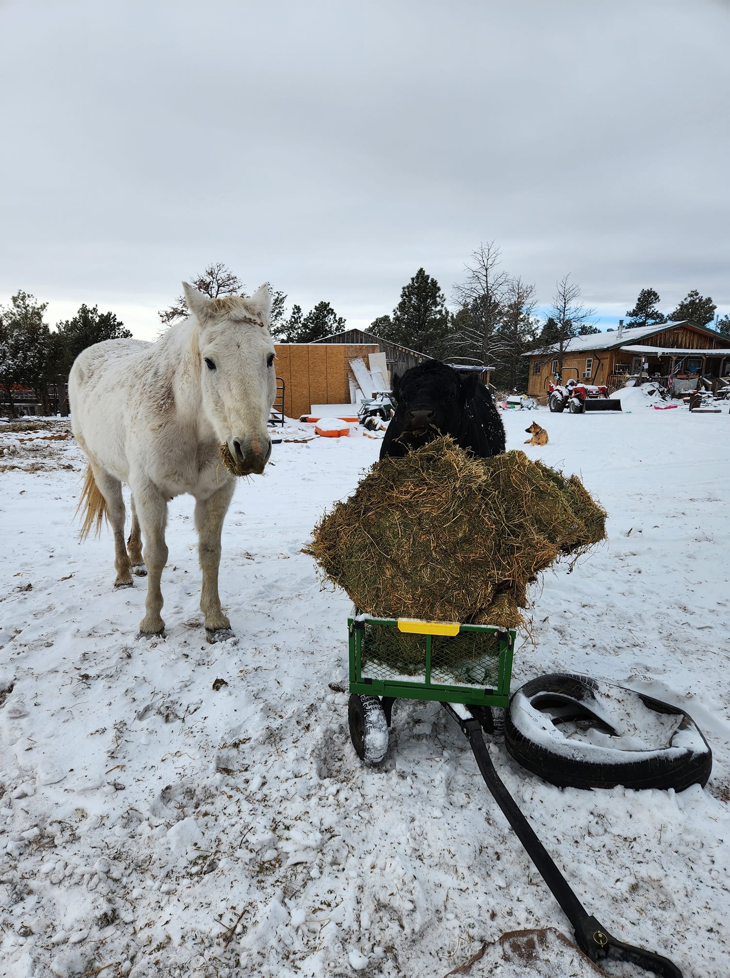
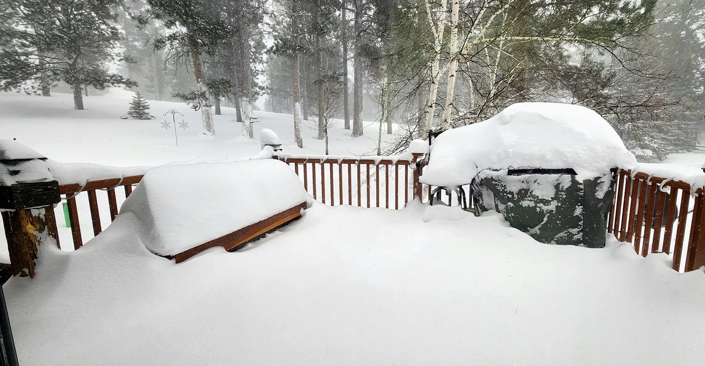
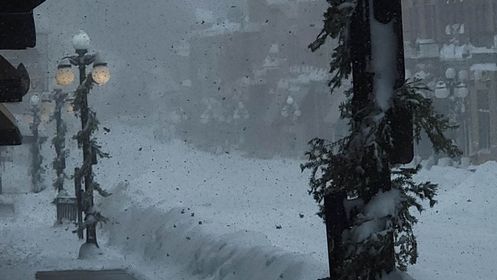
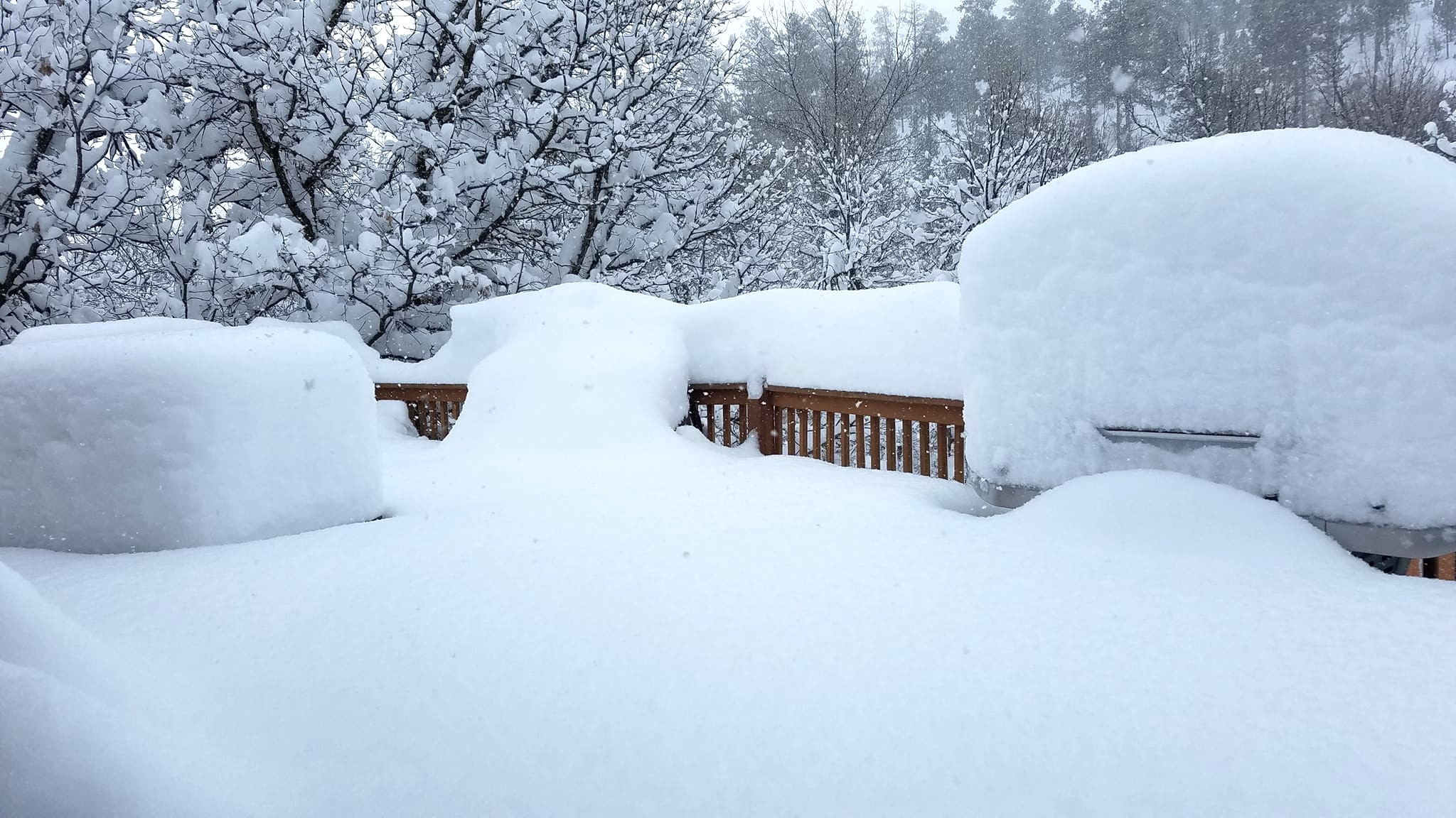
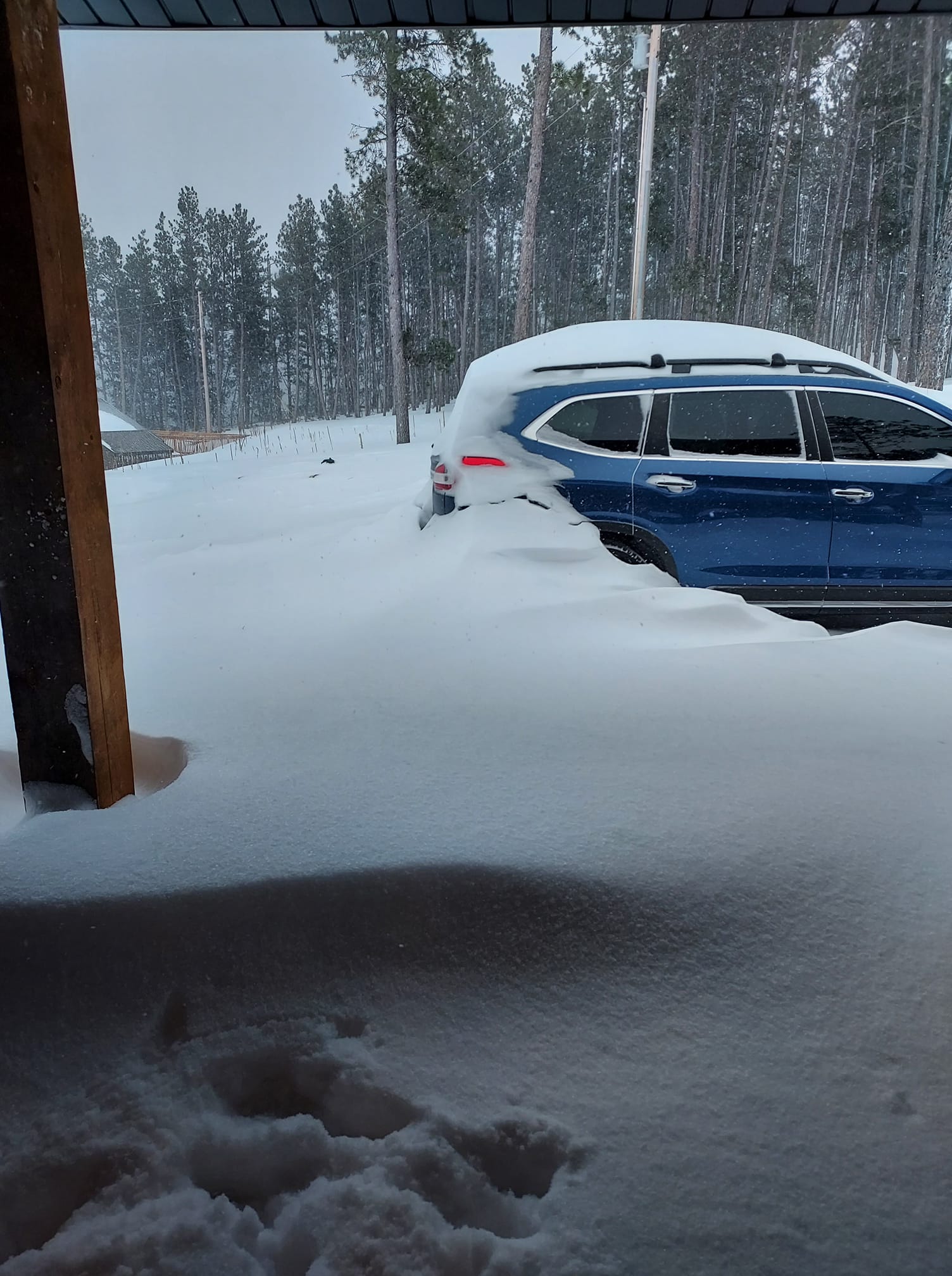
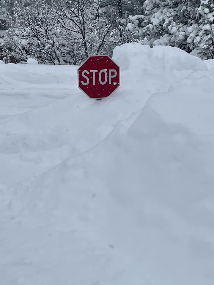
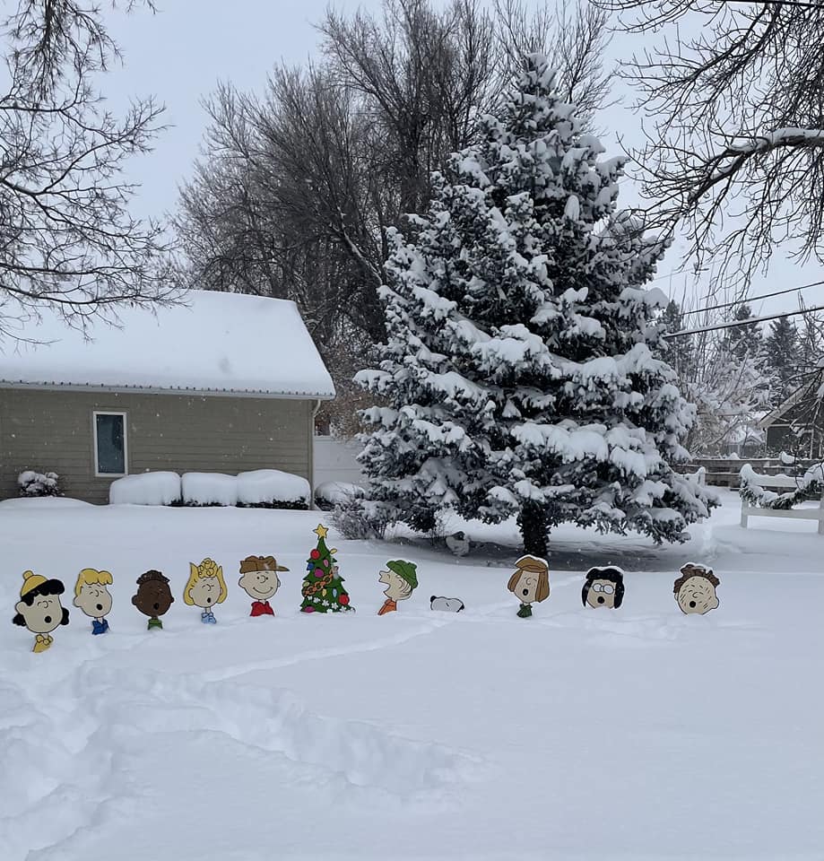
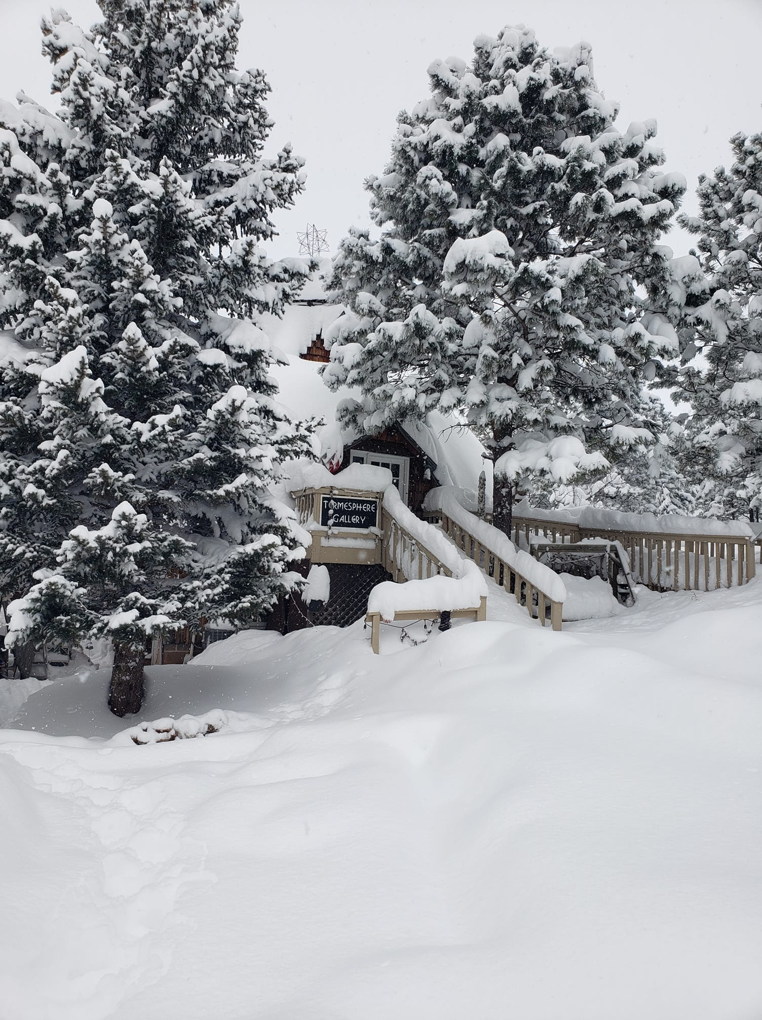
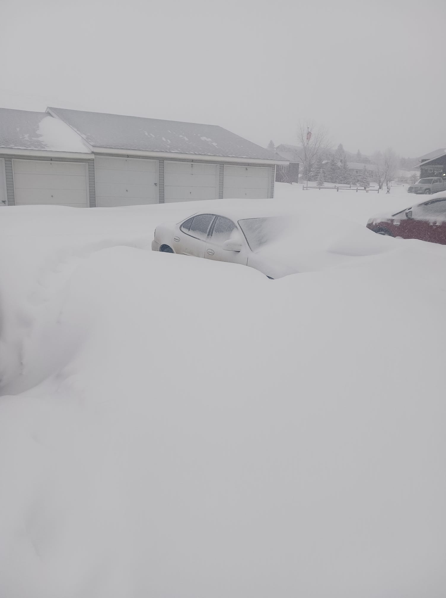
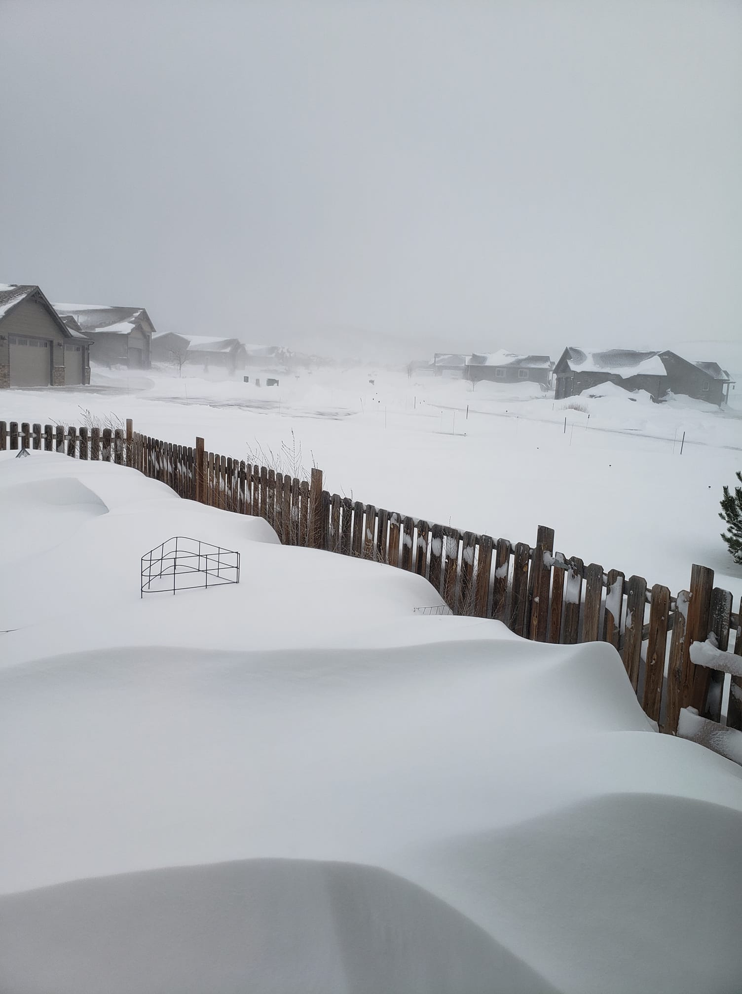
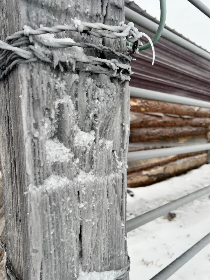
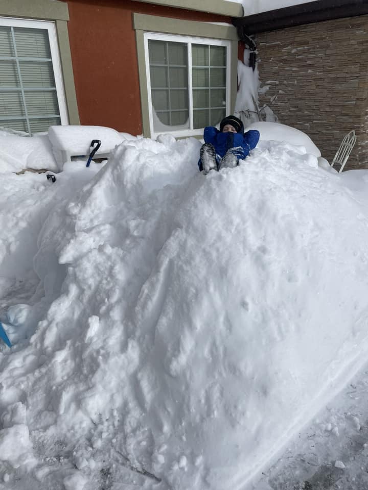
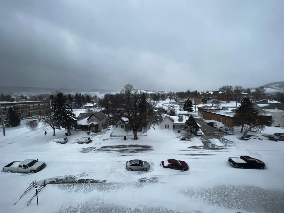
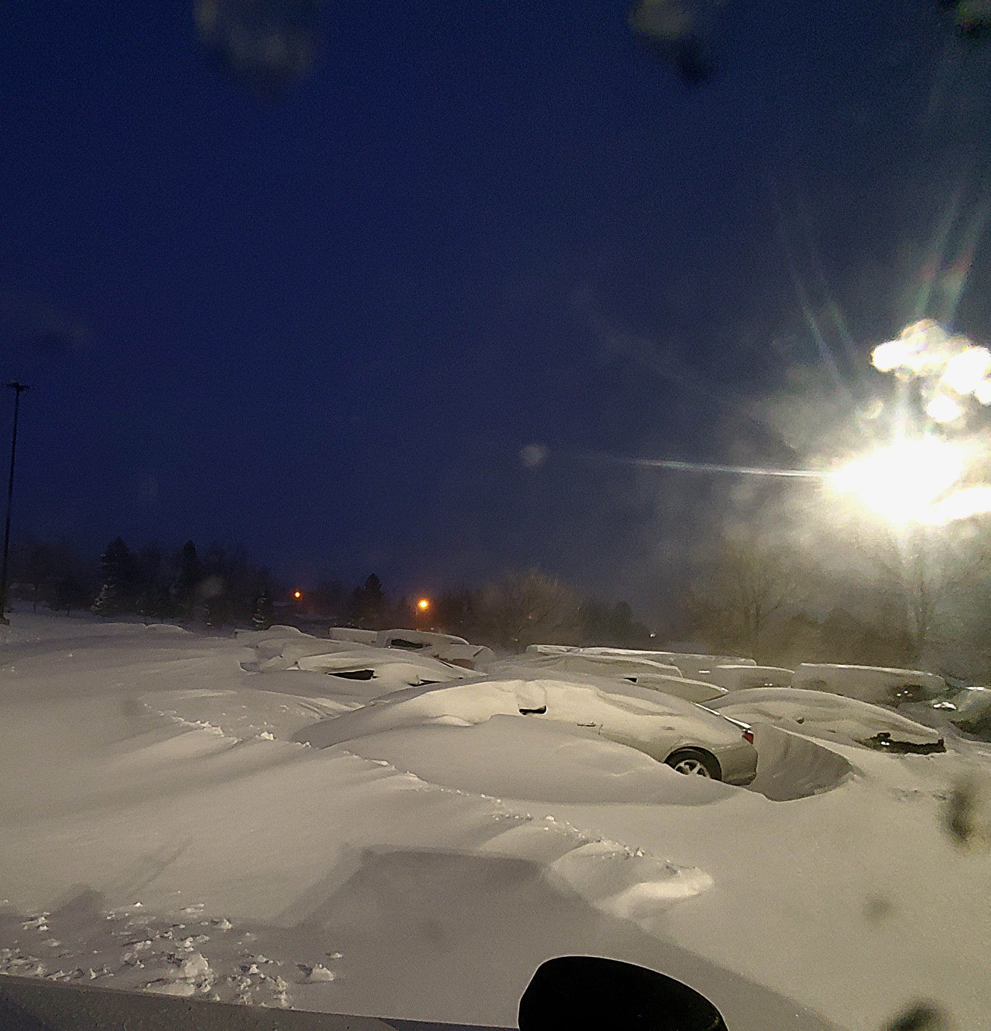
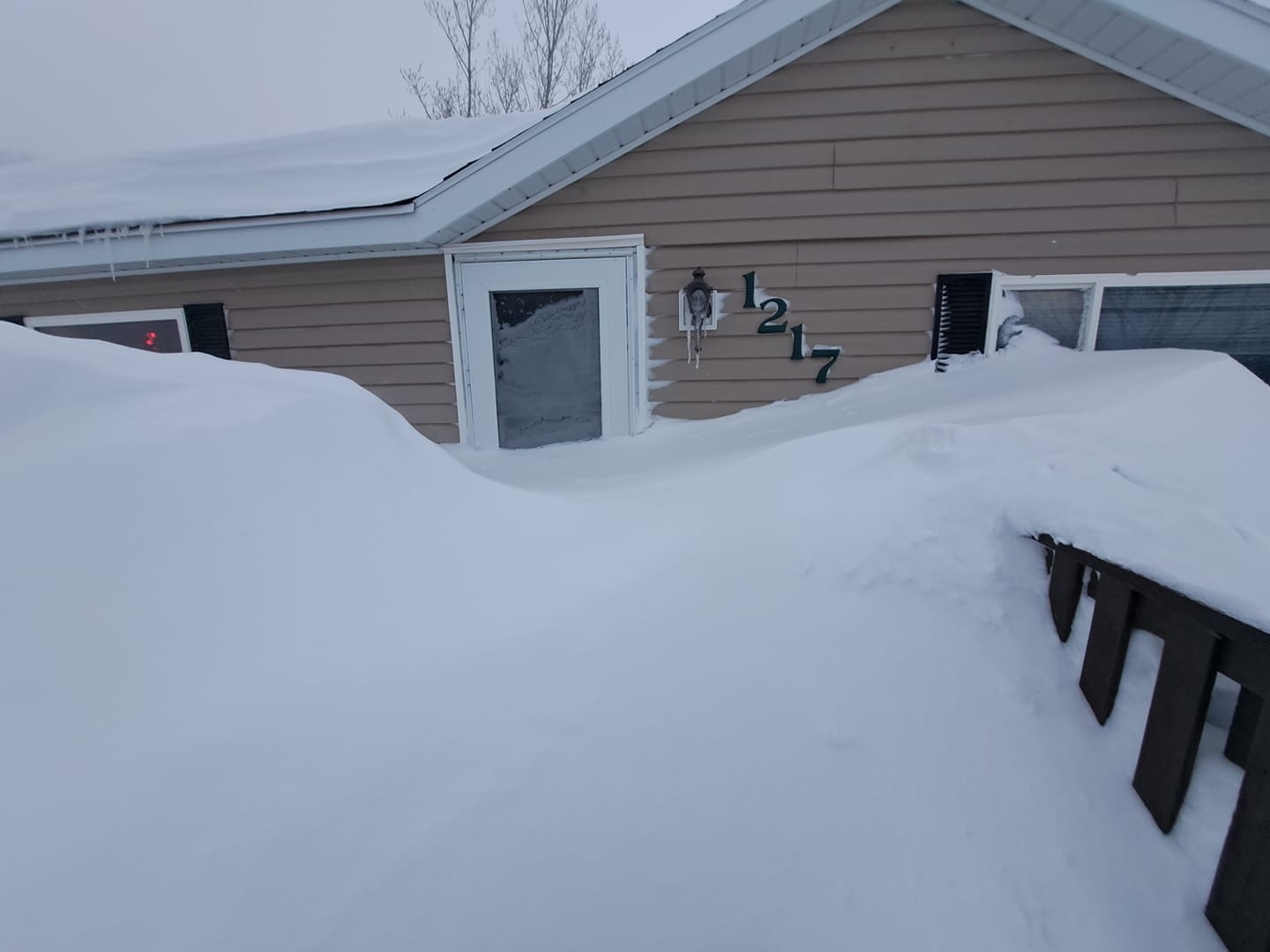
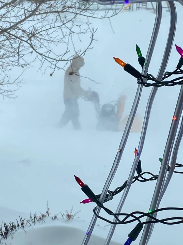
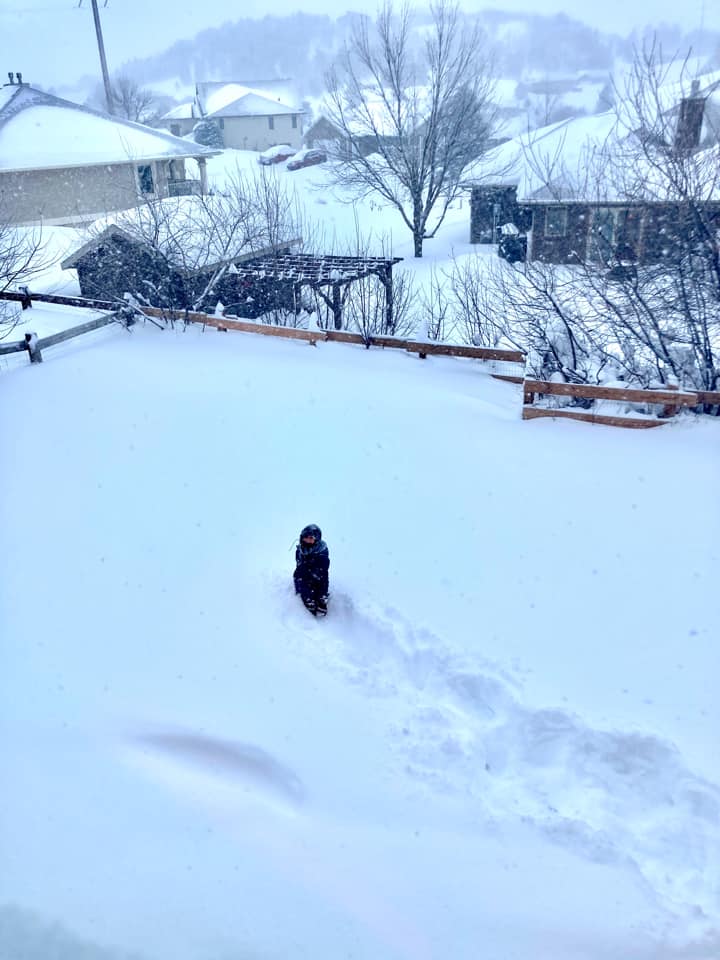
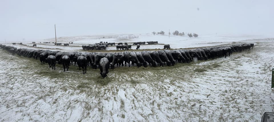
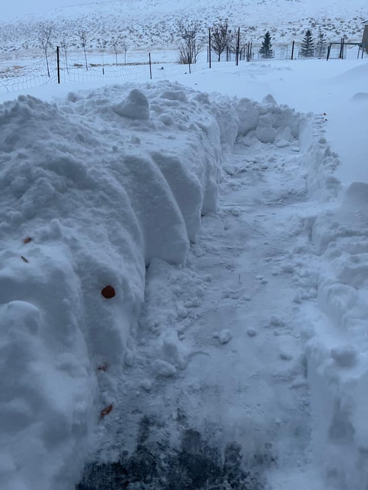
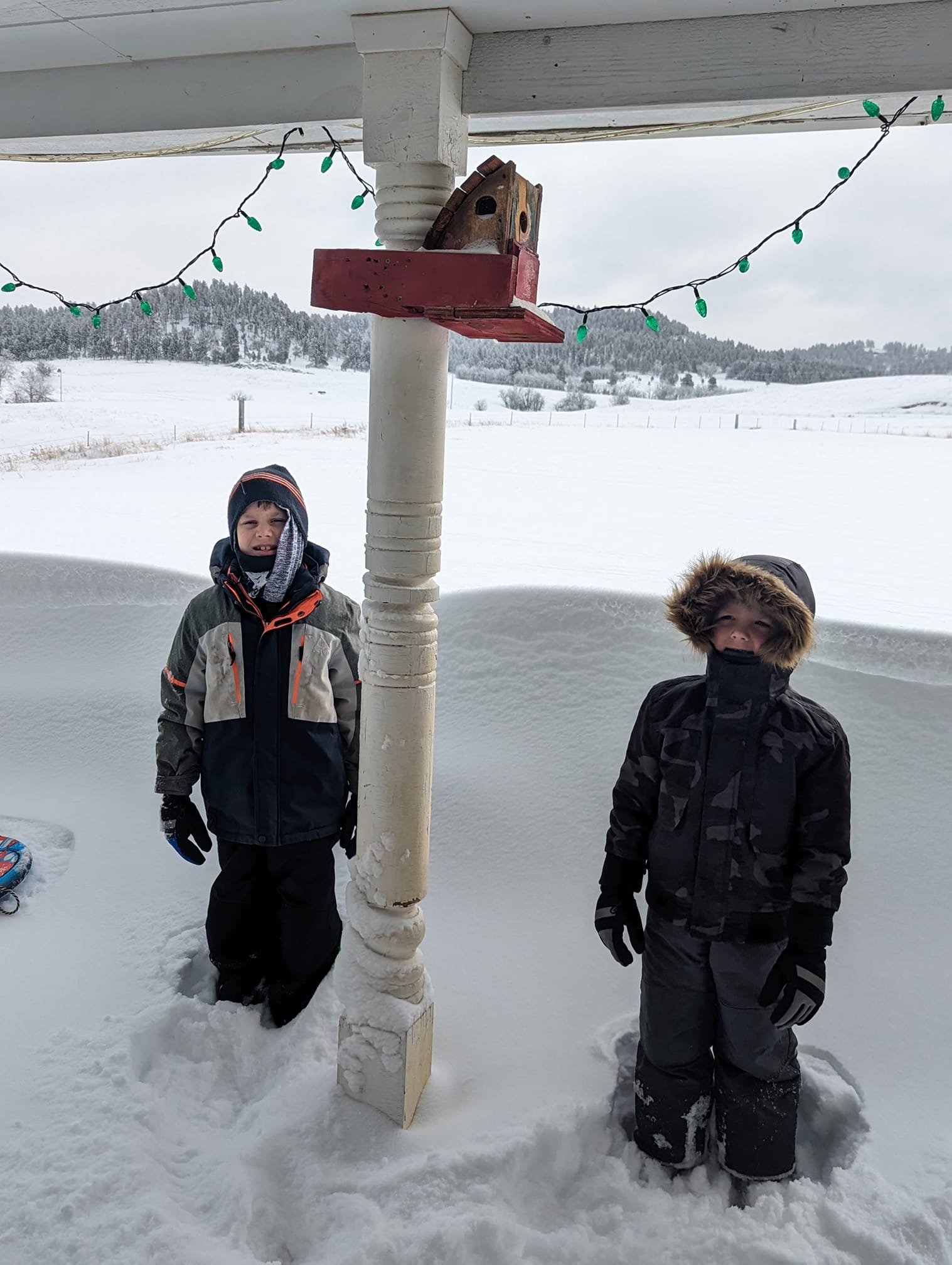
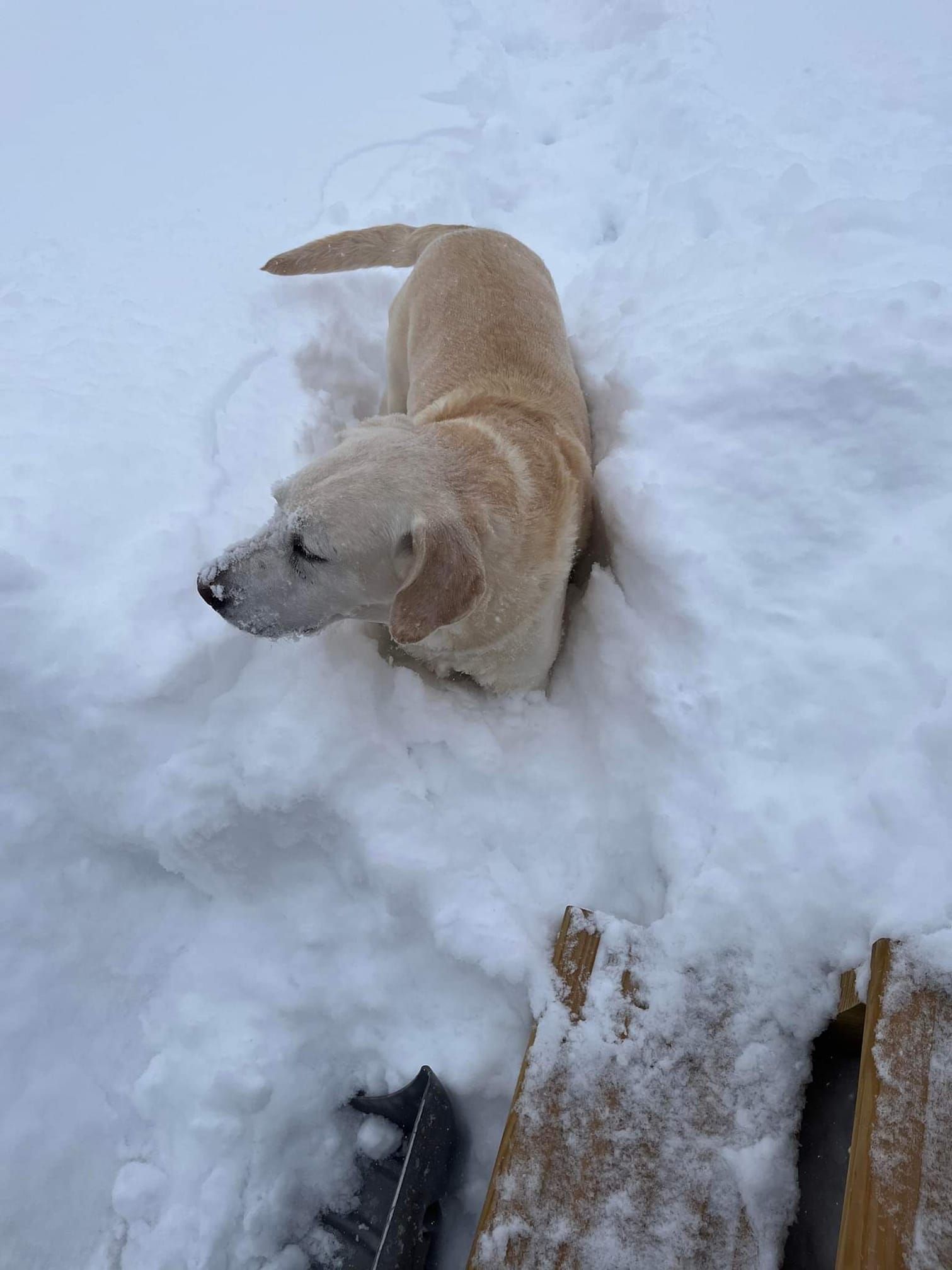
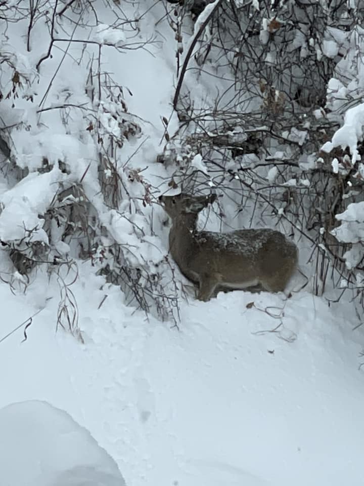
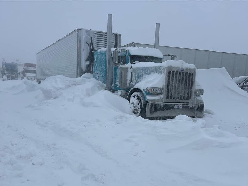
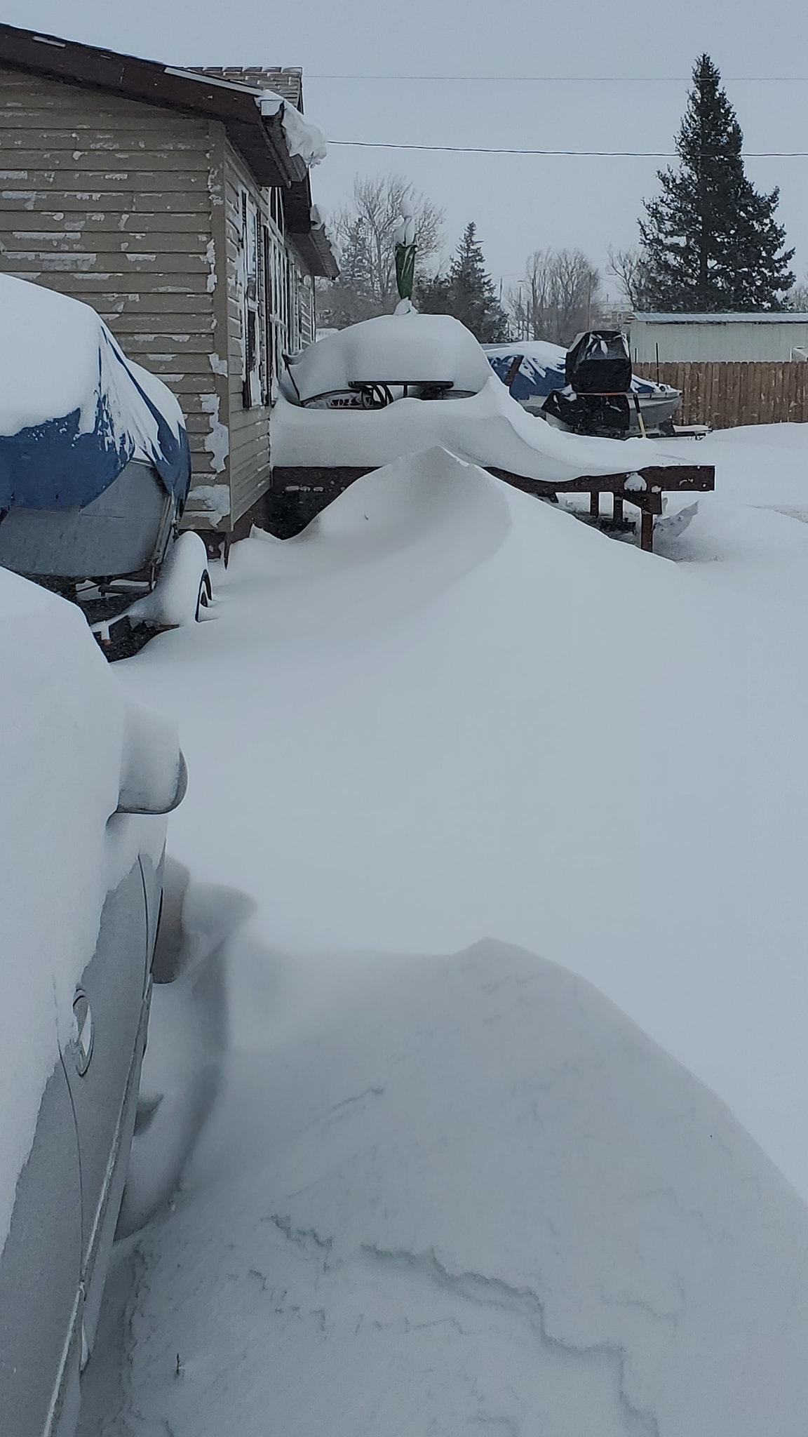
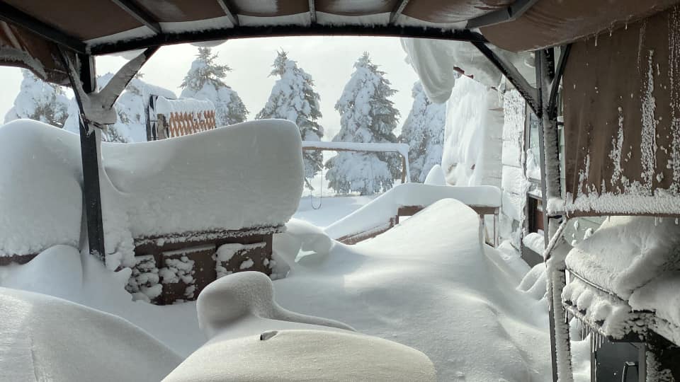
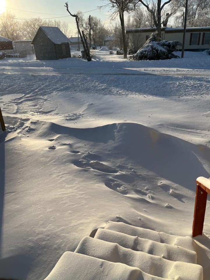
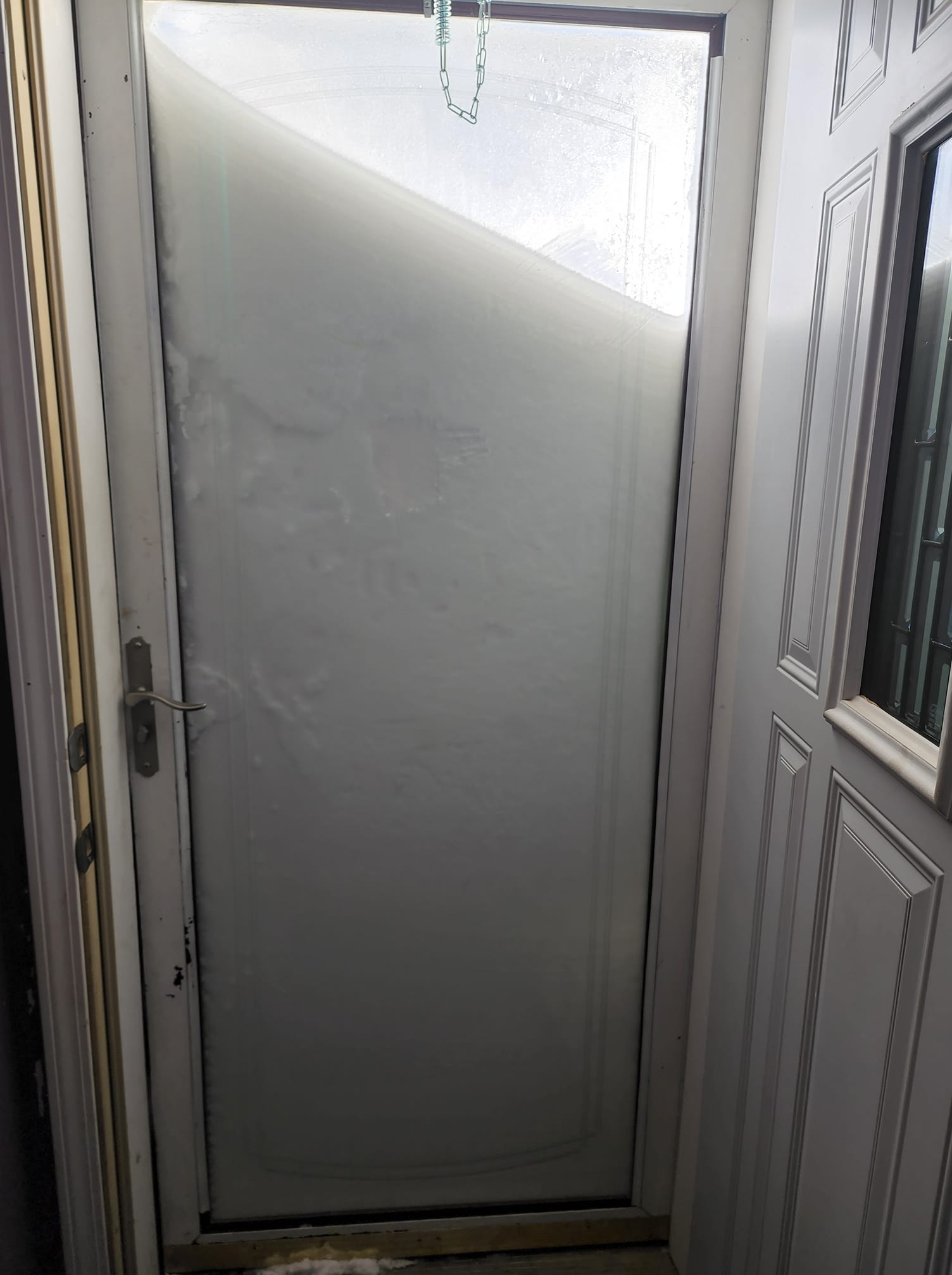
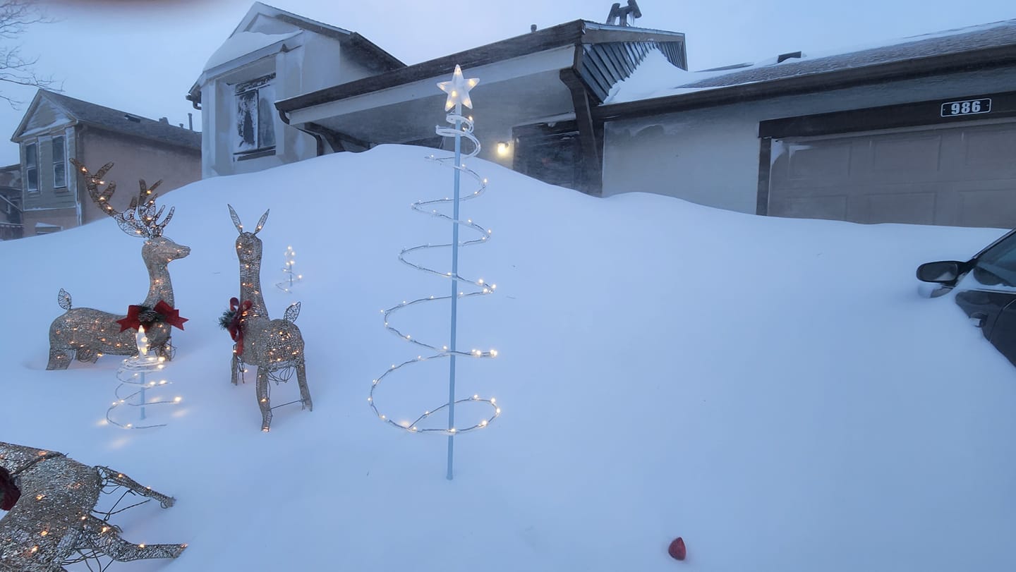
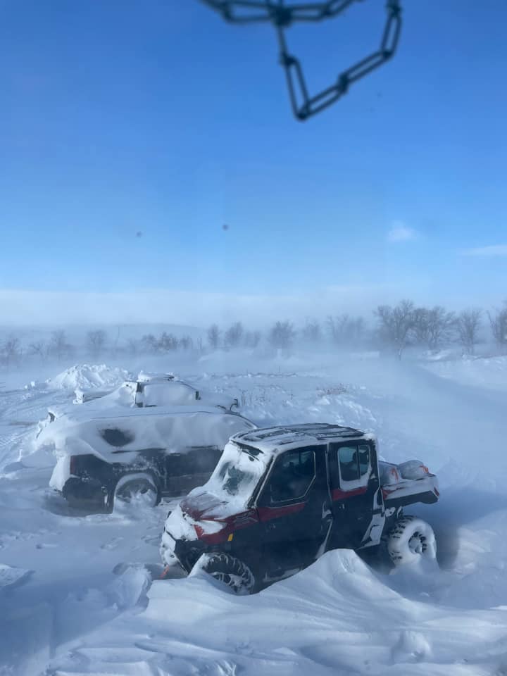
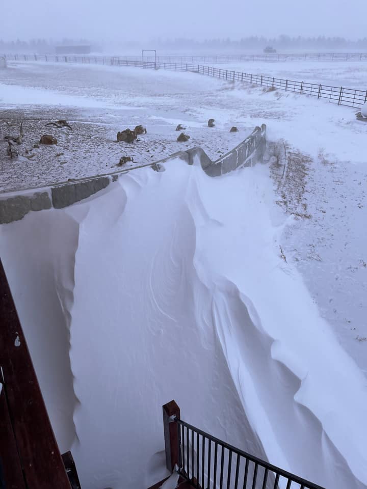
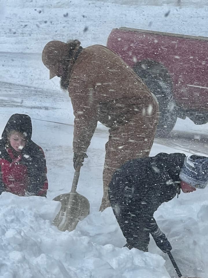
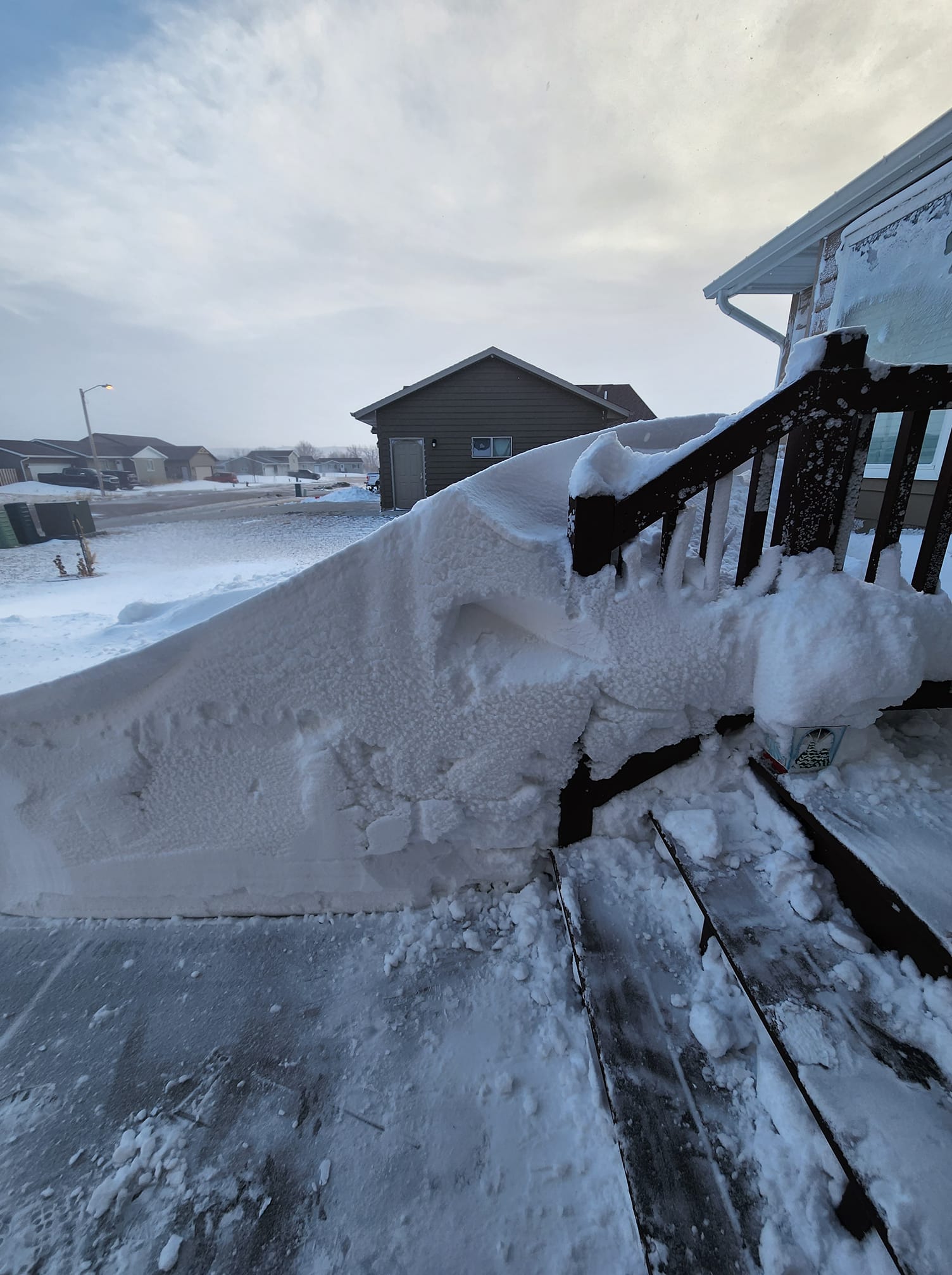
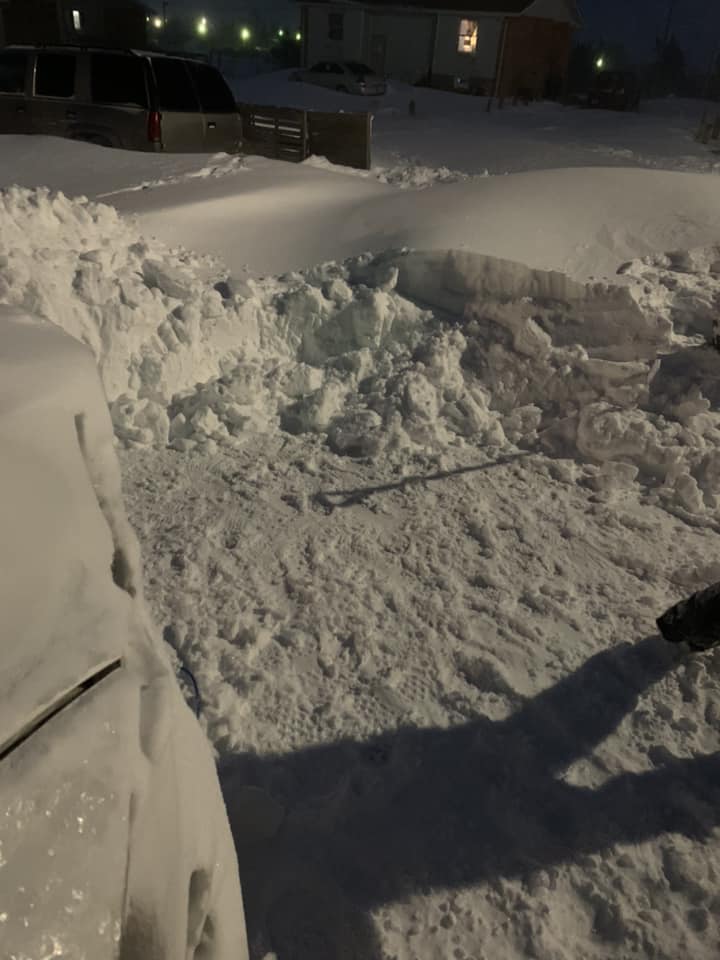
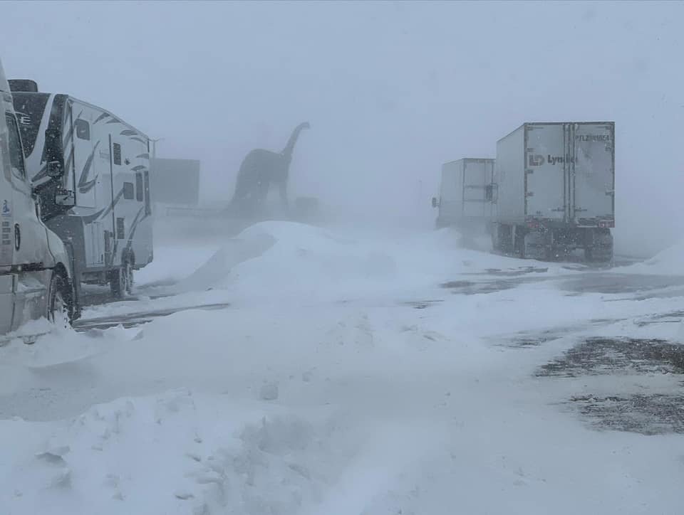
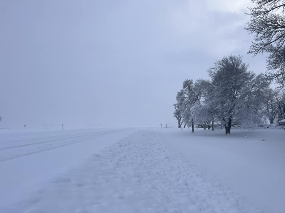
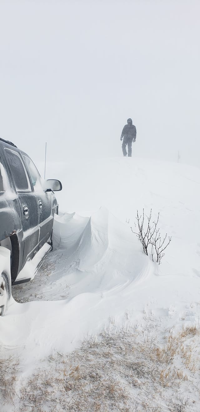
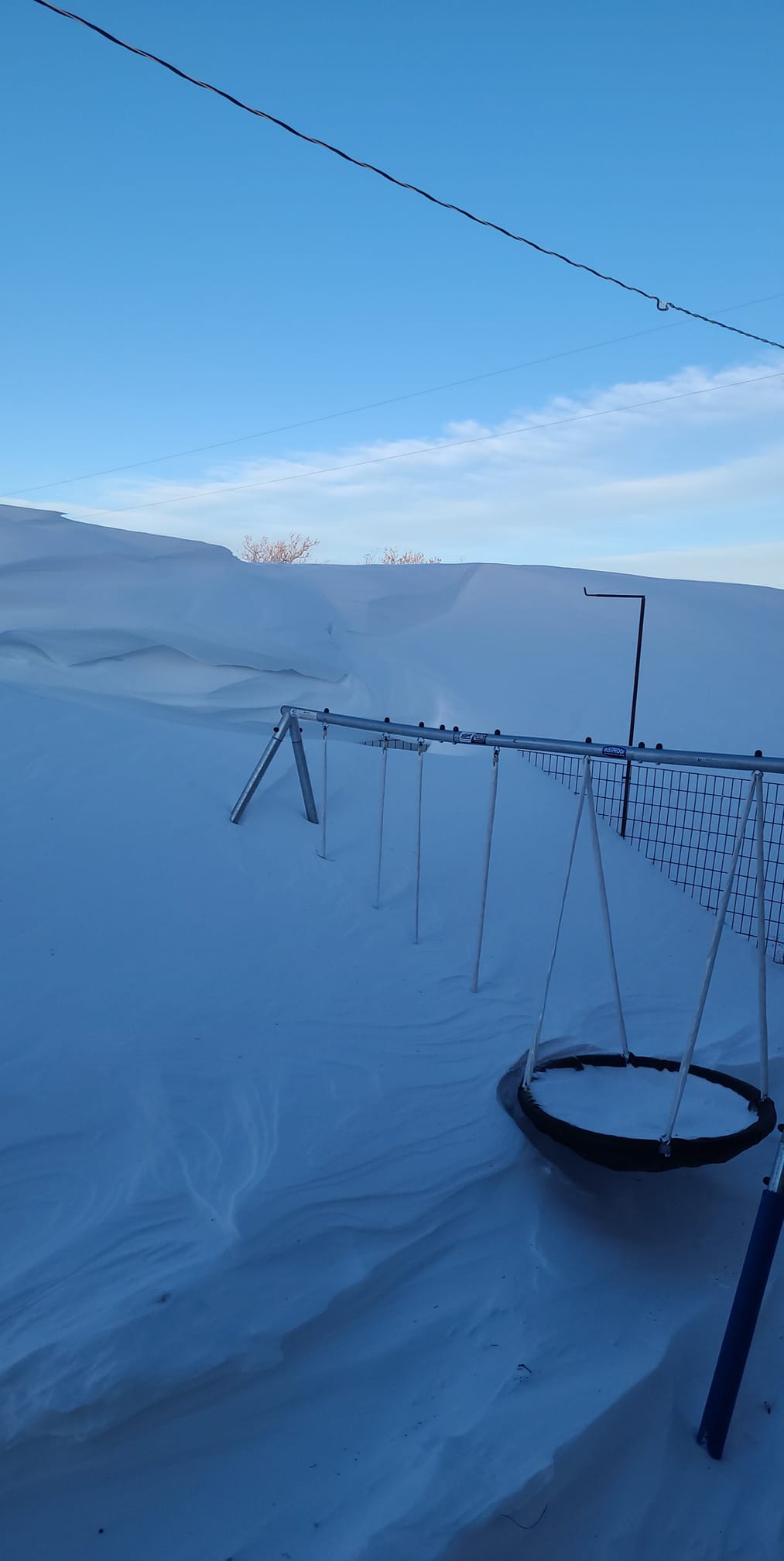
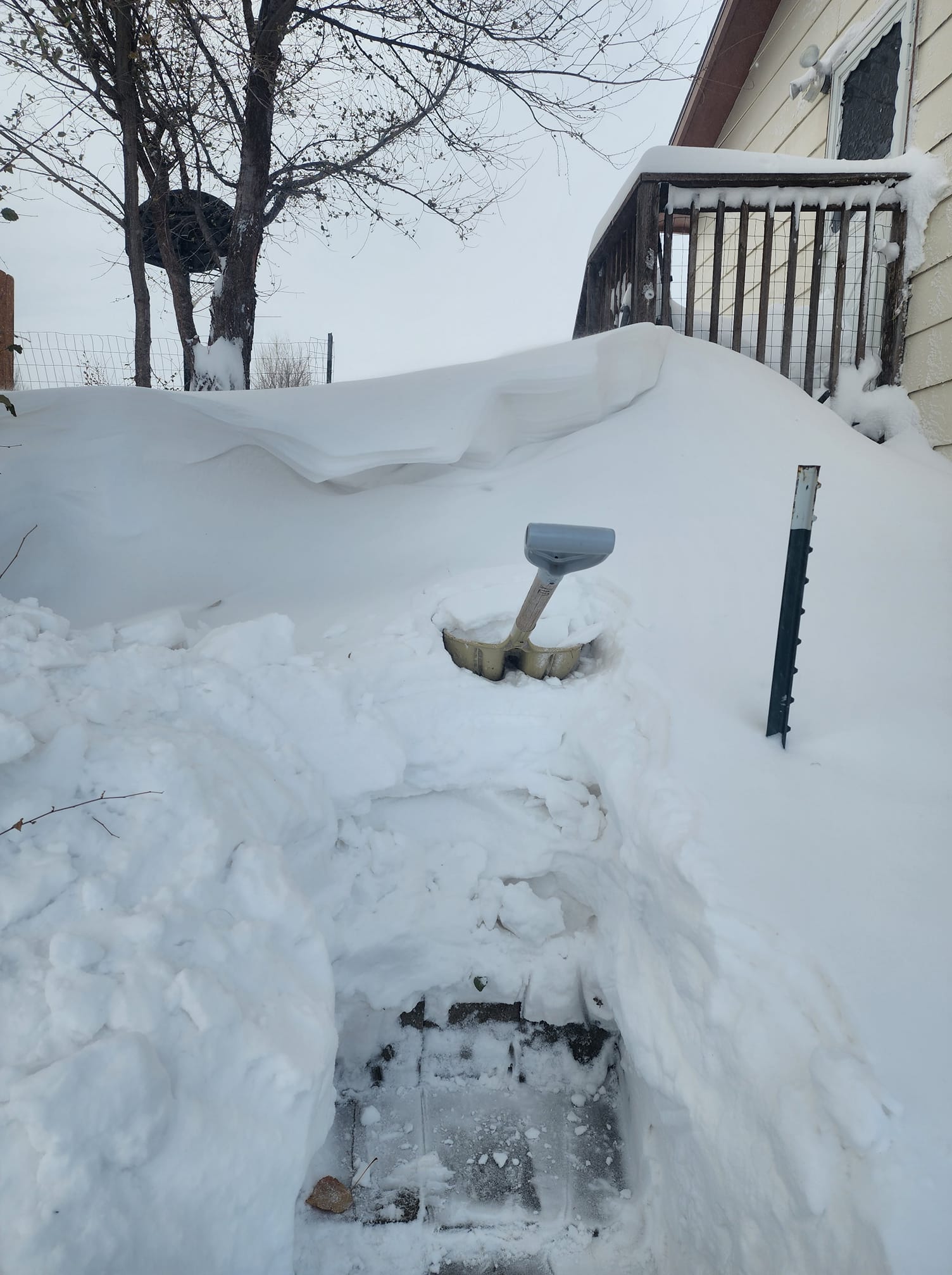
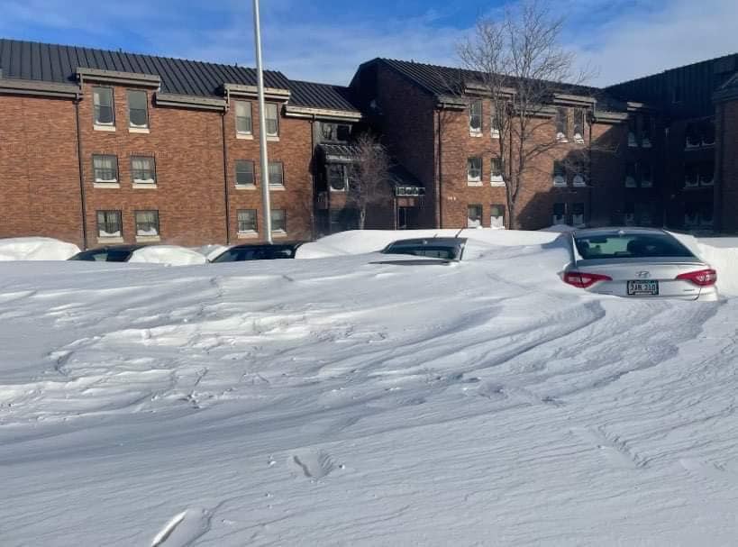
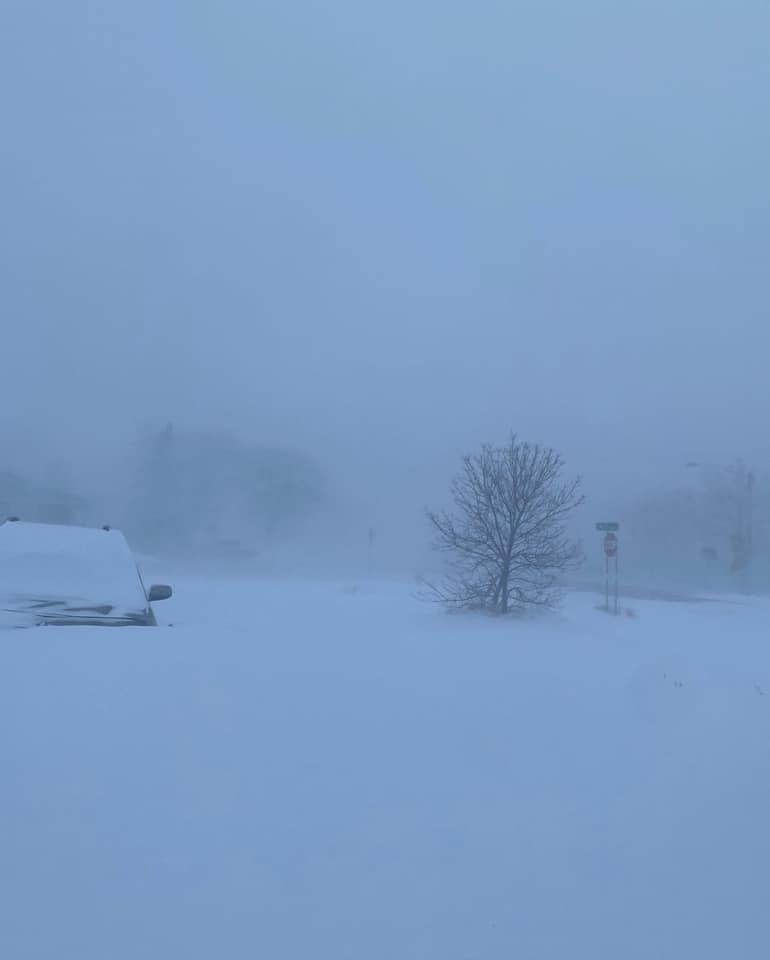
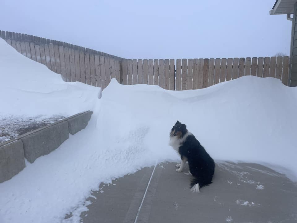
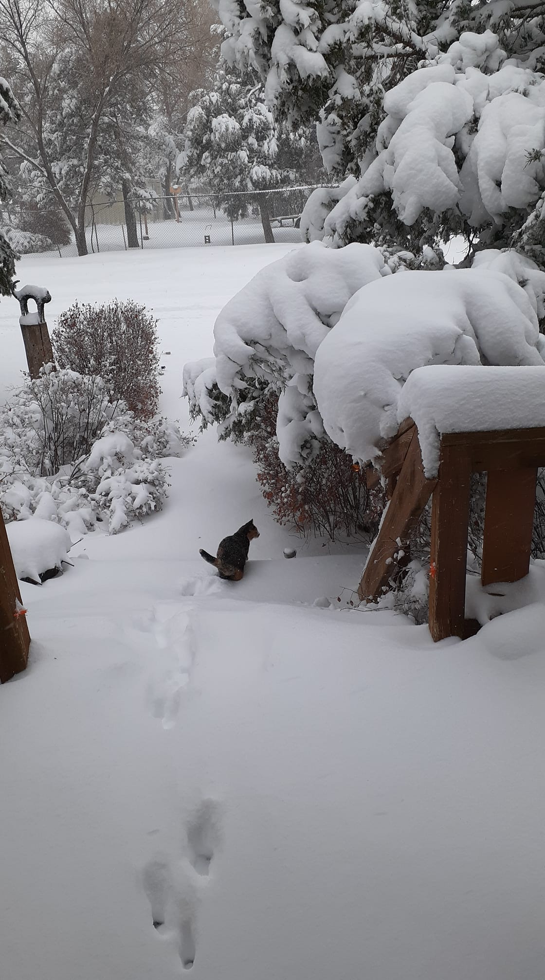
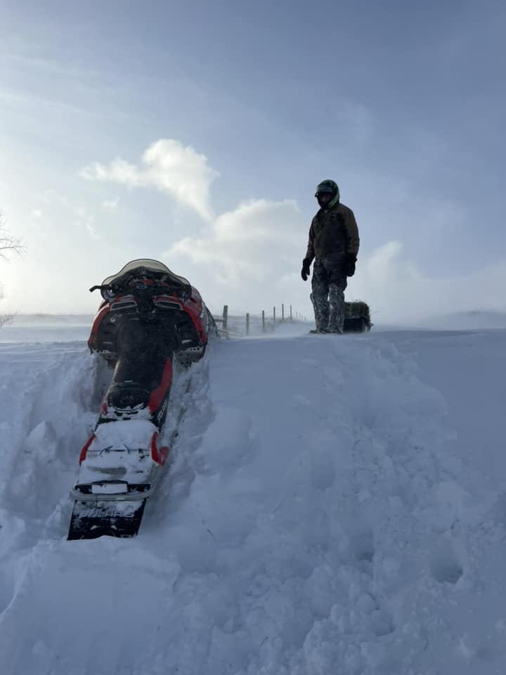
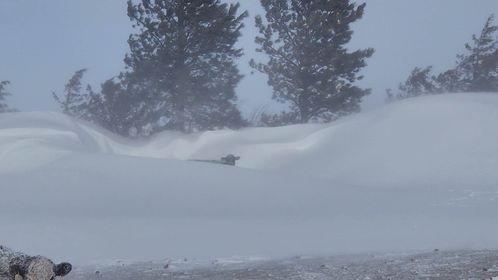
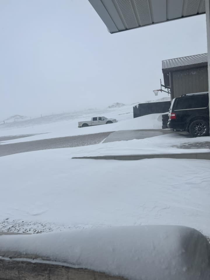
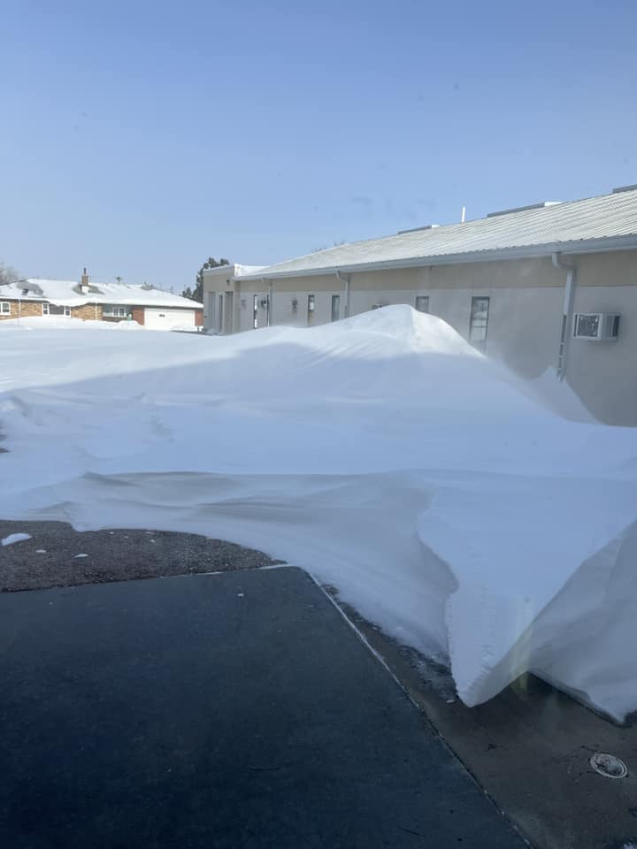
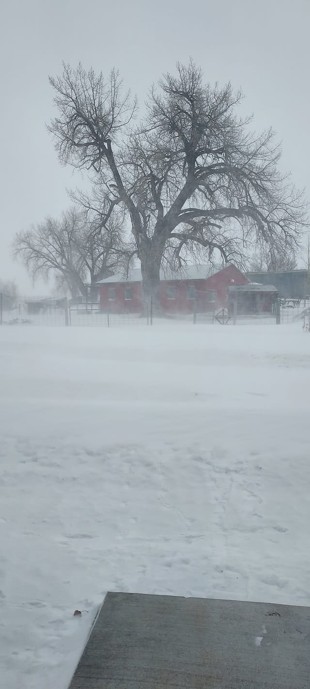
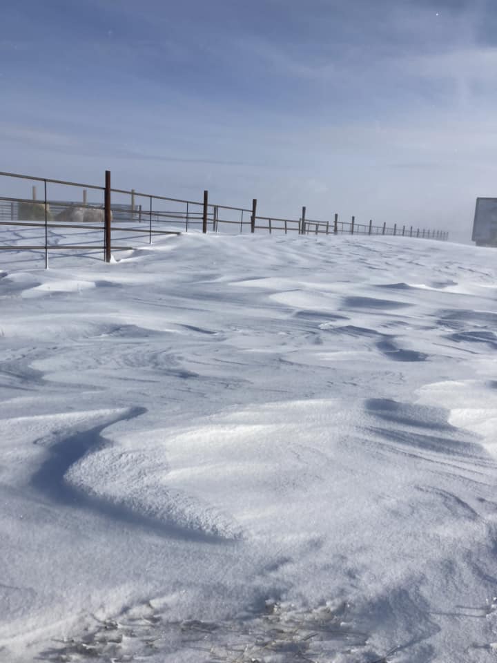
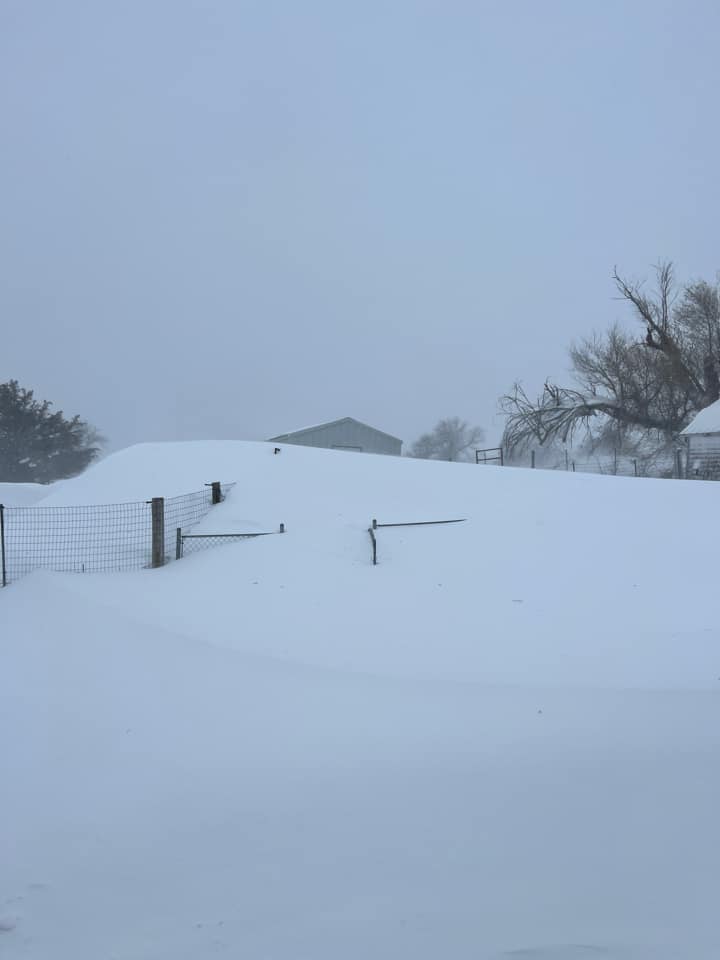
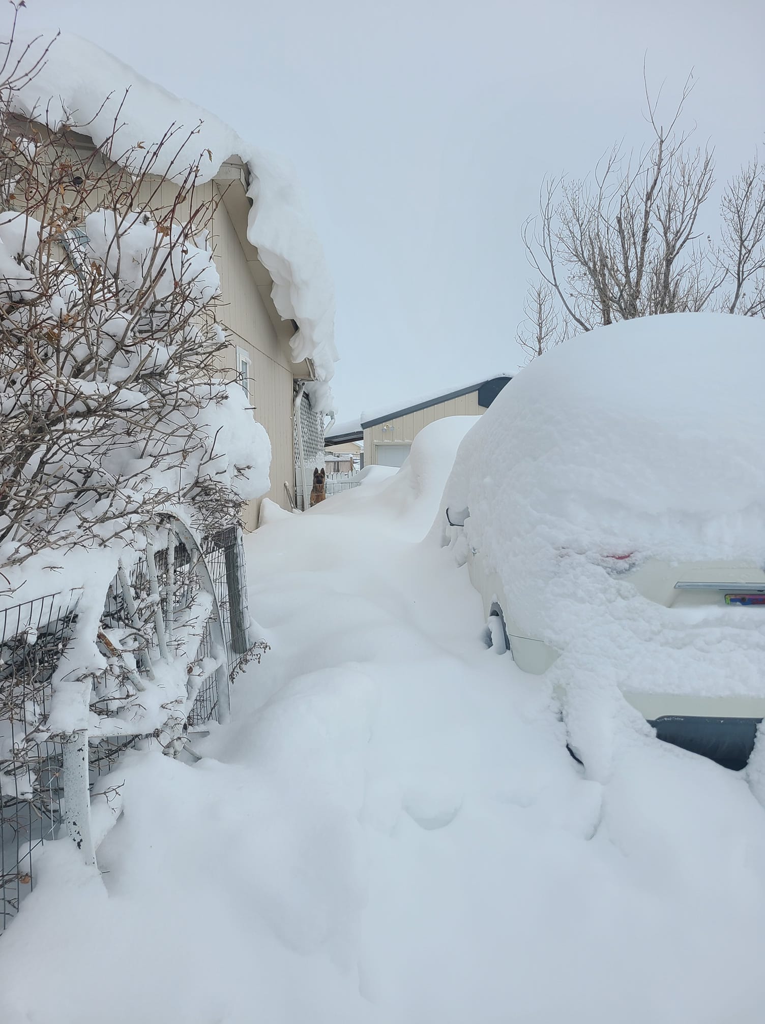
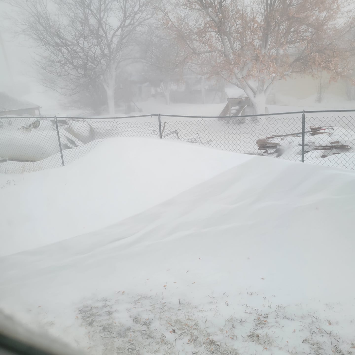
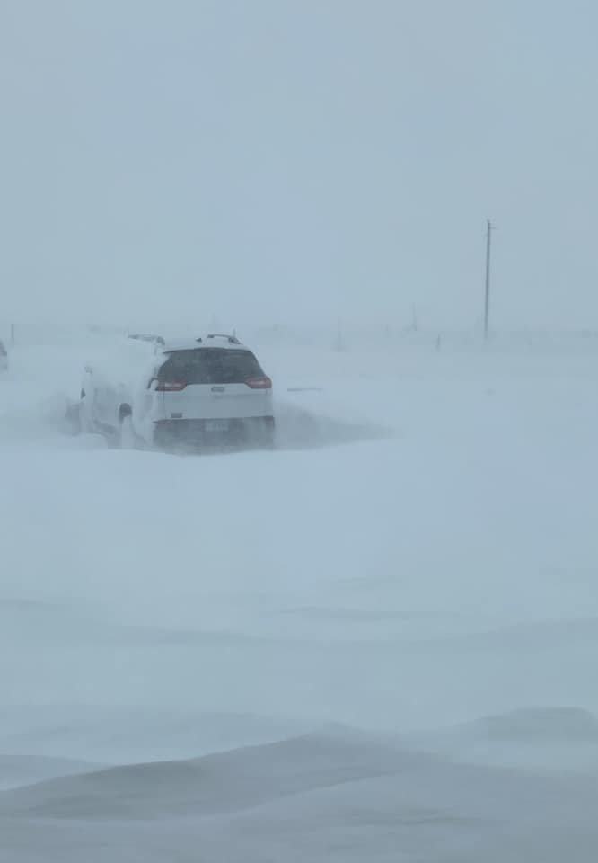
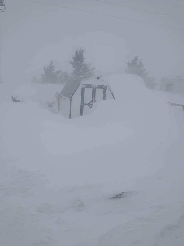
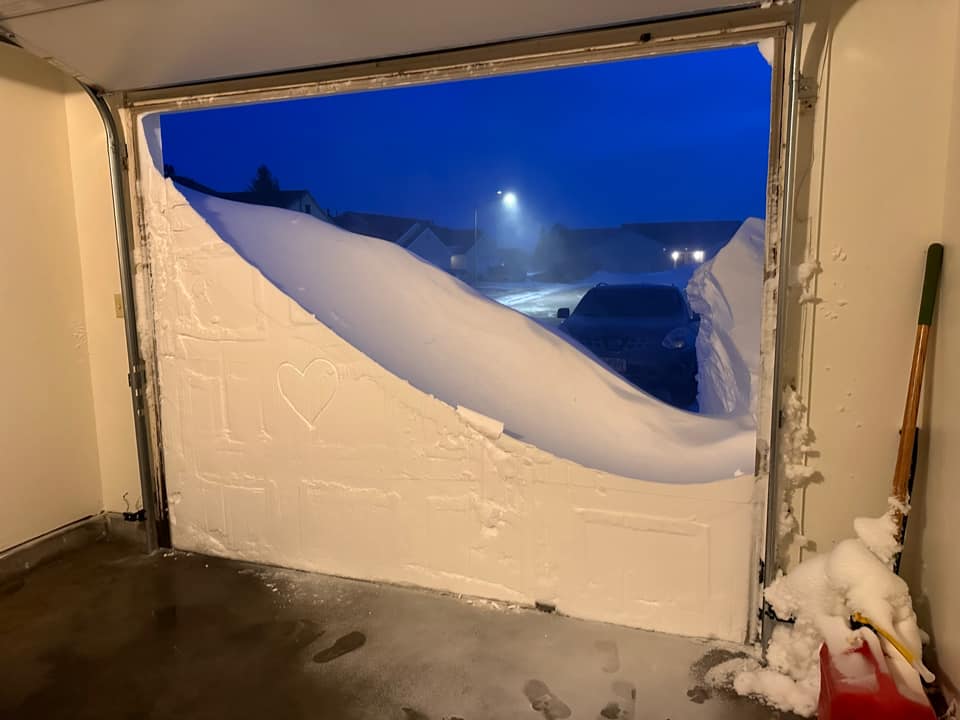
A potent and long-lasting low pressure system brought widespread snow and blizzard conditions to much of the northern Plains from late Monday, December 12, 2022 through Friday, December 16. Conditions gradually improved late Friday, December 16. The storm started with a period of freezing drizzle, mainly across the South Dakota plains. Ice accumulations resulted in slippery roads and hazardous travel conditions, even before the snow started. Precipitation changed over to snow by Tuesday. Snow continued through Wednesday and Thursday before finally ending on Friday. Strong northwesterly winds, gusting to 60 mph or higher, led to blowing and drifting snow throughout the event, and contributed to upslope-enhanced snowfall over the northern Black Hills and foothills. Those locations received the highest amounts of snow, with around 3 feet reported in the Spearfish and Sturgis areas and around 4 feet reported in the Cheyenne Crossing and Lead/Deadwood areas. From Pine Ridge eastward into central SD, 2 to 3 feet of snow were reported. Many locations across our area received a foot or two of snow. Due to the effects of downsloping winds, the southern Black Hills and foothills were spared from the worst of the snow and strong winds; only a couple inches of snow were reported in those areas. The strong winds lasted through Friday, so even after the snow ended, blizzard conditions continued for much of the South Dakota plains. More information about the storm can be found at the Satellite Liaison Blog. |
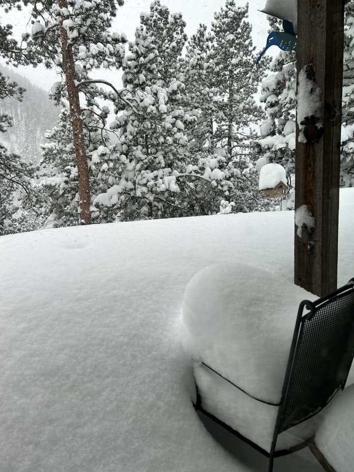
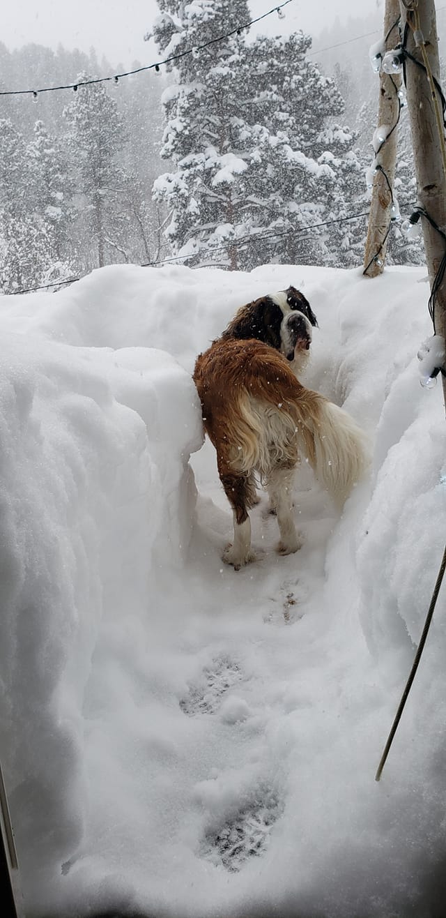
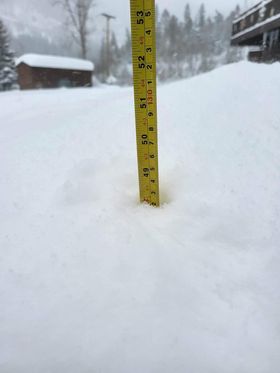
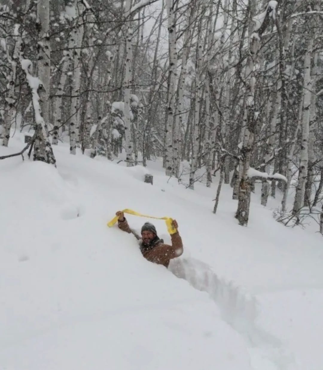
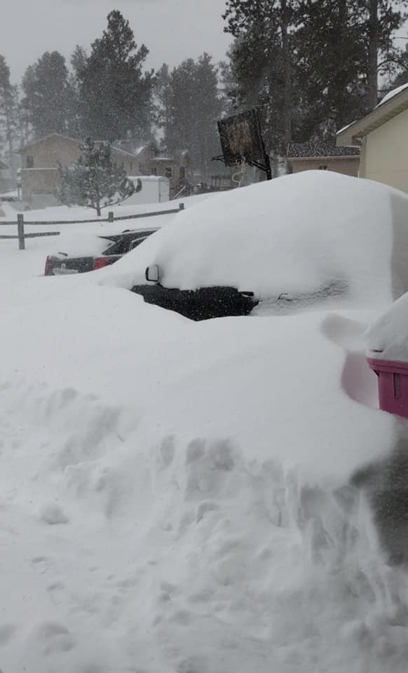
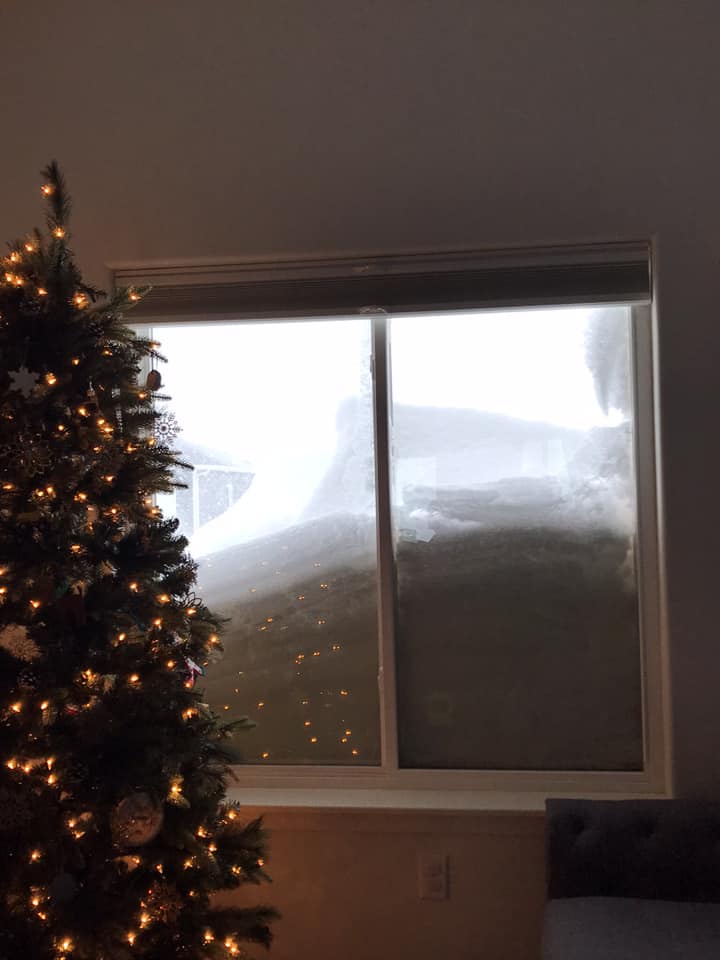
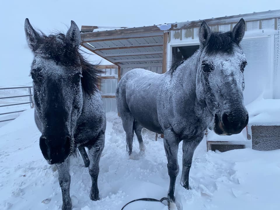
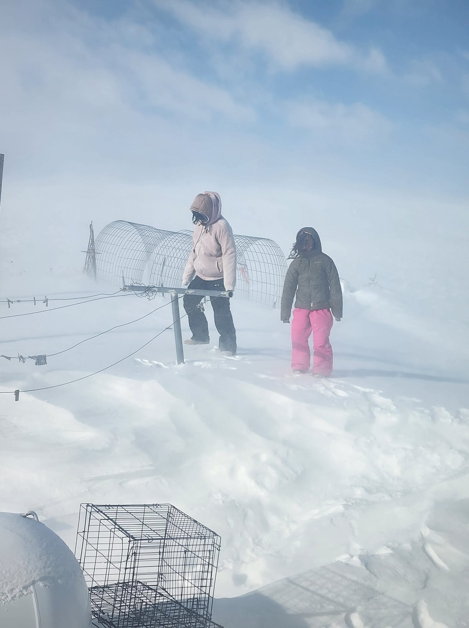
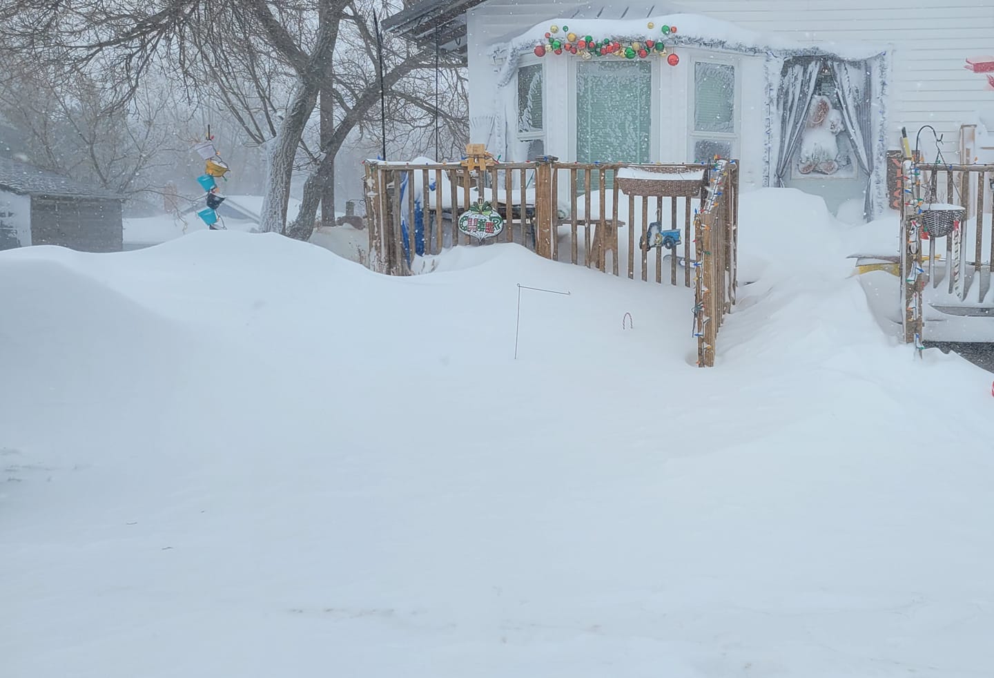
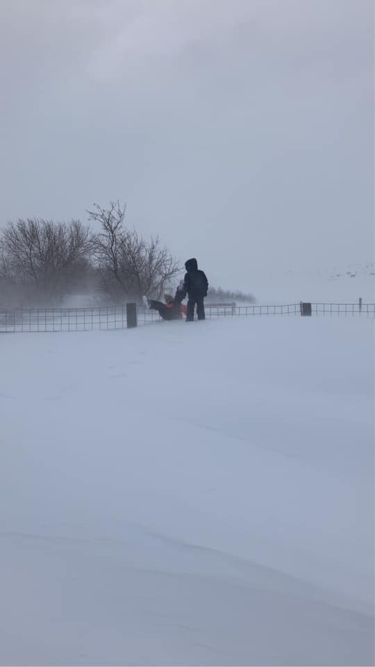
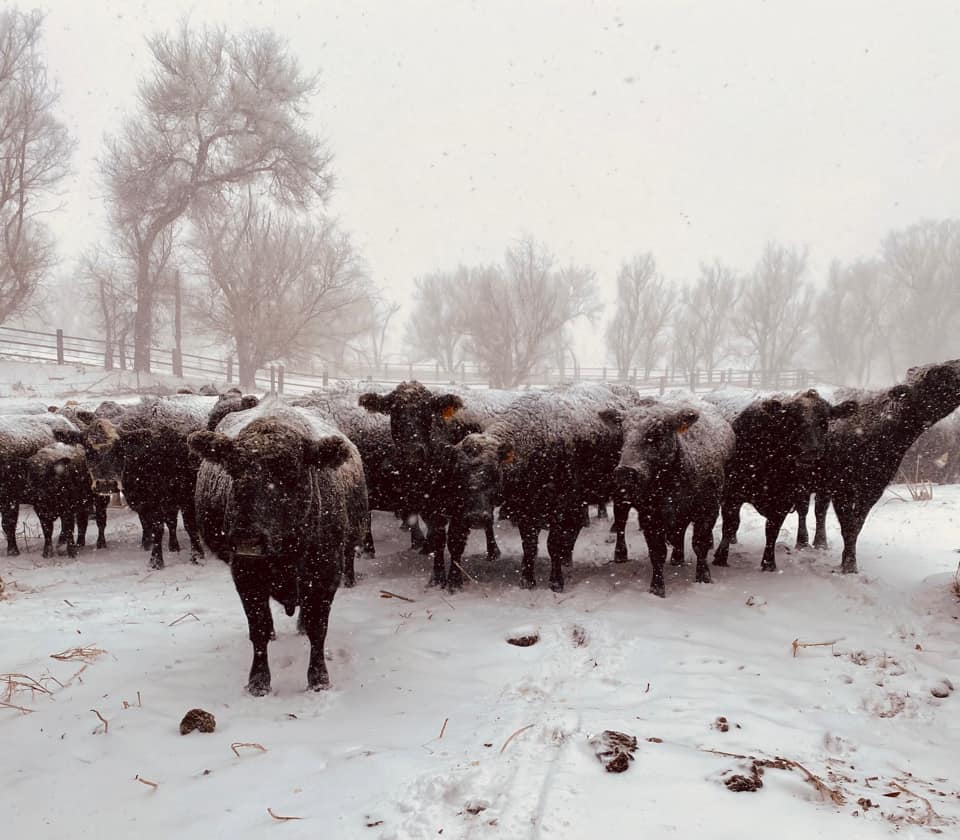
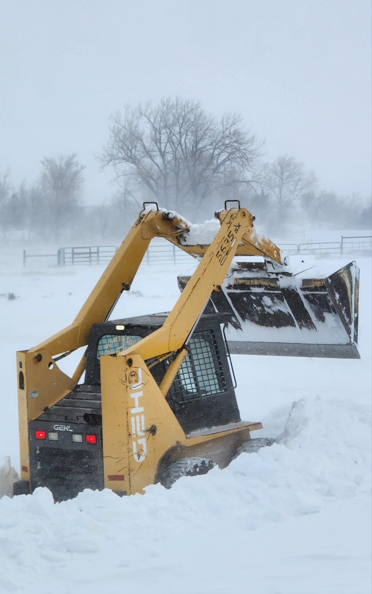
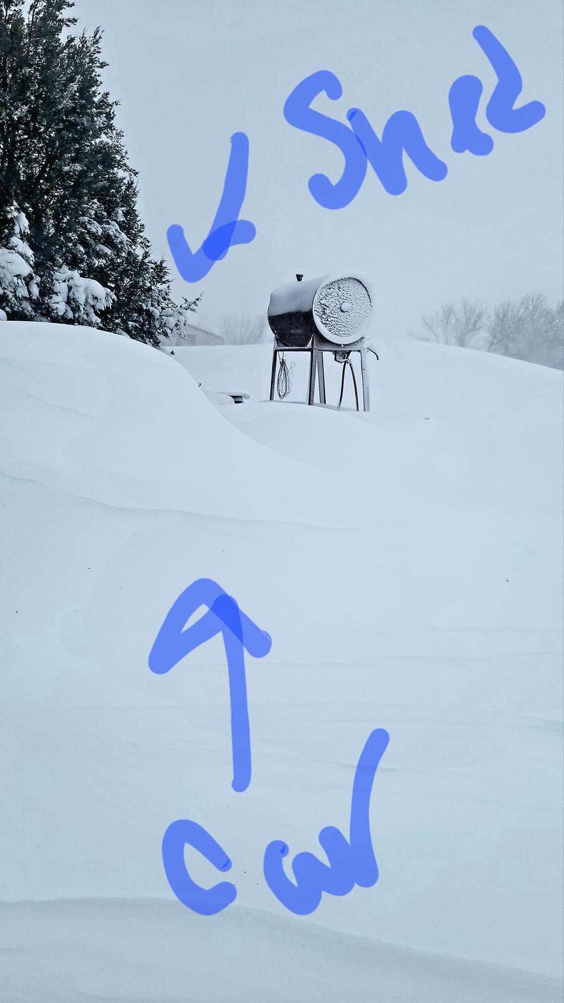
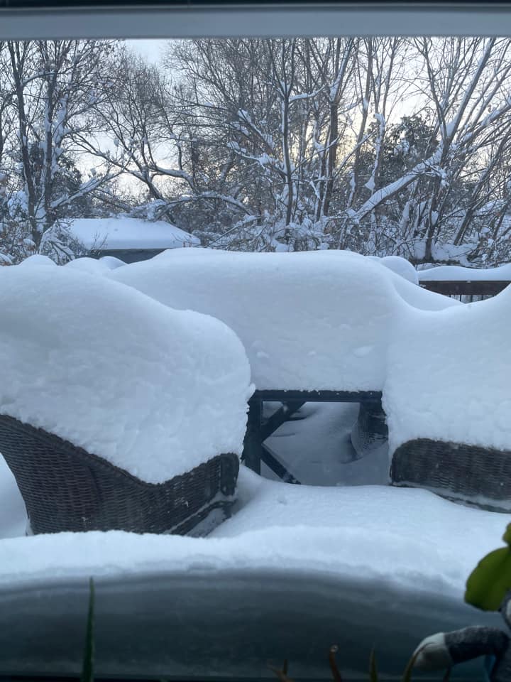
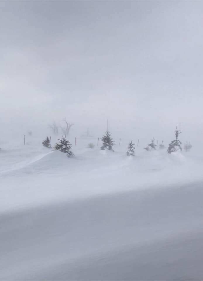
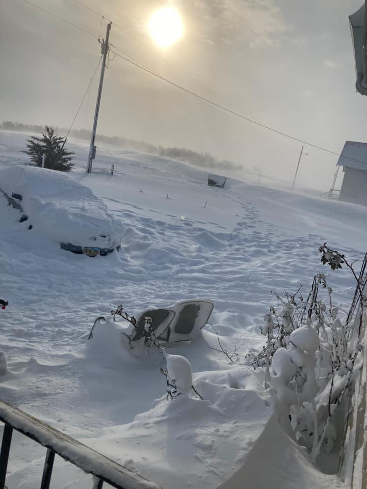
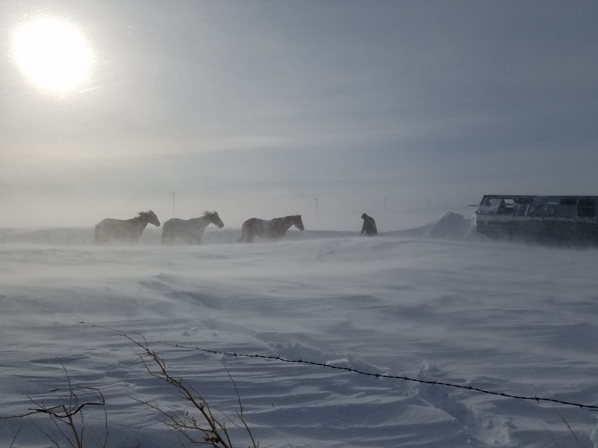 Photo from Kelly Hunter in the Swett/Martin area |
Snowfall Map
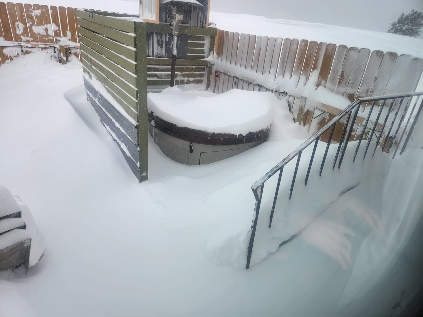
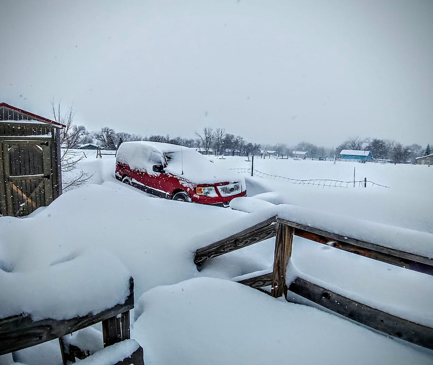
Photos
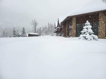
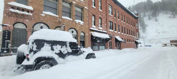
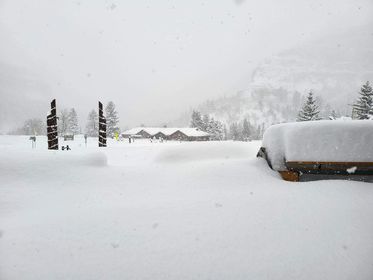
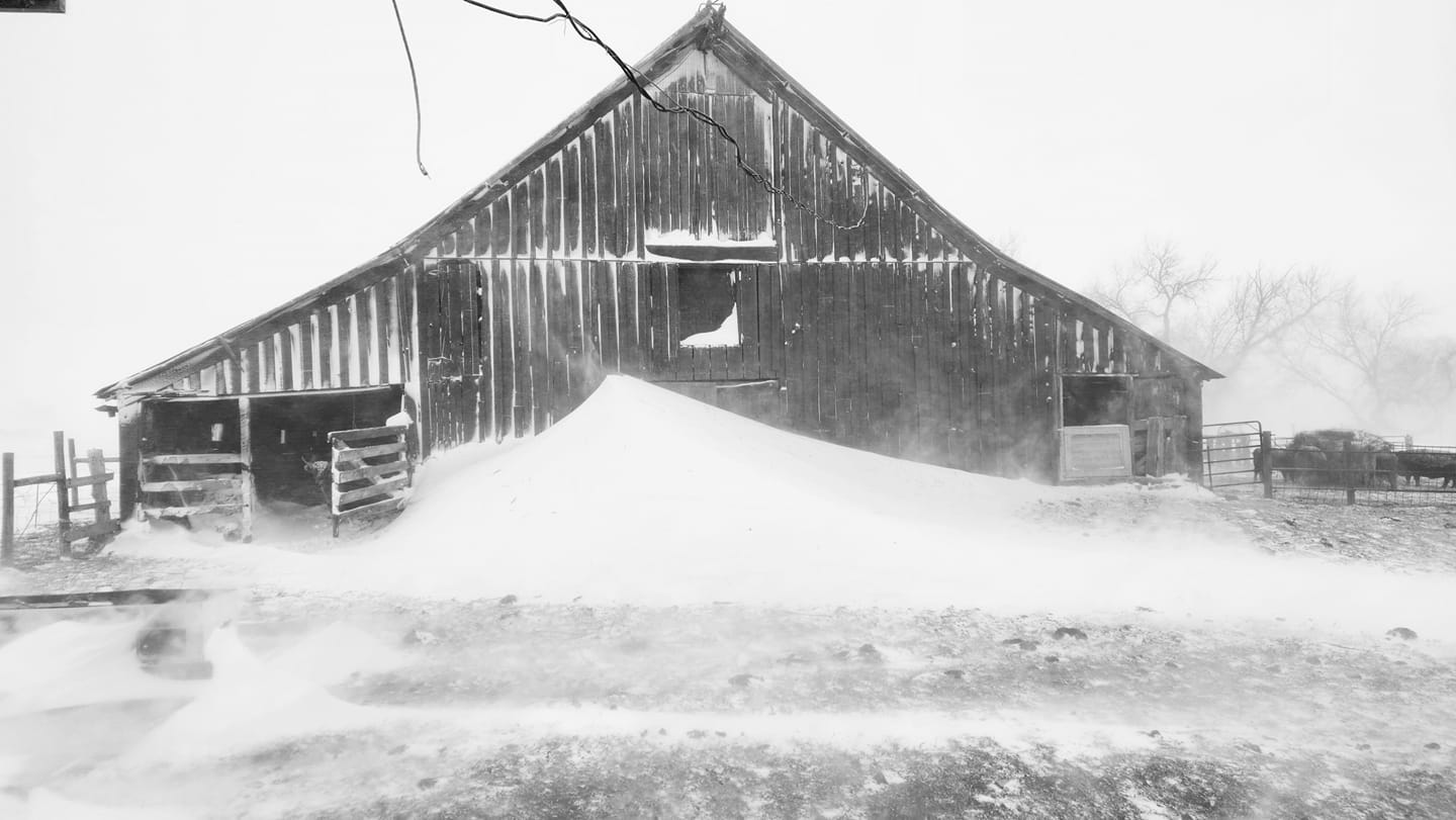
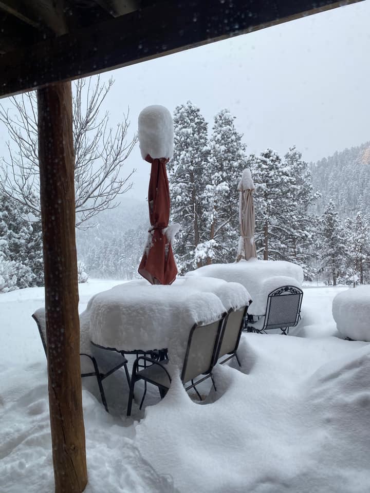
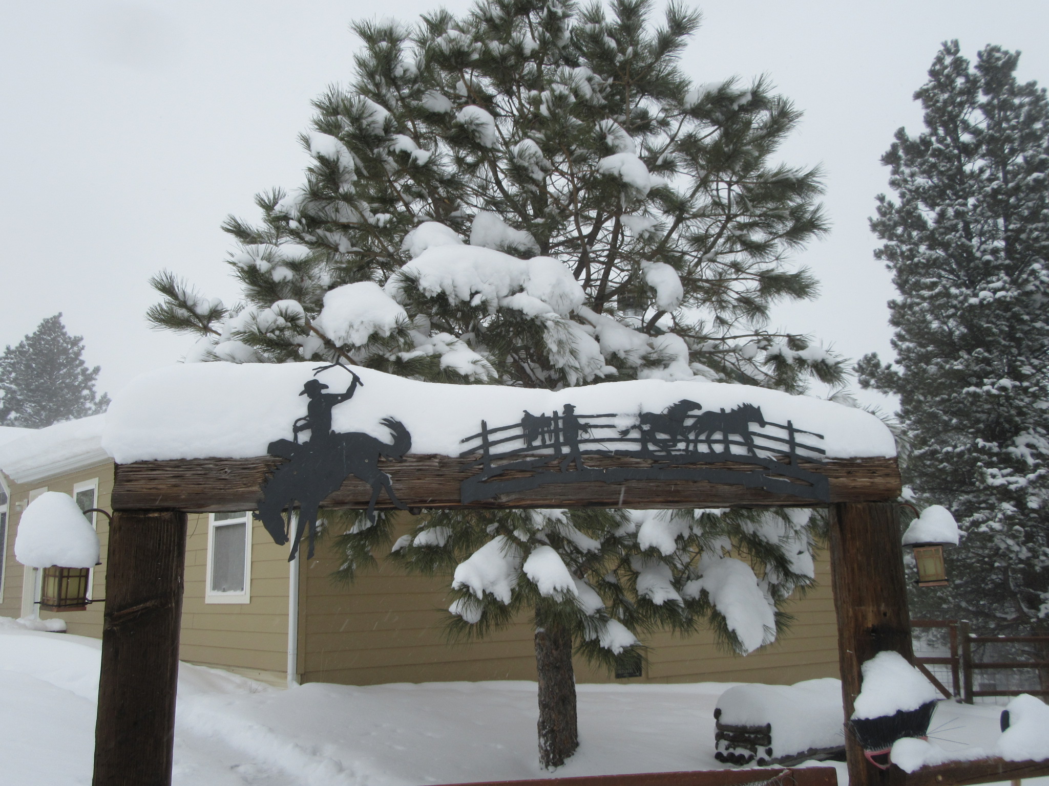
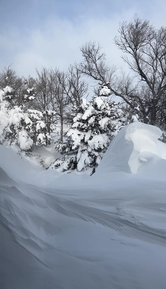
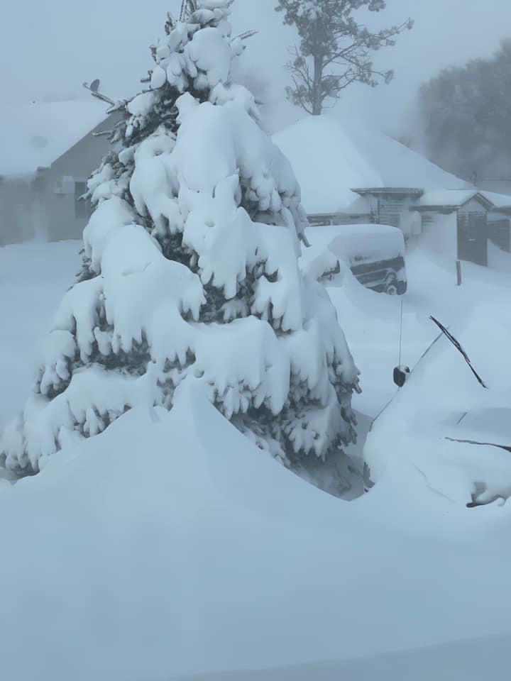
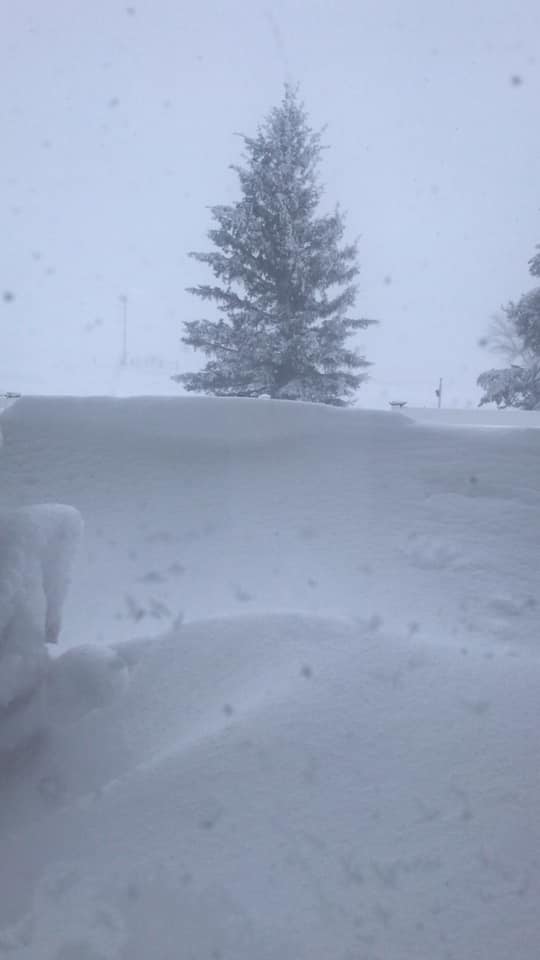
Black Hills
 |
 |
 |
 |
| 2 miles NW of Deadwood (Savannah Horst) |
2 miles S of Lead (Ronnie Hess) |
Central City/Lead area (Wendy K. Freier) |
Lead (Joe Curtin) |
 |
 |
 |
| Deadwood (Levi Kessler) |
Lead (Joe Curtin) |
Lead (Luci Seid) |
 |
 |
 |
| Deadwood (Alison Strauss) |
Deadwood (Jamie Durbin-Villegas) |
Between Deadwood and Spearfish (Kristy Eastman) |
 |
 |
| Spearfish Canyon Lodge (Kayla Betten) |
Deadwood (Levi Kessler) |
 |
 |
 |
| Lead (Dan Seid) |
Spearfish Canyon Lodge (Kayla Betten) |
Spearfish Canyon Lodge (Kayla Betten) |
 |
 |
 |
| Deadwood (Levi Kessler) |
Deadwood (Levi Kessler) |
Argyle (Alexandra Odom) |
 |
 |
| Lead (Cherie Hintz) |
Deadwood (Levi Kessler) |
 |
 |
 |
 |
| Cheyenne Crossing (Randy Jilek) |
Cheyenne Crossing (Randy Jilek) |
Lead (Anna Bormes) |
Argyle (Shelley Meyer Vestal) |
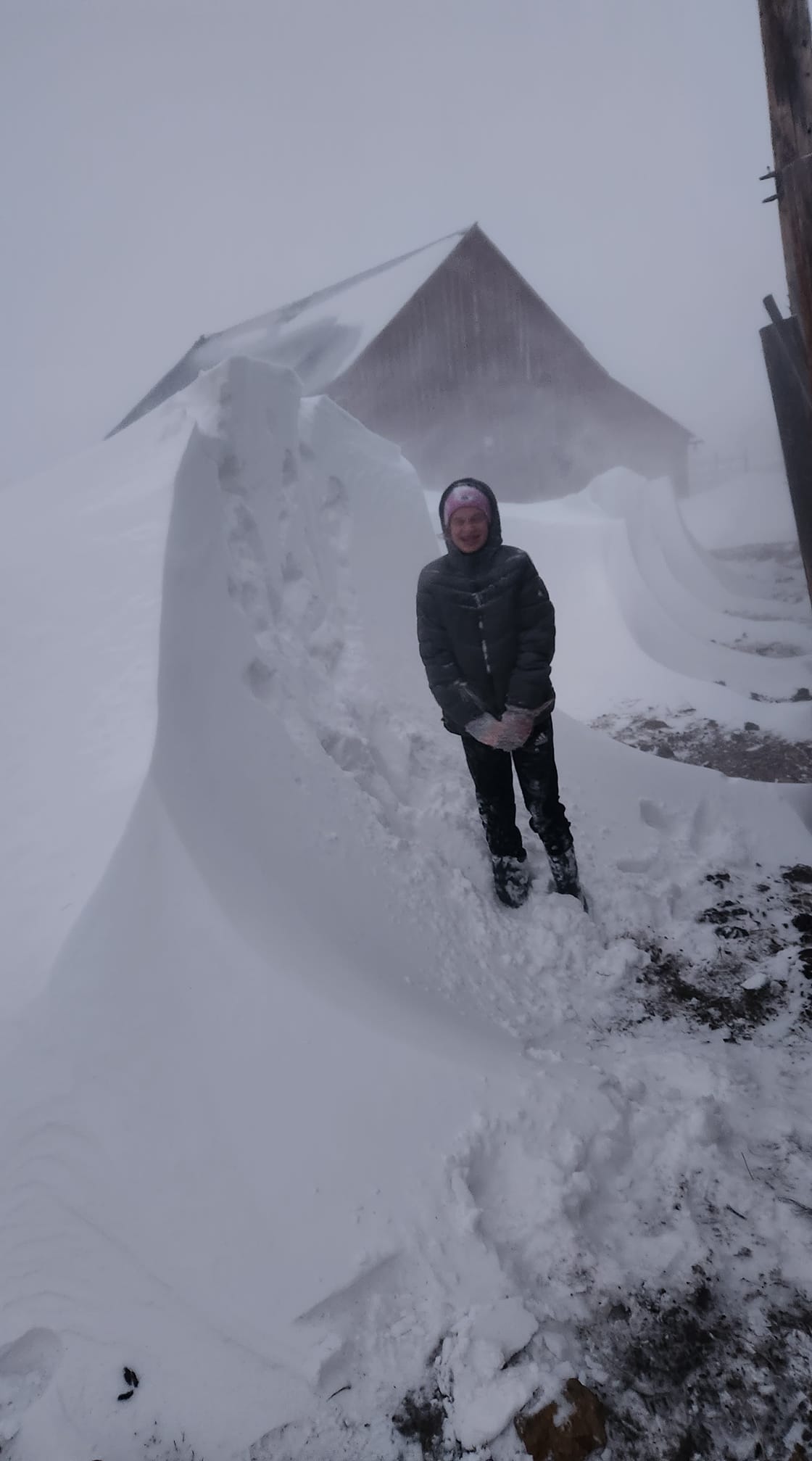
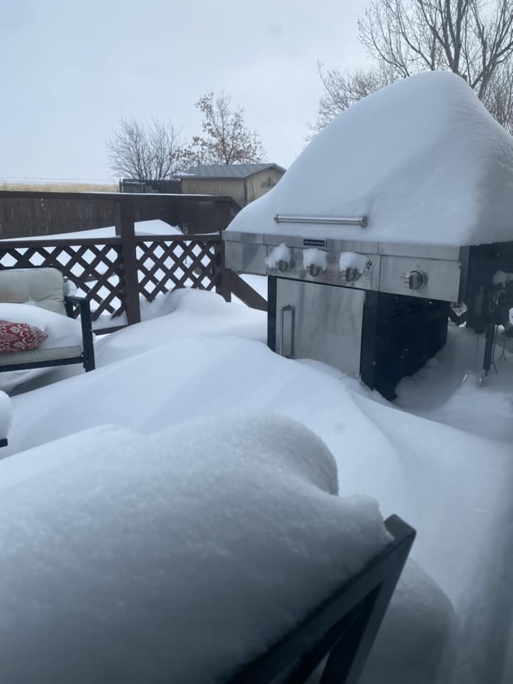
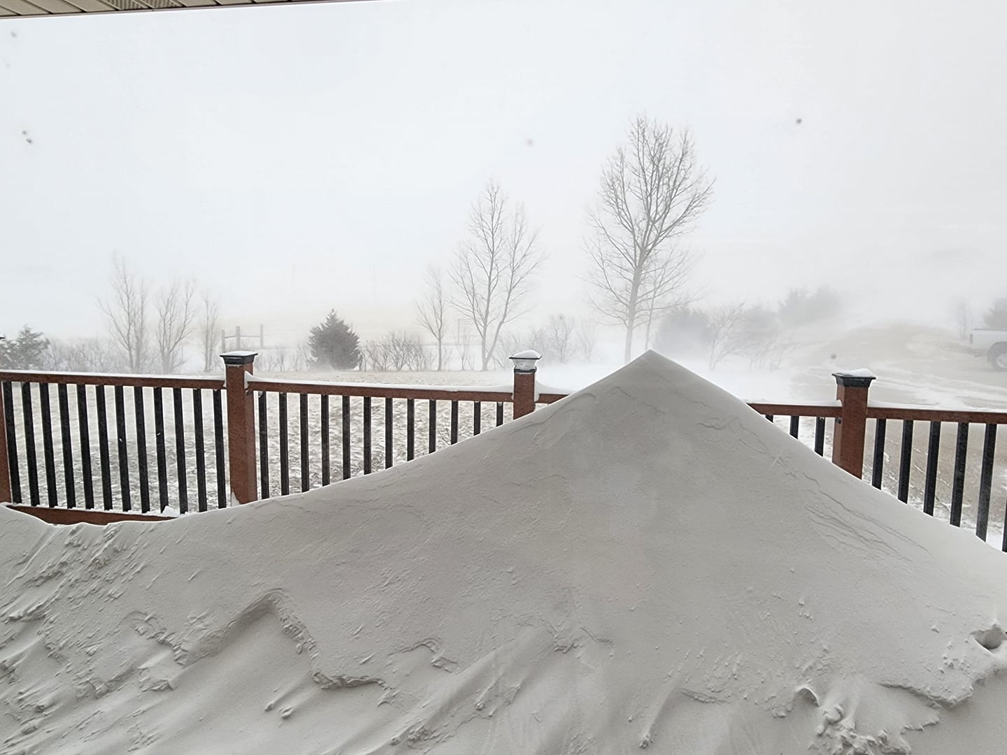
Foothills
 |
 |
 |
| 3 miles SW of Whitewood (Sharon Kirpatrick-Sanchez) |
Boulder Canyon (Catrina Feige) |
Spearfish (Amber Cloyes Schneider) |
 |
 |
 |
 |
| Spearfish (Anne Obermueller) |
Sturgis (Katie Belles) |
Spearfish (Dick Termes) |
Spearfish (Terry J. Bender) |
 |
 |
 |
| Boulder Canyon (Shannon Schuster) |
5 miles E of Tilford (Kellen Pfleger) |
5 miles E of Tilford (Kellen Pfleger) |
 |
 |
 |
 |
| Spearfish (Shelly L. Petersen) |
NW Spearfish (Brian Mettler) |
Spearfish (Molly Lynn Ager) |
Spearfish (Melissa Ann) |
 |
 |
 |
| Sturgis (Taylor Block) |
Spearfish (Eric Hanson) |
Spearfish (Aaron Koski) |
 |
 |
 |
 |
| Spearfish (Diane Dodson) |
Spearfish (Misty Dawn Ziadat) |
Spearfish (Lizzie Mattson) |
Spearfish (Molly Amann) |
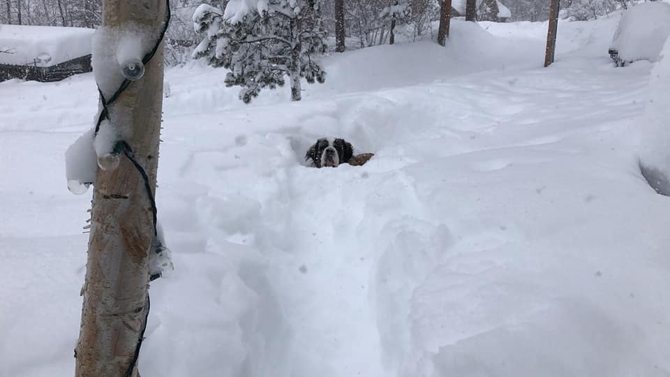
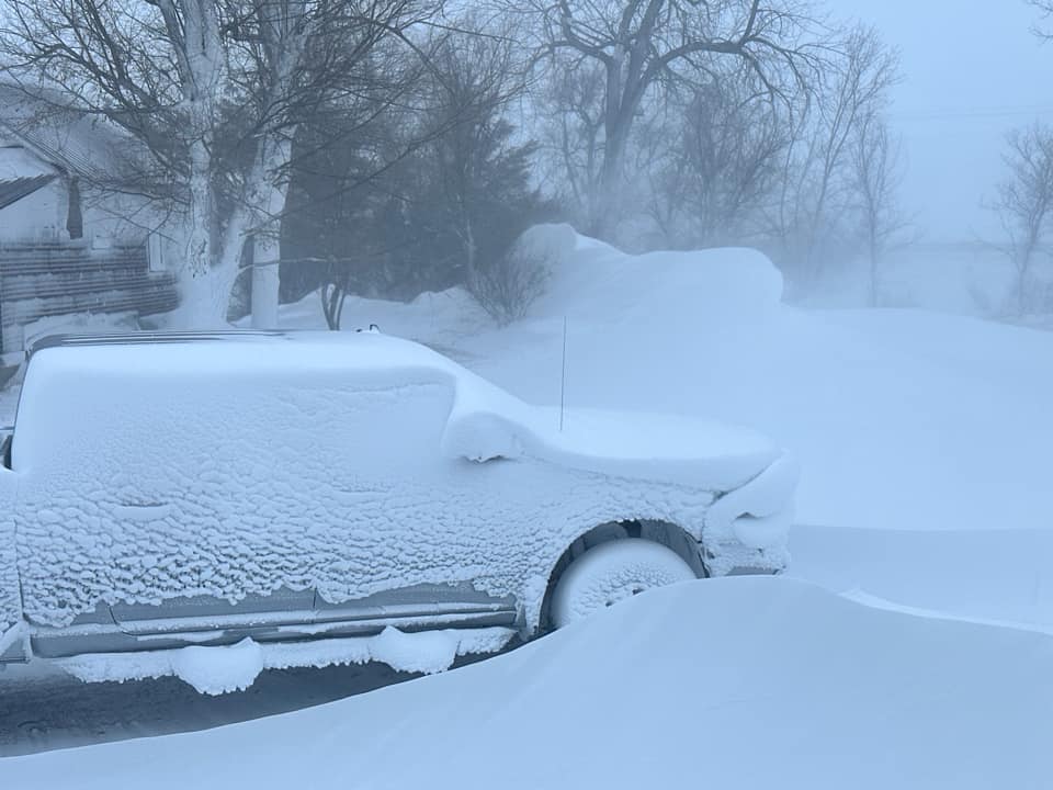
Northeastern Wyoming
 |
 |
 |
| S Gillette (Lorri Young Lang) |
Sand Creek (Gregg Brottlund) |
W Gillette (Angela Cope) |
 |
 |
| Rozet (Selby Graham) |
Gillette (Amber Cotney) |
 |
 |
 |
 |
| Gillette (Jessica Feltmeyer Seders) |
Gillette (Jessica Kukuchka) |
Aladdin (Kelsey Wagner) |
Four Corners (Jeremy Holt) |
 |
 |
 |
| Beulah (Doris Saari Peterson) |
4 miles S of Devils Tower (Heike Bohl) |
Gillette (Jessica Sims) |
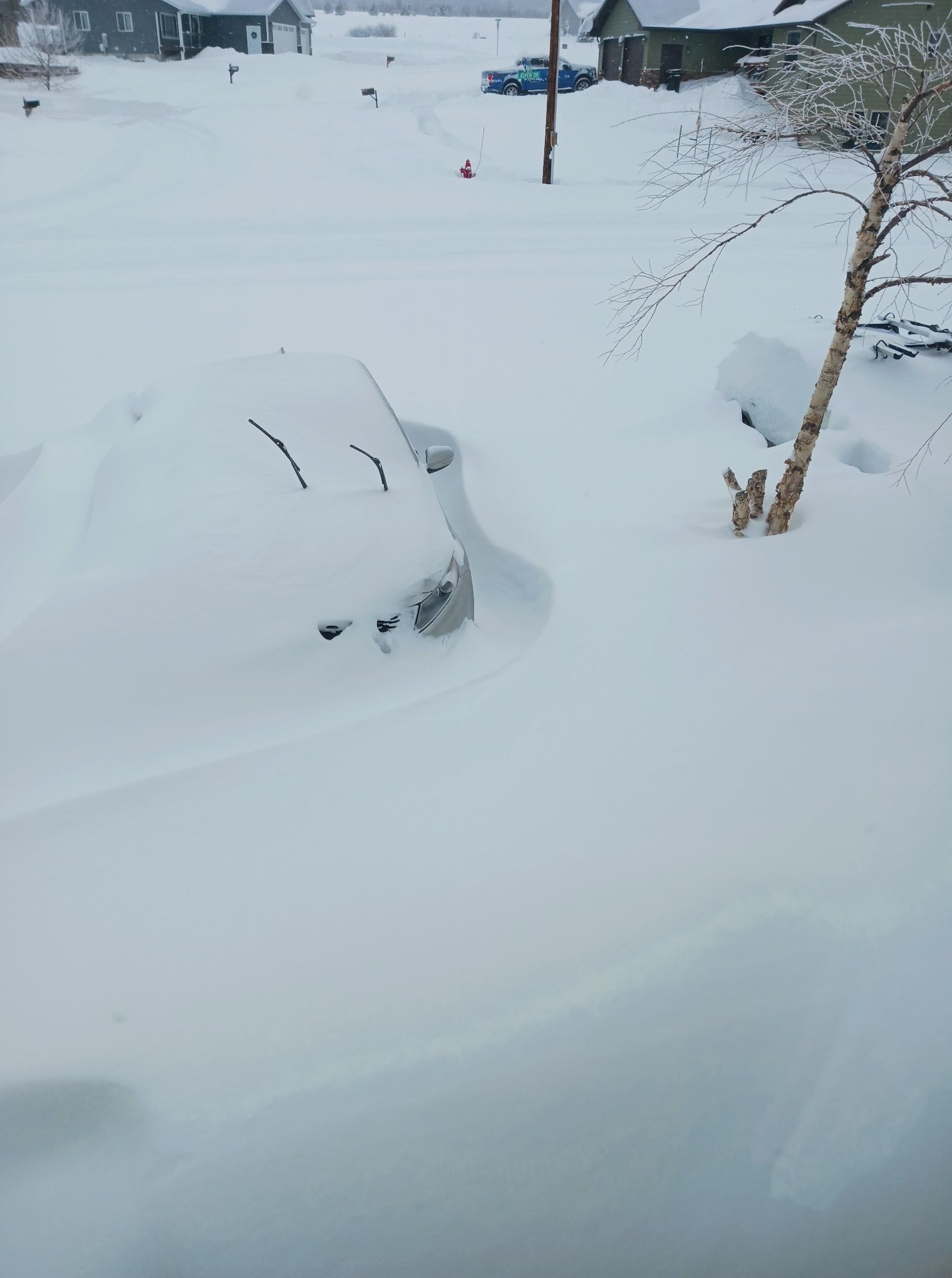
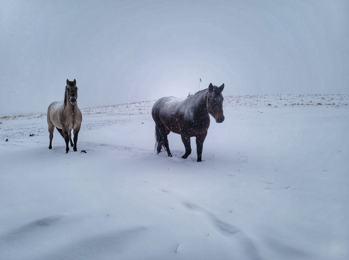
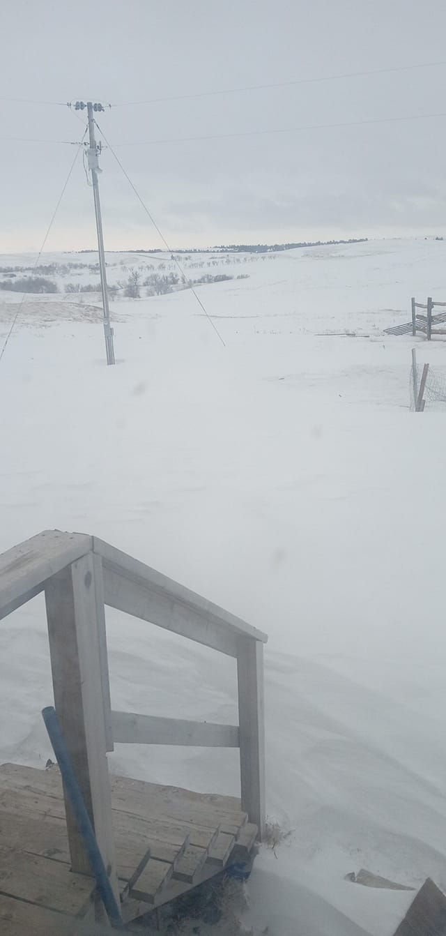
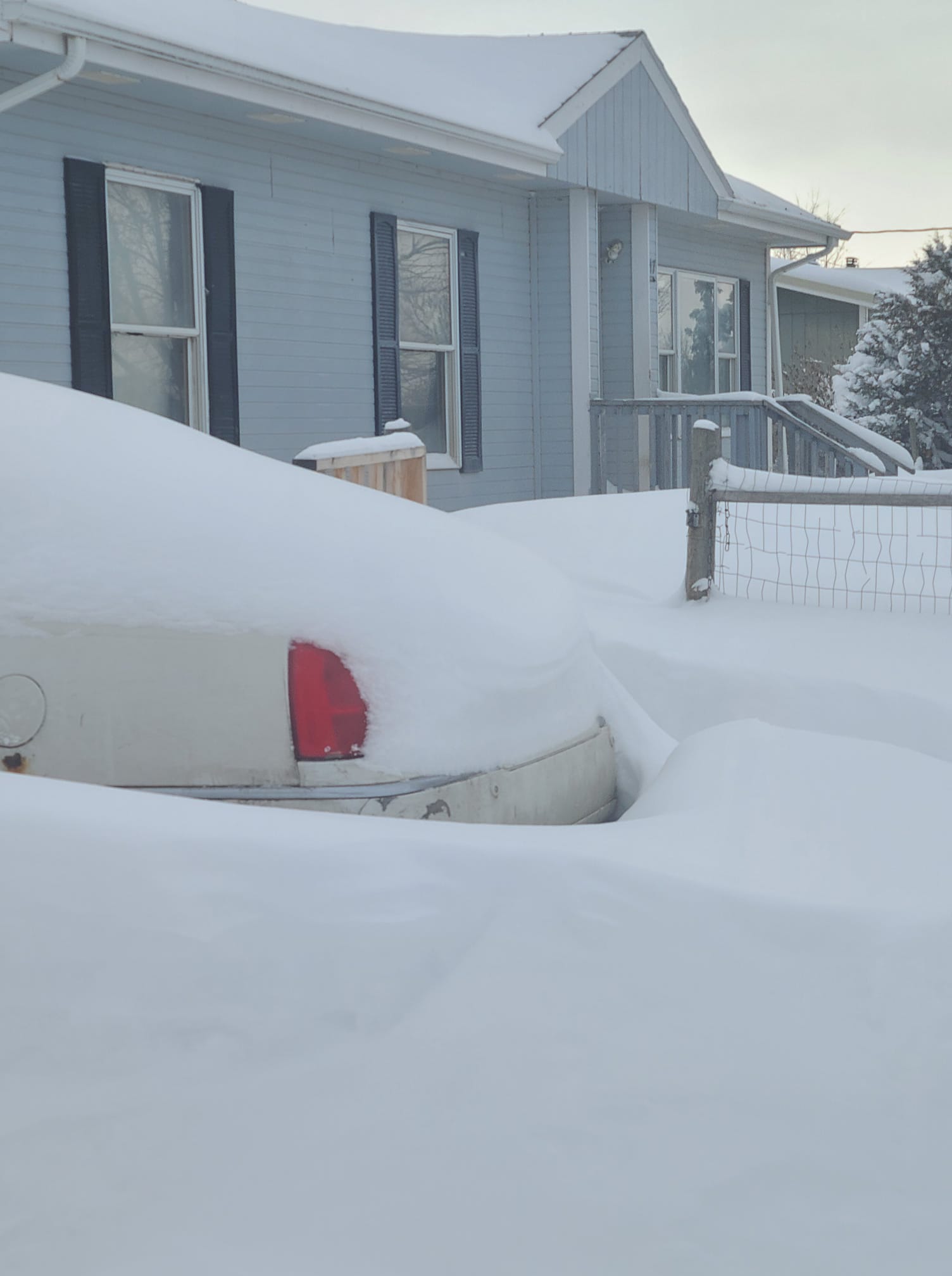
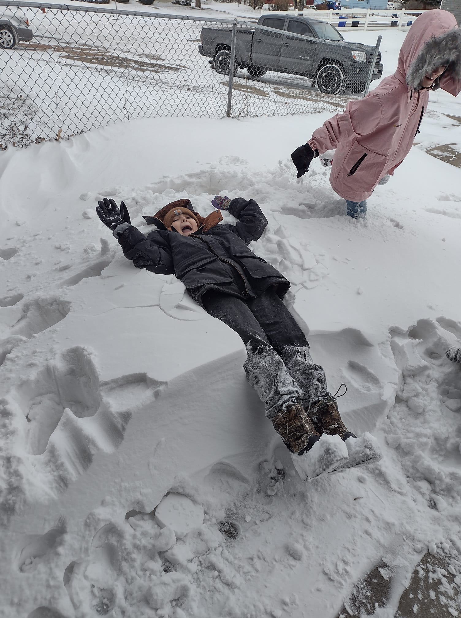
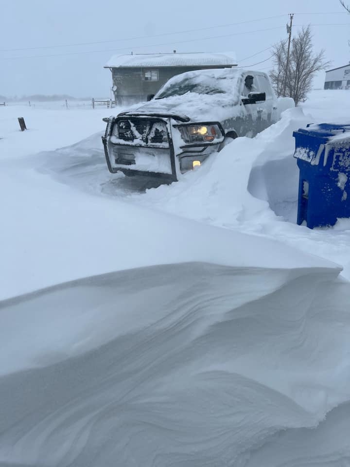
South Dakota Plains
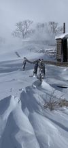 |
 |
 |
 |
| 5 miles E of Mission (Shar Colombe) | 9 miles E of New Underwood (Nancy Whitton-Volmer) |
Mosher (Auriah Prue) |
Wounded Knee (Karmello Gray Beard) |
 |
 |
 |
| Winner (Jamie Smith) |
Pine Ridge (La Fawn Conroy) |
Martin (Samantha Leigh) |
 |
 |
 |
 |
| Rosebud (Madison Anderson) |
N Rapid City (Jess Szep) |
Wall (Jackie Kusser) |
Scenic (Dusty Smith) |
 |
 |
 |
| Nisland (Hidie Wetzler) |
Winner (Randy Kludt) |
Lemmon (Kaitlin Moen) |
 |
 |
|
| Lemmon (Rae-Lynn Kropius) |
N Box Elder (Carissa Williams) |
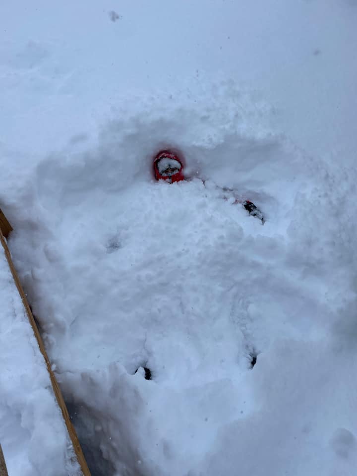
Swett (Kelly Hunter) |
 |
 |
 |
| Box Elder (Carissa Eldridge) |
Wood (Shayna Dillon) |
Reva (Tayle Brink) |
 |
 |
 |
| Rosebud (Cheyenne Hosselton Edwards) |
Okreek (Jamie L. Kangi Hanska) |
Pine Ridge (Nancy Biggz) |
 |
 |
 |
 |
| Newell (Hope Hager Komes) |
Hereford (Paula Phillips) |
Box Elder (Kay Luther) |
Batesland (Naiche Tayac) |
 |
 |
 |
 |
| 5 miles E of Mission (Shar Colombe) |
Colome (Lisa Roger Hauf) |
25 miles NW of Buffalo (Susan Nelson) |
9 miles N of Box Elder (Melissa Smith) |
 |
 |
 |
| White River (Casey Emery Krogman) |
Wall (Jackie Kusser) |
7 miles S of Colome (Annette Richards Musser) |
 |
 |
 |
 |
| Union Center (Loren Opstedahl) |
St. Onge (Christa Wheeler) |
Rapid Valley (Jay Brunssen) |
Box Elder (Josh Webster) |
 |
 |
 |
 |
| New Underwood (Marie Hiscox) |
Meadow (Jill Blasius-Miller) |
Box Elder (Claire Cook) |
Eagle Butte (Ronald D. Adams Jr.) |
 |
 |
 |
| 5 miles S of Mission (Samantha Milligan-Flannery) |
8 miles N of Sturgis (Carissa Lee) |
7 miles E of Vale (Ryan Smeenk) |
 |
 |
 |
 |
| Kadoka (Chad-Dana Eisenbraun) |
Fruitdale (Jamie Hockenbary) |
Dupree (Bailey Peterson) |
Ellsworth AFB (Chris Allen) |
 |
 |
 |
 |
| N of Allen (Laura Hicks) |
Pine Ridge (LaFawn Conroy) |
New Underwood (Bill Gillen) |
Kyle (Genia Campbell) |
 |
 |
 |
| New Underwood (Sabrina Green) |
Box Elder (Rebecca Mara) |
Carter (Amy Farlow Greathouse) |
Video
8 miles north of Sturgis, SD (Carissa Lee)
Radar
Radar animation from 5 PM Monday, December 12th to 8 AM Friday, December 16th (courtesy of IEM Mesonet).
Storm Reports
Public Information Statement National Weather Service Rapid City SD 849 AM MST Sat Dec 17 2022 The following are unofficial observations taken during the past 99 hours ********************STORM TOTAL SNOWFALL******************** LOCATION TOTAL TIME/DATE COMMENTS SNOWFALL MEASURED (inches) SOUTH DAKOTA ...Bennett County... 2 WSW Swett 30.0 1128 AM 12/15 Trained Spotter 5 ENE Martin 24.0 1129 AM 12/15 10 ft drifts ...Butte County... 2 SE Nisland 17.0 514 PM 12/15 16 to 18 inches 1 SSE Belle Fourche 16.0 1247 PM 12/16 Trained Spotter ...Custer County... 3 NE Red Shirt 10.0 743 AM 12/17 Public Hermosa 6.0 600 AM 12/14 CoCoRaHS Argyle 5.0 1011 AM 12/14 4 to 5 inches 1 SW Hermosa 4.0 217 PM 12/15 Trained Spotter 3 SSW Argyle 4.0 700 AM 12/14 CoCoRaHS Pringle 4.0 1005 AM 12/14 Social Media 1 E Custer 1.0 223 PM 12/15 Trained Spotter 7 WSW Jewel Cave 1.0 225 PM 12/15 Trained Spotter ...Fall River County... 5 N Oelrichs 15.5 931 AM 12/16 Social Media 2 N Hot Springs 8.0 948 AM 12/16 Social Media 5 SE Hot Springs 6.0 209 PM 12/15 Trained Spotter Hot Springs 5.9 700 AM 12/14 CoCoRaHS 4 W Hot Springs 4.0 700 AM 12/14 CoCoRaHS Oral 4.0 600 AM 12/14 Co-Op Observer Edgemont 3.5 700 AM 12/14 CoCoRaHS 1 NNE Edgemont 3.0 600 AM 12/14 Co-Op Observer ...Haakon County... 5 N Midland 30.0 1028 AM 12/16 Social Media Philip 18.0 122 PM 12/16 Law Enforcement 5 NE Milesville 18.0 600 PM 12/16 Storm total 3 E Midland 12.5 700 AM 12/16 CoCoRaHS ...Harding County... 13 WNW Ladner 14.0 129 PM 12/16 Trained Spotter 3 SSE Harding 14.0 800 AM 12/16 Co-Op Observer 5 NE Buffalo 6.0 126 PM 12/16 Trained Spotter ...Jackson County... Kadoka 28.0 1149 AM 12/16 Social Media 8 E Kyle 24.0 1022 AM 12/16 10 ft drifts ...Lawrence County... Cheyenne Crossing 48.0 1003 AM 12/16 Trained Spotter Deadwood 48.0 1150 AM 12/16 Law Enforcement 5 NW Cheyenne Crossi 48.0 1027 AM 12/15 Social Media 3 ESE Cheyenne Cross 40.6 700 AM 12/17 CoCoRaHS 1 WNW Dwtn Spearfish 36.0 954 AM 12/16 Trained Spotter 1 S Dwtn Spearfish 32.0 1037 AM 12/16 storm total 1 W O`Neil Pass 32.0 1157 AM 12/16 Storm total. 3 SE Saint Onge 29.8 700 AM 12/17 CoCoRaHS 1 NNW Dwtn Spearfish 28.5 900 AM 12/16 Co-Op Observer 2 NNW Saint Onge 28.0 917 AM 12/16 Trained Spotter 3 NE Whitewood 22.0 111 PM 12/16 Trained Spotter 2 WNW Dwtn Spearfish 21.5 700 AM 12/17 CoCoRaHS ...Meade County... Sturgis 35.0 918 AM 12/16 Social Media 5 ESE Elm Springs 24.0 828 AM 12/16 Trained Spotter Fairpoint 22.0 944 AM 12/16 Social Media 2 SSE Sturgis 21.0 614 PM 12/15 Storm total so far 7 NNE Ellsworth AFB 15.0 700 AM 12/16 CoCoRaHS 4 NNW Elm Springs 14.0 600 AM 12/16 CoCoRaHS 1 NNW Piedmont 14.0 800 AM 12/16 NWS Employee 8 SE Mud Butte 9.8 900 AM 12/15 CoCoRaHS 5 NNE Stoneville 9.3 420 PM 12/16 CoCoRaHS Hereford 9.0 115 PM 12/15 estimated 8-10 inches 4 NNE Summerset 6.7 600 AM 12/16 CoCoRaHS ...Mellette County... 5 ESE Norris 33.7 1034 AM 12/16 Trained Spotter 7 N Wood 26.1 600 AM 12/17 CoCoRaHS 2 SSW Norris 23.0 700 AM 12/16 CoCoRaHS 4 NE Wood 13.0 800 AM 12/16 CoCoRaHS ...Oglala Lakota County... Pine Ridge 30.0 1018 AM 12/16 Emergency Manager Batesland 24.0 917 AM 12/16 Social Media ...Pennington County... 1 S Wall 16.0 1007 AM 12/16 Social Media New Underwood 14.0 118 PM 12/15 Social Media 6 W New Underwood 12.0 700 AM 12/16 CoCoRaHS Wall 12.0 1040 AM 12/15 Social Media 4 W Dwtn Rapid City 8.6 700 AM 12/16 CoCoRaHS 1 E Dwtn Rapid City 7.7 1100 AM 12/16 Storm Total Snow 8 WNW Dwtn Rapid Cit 7.6 1100 AM 12/15 Official NWS Obs 3 NNE Johnson Siding 7.3 700 AM 12/16 CoCoRaHS 1 N Johnson Siding 6.9 800 AM 12/15 CoCoRaHS 1 NE Dwtn Rapid City 6.5 600 AM 12/16 CoCoRaHS 1 ESE Pactola Resv 6.2 800 AM 12/15 Co-Op Observer 2 SSE Dwtn Rapid Cit 5.6 700 AM 12/15 CoCoRaHS 3 NE Hisega 4.0 700 AM 12/16 CoCoRaHS 4 NE Rockerville 3.5 1156 AM 12/16 NWS Employee Mount Rushmore 3.0 1158 PM 12/13 Co-Op Observer Hill City 2.0 600 AM 12/15 Co-Op Observer 1 E Hill City 2.0 230 PM 12/15 Trained Spotter ...Perkins County... 8 WNW Usta 14.0 1154 AM 12/16 Trained Spotter Lemmon 12.7 500 PM 12/14 Storm Total Snow 8 WSW Lodgepole 10.0 1108 AM 12/15 estimated 8-12 inches ...Todd County... 4 W Mission 34.0 300 PM 12/14 Social Media Mission 28.0 1247 PM 12/15 Social Media 16 SSE Mission 24.5 600 AM 12/16 CoCoRaHS 4 NW Parmelee 23.0 1135 AM 12/15 Trained Spotter 7 E Lakeview 16.0 700 AM 12/16 Storm total ...Tripp County... Winner 20.0 110 PM 12/15 Social Media 7 S Colome 14.0 313 PM 12/15 Social Media 9 ENE Wewela 10.6 600 AM 12/17 CoCoRaHS ...Ziebach County... 3 E South Eagle Butt 28.0 1020 AM 12/16 Social Media 14 SSE Dupree 23.0 800 AM 12/16 Storm total 18 ESE Dupree 21.0 947 AM 12/16 Social Media Dupree 19.0 1119 AM 12/15 Trained Spotter South Eagle Butte 16.0 506 PM 12/14 Social Media WYOMING ...Campbell County... 4 SE Dwtn Gillette 22.7 430 PM 12/16 Storm total 7 WNW Rozet 18.0 700 AM 12/16 CoCoRaHS Dwtn Gillette 15.0 1000 AM 12/15 Social Media 8 NE Rozet 14.0 353 PM 12/14 been snowing all day 10 WNW Pine Tree Jun 13.0 204 PM 12/16 Trained Spotter 14 NNW Dwtn Gillette 12.2 700 AM 12/15 CoCoRaHS Wright 12.0 700 AM 12/15 CoCoRaHS 5 SW Dwtn Gillette 10.0 700 AM 12/14 CoCoRaHS 11 NNE Weston 7.0 700 AM 12/14 CoCoRaHS 1 NNE Recluse 6.0 159 PM 12/15 1/2 mi visibility ...Crook County... 4 NW Hulett 26.0 511 PM 12/14 Social Media 4 S Devils Tower 20.0 255 PM 12/15 Social Media 15 NNW Alva 18.0 143 PM 12/15 Trained Spotter 5 S Beulah 16.0 349 PM 12/14 Still snowing heavily 15 SE Sundance 15.0 500 AM 12/14 Public 19 NNW New Haven 14.0 155 PM 12/15 Trained Spotter 2 ESE Colony 12.0 1200 PM 12/15 Trained Spotter ...Weston County... 8 NNW Newcastle 10.0 700 AM 12/16 CoCoRaHS 11 NE Morrisey 4.0 700 AM 12/16 CoCoRaHS 3 E Newcastle 3.0 600 AM 12/16 CoCoRaHS 1 E Clareton 3.0 206 PM 12/16 Trained Spotter Newcastle 2.5 1030 AM 12/15 Social Media 4 SE Upton 2.0 700 AM 12/14 CoCoRaHS 1 SE Newcastle 2.0 800 AM 12/16 CoCoRaHS 1 ESE Newcastle 2.0 800 AM 12/16 Co-Op Observer ***********************PEAK WIND GUST*********************** LOCATION MAX WIND TIME/DATE COMMENTS GUST MEASURED (mph) SOUTH DAKOTA ...Bennett County... 1 ESE Martin 51 155 PM 12/15 AWOS ...Butte County... 13 NW Belle Fourche 52 143 AM 12/16 SDDOT 27 WNW Castle Rock 52 256 PM 12/15 RAWS 7 WSW Hoover 52 254 AM 12/16 SDDOT 1 NNW Nisland 50 1030 PM 12/15 SDSU Mesonet ...Custer County... 8 SSW Folsom 57 426 PM 12/13 SDDOT 8 W Jewel Cave 51 659 AM 12/15 SDDOT ...Fall River County... 10 W Edgemont 59 811 AM 12/16 SDDOT 11 W Hot Springs 53 322 PM 12/15 SDDOT ...Haakon County... 1 NE Midland 63 1240 PM 12/15 SDDOT 3 E Philip 63 1243 PM 12/15 ASOS 10 NNW Ottumwa 53 1133 PM 12/15 SDDOT ...Harding County... 1 N Buffalo 61 453 PM 12/15 ASOS 7 NNE Ralph 58 206 PM 12/15 SDDOT 13 SSW Reva 55 1211 AM 12/16 SDDOT 8 N Redig 55 305 PM 12/13 SDDOT 4 N Ludlow 51 208 AM 12/16 SDDOT ...Jackson County... 4 E Cactus Flat 60 1152 PM 12/15 SDDOT 9 ENE Belvidere 54 221 PM 12/15 SDDOT 2 E Cottonwood 54 1035 PM 12/15 SDSU Mesonet 7 E Wanblee 52 718 PM 12/15 SDDOT ...Lawrence County... 1 E Lead 57 430 AM 12/15 CWOP ...Meade County... 7 E Sturgis 63 155 AM 12/16 AWOS 1 NNE Faith 60 1231 AM 12/16 ASOS 1 ENE Mud Butte 59 756 AM 12/16 SDDOT Ellsworth AFB 56 543 AM 12/16 Other Federal 6 NE Summerset 54 715 PM 12/13 Trained Spotter 1 NNW Piedmont 54 440 PM 12/15 NWS Employee Union Center 53 100 AM 12/16 SDSU Mesonet 6 WSW Opal 52 645 AM 12/16 CWOP ...Oglala Lakota County... 9 SW Batesland 54 536 AM 12/15 SDDOT 5 NE Porcupine 52 441 AM 12/15 RAWS ...Pennington County... 3 NW Wasta 70 814 AM 12/16 SDDOT 5 WNW New Underwood 65 1148 PM 12/15 SDDOT 1 E Dwtn Rapid City 64 757 PM 12/15 Official NWS Obs 3 NNW Scenic 64 427 AM 12/15 SDDOT Rapid City Arpt 63 1229 PM 12/13 ASOS 8 S Wall 58 120 AM 12/16 RAWS 1 W Box Elder 57 1247 PM 12/13 SDDOT Wasta 57 346 AM 12/16 CWOP 2 NNW Pactola Res 56 410 AM 12/15 SDDOT 6 W Rochford 55 208 AM 12/15 RAWS 1 WNW Caputa 54 855 PM 12/15 SDSU Mesonet 2 ENE Rockerville 53 1108 AM 12/15 SDDOT 4 S Dwtn Rapid City 52 710 PM 12/15 NWS Employee 9 ENE Hayward 51 608 PM 12/13 CWOP ...Perkins County... 3 W Lemmon 51 1205 AM 12/16 SDDOT ...Todd County... 15 SSE Mission 62 706 AM 12/15 SDDOT 6 W Parmelee 58 828 PM 12/15 RAWS 7 ESE Rosebud 55 130 PM 12/15 SDSU Mesonet 11 SW Parmelee 53 841 PM 12/15 SDDOT ...Tripp County... 1 NE Winner 58 121 PM 12/15 ASOS 2 W Hamill 54 705 AM 12/15 SDSU Mesonet 4 SSE Witten 53 1041 AM 12/13 SDDOT ...Ziebach County... 2 SW Bridger 53 329 AM 12/16 SDDOT WYOMING ...Campbell County... 10 SW Dwtn Gillette 57 515 AM 12/16 CWOP 1 NE Echeta 56 951 PM 12/15 RAWS 5 NNW Dwtn Gillette 56 339 AM 12/15 ASOS 25 ESE Wright 55 405 AM 12/16 RAWS ...Weston County... Four Corners 53 652 AM 12/15 WYDOT 6 WNW Newcastle 52 740 AM 12/15 AWOS ...PRELIMINARY SNOW TOTALS SORTED BY MAGNITUDE... LOCATION SNOWFALL COMMENTS IN/S/ Cheyenne Crossing SD 48.0 1003 AM 12/16/2022 Deadwood SD 48.0 1150 AM 12/16/2022 5 NW Cheyenne Crossing SD 48.0 1027 AM 12/15/2022 3 ESE Cheyenne Crossing SD 40.6 700 AM 12/17/2022 1 S Deadwood SD 36.0 353 PM 12/14/2022 1 WNW Dwtn Spearfish SD 36.0 954 AM 12/16/2022 Sturgis SD 35.0 918 AM 12/16/2022 4 W Mission SD 34.0 300 PM 12/14/2022 5 ESE Norris SD 33.7 1034 AM 12/16/2022 1 S Dwtn Spearfish SD 32.0 1037 AM 12/16/2022 1 W O`Neil Pass SD 32.0 1157 AM 12/16/2022 2 WSW Swett SD 30.0 1128 AM 12/15/2022 Pine Ridge SD 30.0 1018 AM 12/16/2022 5 N Midland SD 30.0 1028 AM 12/16/2022 3 SE Saint Onge SD 29.8 700 AM 12/17/2022 1 NNW Dwtn Spearfish SD 28.5 900 AM 12/16/2022 Kadoka SD 28.0 1149 AM 12/16/2022 Mission SD 28.0 1247 PM 12/15/2022 3 E South Eagle Butte SD 28.0 1020 AM 12/16/2022 2 NNW Saint Onge SD 28.0 917 AM 12/16/2022 7 N Wood SD 26.1 600 AM 12/17/2022 4 NW Hulett WY 26.0 511 PM 12/14/2022 Dwtn Spearfish SD 25.0 423 PM 12/14/2022 16 SSE Mission SD 24.5 600 AM 12/16/2022 Batesland SD 24.0 917 AM 12/16/2022 8 E Kyle SD 24.0 1022 AM 12/16/2022 5 ESE Elm Springs SD 24.0 828 AM 12/16/2022 5 ENE Martin SD 24.0 1129 AM 12/15/2022 14 SSE Dupree SD 23.0 800 AM 12/16/2022 2 SSW Norris SD 23.0 700 AM 12/16/2022 4 NW Parmelee SD 23.0 1135 AM 12/15/2022 4 SE Dwtn Gillette WY 22.7 430 PM 12/16/2022 3 NE Whitewood SD 22.0 111 PM 12/16/2022 Fairpoint SD 22.0 944 AM 12/16/2022 2 WNW Dwtn Spearfish SD 21.5 700 AM 12/17/2022 18 ESE Dupree SD 21.0 947 AM 12/16/2022 2 SSE Sturgis SD 21.0 614 PM 12/15/2022 Winner SD 20.0 110 PM 12/15/2022 Cedar Butte SD 20.0 1036 AM 12/14/2022 4 S Devils Tower WY 20.0 255 PM 12/15/2022 Dupree SD 19.0 1119 AM 12/15/2022 15 NNW Alva WY 18.0 143 PM 12/15/2022 7 WNW Rozet WY 18.0 700 AM 12/16/2022 Philip SD 18.0 122 PM 12/16/2022 5 NE Milesville SD 18.0 600 PM 12/16/2022 2 SE Nisland SD 17.0 514 PM 12/15/2022 1 SSE Belle Fourche SD 16.0 1247 PM 12/16/2022 1 S Wall SD 16.0 1007 AM 12/16/2022 7 E Lakeview SD 16.0 700 AM 12/16/2022 5 N Oelrichs SD 15.5 931 AM 12/16/2022 Dwtn Gillette WY 15.0 1000 AM 12/15/2022 7 NNE Ellsworth AFB SD 15.0 700 AM 12/16/2022 4 NNW Elm Springs SD 14.0 600 AM 12/16/2022 New Underwood SD 14.0 118 PM 12/15/2022 7 S Colome SD 14.0 313 PM 12/15/2022 13 WNW Ladner SD 14.0 129 PM 12/16/2022 3 SSE Harding SD 14.0 800 AM 12/16/2022 1 NNW Piedmont SD 14.0 800 AM 12/16/2022 8 NE Rozet WY 14.0 353 PM 12/14/2022 19 NNW New Haven WY 14.0 155 PM 12/15/2022 8 WNW Usta SD 14.0 1154 AM 12/16/2022 4 NE Wood SD 13.0 800 AM 12/16/2022 10 WNW Pine Tree Junction WY 13.0 204 PM 12/16/2022 Lemmon SD 12.7 500 PM 12/14/2022 3 E Midland SD 12.5 700 AM 12/16/2022 14 NNW Dwtn Gillette WY 12.2 700 AM 12/15/2022 2 ESE Colony WY 12.0 1200 PM 12/15/2022 6 W New Underwood SD 12.0 700 AM 12/16/2022 Wright WY 12.0 700 AM 12/15/2022 Wall SD 12.0 1040 AM 12/15/2022 9 ENE Wewela SD 10.6 600 AM 12/17/2022 3 NE Red Shirt SD 10.0 743 AM 12/17/2022 8 WSW Lodgepole SD 10.0 1108 AM 12/15/2022 8 NNW Newcastle WY 10.0 700 AM 12/16/2022 8 SE Mud Butte SD 9.8 900 AM 12/15/2022 5 NNE Stoneville SD 9.3 420 PM 12/16/2022 3 ENE Kyle SD 9.0 600 AM 12/14/2022 Hereford SD 9.0 115 PM 12/15/2022 4 W Dwtn Rapid City SD 8.6 700 AM 12/16/2022 2 N Hot Springs SD 8.0 948 AM 12/16/2022 15 ENE Redig SD 8.0 1013 AM 12/14/2022 1 E Dwtn Rapid City SD 7.7 1100 AM 12/16/2022 8 WNW Dwtn Rapid City SD 7.6 1100 AM 12/15/2022 3 NNE Johnson Siding SD 7.3 700 AM 12/16/2022 1 N Johnson Siding SD 6.9 800 AM 12/15/2022 4 NNE Summerset SD 6.7 600 AM 12/16/2022 1 NE Dwtn Rapid City SD 6.5 600 AM 12/16/2022 1 ESE Pactola Resv SD 6.2 800 AM 12/15/2022 1 NNE Recluse WY 6.0 159 PM 12/15/2022 5 SE Hot Springs SD 6.0 209 PM 12/15/2022 Hermosa SD 6.0 600 AM 12/14/2022 5 NE Buffalo SD 6.0 126 PM 12/16/2022 6 SW Beulah WY 6.0 800 AM 12/14/2022 2 SSE Dwtn Rapid City SD 5.6 700 AM 12/15/2022 1 S Rockerville SD 5.5 854 PM 12/14/2022 Argyle SD 5.0 1011 AM 12/14/2022 14 S Mission SD 5.0 600 AM 12/16/2022 3 NE Hisega SD 4.0 700 AM 12/16/2022 3 SSW Argyle SD 4.0 700 AM 12/14/2022 11 NE Morrisey WY 4.0 700 AM 12/16/2022 4 W Hot Springs SD 4.0 700 AM 12/14/2022 Oral SD 4.0 600 AM 12/14/2022 Pringle SD 4.0 1005 AM 12/14/2022 Edgemont SD 3.5 700 AM 12/14/2022 4 NE Rockerville SD 3.5 1156 AM 12/16/2022 9 SE Meadow SD 3.0 700 AM 12/15/2022 Mount Rushmore SD 3.0 1158 PM 12/13/2022 3 E Newcastle WY 3.0 600 AM 12/16/2022 1 E Clareton WY 3.0 206 PM 12/16/2022 1 SW Dwtn Rapid City SD 3.0 800 AM 12/14/2022 1 NNE Edgemont SD 3.0 600 AM 12/14/2022 Newcastle WY 2.5 1030 AM 12/15/2022 Hill City SD 2.0 600 AM 12/15/2022 1 SE Newcastle WY 2.0 800 AM 12/16/2022 1 E Hill City SD 2.0 230 PM 12/15/2022 1 ESE Newcastle WY 2.0 800 AM 12/16/2022 1 E Custer SD 1.0 223 PM 12/15/2022 7 WSW Jewel Cave SD 1.0 225 PM 12/15/2022 ...MAXIMUM OBSERVED WINDS SORTED BY MAGNITUDE... LOCATION MAX WIND COMMENTS MPH 3 NW Wasta SD 70 814 AM 12/16/2022 5 WNW New Underwood SD 65 1148 PM 12/15/2022 1 E Dwtn Rapid City SD 64 757 PM 12/15/2022 3 NNW Scenic SD 64 427 AM 12/15/2022 1 NE Midland SD 63 1240 PM 12/15/2022 7 E Sturgis SD 63 155 AM 12/16/2022 Rapid City Arpt SD 63 1229 PM 12/13/2022 3 E Philip SD 63 1243 PM 12/15/2022 15 SSE Mission SD 62 706 AM 12/15/2022 1 N Buffalo SD 61 453 PM 12/15/2022 4 E Cactus Flat SD 60 1152 PM 12/15/2022 1 NNE Faith SD 60 1231 AM 12/16/2022 1 ENE Mud Butte SD 59 756 AM 12/16/2022 10 W Edgemont SD 59 811 AM 12/16/2022 1 NE Winner SD 58 121 PM 12/15/2022 7 NNE Ralph SD 58 206 PM 12/15/2022 6 W Parmelee SD 58 828 PM 12/15/2022 8 S Wall SD 58 120 AM 12/16/2022 10 SW Dwtn Gillette WY 57 515 AM 12/16/2022 8 SSW Folsom SD 57 426 PM 12/13/2022 1 W Box Elder SD 57 1247 PM 12/13/2022 Wasta SD 57 346 AM 12/16/2022 1 E Lead SD 57 430 AM 12/15/2022 2 NNW Pactola Res SD 56 410 AM 12/15/2022 1 NE Echeta WY 56 951 PM 12/15/2022 Ellsworth AFB SD 56 543 AM 12/16/2022 5 NNW Dwtn Gillette WY 56 339 AM 12/15/2022 25 ESE Wright WY 55 405 AM 12/16/2022 13 SSW Reva SD 55 1211 AM 12/16/2022 6 W Rochford SD 55 208 AM 12/15/2022 8 N Redig SD 55 305 PM 12/13/2022 7 ESE Rosebud SD 55 130 PM 12/15/2022 6 NE Summerset SD 54 715 PM 12/13/2022 1 WNW Caputa SD 54 855 PM 12/15/2022 9 ENE Belvidere SD 54 221 PM 12/15/2022 9 SW Batesland SD 54 536 AM 12/15/2022 1 NNW Piedmont SD 54 440 PM 12/15/2022 2 E Cottonwood SD 54 1035 PM 12/15/2022 2 W Hamill SD 54 705 AM 12/15/2022 11 W Hot Springs SD 53 322 PM 12/15/2022 2 ENE Rockerville SD 53 1108 AM 12/15/2022 4 SSE Witten SD 53 1041 AM 12/13/2022 2 SW Bridger SD 53 329 AM 12/16/2022 10 NNW Ottumwa SD 53 1133 PM 12/15/2022 Four Corners WY 53 652 AM 12/15/2022 11 SW Parmelee SD 53 841 PM 12/15/2022 Union Center SD 53 100 AM 12/16/2022 4 S Dwtn Rapid City SD 52 710 PM 12/15/2022 13 NW Belle Fourche SD 52 143 AM 12/16/2022 6 WSW Opal SD 52 645 AM 12/16/2022 5 NE Porcupine SD 52 441 AM 12/15/2022 6 WNW Newcastle WY 52 740 AM 12/15/2022 27 WNW Castle Rock SD 52 256 PM 12/15/2022 7 WSW Hoover SD 52 254 AM 12/16/2022 7 E Wanblee SD 52 718 PM 12/15/2022 9 ENE Hayward SD 51 608 PM 12/13/2022 1 ESE Martin SD 51 155 PM 12/15/2022 8 W Jewel Cave SD 51 659 AM 12/15/2022 4 N Ludlow SD 51 208 AM 12/16/2022 3 W Lemmon SD 51 1205 AM 12/16/2022 1 NNW Nisland SD 50 1030 PM 12/15/2022
Environment
Here is a water vapor satellite loop (courtesy of COD) of the blizzard from 6 am MST 12 December to noon MST 15 December 2022 show just how large the storm was and how it stalled over the northern plains resulting in several days of snow, strong winds, and blizzard conditions.
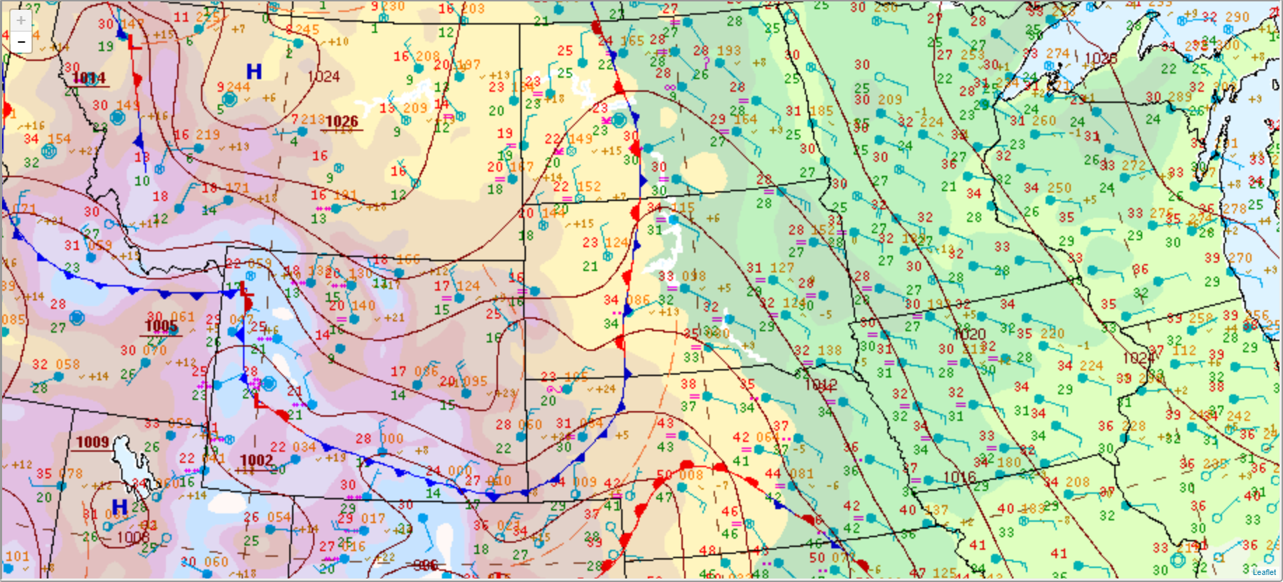
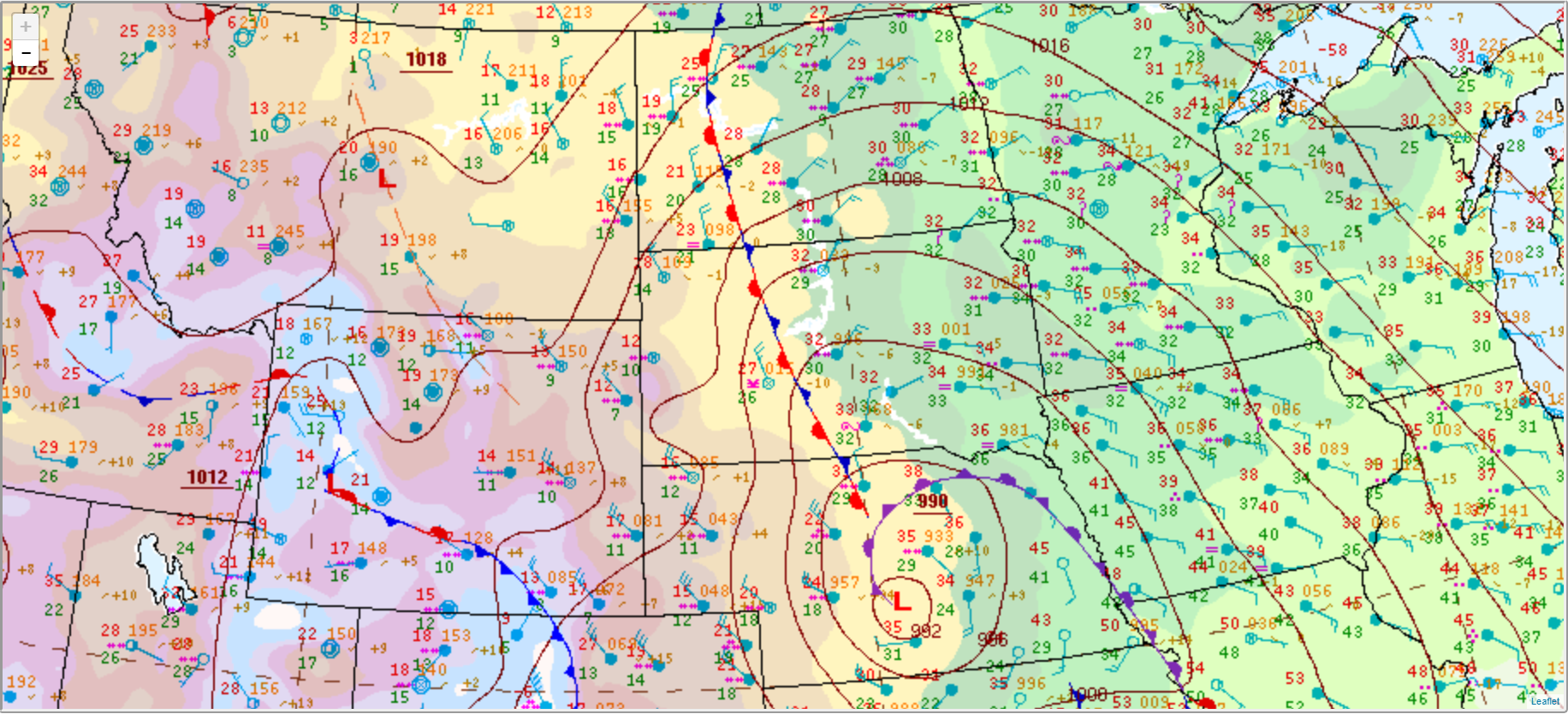
Below are surface maps at three different periods during the storm. Even after the low shifted eastward into Minnesota towards the end of the event, strong winds and bands of snow continued creating blizzard conditions across western SD through Friday the 16th.
 |
 |
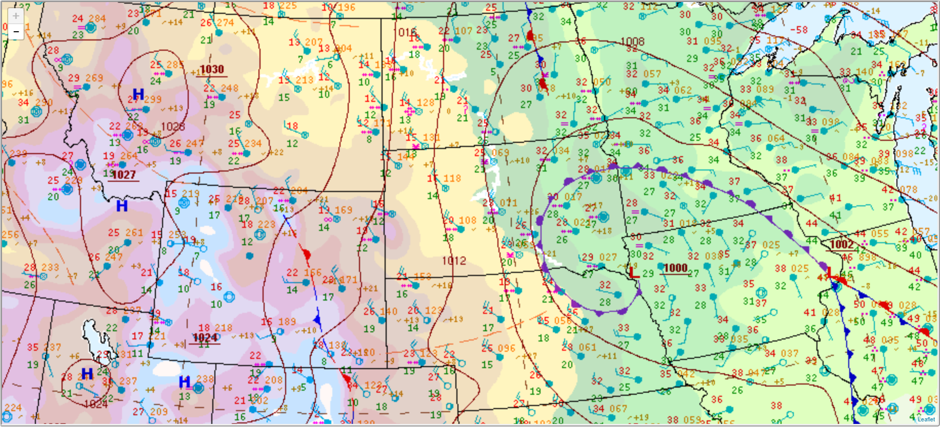 |
| 00Z Dec 13th (Monday evening) | 00Z Dec 14th (Tuesday evening) | 00Z Dec 15th (Wednesday evening) |
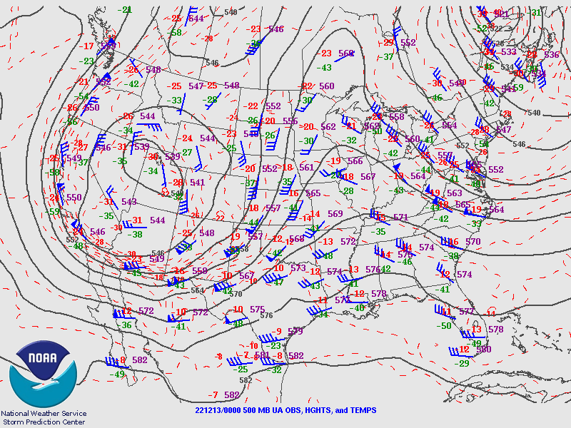
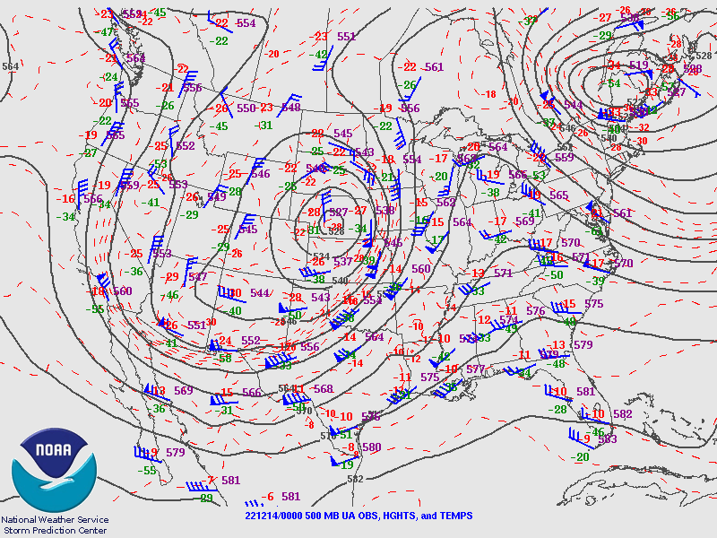
Likewise, 500 mb charts at corresponding times show a very large, deep midlevel to upper-level trough across the western U.S. slowly moving over the Plains and toward the Upper Midwest. The trough strengthened significantly from Monday evening to Tuesday evening, coincident with the onset of blizzard conditions across much of western and central South Dakota.
 |
 |
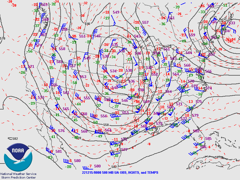 |
| 00Z Dec 13th (Monday evening) | 00Z Dec 14th (Tuesday evening) | 00Z Dec 15th (Wednesday evening) |
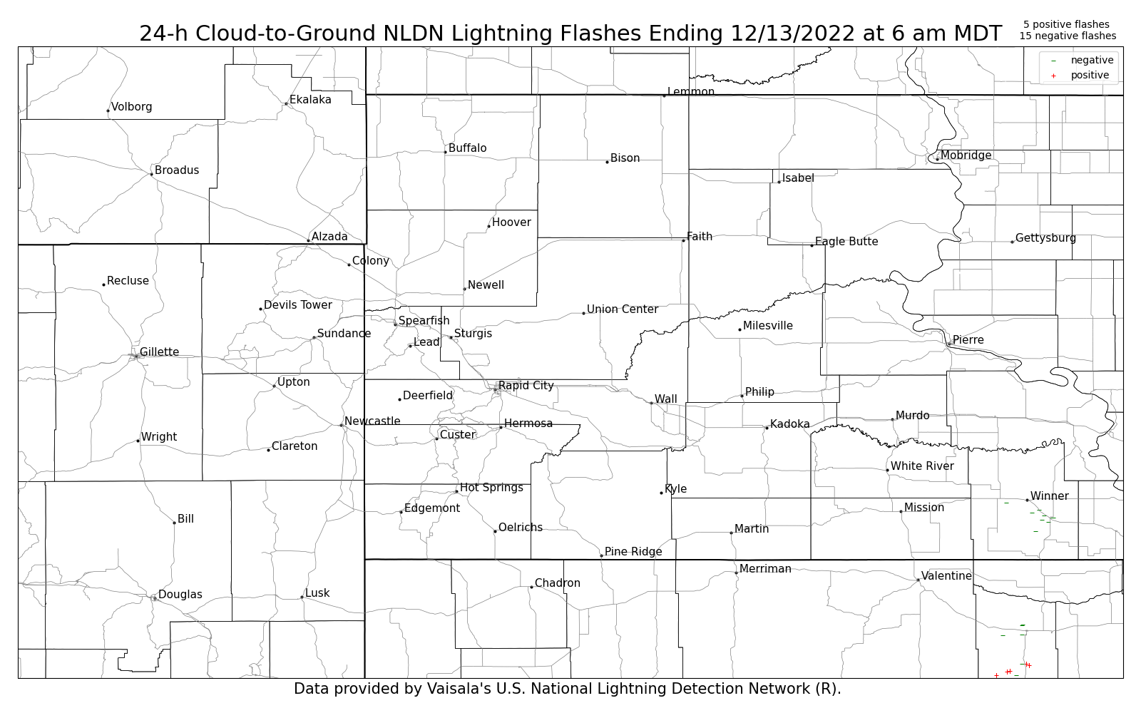
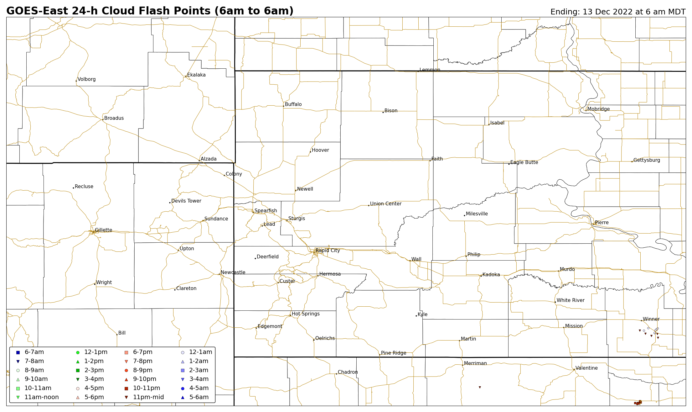
A few thunderstorms moved across south-central early Wednesday morning on 13 December 2022, producing some lightning flashes in Tripp County. The first image below shows cloud-to-ground strikes; the second image shows the total lightning (in-cloud plus cloud-to-ground); and the third image shows information from the weather balloon from at Rapid City at 5 am MST (indicating a somewhat unstable atmosphere).
 |
 |
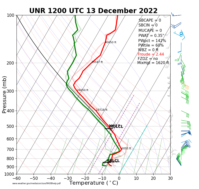 |
| Figure 7: 24-h cloud-to-ground lightning flashes ending at 5 am MST on 13 December 2022. | Figure 8: 24-h total lightning flashes ending at 5 am MST on 13 December 2022. | Figure 9: Temperature, moisture, and wind information from the weather balloon valid at 5 am MST on 13 December 2022. |
 |
Media use of NWS Web News Stories is encouraged! Please acknowledge the NWS as the source of any news information accessed from this site. |
|

