
Tropical Depression Two is expected to gradually strengthen and could bring tropical storm conditions to the Florida Panhandle beginning late Monday. Areas of flash flooding will be possible through Thursday along the eastern and central Gulf Coast. Severe thunderstorms will develop and move along a cold front crossing the Upper Midwest Monday, and through the Ohio Valley/Mid-Atlantic on Tuesday. Read More >
Overview
|
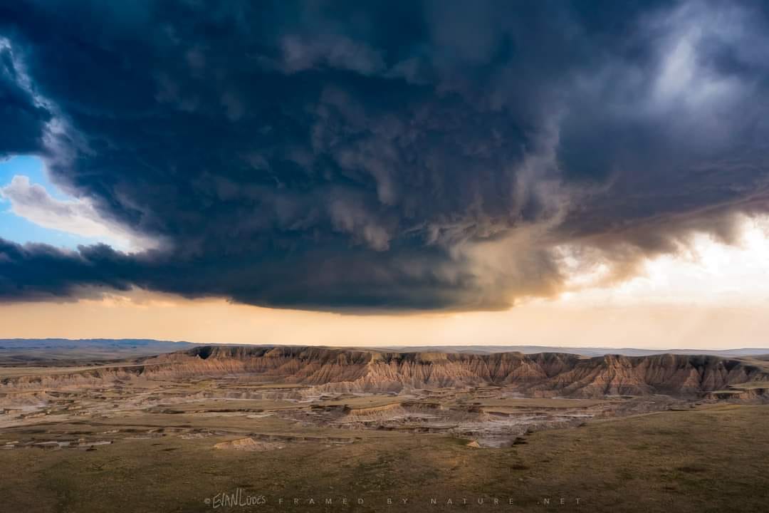
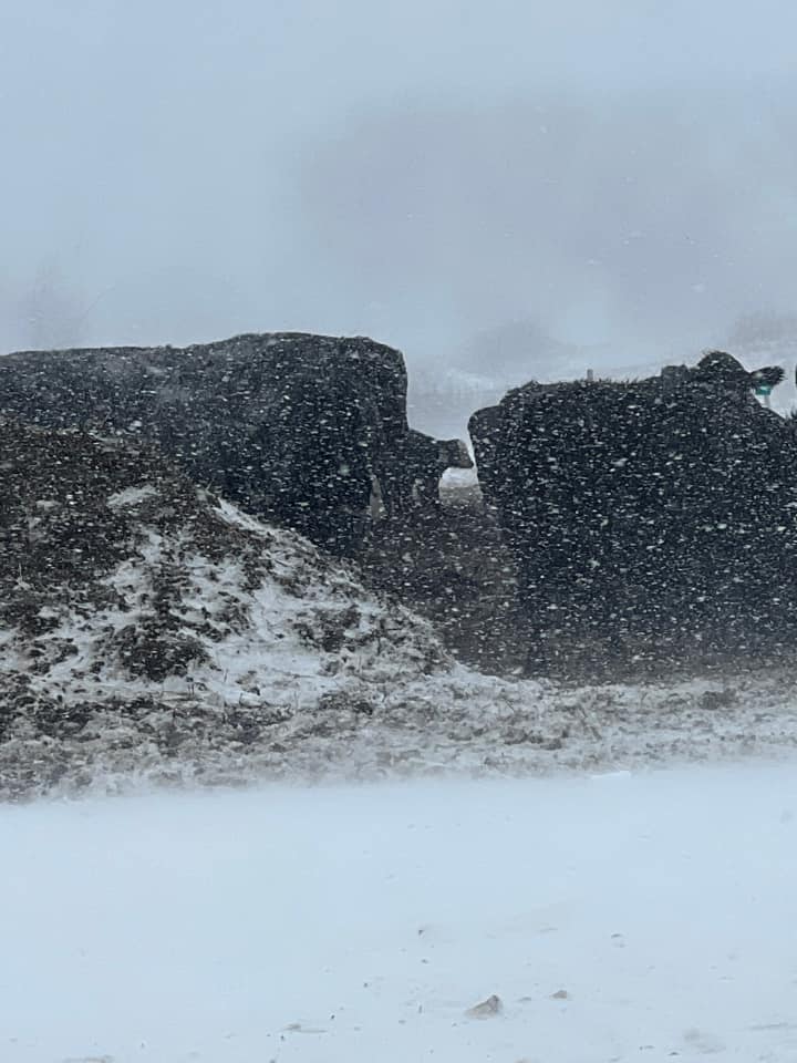
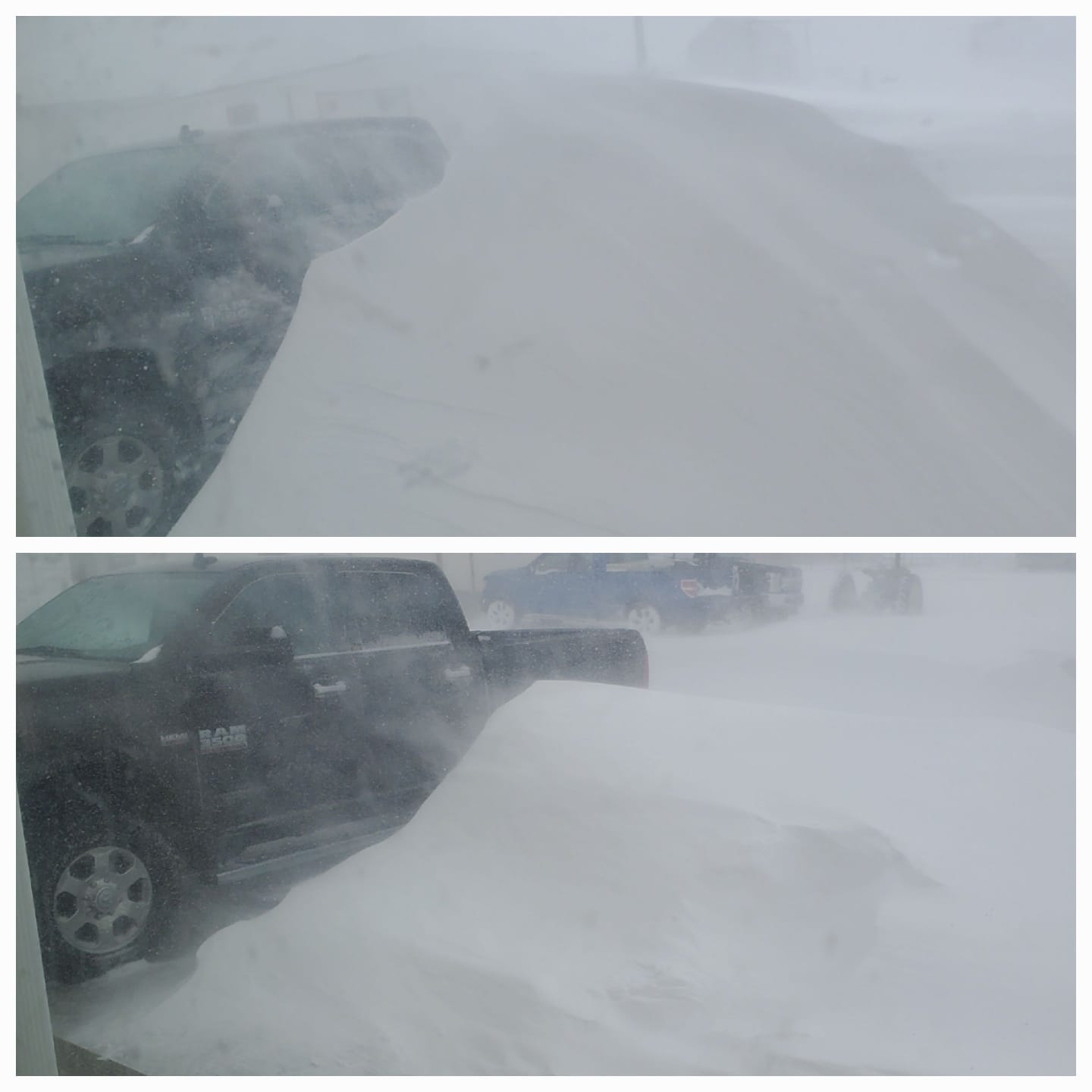
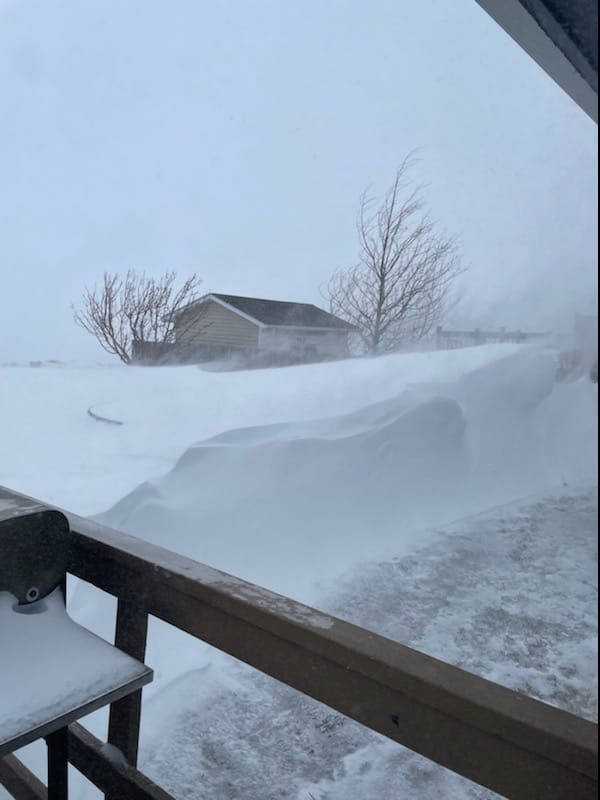
A significant low pressure system approached the northern plains on Friday, April 22. Ahead of this system, warm, moist air was advected into our region. Thunderstorms began to develop early Friday evening, some of which became severe, dropping large hail and producing strong winds. Several places received an inch or two of rain, much needed in our current drought situation. Storms moved eastward and dissipated Friday night. On Saturday morning, precipitation increased again, and rain changed over to snow. Northwesterly winds became strong, gusting to 70+ mph in some locations. The strong winds combined with the falling snow created very poor visibilities and hazardous travel conditions. Some areas received heavy snow, but even in areas that didn't receive heavy snow, the blowing snow caused blizzard conditions. |
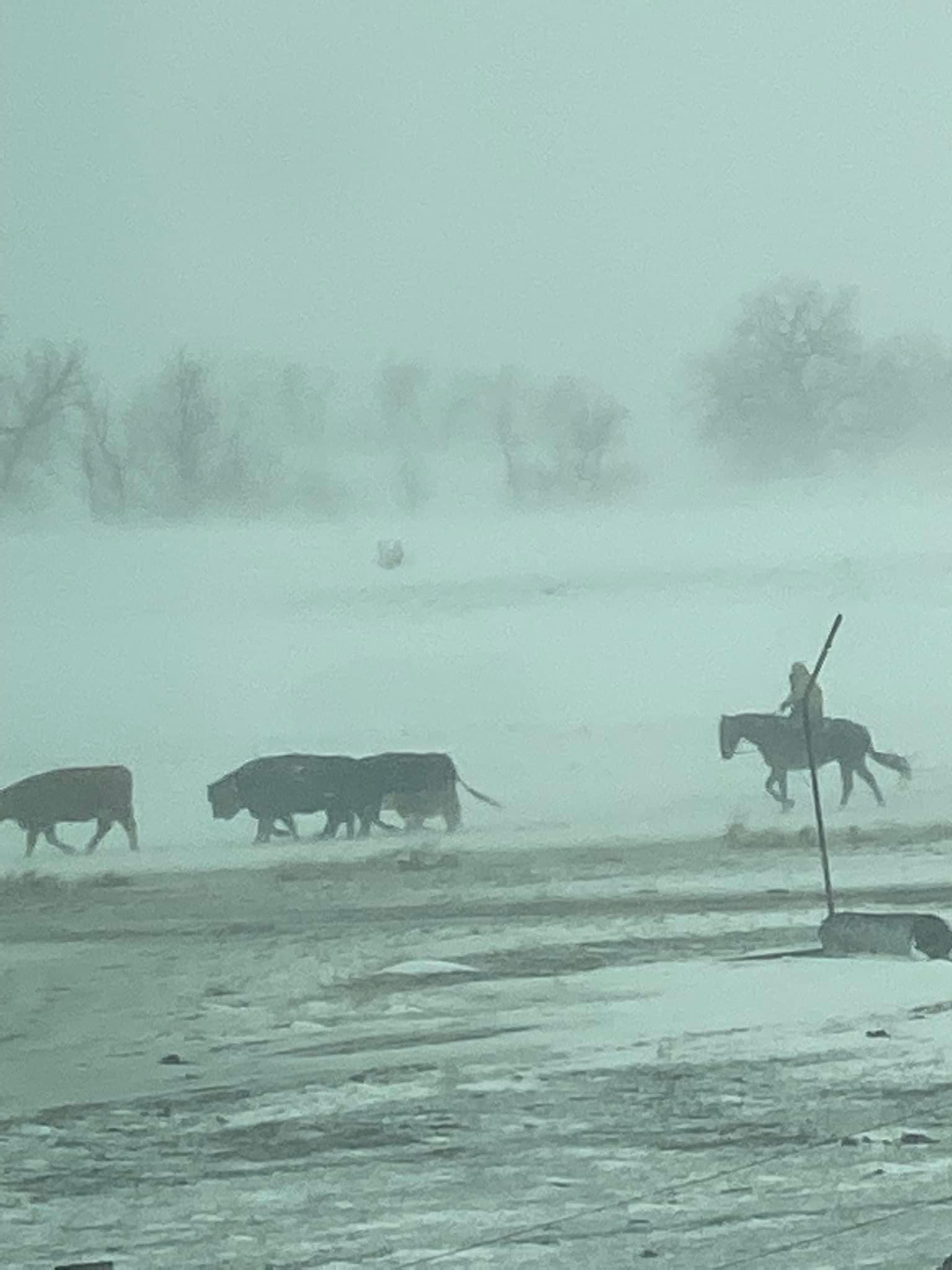
 West of Gillette (A. Cope) |
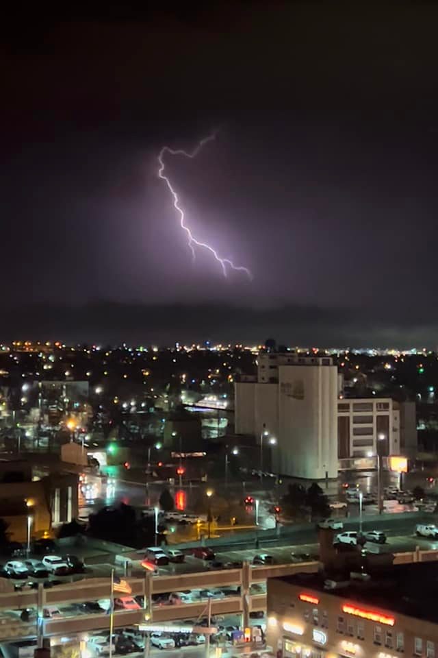
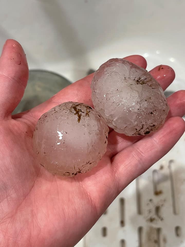
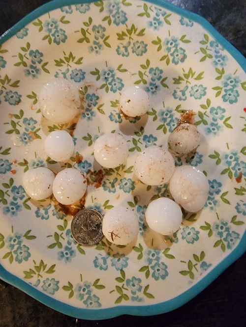
Severe Thunderstorms:
Friday, April 22
Severe thunderstorms brought strong winds, large hail, and heavy rain to the area.
 |
 |
 |
 |
| Rapid City (P. Hill) | Edgemont (J. Essink) | 7 S Custer (L. Piggott) | 2 W Hot Springs (J. Burgess) |
 |
 |
| North of Oglala (E. Ludes) | Badlands (J. Tang) |
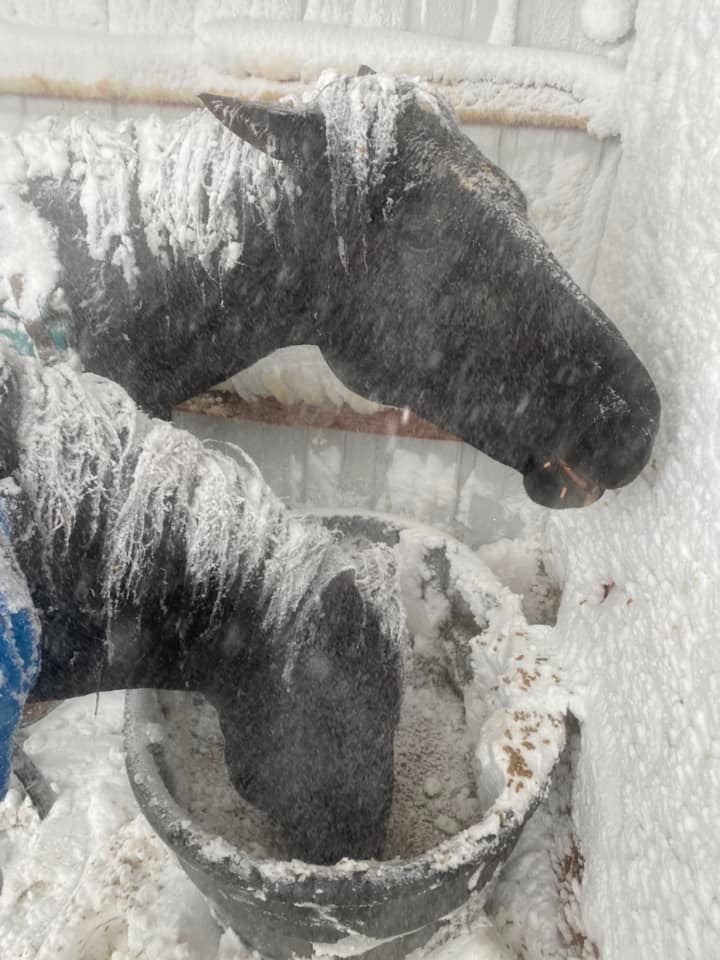
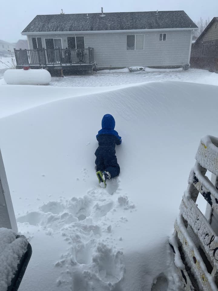
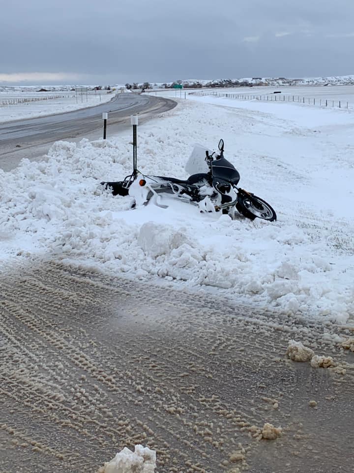
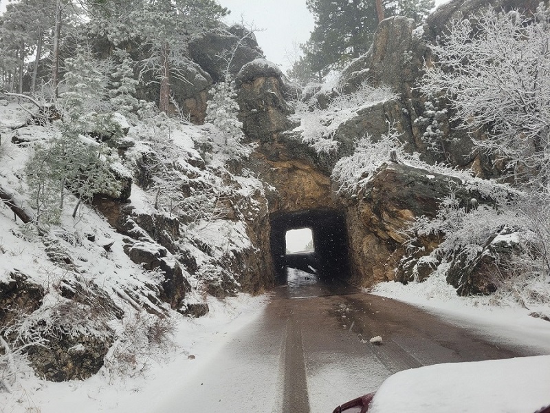
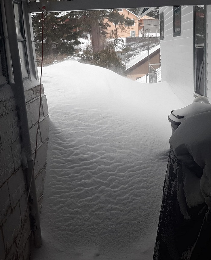
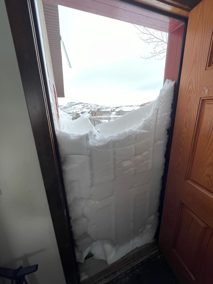
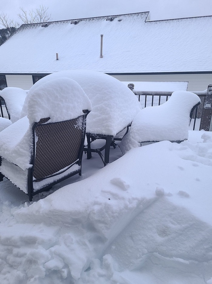
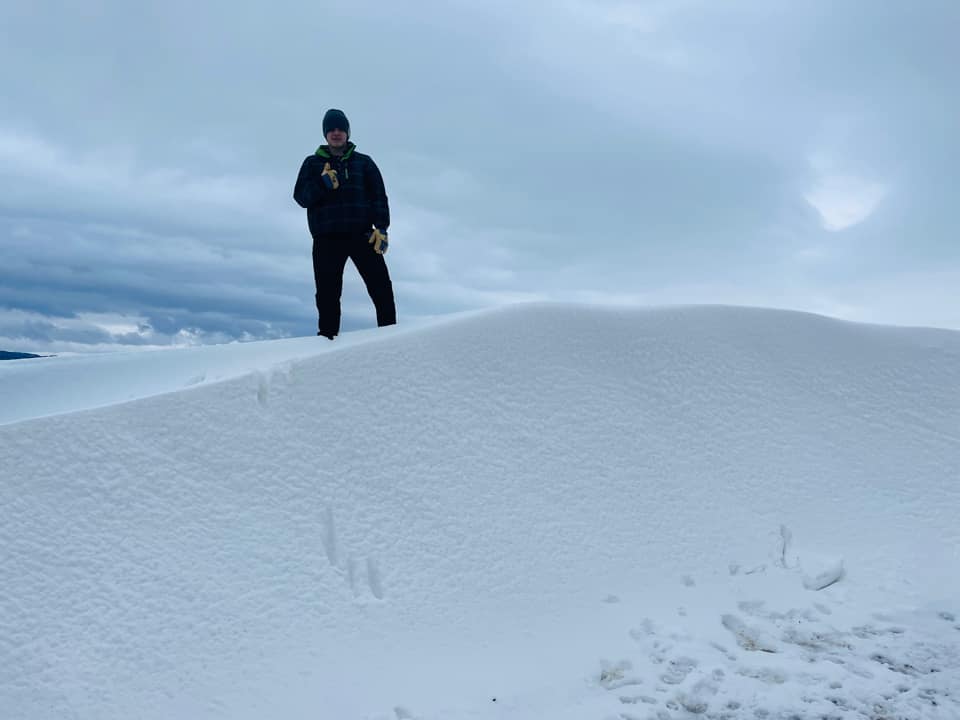
Snowstorm/Blizzard:
Saturday and Sunday, April 23-24
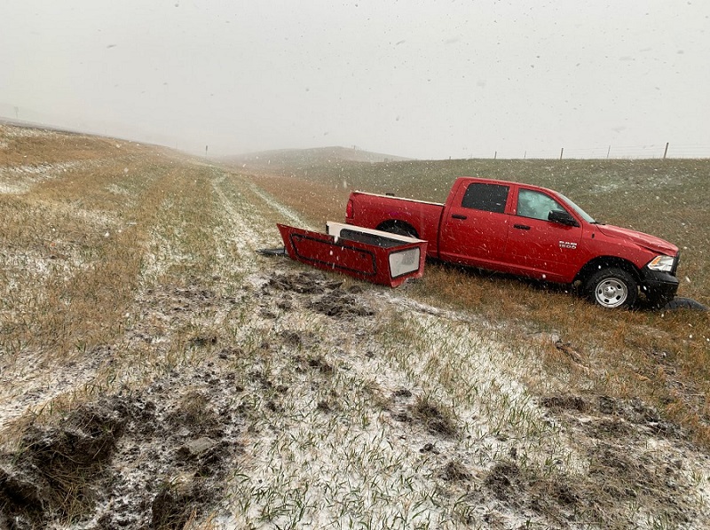
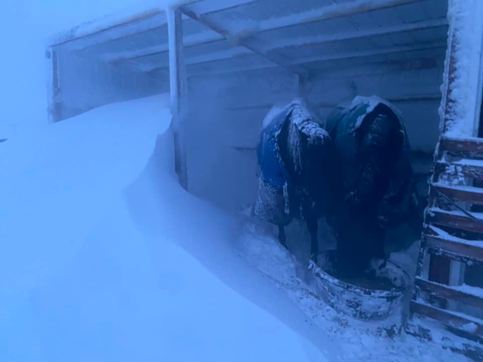
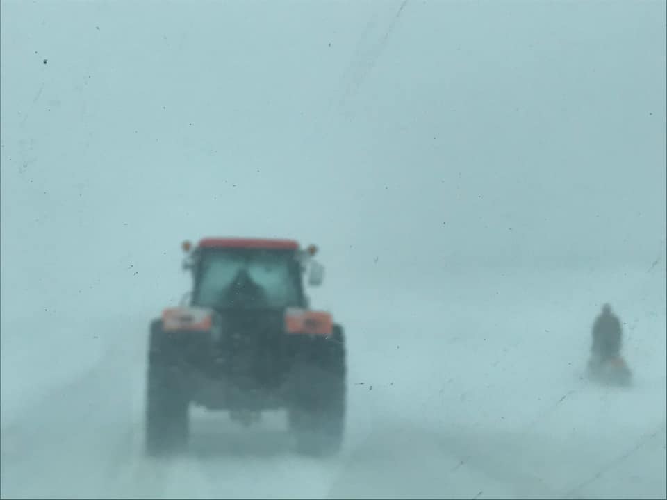
Rain changed to snow by early Saturday morning. Some places received heavy snowfall, while other places had snowmelt as it fell. Gusty winds brought low visibility and blizzard conditions to much of the area, which caused hazardous travel.
 |
 |
 |
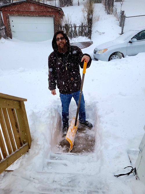 |
| Gillette (B. Miller) | Scenic (B.J. Walker) | 19 N Camp Crook (E. Klocksiem) | Lead (L.J. Osburne) |
 |
 |
 |
 |
| By New Underwood (SD Public Safety) | West of Gillette (A. Cope) | South of Buffalo (B. Wardell) | 5 E Pringle (T. Carlin) |
 |
 |
 |
 |
| Belle Fourche (K. Benson Owen) | Spearfish (@aowolf) | Gillette (A. Herman) | Gillette (R. Hoffman) |
 |
 |
 |
 |
| Lead (S. Mason) | Spearfish (E. Elder) | Spearfish (D. Krugman) | Buffalo Chip (R. Gutknecht) |
Conditions on I-90 East of Box Elder towards Wall. Thanks so Much Amanda Webster...@NWSRapidCity pic.twitter.com/YhkUnORUQE
— Brant Beckman (@BrantBeckmanwx) April 23, 2022
I-90 is shut down from mile marker 67 to 110. pic.twitter.com/ER3FPv635y
— Pennington County SO (@PennCoSheriff) April 23, 2022
I-90 is closing at 7 PM MT from Sturgis to the WY state line. Yes, it is that bad - as you can see. Stay home and stay safe. #KeepSDsafe pic.twitter.com/ueNaaEdMws
— SDPublicSafety (@SDPublicSafety) April 24, 2022
Radar
Severe thunderstorms on Friday, April 22
Storms ending, and rain changing to snow on Saturday, April 23
Storm Reports
...PRELIMINARY SNOW AND SLEET TOTALS SORTED BY MAGNITUDE...

LOCATION                      SNOWFALL    COMMENTS
                               IN/S/

Lead SD                        22.0        900 AM 4/24/2022
4 SE Dwtn Gillette WY          19.0        430 PM 4/24/2022
3 SW Whitewood SD              18.0       1148 AM 4/24/2022
8 NW Rockypoint WY             18.0        921 AM 4/24/2022
1 NNW Dwtn Spearfish SD        15.8        900 AM 4/24/2022
12 WSW Dwtn Gillette WY        15.0        600 AM 4/24/2022
6 E Deadwood SD                15.0        352 PM 4/24/2022
4 S Devils Tower WY            15.0       1223 PM 4/24/2022
8 NW Terry Peak SD             14.0        312 PM 4/23/2022
3 SSE Harding SD               14.0        800 AM 4/24/2022
Dwtn Spearfish SD              12.0        556 PM 4/23/2022
14 WNW Ladner SD               12.0        600 AM 4/24/2022
Dwtn Gillette WY               11.5        415 PM 4/23/2022
5 SW Nemo SD                   10.5       1223 PM 4/24/2022
10 SSW Reva SD                 10.0        600 AM 4/24/2022
Cheyenne Crossing SD           10.0        707 AM 4/24/2022
13 W Lodgepole SD               9.0        908 PM 4/23/2022
Newcastle WY                    9.0        736 AM 4/24/2022
Saint Onge SD                   8.0       1004 AM 4/24/2022
3 NE Whitewood SD               8.0       1024 AM 4/24/2022
2 ENE Weston WY                 8.0        600 AM 4/24/2022
1 SE Ladner SD                  8.0        250 PM 4/23/2022
1 NE Upton WY                   7.0        747 AM 4/24/2022
1 SW Shadehill SD               7.0        600 AM 4/24/2022
5 S Lodgepole SD                7.0        251 PM 4/23/2022
2 WNW Dwtn Spearfish SD         6.0        321 PM 4/23/2022
2 N Four Corners WY             6.0        453 PM 4/23/2022
Moorcroft WY                    6.0        439 PM 4/23/2022
Lemmon SD                       5.5        632 PM 4/24/2022
5 NNE Belle Fourche Resv SD     5.0        600 AM 4/24/2022
2 W Custer SD                   5.0       1009 AM 4/24/2022
7 S Custer SD                   5.0        534 PM 4/23/2022
5 E Newell SD                   5.0       1225 PM 4/24/2022
5 ESE Elm Springs SD            4.0        538 PM 4/23/2022
2 ESE Belle Fourche Resv SD     4.0        600 AM 4/24/2022
Tilford SD                      4.0        126 PM 4/24/2022
Beulah WY                       4.0        247 PM 4/23/2022
1 SSW Rockerville SD            4.0       1225 PM 4/24/2022
1 N Hot Springs SD              3.5       1227 PM 4/24/2022
8 SSW Union Center SD           3.0        338 PM 4/23/2022
7 SE Mud Butte SD               3.0        329 PM 4/23/2022
3 N Johnson Siding SD           2.0        325 PM 4/23/2022
14 SSE Dupree SD                1.8        800 AM 4/24/2022

...MAXIMUM OBSERVED WINDS SORTED BY MAGNITUDE...

LOCATION                      MAX WIND    COMMENTS
                               MPH

1 E Dwtn Rapid City SD           76        129 AM 4/24/2022
Rapid City Arpt SD               76        923 AM 4/23/2022
25 ESE Wright WY                 72        305 PM 4/23/2022
1 E Lead SD                      71       1210 AM 4/24/2022
1 N Buffalo SD                   71        601 PM 4/23/2022
5 WNW New Underwood SD           70        928 PM 4/23/2022
1 W Box Elder SD                 70        938 AM 4/23/2022
3 NW Wasta SD                    70        957 PM 4/23/2022
13 SSW Reva SD                   68        245 PM 4/23/2022
12 WSW Castle Rock SD            68        630 PM 4/23/2022
1 ENE Mud Butte SD               68        355 PM 4/23/2022
1 NE Echeta WY                   68        351 PM 4/23/2022
10 W Edgemont SD                 68       1234 PM 4/23/2022
7 E Sturgis SD                   68        655 AM 4/24/2022
3 NNW Scenic SD                  68       1110 PM 4/23/2022
Ellsworth AFB SD                 67        843 PM 4/23/2022
8 S Wall SD                      67        120 AM 4/24/2022
4 E Cactus Flat SD               66        646 PM 4/23/2022
8 N Redig SD                     66        313 AM 4/24/2022
11 W Hot Springs SD              64        352 PM 4/23/2022
1 NNE Faith SD                   64       1018 PM 4/23/2022
4 N Ludlow SD                    64        607 PM 4/23/2022
1 NE Midland SD                  63        510 PM 4/23/2022
7 WSW Hoover SD                  63       1159 PM 4/23/2022
5 NNW Dwtn Gillette WY           63        540 PM 4/23/2022
7 NNE Ralph SD                   62        349 AM 4/24/2022
10 NNW Ottumwa SD                62        509 AM 4/24/2022
Four Corners WY                  62        236 PM 4/23/2022
3 E Philip SD                    62        310 AM 4/24/2022
7 SSE Meadow SD                  61       1036 PM 4/23/2022
6 W Parmelee SD                  61        728 AM 4/24/2022
15 SSE Mission SD                61        700 AM 4/24/2022
8 SSW Union Center SD            60        338 PM 4/23/2022
9 ENE Belvidere SD               60        754 AM 4/24/2022
5 ESE Elm Springs SD             60        538 PM 4/23/2022
7 E Wanblee SD                   60        938 PM 4/23/2022
1 NE Winner SD                   59        941 AM 4/24/2022
13 NW Belle Fourche SD           59        652 PM 4/23/2022
2 NNW Pactola Res SD             59        229 AM 4/24/2022
1 NNW Piedmont SD                59        720 AM 4/24/2022
13 NNE Wright WY                 58        236 PM 4/23/2022
4 S Dwtn Rapid City SD           58       1140 PM 4/23/2022
8 WNW Fairburn SD                58       1018 AM 4/23/2022
16 WSW Dwtn Gillette WY          58        212 PM 4/23/2022
2 SSW Custer SD                  58        503 PM 4/23/2022
4 E Dwtn Spearfish SD            58        735 PM 4/23/2022
8 W Jewel Cave SD                58        416 PM 4/23/2022
3 W Lemmon SD                    58        700 PM 4/23/2022
3 SE Dwtn Spearfish SD           57        811 PM 4/23/2022
11 SW Parmelee SD                57       1132 PM 4/23/2022
3 W Union Center SD              56        249 PM 4/23/2022
5 NE Porcupine SD                56       1241 AM 4/24/2022
1 SSW Rozet WY                   56       1100 AM 4/23/2022
2 ENE Rockerville SD             55       1000 PM 4/23/2022
4 SSE Witten SD                  55        840 AM 4/24/2022
Wasta SD                         55        930 PM 4/23/2022
8 SSW Folsom SD                  54        735 AM 4/23/2022
Wright WY                        54        116 PM 4/23/2022
1 NNW Nisland SD                 54        345 PM 4/23/2022
Tilford SD                       54        319 PM 4/23/2022
7 S Shadehill SD                 53       1108 PM 4/23/2022
9 ENE Hayward SD                 53        827 AM 4/24/2022
6 WNW Newcastle WY               53        115 PM 4/23/2022
Beulah WY                        53        952 PM 4/23/2022
7 ESE Rosebud SD                 53        725 AM 4/24/2022
Wewela SD                        53        424 AM 4/24/2022
9 NNE Edgemont SD                52        757 PM 4/23/2022
3 E Dwtn Gillette WY             52        645 PM 4/23/2022
2 SW Bridger SD                  52        229 AM 4/24/2022
2 E Cottonwood SD                52        225 AM 4/24/2022
27 WNW Castle Rock SD            52        456 PM 4/23/2022
12 E Oelrichs SD                 51        405 PM 4/23/2022
1 ESE Martin SD                  51        615 AM 4/24/2022
7 NW Rockypoint WY               51        630 PM 4/23/2022
10 W Reva SD                     50        805 PM 4/23/2022
1 SW Newell SD                   50        510 PM 4/23/2022
10 ESE Pine Haven WY             50        222 PM 4/23/2022
4 NW Cheyenne Crossing SD        50       1158 PM 4/23/2022
2 W Hamill SD                    50        820 AM 4/24/2022

...MAXIMUM HAIL SIZE SORTED BY MAGNITUDE...

LOCATION                      MAX SIZE    COMMENTS
                               IN/S/

Cottonwood SD                  3.50        555 PM 4/22/2022
1 WNW Sharps Corner SD         2.50        432 PM 4/22/2022
1 SSW Custer SD                2.00        820 PM 4/22/2022
Custer SD                      1.75        825 PM 4/22/2022
7 SW Custer SD                 1.75        814 PM 4/22/2022
19 S Quinn SD                  1.75        516 PM 4/22/2022
20 S South Eagle Butte SD      1.75        730 PM 4/22/2022
12 N Kyle SD                   1.75        456 PM 4/22/2022
17 N Philip SD                 1.75        630 PM 4/22/2022
4 SE Wind Cave Visitors Cente  1.75        933 PM 4/22/2022
4 W Pringle SD                 1.50        806 PM 4/22/2022
4 NW Kirley SD                 1.50        710 PM 4/22/2022
11 N Philip SD                 1.50        627 PM 4/22/2022
12 W Philip SD                 1.25        600 PM 4/22/2022
5 SSW Custer SD                1.25        815 PM 4/22/2022
3 SE Deerfield SD              1.25        815 PM 4/22/2022
5 SSE Ideal SD                 1.25        717 PM 4/22/2022
Box Elder SD                   1.00        926 PM 4/22/2022
Sharps Corner SD               1.00        435 PM 4/22/2022
5 NNW Fairburn SD              1.00        926 PM 4/22/2022
9 SSW Jewel Cave SD            0.88        755 PM 4/22/2022
15 ENE Cherry Creek SD         0.88        733 PM 4/22/2022
2 S Lead SD                    0.88        831 PM 4/22/2022
8 W Billsburg SD               0.88        645 PM 4/22/2022
1 S Oglala SD                  0.88        335 PM 4/22/2022
5 ESE Hot Springs SD           0.75        917 PM 4/22/2022
1 NNW Piedmont SD              0.75        922 PM 4/22/2022
3 N Johnson Siding SD          0.70        911 PM 4/22/2022
15 SW Billsburg SD             0.70        620 PM 4/22/2022
15 NW Edgemont SD              0.70        737 PM 4/22/2022
6 WNW Custer SD                0.70        830 PM 4/22/2022

...PRELIMINARY RAINFALL TOTALS SORTED BY MAGNITUDE...

LOCATION                      TOTAL RAIN  COMMENTS
                               IN/S/

1 SSW Opal SD                  2.40        950 AM 4/23/2022
Buffalo SD                     2.36        630 AM 4/23/2022
2 ESE Belle Fourche Resv SD    2.00       1100 PM 4/22/2022
11 SW Buffalo SD               1.46        900 AM 4/23/2022
2 WNW Dwtn Spearfish SD        1.28        700 AM 4/23/2022
 |
Media use of NWS Web News Stories is encouraged! Please acknowledge the NWS as the source of any news information accessed from this site. |
|

