
Tropical Depression Two is expected to gradually strengthen and could bring tropical storm conditions to the Florida Panhandle beginning late Monday. Areas of flash flooding will be possible through Thursday along the eastern and central Gulf Coast. Severe thunderstorms will develop and move along a cold front crossing the Upper Midwest Monday, and through the Ohio Valley/Mid-Atlantic on Tuesday. Read More >
Overview
|
On July 8, 2021, a powerful supercell thunderstorm tracked from extreme southeastern Montana to just east of the Black Hills and into north-central Nebraska. This storm made a direct hit on the NWS Rapid City radar just north of New Underwood, South Dakota. Hail up to tennis ball size and wind gusts up to 70 mph produced damaging wind-driven hail that affected much of the storm's path. Satellite images revealed vegetation damage several days after the hailstorm. |
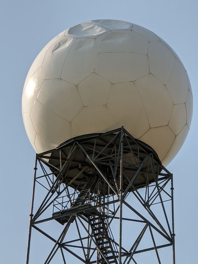 July 9, 2021 KUDX WSR-88D Radar Dome Damage |
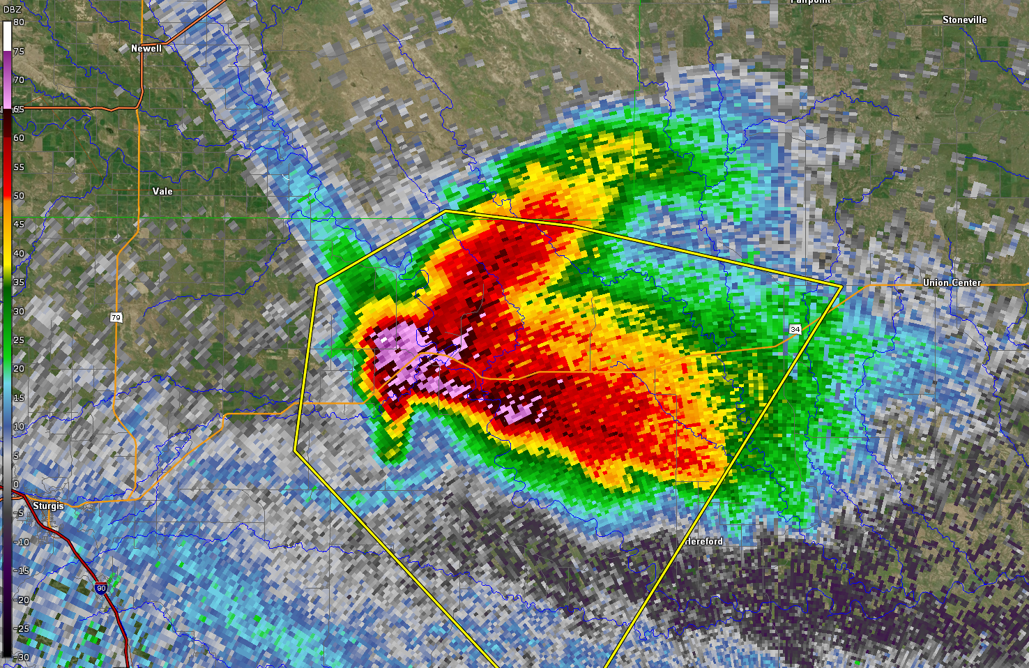
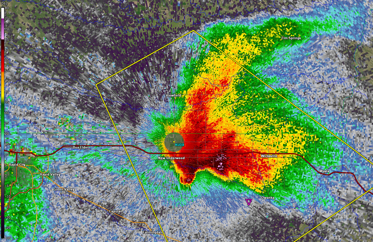
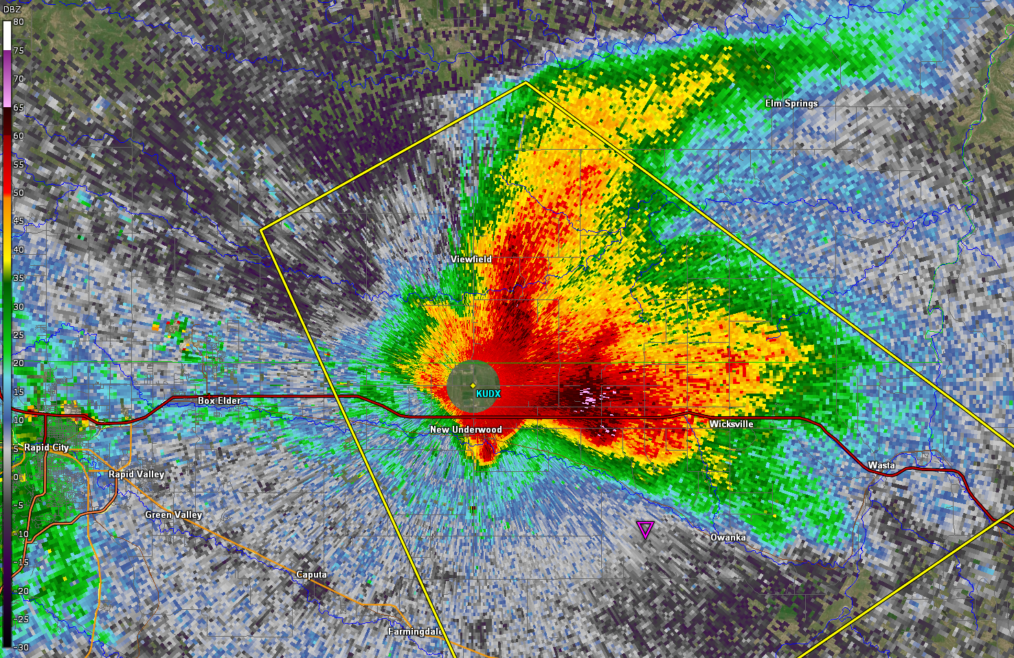 554 PM MDT July 8, 2021 0.5 Degree Base Reflectivity as the supercell hit the Radar Dome |
Photos
NWS Radar Dome near New Underwood, SD, and Hailstorm Aftermath
|
 |
 |
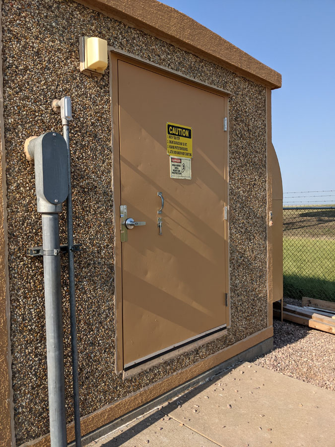 |
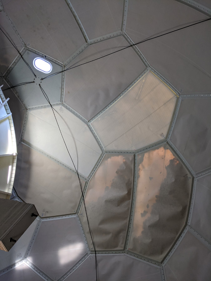
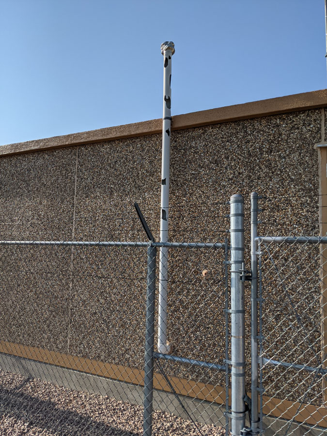
| July 9, 2021 KUDX WSR-88D Radar Dome | July 11, 2021 KUDX WSR-88D Inside The Radar Dome | July 9, 2021 Broken Exhaust Pipe at KUDX WSR-88D Radar | July 9, 2021 Wind-Driven Hail Damage to Steel Door at KUDX WSR-88D Radar |
Hey so ya'll might have heard there was this supercell in SD a couple weeks back... ;) Here's the story: it was spectacular, moving incredibly fast, and almost totaled all of our cars - but it would have been worth it. The End.
— Jen Walton (@mejenwalton) July 24, 2021
Faith, SD - 7.8.21#sdwx #StormHour pic.twitter.com/Jtx8JhE4Sa
2” hail just north of Bison, SD @NWSRapidCity pic.twitter.com/K1cj2PB4hC
— Adam Lucio (@AdamLucioWX) July 9, 2021
Quick DSLR edit from shortly after sunset tonight. Forgot I still had my polarizer on but I kinda like the long exposure here showing the rapid motion within this powerful, fast-moving supercell. A high Plains Earth-eater classic! #sdwx pic.twitter.com/suGRJnDtGd
— Jim Tang (@wxmann) July 9, 2021
THU-6:09 PM: Tennis ball hail going sideways at 60-70 MPH has damaged multiple vehicles on the highway a mile East of New Underwood on I-90. Use extreme caution as this storm races to the southeast. @NWSRapidCity pic.twitter.com/SRk5XrCBJI
— Brant Beckman (@BrantBeckmanwx) July 9, 2021
THU-4:58 PM: This rotating severe thunderstorm has dropped golf ball size hail in Newell, SD and is pressing southeast towards rural Meade County. Stay alert @NWSRapidCity pic.twitter.com/f2JH8mxiK6
— Brant Beckman (@BrantBeckmanwx) July 8, 2021
Radar, Lightning, Satellite
 |
 |
 |
|
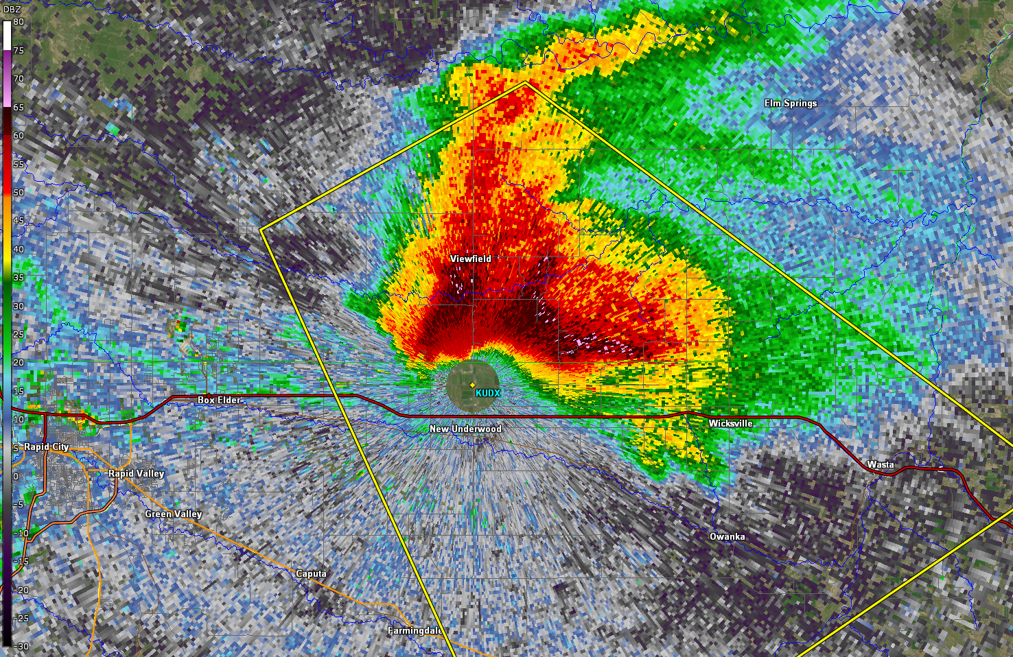
| 510 PM MDT July 8, 2021 0.5 Degree Base Reflectivity (large three body scatter spike) | 549 PM MDT July 8, 2021 0.5 Degree Base Reflectivity | 552 PM MDT July 8, 2021 0.5 Degree Base Reflectivity | 554 PM MDT July 8, 2021 0.5 Degree Base Reflectivity |
 |
 |
 |
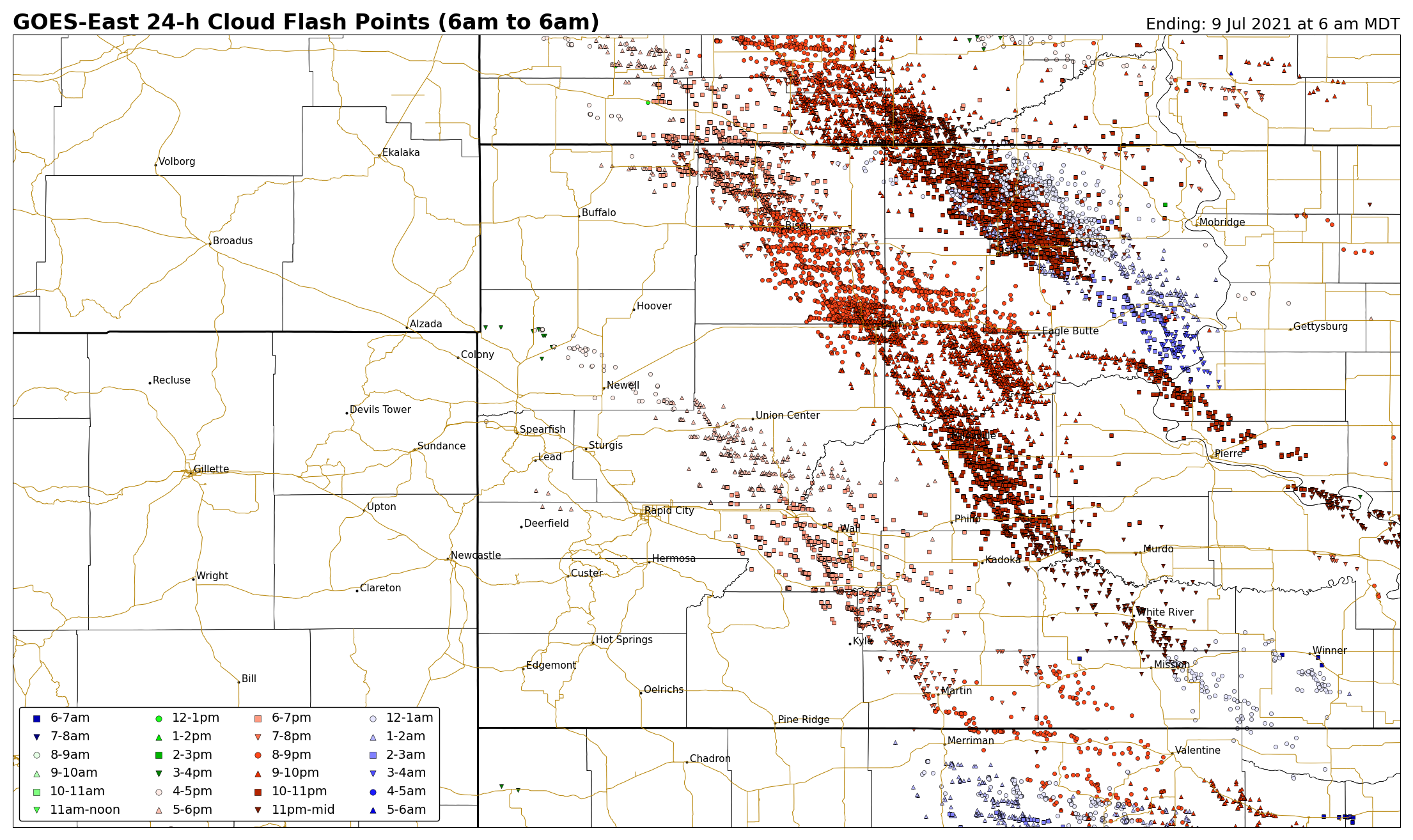 |
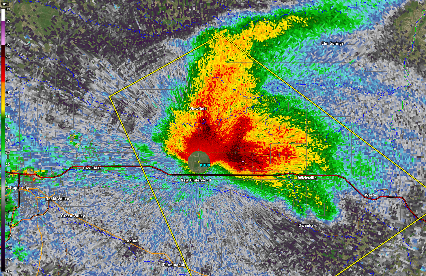
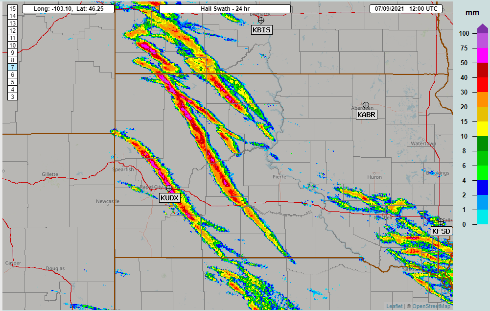
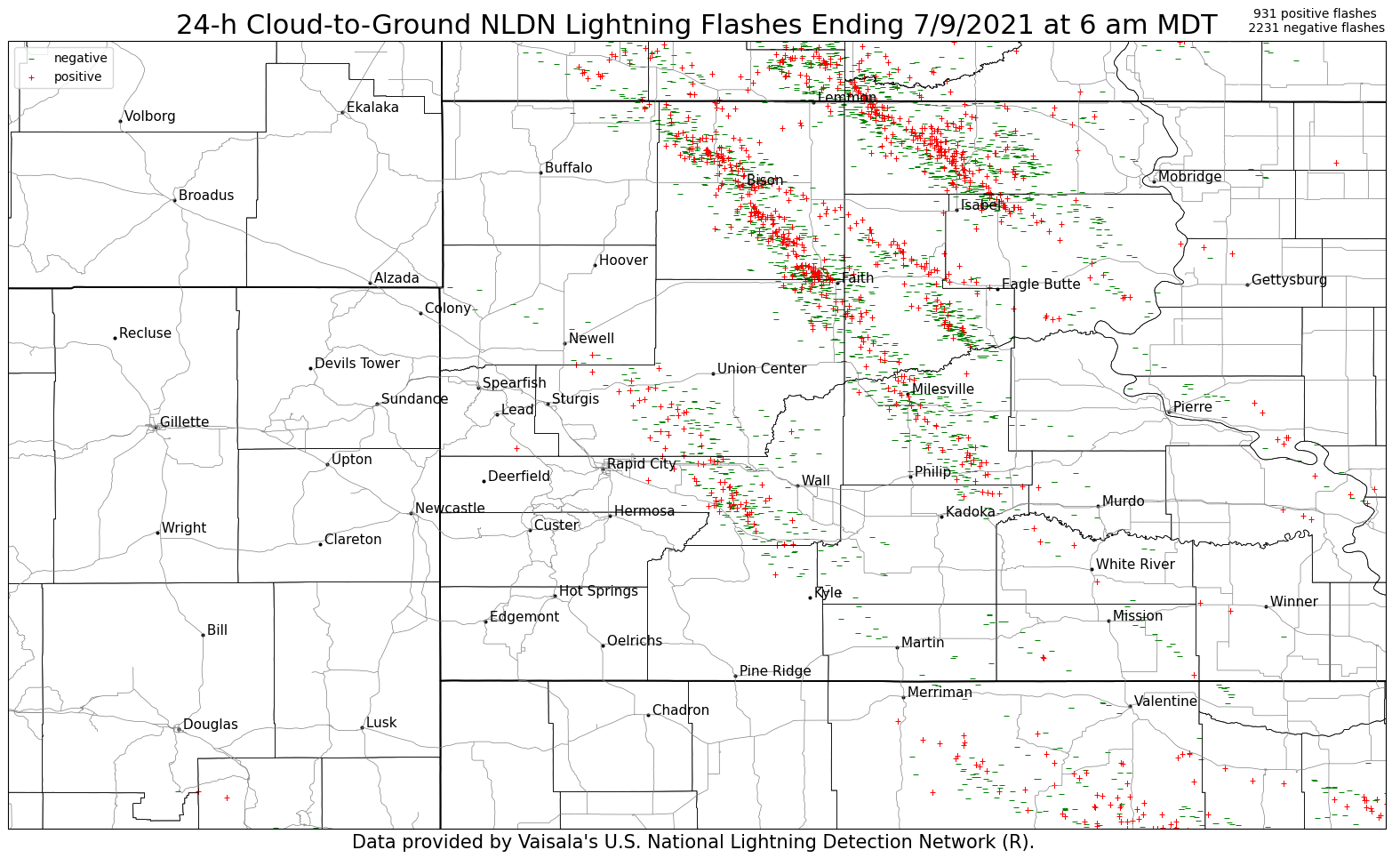
| 557 PM MDT July 8, 2021 0.5 Degree Base Reflectivity | 24-h MRMS MESH Tracks | 24-h Cloud-to-Ground NLDN Lightning Flashes Ending 7/9/2021 at 6 am MDT | GOES-East 24-h Cloud Flash Points (6am July 8 to 6am July 9, 2021) |
July 8, 2021 502 PM to 602 PM MDT 0.5 Degree Base Reflectivity Radar Loop
July 8, 2021 314 PM to 829 PM MDT 0.5km Visible Satellite Loop
Storm Reports
...MAXIMUM HAIL SIZE SORTED BY MAGNITUDE July 8, 2021...

LOCATION                      MAX SIZE    COMMENTS
                               IN/S/

5 N Scenic SD                  2.75        630 PM 7/08/2021
2 E New Underwood SD           2.50        600 PM 7/08/2021
12 S Faith SD                  2.50        907 PM 7/08/2021
1 N Bison SD                   2.00        704 PM 7/08/2021
8 WNW Usta SD                  2.00        824 PM 7/08/2021
14 SSE Hereford SD             1.75        544 PM 7/08/2021
3 W White River SD             1.50       1130 PM 7/08/2021
6 W Martin SD                  1.50        755 PM 7/08/2021
8 WSW Lodgepole SD             1.50        726 PM 7/08/2021
1 ENE Bridger SD               1.00        940 PM 7/08/2021
6 NNW Kyle SD                  1.00        713 PM 7/08/2021
Dupree SD                      1.00        840 PM 7/08/2021
8 WSW Hereford SD              1.00        528 PM 7/08/2021
7 N Belvidere SD               1.00       1050 PM 7/08/2021
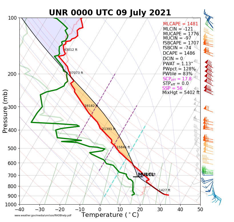
Environment
The atmosphere was unstable and had very strong vertical wind shear, which was highly supportive of hail-producing supercells, but not tornadoes.
 |
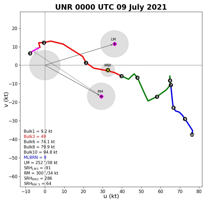 |
| 00z KUDX July 9, 2021 Sounding | 00z KUDX July 9, 2021 Hodograph |
 |
Media use of NWS Web News Stories is encouraged! Please acknowledge the NWS as the source of any news information accessed from this site. |
|

