
Tropical Depression Two is expected to gradually strengthen and could bring tropical storm conditions to the Florida Panhandle beginning late Monday. Areas of flash flooding will be possible through Thursday along the eastern and central Gulf Coast. Severe thunderstorms will develop and move along a cold front crossing the Upper Midwest Monday, and through the Ohio Valley/Mid-Atlantic on Tuesday. Read More >
Overview
|
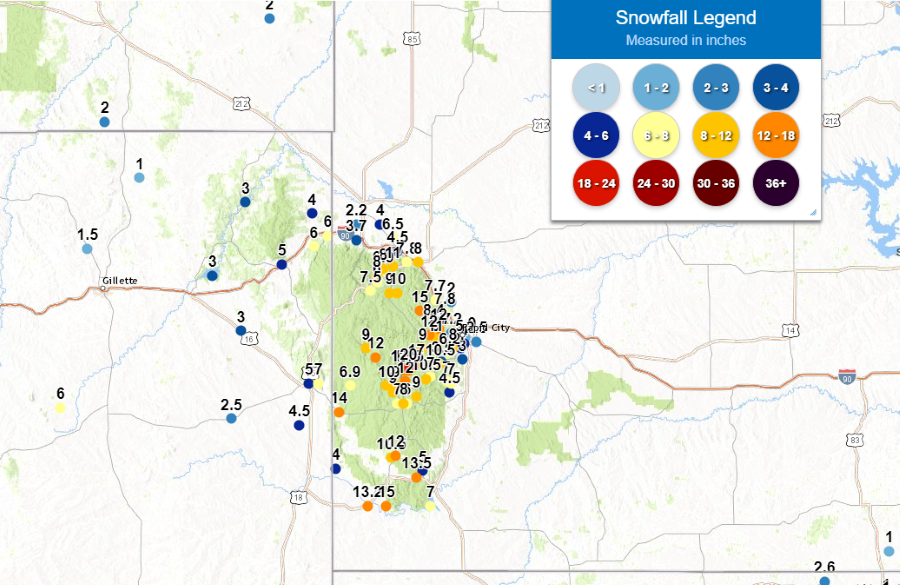
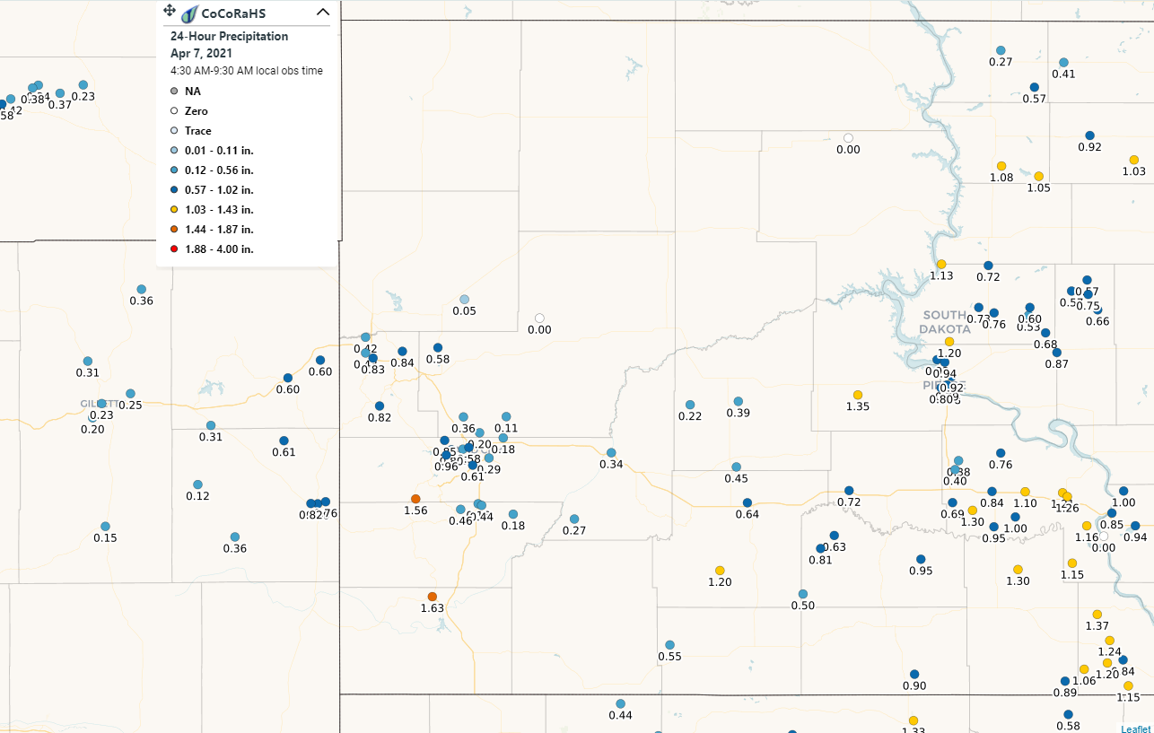
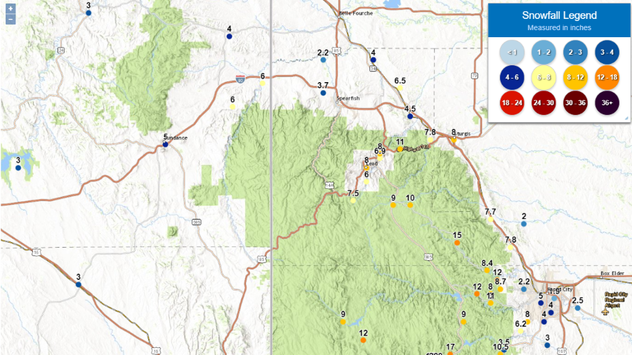
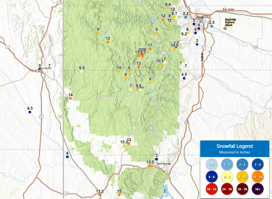
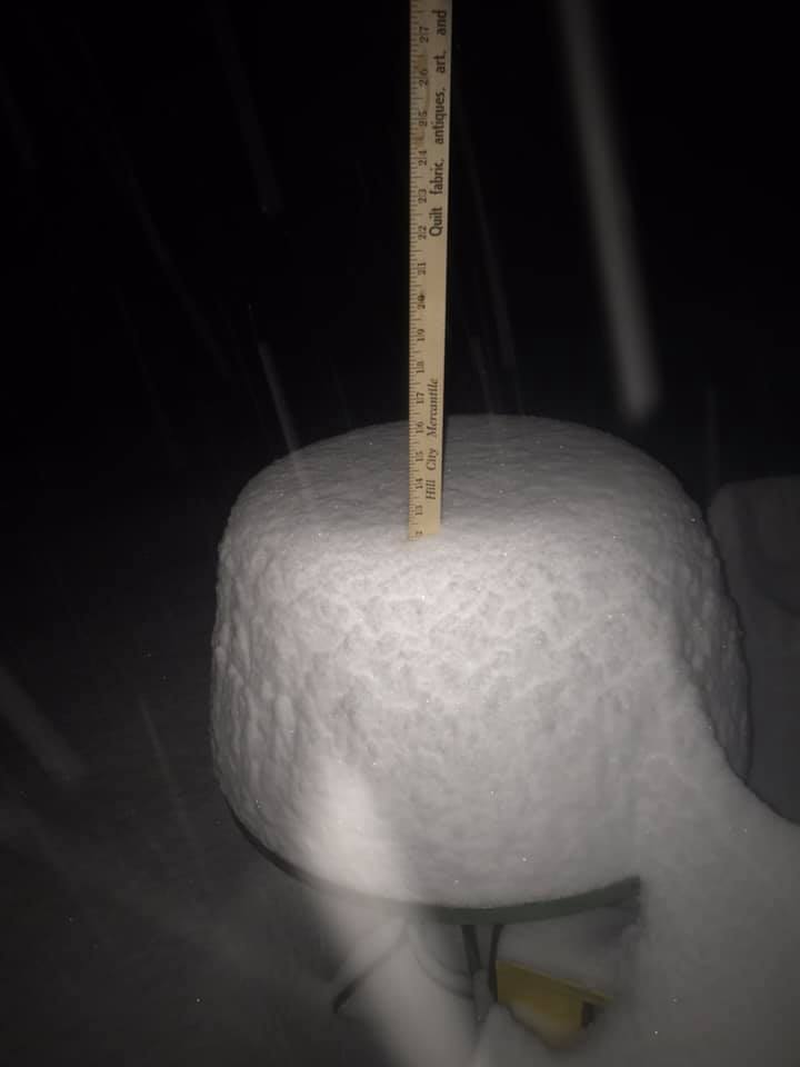
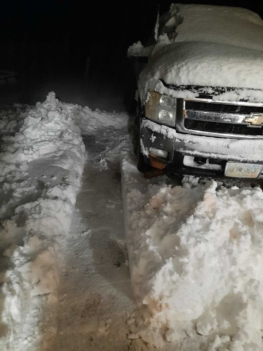
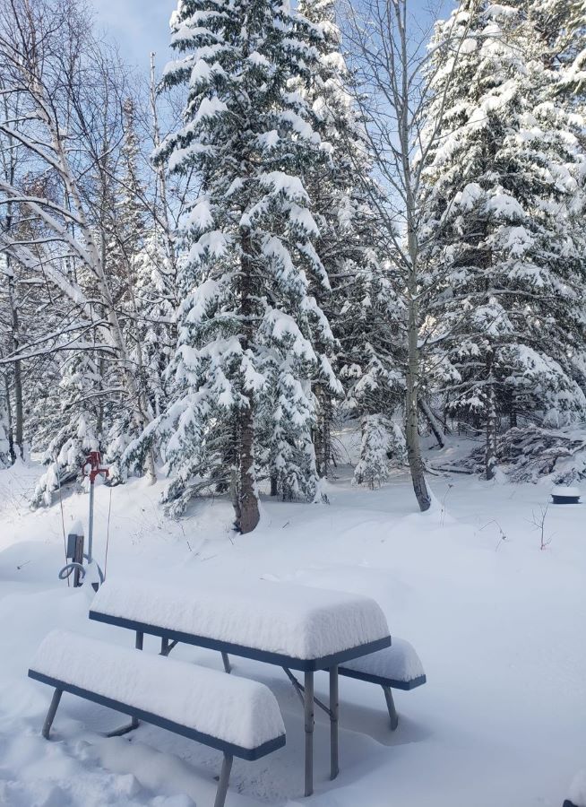
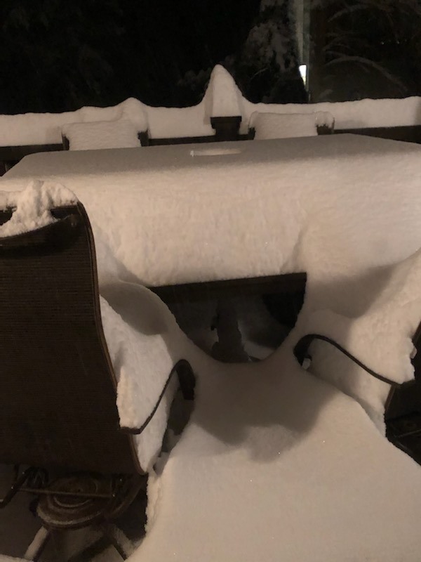
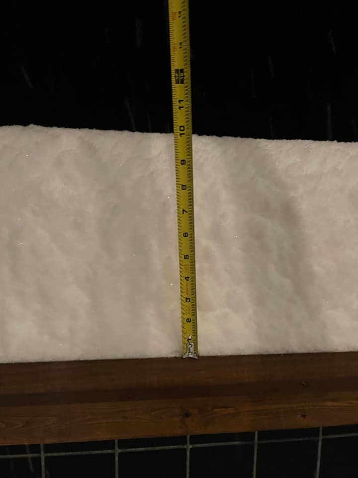
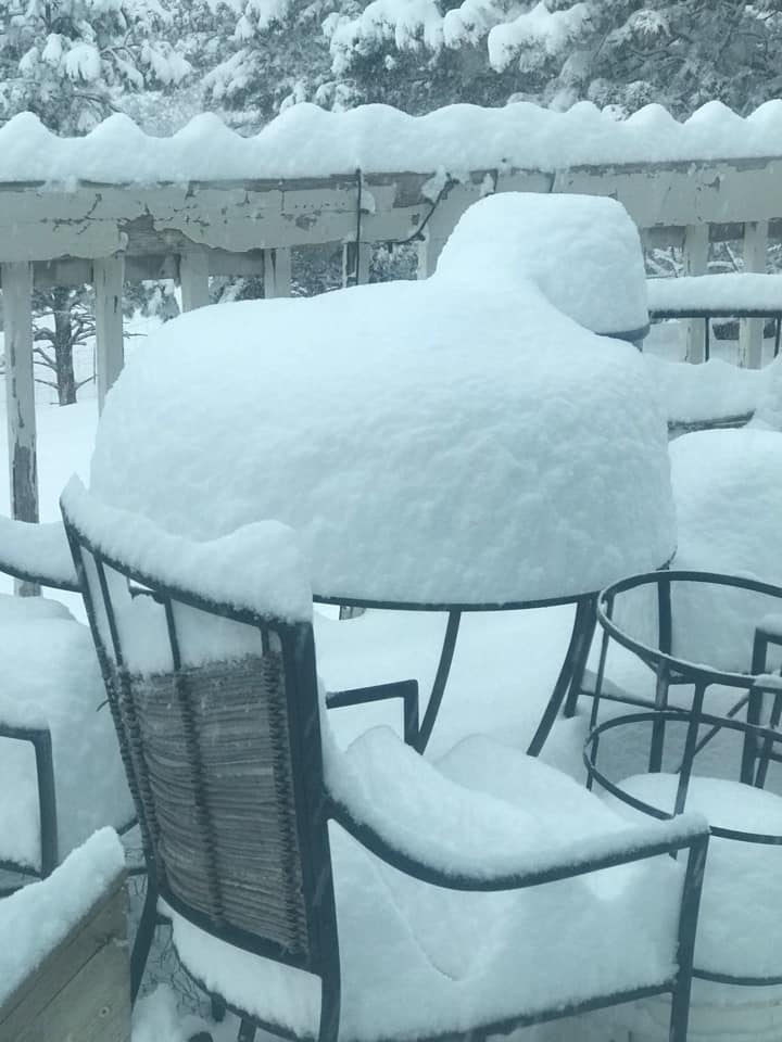
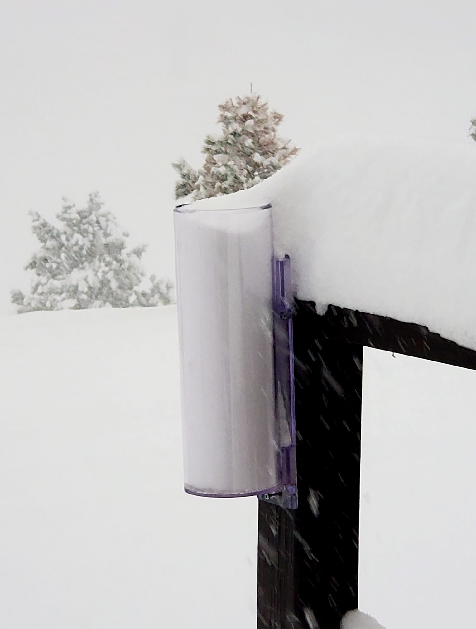
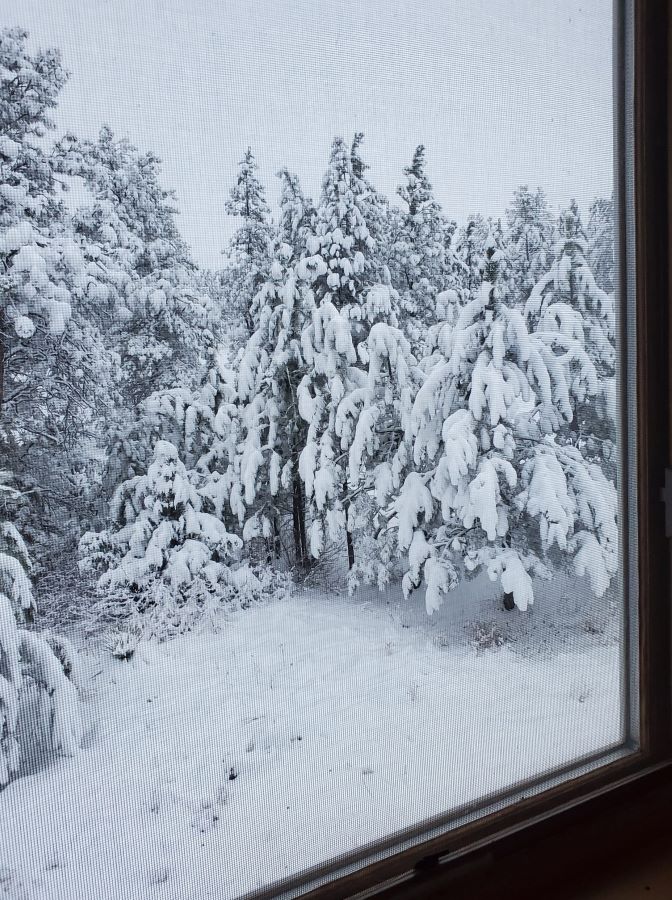
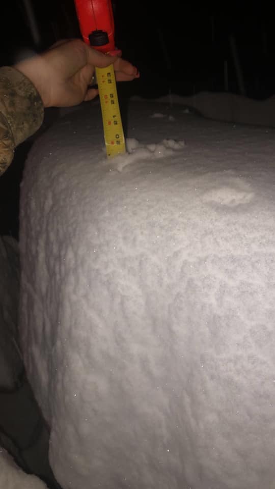
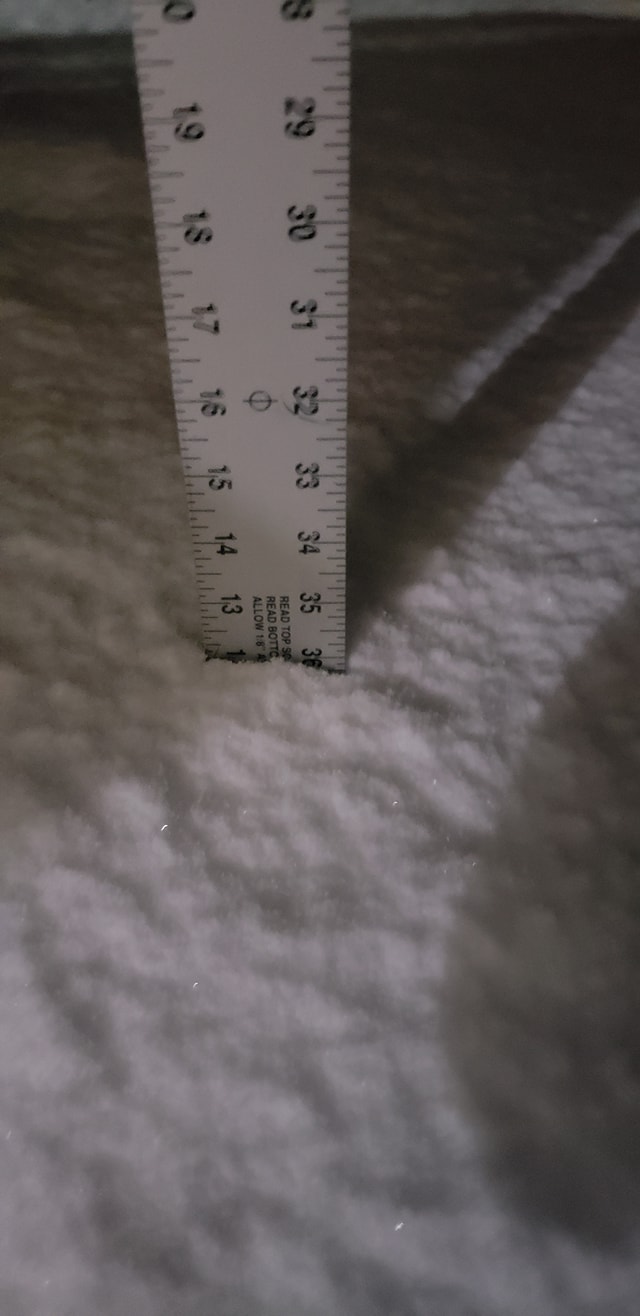
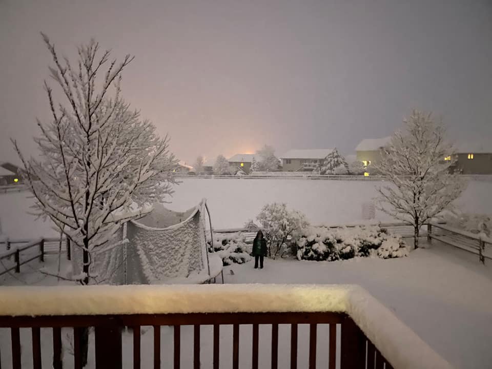
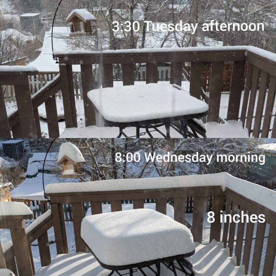
On April 5, 2021, a strong weather system moved across the Central Plains, bringing beneficial rain and snow to the Black Hills region. The rain and snow began at night, with majority of the snow falling on April 6, 2021. The highest snowfall amounts were reported around the Hill City area, where around 20 inches of snow fell. Across the plains, beneficial rainfall was observed across northeastern Wyoming, southwestern South Dakota, and south central South Dakota. Rainfall amounts varied from almost nothing across northwestern South Dakota to over an inch and a half around Wanblee. |
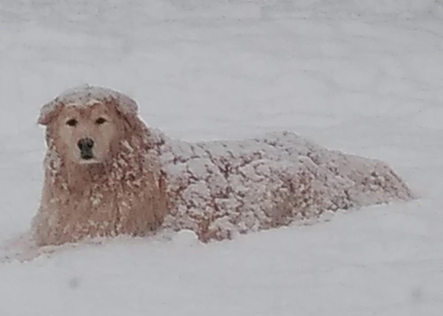 |
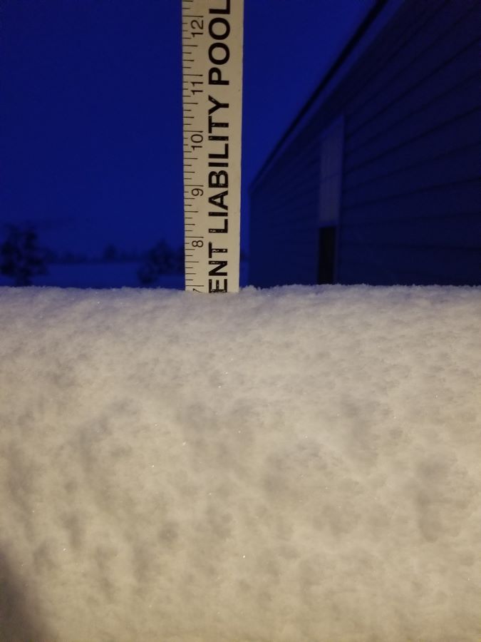
| Aladdin, WY (courtesy Christina Kirkpatrick) |
Snowfall and Rainfall Reports
| Snowfall Reports (Northeastern Wyoming and Western South Dakota) |
Rainfall Reports (Northeastern Wyoming and Western South Dakota) Map Courtesy of CoCoRaHS |
 |
 |
| Snowfall Reports (Northern Black Hills) |
Snowfall Reports (Southern Black Hills) |
 |
 |
The following are unofficial observations

********************STORM TOTAL SNOWFALL********************

LOCATION                TOTAL      TIME/DATE  COMMENTS
                     SNOWFALL       MEASURED
                     (inches)

SOUTH DAKOTA

...Custer County...
  9 W Jewel Cave         14.0   911 PM  4/06  Public
  Argyle                 12.0   744 AM  4/07  Trained Spotter
  2 WSW Argyle           10.5   816 AM  4/07  Trained Spotter
  8 NW Custer            10.0   645 PM  4/06  Public
  5 NW Custer             9.0   714 PM  4/06  Public
  5 ENE Custer            9.0   618 AM  4/07  Trained Spotter
  6 NNW Custer            9.0   639 PM  4/06  Public
  Custer                  8.0   735 PM  4/06  Public
  5 WNW Hermosa           7.0   943 PM  4/06  Trained Spotter
  2 W Custer              7.0   615 PM  4/06  Public
  1 E Custer              6.0   714 PM  4/06  Public
  6 W Hermosa             4.5   700 AM  4/07  CoCoRaHS

...Fall River County...
  6 E Edgemont           15.0   731 AM  4/07  Social Media
  2 W Hot Springs        13.5  1248 AM  4/07  Social Media
  Edgemont               13.2  1206 AM  4/07  Social Media
  1 S Angostura Resv      7.0   758 AM  4/07  Social Media
  2 N Hot Springs         5.0   716 PM  4/06  Public
  4 S Dewey               4.0   627 PM  4/06  Public

...Lawrence County...
  Nemo                   15.0  1012 PM  4/06  Public
  3 ENE Deadwood         11.0  1017 PM  4/06  Trained Spotter
  3 ESE Brownsville      10.0   751 AM  4/07  Social Media
  Brownsville             9.0   915 PM  4/06  Public
  Deadwood                8.0  1215 AM  4/07  Social Media
  Lead                    8.0   755 PM  4/06  Public
  3 W Sturgis             7.8  1005 PM  4/06  Public
  6 SSW Lead              7.5   700 AM  4/07  CoCoRaHS
  1 SSW Deadwood          6.9   811 AM  4/07  Public
  4 NNW Whitewood         6.5   530 AM  4/07  CoCoRaHS
  2 S Lead                6.0   757 PM  4/06  Public
  Whitewood               4.5   940 PM  4/06  Public
  2 NNW Saint Onge        4.0   832 AM  4/07  Trained Spotter
  3 WNW Spearfish         3.7   700 AM  4/07  CoCoRaHS
  7 NNW Spearfish         2.2   700 AM  4/07  CoCoRaHS

...Meade County...
  Sturgis                 8.0   940 PM  4/06  Public
  Summerset               7.8  1207 AM  4/07  Social Media
  1 NNW Piedmont          7.7  1142 PM  4/06  NWS Employee
  5 E Piedmont            2.0   630 AM  4/07  CoCoRaHS

...Pennington County...
  Hill City              20.0   958 PM  4/06  Public
  3 ENE Hill City        17.0  1000 PM  4/06  Public
  1 SW Hill City         13.5   642 PM  4/06  Public
  1 S Hill City          12.5   822 PM  4/06  Public
  4 SE Deerfield         12.0   715 PM  4/06  Public
  Johnson Siding         12.0  1004 PM  4/06  Public
  4 SSW Hill City        12.0   552 AM  4/07  CoCoRaHS
  3 ENE Johnson Siding   12.0   827 AM  4/07  Public
  8 W Rapid City         11.0   700 AM  4/07  CoCoRaHS
  1 SW Rockerville       10.5   800 AM  4/07  Social Media
  Mount Rushmore         10.5   106 AM  4/07  Co-Op Observer
  Deerfield               9.0   643 PM  4/06  Public
  3 N Sheridan Lake       9.0   816 AM  4/07  NWS Employee
  1 E Hill City           9.0   636 PM  4/06  Trained Spotter
  7 W Rapid City          8.7   700 AM  4/07  CoCoRaHS
  10 WNW Rapid City       8.4   700 AM  4/07  CoCoRaHS
  5 SW Dwtn Rapid City    8.0   630 AM  4/07  NWS Employee
  2 E Johnson Siding      8.0   821 PM  4/06  Public
  Keystone                7.0   758 PM  4/06  Public
  Hayward                 7.0   731 AM  4/07  Social Media
  13 E Newcastle          6.9   956 PM  4/06  Public
  4 NE Rockerville        6.2  1135 PM  4/06  NWS Employee
  1 N Hisega              6.0   744 PM  4/06  NWS Employee
  2 SW Dwtn Rapid City    5.0  1136 PM  4/06  NWS Employee
  4 S Rapid City          4.0   745 AM  4/07  CoCoRaHS
  3 S Dwtn Rapid City     4.0   630 AM  4/07  NWS Employee
  Rockerville             3.5   642 PM  4/06  Public
  8 S Dwtn Rapid City     3.0   713 PM  4/06  Public
  5 ESE Rapid City        2.5   700 AM  4/07  CoCoRaHS
  3 WNW Rapid City        2.2   700 AM  4/07  CoCoRaHS
  1 E Dwtn Rapid City     1.9  1258 AM  4/07  Official NWS Obs

...Todd County...
  5 SE Olsonville         1.0   600 AM  4/07  CoCoRaHS

WYOMING

...Campbell County...
  14 W Wright             6.0   916 AM  4/07  Trained Spotter
  14 NNW Gillette         1.5   700 AM  4/07  CoCoRaHS
  11 NE Weston            1.0   700 AM  4/07  CoCoRaHS

...Crook County...
  Beulah                  6.0   822 PM  4/06  Public
  6 SW Beulah             6.0   800 AM  4/07  CoCoRaHS
  Sundance                5.0   627 PM  4/06  Public
  Aladdin                 4.0   732 PM  4/06  Public
  Hulett                  3.0   910 PM  4/06  Public
  Pine Haven              3.0   624 PM  4/06  Public

...Weston County...
  1 W Newcastle           8.0   700 AM  4/07  CoCoRaHS
  4 E Newcastle           7.0   600 AM  4/07  CoCoRaHS
  Newcastle               5.0   655 PM  4/06  Public
  13 SSW Newcastle        4.5   700 AM  4/07  CoCoRaHS
  Upton                   3.0   637 PM  4/06  Public
  26 WSW Newcastle        2.5   700 AM  4/07  CoCoRaHS


********************STORM TOTAL RAINFALL********************

LOCATION                TOTAL      TIME/DATE  COMMENTS
                     RAINFALL       MEASURED
                     (inches)

SOUTH DAKOTA

...Bennett County...
  7 NNE Batesland        0.55   800 AM  4/07  CoCoRaHS

...Jackson County...
  11 ENE Wanblee         1.60   400 PM  4/06  Trained Spotter
  4 WSW Wanblee          1.20   700 AM  4/07  CoCoRaHS
  3 WNW Kadoka           0.64   530 AM  4/07  CoCoRaHS

...Lawrence County...
  4 NNW Whitewood        0.84   530 AM  4/07  CoCoRaHS
  6 SSW Lead             0.82   700 AM  4/07  CoCoRaHS

...Mellette County...
  13 ENE White River     0.95   600 AM  4/07  CoCoRaHS
  17 NW White River      0.63   600 AM  4/07  CoCoRaHS

...Pennington County...
  4 SSW Hill City        1.56   552 AM  4/07  CoCoRaHS
  8 W Rapid City         0.96   700 AM  4/07  CoCoRaHS
  10 WNW Rapid City      0.85   700 AM  4/07  CoCoRaHS
  7 W Rapid City         0.80   700 AM  4/07  CoCoRaHS
  4 S Rapid City         0.61   745 AM  4/07  CoCoRaHS
  3 WNW Rapid City       0.50   700 AM  4/07  CoCoRaHS

...Todd County...
  5 SE Olsonville        0.90   600 AM  4/07  CoCoRaHS

...Tripp County...
  1 NE Ideal             1.30   600 AM  4/07  CoCoRaHS
  13 SSW Dallas          0.89   600 AM  4/07  CoCoRaHS

WYOMING

...Crook County...
  6 SW Beulah            0.60   800 AM  4/07  CoCoRaHS

...Weston County...
  1 W Newcastle          0.82   700 AM  4/07  CoCoRaHS
  4 E Newcastle          0.76   600 AM  4/07  CoCoRaHS


...PRELIMINARY SNOW AND SLEET TOTALS SORTED BY MAGNITUDE...

LOCATION                      SNOWFALL    COMMENTS
                               IN/S/

Hill City SD                   20.0        958 PM 4/06/2021
3 ENE Hill City SD             17.0       1000 PM 4/06/2021
6 E Edgemont SD                15.0        731 AM 4/07/2021
Nemo SD                        15.0       1012 PM 4/06/2021
9 W Jewel Cave SD              14.0        911 PM 4/06/2021
2 W Hot Springs SD             13.5       1248 AM 4/07/2021
1 SW Hill City SD              13.5        642 PM 4/06/2021
Edgemont SD                    13.2       1206 AM 4/07/2021
1 S Hill City SD               12.5        822 PM 4/06/2021
Argyle SD                      12.0        744 AM 4/07/2021
4 SE Deerfield SD              12.0        715 PM 4/06/2021
Johnson Siding SD              12.0       1004 PM 4/06/2021
4 SSW Hill City SD             12.0        552 AM 4/07/2021
3 ENE Johnson Siding SD        12.0        827 AM 4/07/2021
3 ENE Deadwood SD              11.0       1017 PM 4/06/2021
8 W Rapid City SD              11.0        700 AM 4/07/2021
1 SW Rockerville SD            10.5        800 AM 4/07/2021
Mount Rushmore SD              10.5        106 AM 4/07/2021
2 WSW Argyle SD                10.5        816 AM 4/07/2021
3 ESE Brownsville SD           10.0        751 AM 4/07/2021
8 NW Custer SD                 10.0        645 PM 4/06/2021
Deerfield SD                    9.0        643 PM 4/06/2021
3 N Sheridan Lake SD            9.0        816 AM 4/07/2021
5 NW Custer SD                  9.0        714 PM 4/06/2021
5 ENE Custer SD                 9.0        618 AM 4/07/2021
6 NNW Custer SD                 9.0        639 PM 4/06/2021
1 E Hill City SD                9.0        636 PM 4/06/2021
Brownsville SD                  9.0        915 PM 4/06/2021
7 W Rapid City SD               8.7        700 AM 4/07/2021
10 WNW Rapid City SD            8.4        700 AM 4/07/2021
Deadwood SD                     8.0       1215 AM 4/07/2021
Sturgis SD                      8.0        940 PM 4/06/2021
Custer SD                       8.0        735 PM 4/06/2021
1 W Newcastle WY                8.0        700 AM 4/07/2021
5 SW Dwtn Rapid City SD         8.0        630 AM 4/07/2021
2 E Johnson Siding SD           8.0        821 PM 4/06/2021
Lead SD                         8.0        755 PM 4/06/2021
3 W Sturgis SD                  7.8       1005 PM 4/06/2021
Summerset SD                    7.8       1207 AM 4/07/2021
1 NNW Piedmont SD               7.7       1142 PM 4/06/2021
6 SSW Lead SD                   7.5        700 AM 4/07/2021
5 WNW Hermosa SD                7.0        943 PM 4/06/2021
2 W Custer SD                   7.0        615 PM 4/06/2021
1 S Angostura Resv SD           7.0        758 AM 4/07/2021
Keystone SD                     7.0        758 PM 4/06/2021
4 E Newcastle WY                7.0        600 AM 4/07/2021
Hayward SD                      7.0        731 AM 4/07/2021
1 SSW Deadwood SD               6.9        811 AM 4/07/2021
13 E Newcastle SD               6.9        956 PM 4/06/2021
4 NNW Whitewood SD              6.5        530 AM 4/07/2021
4 NE Rockerville SD             6.2       1135 PM 4/06/2021
1 E Custer SD                   6.0        714 PM 4/06/2021
2 S Lead SD                     6.0        757 PM 4/06/2021
1 N Hisega SD                   6.0        744 PM 4/06/2021
14 W Wright WY                  6.0        916 AM 4/07/2021
Beulah WY                       6.0        822 PM 4/06/2021
6 SW Beulah WY                  6.0        800 AM 4/07/2021
2 SW Dwtn Rapid City SD         5.0       1136 PM 4/06/2021
Sundance WY                     5.0        627 PM 4/06/2021
2 N Hot Springs SD              5.0        716 PM 4/06/2021
Newcastle WY                    5.0        655 PM 4/06/2021
6 W Hermosa SD                  4.5        700 AM 4/07/2021
Whitewood SD                    4.5        940 PM 4/06/2021
13 SSW Newcastle WY             4.5        700 AM 4/07/2021
Aladdin WY                      4.0        732 PM 4/06/2021
2 NNW Saint Onge SD             4.0        832 AM 4/07/2021
4 S Rapid City SD               4.0        745 AM 4/07/2021
4 S Dewey SD                    4.0        627 PM 4/06/2021
3 S Dwtn Rapid City SD          4.0        630 AM 4/07/2021
3 WNW Spearfish SD              3.7        700 AM 4/07/2021
Rockerville SD                  3.5        642 PM 4/06/2021
8 S Dwtn Rapid City SD          3.0        713 PM 4/06/2021
Hulett WY                       3.0        910 PM 4/06/2021
Upton WY                        3.0        637 PM 4/06/2021
Pine Haven WY                   3.0        624 PM 4/06/2021
5 ESE Rapid City SD             2.5        700 AM 4/07/2021
26 WSW Newcastle WY             2.5        700 AM 4/07/2021
3 WNW Rapid City SD             2.2        700 AM 4/07/2021
7 NNW Spearfish SD              2.2        700 AM 4/07/2021
5 E Piedmont SD                 2.0        630 AM 4/07/2021
1 E Dwtn Rapid City SD          1.9       1258 AM 4/07/2021
14 NNW Gillette WY              1.5        700 AM 4/07/2021
5 SE Olsonville SD              1.0        600 AM 4/07/2021
11 NE Weston WY                 1.0        700 AM 4/07/2021


...PRELIMINARY RAINFALL TOTALS SORTED BY MAGNITUDE...

LOCATION                      TOTAL RAIN  COMMENTS
                               IN/S/

11 ENE Wanblee SD              1.60        400 PM 4/06/2021
4 SSW Hill City SD             1.56        552 AM 4/07/2021
1 NE Ideal SD                  1.30        600 AM 4/07/2021
4 WSW Wanblee SD               1.20        700 AM 4/07/2021
8 W Rapid City SD              0.96        700 AM 4/07/2021
13 ENE White River SD          0.95        600 AM 4/07/2021
5 SE Olsonville SD             0.90        600 AM 4/07/2021
13 SSW Dallas SD               0.89        600 AM 4/07/2021
10 WNW Rapid City SD           0.85        700 AM 4/07/2021
4 NNW Whitewood SD             0.84        530 AM 4/07/2021
1 W Newcastle WY               0.82        700 AM 4/07/2021
6 SSW Lead SD                  0.82        700 AM 4/07/2021
7 W Rapid City SD              0.80        700 AM 4/07/2021
4 E Newcastle WY               0.76        600 AM 4/07/2021
3 WNW Kadoka SD                0.64        530 AM 4/07/2021
17 NW White River SD           0.63        600 AM 4/07/2021
4 S Rapid City SD              0.61        745 AM 4/07/2021
6 SW Beulah WY                 0.60        800 AM 4/07/2021
7 NNE Batesland SD             0.55        800 AM 4/07/2021
3 WNW Rapid City SD            0.50        700 AM 4/07/2021
|
|
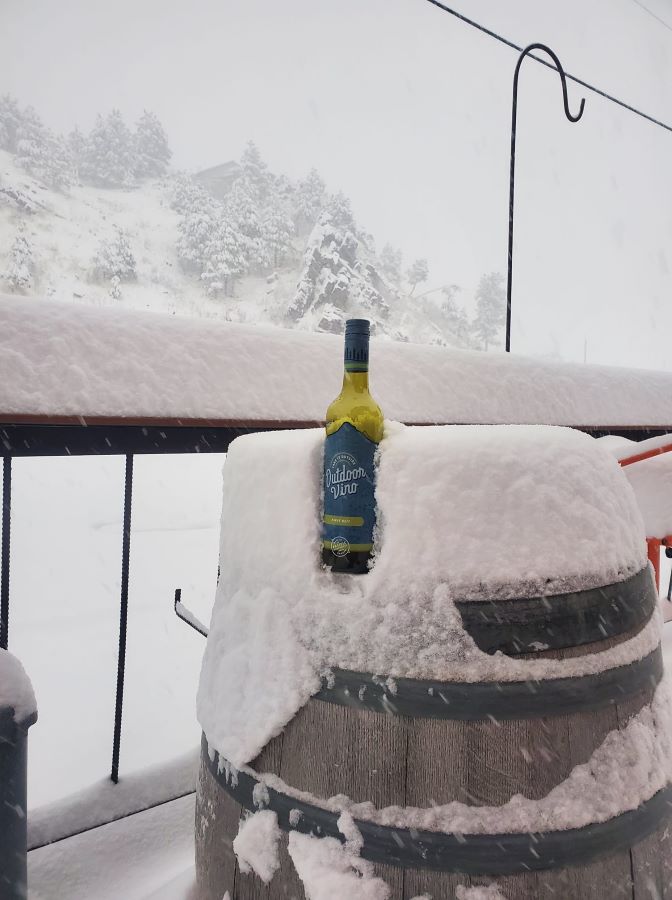
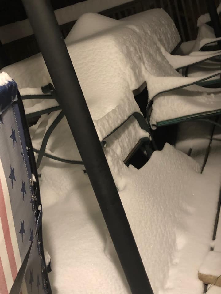
Photos & Video
 |
 |
||
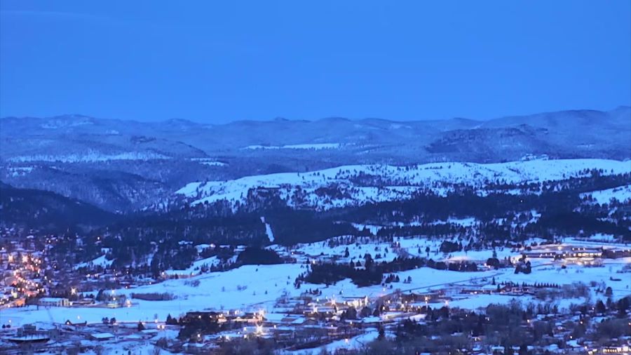
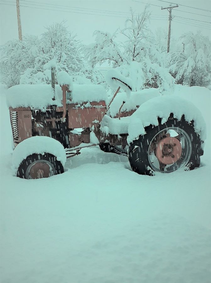
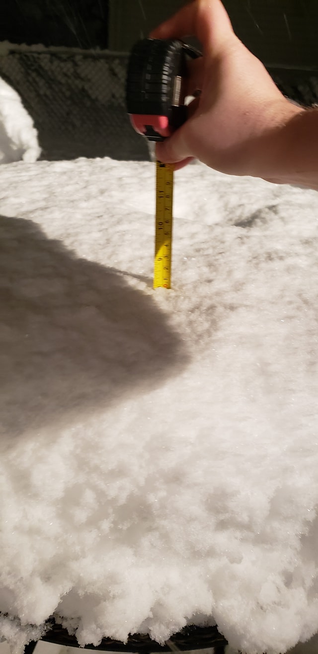
| Black Hills Snowfall (courtesy Kyle Carstens) |
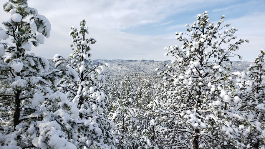
Snow on the Schroeder Fire (courtesy Brant Beckman) |
 |
 |
 |
 |
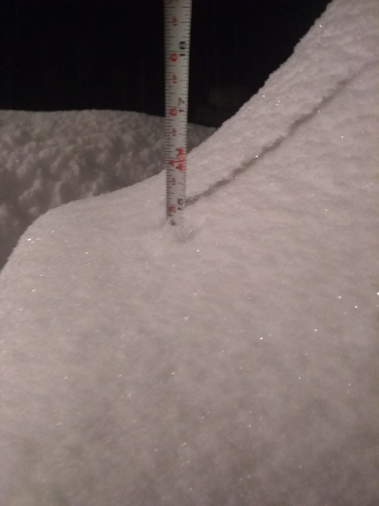
| 10 West of Black Hawk (courtesy Monte Norman) |
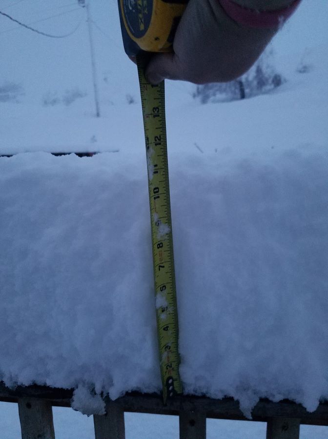
1 South of Hill City (courtesy Karen Street) |
2 North of Hot Springs (courtesy David Finn) |
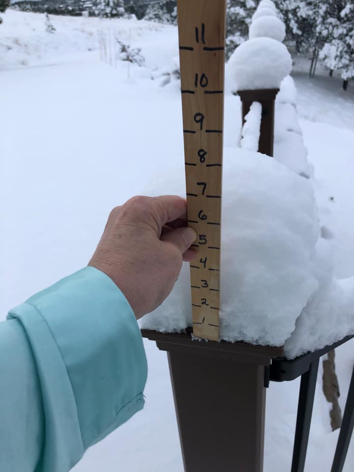
2 South of Lead (courtesy Ronnie Hess) |
 |
 |
 |
 |
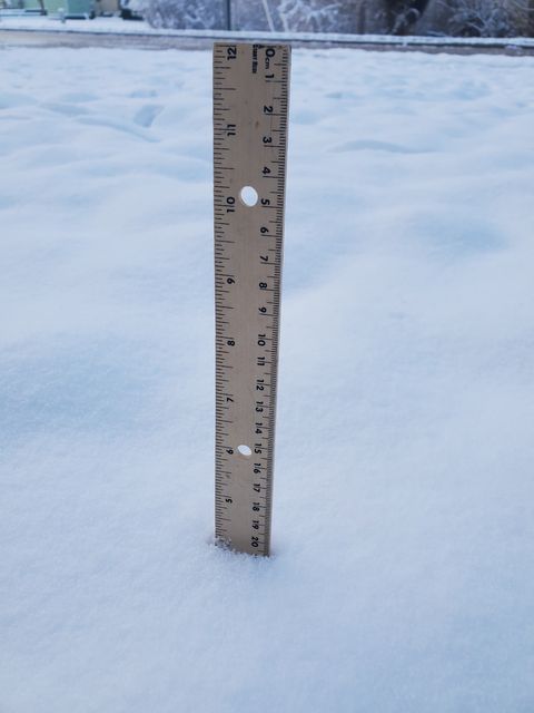
| Three Forks (courtesy Chad Lewis) |
Three Forks (courtesy Tara Pavlik) |
3 South of Argyle (courtesy Angie Sassman) |
4 Southeast of Deerfield (courtesy Rob Ristesund) |
 |
 |
 |
 |
| 9 West of Deerfield (courtesy Rebecca Stepp-Langen) |
Custer Highlands (courtesy Amber Corporon) |
Edgemont (courtesy Mitchell Marsh) |
Edgemont (courtesy Nathan Trotter) |
 |
 |
 |
 |
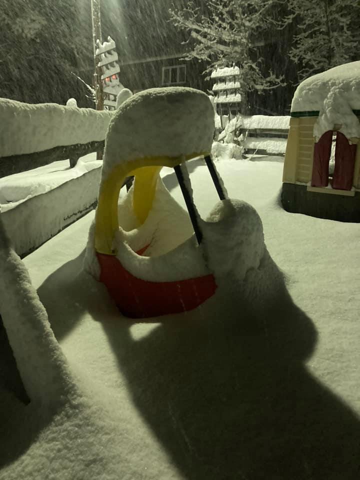
| Hayward (courtesy Julia Rombough) |
Hill City (courtesy Alisha Coy) |
Hill City (courtesy Mary Hix-Randallr) |
Hill City (courtesy Shelby Walton) |
 |
 |
 |
 |
| Hot Springs (courtesy Joni Burgess) |
Sturgis (courtesy Kristine Swackhammer) |
Nemo (courtesy Julie and Norman Eggers) |
Spearfish (courtesy Rebecca Kalbach) |
 |
 |
||
| Whitewood (courtesy Katie Solvie) |
Lead (courtesy Jackie Rinehart) |
||
Satellite and Radar
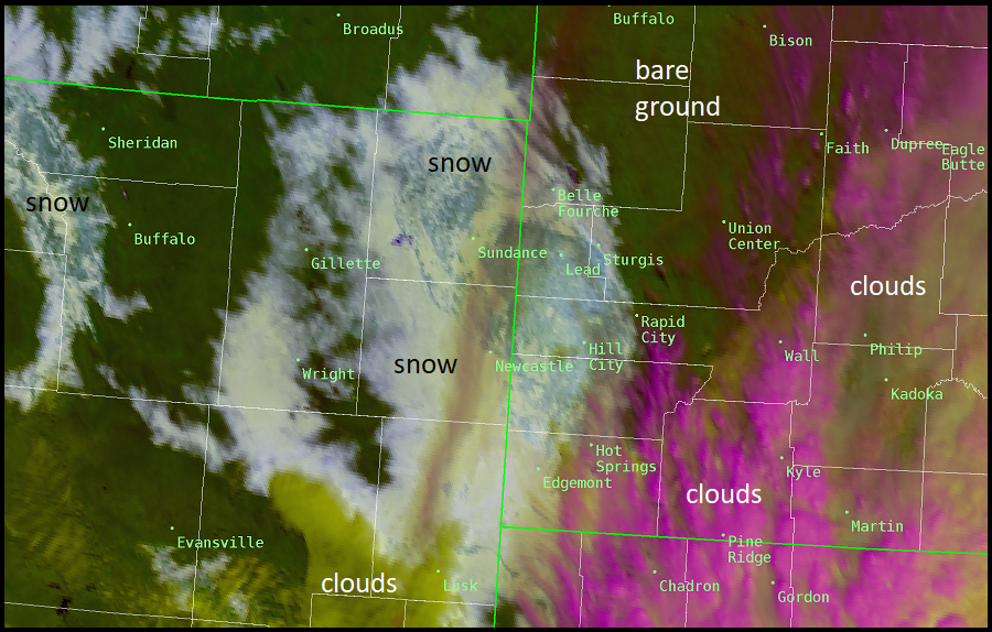 |
| Satellite Image from April 7, 2021 showing the areas of snow, clouds and bare ground. |
 |
Media use of NWS Web News Stories is encouraged! Please acknowledge the NWS as the source of any news information accessed from this site. |
|

