Heat expands across the Desert Southwest, Plains, Mississippi Valley and Midwest into Monday. Fire weather concerns continue for portions of the Intermountain West. Active monsoonal moisture fuels thunderstorms over the Southwest with possible flash flooding. Tropical cyclone Fausto in the Pacific, should weaken as it approaches Hawaii; Dangerous surf, swells and rip currents are expected. Read More >
Overview
|
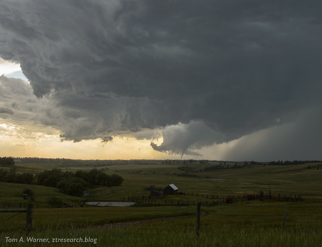
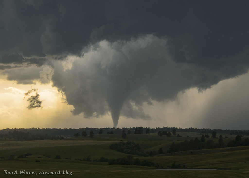
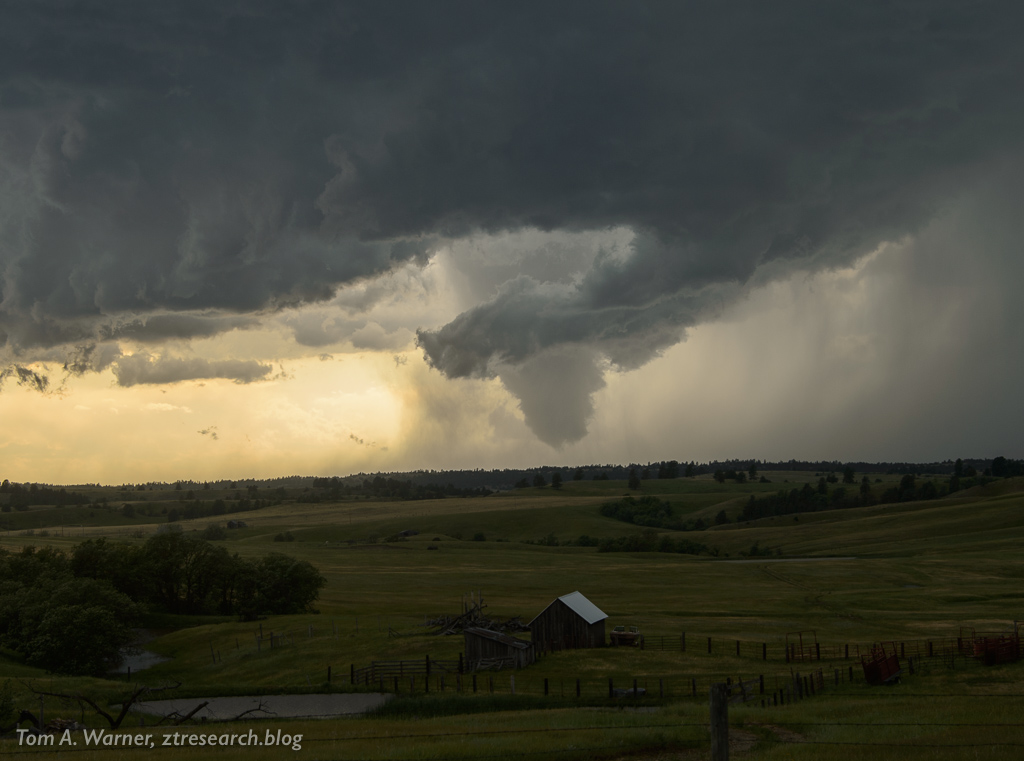
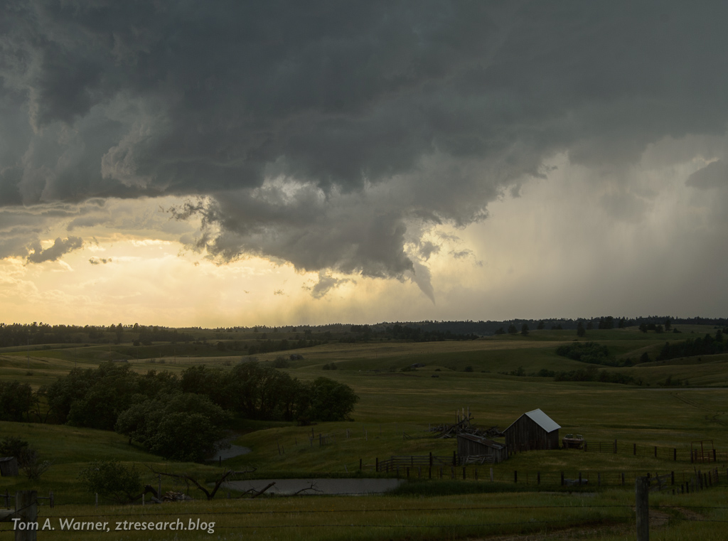
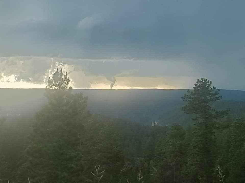
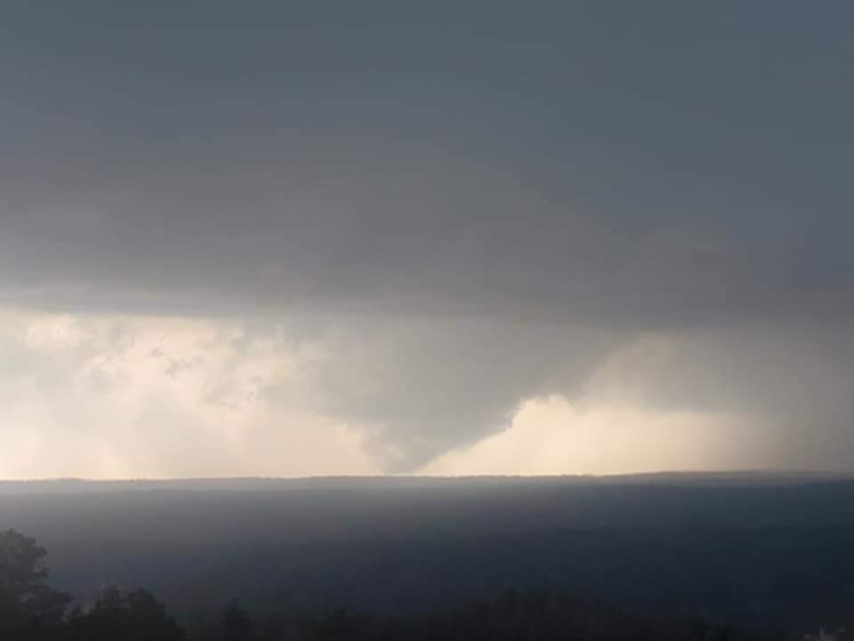
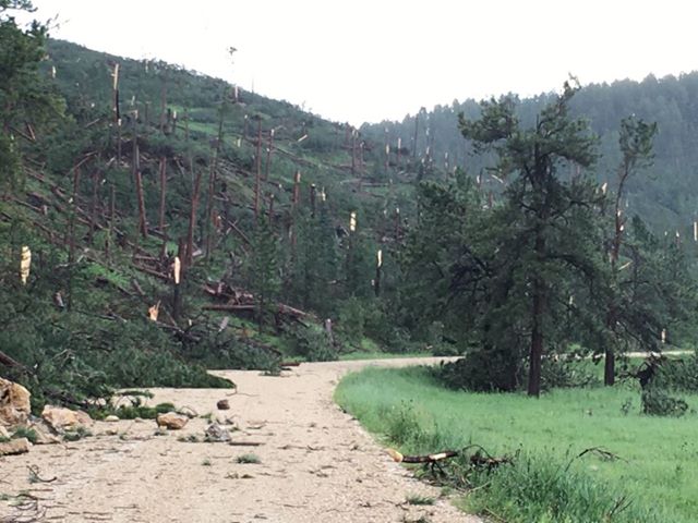
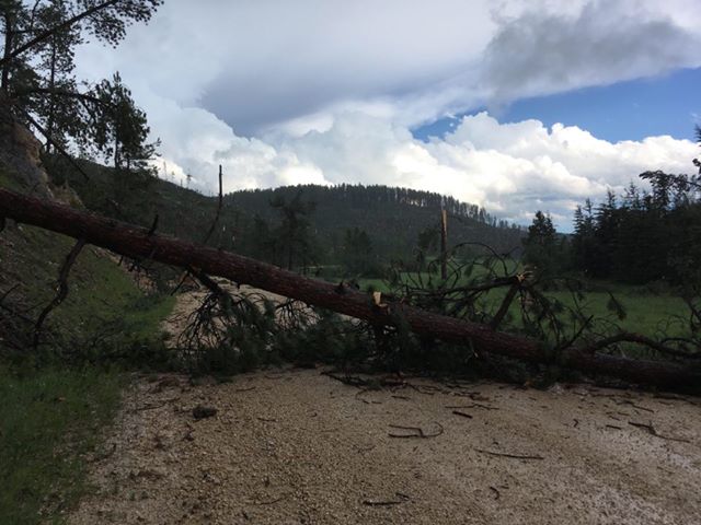
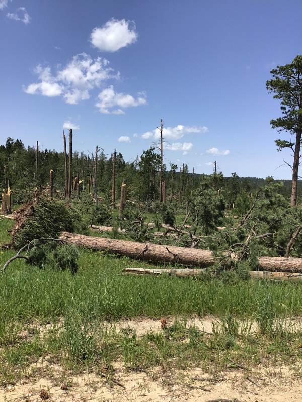
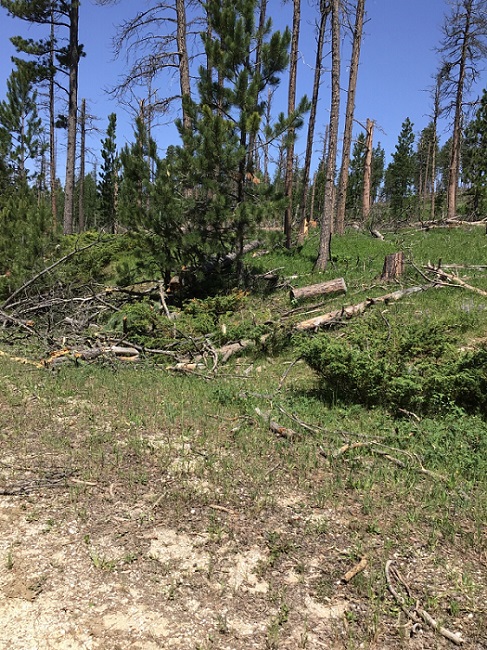
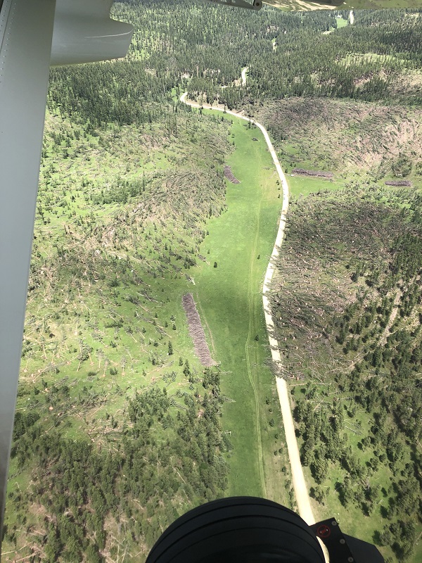
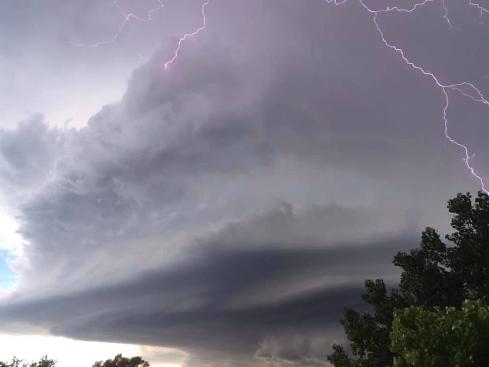
On the afternoon of July 6, 2020, powerful thunderstorms developed across northeastern Wyoming and southeastern MT. They merged and strengthened as they moved over Sundance and into the Black Hills area. |
|
Tornadoes
|
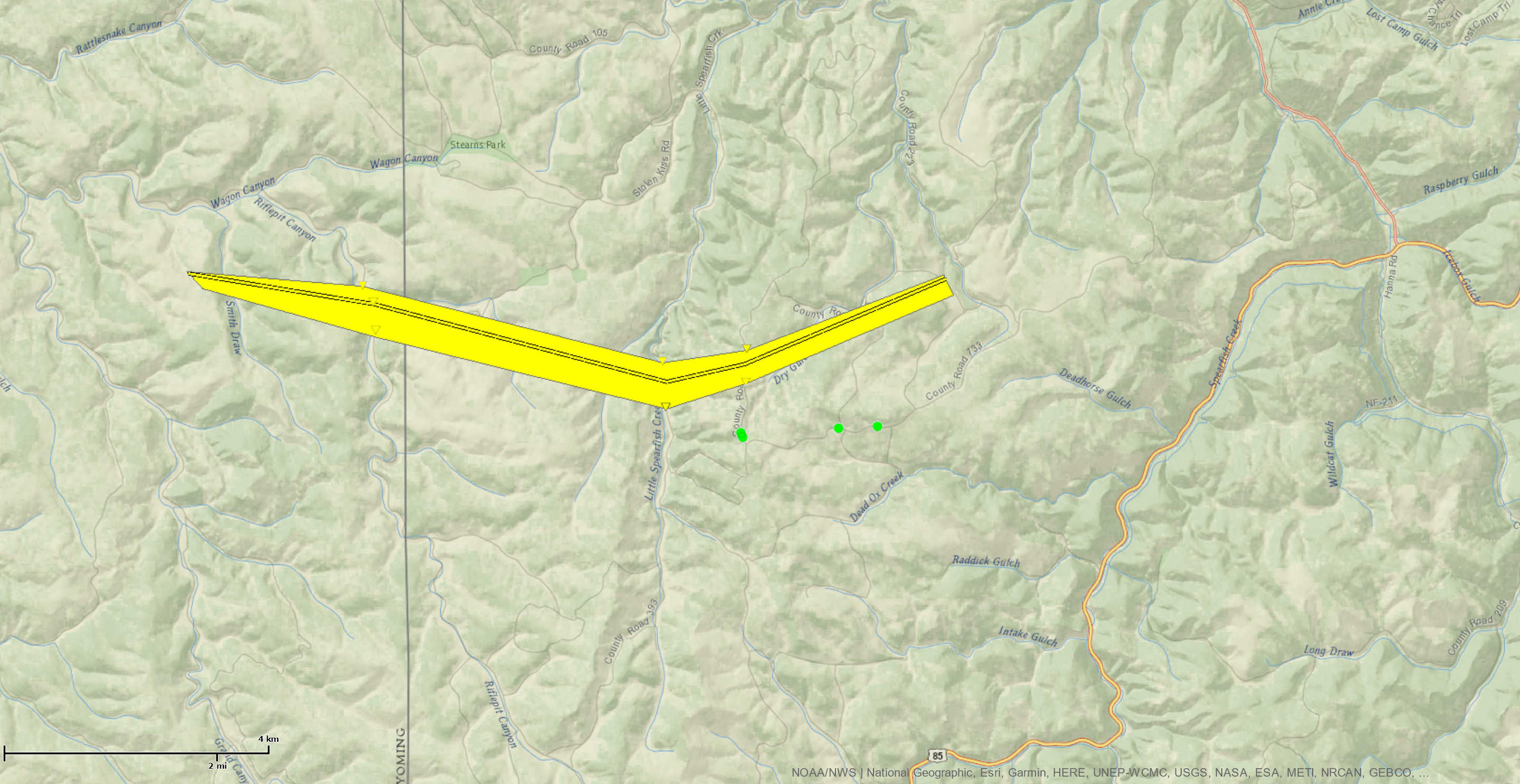
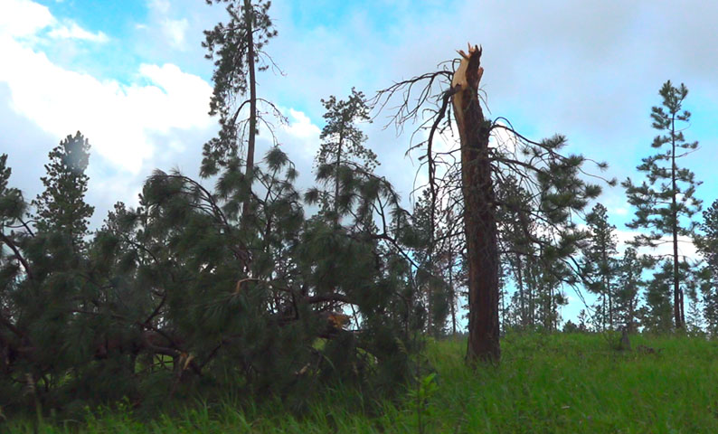
Tornado - 8 miles NNW New Haven
Track Map 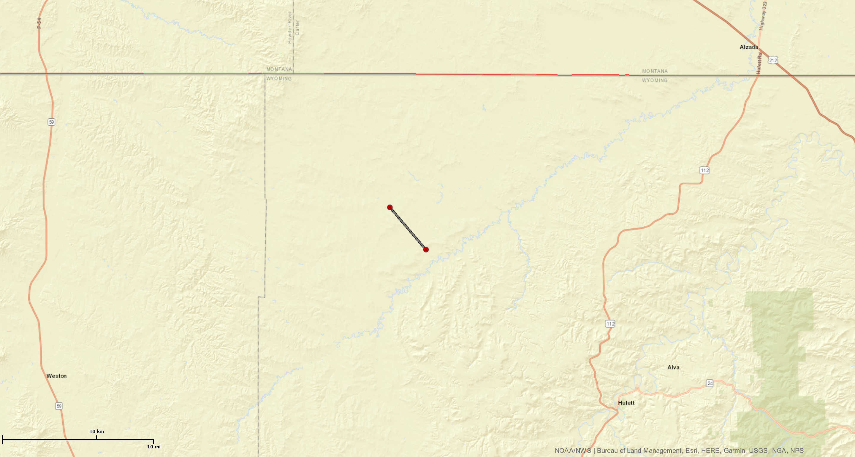 
|
||||||||||||||||
Videos and Tweets
|
||||||||||||||||
|
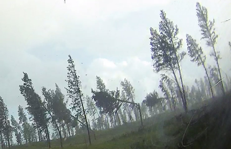
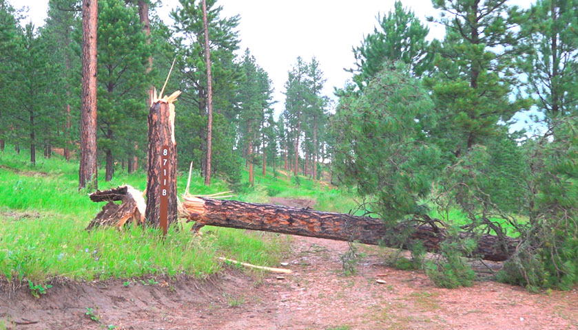
Tornado - State Line
|
||||||||||||||||||||||||||
|
||||||||||||||||||||||||||
The Enhanced Fujita (EF) Scale classifies tornadoes into the following categories:
| EF0 Weak 65-85 mph |
EF1 Moderate 86-110 mph |
EF2 Significant 111-135 mph |
EF3 Severe 136-165 mph |
EF4 Extreme 166-200 mph |
EF5 Catastrophic 200+ mph |
 |
|||||
Photos
 |
 |
 |
 |
| SW Rapid City (S. Coleman) |
South Rapid City (T. Snyder) |
South Rapid City (M. Riebe) |
South Rapid City (A. Popken) |
 |
 |
 |
 |
| Rapid City (M. Thornton) |
West Rapid City (K. Palmer) |
South Rapid City (B. Aker) |
West Rapid City (Y. Turner Charland) |
 |
 |
 |
 |
| Sundance (E. Ludes) |
Sundance (E. Ludes) |
Sundance (E. Ludes) |
Sundance (E. Ludes) |
 |
 |
 |
 |
| Folsom (G. Peterson Mostek) |
SW Rapid City (K. Graves) |
SW Rapid City (R. Rae) |
West Rapid City (C. Reiter) |
Radar
Storm Reports
The storm reports listed below are in descending order and may not
necessarily be the final storm reports.

Hail reports listed by size (inches)

 SIZE    LOCATION                 ST  COUNTY           TIME
 ------  -----------------------  --  --------------   -------
  2.75   1 ESE JOHNSON SIDING     SD  PENNINGTON       0738 PM
  2.75   3 NW OSHOTO              WY  CROOK            0530 PM
                 TENNIS BALL TO BASEBALL HAIL. FUNNEL CLOUD,
                 BUT DIDN`T TOUCH DOWN.
  2.75   1 NW LIGHTNING FLAT      WY  CROOK            0500 PM
                 TENNIS BALL TO BASEBALL SIZE HAIL. LASTED 15-
                 20 MINUTES.
  2.50   4 SE FOLSOM              SD  CUSTER           0830 PM
  2.50   3 SSW DWTN RAPID CITY    SD  PENNINGTON       0749 PM
  2.50   3 WSW DWTN RAPID CITY    SD  PENNINGTON       0748 PM
  2.00   7 SW RAPID CITY ARPT     SD  PENNINGTON       0802 PM
  2.00   3 S DWTN RAPID CITY      SD  PENNINGTON       0751 PM
  2.00   4 S DWTN RAPID CITY      SD  PENNINGTON       0751 PM
  2.00   4 SW DWTN RAPID CITY     SD  PENNINGTON       0745 PM
  2.00   4 NE ROCKERVILLE         SD  PENNINGTON       0744 PM
  2.00   8 NW ROCKYPOINT          WY  CAMPBELL         0505 PM
                 SEVERAL INCHES OF LARGE HAIL. BROKEN WINDOWS.
  1.75   14 SSE HEREFORD          SD  MEADE            0817 PM
  1.75   7 SW RAPID CITY ARPT     SD  PENNINGTON       0755 PM
                 45-50 MPH WINDS
  1.75   2 SW DWTN RAPID CITY     SD  PENNINGTON       0745 PM
  1.75   11 SE SUNDANCE           WY  CROOK            0647 PM
  1.50   1 N HISEGA               SD  PENNINGTON       0736 PM
  1.25   8 S DWTN RAPID CITY      SD  PENNINGTON       0755 PM
  1.25   1 E DWTN RAPID CITY      SD  PENNINGTON       0750 PM
  1.00   7 NNE ELLSWORTH AFB      SD  MEADE            0815 PM
                 ESTIMATED 50 MPH WINDS
  1.00   1 N HISEGA               SD  PENNINGTON       0735 PM
  1.00   3 N JOHNSON SIDING       SD  PENNINGTON       0730 PM
  1.00   5 NW JOHNSON SIDING      SD  PENNINGTON       0730 PM
  1.00   6 SSE BROWNSVILLE        SD  LAWRENCE         0713 PM
  1.00   4 SSE DEVILS TOWER       WY  CROOK            0549 PM
  1.00   3 W SHADEHILL            SD  PERKINS          0250 PM
  0.50   10 N HULETT              WY  CROOK            0550 PM


Tstm wind reports listed by speed (mph)

 SPEED   LOCATION                 ST  COUNTY           TIME
 ------  -----------------------  --  --------------   -------
 75.00   2 W HAMILL               SD  TRIPP            1130 PM
 71.00   12 NW IDEAL              SD  TRIPP            1059 PM
 70.00   1 NE MIDLAND             SD  HAAKON           0952 PM
 70.00   1 NE MIDLAND             SD  HAAKON           0947 PM
 68.00   1 NE WINNER              SD  TRIPP            1121 PM
 65.00   1 NE MIDLAND             SD  HAAKON           0942 PM
 65.00   10 N HULETT              WY  CROOK            0550 PM
                 6 INCH TREE LIMBS BROKE, WINDS OF 60 TO 70
                 MPH ESTIMATED.
 64.00   1 NE WINNER              SD  TRIPP            1119 PM
 64.00   9 ENE BELVIDERE          SD  JACKSON          0957 PM
 64.00   3 E PHILIP               SD  HAAKON           0919 PM
 63.00   2 W HAMILL               SD  TRIPP            1125 PM
 63.00   7 ESE ROSEBUD            SD  TODD             1100 PM
 61.00   4 SSE WITTEN             SD  TRIPP            1104 PM
 61.00   4 W OTTUMWA              SD  HAAKON           0925 PM
 60.00   3 NW WASTA               SD  PENNINGTON       0858 PM
 60.00   14 SSE HEREFORD          SD  MEADE            0817 PM
 60.00   STURGIS                  SD  MEADE            0725 PM
 60.00   HOOVER                   SD  BUTTE            0710 PM
 60.00   10 NW CASTLE ROCK        SD  BUTTE            0645 PM
 58.00   7 NW ROCKYPOINT          WY  CROOK            0459 PM
 57.00   7 ESE ROSEBUD            SD  TODD             1055 PM
 54.00   WEWELA                   SD  TRIPP            1154 PM
 54.00   9 ENE BELVIDERE          SD  JACKSON          0952 PM
 53.00   12 WSW CASTLE ROCK       SD  BUTTE            0656 PM
 52.00   WEWELA                   SD  TRIPP            1139 PM
 51.00   1 NNE FAITH              SD  MEADE            0836 PM
 50.00   WEWELA                   SD  TRIPP            1149 PM
 50.00   2 W HAMILL               SD  TRIPP            1120 PM
 50.00   4 E CACTUS FLAT          SD  JACKSON          0954 PM
 50.00   4 E CACTUS FLAT          SD  JACKSON          0939 PM
 |
Media use of NWS Web News Stories is encouraged! Please acknowledge the NWS as the source of any news information accessed from this site. |
|