
Tropical Depression Two is expected to gradually strengthen and could bring tropical storm conditions to the Florida Panhandle beginning late Monday. Areas of flash flooding will be possible through Thursday along the eastern and central Gulf Coast. Severe thunderstorms will develop and move along a cold front crossing the Upper Midwest Monday, and through the Ohio Valley/Mid-Atlantic on Tuesday. Read More >
Overview
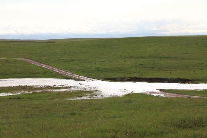
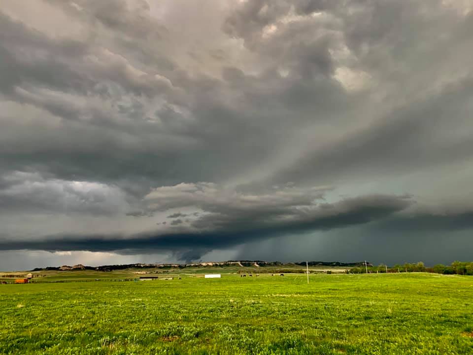
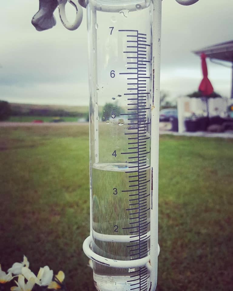
On May 23, 2020, severe thunderstorms brought large hail and flash flooding to portions of the Black Hills and western South Dakota plains. The largest hail was golfball size reported in Haakon and Pennington counties. Heavy rain caused flash flooding across portions of Haakon and Meade counties.
 |
|
Philip (Katie B) |
Photos
 |
 |
 |
| Flooding 15 NE Rapid City (Robin R) |
3 E Piedmont (Michael P) |
Oglala (Cheyenne GW) |
 |
 |
 |
| 20 N Rapid City (Lexi E) |
9 NNE Box Elder (Susan C) |
Near Piedmont/Black Hawk |
.jpg) |
 |
 |
| West Cottonwood (Tom W) |
West Cottonwood (Tom W) |
Between Philip and Midland (Ryon B) |
Radar
| Radar loop of the severe storms during the afternoon and evening of May 23, 2020. |
Storm Reports
The storm reports listed below are in descending order and may not
necessarily be the final storm reports.

Hail reports listed by size (inches)

 SIZE    LOCATION                 ST  COUNTY           TIME
 ------  -----------------------  --  --------------   -------
  1.75   11 W PHILIP              SD  HAAKON           0424 PM
  1.75   6 W OWANKA               SD  PENNINGTON       0205 PM
  1.50   3 W COTTONWOOD           SD  JACKSON          0332 PM
  1.50   9 S UNION CENTER         SD  MEADE            0318 PM
  1.50   SUMMERSET                SD  MEADE            0224 PM
  1.25   7 NNE ELLSWORTH AFB      SD  MEADE            0305 PM
  1.00   7 E WANBLEE              SD  JACKSON          0730 PM
  1.00   12 N PHILIP              SD  HAAKON           0630 PM
  1.00   7 NNE POTATO CREEK       SD  JACKSON          0630 PM
  1.00   11 S BILLSBURG           SD  HAAKON           0600 PM
                 HAIL COVERED A 3 MILE STRETCH OF HIGHWAY 73
  1.00   13 SSW BILLSBURG         SD  HAAKON           0540 PM
  1.00   12 WSW BILLSBURG         SD  HAAKON           0507 PM
  1.00   5 ESE ELM SPRINGS        SD  MEADE            0500 PM
  1.00   5 S WHITE OWL            SD  MEADE            0420 PM
                 ROOF TORN OFF THE BARN, SEVERAL TREES
                 UPROOTED.
  1.00   3 WSW HILL CITY          SD  PENNINGTON       0345 PM
  1.00   3 WNW COTTONWOOD         SD  JACKSON          0324 PM
  1.00   5 ESE ELM SPRINGS        SD  MEADE            0310 PM
  1.00   5 SSW MYSTIC             SD  PENNINGTON       0300 PM
  1.00   4 W CACTUS FLAT          SD  JACKSON          0258 PM
  1.00   SUMMERSET                SD  MEADE            0227 PM
  1.00   1 NNW SUMMERSET          SD  MEADE            0220 PM
  0.88   6 W BILLSBURG            SD  HAAKON           0524 PM
  0.88   INTERIOR                 SD  JACKSON          0228 PM


Tstm wind reports listed by speed (mph)

 SPEED   LOCATION                 ST  COUNTY           TIME
 ------  -----------------------  --  --------------   -------
 52.00   4 E CACTUS FLAT          SD  JACKSON          0629 PM
 51.00   1 NNE FAITH              SD  MEADE            0816 PM
 51.00   3 W UNION CENTER         SD  MEADE            0613 PM
 51.00   8 N REDIG                SD  HARDING          0212 PM


Rain amounts (inches)

 AMOUNT  LOCATION                 ST  COUNTY           TIME
 ------  -----------------------  --  --------------   -------
  3.53   18 N PHILIP              SD  HAAKON           0700 AM
  2.60   12 N COTTONWOOD          SD  HAAKON           0700 PM
  2.13   2 E MIDLAND              SD  HAAKON           0700 AM
  2.07   13 W MARTIN              SD  BENNETT          0600 AM
  2.00   11 ENE WANBLEE           SD  JACKSON          0733 AM
                 STORM TOTAL RAIN. PILES OF SMALL HAIL STILL
                 ON THE GROUND THIS MORNING
  2.00   8 N QUINN                SD  PENNINGTON       0424 PM
  1.55   11 W PHILIP              SD  HAAKON           0400 PM
                 1.55" OF RAIN FROM 2 PM TO 4 PM
  1.44   5 E ELM SPRINGS          SD  MEADE            0700 AM
  1.40   7 N KIRLEY               SD  HAAKON           0700 AM
  1.29   4 W MARTIN               SD  BENNETT          1126 PM
  1.27   6 NNW KIRLEY             SD  HAAKON           1031 AM
  1.12   3 WNW KADOKA             SD  JACKSON          0530 AM
  1.09   4 WSW WANBLEE            SD  JACKSON          0700 AM
  1.03   17 NW WHITE RIVER        SD  MELLETTE         0700 AM
  1.01   6 SSW MYSTIC             SD  PENNINGTON       0700 AM
  1.00   7 WSW WANBLEE            SD  JACKSON          0900 PM
                 ONE INCH OF RAIN FROM 0730 PM TO 900 PM.
  0.93   3 E PHILIP               SD  HAAKON           0900 PM
  0.91   7 NNE ELLSWORTH AFB      SD  MEADE            1155 PM
  0.90   8 E MARTIN               SD  BENNETT          0700 AM
                 24-HOUR RAINFALL.
  0.73   2 W DEERFIELD RES        SD  PENNINGTON       0245 PM
                 0.73" IN ABOUT AN HOUR FROM 145 PM TO 245 PM
  0.62   14 E BEAR BUTTE STATE P  SD  MEADE            0330 PM
                 RAINFALL FROM 130 PM TO 330 PM.
 |
Media use of NWS Web News Stories is encouraged! Please acknowledge the NWS as the source of any news information accessed from this site. |
|

