Tropical Depression Two is expected to gradually strengthen and could bring tropical storm conditions to the Florida Panhandle beginning late Monday. Areas of flash flooding will be possible through Thursday along the eastern and central Gulf Coast. Severe thunderstorms will develop and move along a cold front crossing the Upper Midwest Monday, and through the Ohio Valley/Mid-Atlantic on Tuesday. Read More >
Overview
|
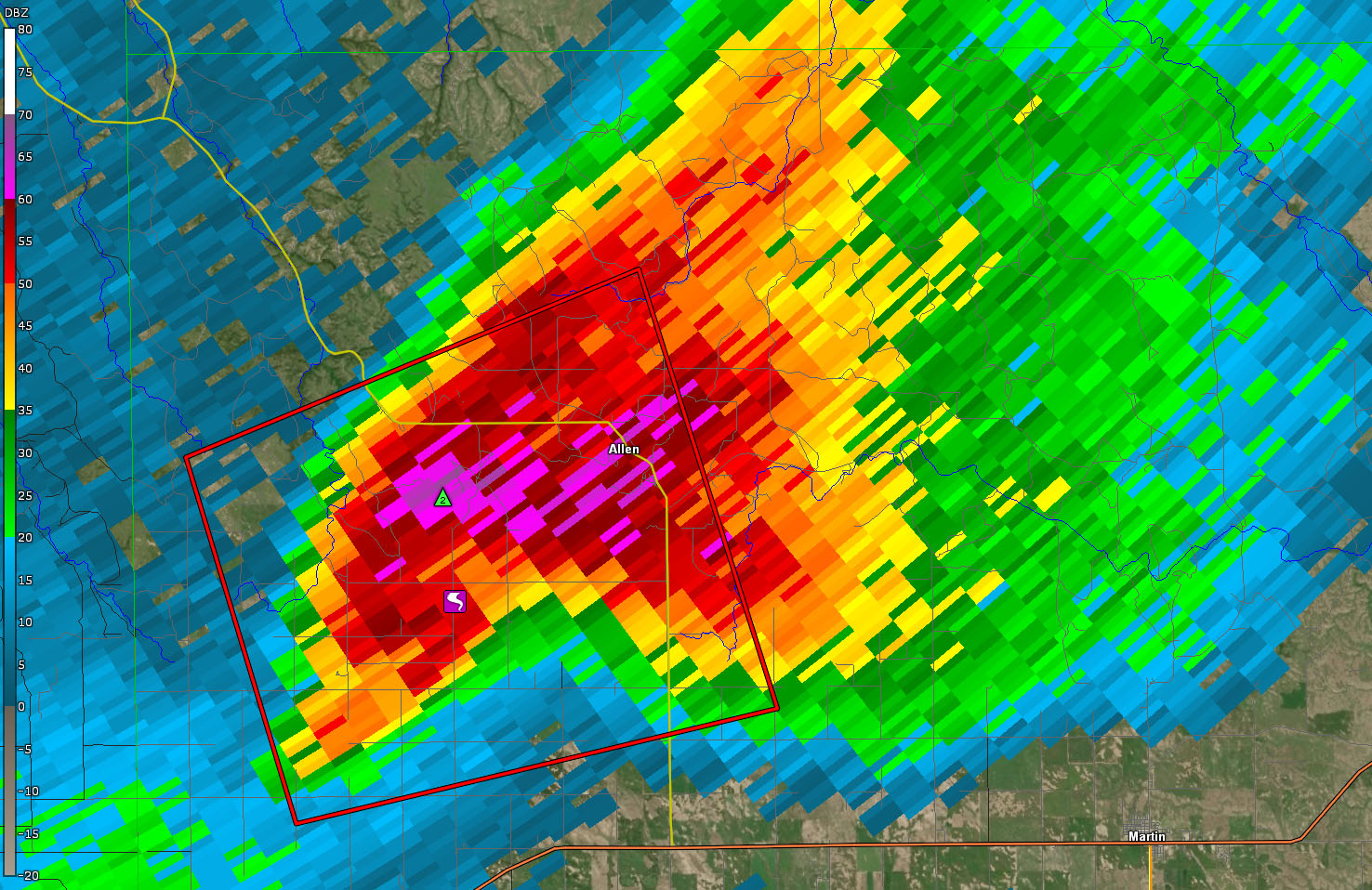
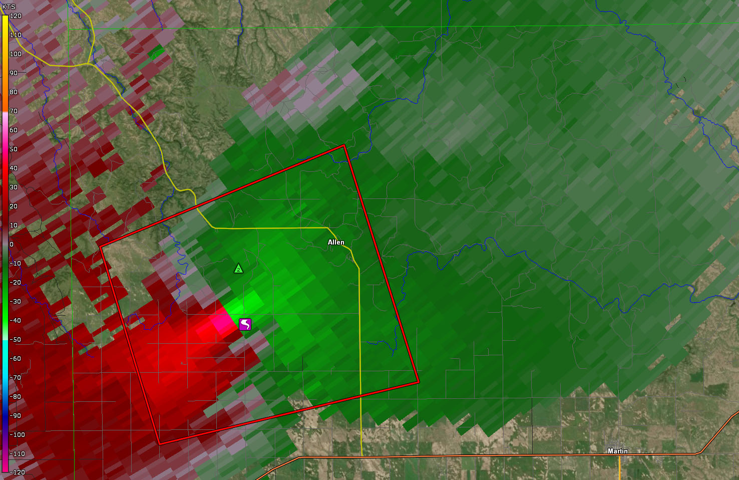
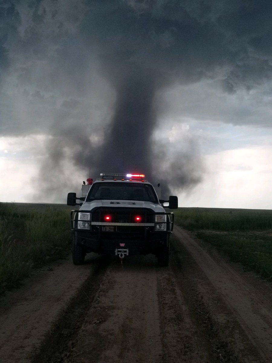
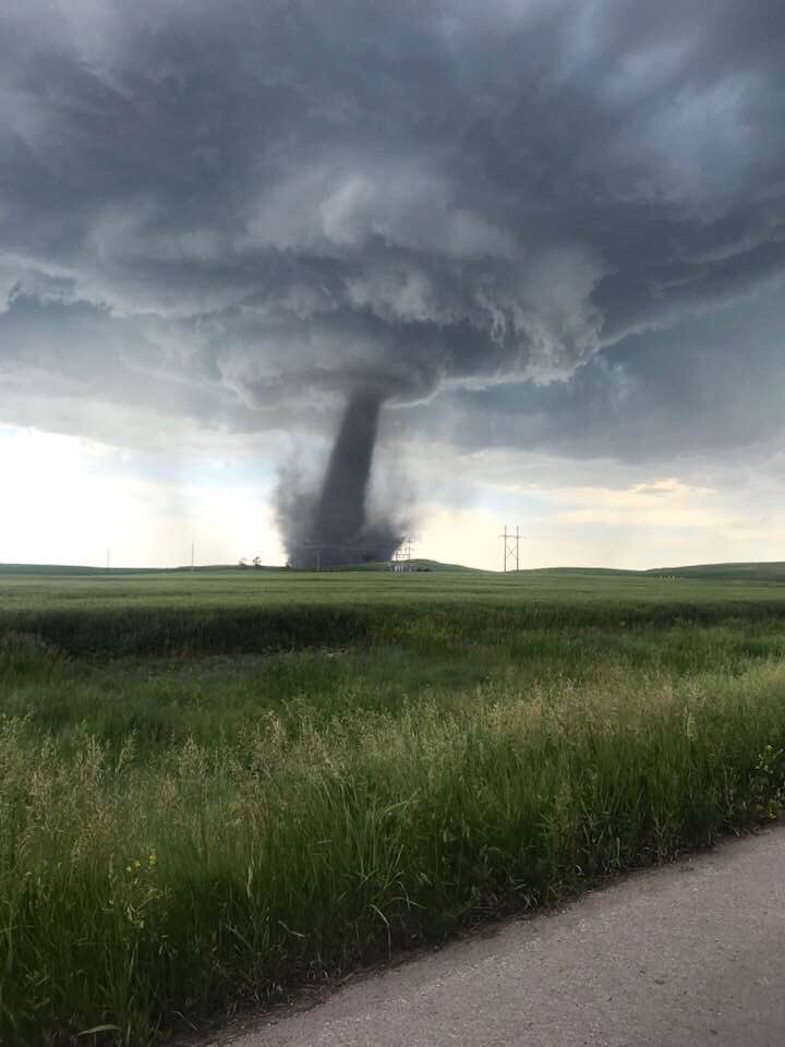
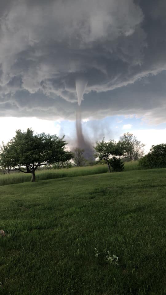
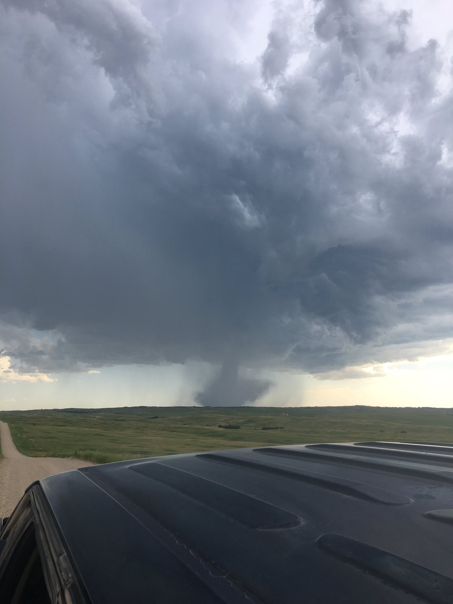
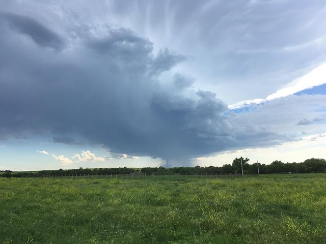
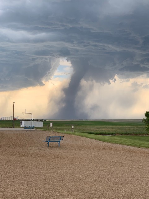
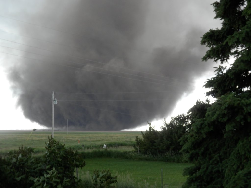
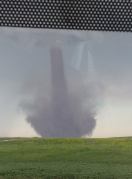
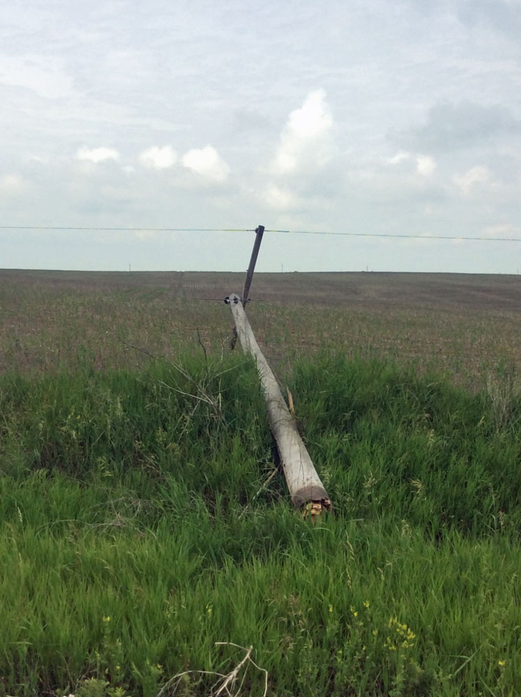
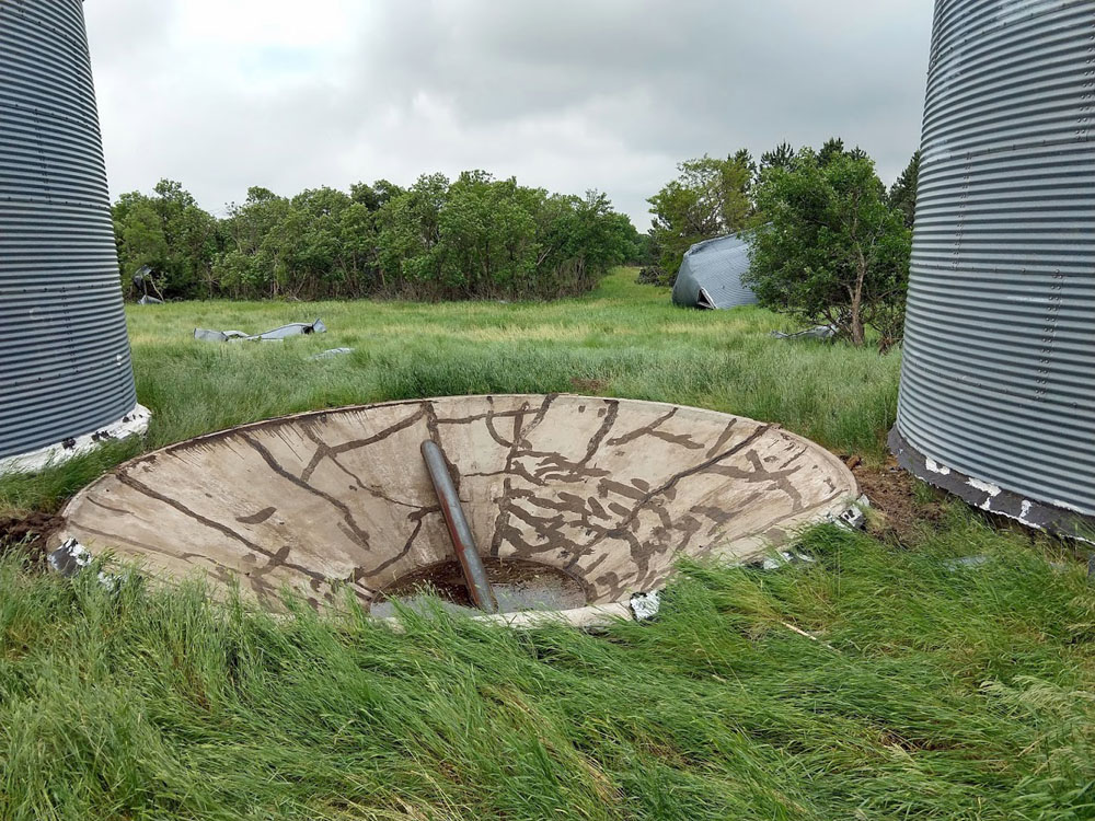
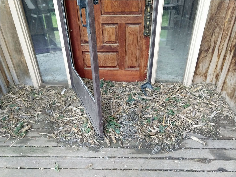
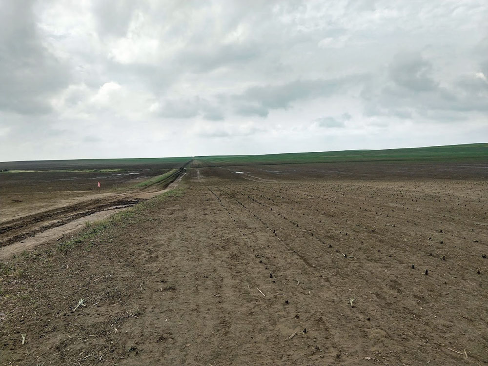
On June 29, 2019 a surface boundary was located across south central South Dakota. Very strong instability along the boundary was realized when a thunderstorm exploded along it. The thunderstorm updraft stretched energy along the boundary into a very slow moving tornado near Allen, SD. The tornado was visible for many miles. It was unusual because it only moved within a two mile area, but lasted about 40 minutes. Fortunately, it spun over corn fields most of the time. It damaged a house, blew over a couple of grain bins, snapped power poles, and carried grain bags. The tornado was rated EF-1 by an NWS storm survey team. More information about the environment of the Allen tornado can be found here. |
 Courtesy Chris O. |
 |
 |
 |
| Courtesy Gail S. | Courtesy Josie D. | Courtesy Ang G. |
Tornado
|
Tornado - Near Allen, SD
|
||||||||||||||||
|
||||||||||||||||
The Enhanced Fujita (EF) Scale classifies tornadoes into the following categories:
| EF0 Weak 65-85 mph |
EF1 Moderate 86-110 mph |
EF2 Significant 111-135 mph |
EF3 Severe 136-165 mph |
EF4 Extreme 166-200 mph |
EF5 Catastrophic 200+ mph |
 |
|||||
Photos & Video
Video courtesy Steve Wilson and OST / Bennett County Emergency Management
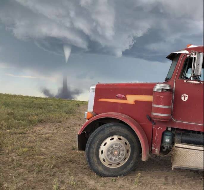
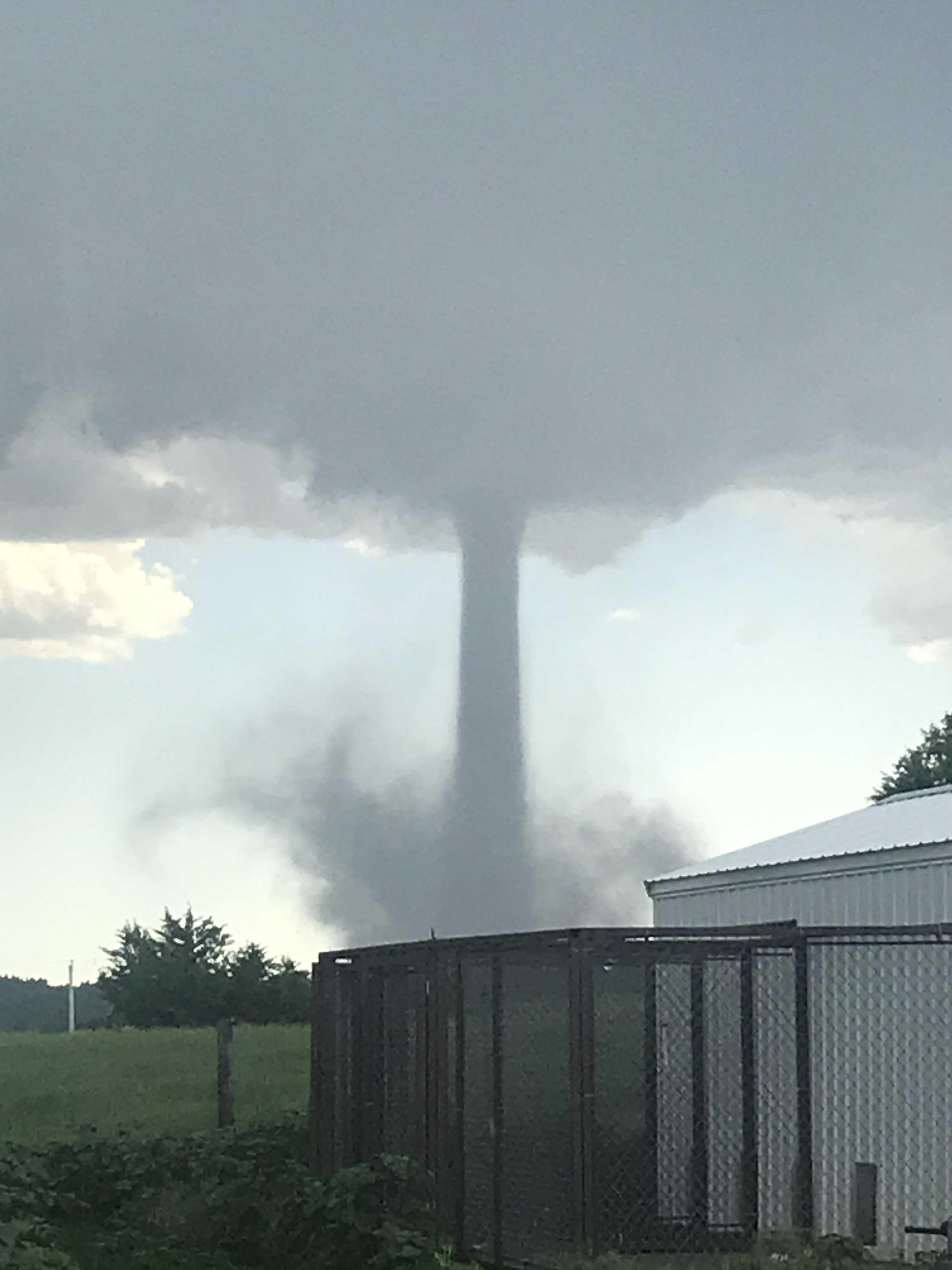
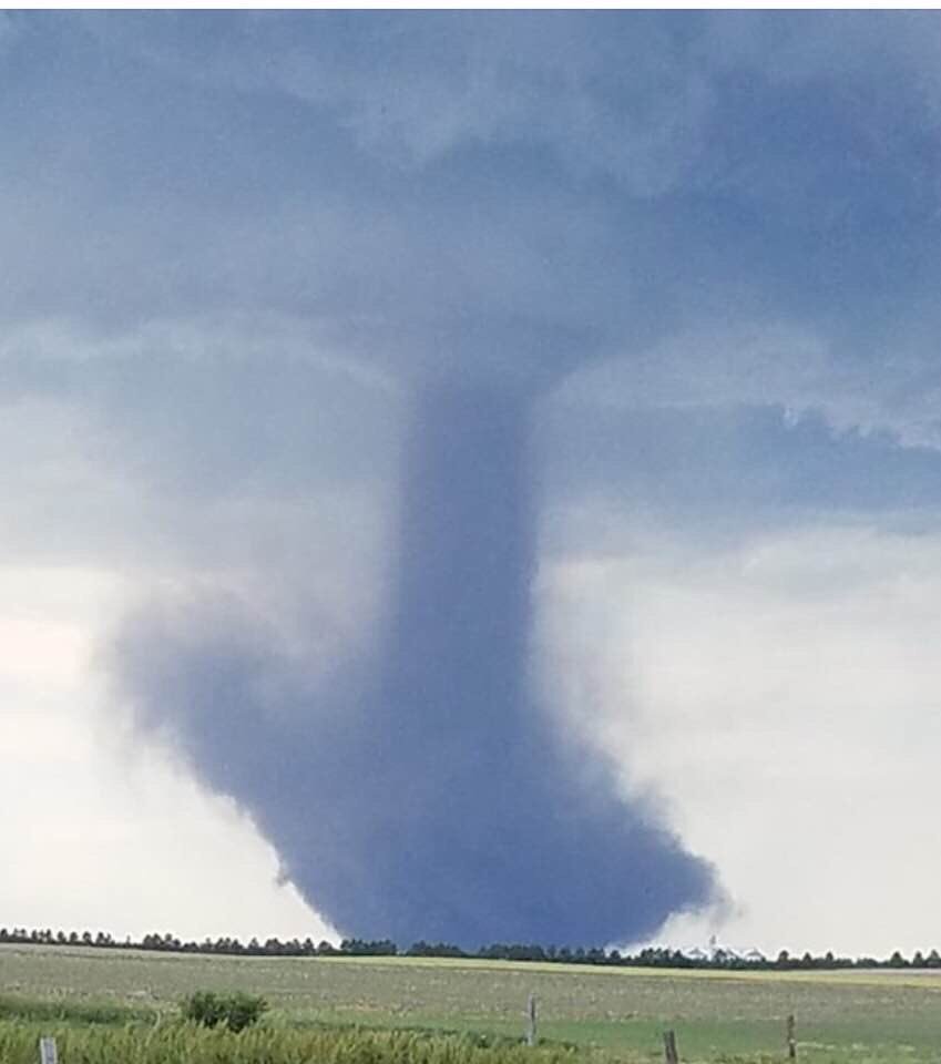
Tornado Pictures Near Allen, SD
 |
 |
 |
 |
| Courtesy Laura H. | Courtesy Laura B. | Courtesy Lonna L. | Courtesy Luke K. |
 |
 |
 |
| Courtesy Dan F. | Courtesy Chris O. | Courtesy Ang C. |
Tornado Damage Survey Pictures
 |
 |
 |
 |
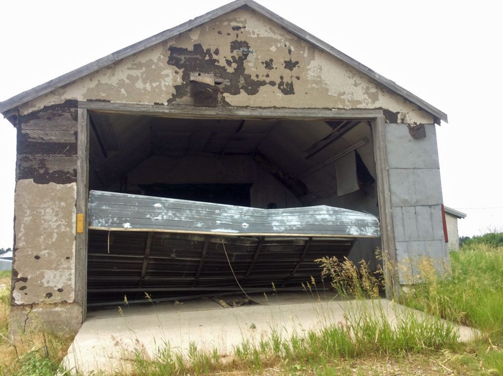
| Collapsed barn door NWS Storm Survey |
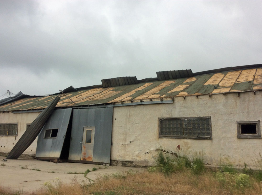
Barn roof damage NWS Storm Survey |
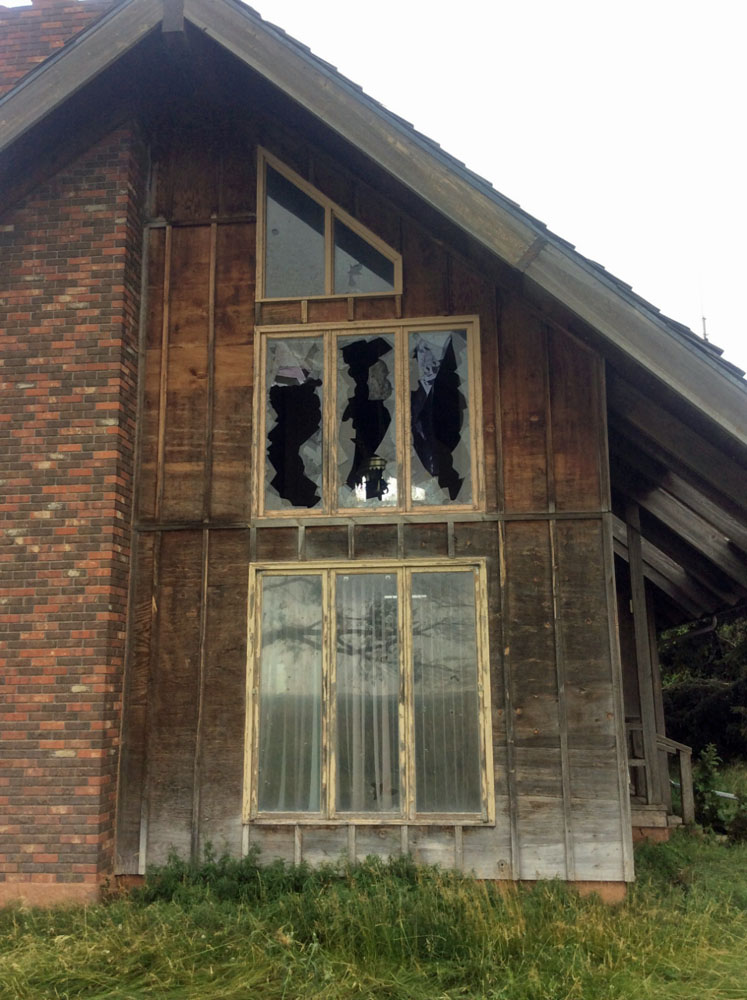
Broken house windows NWS Storm Survey |
Power pole snapped NWS Storm Survey |
 |
 |
 |
 |
| Grain bin foundation NWS Storm Survey |
Corn stalks piled against a house NWS Storm Survey |
Tornado scoured corn fields NWS Storm Survey |
Tornado scoured corn fields NWS Storm Survey |
 |
Media use of NWS Web News Stories is encouraged! Please acknowledge the NWS as the source of any news information accessed from this site. |
|


.jpg)