Tropical Depression Two is expected to gradually strengthen and could bring tropical storm conditions to the Florida Panhandle beginning late Monday. Areas of flash flooding will be possible through Thursday along the eastern and central Gulf Coast. Severe thunderstorms will develop and move along a cold front crossing the Upper Midwest Monday, and through the Ohio Valley/Mid-Atlantic on Tuesday. Read More >
Overview
|
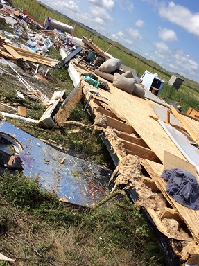
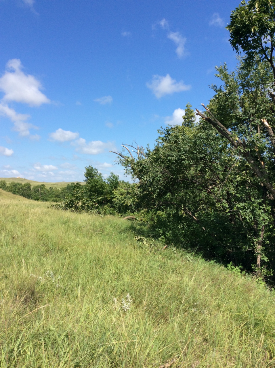
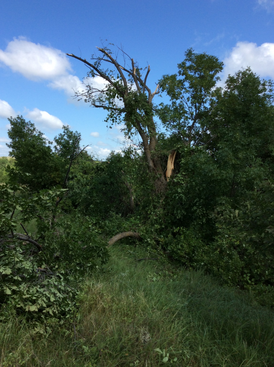
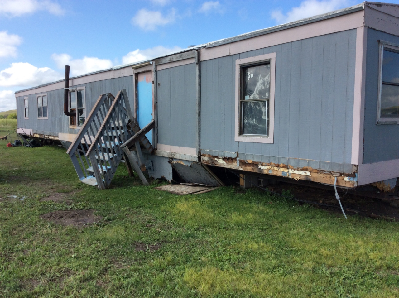
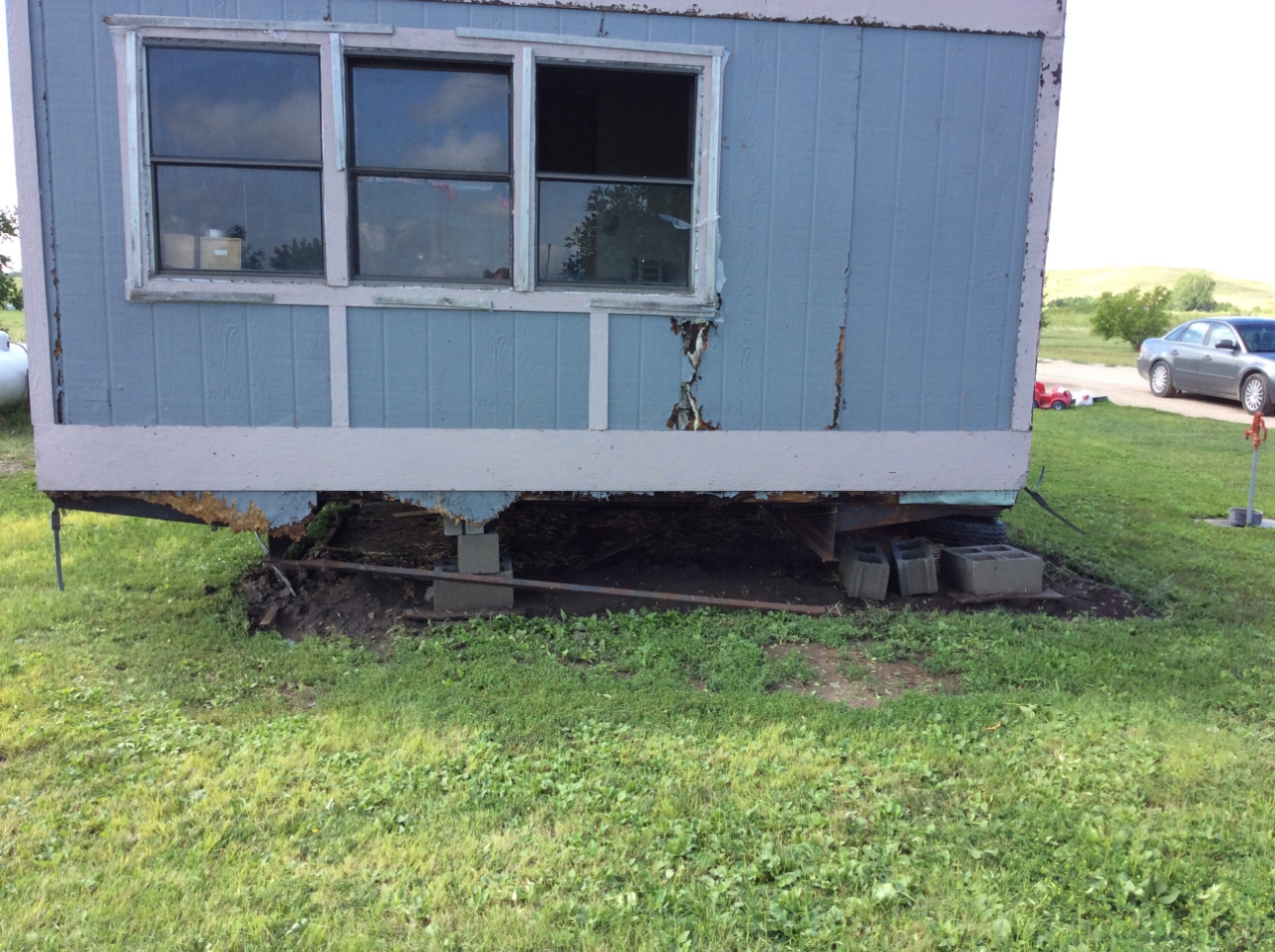
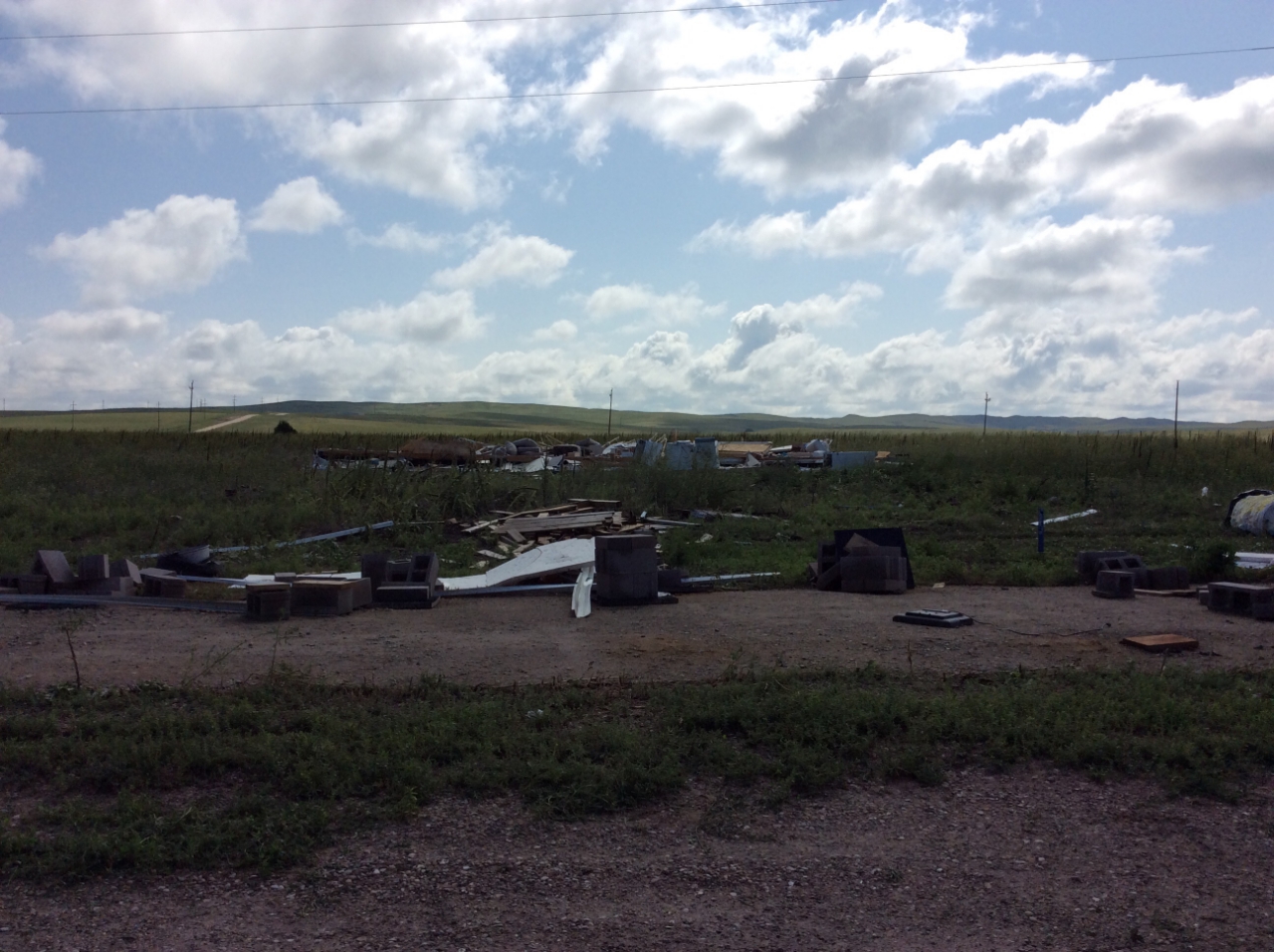
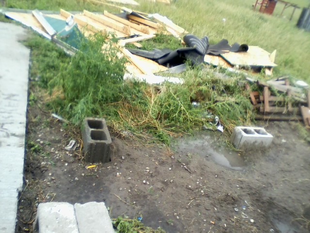
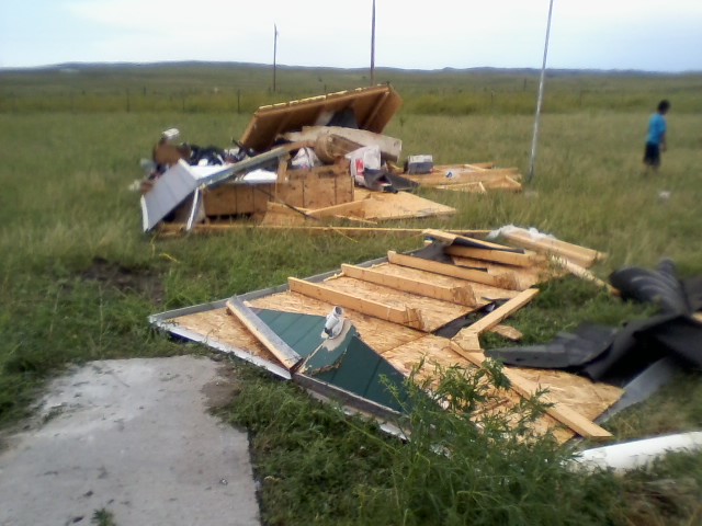
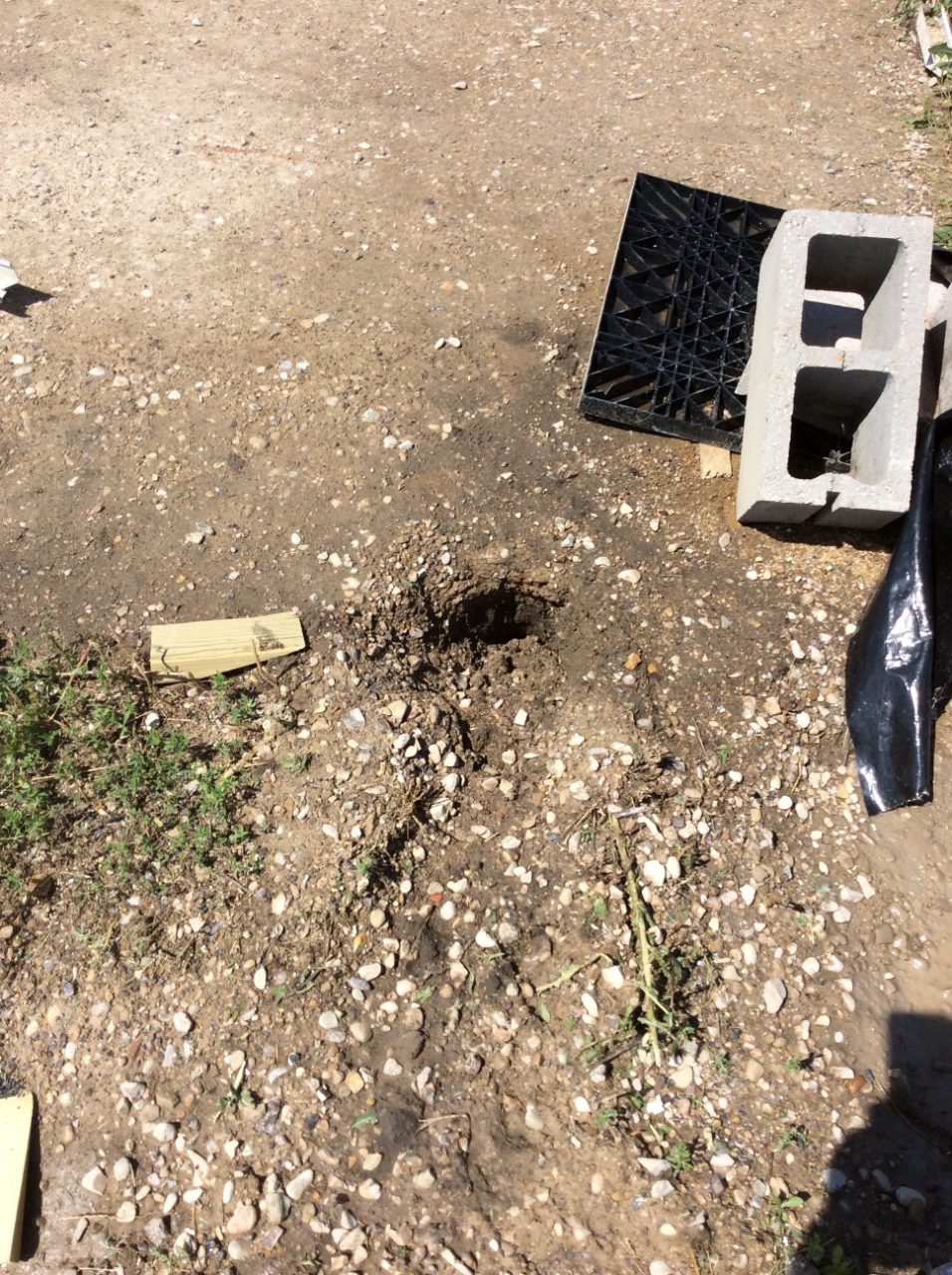
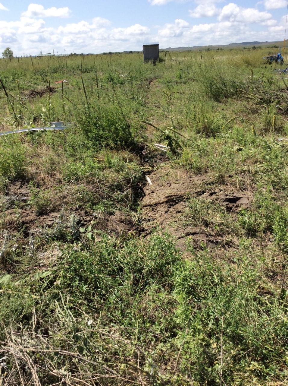
During the afternoon of July 29, 2018, an intense thunderstorm over northeast and east-central Oglala Lakota County produced a brief tornado and significant straight-line wind damage. The tornado developed about 6.5 miles south of Kyle, SD in a small grove of trees off American Horse Creek Road. The tops of trees were twisted and broken off. The highest winds of the tornado were estimated to be 80 mph, which gives it a rating of EF-0. In addition, straight-line winds severely damaged several houses southwest of Kyle, with one house being completely destroyed. Estimated wind speeds there were as high as 120 mph. |
(NWS Storm Survey) |
Tornado:
|
Tornado - 6 miles south of Kyle
Track Map 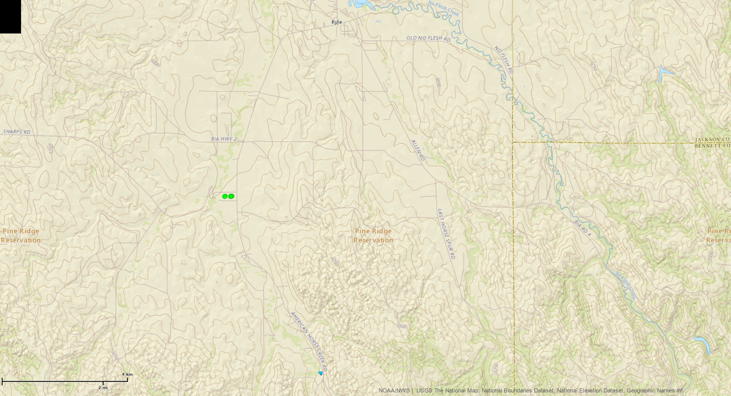  |
||||||||||||||||
 |
 |
||
| 6 S Kyle (NWS Storm Survey) |
6 S Kyle (NWS Storm Survey) |
The Enhanced Fujita (EF) Scale classifies tornadoes into the following categories:
| EF0 Weak 65-85 mph |
EF1 Moderate 86-110 mph |
EF2 Significant 111-135 mph |
EF3 Severe 136-165 mph |
EF4 Extreme 166-200 mph |
EF5 Catastrophic 200+ mph |
 |
|||||
Wind & Hail Pictures:
Wind
 |
 |
 |
 |
| 3 SW Kyle (NWS Storm Survey) |
3 SW Kyle (NWS Storm Survey) |
3 SW Kyle (NWS Storm Survey) |
5 SW Kyle (Kateland Cross) |
 |
 |
||
| 5 SW Kyle (Kateland Cross) |
5 SW Kyle (Kateland Cross) |
 |
 |
 |
| 3 SW Kyle (NWS Storm Survey) |
3 SW Kyle (NWS Storm Survey) |
3 SW Kyle (NWS Storm Survey) |
Hail
 |
 |
||
| 5 SW Kyle (Kateland Cross) |
Near Kyle (Kateland Cross) |
Radar
Storm Reports
The storm reports listed below are in descending order and may not
necessarily be the final storm reports.

Hail reports listed by size (inches)

 SIZE    LOCATION                 ST  COUNTY           TIME
 ------  -----------------------  --  --------------   -------
  2.00   KYLE                     SD  OGLALA LAKOTA    0210 PM
  1.75   4 N DOWNTOWN SPEARFISH   SD  LAWRENCE         0240 PM
  1.25   3 ENE KYLE               SD  OGLALA LAKOTA    0210 PM
  1.00   9 NW EDGEMONT            SD  FALL RIVER       0605 PM
  1.00   6 SSE BROWNSVILLE        SD  LAWRENCE         0328 PM
  1.00   BROWNSVILLE              SD  LAWRENCE         0315 PM
  1.00   5 W WHITEWOOD            SD  LAWRENCE         0255 PM
  1.00   11 SE OELRICHS           SD  FALL RIVER       0240 PM
  1.00   1 WNW WIND CAVE VISITOR  SD  CUSTER           0130 PM
  0.88   1 WNW PACTOLA RESERVOIR  SD  PENNINGTON       0340 PM
  0.50   3 N SHERIDAN LAKE        SD  PENNINGTON       0351 PM


Tstm wind reports listed by speed (mph)

 SPEED   LOCATION                 ST  COUNTY           TIME
 ------  -----------------------  --  --------------   -------
 69.00   11 SE OELRICHS           SD  FALL RIVER       0240 PM
 60.00   BROWNSVILLE              SD  LAWRENCE         0310 PM
 60.00   5 W WHITEWOOD            SD  LAWRENCE         0255 PM
 58.00   1 N BUFFALO              SD  HARDING          1253 PM
 |
Media use of NWS Web News Stories is encouraged! Please acknowledge the NWS as the source of any news information accessed from this site. |
|