
Tropical Depression Two is expected to gradually strengthen and could bring tropical storm conditions to the Florida Panhandle beginning late Monday. Areas of flash flooding will be possible through Thursday along the eastern and central Gulf Coast. Severe thunderstorms will develop and move along a cold front crossing the Upper Midwest Monday, and through the Ohio Valley/Mid-Atlantic on Tuesday. Read More >
Overview
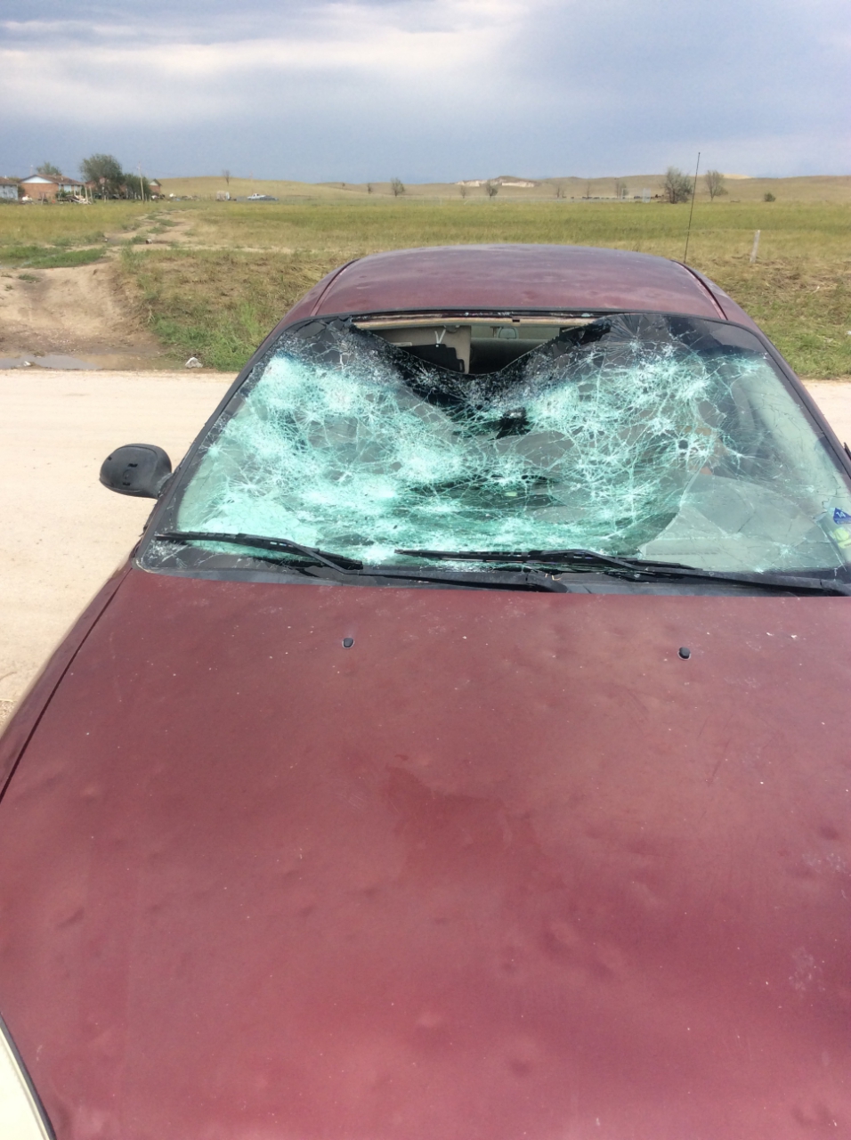
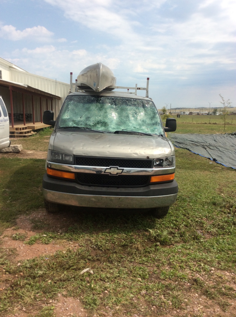
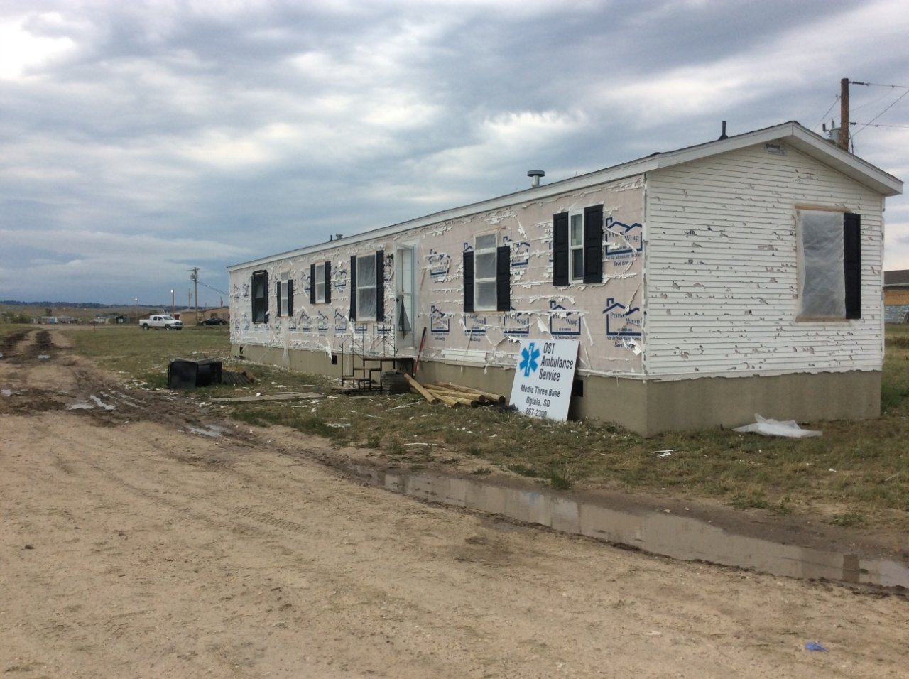
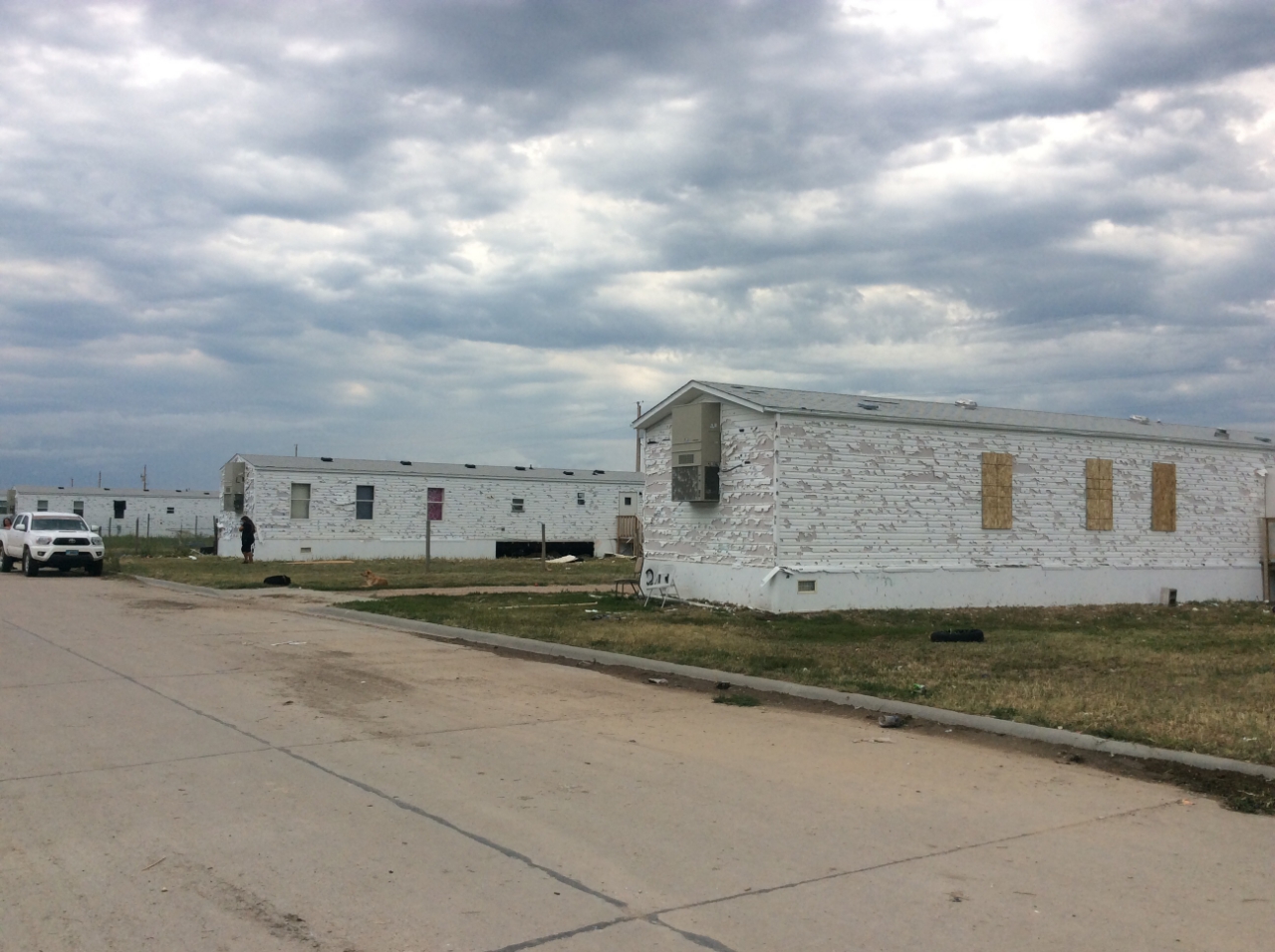
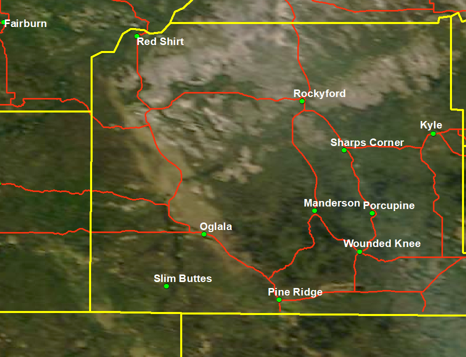
During the evening of July 27, 2018, a supercell thunderstorm tracked southeast across Oglala Lakota County, producing large wind-driven hail that resulted in extensive damage to homes, vehicles, and crops. 300 or more homes and over 100 vehicles sustained damage. There were minor injuries reported from broken glass. 3.25 inch hail (between baseball and softball size) and winds of 80 mph were reported.
This story will be updated as additional information is received.
Damage Photos
 |
 |
 |
 |
 |
Radar
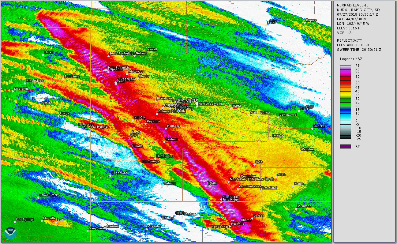
The first image below is a radar animation of when the severe hailstorm was moving through Oglala Lakota County. The second image is an accumulation of the maximum radar reflectivity values from about 2:30 pm to 8:30 pm MDT on July 27, 2018. Note the very intense (red, purple, and white) colors from north of Hulett, Wyoming, across the Black Hills and then through the Oglala and Pine Ridge areas.
Storm Reports
THE STORM REPORTS LISTED BELOW ARE IN DESCENDING ORDER AND MAY NOT
NECESSARILY BE THE FINAL STORM REPORTS.

HAIL REPORTS LISTED BY SIZE (INCHES)

 SIZE    LOCATION                 ST  COUNTY           TIME
 ------  -----------------------  --  --------------   -------
  3.25   6 SE OGLALA              SD  OGLALA LAKOTA    0746 PM
  1.75   PINE RIDGE               SD  OGLALA LAKOTA    0755 PM
  1.75   1 S OGLALA               SD  OGLALA LAKOTA    0734 PM
  1.75   8 W DOWNTOWN SPEARFISH   SD  LAWRENCE         0425 PM
                 HAIL BROKE OUT WINDOWS ON THE HOUSE AND
                 VEHICLES
  1.50   PINE RIDGE               SD  OGLALA LAKOTA    0751 PM
  1.50   1 NE OGLALA              SD  OGLALA LAKOTA    0735 PM
  1.50   5 W DOWNTOWN SPEARFISH   SD  LAWRENCE         0431 PM
  1.25   9 W DOWNTOWN SPEARFISH   SD  LAWRENCE         0428 PM
  1.00   1 ESE PINE RIDGE         SD  OGLALA LAKOTA    0759 PM
  1.00   1 ENE PRINGLE            SD  CUSTER           0628 PM
                 HAIL COVERING GROUND.
  1.00   2 W HERMOSA              SD  CUSTER           0611 PM
  1.00   4 N SILVER CITY          SD  PENNINGTON       0527 PM
                 AT LEAST AN INCH OF HAIL ON GROUND.
  1.00   6 S DEADWOOD             SD  LAWRENCE         0505 PM
  1.00   1 WNW DOWNTOWN SPEARFIS  SD  LAWRENCE         0434 PM
  1.00   2 NW DOWNTOWN SPEARFISH  SD  LAWRENCE         0430 PM
  1.00   6 ENE ALADDIN            WY  CROOK            0401 PM
  1.00   SAINT FRANCIS            SD  TODD             0400 PM
  1.00   14 WNW COLONY            WY  CROOK            0305 PM


TSTM WIND REPORTS LISTED BY SPEED (MPH)

 SPEED   LOCATION                 ST  COUNTY           TIME
 ------  -----------------------  --  --------------   -------
 80.00   OGLALA                   SD  OGLALA LAKOTA    0733 PM
 70.00   1 ESE PINE RIDGE         SD  OGLALA LAKOTA    0759 PM
 70.00   3 SE FAIRBURN            SD  CUSTER           0641 PM
 60.00   22 SSW SPOTTED HORSE     WY  CAMPBELL         0815 PM
 60.00   1 S OGLALA               SD  OGLALA LAKOTA    0734 PM
 60.00   14 SSW RED SHIRT         SD  OGLALA LAKOTA    0704 PM
                 60+ MPH GUSTS.
 60.00   10 WSW HILL CITY         SD  PENNINGTON       0530 PM
 60.00   9 W DOWNTOWN SPEARFISH   SD  LAWRENCE         0428 PM
 60.00   1 N BEULAH               WY  CROOK            0420 PM
 59.00   DOWNTOWN SPEARFISH       SD  LAWRENCE         0437 PM
 58.00   4 N SILVER CITY          SD  PENNINGTON       0523 PM
 52.00   5 NNW DOWNTOWN GILLETTE  WY  CAMPBELL         0851 PM
 50.00   14 WNW COLONY            WY  CROOK            0305 PM
 |
Media use of NWS Web News Stories is encouraged! Please acknowledge the NWS as the source of any news information accessed from this site. |
|

