Tropical Depression Two is expected to gradually strengthen and could bring tropical storm conditions to the Florida Panhandle beginning late Monday. Areas of flash flooding will be possible through Thursday along the eastern and central Gulf Coast. Severe thunderstorms will develop and move along a cold front crossing the Upper Midwest Monday, and through the Ohio Valley/Mid-Atlantic on Tuesday. Read More >
Overview
During the afternoon of June 1, 2018, a storm dropped four tornadoes around Gillette, WY.
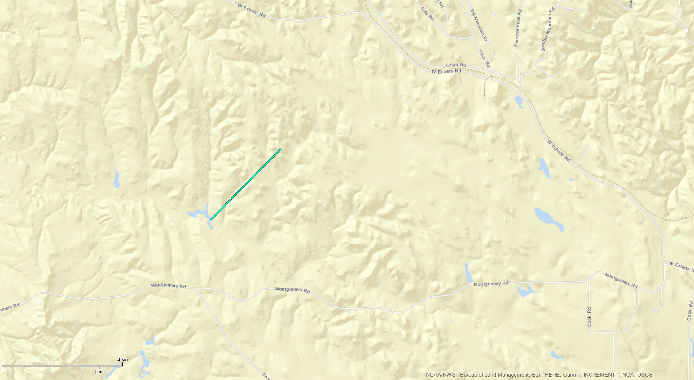
Based on video evidence, a brief tornado touched down about 11 miles west of Gillette. It was located between Montgomery Road and Echeta Road, south of the Oriva Hills subdivision. It was on the ground for about four minutes, from around 1:34 pm MDT until 1:38 pm MDT. Since there was no visible damage, this tornado was rated as EF-0.
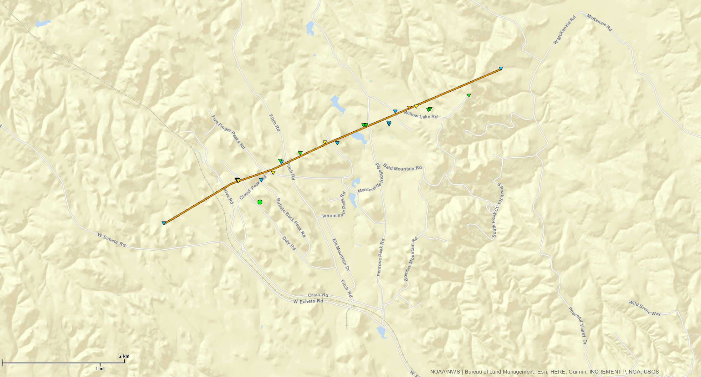
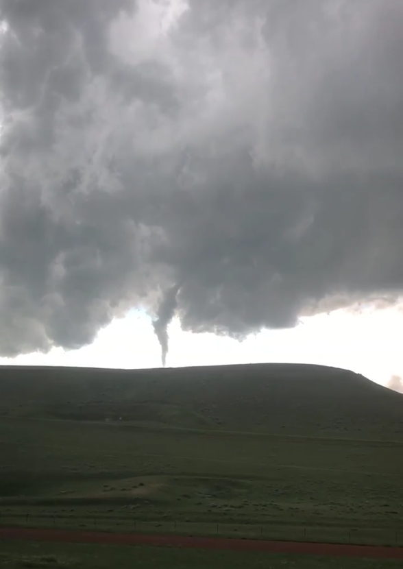
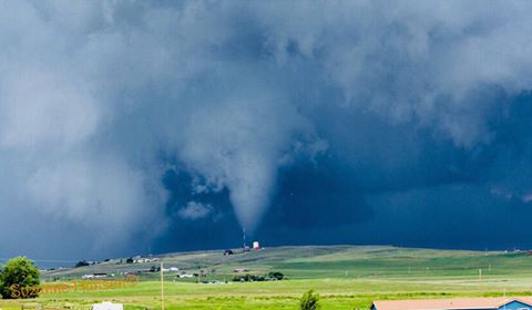
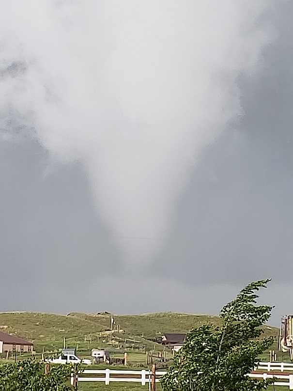
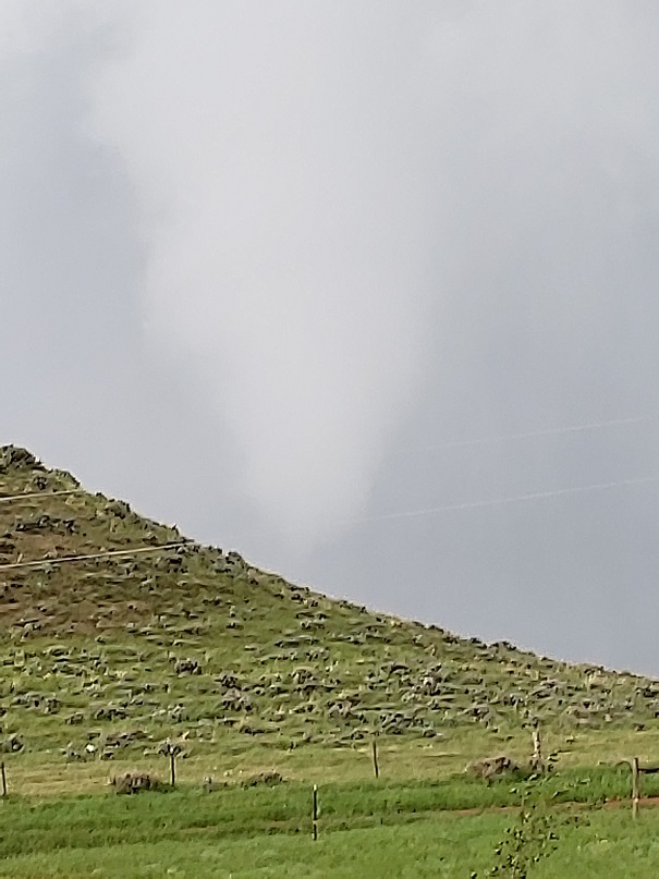
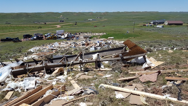
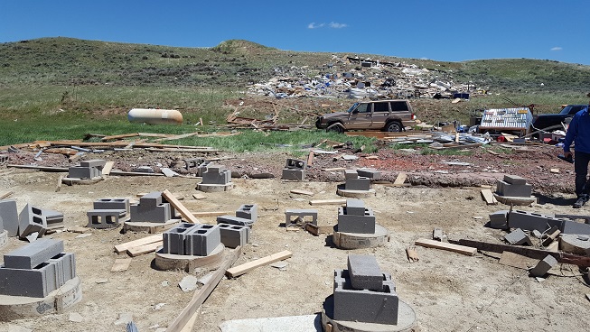
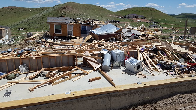
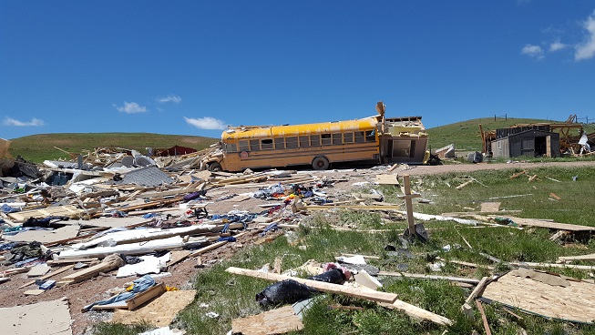
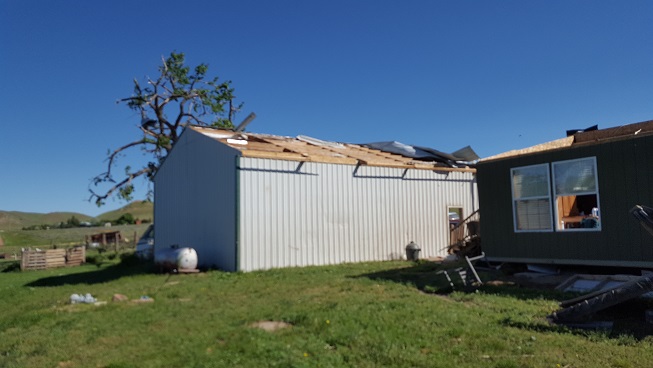
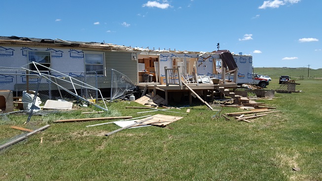
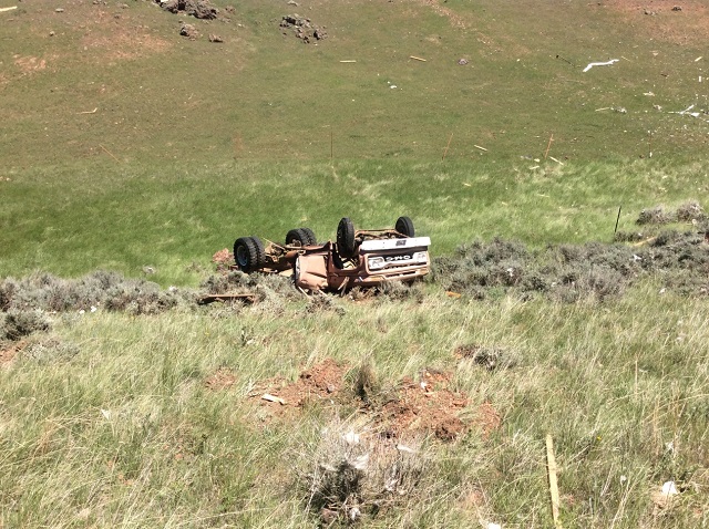
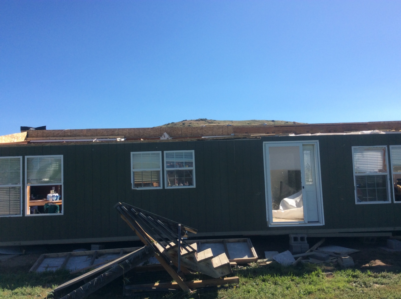
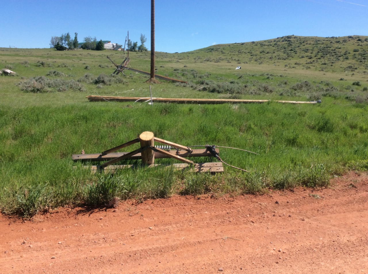
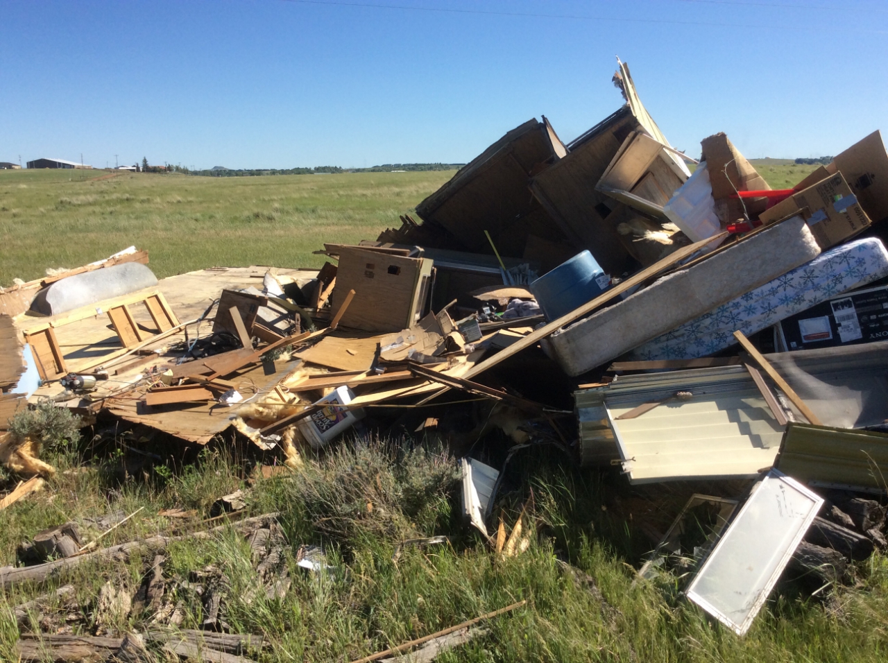
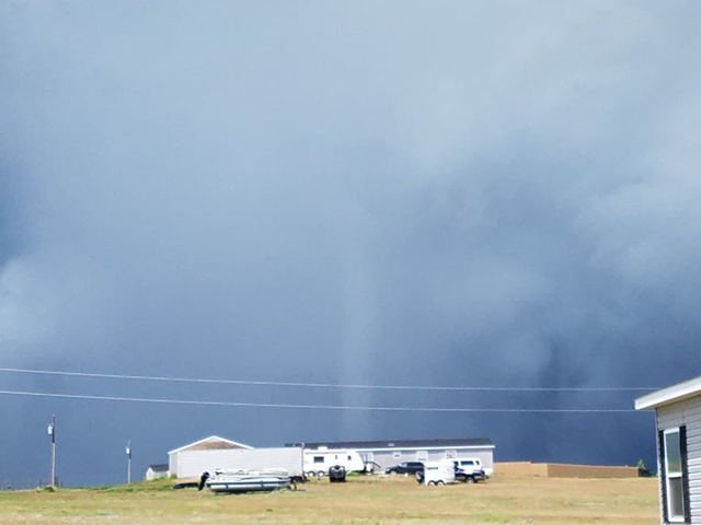
As the first tornado dissipated, a second tornado developed just north of the first one. The second tornado touched down about 10 miles west northwest of Gillette around 1:41 pm MDT. It traveled in an east northeast direction and dissipated around 1:52 pm MDT. It was on the ground for around 11 minutes over the Oriva Hills subdivision. The tornado destroyed and damaged numerous homes and outbuildings, rolled vehicles, and snapped electrical transmission poles and trees. The majority of damage associated with the tornado was consistent with an EF-1 and EF-2 tornado, but the most severe damage was consistent with an EF-3 tornado. Therefore, this tornado has been rated EF-3, with winds estimated around 136 mph.
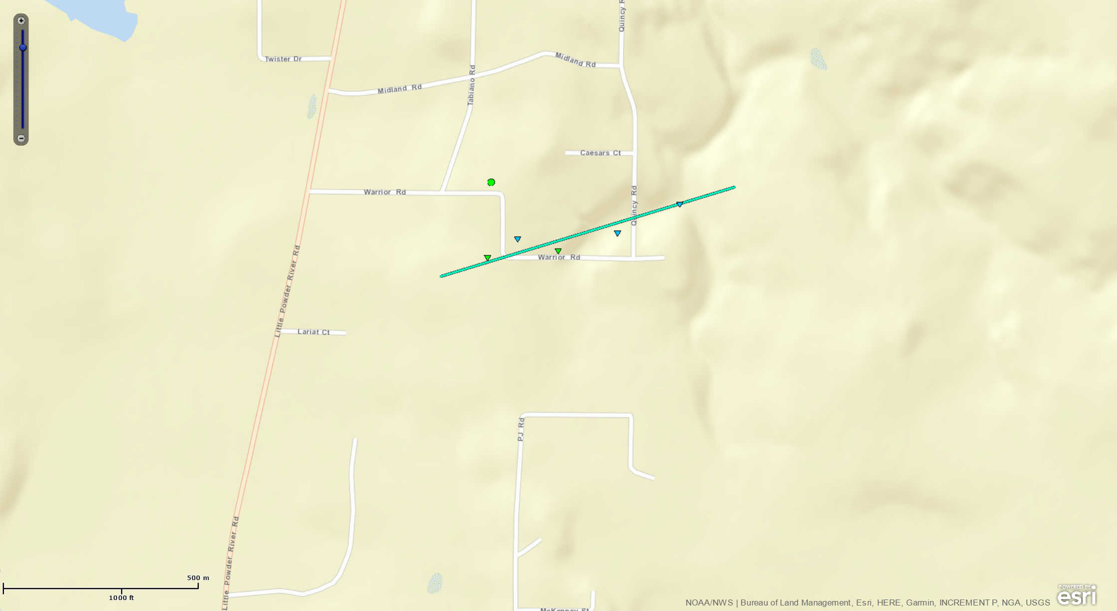
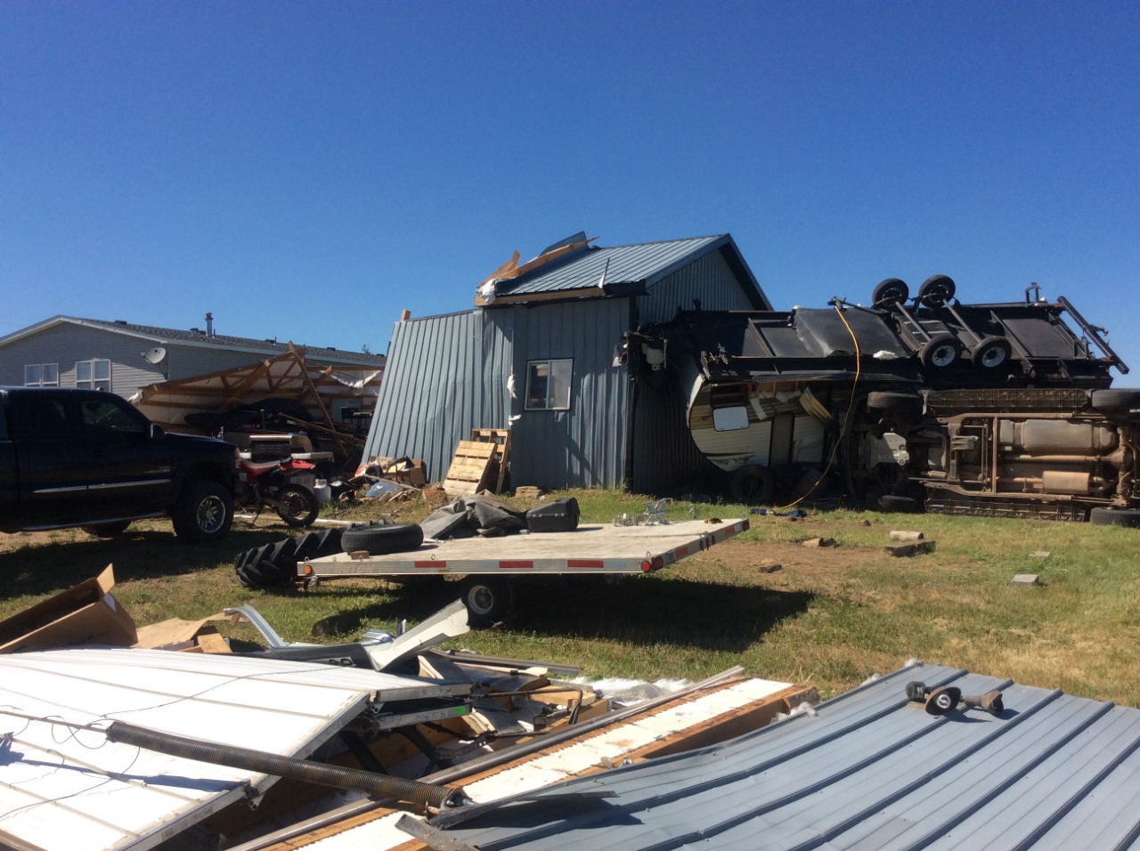
The third tornado was a short-lived landspout. It developed 3 miles north northeast of Gillette, in the Warrior Hills Subdivision. It was on the ground for one half mile, from around 1:55 pm MDT until 1:56 pm MDT. It damaged a large shed, flipped a camper onto a vehicle, destroyed another camper, and damaged several wooden fences. This tornado has been rated as EF-1, with winds estimated around 90 mph.
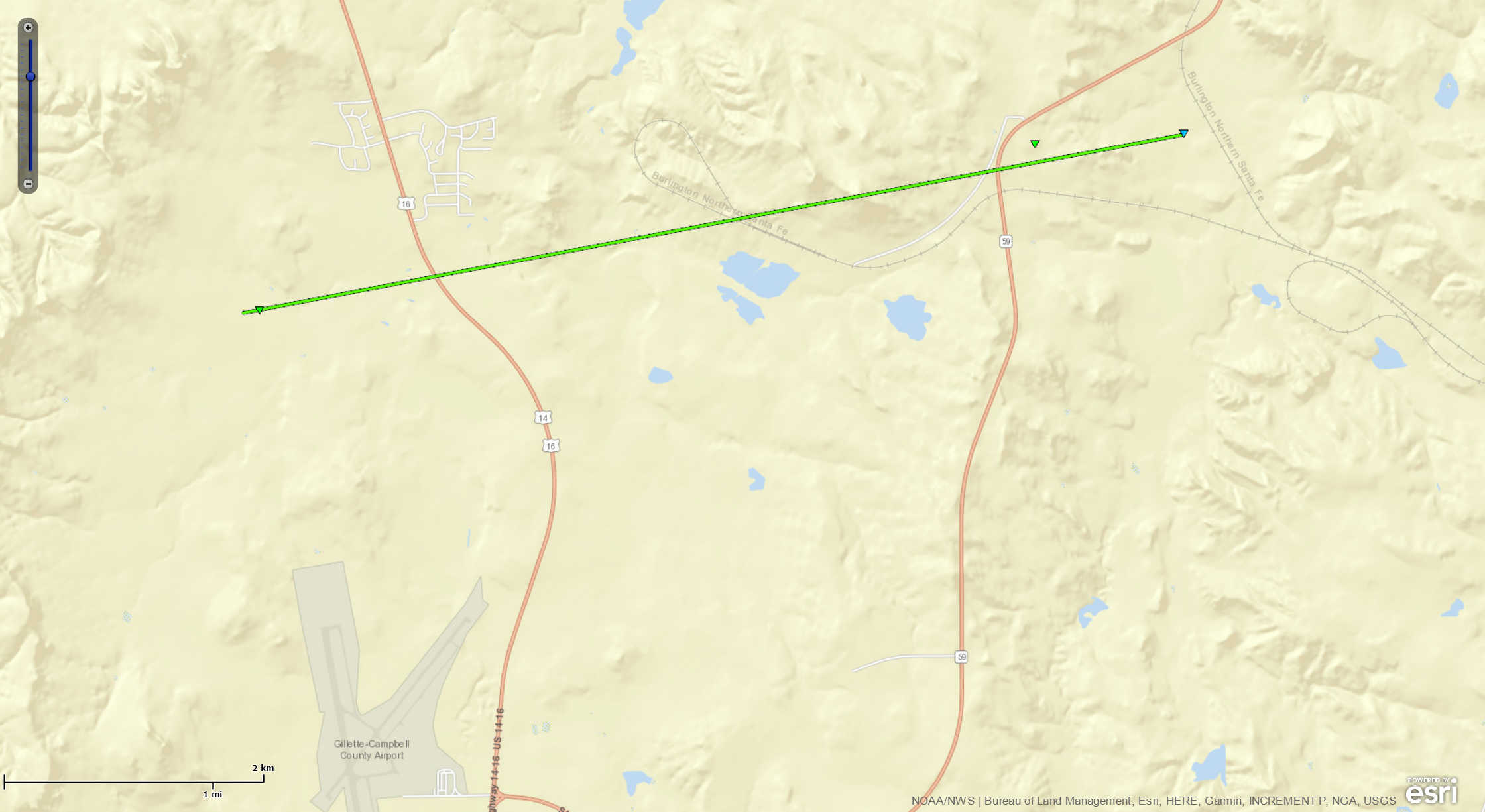
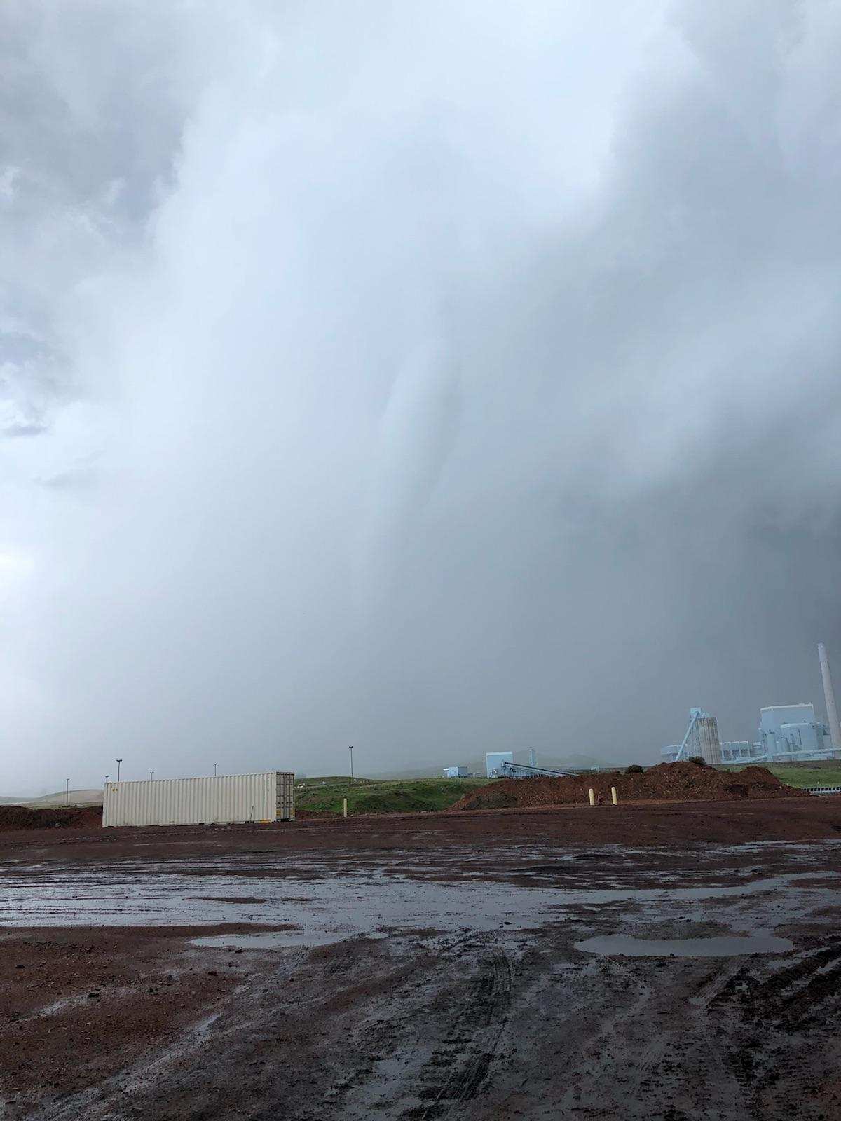
The fourth tornado touched down over the west pit of the Eagle Butte Mine at 1:59 pm MDT, about 7 miles north of Gillette. This tornado traveled in an east northeast direction for around 8 minutes before dissipating just east of the Dry Fork Power Plant around 2:07 pm MDT. This tornado snapped and bent over seven power poles, damaged the control room building at the mine, and damaged several vehicles at the Eagle Butte Mine and Dry Fork Power Plant. A dumpster was also thrown a few hundred yards. This damage has been rated EF-1, with winds estimated around 100 mph.
Tornadoes:
|
Tornado 1 - Gillette, WY
|
||||||||||||||||
|
Tornado 2 - Gillette, WY
|
||||||||||||||||
|
Tornado 3 - Gillette, WY
|
||||||||||||||||
|
Tornado 4 - Gillette, WY
|
||||||||||||||||
The Enhanced Fujita (EF) Scale classifies tornadoes into the following categories:
| EF0 Weak 65-85 mph |
EF1 Moderate 86-110 mph |
EF2 Significant 111-135 mph |
EF3 Severe 136-165 mph |
EF4 Extreme 166-200 mph |
EF5 Catastrophic 200+ mph |
 |
|||||
Tornado 1: EF-0 Tornado between Montgomery Road and Echeta Road
 |
| Looking south southwest from Oriva Hills Subdivision (photo courtesy of Cary Morris) |
Tornado 2: Oriva Hills Subdivision EF-3 Tornado
 |
 |
 |
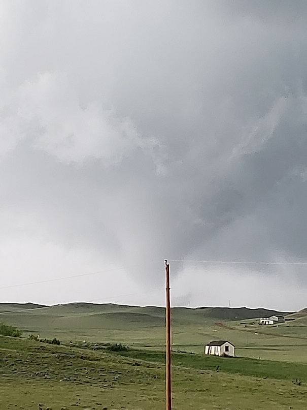 |
| Tornado Moving Through Oriva Hills (photo courtesy of Suzanne Hansen) |
Tornado Moving Through Oriva Hills (photo courtesy of Cody Brosa) |
Tornado Moving Through Oriva Hills (photo courtesy of Cody Brosa) |
Tornado Moving Through Oriva Hills (photo courtesy of Cody Brosa) |
 |
 |
 |
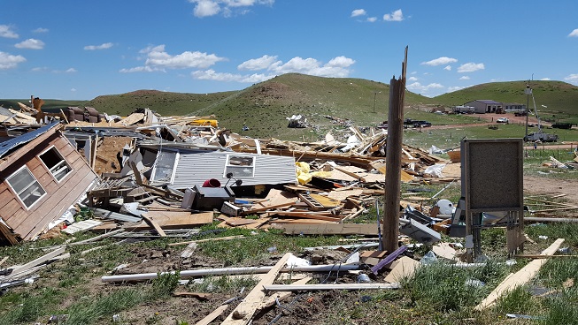 |
| Site of EF-3 Damage (NWS Storm Survey) |
Site of EF-3 Damage (NWS Storm Survey) |
Modular Home on Concrete Foundation (NWS Storm Survey) |
Modular Home on Concrete Foundation (NWS Storm Survey) |
 |
 |
 |
 |
| Modular Home on Concrete Foundation (NWS Storm Survey) |
First Damaged Home (NWS Storm Survey) |
Tied Down Modular Home (NWS Storm Survey) |
Dump Truck Thrown Over Ridge 150 yards (NWS Storm Survey) |
 |
 |
 |
 |
| Tied Down Modular Home (NWS Storm Survey) |
Snapped Electrical Poles (NWS Storm Survey) |
Reflectivity (storm intensity) (NWS WSR-88D Doppler Radar) |
Velocity (wind) (NWS WSR-88D Doppler Radar) |
🌪ï¸NEW VIDEO🌪ï¸
— Live Storm Chasers (@LiveStormChaser) June 1, 2018
Damaging tornado this afternoon across parts of Gillette, WY
Viewer Bailey D shared us these videos!
Date: 06-01-2018
Location: Gillette, WY#WYwx pic.twitter.com/hQxeTYhRKc
Tornado 3: Landspout North of Gillette
 |
 |
||
| Damage on Warrior Road (NWS Storm Survey) |
Damage on Warrior Road (NWS Storm Survey) |
Tornado 4: EF-1 Tornado over Eagle Butte Mine and Dry Fork Power Plant
 |
 |
 |
 |
| Photo of Tornado over Eagle Butte Mine Taken from Warrior Road (photo courtesy of Chad Worden) |
Photo of Tornado over Eagle Butte Mine (photo courtesy of Campbell County Emergency Management) |
Reflectivity (storm intensity) (NWS WSR-88D Doppler Radar) |
Velocity (wind) (NWS WSR-88D Doppler Radar) |
Storm Reports
PRELIMINARY LOCAL STORM REPORT...SUMMARY
NATIONAL WEATHER SERVICE RAPID CITY SD
404 PM MDT SUN JUN 03 2018

..TIME...   ...EVENT...      ...CITY LOCATION...     ...LAT.LON...
..DATE...   ....MAG....      ..COUNTY LOCATION..ST.. ...SOURCE....
            ..REMARKS..

0130 PM     FUNNEL CLOUD     12 W DOWNTOWN GILLETTE  44.29N 105.74W
06/01/2018                   CAMPBELL           WY   FIRE DEPT/RESCUE

0130 PM     HAIL             15 WNW DOWNTOWN GILLETT 44.36N 105.80W
06/01/2018  E1.00 INCH       CAMPBELL           WY   PUBLIC

0134 PM     TORNADO          11 W DOWNTOWN GILLETTE  44.30N 105.73W
06/01/2018                   CAMPBELL           WY   PUBLIC

            TORNADO WAS FROM 134 PM TO 138 PM. LOCATION AND TIME
            ESTIMATED FROM VIDEO.

0140 PM     HAIL             14 WNW DOWNTOWN GILLETT 44.37N 105.76W
06/01/2018  E1.50 INCH       CAMPBELL           WY   PUBLIC

0141 PM     TORNADO          10 WNW DOWNTOWN GILLETT 44.35N 105.69W
06/01/2018                   CAMPBELL           WY   NWS STORM SURVEY

            *** 2 INJ *** ...CORRECTED EVENT TIME... SEVERAL HOMES
            DAMAGED OR DESTROYED, ROLLED VEHICLES, ELECTRICAL
            TRANSMISSION LINES AND TREES SNAPPED. TORNADO WAS FROM
            141 PM TO 152 PM.

0155 PM     TORNADO          3 NNE DOWNTOWN GILLETTE 44.33N 105.48W
06/01/2018                   CAMPBELL           WY   NWS STORM SURVEY

            DAMAGED A LARGE SHED, FLIPPED A CAMPER ONTO A VEHICLE,
            DESTROYED ANOTHER CAMPER, AND DAMAGED SEVERAL WOODEN
            FENCES. SHORT LIVED LANDSPOUT FROM 155 PM TO 156 PM.

0159 PM     TORNADO          8 NNW DOWNTOWN GILLETTE 44.40N 105.54W
06/01/2018                   CAMPBELL           WY   NWS STORM SURVEY

            7 POWER POLES SNAPPED, DAMAGE TO CONTROL ROOM AT THE
            EAGLE BUTTE MINE, DAMAGE TO VEHICLES. TORNADO WAS FROM
            159 PM TO 207 PM.

0207 PM     FUNNEL CLOUD     10 N DOWNTOWN GILLETTE  44.44N 105.48W
06/01/2018                   CAMPBELL           WY   LAW ENFORCEMENT

0225 PM     HAIL             1 SSE DEVILS TOWER      44.58N 104.71W
06/01/2018  E1.50 INCH       CROOK              WY   TRAINED SPOTTER

0225 PM     HAIL             5 SW CARLILE            44.43N 104.87W
06/01/2018  E1.00 INCH       CROOK              WY   TRAINED SPOTTER

0230 PM     HAIL             HULETT                  44.68N 104.60W
06/01/2018  E1.00 INCH       CROOK              WY   TRAINED SPOTTER

            15-20 MINUTES OF HAIL... ALSO ESTIMATED 50 MPH WIND
            GUSTS

0230 PM     FUNNEL CLOUD     4 E DEVILS TOWER        44.60N 104.63W
06/01/2018                   CROOK              WY   FIRE DEPT/RESCUE

0235 PM     TSTM WND GST     2 SE HULETT             44.66N 104.57W
06/01/2018  M58 MPH          CROOK              WY   AWOS

0315 PM     HAIL             COLONY                  44.87N 104.16W
06/01/2018  E1.00 INCH       CROOK              WY   TRAINED SPOTTER

0330 PM     HAIL             5 SW KEYAPAHA           43.05N 100.20W
06/01/2018  E1.00 INCH       TODD               SD   PUBLIC

0346 PM     HAIL             2 SW KEYAPAHA           43.08N 100.16W
06/01/2018  E1.00 INCH       TRIPP              SD   PUBLIC

0349 PM     NON-TSTM WND GST 1 N BUFFALO             45.60N 103.55W
06/01/2018  M61 MPH          HARDING            SD   ASOS

0356 PM     TSTM WND GST     NEWELL                  44.72N 103.43W
06/01/2018  M61 MPH          BUTTE              SD   MESONET

0400 PM     HAIL             7 NW NEWELL             44.79N 103.52W
06/01/2018  E1.75 INCH       BUTTE              SD   PUBLIC

0400 PM     HAIL             2 N NEWELL              44.74N 103.42W
06/01/2018  E1.25 INCH       BUTTE              SD   TRAINED SPOTTER

            QUARTER TO HALF DOLLAR SIZED HAIL FROM 400 PM TO 408
            PM.

0406 PM     NON-TSTM WND GST 4 E DOWNTOWN SPEARFISH  44.48N 103.79W
06/01/2018  M58 MPH          LAWRENCE           SD   AWOS

0410 PM     NON-TSTM WND GST 7 NNE RALPH             45.86N 102.98W
06/01/2018  M63 MPH          HARDING            SD   DEPT OF HIGHWAYS

0430 PM     TSTM WND GST     1 ENE MUD BUTTE         45.01N 102.86W
06/01/2018  M75 MPH          MEADE              SD   DEPT OF HIGHWAYS

0440 PM     TSTM WND GST     1 ENE MUD BUTTE         45.01N 102.86W
06/01/2018  M59 MPH          MEADE              SD   DEPT OF HIGHWAYS

0445 PM     HAIL             2 ESE WINNER            43.36N  99.83W
06/01/2018  E1.00 INCH       TRIPP              SD   TRAINED SPOTTER

0445 PM     HEAVY RAIN       2 ESE WINNER            43.36N  99.83W
06/01/2018  M1.13 INCH       TRIPP              SD   TRAINED SPOTTER

0510 PM     NON-TSTM WND GST 3 NW WASTA              44.10N 102.50W
06/01/2018  M63 MPH          PENNINGTON         SD   DEPT OF HIGHWAYS

0510 PM     NON-TSTM WND GST 1 WSW RED ELM           45.05N 101.80W
06/01/2018  M63 MPH          ZIEBACH            SD   DEPT OF HIGHWAYS

0510 PM     NON-TSTM WND GST 1 NNE FAITH             45.04N 102.02W
06/01/2018  M70 MPH          MEADE              SD   ASOS

0542 PM     NON-TSTM WND GST 3 E PHILIP              44.05N 101.60W
06/01/2018  M62 MPH          HAAKON             SD   ASOS

0620 PM     NON-TSTM WND GST 8 S WALL                43.88N 102.24W
06/01/2018  M60 MPH          PENNINGTON         SD   MESONET


&&


The storm reports listed below are in descending order and may not
necessarily be the final storm reports.


Hail reports listed by size (inches)

 SIZE    LOCATION                 ST  COUNTY           TIME
 ------  -----------------------  --  --------------   -------
  1.75   7 NW NEWELL              SD  BUTTE            0400 PM
  1.50   1 SSE DEVILS TOWER       WY  CROOK            0225 PM
  1.50   14 WNW DOWNTOWN GILLETT  WY  CAMPBELL         0140 PM
  1.25   2 N NEWELL               SD  BUTTE            0400 PM
                 QUARTER TO HALF DOLLAR SIZED HAIL FROM 400 PM
                 TO 408 PM.
  1.00   2 ESE WINNER             SD  TRIPP            0445 PM
  1.00   2 SW KEYAPAHA            SD  TRIPP            0346 PM
  1.00   5 SW KEYAPAHA            SD  TODD             0330 PM
  1.00   COLONY                   WY  CROOK            0315 PM
  1.00   HULETT                   WY  CROOK            0230 PM
                 15-20 MINUTES OF HAIL... ALSO ESTIMATED 50
                 MPH WIND GUSTS
  1.00   5 SW CARLILE             WY  CROOK            0225 PM
  1.00   15 WNW DOWNTOWN GILLETT  WY  CAMPBELL         0130 PM


Tstm wind reports listed by speed (mph)

 SPEED   LOCATION                 ST  COUNTY           TIME
 ------  -----------------------  --  --------------   -------
 75.00   1 ENE MUD BUTTE          SD  MEADE            0430 PM
 61.00   NEWELL                   SD  BUTTE            0356 PM
 59.00   1 ENE MUD BUTTE          SD  MEADE            0440 PM
 58.00   2 SE HULETT              WY  CROOK            0235 PM


Rain amounts (inches)

 AMOUNT  LOCATION                 ST  COUNTY           TIME
 ------  -----------------------  --  --------------   -------
  1.13   2 ESE WINNER             SD  TRIPP            0445 PM


Wind gust reports listed by speed (mph)

 SPEED   LOCATION                 ST  COUNTY           TIME
 ------  -----------------------  --  --------------   -------
 70.00   1 NNE FAITH              SD  MEADE            0510 PM
 63.00   1 WSW RED ELM            SD  ZIEBACH          0510 PM
 63.00   3 NW WASTA               SD  PENNINGTON       0510 PM
 63.00   7 NNE RALPH              SD  HARDING          0410 PM
 62.00   3 E PHILIP               SD  HAAKON           0542 PM
 61.00   1 N BUFFALO              SD  HARDING          0349 PM
 60.00   8 S WALL                 SD  PENNINGTON       0620 PM
 58.00   4 E DOWNTOWN SPEARFISH   SD  LAWRENCE         0406 PM
 |
Media use of NWS Web News Stories is encouraged! Please acknowledge the NWS as the source of any news information accessed from this site. |
|