
Tropical Depression Two is expected to gradually strengthen and could bring tropical storm conditions to the Florida Panhandle beginning late Monday. Areas of flash flooding will be possible through Thursday along the eastern and central Gulf Coast. Severe thunderstorms will develop and move along a cold front crossing the Upper Midwest Monday, and through the Ohio Valley/Mid-Atlantic on Tuesday. Read More >
Overview
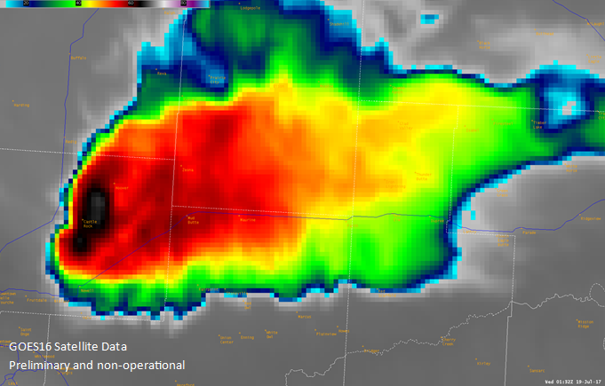
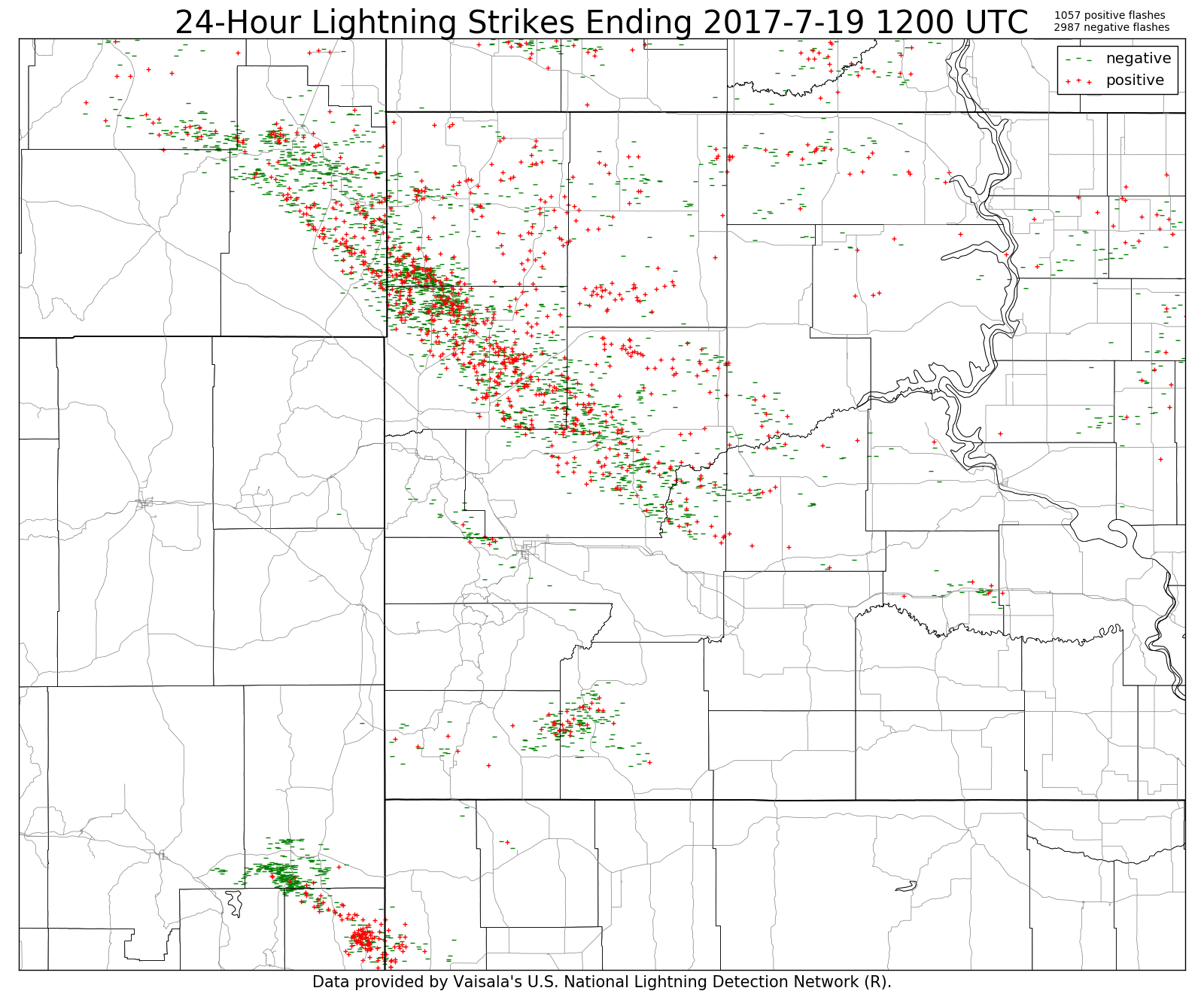
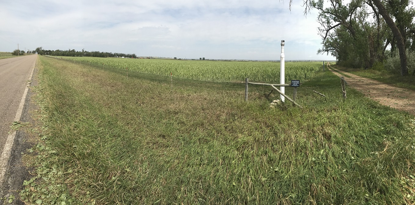
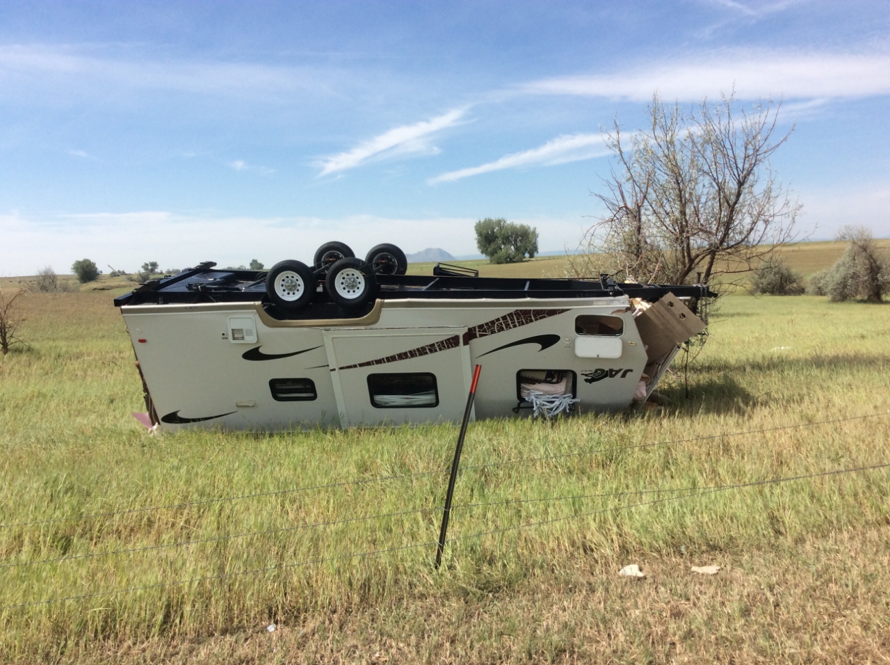
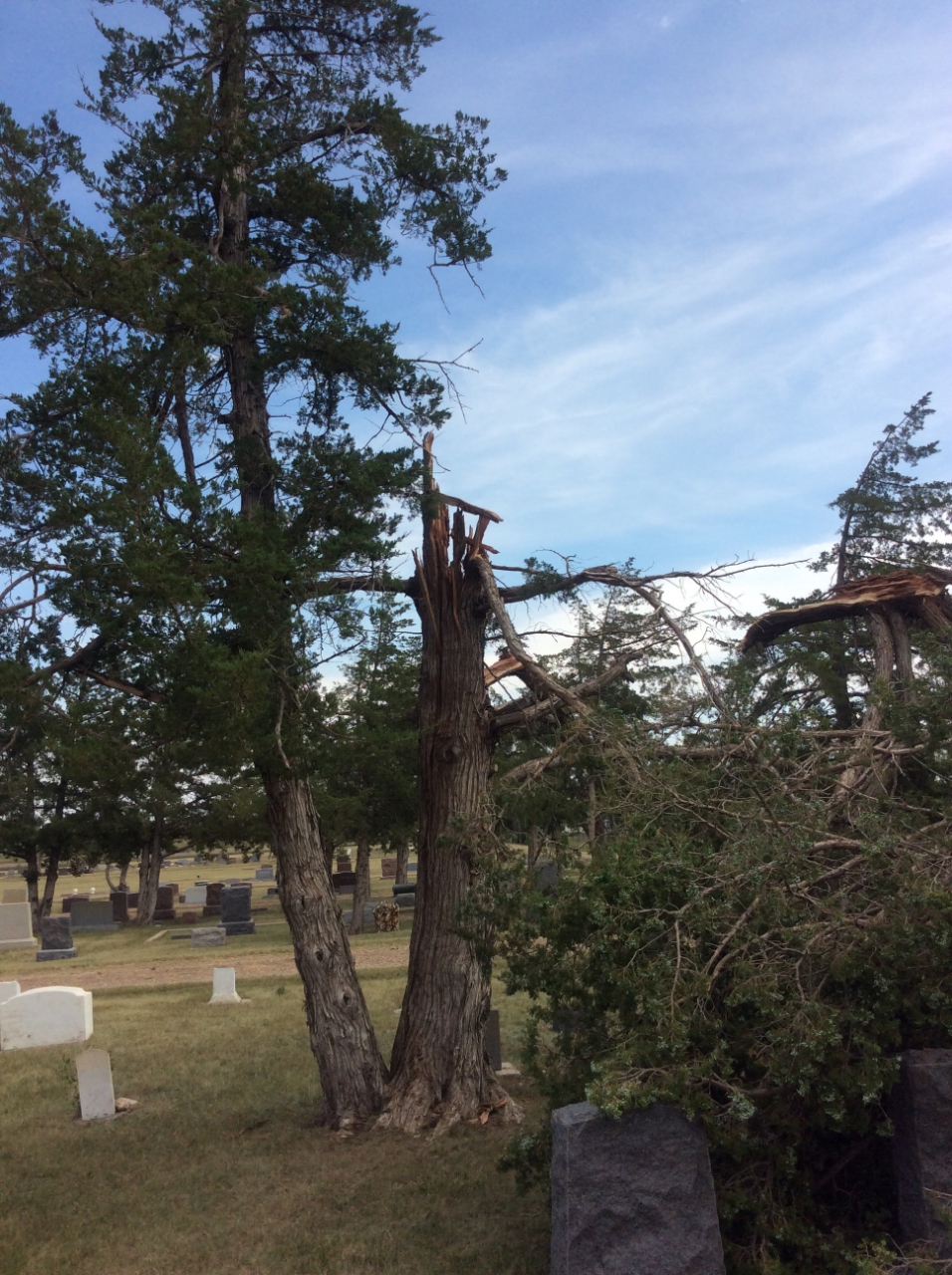
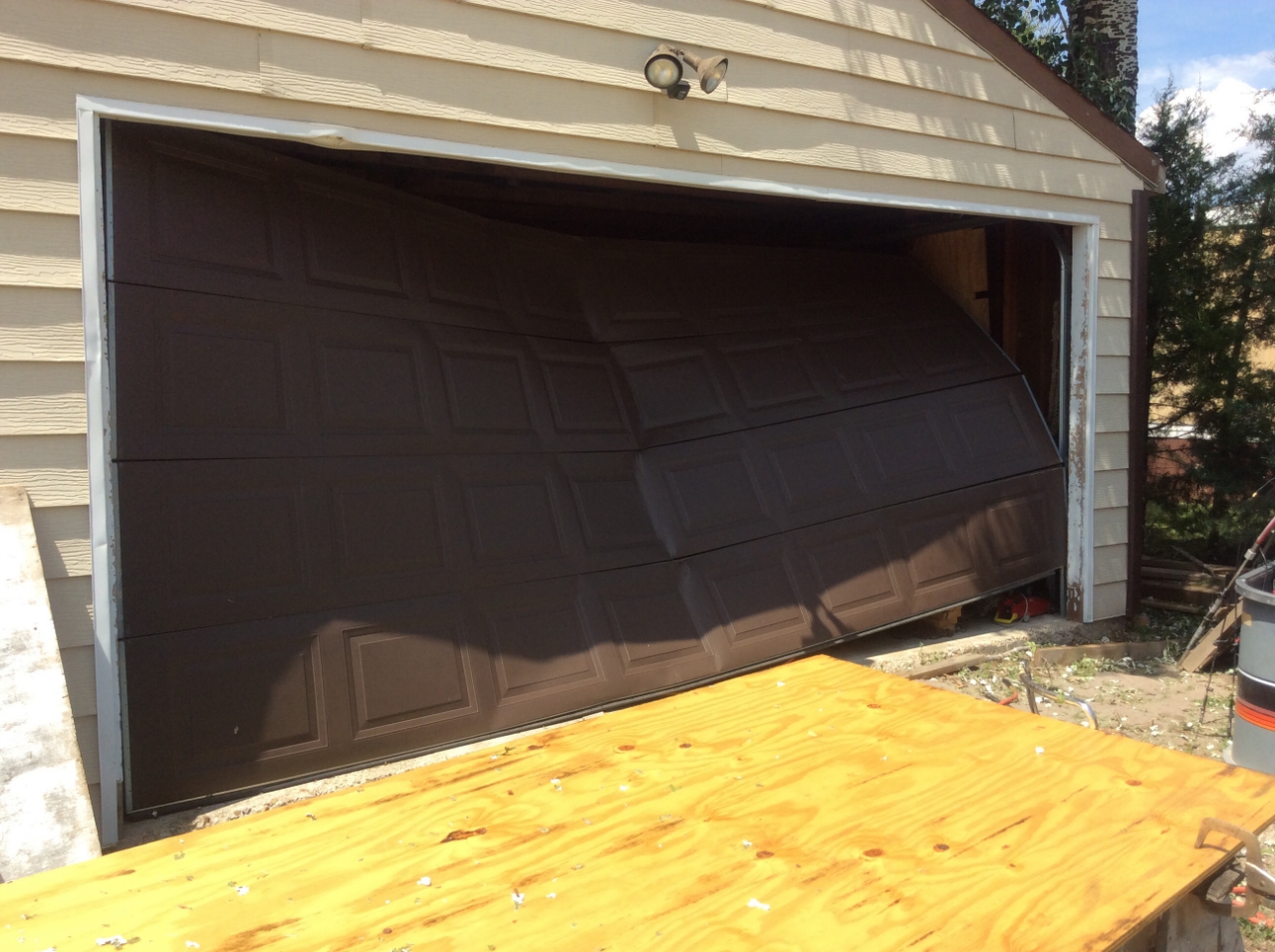
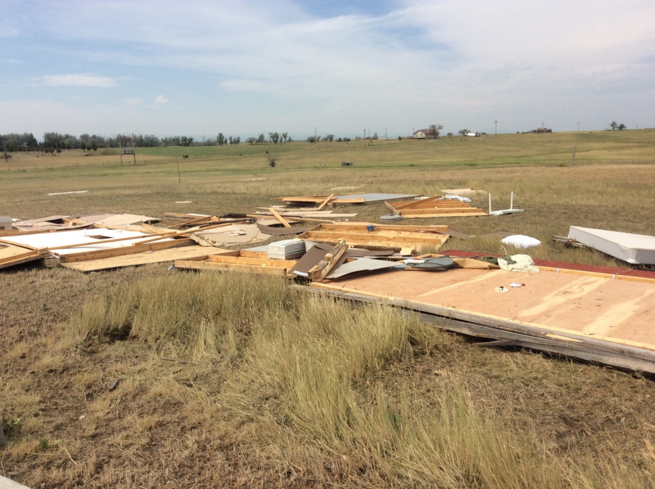
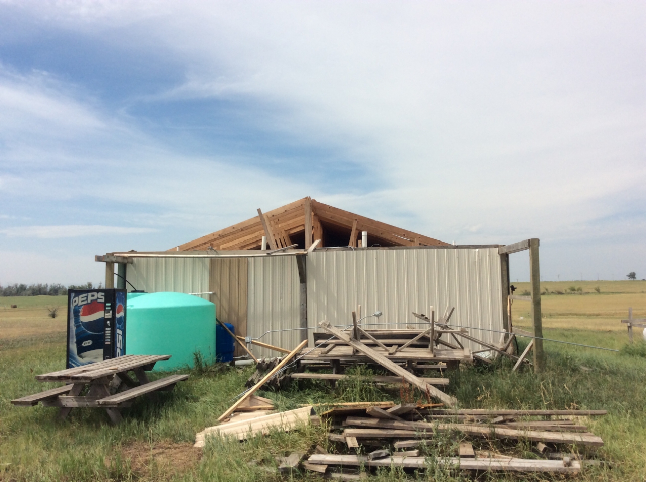
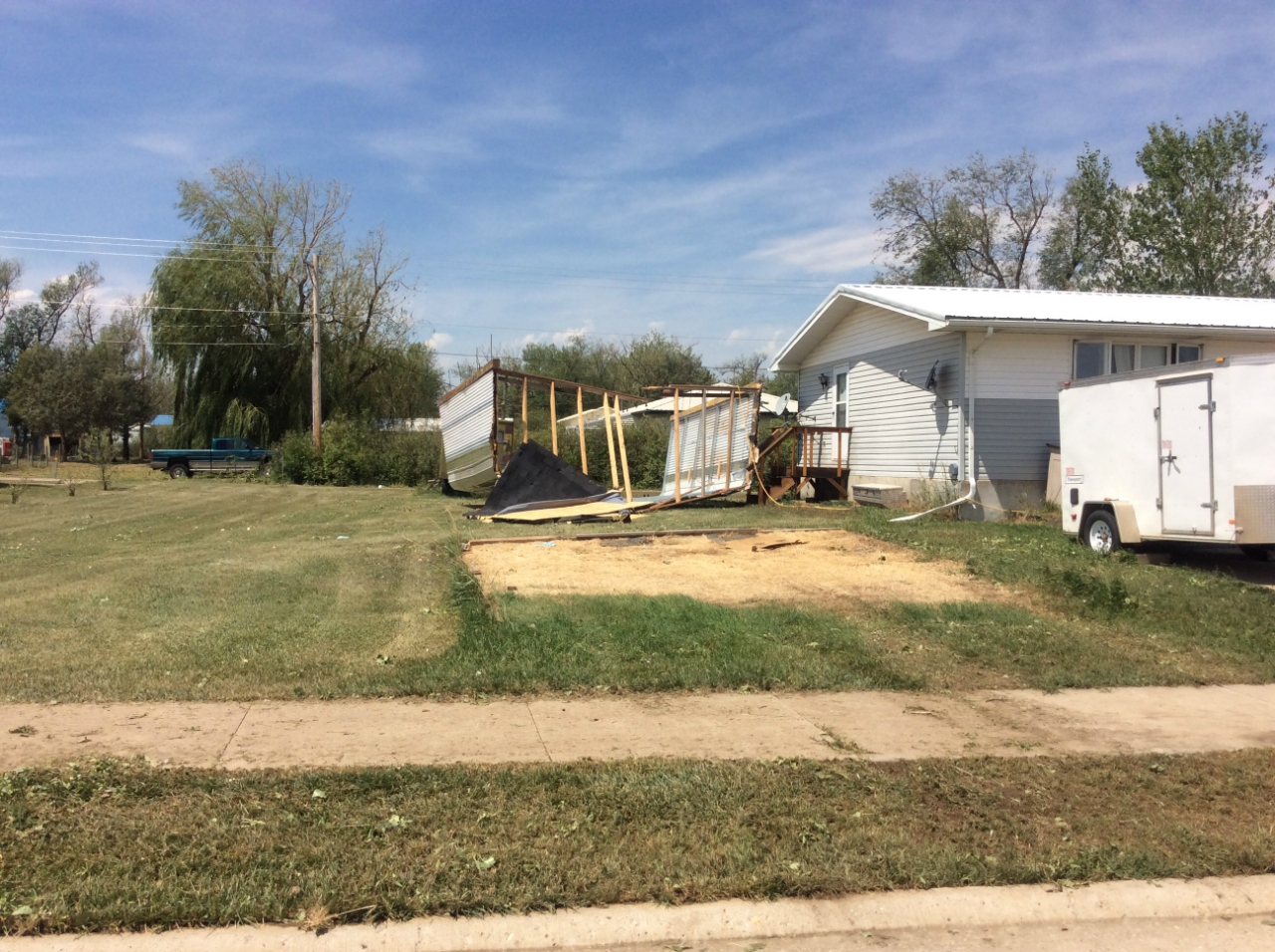
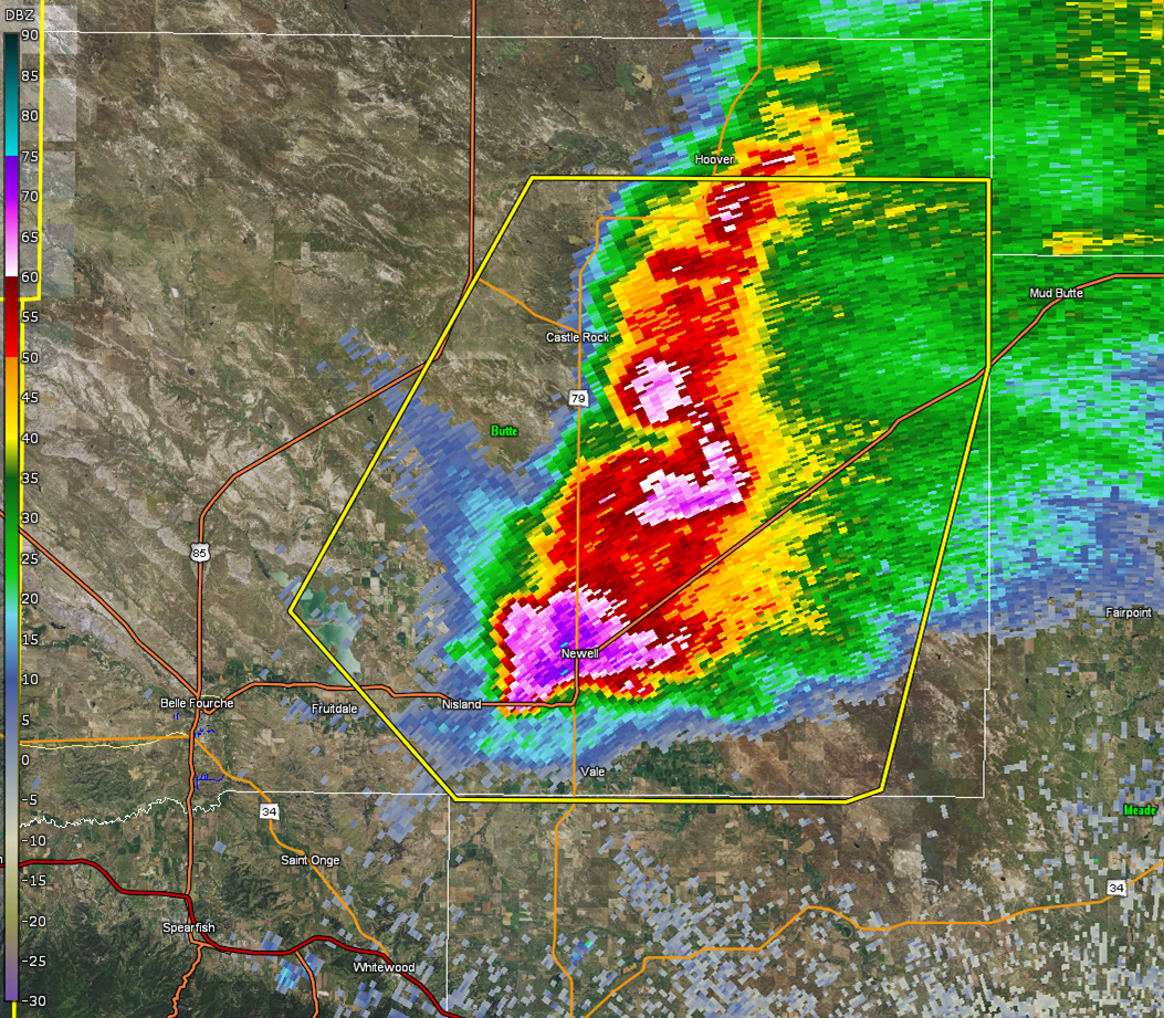
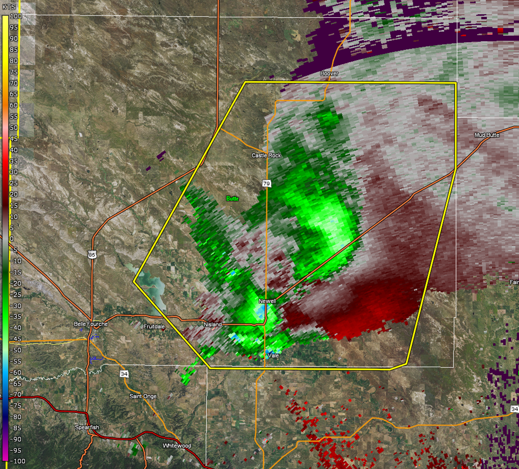
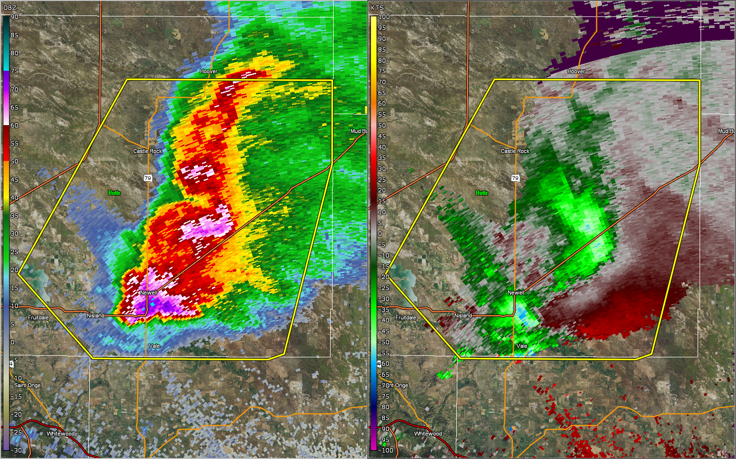
During the evening of Tuesday, July 18, 2017, a supercell moved from southeastern Montana into northwestern South Dakota. It strengthened as it moved over the Newell area, dropping up to baseball sized hail, with wind gusts of 90 to 100 mph. A wind sensor in Newell broke with a measured wind gust of 93 mph. These strong winds and large hail caused damage around the Newell and Vale areas. Buildings and campers were tipped over, homes and businesses were damaged, and trees and crops were destroyed. A storm survey was completed on Wednesday, July 19th, and several pictures were taken of the damage.
Infrared and Lightning Imagery
 |
 |
||
| Infrared Imagery | 24 Hr Lightning Strikes |
Photos:
Damage from the Newell/Vale Area
 |
 |
 |
 |
| Corn Damage (3 E Vale) |
Flipped Camper (1.5 E Vale) |
Damaged Tree (1 S Newell) |
Damaged Garage Door (Newell) |
 |
 |
 |
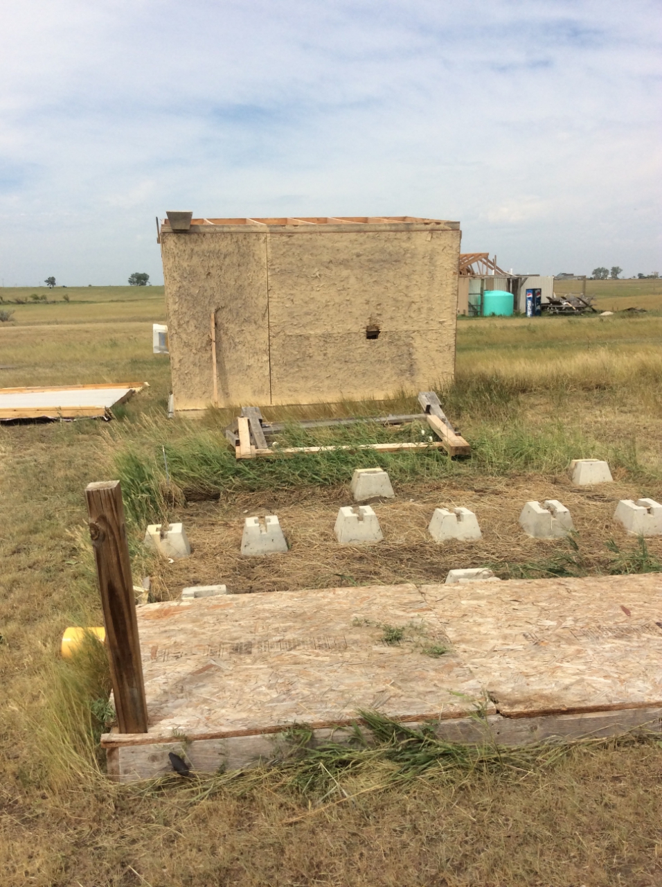 |
| Destroyed Buildings (1/2 S Newell) |
Roof Damage (1/2 S Newell) |
Flipped Carport (Newell) |
Flipped Building (1/2 S Newell) |
Radar:

 |
 |
 |
|
| Reflectivity at 731 PM MDT | Velocity at 731 PM MDT | Reflectivity/Velocity at 733 PM MDT |
Storm Reports
THE STORM REPORTS LISTED BELOW ARE IN DESCENDING ORDER AND MAY NOT NECESSARILY
BE THE FINAL STORM REPORTS.

HAIL REPORTS LISTED BY SIZE (INCHES)

 SIZE    LOCATION                 ST  COUNTY           TIME
 ------  -----------------------  --  --------------   -------
  2.75   NEWELL                   SD  BUTTE            0730 PM
                 RELAYED BY NWS EMPLOYEE...SIGNIFICANT WIND
                 AND HAIL DAMAGE AROUND TOWN
  2.00   4 SW NEWELL              SD  BUTTE            0732 PM
                 ALSO HAD 50 MPH WINDS
  1.75   1 E VALE                 SD  BUTTE            0751 PM
  1.75   3 S NEWELL               SD  BUTTE            0735 PM
  1.75   NEWELL                   SD  BUTTE            0730 PM
                 CAR WINDOWS BROKEN... SOME HOUSE WINDOWS
                 BROKEN
  1.25   NEWELL                   SD  BUTTE            0730 PM
  1.00   17 W CASTLE ROCK         SD  BUTTE            0657 PM
  1.00   28 NNW BELLE FOURCHE RES SD  BUTTE            0635 PM
  0.88   7 WNW NEWELL             SD  BUTTE            0725 PM
  0.75   16 NW HEREFORD           SD  MEADE            0808 PM

TSTM WIND REPORTS LISTED BY SPEED (MPH)

 SPEED   LOCATION                 ST  COUNTY           TIME
 ------  -----------------------  --  --------------   -------
 93.00   NEWELL                   SD  BUTTE            0730 PM
                 WIND SENSOR DESTROYED BY HAIL AFTER RECORDING
                 GUST
 75.00   6 NNW HEREFORD           SD  MEADE            0830 PM
 70.00   16 NW HEREFORD           SD  MEADE            0808 PM
 68.00   3 W UNION CENTER         SD  MEADE            0825 PM
 65.00   5 ESE ELM SPRINGS        SD  MEADE            0900 PM
 60.00   1 N HEREFORD             SD  MEADE            0835 PM
 60.00   7 WNW NEWELL             SD  BUTTE            0725 PM
 60.00   17 W CASTLE ROCK         SD  BUTTE            0657 PM
 60.00   28 NNW BELLE FOURCHE RES SD  BUTTE            0635 PM
 60.00   8 WSW HARDING            SD  HARDING          0610 PM
 60.00   4 N SILVER CITY          SD  PENNINGTON       0525 PM
 55.00   27 WNW CASTLE ROCK       SD  BUTTE            0616 PM
 51.00   8 N REDIG                SD  HARDING          0700 PM

RAIN AMOUNTS (INCHES)

 AMOUNT  LOCATION                 ST  COUNTY           TIME
 ------  -----------------------  --  --------------   -------
  1.50   NEWELL                   SD  BUTTE            0730 PM
                 FELL IN ABOUT 30 MINUTES
 |
Media use of NWS Web News Stories is encouraged! Please acknowledge the NWS as the source of any news information accessed from this site. |
|

