Heavy rainfall capable of causing flash flooding will continue to impact Hawaii through Monday. Severe thunderstorms and heavy rain are possible in parts of Texas and the southern Plains and the Upper Great Lakes. Heavy mountain snow continues in California's Sierra Nevada and rain with gusty winds to lower elevations. Super Typhoon Sinlaku will impact the Marianas through midweek. Read More >
Overview
February 23-24, 2017 - A snowstorm developed early in the morning of February 23 and persisted until the early morning of February 24. Heavy snow fell over parts of northeast Wyoming and southern South Dakota.Snow/Ice
SNOW REPORTS LISTED BY AMOUNT

 INCHES  LOCATION                 ST  COUNTY           TIME
 ------  -----------------------  --  --------------   -------
 15.00   4 E KEYAPAHA             SD  TRIPP            0112 PM
 12.00   14 SSW PROVO             SD  FALL RIVER       1043 AM
 11.00   5 ENE DOWNTOWN CUSTER    SD  CUSTER           0751 AM
 10.00   WRIGHT                   WY  CAMPBELL         1049 AM
  8.50   5 S HILL CITY            SD  PENNINGTON       0744 AM
  8.00   1 E CLARETON             WY  WESTON           1141 AM
  8.00   7 E LAKEVIEW             SD  TODD             1043 AM
  8.00   1 S LAKEVIEW             SD  TODD             0843 AM
  8.00   1 ENE MILLBORO           SD  TRIPP            0400 AM
  7.00   6 NW CLEARFIELD          SD  TRIPP            0112 PM
  7.00   7 W HERMOSA              SD  CUSTER           0712 AM
  6.00   2 E DOWNTOWN STURGIS     SD  MEADE            0118 PM
  6.00   7 W DOWNTOWN RAPID CITY  SD  PENNINGTON       0700 AM
  5.90   HILL CITY                SD  PENNINGTON       0800 AM
  5.50   5 SSW DOWNTOWN RAPID CI  SD  PENNINGTON       1248 PM
  5.50   HILL CITY                SD  PENNINGTON       0759 AM
  5.40   4 NE ROCKERVILLE         SD  PENNINGTON       0710 AM
  5.00   4 WNW NEMO               SD  LAWRENCE         1149 AM
  5.00   10 WNW DOWNTOWN RAPID C  SD  PENNINGTON       0700 AM
  4.80   1 SSW DOWNTOWN HOT SPRI  SD  FALL RIVER       0700 AM
  4.50   2 SSE DOWNTOWN RAPID CI  SD  PENNINGTON       1034 AM
  4.50   3 ENE KYLE               SD  OGLALA LAKOTA    0743 AM
  4.50   20 ENE MARTIN            SD  BENNETT          0700 AM
  4.40   1 E DOWNTOWN RAPID CITY  SD  PENNINGTON       0450 AM
  4.20   4 NNW WHITEWOOD          SD  LAWRENCE         1035 AM
  4.20   4 NNW WHITEWOOD          SD  LAWRENCE         0530 AM
  4.00   3 NE WHITEWOOD           SD  LAWRENCE         1256 PM
  4.00   8 E SMITHWICK            SD  FALL RIVER       1042 AM
  4.00   5 E PORCUPINE            SD  OGLALA LAKOTA    0300 AM
  4.00   4 NE ROCKERVILLE         SD  PENNINGTON       0507 PM
  3.50   3 SSE WHITE RIVER        SD  MELLETTE         1054 AM
  3.50   6 SSW LEAD               SD  LAWRENCE         1040 AM
  3.50   5 E PIEDMONT             SD  MEADE            1036 AM
  3.00   6 W WANBLEE              SD  JACKSON          1201 PM
  3.00   2 NW BUFFALO GAP         SD  CUSTER           1115 AM
  3.00   4 SE FOLSOM              SD  CUSTER           1111 AM
  3.00   4 W MOSHER               SD  MELLETTE         1051 AM
  3.00   8 W DOWNTOWN HOT SPRING  SD  FALL RIVER       1047 AM
  3.00   16 W MARTIN              SD  BENNETT          1037 AM
  3.00   4 NW DOWNTOWN RAPID CIT  SD  PENNINGTON       0803 AM
  3.00   RAPID CITY AIRPORT       SD  PENNINGTON       0510 AM
  2.50   LEAD                     SD  LAWRENCE         1153 AM
  2.50   7 W CEDAR BUTTE          SD  MELLETTE         1057 AM
  2.00   8 NNE BOX ELDER          SD  MEADE            1039 AM
  2.00   DOWNTOWN SPEARFISH       SD  LAWRENCE         1038 AM
  2.00   7 SW BROWNSVILLE         SD  LAWRENCE         0504 AM
  1.20   19 SW UPTON              WY  WESTON           1042 AM
  1.10   2 SW HAMILL              SD  TRIPP            1042 AM
  1.00   EDGEMONT                 SD  FALL RIVER       1041 AM
  1.00   6 SW LADNER              SD  HARDING          0935 AM
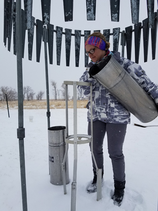
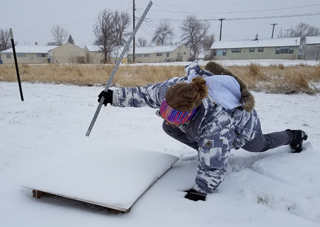
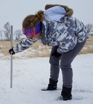
Measuring Snow
One of our meteorologists measures the snow around lunch time February 23, 2017.


Radar Loop
| Radar animation of the event starting in the evening on February 23, 2017, and ending in the early morning hours of February 24, 2017 |
 |
Media use of NWS Web News Stories is encouraged! Please acknowledge the NWS as the source of any news information accessed from this site. |
 |