Tropical Depression Two is expected to gradually strengthen and could bring tropical storm conditions to the Florida Panhandle beginning late Monday. Areas of flash flooding will be possible through Thursday along the eastern and central Gulf Coast. Severe thunderstorms will develop and move along a cold front crossing the Upper Midwest Monday, and through the Ohio Valley/Mid-Atlantic on Tuesday. Read More >
Overview
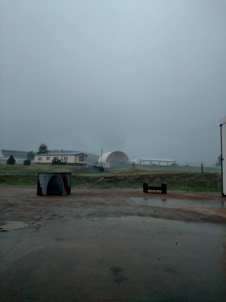
During the afternoon of June 13 2016, a tornado touched down about 3 miles northwest of Hermosa at 4:22 pm MDT. The tornado traveled in a northeast direction and was on the ground for approximately 12 minutes. The tornado dissipated about 6 miles northeast of Hermosa.
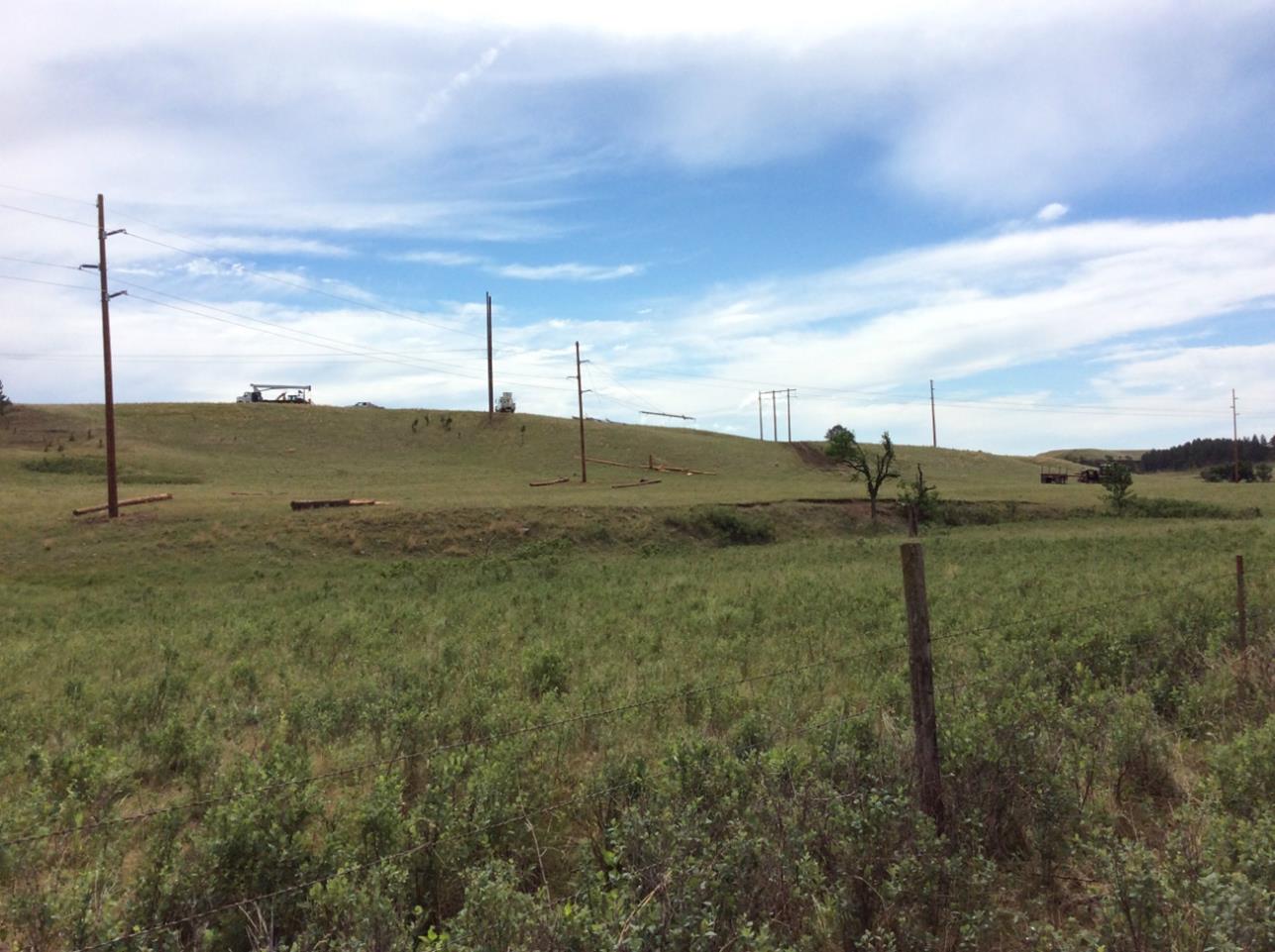
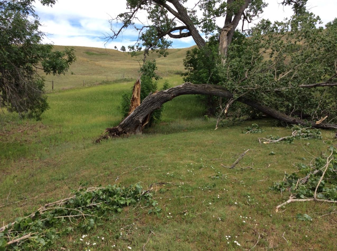
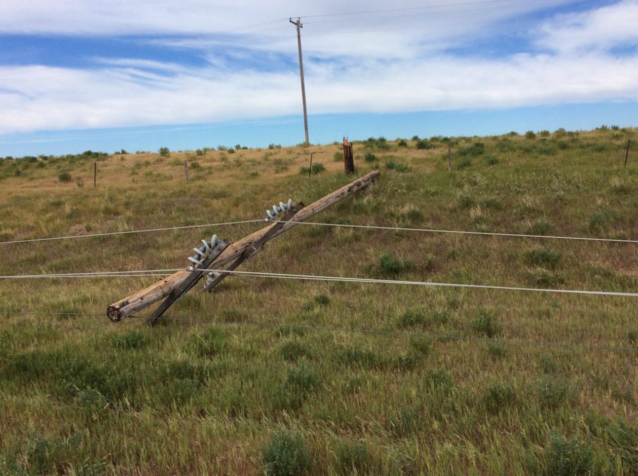
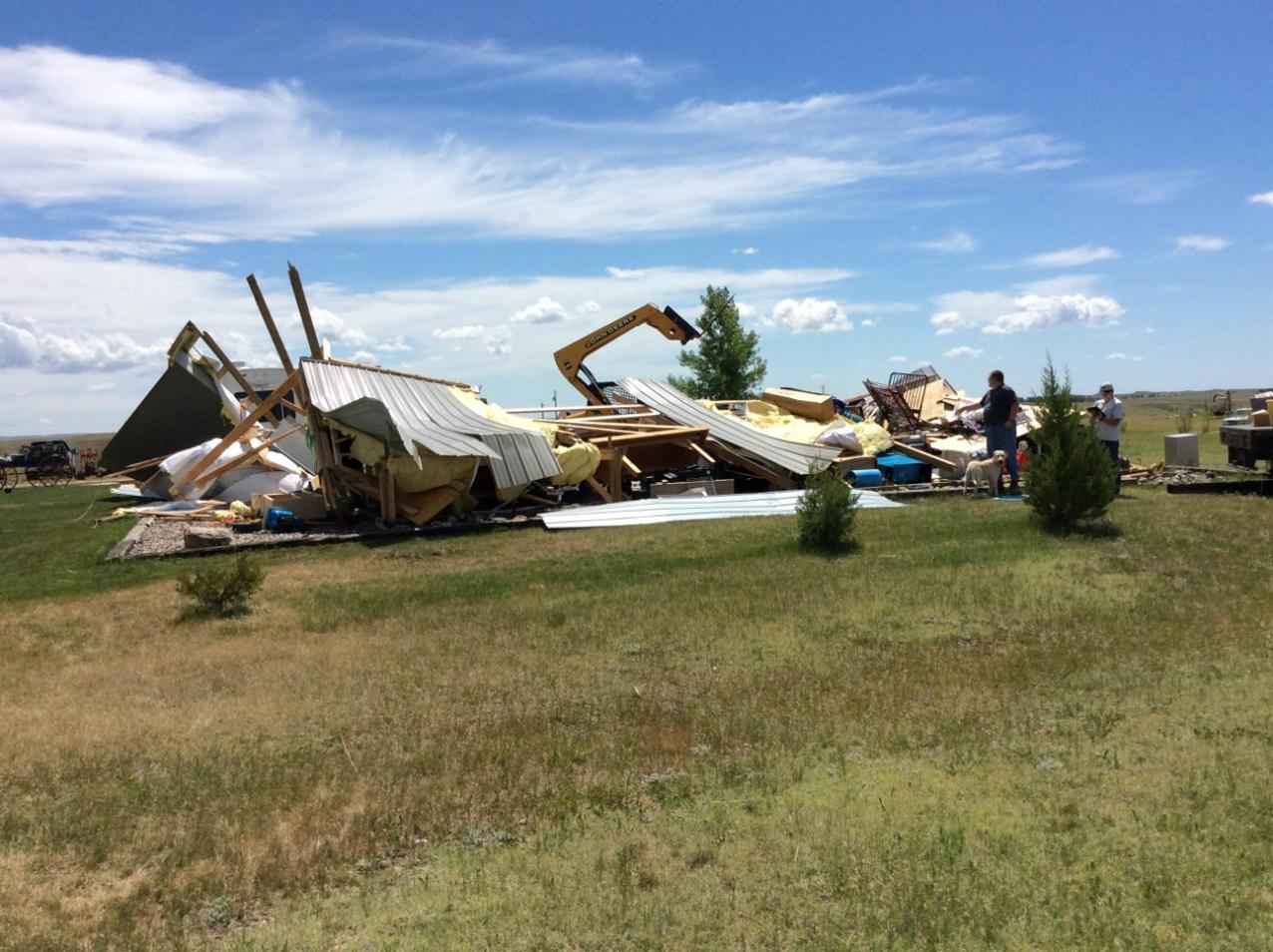
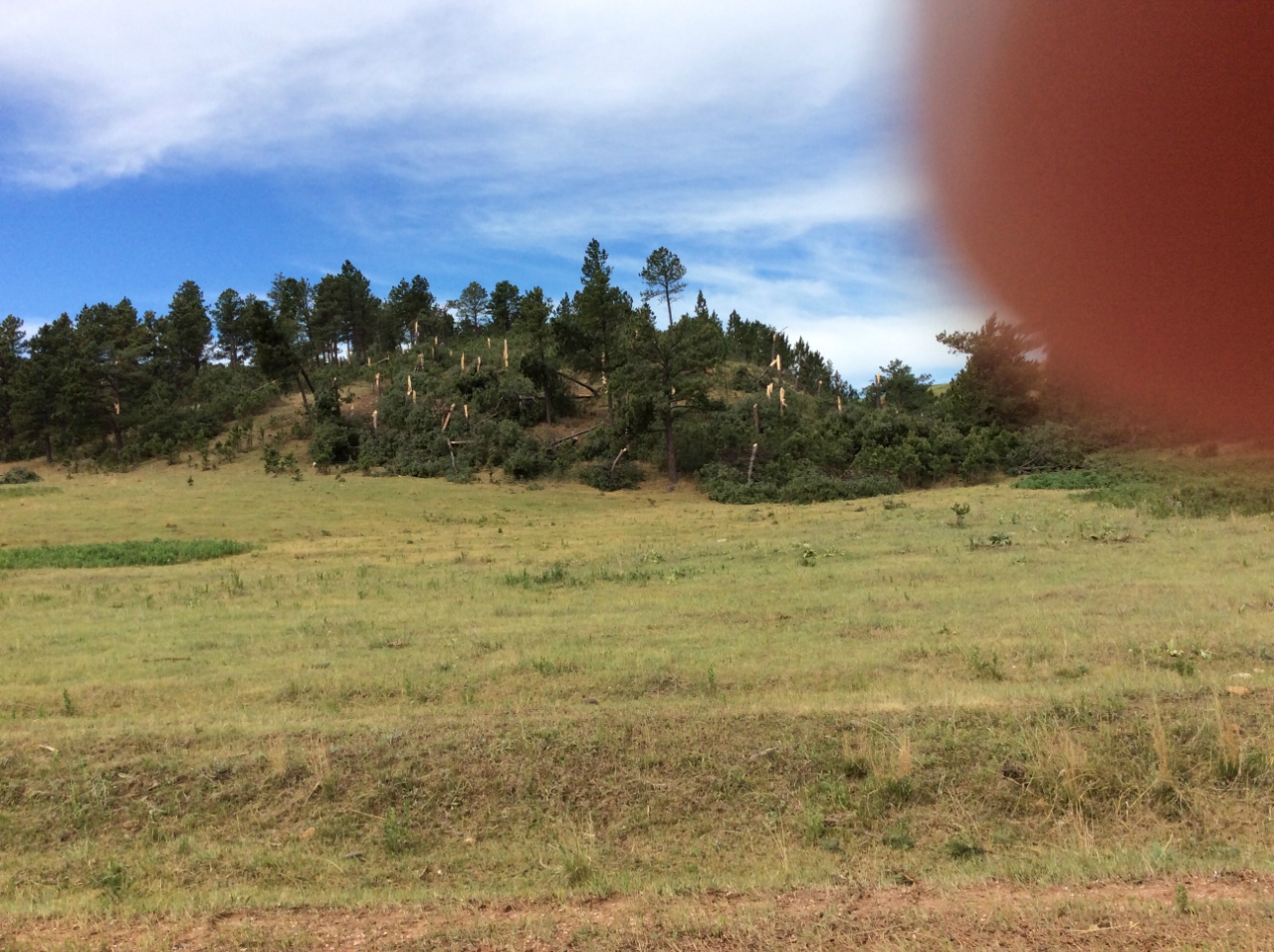
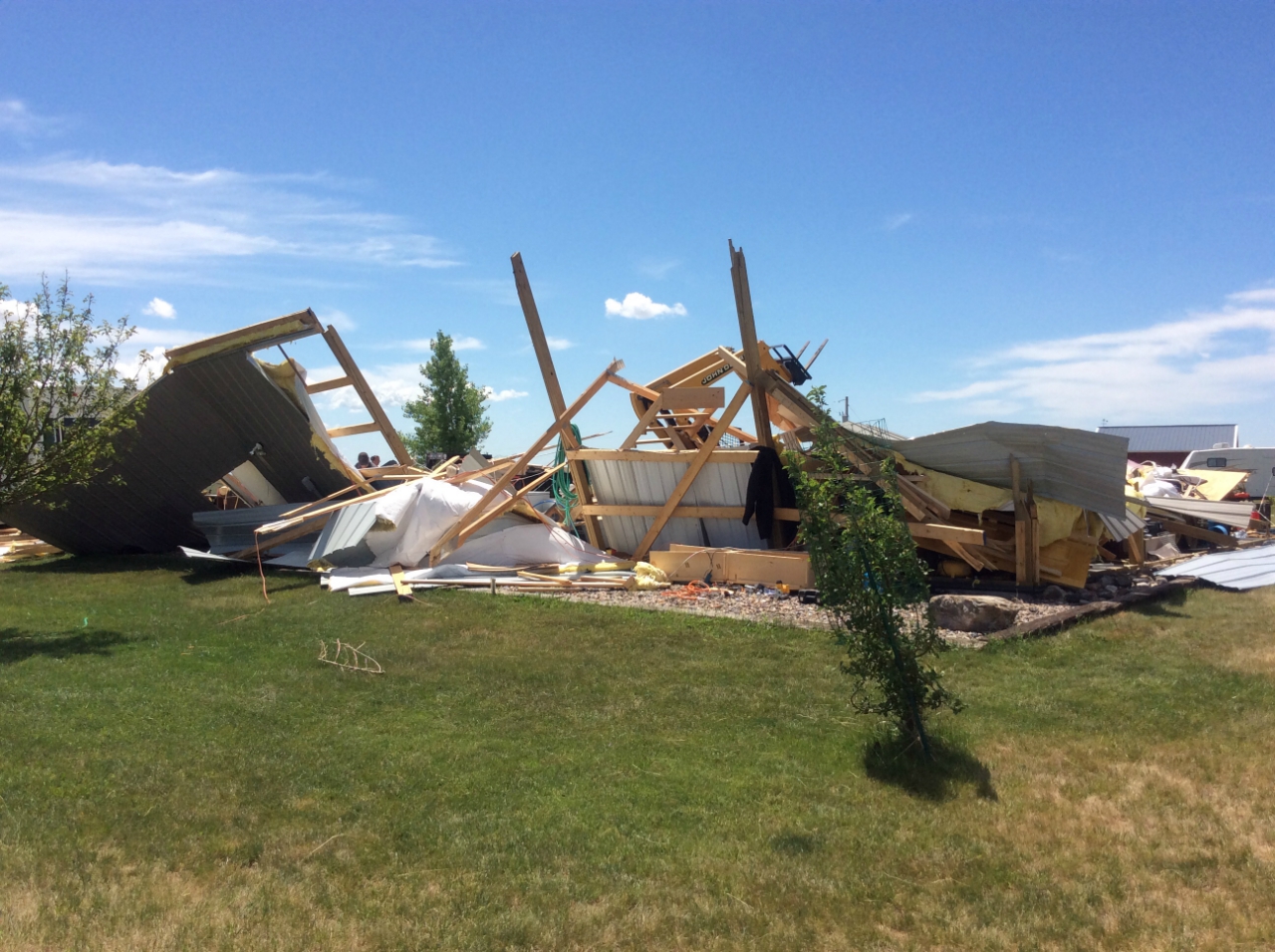
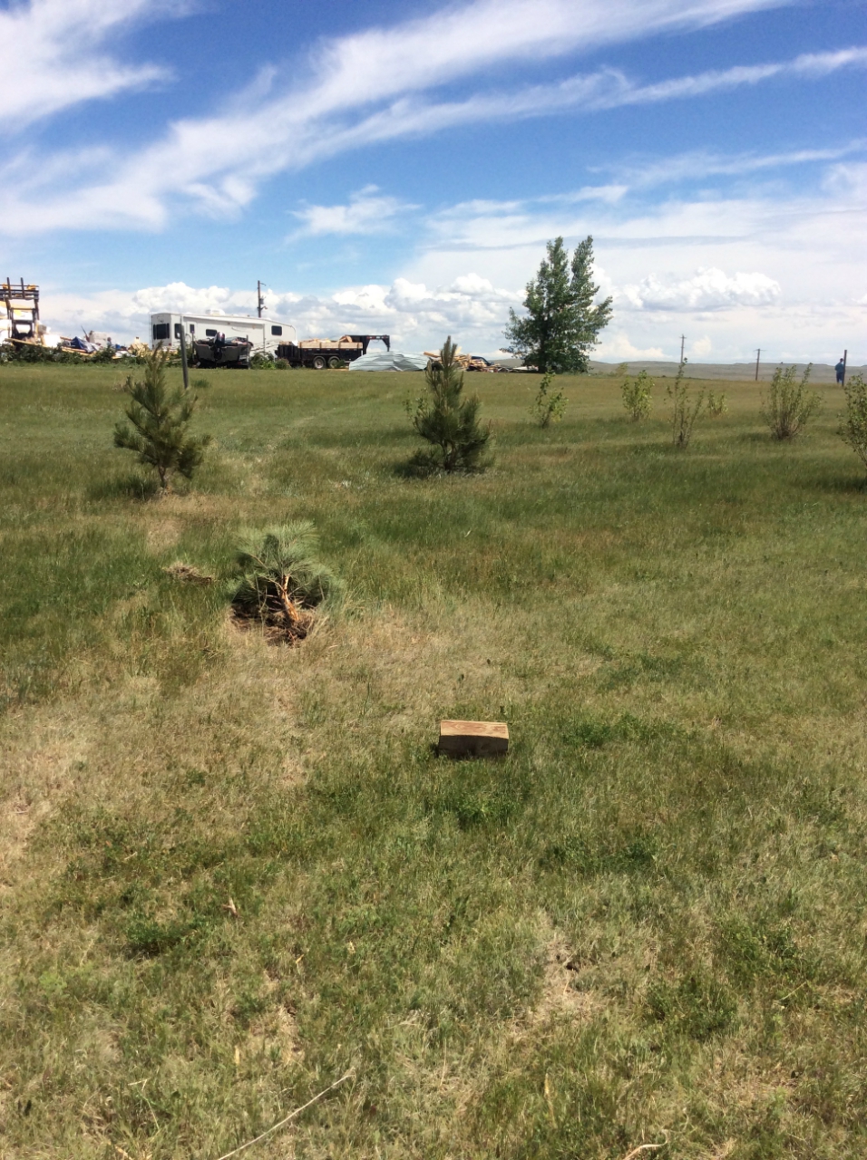
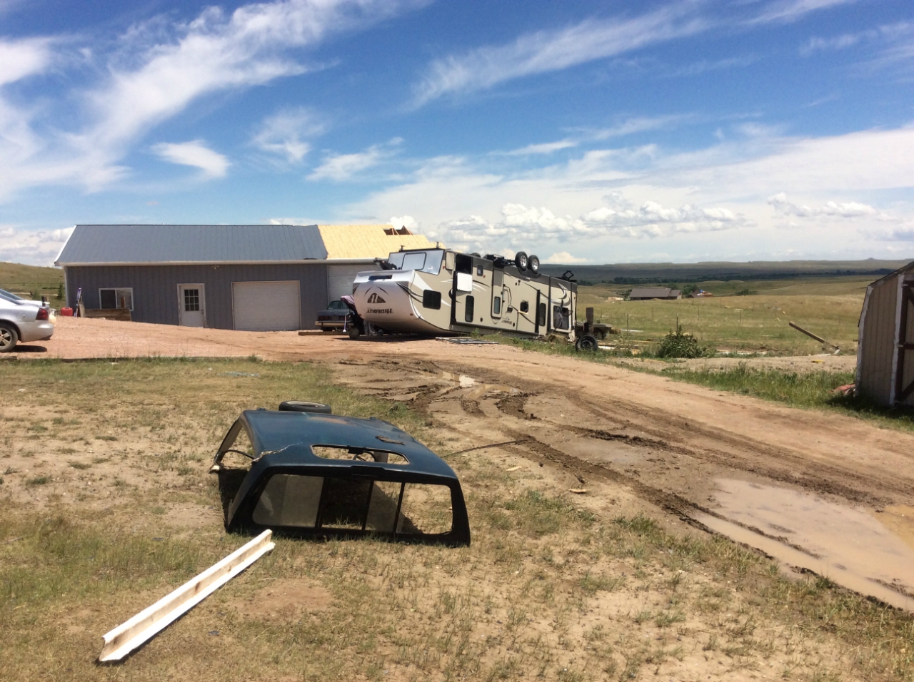
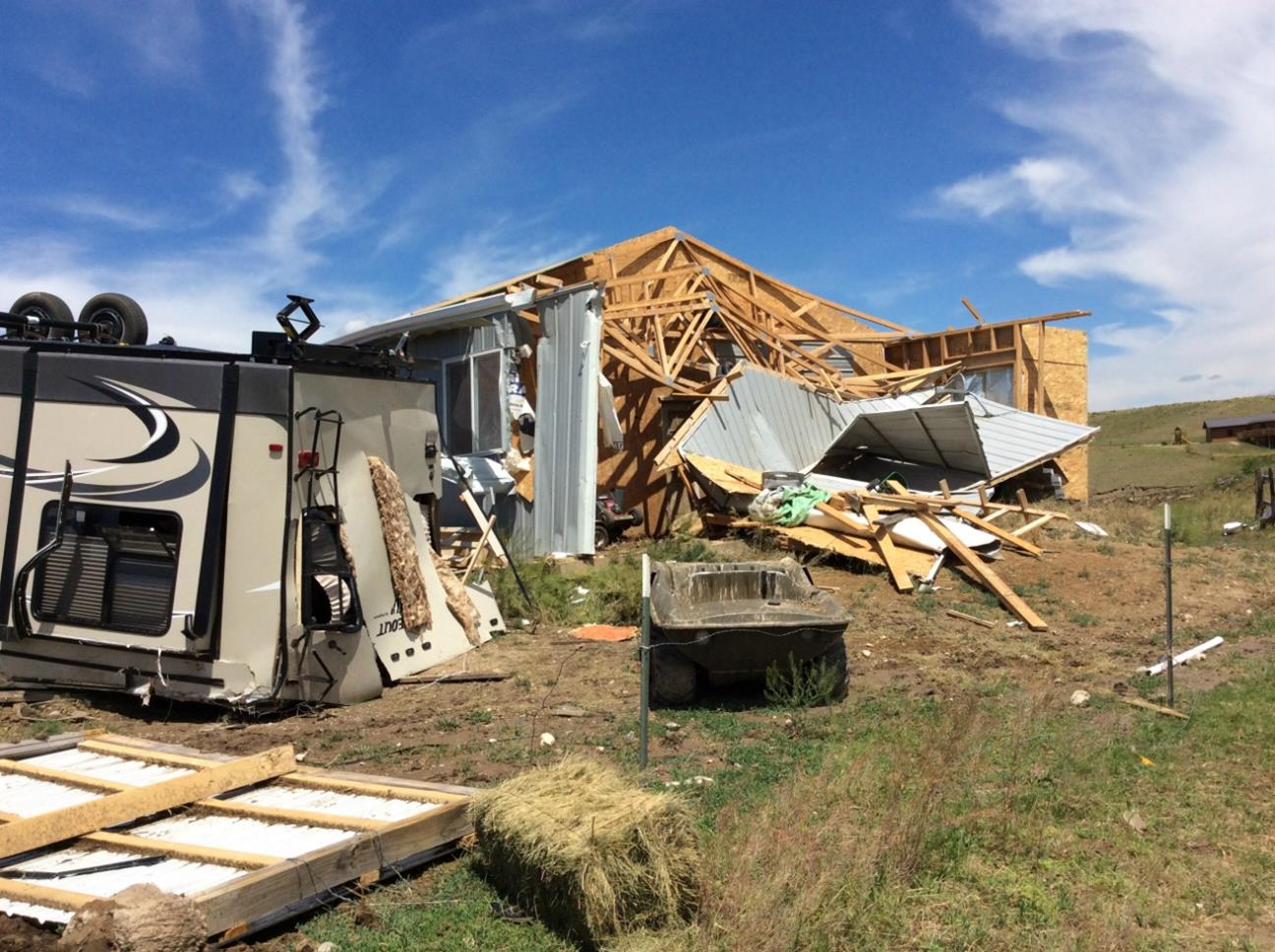
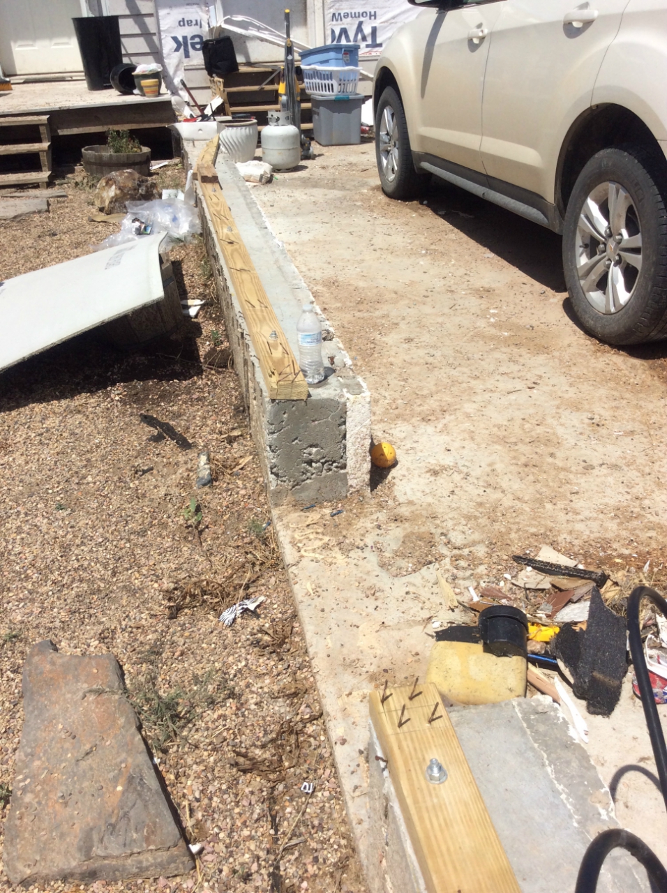
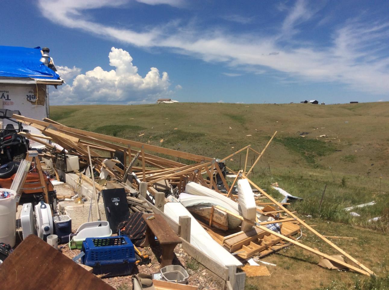
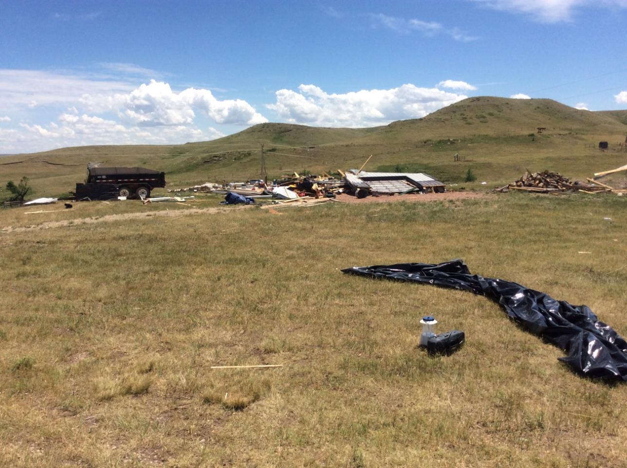
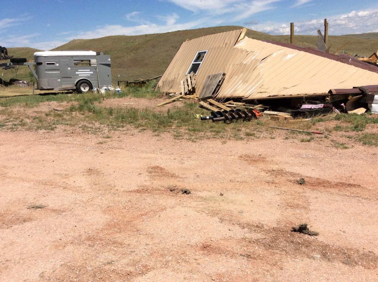
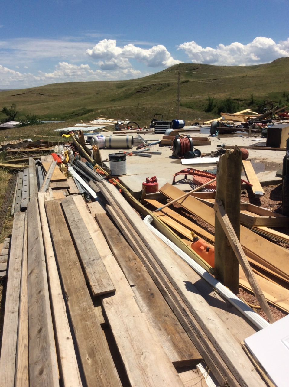
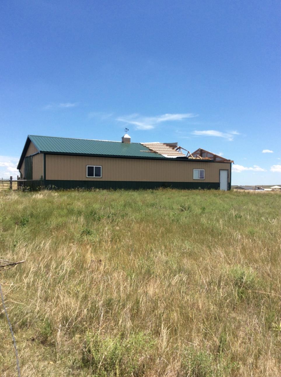
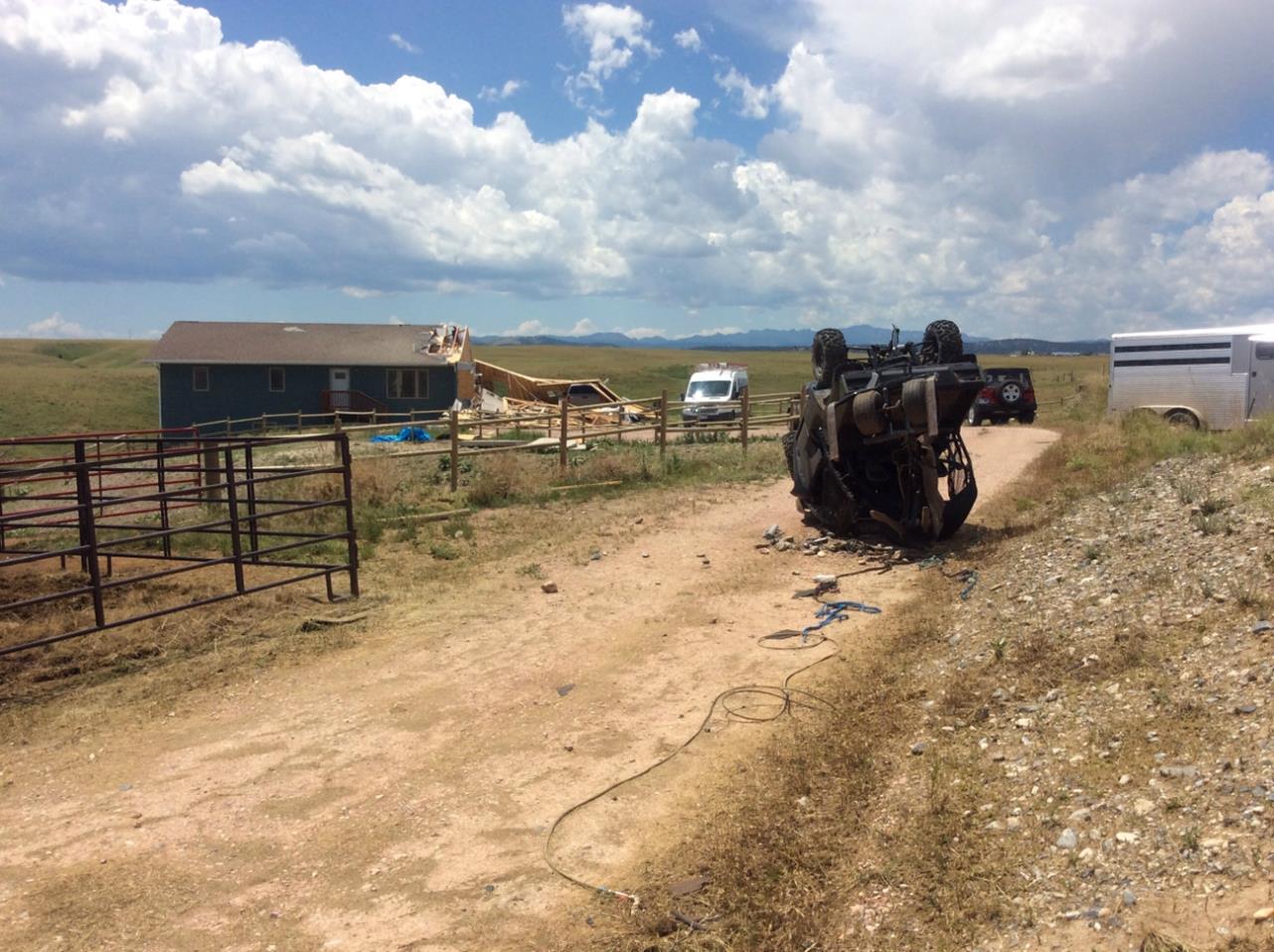
The tornado initially touched down in a wooded area along Murphy Road, where numerous pine trees were snapped. As the tornado tracked northeast, it snapped several power poles along Highway 79. As the tornado entered the Spring Creek Acres subdivision, several homes were badly damaged and many outbuildings were destroyed. Preliminary damage associated with this tornado has been rated EF-2, with winds estimated between 120 and 125 mph.
Tornado:
|
Tornado - North of Hermosa
Track Map 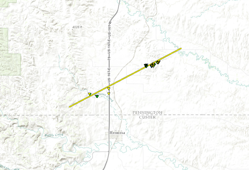 
|
||||||||||||||
|
The Enhanced Fujita (EF) Scale classifies tornadoes into the following categories:
| EF0 Weak 65-85 mph |
EF1 Moderate 86-110 mph |
EF2 Significant 111-135 mph |
EF3 Severe 136-165 mph |
EF4 Extreme 166-200 mph |
EF5 Catastrophic 200+ mph |
 |
|||||
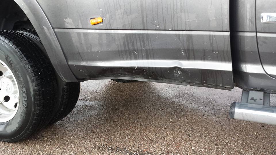
Lightning Strike
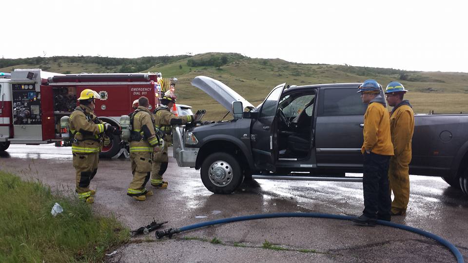
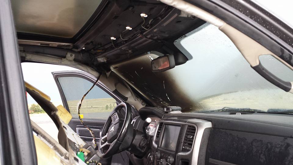
This pick-up truck was struck by lightning on S. Hwy 79. The owner said the truck flashed and completely shut down. The lightning bolt actually struck the top of the truck, causing a fire in the interior of the cab. A vehicle following the truck said the lightning also struck the ground and put a hole in the road. The asphalt blew up and hit the lower side of the truck causing body damage. Pictures and description courtesy of the Rapid Valley Volunteer Fire Department.
 |
 |
 |
 |
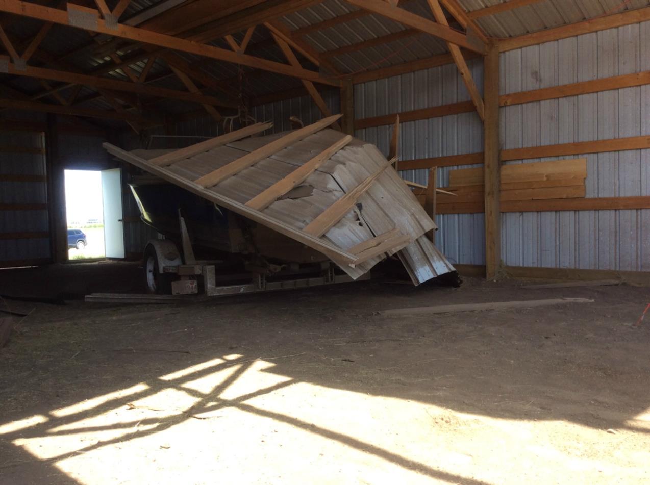
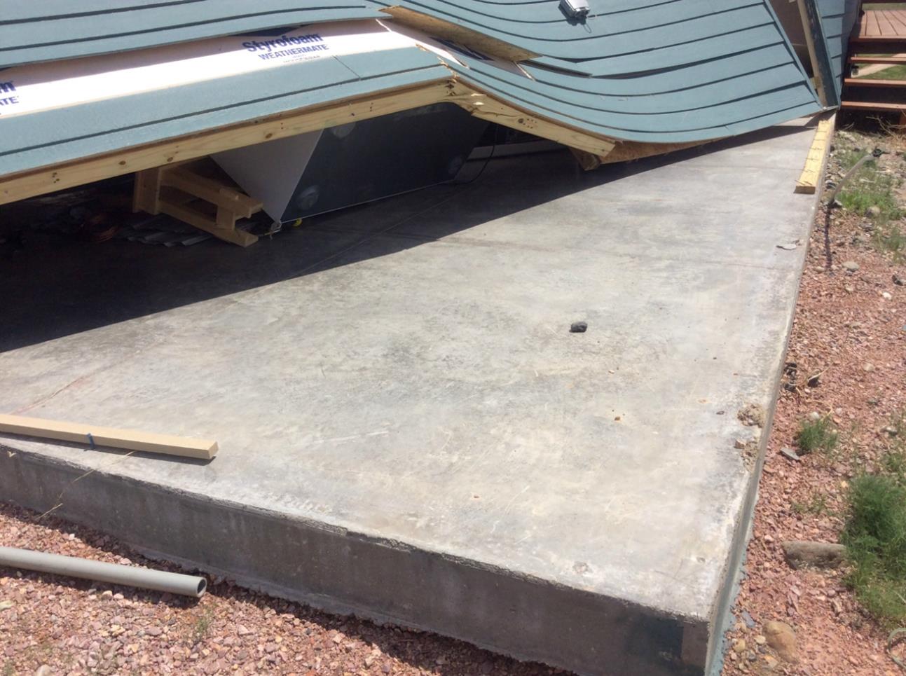
Photos:
Photos from the Damage Survey
 |
 |
 |
 |
 |
 |
 |
 |
 |
 |
 |
 |
 |
 |
 |
 |
 |
 |
 |
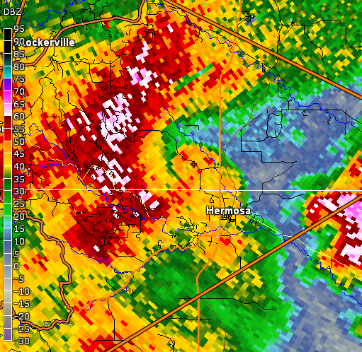
Radar:
Reflectivity (storm intensity) and velocity (wind) images from the National Weather Service WSR-88D Doppler radar in New Underwood, SD depicting the tornado near Hermosa.
 |
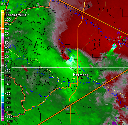 |
| Reflectivity (intensity) | Velocity (wind) |
Storm Reports
PRELIMINARY LOCAL STORM REPORT...SUMMARY
NATIONAL WEATHER SERVICE RAPID CITY SD
904 PM MDT MON JUN 13 2016

..TIME...   ...EVENT...      ...CITY LOCATION...     ...LAT.LON...
..DATE...   ....MAG....      ..COUNTY LOCATION..ST.. ...SOURCE....
            ..REMARKS..

1230 PM     HAIL             10 WNW PINE TREE JUNCTI 43.68N 105.97W
06/13/2016  E0.25 INCH       CAMPBELL           WY   TRAINED SPOTTER

            HAIL COVERED GROUND

1250 PM     HAIL             8 S SAVAGETON           43.75N 105.79W
06/13/2016  E0.25 INCH       CAMPBELL           WY   TRAINED SPOTTER

0105 PM     HAIL             4 NE SAVAGETON          43.90N 105.73W
06/13/2016  E0.70 INCH       CAMPBELL           WY   PUBLIC

0105 PM     TSTM WND GST     4 NE SAVAGETON          43.90N 105.73W
06/13/2016  E60 MPH          CAMPBELL           WY   PUBLIC

0130 PM     TSTM WND GST     13 NNE WRIGHT           43.93N 105.45W
06/13/2016  M72 MPH          CAMPBELL           WY   DEPT OF HIGHWAYS

0217 PM     TSTM WND GST     MOORCROFT               44.27N 104.95W
06/13/2016  M75 MPH          CROOK              WY   MESONET

0240 PM     TSTM WND GST     10 ESE PINE HAVEN       44.29N 104.63W
06/13/2016  M54 MPH          CROOK              WY   DEPT OF HIGHWAYS

0300 PM     HAIL             1 WNW HULETT            44.69N 104.63W
06/13/2016  E1.75 INCH       CROOK              WY   TRAINED SPOTTER

            A FEW STONES TO GOLF BALL SIZE... MOSTLY HALF INCH...
            LASTED ABOUT 30 MINUTES.

0320 PM     TSTM WND GST     1 N BEULAH              44.54N 104.08W
06/13/2016  M52 MPH          CROOK              WY   DEPT OF HIGHWAYS

0339 PM     TSTM WND GST     JEWEL CAVE              43.73N 103.83W
06/13/2016  E50 MPH          CUSTER             SD   PARK SERVICE

0339 PM     HAIL             JEWEL CAVE              43.73N 103.83W
06/13/2016  E0.70 INCH       CUSTER             SD   PARK SERVICE

0401 PM     HAIL             10 E DOWNTOWN CUSTER    43.77N 103.40W
06/13/2016  E1.50 INCH       CUSTER             SD   TRAINED SPOTTER

0405 PM     HAIL             7 W HERMOSA             43.84N 103.33W
06/13/2016  E1.50 INCH       CUSTER             SD   TRAINED SPOTTER

0425 PM     HAIL             1 SSW RAPID VALLEY      44.05N 103.14W
06/13/2016  E1.00 INCH       PENNINGTON         SD   NWS EMPLOYEE

0427 PM     FUNNEL CLOUD     7 E HAYWARD             43.89N 103.19W
06/13/2016                   PENNINGTON         SD   BROADCAST MEDIA

0430 PM     TORNADO          4 NNE HERMOSA           43.89N 103.16W
06/13/2016                   PENNINGTON         SD   NWS EMPLOYEE

            STRUCTURE DAMAGE TO SEVERAL HOMES

0433 PM     HAIL             4 S DOWNTOWN RAPID CITY 44.02N 103.23W
06/13/2016  E1.75 INCH       PENNINGTON         SD   PUBLIC

0438 PM     TSTM WND GST     4 S DOWNTOWN RAPID CITY 44.02N 103.24W
06/13/2016  M47 MPH          PENNINGTON         SD   NWS EMPLOYEE

0440 PM     HAIL             7 SW RAPID CITY AIRPORT 43.98N 103.17W
06/13/2016  E1.75 INCH       PENNINGTON         SD   NWS EMPLOYEE

0442 PM     HAIL             7 SW RAPID CITY AIRPORT 43.98N 103.17W
06/13/2016  E1.50 INCH       PENNINGTON         SD   NWS EMPLOYEE

0442 PM     TSTM WND GST     1 N BUFFALO             45.60N 103.55W
06/13/2016  M66 MPH          HARDING            SD   ASOS

0445 PM     TSTM WND GST     ELLSWORTH AFB           44.15N 103.10W
06/13/2016  E80 MPH          MEADE              SD   OTHER FEDERAL

0450 PM     TSTM WND GST     1 ENE MUD BUTTE         45.01N 102.86W
06/13/2016  M53 MPH          MEADE              SD   DEPT OF HIGHWAYS

0500 PM     TSTM WND GST     5 WNW NEW UNDERWOOD     44.12N 102.93W
06/13/2016  M69 MPH          PENNINGTON         SD   DEPT OF HIGHWAYS

0503 PM     TSTM WND GST     RAPID CITY AIRPORT      44.05N 103.06W
06/13/2016  M63 MPH          PENNINGTON         SD   ASOS

0510 PM     TSTM WND GST     4 N LUDLOW              45.88N 103.38W
06/13/2016  M51 MPH          HARDING            SD   DEPT OF HIGHWAYS

0510 PM     TSTM WND GST     3 NNW SCENIC            43.82N 102.58W
06/13/2016  M58 MPH          PENNINGTON         SD   DEPT OF HIGHWAYS

0513 PM     TSTM WND GST     MOUNT RUSHMORE          43.88N 103.45W
06/13/2016  M49 MPH          PENNINGTON         SD   MESONET

0530 PM     TSTM WND GST     3 E WICKSVILLE          44.10N 102.50W
06/13/2016  M66 MPH          PENNINGTON         SD   DEPT OF HIGHWAYS

0530 PM     TSTM WND GST     5 NE PORCUPINE          43.29N 102.27W
06/13/2016  M63 MPH          OGLALA LAKOTA      SD   MESONET

0600 PM     TSTM WND GST     9 SW BATESLAND          43.05N 102.22W
06/13/2016  M51 MPH          OGLALA LAKOTA      SD   DEPT OF HIGHWAYS

0620 PM     TSTM WND GST     8 S WALL                43.88N 102.24W
06/13/2016  M60 MPH          PENNINGTON         SD   MESONET

0640 PM     TSTM WND GST     4 E CACTUS FLAT         43.84N 101.82W
06/13/2016  M50 MPH          JACKSON            SD   DEPT OF HIGHWAYS

0702 PM     HAIL             7 S MARTIN              43.07N 101.73W
06/13/2016  E1.00 INCH       BENNETT            SD   PUBLIC

0702 PM     TSTM WND GST     7 S MARTIN              43.07N 101.73W
06/13/2016  E60 MPH          BENNETT            SD   PUBLIC

0710 PM     TSTM WND GST     9 N VETAL               43.35N 101.37W
06/13/2016  E60 MPH          BENNETT            SD   PUBLIC

THE STORM REPORTS LISTED BELOW ARE IN DESCENDING ORDER AND MAY NOT NECESSARILY
BE THE FINAL STORM REPORTS.

HAIL REPORTS LISTED BY SIZE (INCHES)

 SIZE    LOCATION                 ST  COUNTY           TIME
 ------  -----------------------  --  --------------   -------
  1.75   7 SW RAPID CITY AIRPORT  SD  PENNINGTON       0440 PM
  1.75   4 S DOWNTOWN RAPID CITY  SD  PENNINGTON       0433 PM
  1.75   1 WNW HULETT             WY  CROOK            0300 PM
  1.50   7 SW RAPID CITY AIRPORT  SD  PENNINGTON       0442 PM
  1.50   7 W HERMOSA              SD  CUSTER           0405 PM
  1.50   10 E DOWNTOWN CUSTER     SD  CUSTER           0401 PM
  1.00   7 S MARTIN               SD  BENNETT          0702 PM
  1.00   1 SSW RAPID VALLEY       SD  PENNINGTON       0425 PM
  0.70   JEWEL CAVE               SD  CUSTER           0339 PM
  0.70   4 NE SAVAGETON           WY  CAMPBELL         0105 PM
  0.25   8 S SAVAGETON            WY  CAMPBELL         1250 PM
  0.25   10 WNW PINE TREE JUNCTI  WY  CAMPBELL         1230 PM

TSTM WIND REPORTS LISTED BY SPEED (MPH)

 SPEED   LOCATION                 ST  COUNTY           TIME
 ------  -----------------------  --  --------------   -------
 80.00   ELLSWORTH AFB            SD  MEADE            0445 PM
 75.00   MOORCROFT                WY  CROOK            0217 PM
 72.00   13 NNE WRIGHT            WY  CAMPBELL         0130 PM
 69.00   5 WNW NEW UNDERWOOD      SD  PENNINGTON       0500 PM
 66.00   3 E WICKSVILLE           SD  PENNINGTON       0530 PM
 66.00   1 N BUFFALO              SD  HARDING          0442 PM
 63.00   5 NE PORCUPINE           SD  OGLALA LAKOTA    0530 PM
 63.00   RAPID CITY AIRPORT       SD  PENNINGTON       0503 PM
 60.00   9 N VETAL                SD  BENNETT          0710 PM
 60.00   7 S MARTIN               SD  BENNETT          0702 PM
 60.00   8 S WALL                 SD  PENNINGTON       0620 PM
 60.00   4 NE SAVAGETON           WY  CAMPBELL         0105 PM
 58.00   3 NNW SCENIC             SD  PENNINGTON       0510 PM
 54.00   10 ESE PINE HAVEN        WY  CROOK            0240 PM
 53.00   1 ENE MUD BUTTE          SD  MEADE            0450 PM
 52.00   1 N BEULAH               WY  CROOK            0320 PM
 51.00   9 SW BATESLAND           SD  OGLALA LAKOTA    0600 PM
 51.00   4 N LUDLOW               SD  HARDING          0510 PM
 50.00   4 E CACTUS FLAT          SD  JACKSON          0640 PM
 50.00   JEWEL CAVE               SD  CUSTER           0339 PM
 49.00   MOUNT RUSHMORE           SD  PENNINGTON       0513 PM
 47.00   4 S DOWNTOWN RAPID CITY  SD  PENNINGTON       0438 PM
 |
Media use of NWS Web News Stories is encouraged! Please acknowledge the NWS as the source of any news information accessed from this site. |
|