Tropical Depression Two is expected to gradually strengthen and could bring tropical storm conditions to the Florida Panhandle beginning late Monday. Areas of flash flooding will be possible through Thursday along the eastern and central Gulf Coast. Severe thunderstorms will develop and move along a cold front crossing the Upper Midwest Monday, and through the Ohio Valley/Mid-Atlantic on Tuesday. Read More >
Overview
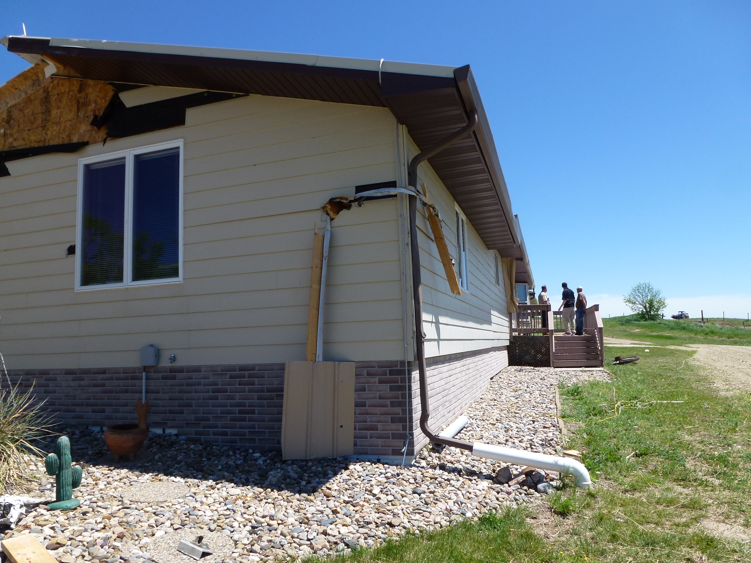
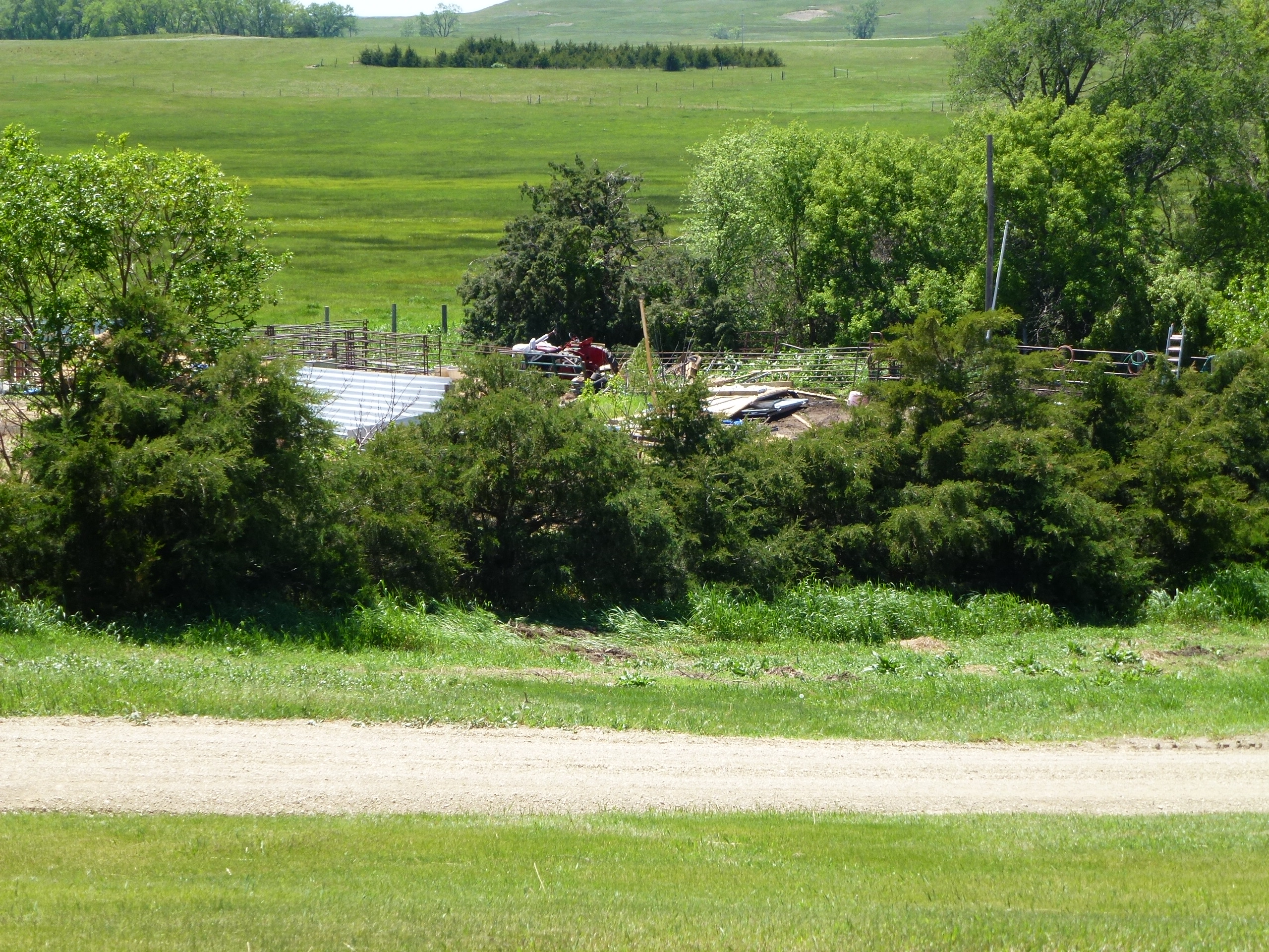
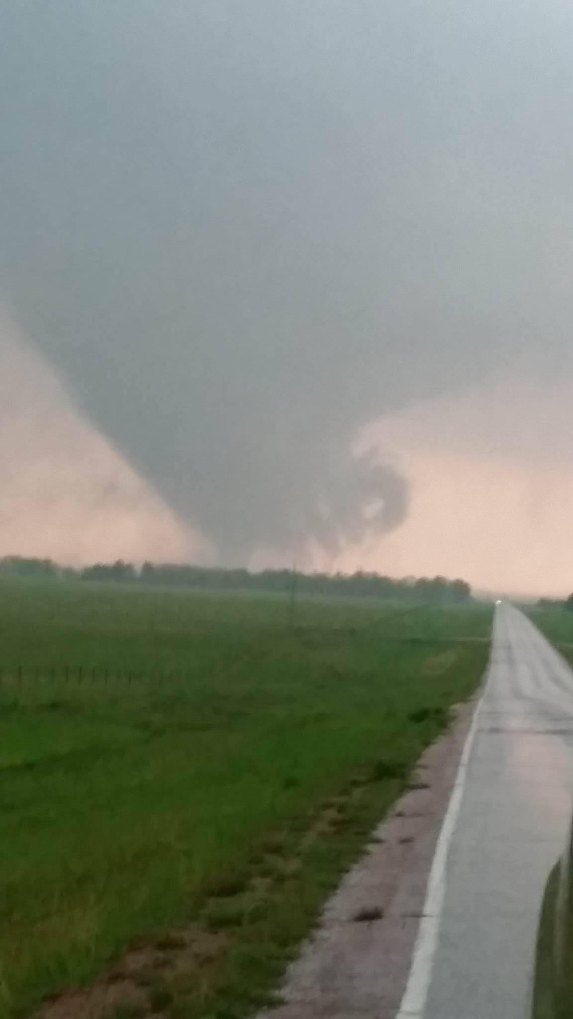
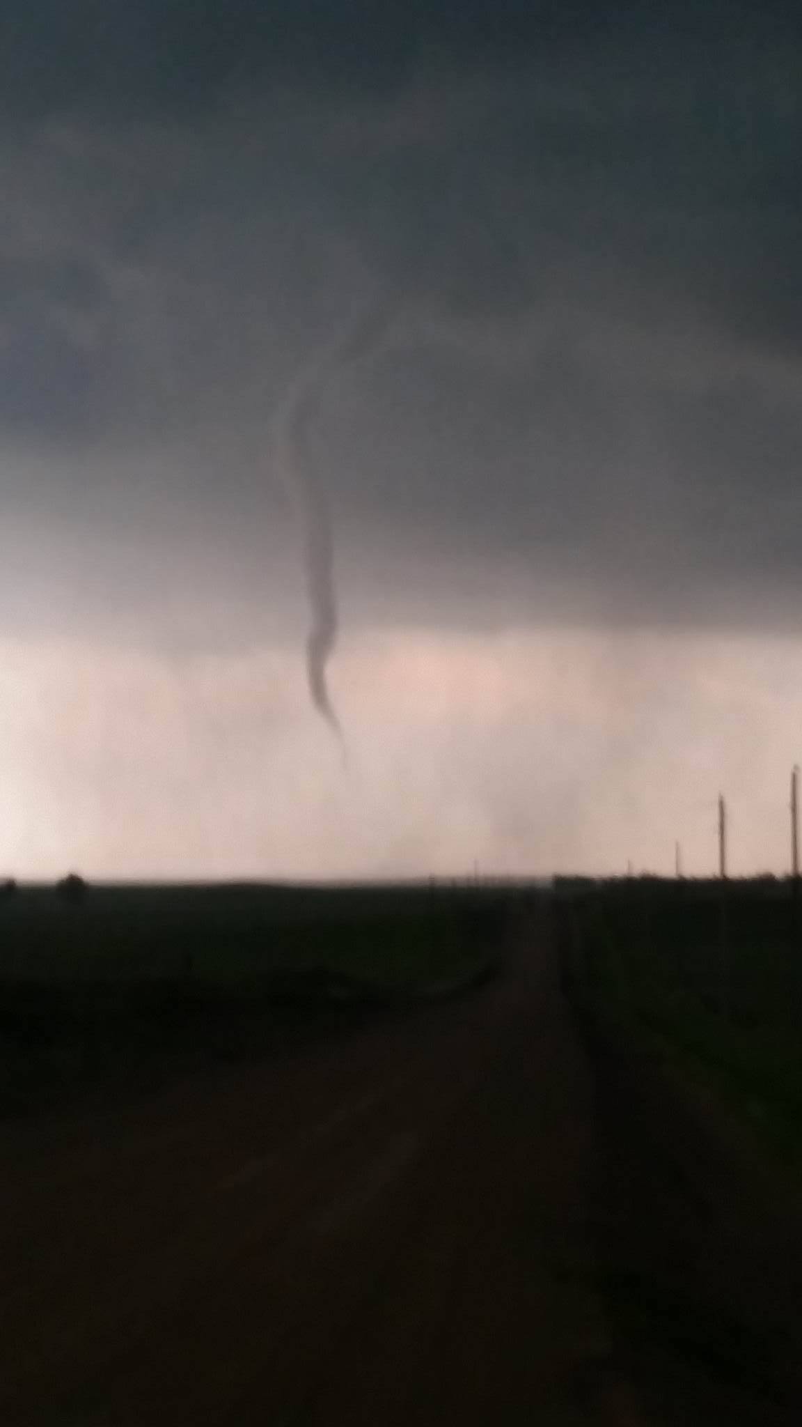
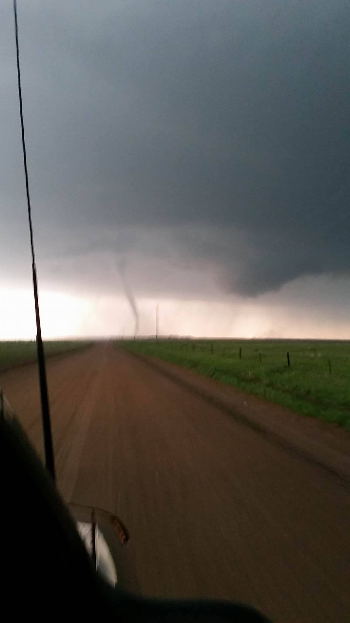
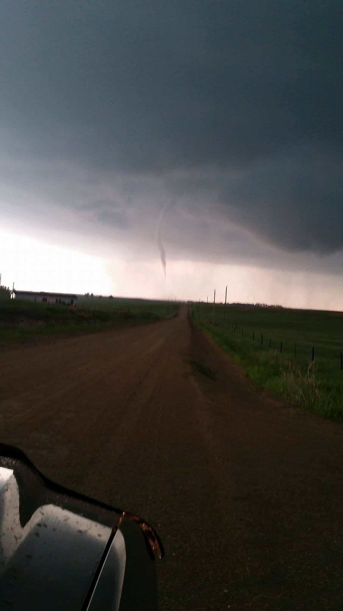
Two tornadoes occurred in south central South Dakota during the early evening of May 22, 2016. One tornado touched down about two miles east of the Littleburg School southeast of Mission in Todd County. Eight to ten power poles were snapped at the ground and several large trees were heavily damaged. Another tornado caused damage on a ranch about ten miles southwest of Winner in Tripp County and microburst winds produced damage southeast of Colome.
Tornadoes:
|
Tornado - Littleburg, SD
Track Map 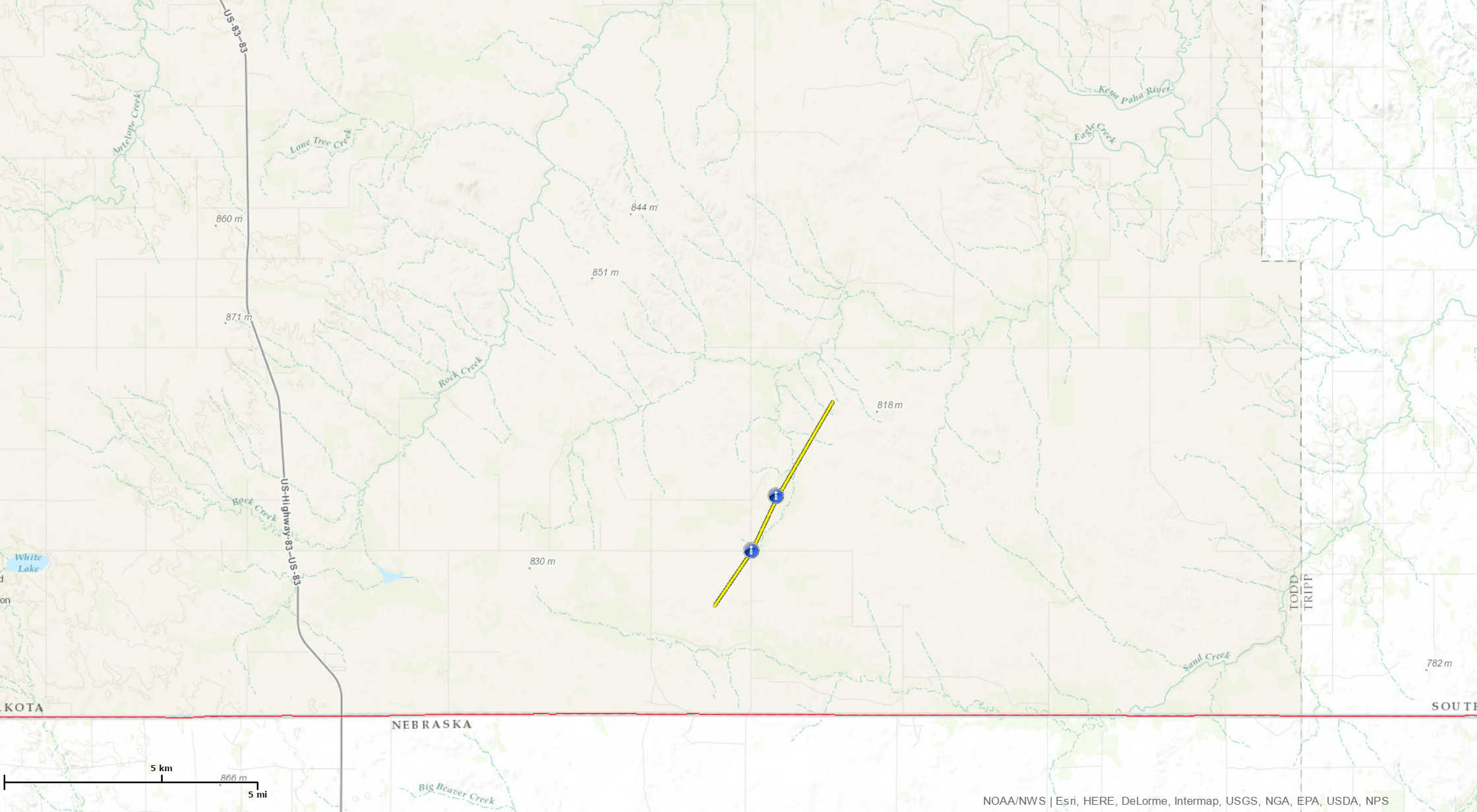 
Downloadable KMZ File |
||||||||||||||||
|
||||||||||||||||
|
Tornado - Dog Ear, SD
Track Map 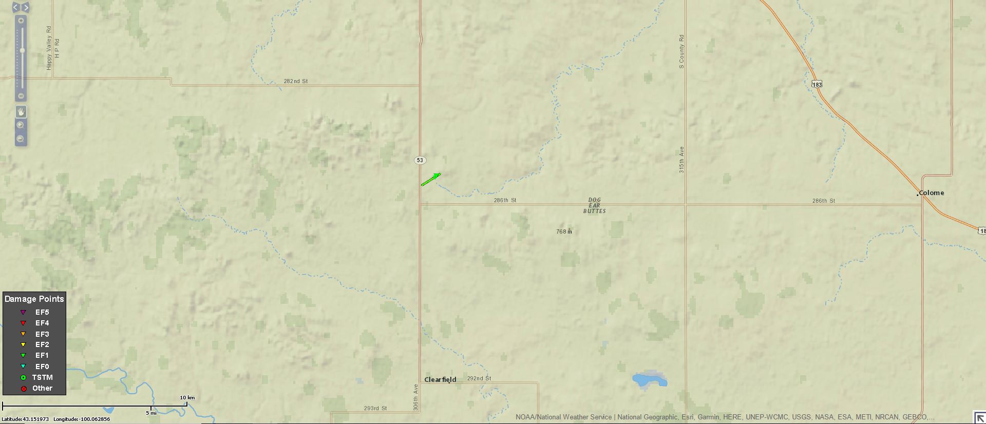
Downloadable KMZ File |
||||||||||||||||
|
||||||||||||||||
The Enhanced Fujita (EF) Scale classifies tornadoes into the following categories:
| EF0 Weak 65-85 mph |
EF1 Moderate 86-110 mph |
EF2 Significant 111-135 mph |
EF3 Severe 136-165 mph |
EF4 Extreme 166-200 mph |
EF5 Catastrophic 200+ mph |
 |
|||||
Wind:
A small downburst caused damage at a residence southeast of Colome in Tripp County. A shed was demolished, with the debris scattered about a mile away, and a tractor-trailer was tipped over.
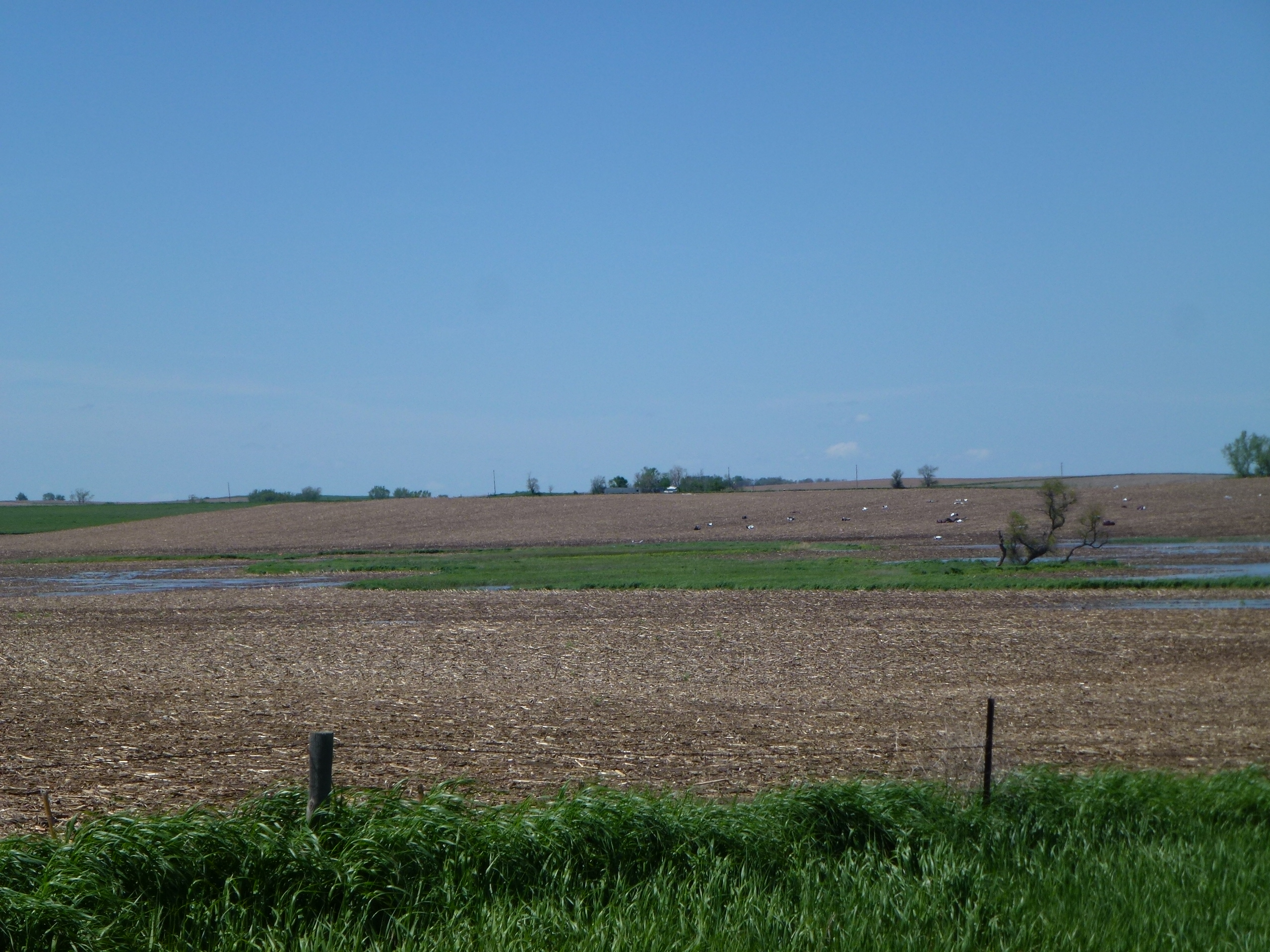 |
| Debris southeast of Colome |
Photos & Video:
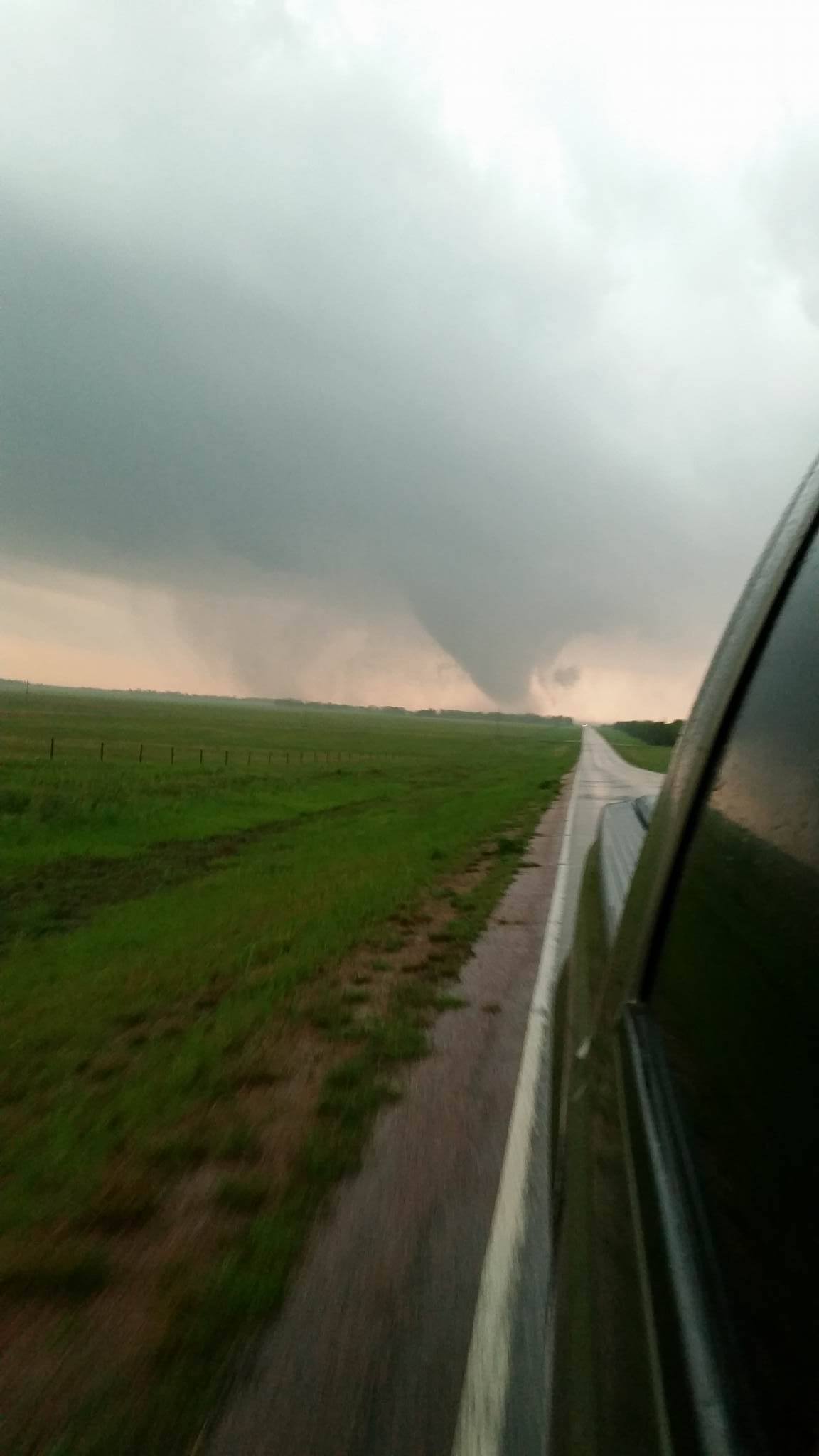
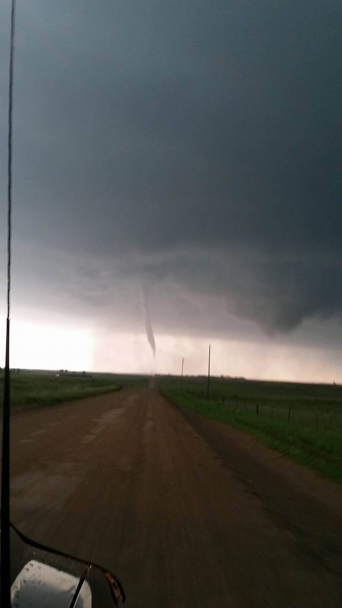
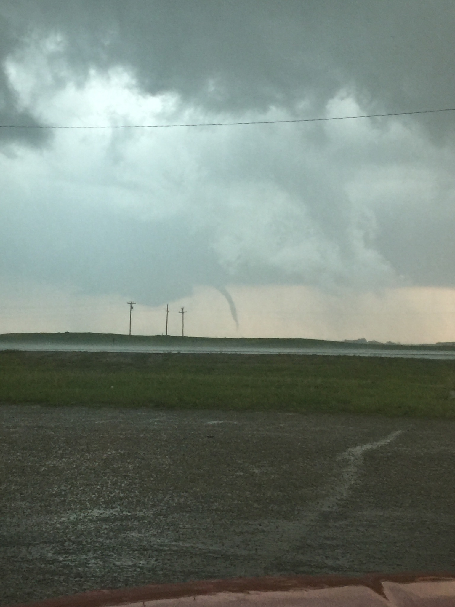
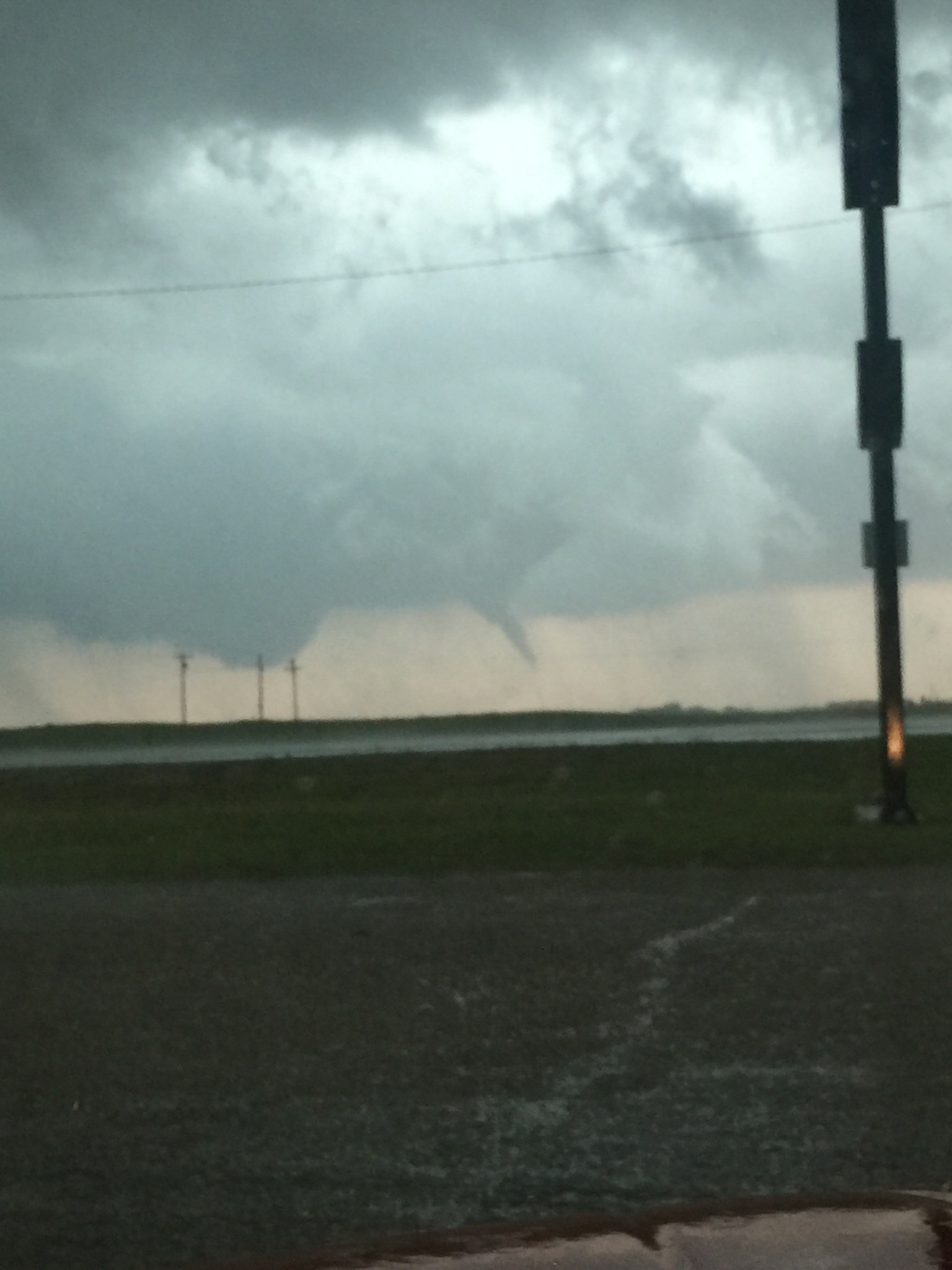
Littleburg Tornado (credit photographer listed)
 |
 |
 |
 |
| Littleburg (Kristi Monroe) |
Littleburg (Kara Walking) |
Littleburg (Kristi Monroe) |
Littleburg (Kristi Monroe) |
 |
 |
 |
 |
| Littleburg (Kristi Monroe) |
Littleburg (Kristi Monroe) |
Littleburg (Kara Walking) |
Littleburg (Kristi Monroe) |
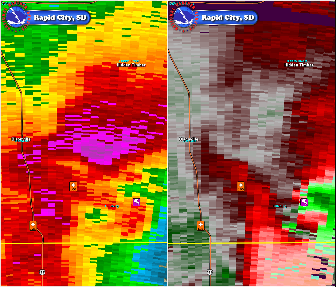
Radar:
Reflectivity (storm intensity) and velocity (wind) images from the National Weather Service WSR-88D Doppler radar in Thedford, NE depicting the tornadoes.
 |
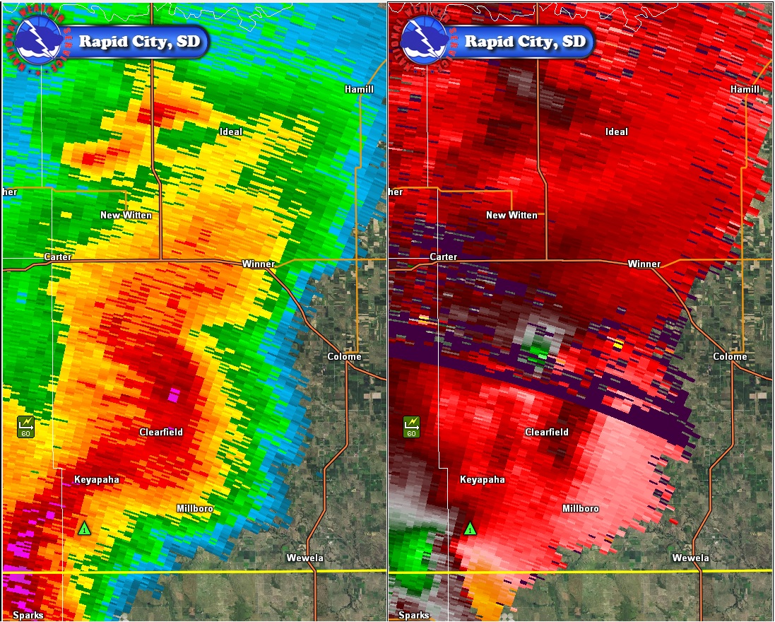 |
| Littleburg, Todd County, SD | Dog Ear, Tripp County, SD |
Storm Reports
All times are in Mountain Daylight Time
..TIME...   ...EVENT...      ...CITY LOCATION...     ...LAT.LON...
..DATE...   ....MAG....      ..COUNTY LOCATION..ST.. ...SOURCE....
            ..REMARKS..

0255 PM     HAIL             5 W ROSEBUD             43.23N 100.95W
05/22/2016  E1.25 INCH       TODD               SD   PUBLIC
            QUARTER TO HALF DOLLAR SIZE HAIL... LOTS OF IT.

0354 PM     HAIL             4 NW PARMELEE           43.36N 101.09W
05/22/2016  E1.00 INCH       TODD               SD   TRAINED SPOTTER

0430 PM     HAIL             10 SE SAINT FRANCIS     43.04N 100.76W
05/22/2016  E1.25 INCH       TODD               SD   PUBLIC
            QUARTER TO HALF DOLLAR HAIL

0450 PM     HAIL             5 S LAKEVIEW            43.04N 100.75W
05/22/2016  E1.25 INCH       TODD               SD   PUBLIC

0505 PM     HAIL             7 WSW LITTLEBURG        43.02N 100.59W
05/22/2016  E1.25 INCH       TODD               SD   PUBLIC
            QUARTER TO HALF DOLLAR HAIL

0520 PM     HAIL             18 SSE MISSION          43.07N 100.52W
05/22/2016  E1.00 INCH       TODD               SD   PUBLIC

0535 PM     TORNADO          3 NE LITTLEBURG         43.08N 100.41W
05/22/2016                   TODD               SD   PUBLIC

0610 PM     TSTM WND GST     9 ESE HIDDEN TIMBER     43.18N 100.26W
05/22/2016  E60 MPH          TODD               SD   PUBLIC

0645 PM     TSTM WND GST     6 S KEYAPAHA            43.01N 100.13W
05/22/2016  E60 MPH          TRIPP              SD   PUBLIC
            SOME ROOF DAMAGE TO FARM BUILDINGS

0705 PM     TORNADO          10 SW WINNER            43.27N 100.00W
05/22/2016                   TRIPP              SD   LAW ENFORCEMENT
            REPORTS OF BUILDING DAMAGE POWER LINES DOWN ROOF RIPPED
            OFF

0745 PM     NON-TSTM WND GST 4 S DOWNTOWN RAPID CITY 44.02N 103.24W
05/22/2016  M60 MPH          PENNINGTON         SD   NWS EMPLOYEE

0745 PM     HIGH SUST WINDS  4 S DOWNTOWN RAPID CITY 44.02N 103.24W
05/22/2016  M42 MPH          PENNINGTON         SD   NWS EMPLOYEE

0819 PM     NON-TSTM WND GST 4 S DOWNTOWN RAPID CITY 44.02N 103.24W
05/22/2016  M63 MPH          PENNINGTON         SD   NWS EMPLOYEE

0820 PM     FLASH FLOOD      COLOME                  43.26N  99.72W
05/22/2016                   TRIPP              SD   LAW ENFORCEMENT
            WATER RUNNING OVER STREETS IN COLOME

0838 PM     TSTM WND GST     1 SE VETAL              43.21N 101.36W
05/22/2016  E70 MPH          BENNETT            SD   TRAINED SPOTTER

0839 PM     NON-TSTM WND GST RAPID CITY AIRPORT      44.05N 103.06W
05/22/2016  M58 MPH          PENNINGTON         SD   ASOS

0839 PM     HIGH SUST WINDS  RAPID CITY AIRPORT      44.05N 103.06W
05/22/2016  M41 MPH          PENNINGTON         SD   ASOS

0841 PM     NON-TSTM WND GST 5 NE PORCUPINE          43.29N 102.27W
05/22/2016  M57 MPH          OGLALA LAKOTA      SD   MESONET


HAIL REPORTS LISTED BY SIZE (INCHES)

 SIZE    LOCATION                 ST  COUNTY           TIME
 ------  -----------------------  --  --------------   -------
  1.25   7 WSW LITTLEBURG         SD  TODD             0505 PM
  1.25   5 S LAKEVIEW             SD  TODD             0450 PM
  1.25   10 SE SAINT FRANCIS      SD  TODD             0430 PM
  1.25   5 W ROSEBUD              SD  TODD             0255 PM
  1.00   18 SSE MISSION           SD  TODD             0520 PM
  1.00   4 NW PARMELEE            SD  TODD             0354 PM

TSTM WIND REPORTS LISTED BY SPEED (MPH)

 SPEED   LOCATION                 ST  COUNTY           TIME
 ------  -----------------------  --  --------------   -------
 70.00   1 SE VETAL               SD  BENNETT          0838 PM
 60.00   6 S KEYAPAHA             SD  TRIPP            0645 PM
 60.00   9 ESE HIDDEN TIMBER      SD  TODD             0610 PM

WIND GUST REPORTS LISTED BY SPEED (MPH)

 SPEED   LOCATION                 ST  COUNTY           TIME
 ------  -----------------------  --  --------------   -------
 63.00   4 S DOWNTOWN RAPID CITY  SD  PENNINGTON       0819 PM
 60.00   4 S DOWNTOWN RAPID CITY  SD  PENNINGTON       0745 PM
 58.00   RAPID CITY AIRPORT       SD  PENNINGTON       0839 PM
 57.00   5 NE PORCUPINE           SD  OGLALA LAKOTA    0841 PM
 |
Media use of NWS Web News Stories is encouraged! Please acknowledge the NWS as the source of any news information accessed from this site. |
|