Tropical Depression Two is expected to gradually strengthen and could bring tropical storm conditions to the Florida Panhandle beginning late Monday. Areas of flash flooding will be possible through Thursday along the eastern and central Gulf Coast. Severe thunderstorms will develop and move along a cold front crossing the Upper Midwest Monday, and through the Ohio Valley/Mid-Atlantic on Tuesday. Read More >
Overview
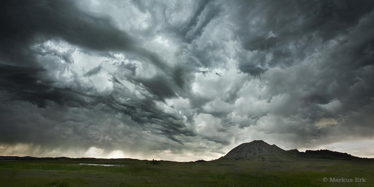
A series of severe thunderstorms rolled across northeastern Wyoming and western South Dakota on 27 July 2015. Hail up to 3.5" in diameter and wind gusts up to 73 mph were reported. Prodigious amounts of hail fell in Custer, South Dakota. The hail looked like snow due to the depth. Record rainfall also fell at the Rapid City Regional Airport.
|
Picture of thunderstorm (courtesy Markus Erk) as it was passing by Bear Butte |
Social Media Reports
Tonight: Car stranded in pile of hail on 8th street in Custer, SD. #kelowx pic.twitter.com/JRMEcc14mh
— Jay Trobec (@trobec) July 28, 2015
Quite the hail haul in Custer, SD by Kristie Meyer. pic.twitter.com/yeh3pm6jFE
— Ginger Zee (@Ginger_Zee) July 28, 2015
@NWSRapidCity Photo from Jerid Maskovich in Custer, SD from earlier this evening. pic.twitter.com/GrNipaFDA3
— NWS Aberdeen (@NWSAberdeen) July 28, 2015
The calm after the storm. A view from the Rapid City WFO of some mammatus clouds from the passing storms! #sdwx pic.twitter.com/ujDc9GAJpx
— NWS Rapid City (@NWSRapidCity) July 28, 2015
Shelf cloud nearly overhead west of howes #sdwx pic.twitter.com/XcwcKc2AF0
— Dan McKemy (@Wx_Dan) July 28, 2015
Great KOTA Territory News viewer and reader photos of today's storm. #hail #storm https://t.co/sjlRbTdLu8 pic.twitter.com/JEE0aJVrsM
— KOTA Territory News (@kotatweets) July 28, 2015
Wild ride in @Custer_SD tonight! @yakishk #snowplows will be out! @lakeforkfishn @wxbrad pic.twitter.com/NLmREkltPX
— Nature Tech Family (@naturetechfam) July 27, 2015
Downtown Custer- @KOTAWeather @yakishk @DavidSWX @mikemodrick @egardnerkota pic.twitter.com/8eCe0mpuOi
— Katy Urban (@KatyUrban1) July 28, 2015
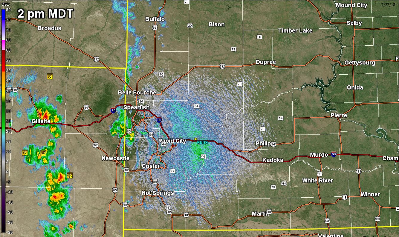
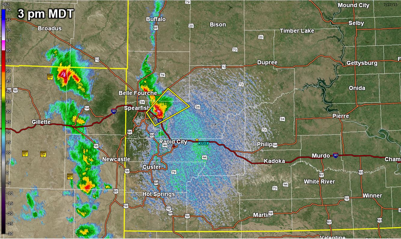
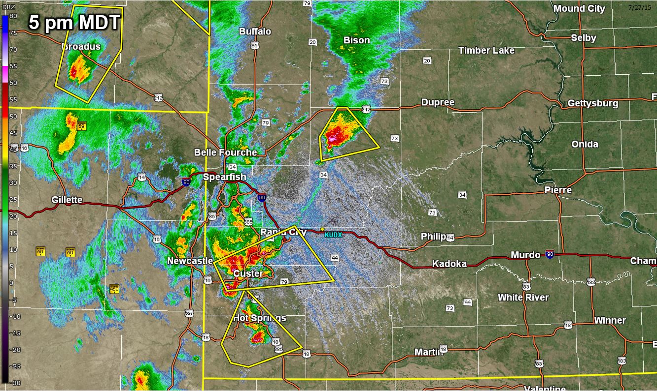
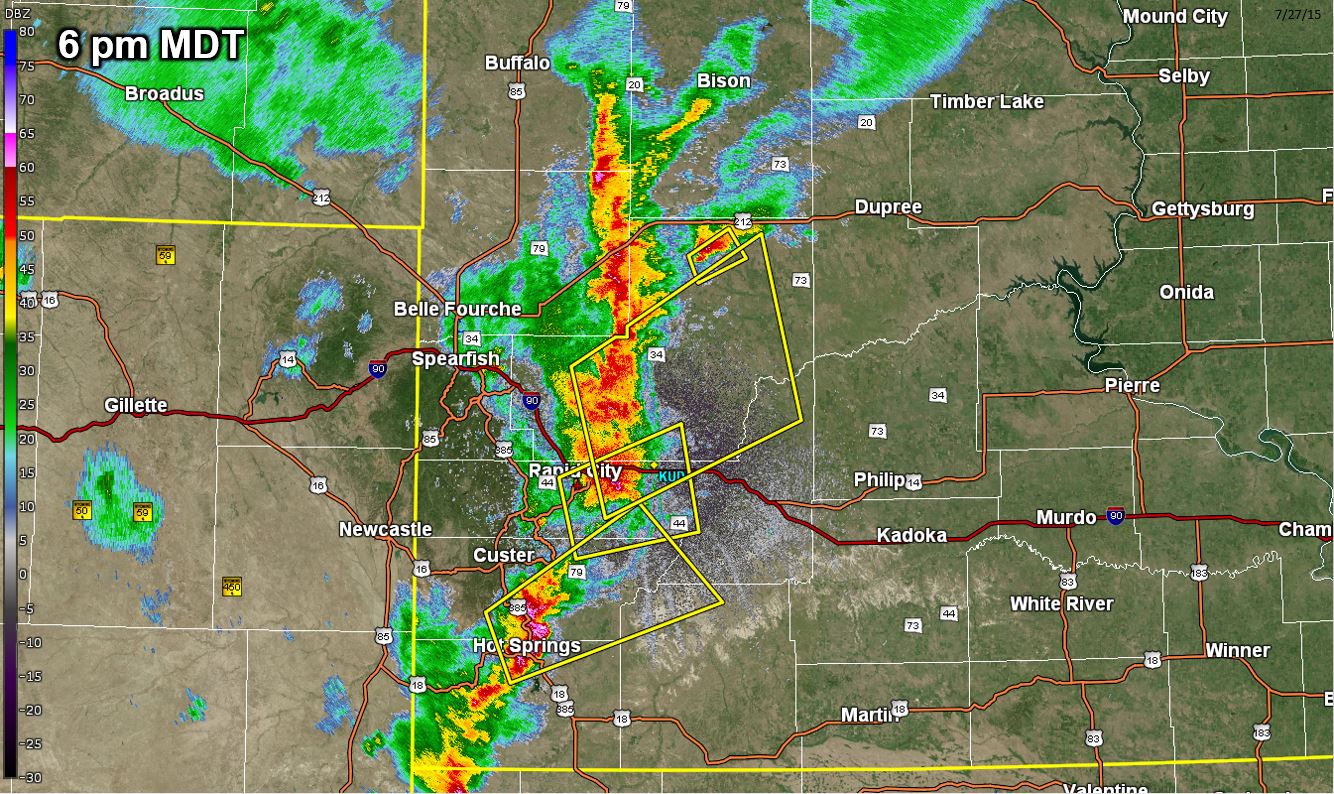
Radar
Hourly radar images from 2 pm MDT 27 July 2015 to 12 am MDT 28 July 2015
 |
 |
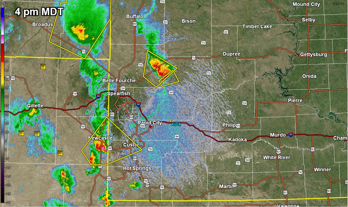 |
| Radar image at 2 pm MDT 27 July 2015 | Radar image at 3 pm MDT 27 July 2015 | Radar image at 4 pm MDT 27 July 2015 |
 |
 |
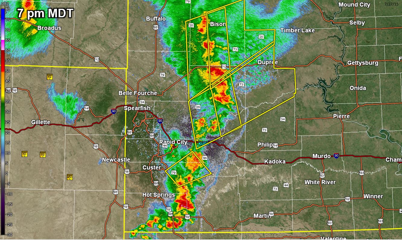 |
| Radar image at 5 pm MDT 27 July 2015 | Radar image at 6 pm MDT 27 July 2015 | Radar image at 7 pm MDT 27 July 2015 |
 |
 |
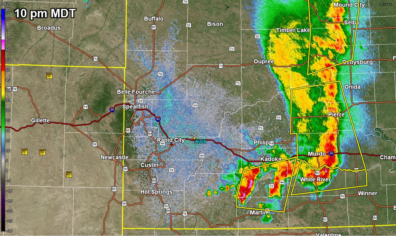 |
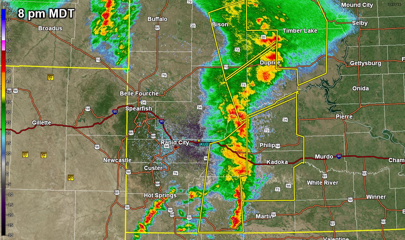
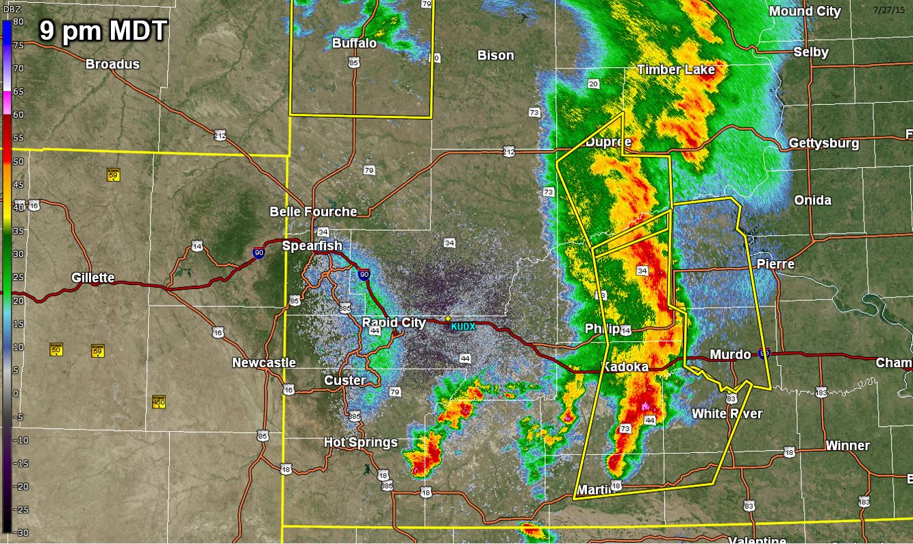
| Radar image at 8 pm MDT 27 July 2015 | Radar image at 9 pm MDT 27 July 2015 | Radar image at 10 pm MDT 27 July 2015 |
 |
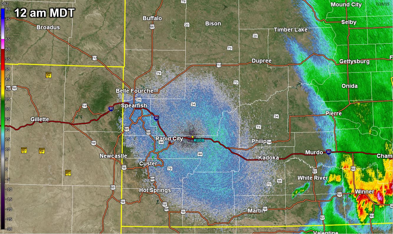 |
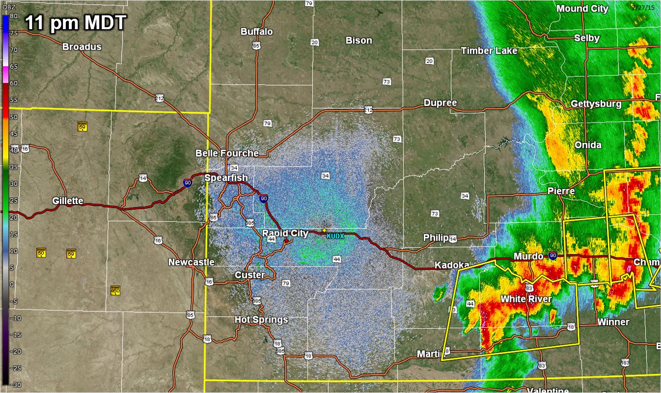
| Radar image at 11 pm MDT 27 July 2015 | Radar image at 12 am MDT 28 July 2015 |
Storm Reports
...RECORD DAILY MAXIMUM RAINFALL SET AT RAPID CITY AIRPORT SD...
A RECORD RAINFALL OF 0.74 INCHES WAS SET AT RAPID CITY AIRPORT SD YESTERDAY (July 27, 2015). THIS BREAKS THE OLD RECORD OF 0.62 SET IN 1953.
Below is a map of storm reports from July 27, 2015.
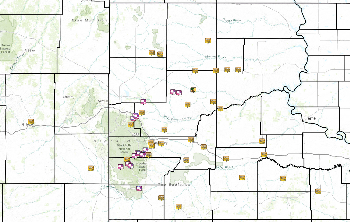
THE STORM REPORTS LISTED BELOW ARE IN DESCENDING ORDER AND MAY NOT NECESSARILY
BE THE FINAL STORM REPORTS for July 27, 2015.

HAIL REPORTS LISTED BY SIZE (INCHES)

 SIZE    LOCATION                 ST  COUNTY           TIME
 ------  -----------------------  --  --------------   -------
  3.50   3 ESE HILL CITY          SD  PENNINGTON       0500 PM
  1.75   2 NW MOUNT RUSHMORE      SD  PENNINGTON       0510 PM
                 SHAVE REPORT
  1.75   3 W STONEVILLE           SD  MEADE            0505 PM
                 SHAVE REPORT
  1.75   5 NE GALENA              SD  LAWRENCE         0245 PM
                 SHAVE REPORT
  1.50   2 E KEYSTONE             SD  PENNINGTON       0515 PM
                 SHAVE REPORT
  1.50   3 S HILL CITY            SD  PENNINGTON       0515 PM
  1.25   4 S DOWNTOWN RAPID CITY  SD  PENNINGTON       0545 PM
  1.25   1 NW DOWNTOWN STURGIS    SD  MEADE            0254 PM
                 SHAVE REPORT
  1.00   DOWNTOWN HOT SPRINGS     SD  FALL RIVER       0607 PM
  1.00   ROCKERVILLE              SD  PENNINGTON       0523 PM
  1.00   3 SW DOWNTOWN CUSTER     SD  CUSTER           0522 PM
  1.00   KEYSTONE                 SD  PENNINGTON       0515 PM
  1.00   4 W DOWNTOWN CUSTER      SD  CUSTER           0505 PM
                 SHAVE REPORT
  1.00   JEWEL CAVE               SD  CUSTER           0450 PM
  1.00   2 W FAIRPOINT            SD  MEADE            0415 PM
  1.00   VALE                     SD  BUTTE            0325 PM
  1.00   2 NW DOWNTOWN STURGIS    SD  MEADE            0253 PM
                 SHAVE REPORT

TSTM WIND REPORTS LISTED BY SPEED (MPH)

 SPEED   LOCATION                 ST  COUNTY           TIME
 ------  -----------------------  --  --------------   -------
 73.00   7 E WANBLEE              SD  JACKSON          1018 PM
 73.00   1 WSW RED ELM            SD  ZIEBACH          0748 PM
 72.00   RAPID CITY AIRPORT       SD  PENNINGTON       0555 PM
 70.00   OGLALA                   SD  SHANNON          0714 PM
 70.00   ENNING                   SD  MEADE            0645 PM
 69.00   4 S DOWNTOWN RAPID CITY  SD  PENNINGTON       0548 PM
 68.00   1 NE MIDLAND             SD  HAAKON           0850 PM
 66.00   4 E CACTUS FLAT          SD  JACKSON          0820 PM
 65.00   1 SW DOWNTOWN RAPID CIT  SD  PENNINGTON       0542 PM
 64.00   10 SW HILL CITY          SD  CUSTER           0435 PM
 63.00   3 NNW SCENIC             SD  PENNINGTON       0740 PM
 60.00   WHITE RIVER              SD  MELLETTE         1000 PM
 60.00   DUPREE                   SD  ZIEBACH          0820 PM
 60.00   2 SW BRIDGER             SD  ZIEBACH          0720 PM
 60.00   17 SW USTA               SD  PERKINS          0707 PM
 60.00   8 E SMITHWICK            SD  FALL RIVER       0705 PM
 60.00   1 W HOWES                SD  MEADE            0703 PM
 60.00   20 S REVA                SD  HARDING          0615 PM
 60.00   9 NNE BOX ELDER          SD  MEADE            0558 PM
 60.00   6 E KEYSTONE             SD  PENNINGTON       0527 PM
 60.00   JEWEL CAVE               SD  CUSTER           0450 PM
 60.00   14 SW DOWNTOWN NEWCASTL  WY  WESTON           0345 PM
 60.00   VALE                     SD  BUTTE            0325 PM
 60.00   6 NE DOWNTOWN STURGIS    SD  MEADE            0310 PM
 60.00   6 SE DEADWOOD            SD  LAWRENCE         0235 PM
 59.00   1 NNE FAITH              SD  MEADE            0730 PM
 57.00   3 E WICKSVILLE           SD  PENNINGTON       0738 PM
 55.00   4 SSE WITTEN             SD  TRIPP            1129 PM
 55.00   7 E WANBLEE              SD  JACKSON          0940 PM
 54.00   7 E WANBLEE              SD  JACKSON          0830 PM
 54.00   1 NW WALL                SD  PENNINGTON       0755 PM
 54.00   7 SSE MEADOW             SD  PERKINS          0738 PM
 52.00   9 ENE BELVIDERE          SD  JACKSON          0900 PM
Environment
NWS Rapid City balloon information showed an unstable air mass with moderate vertical wind shear.
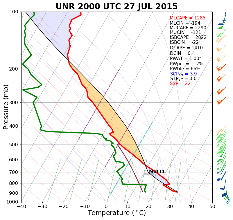 |
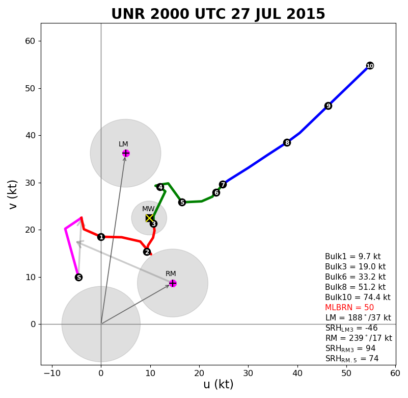 |
| Sounding for Rapid City at 2 pm MDT 27 July 2015 | Hodograph for Rapid City at 2 pm MDT 27 July 2015 |
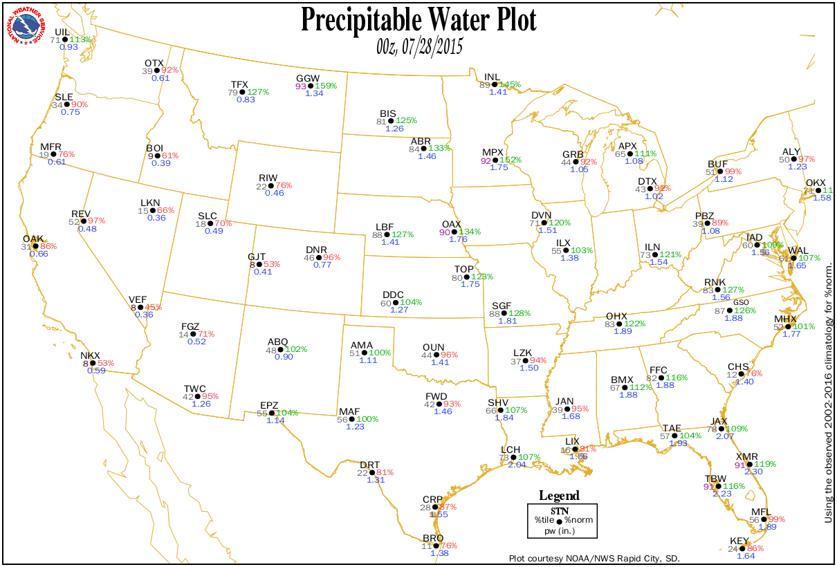
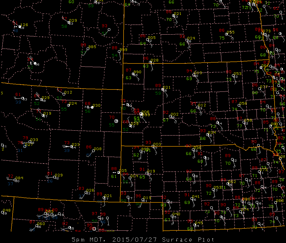
The surface map (left) and precipitable water plot (right) indicated a moderately moist environment.
 |
|
| Surface map valid 5 pm MDT 27 July 2015 | Precipitable water plot valid 6 pm MDT 27 July 2015 (00z the 28th) |
 |
Media use of NWS Web News Stories is encouraged! Please acknowledge the NWS as the source of any news information accessed from this site. |
|