Bitter cold temperatures and dangerous wind chills will persist from Florida to the Northeast through Monday. Daily record low temperatures are forecast across the Southeast and Florida, with some all-time February low temperature records possible across Florida. An Alberta clipper will spread wintry precipitation across the Northern Plains today and into the upper Great Lakes into tonight. Read More >
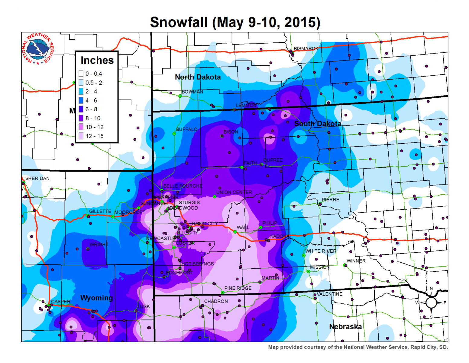
A potent late spring snow storm crossed the Northern Plains May 9-10th, 2015, bringing heavy snowfall and strong winds to the region. Reports of a foot of snow were common across western South Dakota, with the highest report being 20.8 inches in Lead. Mother's Day travel delays occurred.
The National Weather Service Office recorded 13.6 inches of total snowfall from the storm. This was the second highest snowfall total for a May snowstorm. The most snow that the Rapid City area has ever received in a single May snow storm is 14.6 inches on May 3-4, 1905. Below you will find a snowfall map, preliminary snowfall totals, a satellite image depicting the heaviest snow cover at 130 PM MDT for May 11, 2015, and a few storm pictures.

May 9-10, 2015 Storm Total Snowfall Amount (click for larger version)
1km Visible Image from May 11, 2015 at 130PM MDT Depicting Area of Heaviest Snow (click for larger version)

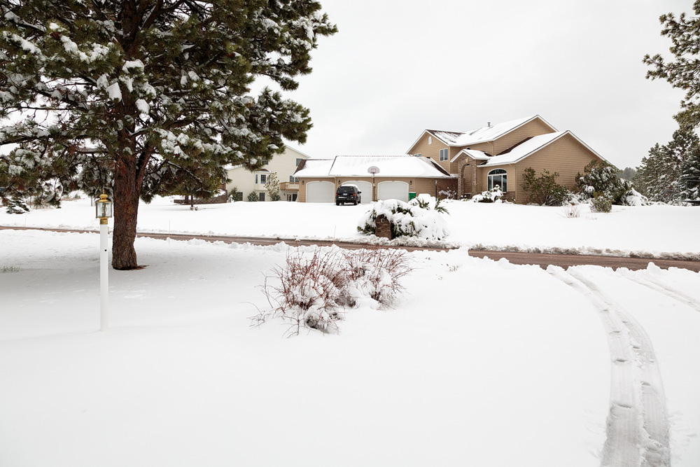
Snow May 10, 2015 over southwest Rapid City, SD

May 10, 2015 near Wall, SD

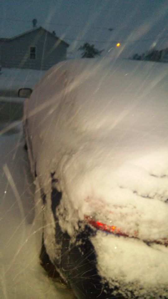
May 10, 2015 Box Elder, SD
| Location | Snowfall (inches) | Report Date | Time |
| Lead | 20.8 | 5/10/2015 | 900 PM |
| 2 SSE Deerfield | 17 | 5/10/2015 | 750 AM |
| 5 E Porcupine | 16 | 5/10/2015 | 700 PM |
| Lead 3.1 NNW | 15 | 5/11/2015 | 801 AM |
| Fort Meade (Sturgis) | 15 | 5/10/2015 | 600 PM |
| Silver City | 14.5 | 5/10/2015 | 700 AM |
| Kyle 2 E | 14.2 | 5/11/2015 | 700 AM |
| 3 NNE Creighton | 14 | 5/10/2015 | 1245 PM |
| 4 NNW Whitewood | 14 | 5/11/2015 | 700 AM |
| Deadwood | 14 | 5/11/2015 | 700 AM |
| Wall 13.0 SSE | 13.9 | 5/10/2015 | 700 AM |
| Spearfish | 13.7 | 5/11/2015 | 700 AM |
| 1E Downtown Rapid City | 13.6 | 5/10/2015 | 600 PM |
| 2 E Kyle | 13 | 5/10/2015 | 700 AM |
| Hill City | 13 | 5/11/2015 | 700 AM |
| Interior | 13 | 5/10/2015 | 500 PM |
| Rapid City Regional Airport | 13 | 5/10/2015 | 1200 AM |
| Rapid City 6.3 SW | 12.8 | 5/11/2015 | 700 AM |
| Oglala | 12.4 | 5/11/2015 | 700 AM |
| Rapid City 5.4 SW | 12.1 | 5/11/2015 | 700 AM |
| Martin 19.6 ENE | 12 | 5/10/2015 | 700 AM |
| Box Elder 8.0 NNE | 12 | 5/10/2015 | 700 AM |
| Rapid City 3.3 SSW | 12 | 5/11/2015 | 700 AM |
| Rapid City 3.8 S | 12 | 5/10/2015 | 700 AM |
| Rapid City 2.4 WNW | 12 | 5/11/2015 | 700 AM |
| 2 NNW Saint Onge | 12 | 5/10/2015 | 700 PM |
| 1 S Oglala | 12 | 5/10/2015 | 800 AM |
| 22 SSE Wall | 12 | 5/10/2015 | 758 AM |
| Martin | 12 | 5/10/2015 | 700 PM |
| Dupree 15 SE | 11.7 | 5/11/2015 | 800 AM |
| Kadoka | 11.5 | 5/10/2015 | 700 AM |
| Hot Springs 0.5 SSW | 11.5 | 5/10/2015 | 700 AM |
| Piedmont 4.6 E | 11.5 | 5/11/2015 | 700 AM |
| Pactola Reservoir | 11.3 | 5/10/2015 | 700 AM |
| Rapid City 9.6 WNW | 11.2 | 5/11/2015 | 700 AM |
| Lead 5.5 SSW | 11 | 5/11/2015 | 700 AM |
| 2 NNW Black Hawk | 11 | 5/10/2015 | 655 AM |
| Wind Cave Visitors Center | 11 | 5/10/2015 | 100 PM |
| 1 NNW Piedmont | 10.5 | 5/10/2015 | 1011 AM |
| 2 NE Box Elder | 10.5 | 5/10/2015 | 700 AM |
| 2 SSE Downtown Rapid City | 10.3 | 5/10/2015 | 700 AM |
| 4 SE Folsom | 10 | 5/10/2015 | 400 PM |
| 8 WNW Usta | 10 | 5/10/2015 | 1134 AM |
| 1 W Hermosa | 10 | 5/10/2015 | 824 AM |
| 3 SSW Downtown Rapid City | 10 | 5/10/2015 | 700 AM |
| Red Owl | 10 | 5/10/2015 | 645 AM |
| Milesville | 10 | 5/10/2015 | 900 PM |
| Bison | 10 | 5/10/2015 | 500 PM |
| 5 SW Downtown Rapid City | 9.9 | 5/10/2015 | 700 AM |
| 10 WNW Downtown Rapid City | 9.5 | 5/10/2015 | 700 AM |
| 6 ESE Box Elder | 9 | 5/10/2015 | 700 AM |
| Oral | 9 | 5/10/2015 | 700 AM |
| Hot Springs 5.2 NW | 9 | 5/10/2015 | 700 AM |
| Oral | 9 | 5/11/2015 | 800 AM |
| Mount Rushmore | 8.7 | 5/10/2015 | 1200 AM |
| 3 WNW Downtown Rapid City | 8.5 | 5/10/2015 | 700 AM |
| Sundance | 8.4 | 5/10/2015 | 1200 AM |
| Philip 18 N | 8 | 5/10/2015 | 700 AM |
| Wright | 8 | 5/10/2015 | 400 PM |
| Aladdin | 8 | 5/10/2015 | 1140 AM |
| 5 SE South Eagle Butte | 8 | 5/10/2015 | 1003 AM |
| 3 WNW Kadoka | 8 | 5/10/2015 | 926 AM |
| Opal | 8 | 5/10/2015 | 700 AM |
| Maurine 12 SW | 8 | 5/11/2015 | 700 AM |
| Belle Fourche | 7.4 | 5/11/2015 | 800 AM |
| Edgemont | 7.2 | 5/10/2015 | 700 AM |
| Edgemont | 7.2 | 5/11/2015 | 700 AM |
| Hermosa 0.3 ENE | 7 | 5/10/2015 | 700 AM |
| 5 NE Aladdin | 7 | 5/10/2015 | 1145 AM |
| 8 W Downtown Spearfish | 7 | 5/10/2015 | 1046 AM |
| 3 SSW Norris | 7 | 5/10/2015 | 700 AM |
| Harding 3 SE | 7 | 5/11/2015 | 700 AM |
| Beulah 6.1 SW | 6 | 5/10/2015 | 700 AM |
| 3 ESE Nisland | 6 | 5/10/2015 | 400 PM |
| 9 NW Creighton | 6 | 5/10/2015 | 1242 PM |
| 2 W Glad Valley | 6 | 5/10/2015 | 954 AM |
| 9 WSW Red Elm | 6 | 5/10/2015 | 826 AM |
| Hoover | 6 | 5/11/2015 | 700 AM |
| Dupree | 6 | 5/10/2015 | 600 PM |
| Hot Springs | 6 | 5/10/2015 | 400 PM |
| 8 ESE Meadow | 5 | 5/10/2015 | 951 AM |
| 12 W Wright | 5 | 5/10/2015 | 840 AM |
| Camp Crook | 5 | 5/10/2015 | 400 PM |
| Lemmon | 5 | 5/11/2015 | 500 PM |
| 13 SSW Downtown Newcastle | 4 | 5/10/2015 | 700 PM |
| 5 SE Pine Haven | 4 | 5/10/2015 | 400 PM |
| 16 SW Savageton | 4 | 5/10/2015 | 400 PM |
| 12 SSE Downtown Newcastle | 3.5 | 5/10/2015 | 700 PM |
| Gillette 0.5 ENE | 3 | 5/10/2015 | 757 AM |
| Cedar Butte | 3 | 5/11/2015 | 800 AM |
| Faith 36.3 W | 2.8 | 5/11/2015 | 700 AM |
| Lemmon 11.2 SW | 2.5 | 5/11/2015 | 700 AM |
| 9 SSE Downtown Gillette | 2 | 5/10/2015 | 634 AM |
| Upton 18.8 SW | 2 | 5/10/2015 | 700 AM |
| Gillette 4 SE | 2 | 5/10/2015 | 430 PM |
| Hullett | 2 | 5/11/2015 | 800 AM |
| Mission 14 S | 0 | 5/10/2015 | 700 PM |