
A slow moving front will be the focus area for heavy to excessive rainfall and a threat for flash/urban flooding across parts of the Gulf Coast into central/northern Florida early this week. Abnormally hot, potentially record-breaking, temperatures will continue for southern California and stretch north toward the Bay Area and Central Valley this week. Read More >
Overview
On June 13, 2014 a tornado developed near Hulett, WY, and moved generally east toward Aladdin, WY. A significant number of large ponderosa pine trees were snapped and uprooted in the Bear Lodge Mountains. One mobile home was completely destroyed, and several outbuildings were damaged or destroyed. There also was one injury reported. After surveying the storm damage, a National Weather Service team rated the tornado as EF-2.
Tornado:
|
Tornado - Hulett to Aladdin, WY
Track Map 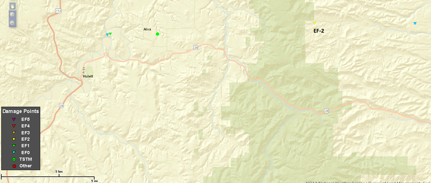  |
||||||||||||||||
The Enhanced Fujita (EF) Scale classifies tornadoes into the following categories:
| EF0 Weak 65-85 mph |
EF1 Moderate 86-110 mph |
EF2 Significant 111-135 mph |
EF3 Severe 136-165 mph |
EF4 Extreme 166-200 mph |
EF5 Catastrophic 200+ mph |
 |
|||||
Damage Photos
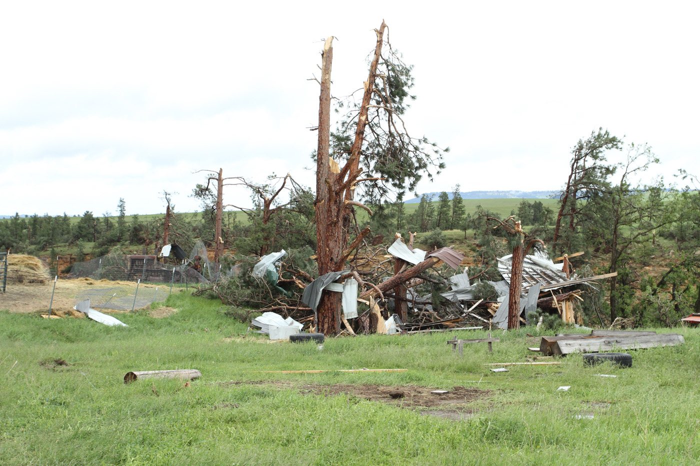
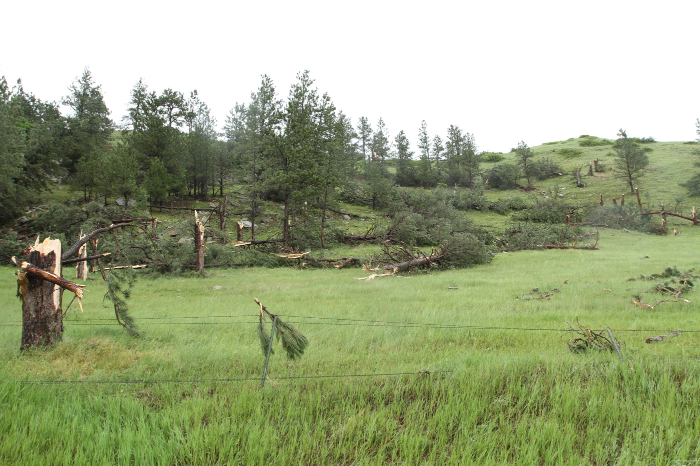
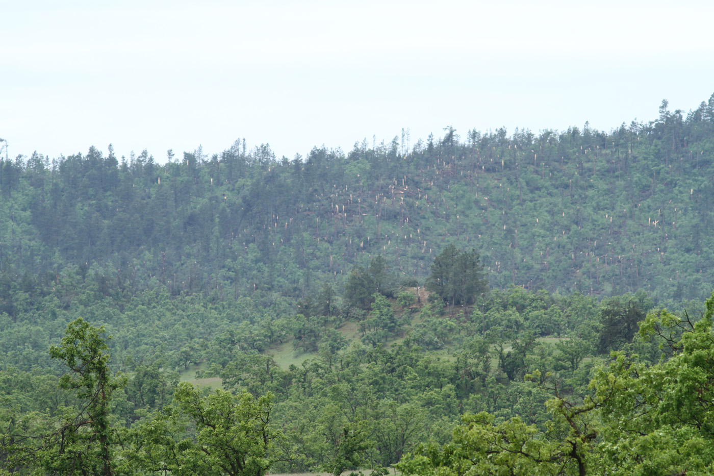
The damage photos below were taken by NWS Rapid City during the storm damage survey.
 |
 |
 |
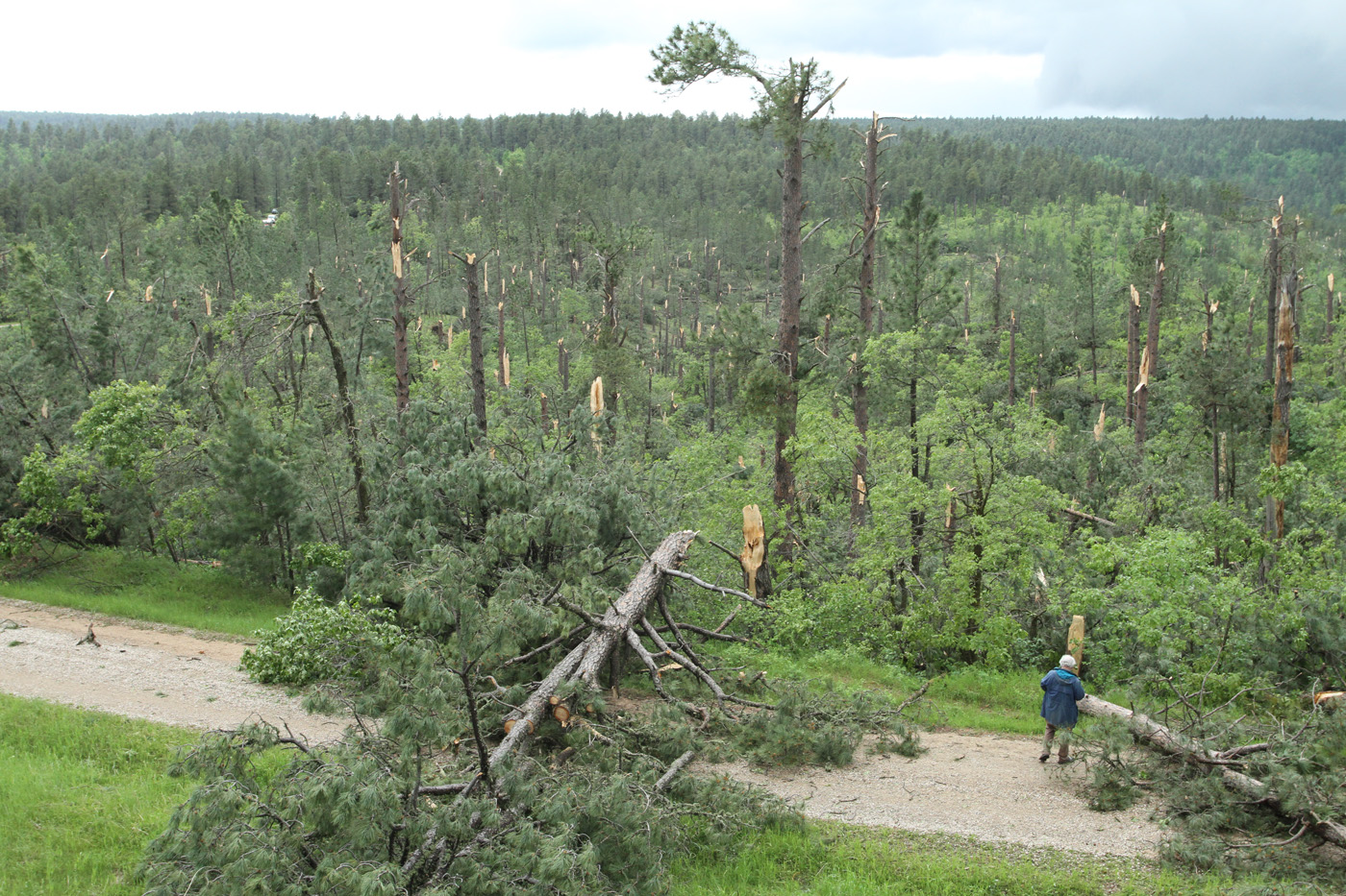 |
| Sheet metal around a tree approximately 3 miles northeast of Hulett | Tree damage north of Alva | Snapped trees north of Alva as the tornado crossed the Bear Lodge Mountains | Damaged trees north of Alva |
Radar
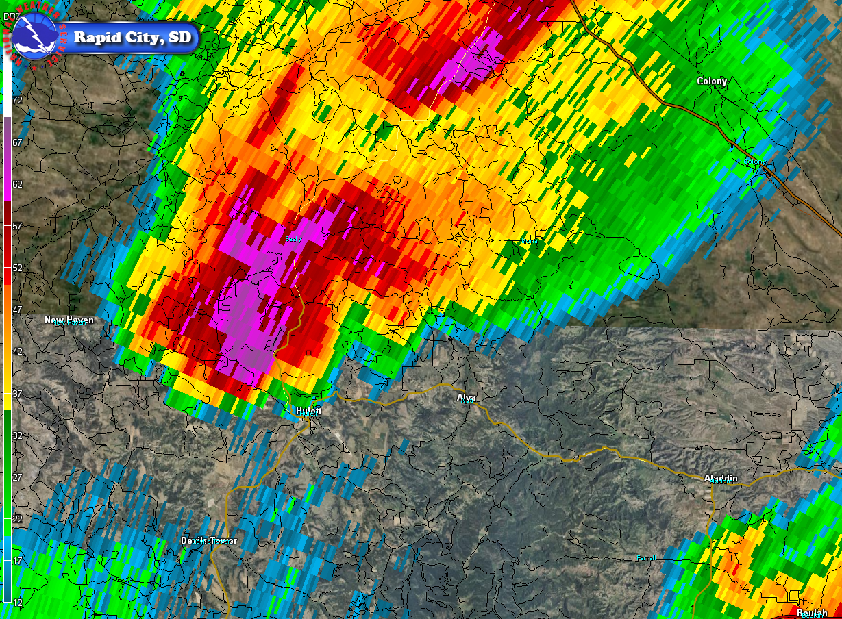
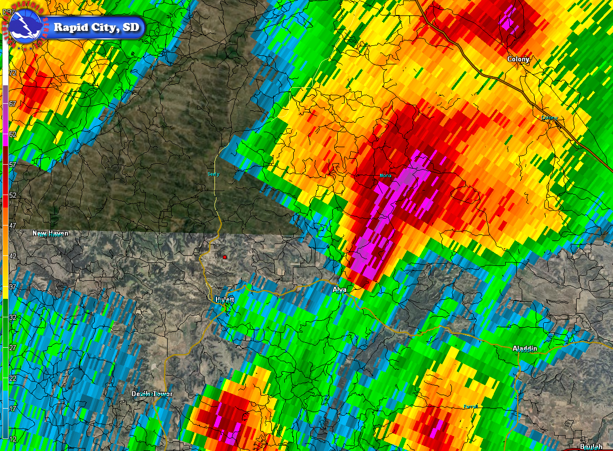
The tornado developed as a supercell thunderstorm moved across the northern Bear Lodge Mountains, and the tornado dissipated as the thunderstorm came off the mountains.
 |
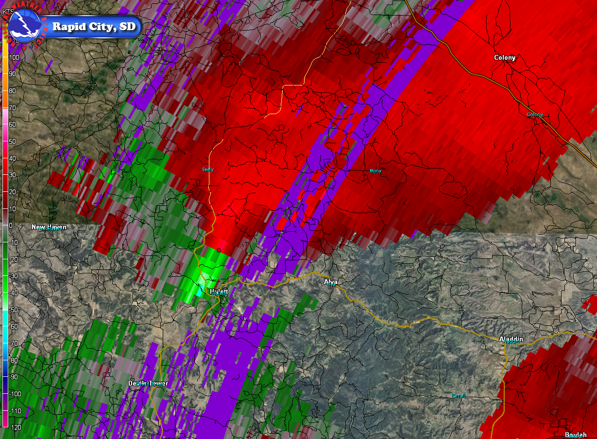 |
| June 13, 2014 438 pm MDT reflectivity image | June 13, 2014 441 pm MDT storm-relative velocity image (note the strong couplet of reds/greens, which indicates the tornado cyclone) |
 |
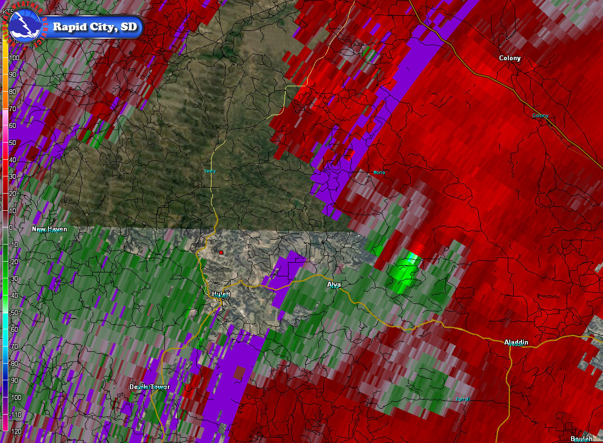 |
| June 13, 2014 458 pm MDT reflectivity image | June 13, 2014 505 pm MDT storm-relative velocity image (note the strong couplet of reds/greens, which indicates the tornado cyclone) |
Environment
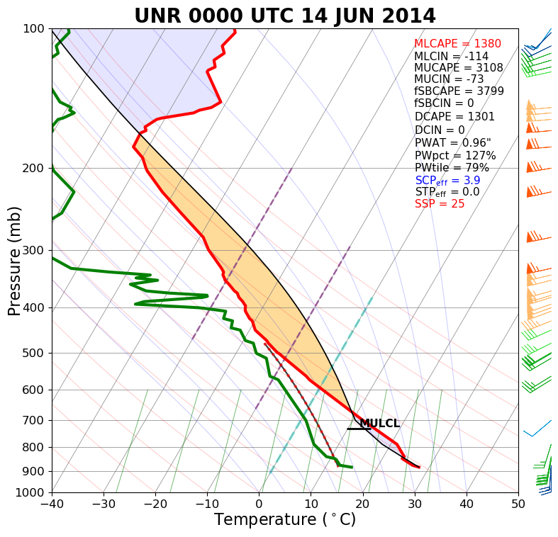
NWS Rapid City balloon information showed an unstable air mass with moderate vertical wind shear. The surface map showed moist air streaming into northeastern Wyoming.
 |
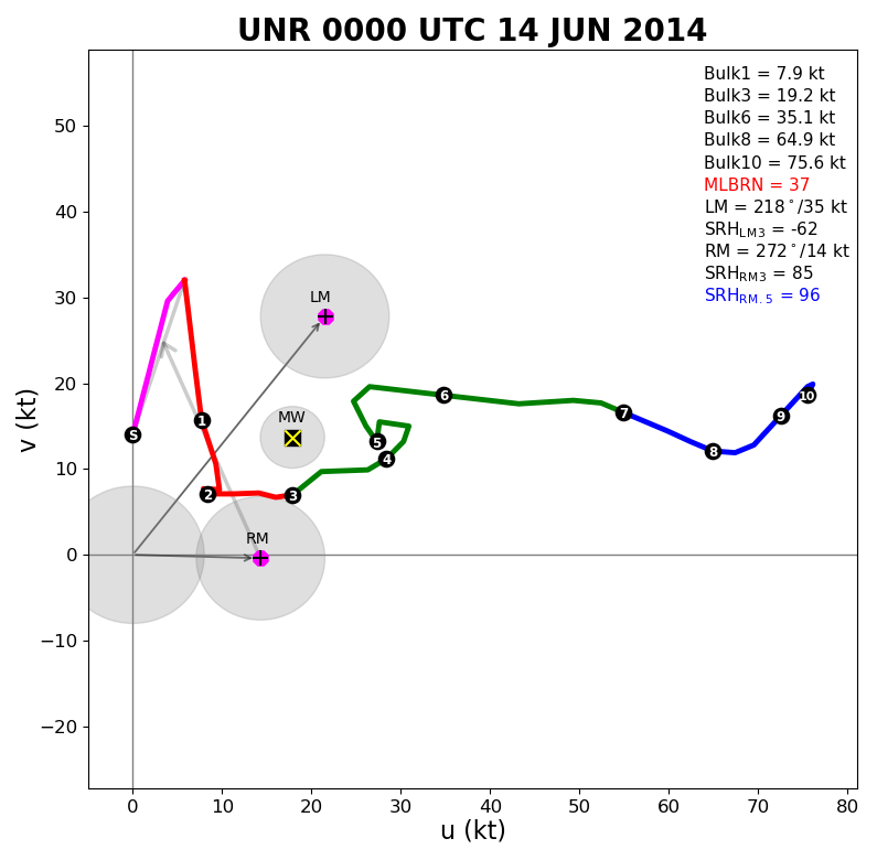 |
| Sounding valid 6 pm MDT 13 June 2014 (00z the 14th) | Hodograph valid 6 pm MDT 13 June 2014 (00z the 14th) |
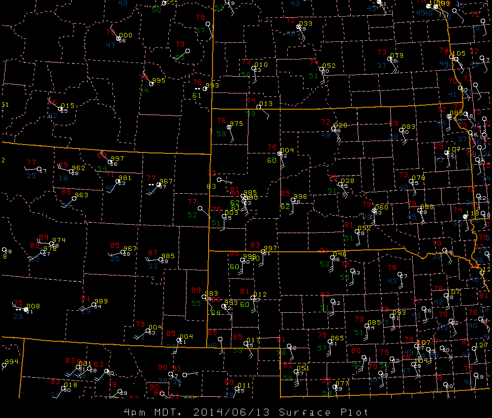 |
| Surface map valid 4 pm MDT 13 June 2014 |
 |
Media use of NWS Web News Stories is encouraged! Please acknowledge the NWS as the source of any news information accessed from this site. |
|


 Follow us on X
 Follow us on Facebook
 Follow us on YouTube
 UNR RSS Feed