
Record setting heat is expected over the next several days from the Intermountain West through the northern Plains. Furthermore, fire weather concerns increase with dry and breezy conditions. Meanwhile, heavy rainfall and severe thunderstorm threats for the Ohio/Tennessee Valleys, central Appalachians and Southeast today. The threat shifts to central Gulf Coast and across central Texas this week. Read More >
Overview
|
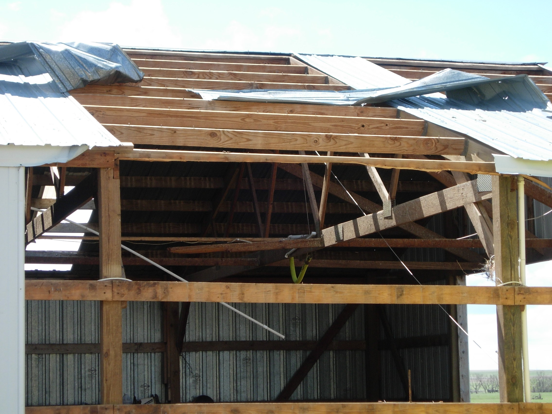
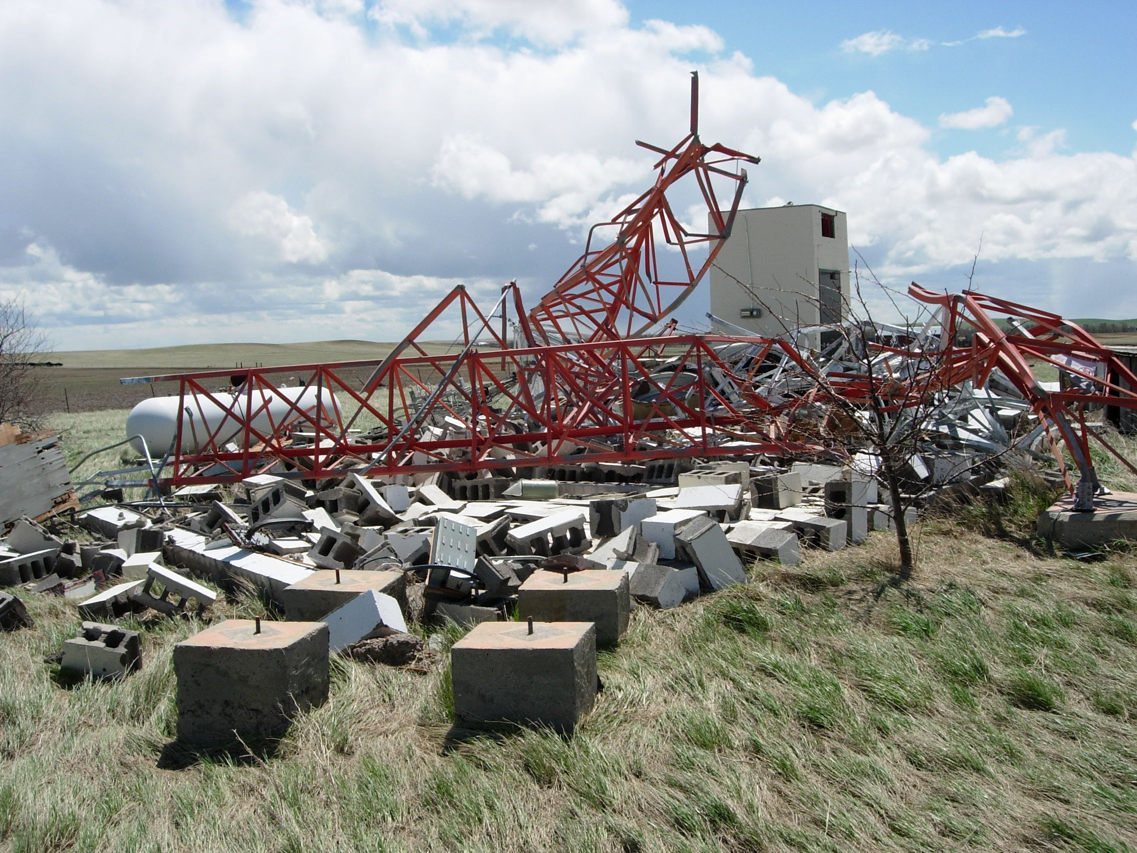
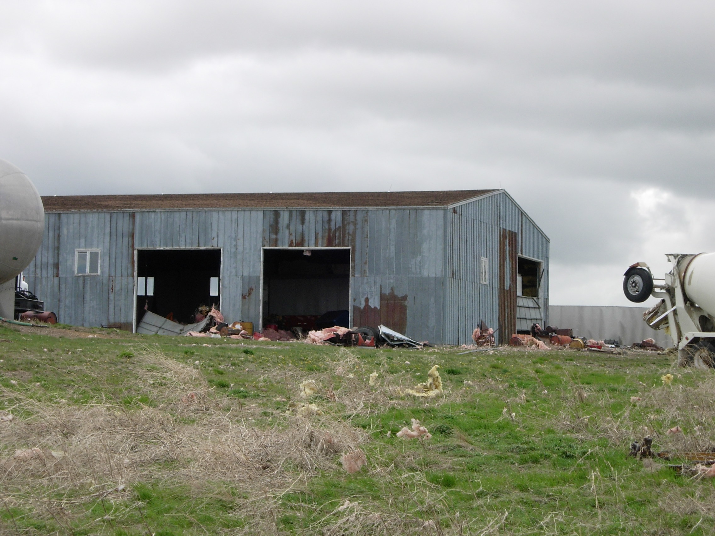
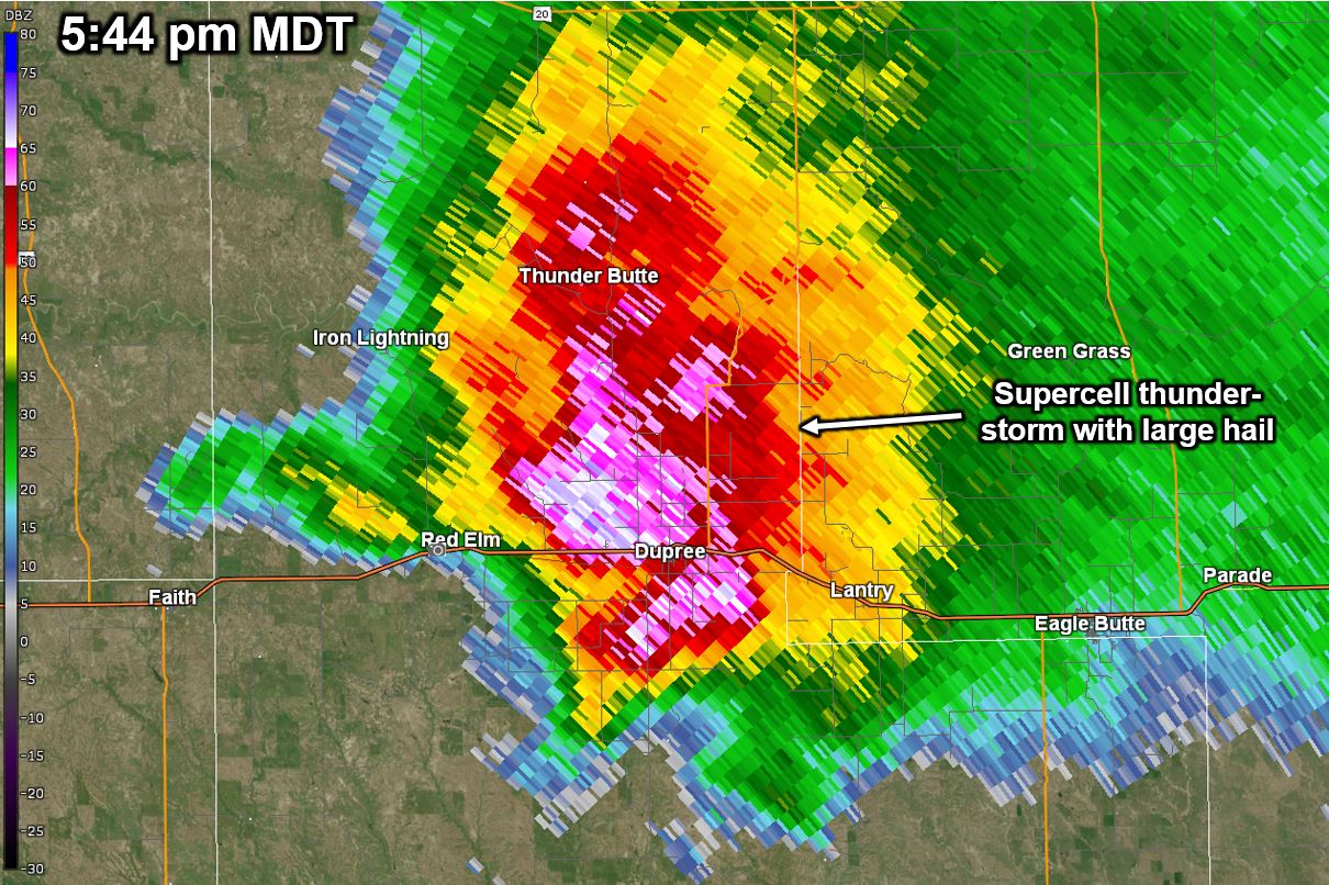
Two tornadoes touched down in Ziebach County, South Dakota Tuesday evening, May 12. Scott Olson of Brookings, South Dakota witnessed the first tornado west of Red Elm (see image to the right). National Weather Service meteorologists confirmed a second tornado occurred after conducting a damage survey the following day. Based on observed damage, the second tornado touched down about five miles west of Dupree and traveled eight miles, with damage ending about three miles northeast of Dupree. Damage included several barns and grain bins, semi-trailers, small mobile homes, and a toppled communications tower. Based on the type of damage, winds were estimated between 100 and 110 mph, giving the second tornado a rating of EF1 on a scale of EF0 to EF5 of the Enhanced Fujita Scale. |
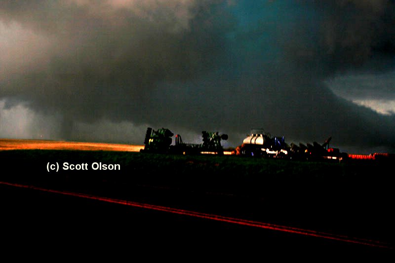 First tornado west of Red Elm around 528 pm MDT. No damage was reported with this tornado. Photo by Scott Olson |
Tornadoes:
|
Tornado - 7.5 miles west of Red Elm, SD
Track Map 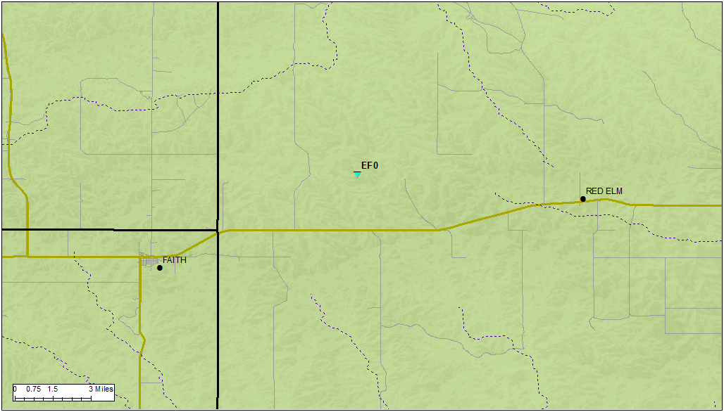 |
|
Tornado - 2.3 miles northeast of Dupree, SD
Track Map 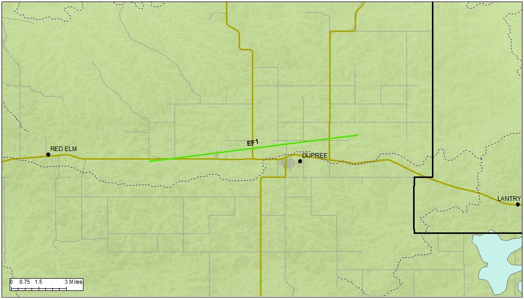 |
||||||||||||||||
The Enhanced Fujita (EF) Scale classifies tornadoes into the following categories:
| EF0 Weak 65-85 mph |
EF1 Moderate 86-110 mph |
EF2 Significant 111-135 mph |
EF3 Severe 136-165 mph |
EF4 Extreme 166-200 mph |
EF5 Catastrophic 200+ mph |
 |
|||||
Photos
 |
 |
 |
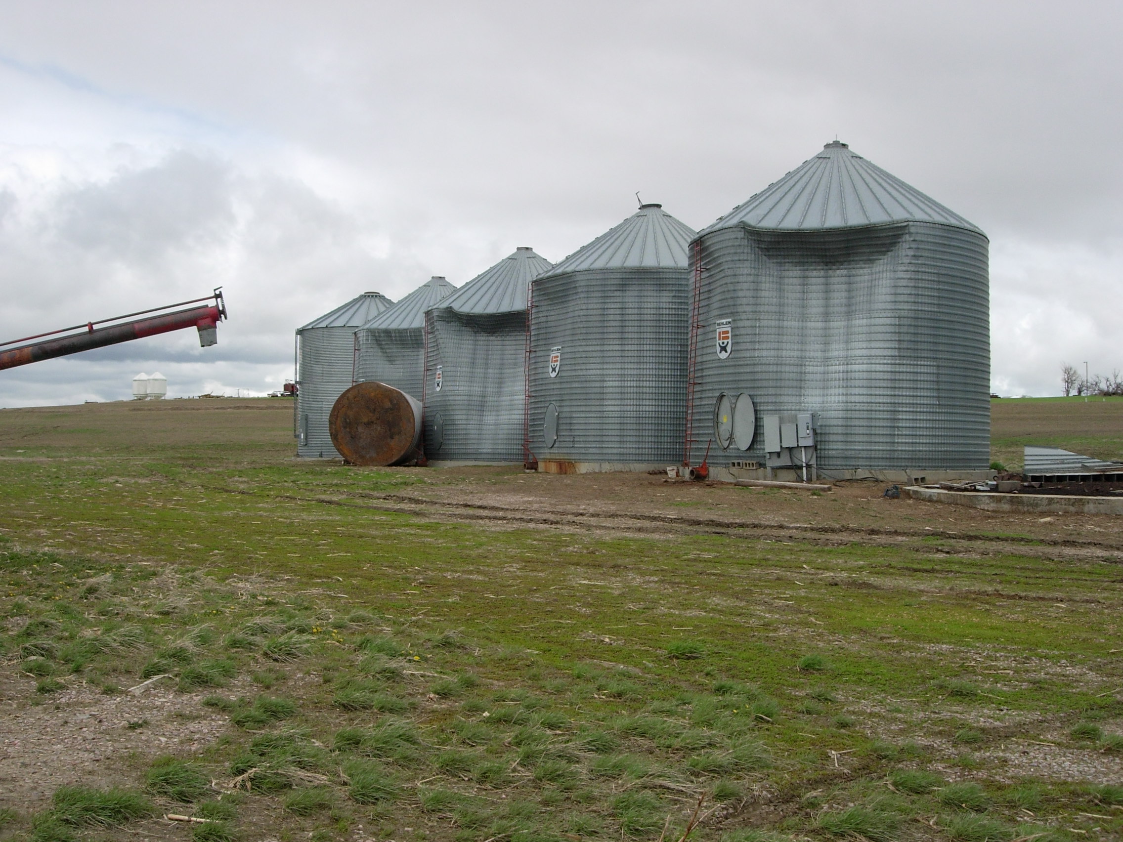 |
| Damage to a barn roof and walls northeast of Dupree | A microwave tower toppled by the winds | Barn damage west of Dupree | Damaged grain bins west of Dupree |
Radar
 |
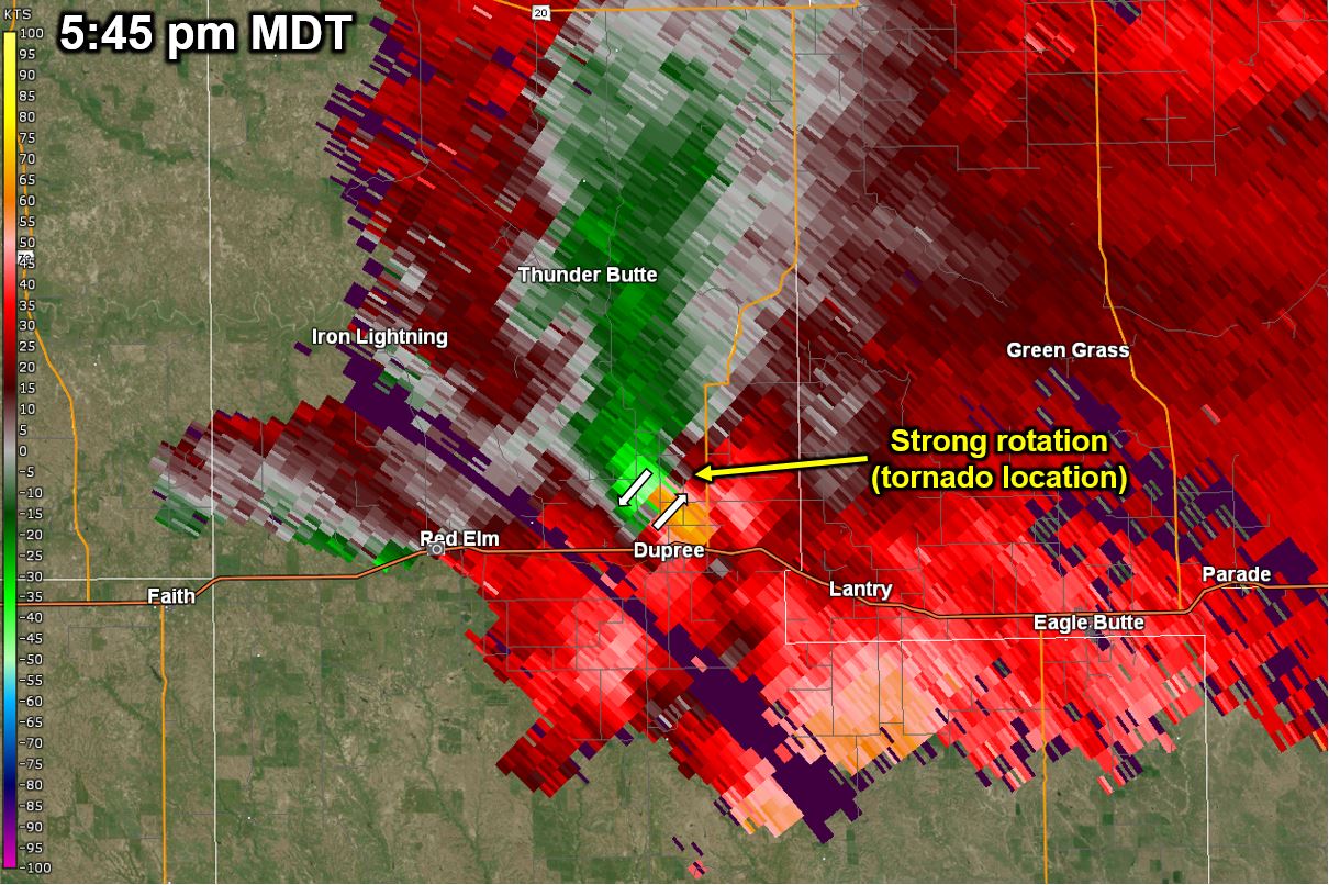 |
| May 12, 2009 544 PM MDT Base Reflectivity Image | May 12, 2009 545 PM MDT Storm Relative Velocity Image |
 |
Media use of NWS Web News Stories is encouraged! Please acknowledge the NWS as the source of any news information accessed from this site. |
|

