Heat expands across the Desert Southwest, Plains, Mississippi Valley and Midwest into Monday. Fire weather concerns continue for portions of the Intermountain West. Active monsoonal moisture fuels thunderstorms over the Southwest with possible flash flooding. Tropical cyclone Fausto in the Pacific, should weaken as it approaches Hawaii; Dangerous surf, swells and rip currents are expected. Read More >
|
|
|
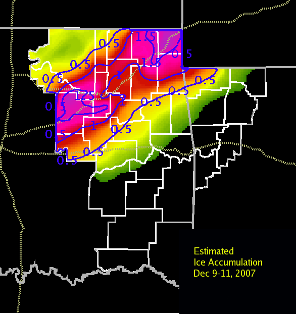
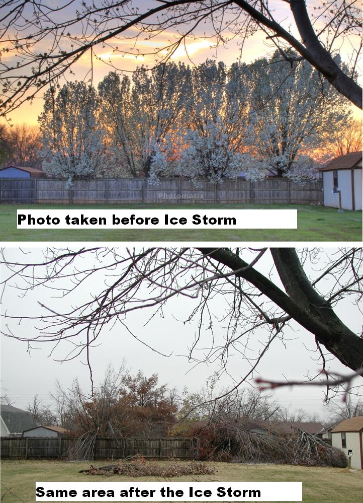
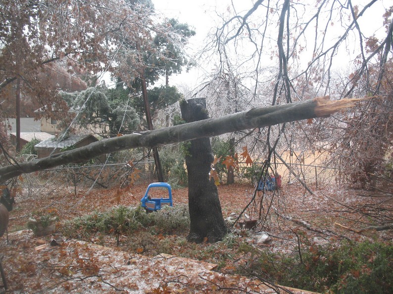
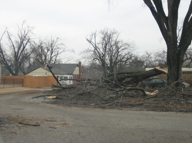
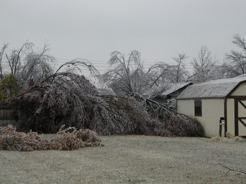
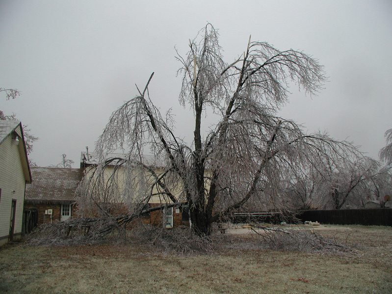
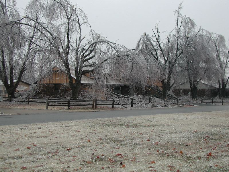
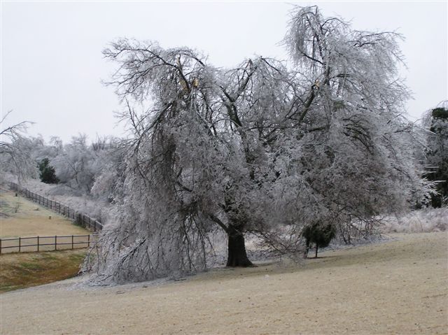
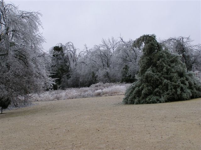
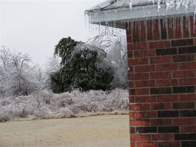
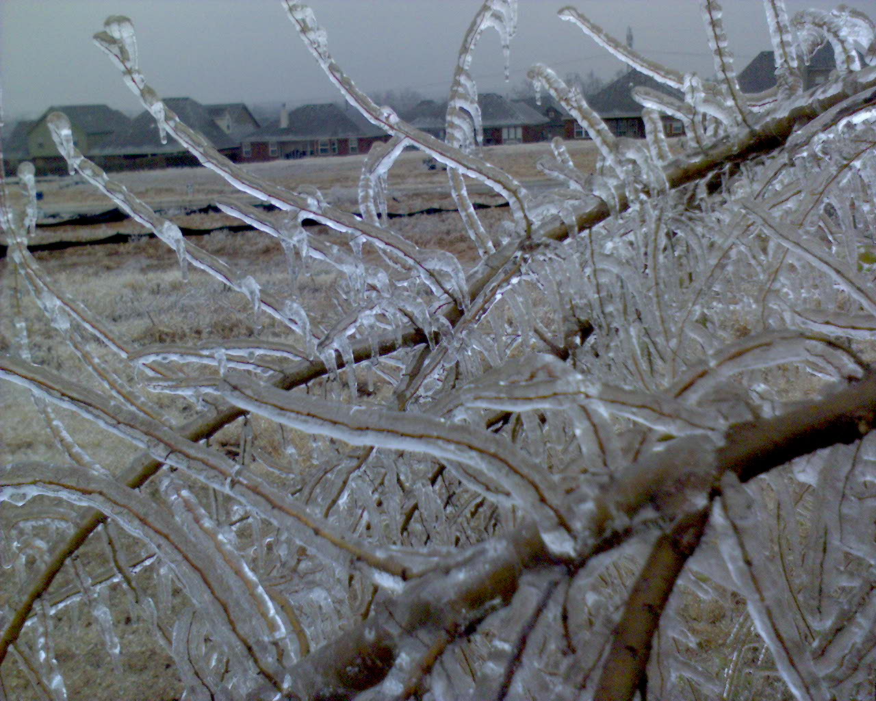
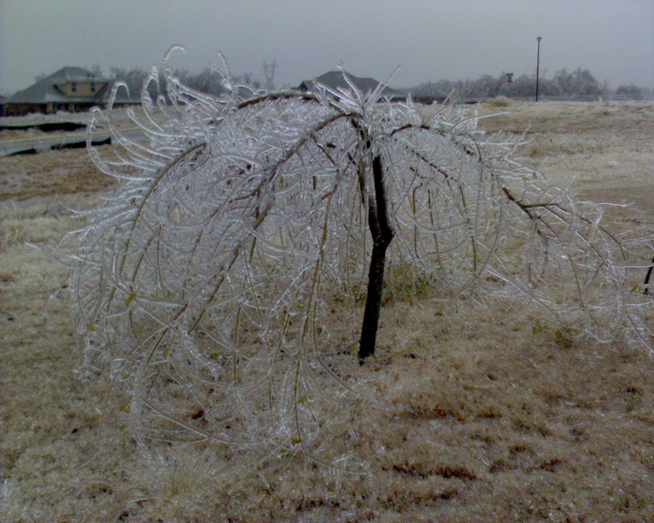
Freezing rain moved into Northeast Oklahoma late Saturday night and early Sunday morning and lasted through Monday. Surface high pressure centered over the Northern Plains drove sub-freezing temperatures southward into Oklahoma, as a strong upper level system dug into the southwester U.S. This allowed warm and moist air to override the shallow sub-freezing air near the surface and produced an environment that allowed continued development of freezing rain in the area for over 36 hours. Thunderstorms produced locally heavy rains and widespread amounts from 1 to 2 inches of rainfall were common. Much of this rain fell in temperatures below 32 degrees and froze in trees, powerlines and exposed surfaces. Ground temperatures were in the lower 40s during most of the event and kept surface roads from becoming too icy. Bridges and overpasses did freeze up and caused some travel problems mainly Sunday night and Monday. The largest impact was power outage with over 200,000 homes without power for several days during and after the event. Severe tree damage will also take days to clean up and years to recover from. Temperatures rose above freezing late Monday, but the damage was done with possibly the costliest Ice Storm in Oklahoma history. The event was forecast well in advance by forecasters at WFO Tulsa. |
| Estimated Total Ice Accumulation (inches) |
|
|
| Photos of Ice |
 |
 |
 |
 |
 |
 |
 |
 |
 |
 |
 |
 |