Overview
Several rounds of severe thunderstorms impacted portions of southeast Kansas and Missouri Ozarks between May 6th to 8th, 2024. The first round occurred late Monday night of May 6th into the early morning hours of Tuesday morning May 7th as a line of thunderstorms moved through the area. This line of thunderstorms produced straight wind gusts of 60 to 70 mph in addition to five tornadoes (2 EF-1 and 3 EF-0). Additional severe thunderstorms moved through the area on Wednesday May 8th. This round of severe thunderstorms produced large hail, damaging wind gusts, and one EF-1 tornado. Large hail sizes included a swath across southwest Missouri of baseballs (2.75 inches) to softballs (4.00 inches). Lastly, localized flash flooding accompanied this active three day stretch of severe weather.
Tornadoes:
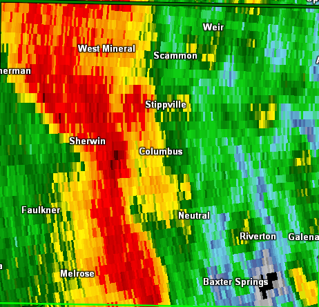
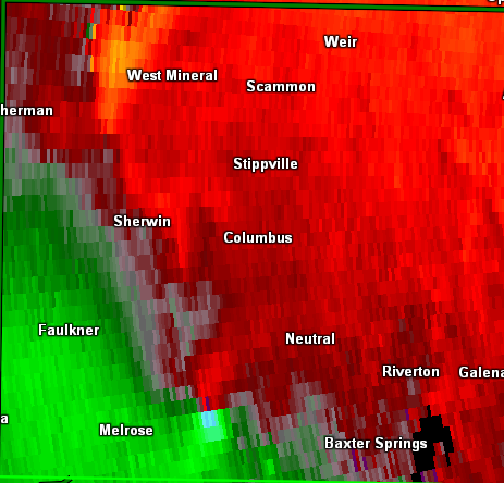
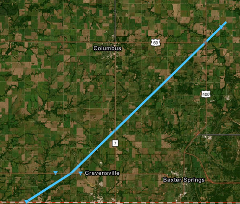
Tornado - Cherokee County
Cherokee County Kansas
| Date |
May 6, 2024 |
| Time (Local) |
11:04 pm - 11:24 pm |
| EF Rating |
EF-0 |
| Est. Peak Winds |
80 mph |
| Path Length |
20.89 miles |
| Max Width |
250 yards |
| Injuries/Deaths |
0/0 |
|
Summary:
A NWS Survey team confirmed that an intermittent EF-0 tornado with maximum winds of 80 mph caused damage to multiple barns and numerous trees to be uprooted or snapped. This is an extension of a tornado out of Ottawa County, OK that occurred on the night of May 6.
|
|
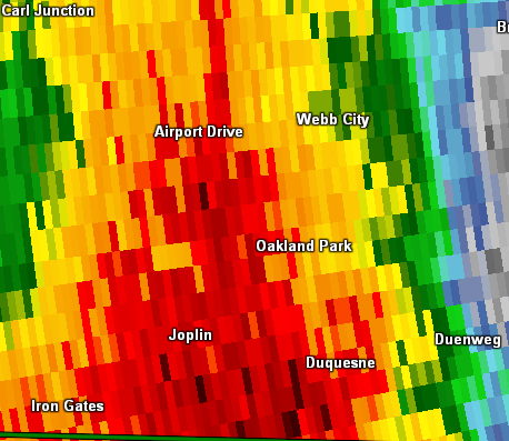
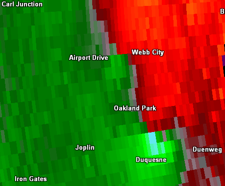
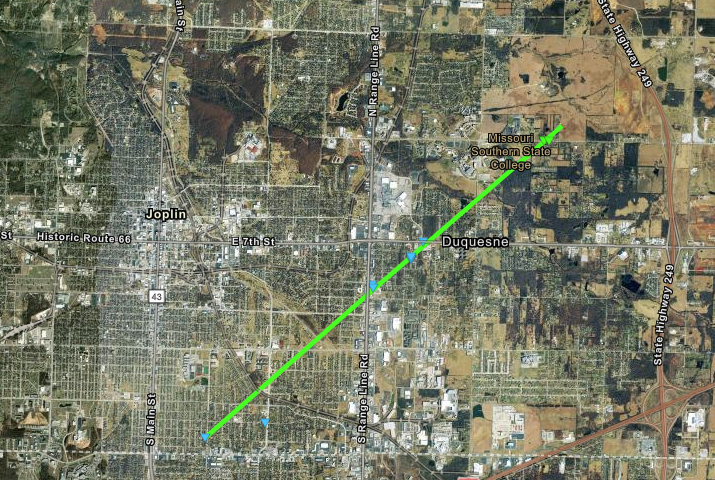
Tornado - Joplin to Duquesne
Jasper County Missouri
| Date |
May 6, 2024 |
| Time (Local) |
11:29 pm - 11:34 pm |
| EF Rating |
EF-1 |
| Est. Peak Winds |
95 mph |
| Path Length |
4.49 miles |
| Max Width |
100 yards |
| Injuries/Deaths |
0/0 |
|
Summary:
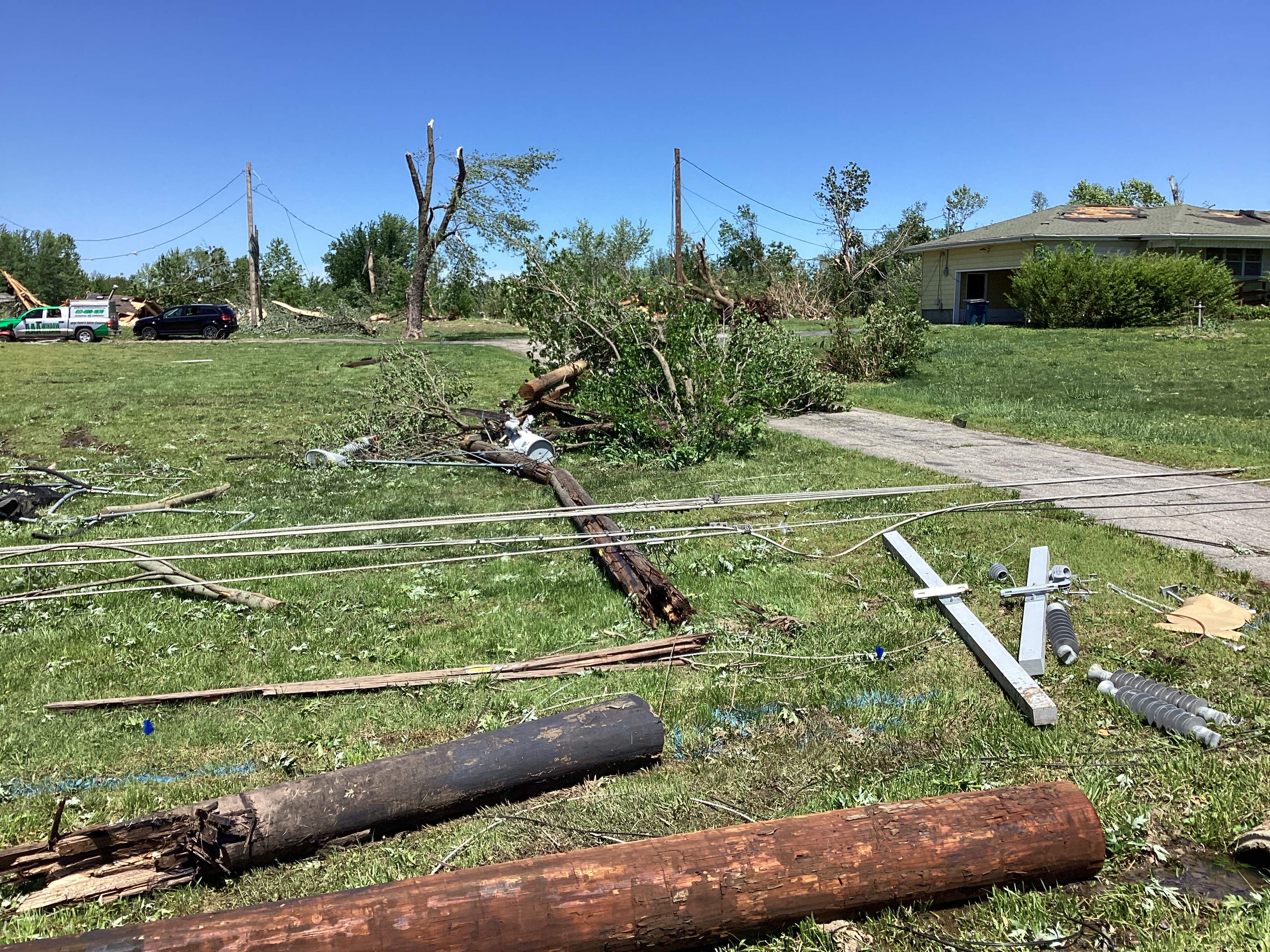
NWS Storm Survey found a EF-1 Tornado with an intermittent damage path across the southeast and east side of Joplin into Duquesne. Numerous tree limb damage and uprooted trees along with powerline damage. Shingle loss on homes. Additional roof damage caused by flying debris.
|
|
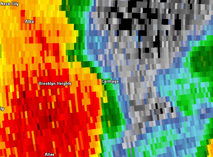
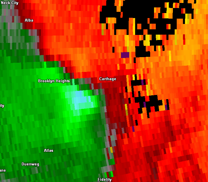
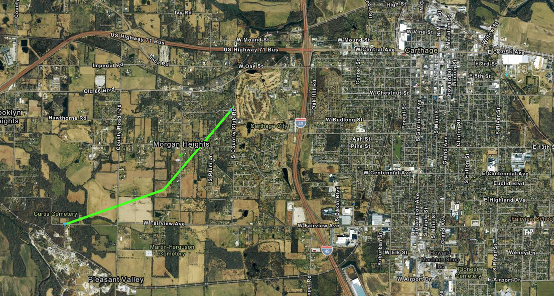
Tornado - West of Carthage
Jasper County Missouri
| Date |
May 6, 2024 |
| Time (Local) |
11:38 pm - 11:39 pm |
| EF Rating |
EF-1 |
| Est. Peak Winds |
95 mph |
| Path Length |
2.03 miles |
| Max Width |
100 yard |
| Injuries/Deaths |
0/0 |
|
Summary:
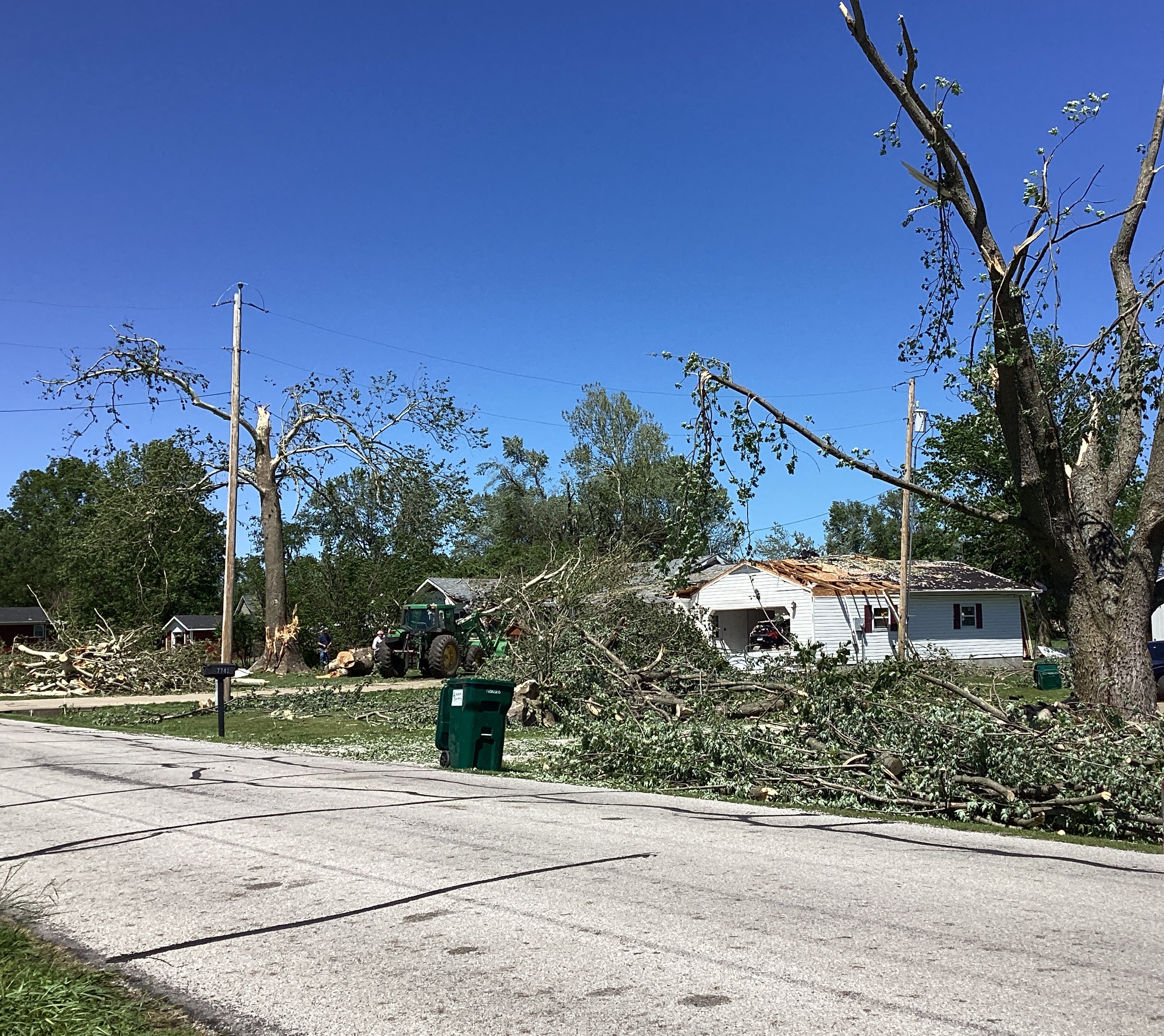
NWS Storm Survey found an EF-1 tornado just west of Carthage. Maximum winds were estimated at 95 mph. Trees were uprooted, powerlines were snapped and several roofs were damaged. Damage in Carthage was the result of widespread 70-80 mph straight line winds winds across Carthage with numerous tree limbs down and trees uprooted.
|
|
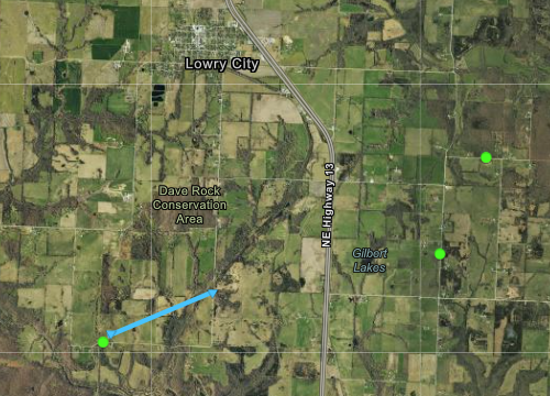
Tornado - 3 SW Lowry City
St. Clair County Missouri
| Date |
May 7th, 2024 |
| Time (Local) |
12:28 AM CDT |
| EF Rating |
EF - 0 |
| Est. Peak Winds |
75 mph |
| Path Length |
1 mile |
| Max Width |
100 yards |
| Injuries/Deaths |
0 / 0 |
|
Summary:
An NWS survey team determined that a tornado touched down near the intersection of county roads NE201 and NE550 and extended to county road 301, causing tree damage in a convergent manner. The tornado damage extended from the intersection of highways B and E through to highway HH.
|
|
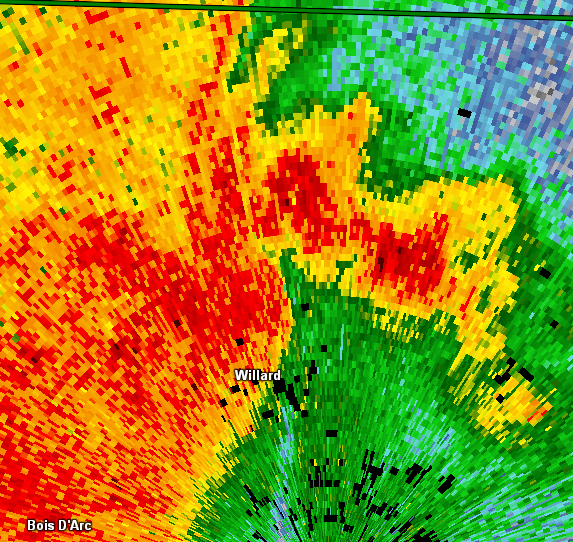
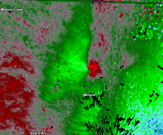
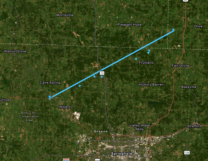
Tornado - Northern Greene County
Greene County Missouri
| Date |
May 7, 2024 |
| Time (Local) |
12:33 am - 12:54 am |
| EF Rating |
EF-0 |
| Est. Peak Winds |
80 mph |
| Path Length |
18.72 miles |
| Max Width |
150 |
| Injuries/Deaths |
1/0 |
|
Summary:
The tornado both uprooted trees and downed large limbs out of numerous other trees, and damaged or destroyed several outbuildings along an intermittent path extending from Greene Hills Country Club northwest west of Willard across northern Greene County into extreme southwest Dallas County near the intersection of Highways 215 and 65. Two homes were damaged by falling trees, with one injury reported in one of these homes.
|
|
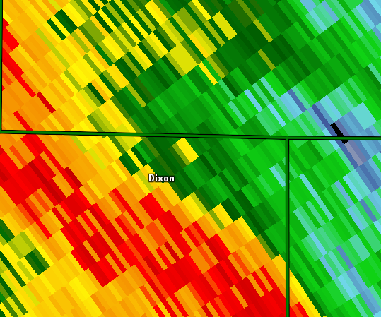
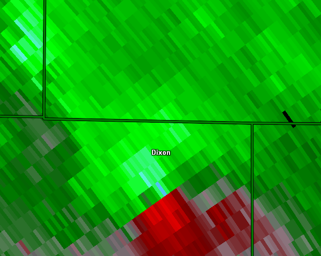
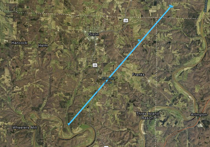
Tornado - Dixon
Pulaski County Missouri
| Date |
May 7, 2024 |
| Time (Local) |
2:28 am - 2:38 am |
| EF Rating |
EF-0 |
| Est. Peak Winds |
80 mph |
| Path Length |
10.1 miles |
| Max Width |
150 yards |
| Injuries/Deaths |
0/0 |
|
Summary:
A NWS Survey found an intermittent EF-0 tornado with maximum winds of 80 mph. The tornado touched down 6 miles south of Dixon near the Gasconade River. It tracked to the northeast before lifting 5 miles northeast of Dixon. Several uprooted trees and large broken limbs along the damage path.
|
|
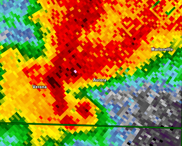
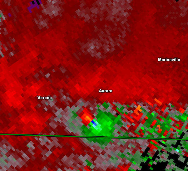
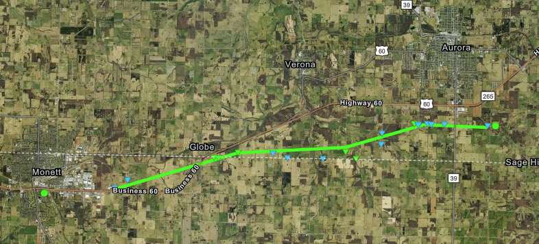
Tornado - SE Monett to SE Aurora
Barry and Lawrence counties Missouri
| Date |
May 8, 2024 |
| Time (Local) |
4:25 pm - 4:46 pm |
| EF Rating |
EF-1 |
| Est. Peak Winds |
95 mph |
| Path Length |
10.57 miles |
| Max Width |
150 yards |
| Injuries/Deaths |
0/0 |
|
Summary:
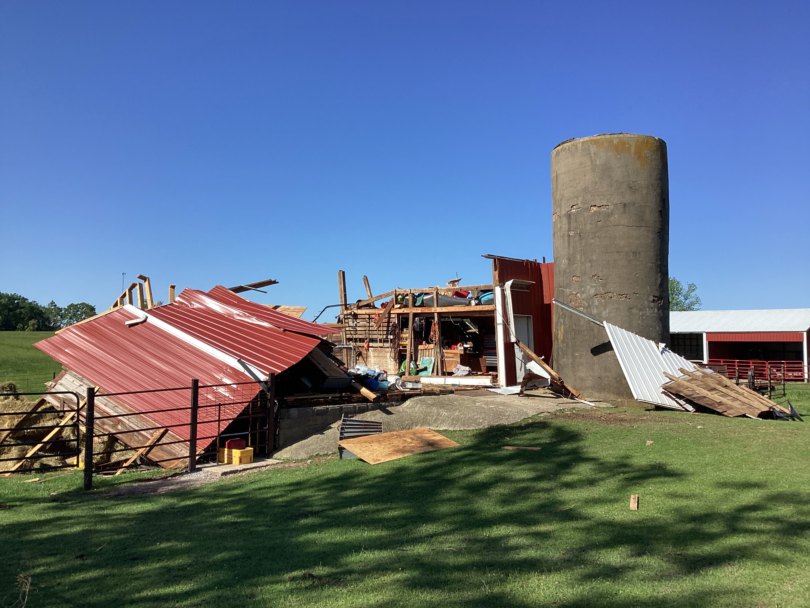
A NWS Survey team confirmed that an EF-1 tornado occurred southeast of Monett in northern Barry county and tracked northeast into southern Lawrence county before lifting southeast of Aurora. Maximum winds of 95 mph caused several trees to be uprooted or snapped, as well as damage to several outbuildings. A mobile home was flipped over, and there was some damage to roofs. The path length was 10.57 miles, and the width was 150 yards.
|
|
The Enhanced Fujita (EF) Scale classifies tornadoes into the following categories:
EF0
Weak
65-85 mph |
EF1
Moderate
86-110 mph |
EF2
Significant
111-135 mph |
EF3
Severe
136-165 mph |
EF4
Extreme
166-200 mph |
EF5
Catastrophic
200+ mph |
 |
Photos & Video
 |
 |
 |
 |
|
Powerlines and trees snapped from Joplin Tornado.
National Weather Service Survey
|
Numerous trees damaged and damage to a home from West of Carthage tornado.
National Weather Service Survey
|
Barn destroyed from Monett-Aurora tornado.
National Weather Service Survey
|
Large baseball sized hailstone.
Photo via social media from Douglas County
|
Storm Reports
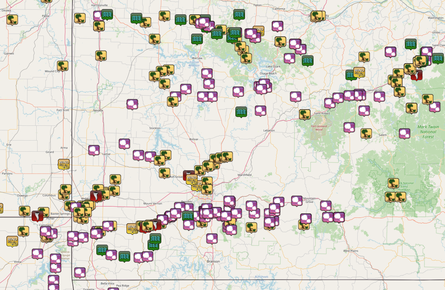
Here is a map of preliminary storm reports from May 6th through May 8th 2024:
 |
Media use of NWS Web News Stories is encouraged!
Please acknowledge the NWS as the source of any news information accessed from this site. |
|


 Weather Story
 Weather Map
 Local Radar