Overview
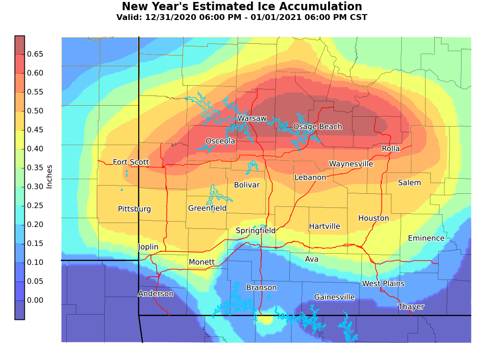
Freezing rain occurred across the area New Year's Eve evening into the morning hours New Year's Day. Ice accumulation generally ranged from a tenth of an inch to just less than three quarters of an inch. The higher amounts occurred across central Missouri, with portions of extreme southwestern MO and south central MO seeing very little, if any, ice accumulations. Scattered power outages and a few downed tree limbs occurred as a result of the ice accumulations across the area.
 |
||
| Total Ice Accumulation - Dec 31, 2020 - Jan1, 2021 |
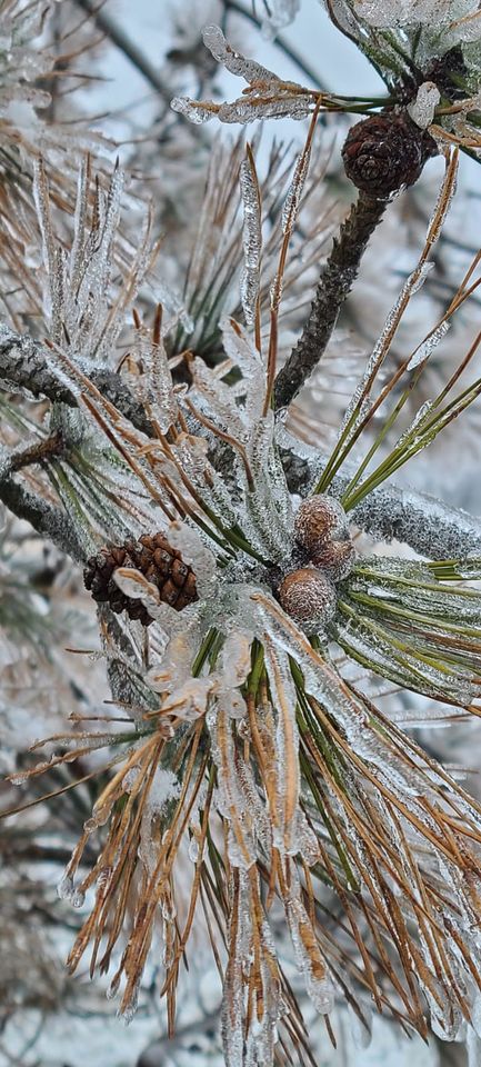
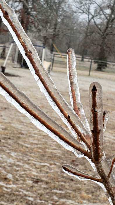
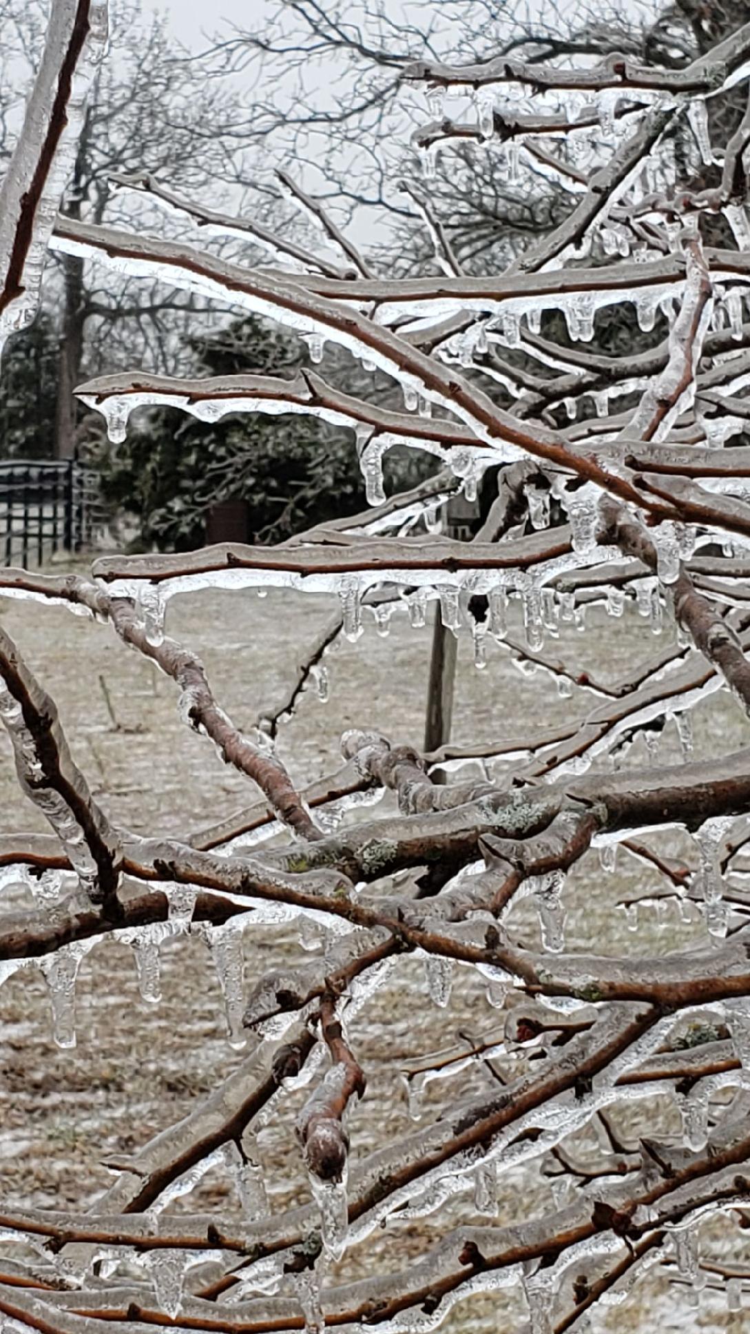
Photos & Video
Header
 |
 |
 |
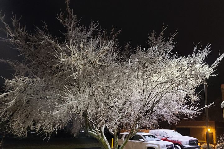 |
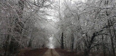
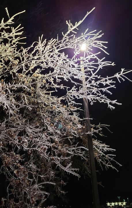
| Republic, MO | Republic, MO | Bendavis, MO | Springfield, MO |
 |
 |
 |
 |
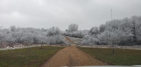
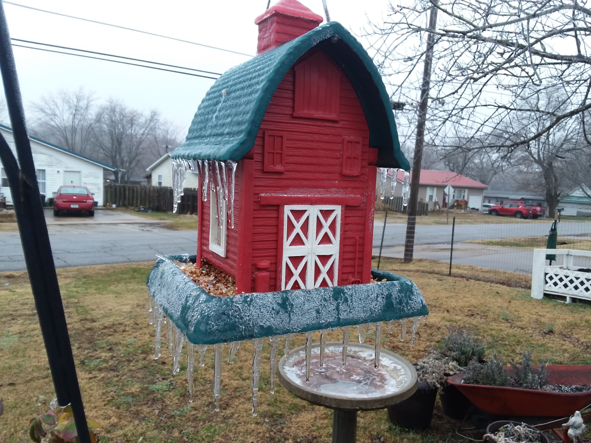
| Springfield, MO | Ava, MO | Pulaski County, MO | Lincoln, MO |
 |
 |
||
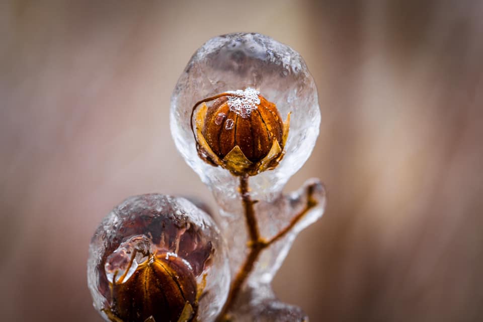
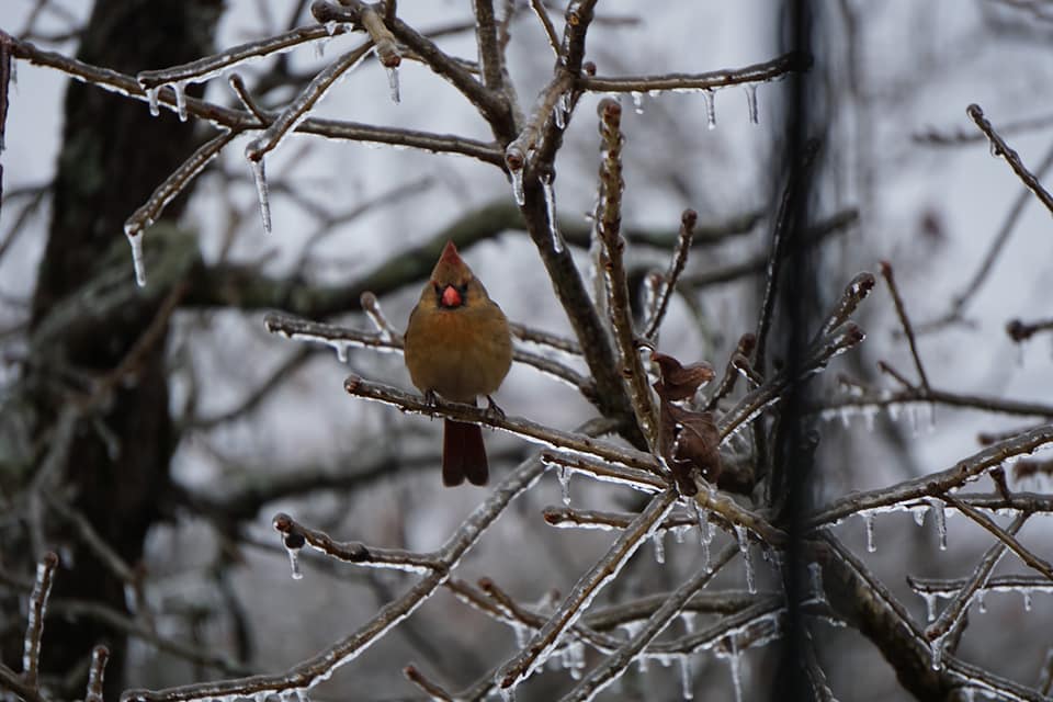
| Marshfield, MO | Marshfield, MO |
Storm Reports
PRELIMINARY LOCAL STORM REPORT...SUMMARY
NATIONAL WEATHER SERVICE SPRINGFIELD MO
248 PM CST FRI JAN 1 2021

..TIME...   ...EVENT...      ...CITY LOCATION...     ...LAT.LON...
..DATE...   ....MAG....      ..COUNTY LOCATION..ST.. ...SOURCE....
            ..REMARKS..

1130 PM     FREEZING RAIN    3 NNE NORTHVIEW         37.32N 92.98W
12/31/2020  M0.10 INCH       WEBSTER            MO   NWS EMPLOYEE

            0.10 INCH OF FLAT ICE ACCRETION.

0100 AM     FREEZING RAIN    BOLIVAR                 37.62N 93.41W
01/01/2021  E0.20 INCH       POLK               MO   PUBLIC

            SOCIAL MEDIA REPORT FROM THE PUBLIC OF 0.20
            INCHES OF ICE ACCRETION ON ELEVATED
            SURFACES.

0145 AM     FREEZING RAIN    NEOSHO                  36.87N 94.37W
01/01/2021  M0.15 INCH       NEWTON             MO   LAW ENFORCEMENT

            LAW ENFORCEMENT REPORTS 0.15 INCHES OF
            FREEZING ACCUMULATION.

0241 AM     FREEZING RAIN    4 N SPRINGFIELD         37.25N 93.30W
01/01/2021  E0.19 INCH       GREENE             MO   PUBLIC

            POWER OUTAGES BEING REPORTED THROUGHOUT THE
            SPRINGFIELD METRO AS A RESULT OF DOWNED TREE
            LIMBS AND ICE ACCUMULATING ON POWERLINES.

0418 AM     FREEZING RAIN    WHEATON                 36.76N 94.06W
01/01/2021  E0.20 INCH       BARRY              MO   FIRE DEPT/RESCUE

            WHEATON FIRE REPORTS 0.20 INCHES OF ICE
            ACCRETION IN WHEATON WITH A COUPLE TREES
            DOWN IN TOWN.

0450 AM     FREEZING RAIN    CARTHAGE                37.18N 94.31W
01/01/2021  U0.01 INCH       JASPER             MO   PUBLIC

            PICTURE OF A BROKEN TREE BRANCH DUE TO ICE
            LOAD. FREEZING RAIN ACCRETION IS UNKNOWN.

0600 AM     FREEZING RAIN    1 ENE AIRPORT DRIVE     37.15N 94.50W
01/01/2021  M0.24 INCH       JASPER             MO   ASOS

            CORRECTS PREVIOUS FREEZING RAIN REPORT FROM
            1 ENE AIRPORT DRIVE. JOPLIN ASOS MEASURED
            0.24 INCHES OF FLAT ICE ACCRETION AS OF 6
            AM.

0600 AM     FREEZING RAIN    VERONA                  36.96N 93.79W
01/01/2021  M0.15 INCH       LAWRENCE           MO   PUBLIC

            MEASURED REPORT OF 0.15 INCHES OF ICE
            ACCRETION.

0800 AM     FREEZING RAIN    1 SE REPUBLIC           37.11N 93.47W
01/01/2021  M0.10 INCH       GREENE             MO   NWS EMPLOYEE

            FLAT ICE ACCRETION.

0800 AM     FREEZING RAIN    2 SSW MORRISVILLE       37.46N 93.44W
01/01/2021  M0.20 INCH       POLK               MO   CO-OP OBSERVER

            0.2 INCHES OF FLAT ICE ACCRETION MEASURED ON
            AN ELEVATED SURFACE THROUGH 8 AM. A FEW
            SMALL BRANCHES BROKEN ON TREES.

0850 AM     FREEZING RAIN    4 NNW HALLTOWN          37.24N 93.66W
01/01/2021  U0.01 INCH       LAWRENCE           MO   PUBLIC

            PICTURE VIA SOCIAL MEDIA OF SEVERAL SMALL
            TREE BRANCHES BROKEN DUE TO THE ICE LOAD.
            FREEZING RAIN ACCRETION IS UNKNOWN.

0915 AM     FREEZING RAIN    3 ESE SPRINGFIELD       37.19N 93.23W
01/01/2021  U0.01 INCH       GREENE             MO   AMATEUR RADIO

            PICTURE OF SEVERAL LARGE TREE BRANCHES
            BROKEN DUE TO ICE LOADING. FREEZING RAIN
            ACCRETION WAS NOT MEASURED AND IS UNKNOWN
            WITH THIS REPORT.

1008 AM     FREEZING RAIN    2 E SACVILLE            37.40N 93.39W
01/01/2021  E0.25 INCH       GREENE             MO   PUBLIC

            A FEW TREE SMALL TREE BRANCHES SNAPPED OFF.
            ICE IS CURRENTLY MELTING.

1014 AM     FREEZING RAIN    APPLETON CITY           38.19N 94.03W
01/01/2021  U0.01 INCH       ST. CLAIR          MO   CO-OP OBSERVER

            SOME BROKEN TREE BRANCHES DUE TO ICE
            ACCRETIONS ON ELEVATED SURFACES. NO ICE
            ACCRETION ON THE GROUND. FREEZING RAIN
            ACCRETION WAS NOT MEASURED.

1044 AM     FREEZING RAIN    FORT SCOTT              37.84N 94.70W
01/01/2021  U0.01 INCH       BOURBON            KS   PUBLIC

            PICTURE SENT VIA SOCIAL MEDIA. TREES DOWN
            DUE TO AN UNKNOWN AMOUNT OF FREEZING RAIN.

1055 AM     FREEZING RAIN    JOPLIN                  37.08N 94.51W
01/01/2021  U0.01 INCH       JASPER             MO   PUBLIC

            PICTURE VIA SOCIAL MEDIA OF SEVERAL LARGE
            TREE LIMBS BROKEN DUE TO ICE LOADING.
            FREEZING RAIN ACCRETION AMOUNTS ARE UNKNOWN
            AND WERE NOT MEASURED.

1100 AM     FREEZING RAIN    1 E DEERFIELD           37.84N 94.48W
01/01/2021  U0.01 INCH       VERNON             MO   PUBLIC

            PICTURE VIA SOCIAL MEDIA OF SEVERAL LARGE
            TREE BRANCHES BROKEN DUE TO ICE LOADING.
            FREEZING RAIN ACCUMULATIONS ARE UNKNOWN AND
            WERE NOT MEASURED.

1100 AM     FREEZING RAIN    MILLER                  37.21N 93.84W
01/01/2021  U0.01 INCH       LAWRENCE           MO   PUBLIC

            PICTURE OF SEVERAL BRANCHES OF A TREE BROKEN
            DUE TO ICE LOADING. FREEZING RAIN ACCRETION
            WAS NOT MEASURED AND IS UNKNOWN.

1153 AM     FREEZING RAIN    1 NNE POMONA            36.88N 91.91W
01/01/2021  M0.24 INCH       HOWELL             MO   PUBLIC

            TOTAL FLAT ICE MEASURED AT UNO ASOS FOR THE
            EVENT THROUGH NOON IS 0.24 INCHES.

0100 PM     FREEZING RAIN    WILLARD                 37.31N 93.43W
01/01/2021  E0.25 INCH       GREENE             MO   PUBLIC

            VIA SOCIAL MEDIA PICTURE. ABOUT A QUARTER OF
            AN INCH FLAT ICE ACCUMULATION IN WILLARD,
            MO. BLANKET OF SNOW ON TOP.

0330 AM     ICE STORM        LAMAR                   37.50N 94.28W
01/01/2021                   BARTON             MO   PUBLIC

            SOME TREE LIMBS DOWN IN LAMAR. LOST POWER
            ABOUT 3:30 THIS AM. REPORTED AT 1PM VIA
            SOCIAL MEDIA.

0553 AM     ICE STORM        1 NW WEBB CITY          37.16N 94.50W
01/01/2021                   JASPER             MO   ASOS

            TOTAL FLAT ICE OF 0.34 INCH ACCUMULATED ON
            JLN ASOS SINCE START OF FREEZING RAIN EVENT.

0700 AM     ICE STORM        ARCADIA                 37.64N 94.62W
01/01/2021                   CRAWFORD           KS   PUBLIC

            PROBABLY .5 TO .75 INCH OF ICE IN MOST AREAS
            OF TOWN HERE IN ARCADIA, KS. TREES ARE DOWN
            FROM THE ICE.

0715 AM     ICE STORM        1 NW SALEM              37.66N 91.55W
01/01/2021                   DENT               MO   COCORAHS

            APPROXIMATE RADIAL ICE ACCUMULATION MEASURED
            ON TREES WAS 0.2 INCHES, WHICH CONVERTS TO
            0.5 INCHES OF FLAT ICE. POWER IS NOT OUT,
            BUT POWER LINES ARE SAGGING SEVERAL FEET AND
            SOME LIMBS HAVE BROKEN FROM TREES DUE TO THE
            ICE LOAD.

0750 AM     ICE STORM        FRONTENAC               37.46N 94.69W
01/01/2021                   CRAWFORD           KS   FIRE DEPT/RESCUE

            RADIAL ICE ACCRETION OF 0.19 INCHES. THIS
            CONVERTS TO 0.48 INCHES OF FLAT ICE
            ACCRETION.

0800 AM     ICE STORM        4 ESE FLEMINGTON        37.79N 93.43W
01/01/2021                   POLK               MO   CO-OP OBSERVER

            0.25 INCHES OF RADIAL ICE ACCRETION MEASURED
            ON TREE LIMBS. THIS CONVERTS TO 0.63 INCHES
            OF FLAT ICE ACCRETION. NO ICE ACCRETION ON
            PAVEMENT OR BROKEN TREE BRANCHES.

0800 AM     ICE STORM        ALDRICH                 37.55N 93.55W
01/01/2021                   POLK               MO   PUBLIC

            PICTURE VIA SOCIAL MEDIA OF A MEASUREMENT OF
            ONE EIGHTH OF AN INCH OF RADIAL ICE
            ACCRETIONS ON A TREE BRANCH. THIS CONVERTS
            TO 0.32 INCHES OF FLAT ICE ACCRETION.

0811 AM     ICE STORM        WAYNESVILLE             37.83N 92.20W
01/01/2021                   PULASKI            MO   PUBLIC

            PICTURE VIA SOCIAL MEDIA OF A MEASUREMENT OF
            0.18 INCHES OF RADIAL ICE ACCRETION ON A
            TREE LIMB. THIS CONVERTS TO 0.48 INCHES OF
            FLAT ICE ACCRETION. ACCRETION IS THROUGH 811
            AM.

0830 AM     ICE STORM        URBANA                  37.84N 93.17W
01/01/2021                   DALLAS             MO   PUBLIC

            PICTURE VIA SOCIAL MEDIA OF 0.20 INCHES OF
            RADIAL ICE MEASURED ON TREE LIMBS. THIS
            CONVERTS TO 0.50 INCHES OF FLAT ICE
            ACCRETION.

0830 AM     ICE STORM        MOUNT VERNON            37.10N 93.82W
01/01/2021                   LAWRENCE           MO   PUBLIC

            PICTURE VIA SOCIAL MEDIA OF A MEASUREMENT OF
            0.22 INCHES OF RADIAL ICE ACCRETIONS ON A
            TREE BRANCH. THIS CONVERTS TO 0.56 INCHES OF
            FLAT ICE ACCRETION.

0920 AM     ICE STORM        2 NNE NORTHVIEW         37.32N 92.97W
01/01/2021                   WEBSTER            MO   CO-OP OBSERVER

            RADIAL ICE ACCRETION MEASUREMENTS ON SEVERAL
            LIMBS VARY BETWEEN 0.20 TO 0.25 INCHES. THIS
            CONVERTS TO 0.50 TO 0.63 INCHES OF FLAT ICE
            ACCRETION. POWER IS ALSO FLICKERING AT THIS
            LOCATION.

0925 AM     ICE STORM        MONETT                  36.92N 93.93W
01/01/2021                   BARRY              MO   PUBLIC

            PICTURE VIA SOCIAL MEDIA OF A 0.15 INCH
            RADIAL ICE ACCRETION. THIS CONVERTS TO 0.38
            INCHES OF FLAT ICE ACCRETION.

0930 AM     ICE STORM        LINN CREEK              38.04N 92.71W
01/01/2021                   CAMDEN             MO   PUBLIC

            RADIAL ICE MEASUREMENT OF ONE EIGHTH OF AN
            INCH. THIS CONVERTS TO 0.32 INCHES OF FLAT
            ICE ACCRETION.

0950 AM     ICE STORM        BUFFALO                 37.65N 93.09W
01/01/2021                   DALLAS             MO   EMERGENCY MNGR

            FLAT ICE ACCRETION ON ELEVATED SURFACE OF
            0.25 INCHES IN BUFFALO.

1018 AM     ICE STORM        NEVADA                  37.84N 94.35W
01/01/2021                   VERNON             MO   PUBLIC

            ESTIMATED FLAT ICE ACCRETIONS ON ELEVATED
            SURFACES OF 0.25 TO 0.5 INCHES. TREES AND
            POWER LINES ALSO REPORTED DOWN IN THE AREA.

1110 AM     ICE STORM        3 E PRESTON             37.94N 93.15W
01/01/2021                   HICKORY            MO   AMATEUR RADIO

            PICTURE SHOWING A MEASUREMENT OF 0.16 INCHES
            OF RADIAL ICE ON A TREE LIMB. THIS CONVERTS
            TO 0.40 INCHES OF FLAT ICE ACCRETION.
            SEVERAL LARGE BROKEN TREE LIMBS OBSERVED.

1152 AM     ICE STORM        5 SSE WILLARD           37.23N 93.39W
01/01/2021                   GREENE             MO   ASOS

            UPDATES PREVIOUS ICE STORM REPORT FROM 5 SSE
            WILLARD. SPRINGFIELD ASOS HAS MEASURED 0.45
            INCHES OF FLAT ICE ACCRETION THROUGH NOON
            SINCE THE EVENT BEGAN.

1153 AM     ICE STORM        1 NNW VICHY             38.13N 91.77W
01/01/2021                   MARIES             MO   ASOS

            UPDATES PREVIOUS ICE STORM REPORT FROM 1 NNW
            VICHY. VICHY ASOS OBSERVED FLAT ICE
            ACCRETIONS OF 0.68 INCHES THROUGH NOON.

1200 PM     ICE STORM        5 SSE WILLARD           37.23N 93.40W
01/01/2021                   GREENE             MO   NWS EMPLOYEE

            CORRECTS PREVIOUS ICE STORM REPORT FROM 5
            SSE WILLARD. UPDATED TO PREVIOUS ICE STORM
            REPORT FROM 5 SSE WILLARD. NOON OBSERVATION
            AT THE NWS OFFICE MEASURED 0.29 INCHES OF
            TOTAL FLAT ICE ACCRETIONS ON AN ICE BOARD
            SINCE THE EVENT BEGAN. RADIAL ICE
            MEASUREMENTS WERE 0.12 INCHES, WITH A
            CONVERSION TO FLAT ICE OF 0.30 INCHES.

1234 PM     ICE STORM        ARCADIA                 37.64N 94.62W
01/01/2021                   CRAWFORD           KS   PUBLIC

            PICTURE OF SEVERAL 12 INCH PLUS DIAMETER
            TREE TOPS AND BRANCHES SNAPPED OFF FROM ICE
            LOADING. FREEZING RAIN ACCRETION ESTIMATED
            AT 0.50 INCHES.

1030 AM     SNOW             CARTHAGE                37.18N 94.31W
01/01/2021  M1.0 INCH        JASPER             MO   PUBLIC

            CORRECTS PREVIOUS SNOW REPORT FROM CARTHAGE.
            SNOW ACCUMULATION FROM 930 AM TO 1030 AM IN
            CARTHAGE.

1100 AM     SNOW             1 E DEERFIELD           37.84N 94.48W
01/01/2021  E1.5 INCH        VERNON             MO   PUBLIC

            ESTIMATED SNOW AMOUNT THROUGH 11 AM.

1108 AM     SNOW             NEOSHO                  36.87N 94.37W
01/01/2021  E2.5 INCH        NEWTON             MO   LAW ENFORCEMENT

            SNOW ACCUMULATION THROUGH 1108 AM.

1250 PM     SNOW             5 SSE WILLARD           37.23N 93.40W
01/01/2021  M0.8 INCH        GREENE             MO   OFFICIAL NWS OBS

            CORRECTS PREVIOUS SNOW REPORT FROM 5 SSE
            WILLARD. UPDATE TO PREVIOUS SNOW REPORT FROM
            5 SSE WILLARD. NWS OFFICE OBSERVATION.
            AMOUNT IS THE EVENT TOTAL SNOWFALL THROUGH
            1250 PM. SNOW HAS ENDED AT THE OFFICE.


&&

$$
 |
Media use of NWS Web News Stories is encouraged! Please acknowledge the NWS as the source of any news information accessed from this site. |
|


 Weather Story
 Weather Map
 Local Radar