Overview
Several rounds of severe thunderstorms and heavy rainfall occurred from April 25th - April 28th. A few tornadoes occurred along with several instances of damaging winds. Widespread heavy rainfall over this time frame led to flash flooding of small creeks and streams and major flooding along the Marmaton and Little Osage River basins. Four day storm total rainfall amounts ranged from 1-12 inches with the highest amounts (12 inches) located across portions of Bourbon and Vernon counties.
Tornadoes:
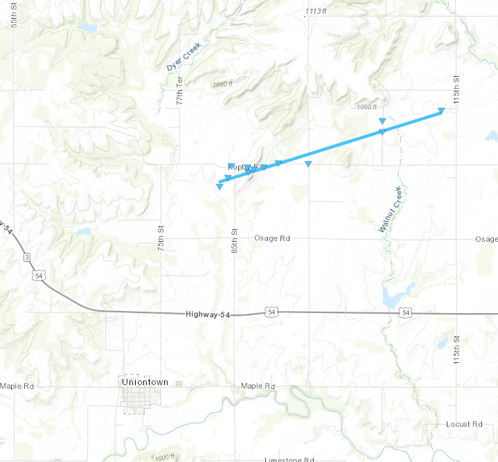
Tornado - Uniontown, Kansas
Bourbon County
| Date |
April 26, 2024 |
| Time (Local) |
5:29pm - 5:32 pm CDT |
| EF Rating |
EF-0 |
| Est. Peak Winds |
85mph |
| Path Length |
3.12 miles |
| Max Width |
75 yards |
| Injuries/Deaths |
0/0 |
|
Summary:
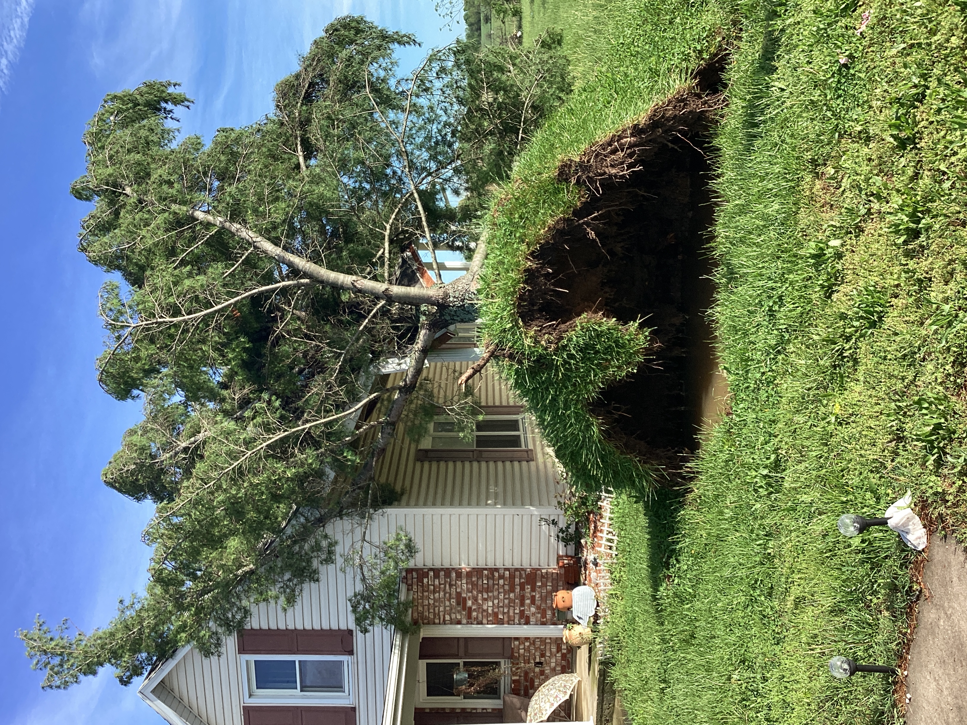
A weak EF-0 tornado occurred 3 miles ENE of Uniontown in Bourbon County, KS. The path length was 3.12 miles with a width of 75 yards. Maximum wind speeds of 85 mph led to siding damage on a home, five outbuildings damaged or destroyed, and a number of trees either uprooted or having large limbs snapped.
|
Track Map
Downloadable KMZ File
 |
 |
 |
 |
|
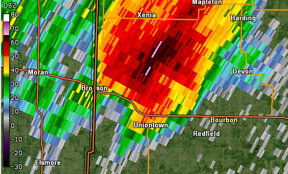
KSGF Radar Reflectivity
April 27, 2024
5:30 PM CDT
|
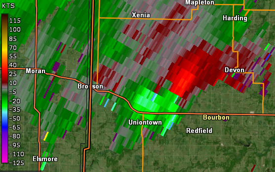
KSGF Radar Velocity
April 27, 2024
5:30 PM CDT
|
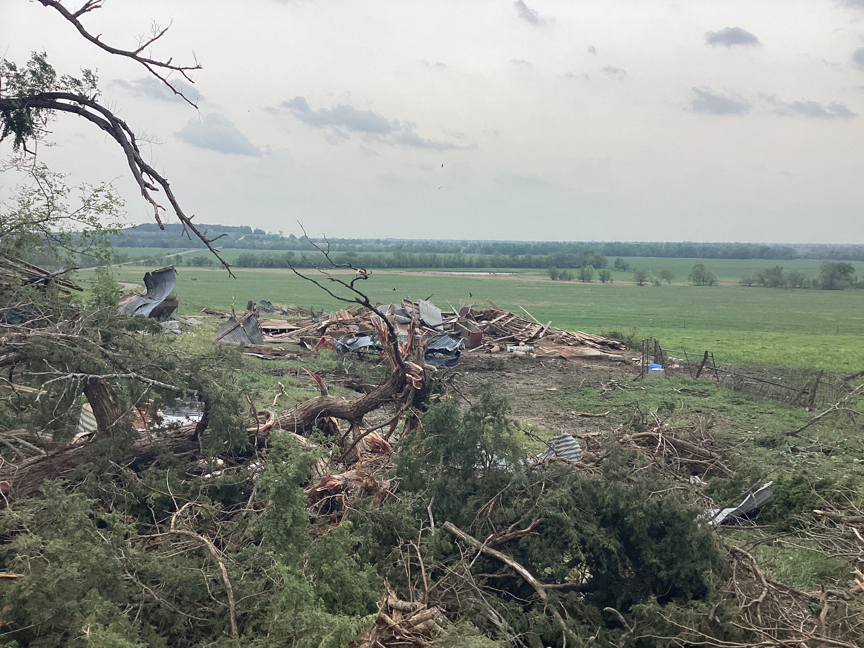
Barn Destroyed
Uniontown Tornado
National Weather Service Survey
|
Roof damage to house and outbuilding damage
Uniontown Tornado
National Weather Service Survey
|
|
|
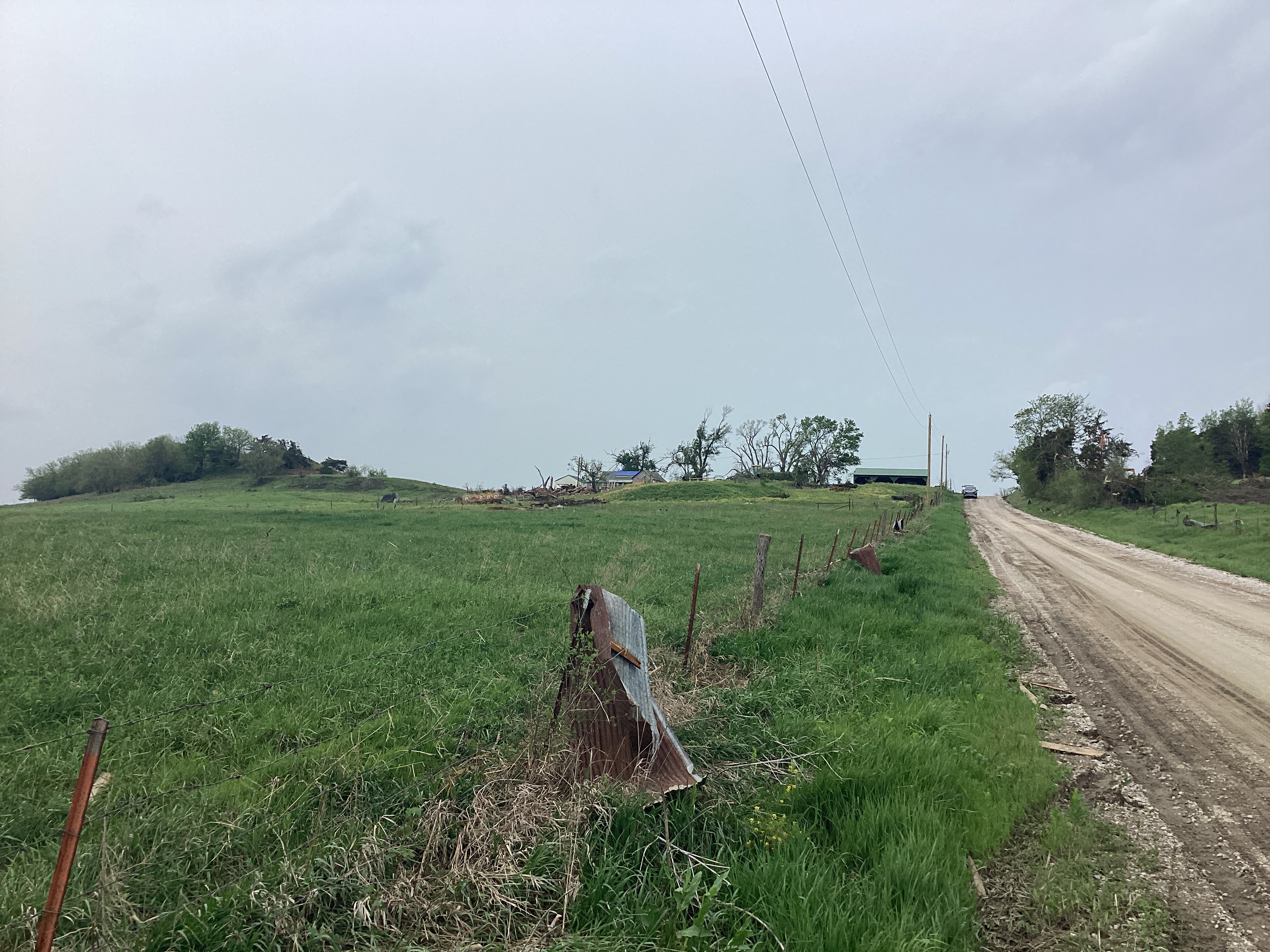
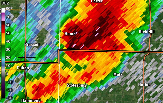
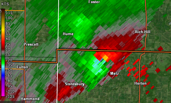
Tornado - Stotesbury, Missouri
Vernon County
| Date |
April 26, 2024 |
| Time (Local) |
6:07pm - 6:13pm CDT |
| EF Rating |
EF-1 |
| Est. Peak Winds |
95 mph |
| Path Length |
3.4 miles |
| Max Width |
95 yards |
| Injuries/Deaths |
0/0 |
|
Summary:
An EF-1 tornado occurred 3 miles ENE of Stotesbury in Vernon County, MO. The path length was 3.4 miles with a width of 95 yards. Maximum wind speeds of 95 mph destroyed two outbuildings and caused a number of trees to be either uprooted or have large limbs snapped.
|
Track Map
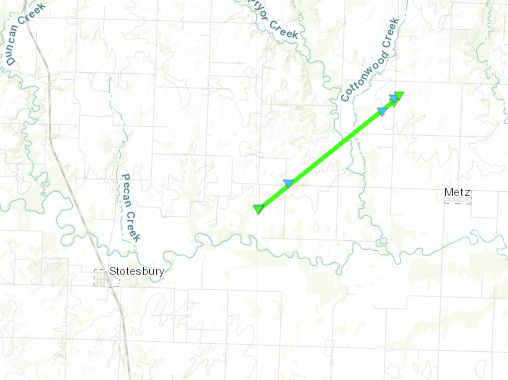
Downloadable KMZ File
 |
 |
 |
 |
|
KSGF Radar Reflectivity
April 26, 2024
6:11 PM CDT
|
KSGF Radar Velocity
April 26, 2024
6:11 PM CDT
|
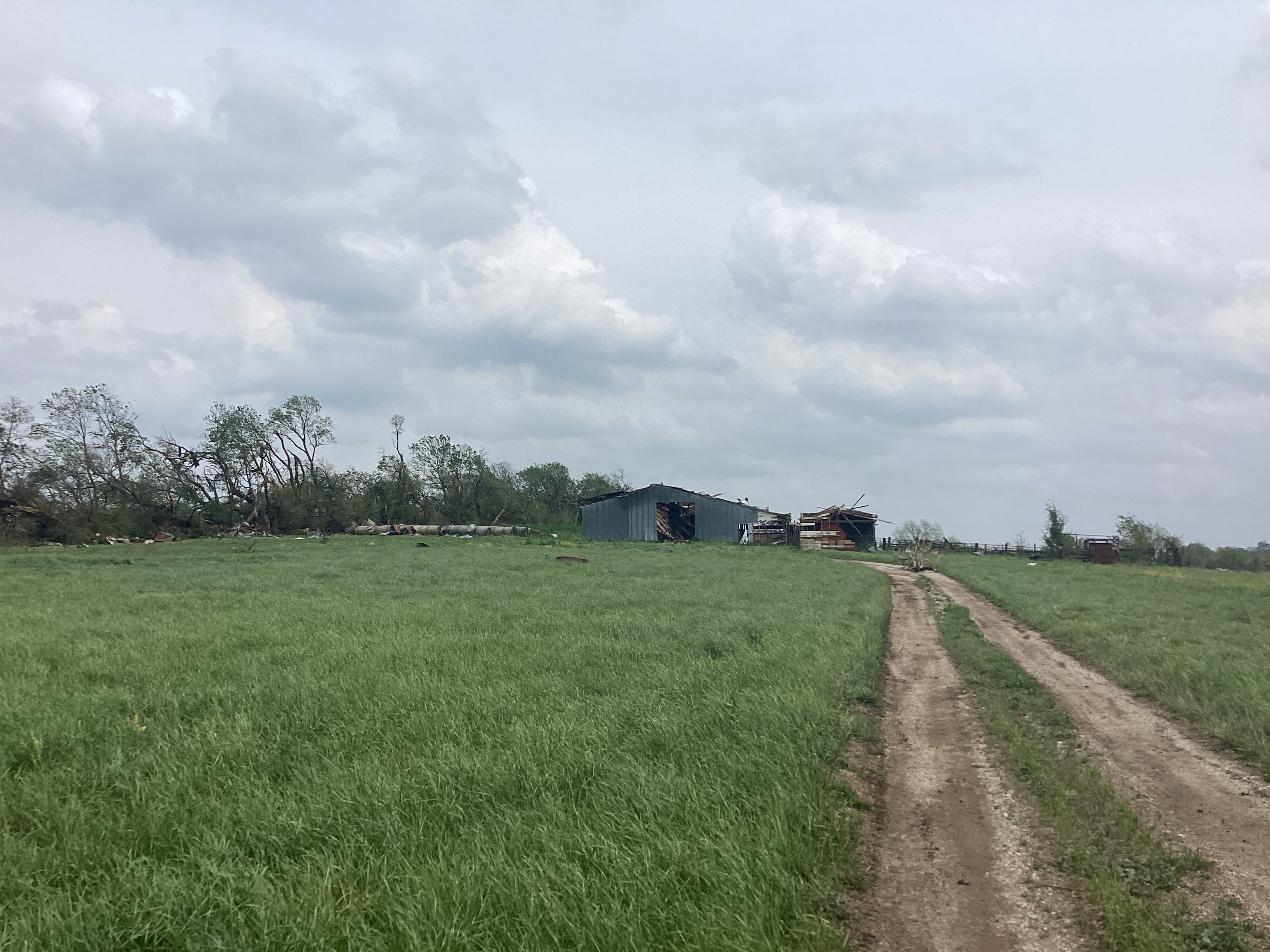
Bran Damaged
Stotesbury Tornado
National Weather Service Survey
|
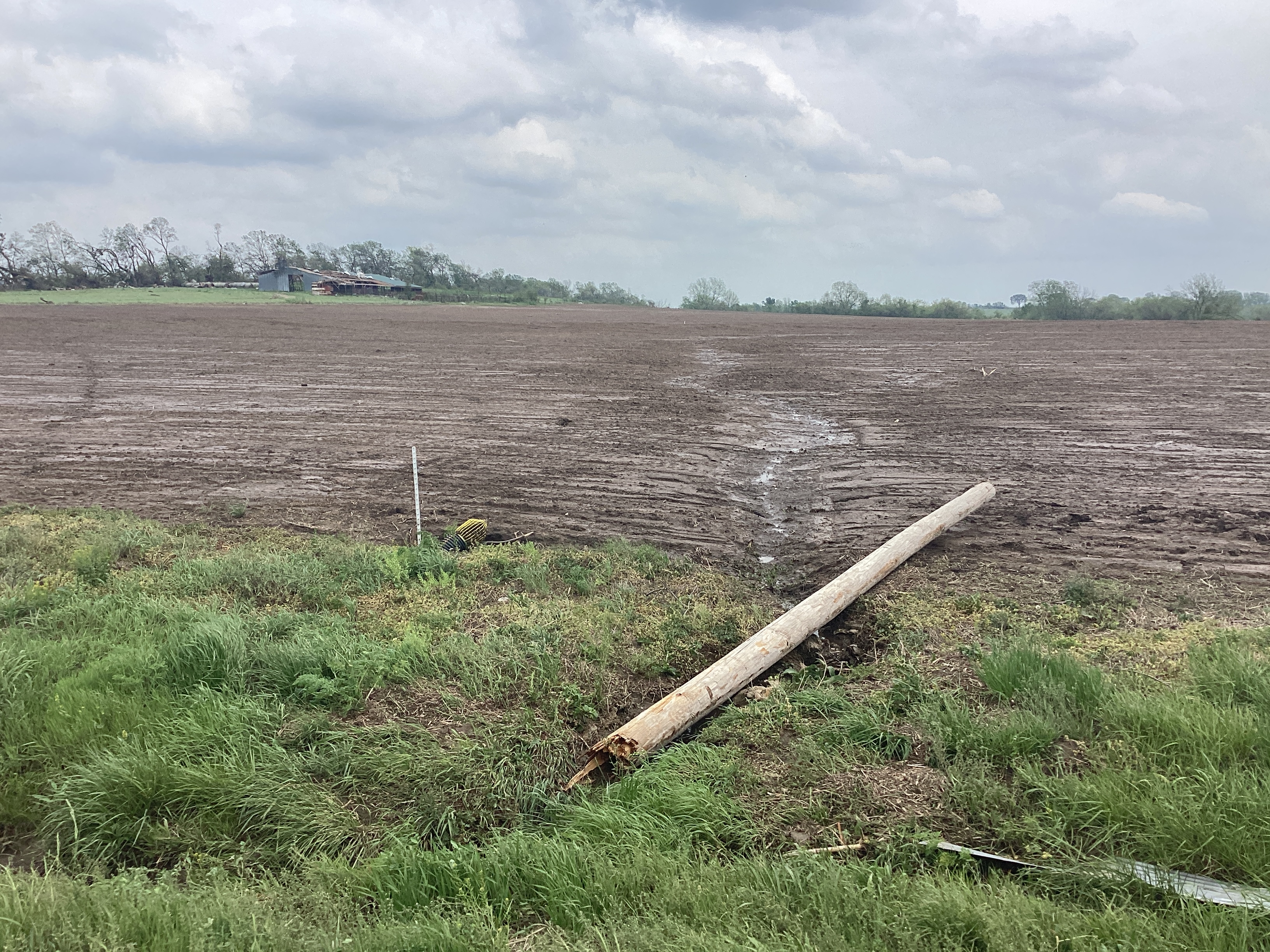
Power Pole Snapped
Stotesbury Tornado
National Weather Service Survey
|
|
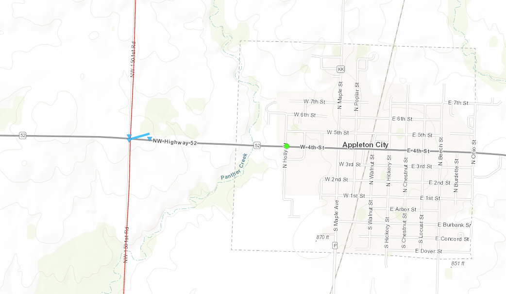
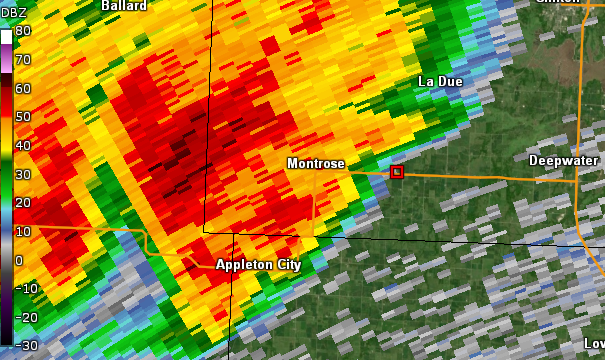
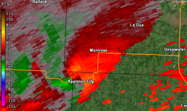
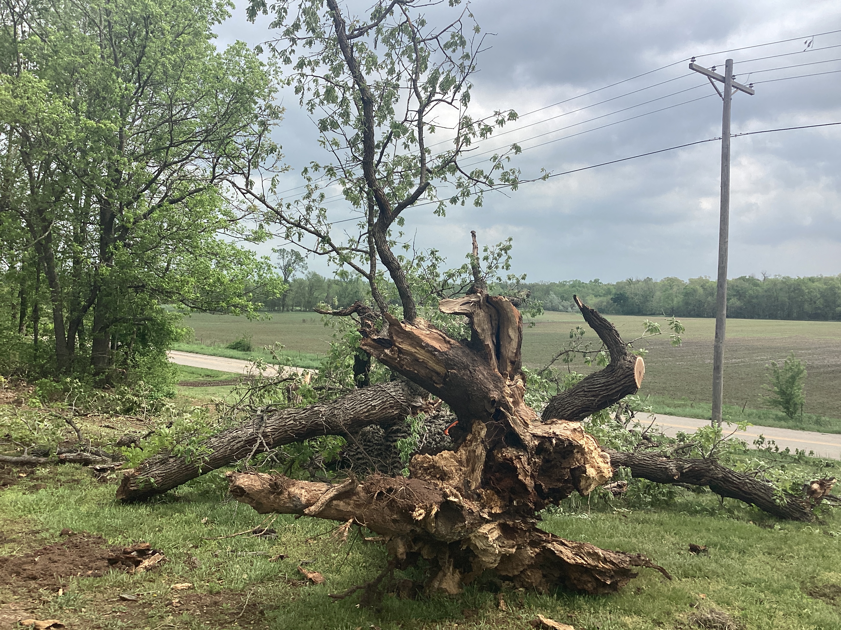
Tornado - Appleton City, MO
St. Clair County
| Date |
April 26, 2024 |
| Time (Local) |
6:56 PM CDT |
| EF Rating |
EF-0 |
| Est. Peak Winds |
80 mph |
| Path Length |
0.10 miles |
| Max Width |
50 yards |
| Injuries/Deaths |
0/0 |
|
Summary:
An NWS storm survey determined that a tornado briefly touched down Friday evening on Highway 52 at the Bates and St Clair county line, downing trees and power lines.
|
Track Map
Downloadable KMZ File
 |
 |
 |
|
|
KSGF Radar Reflectivity
April 26, 2024
6:29 PM CDT
|
KSGF Radar Velocity
April 26, 2024
6:29 PM CDT
|
Tree uprooted
Appleton City Tornado
National Weather Service Survey
|
|
|
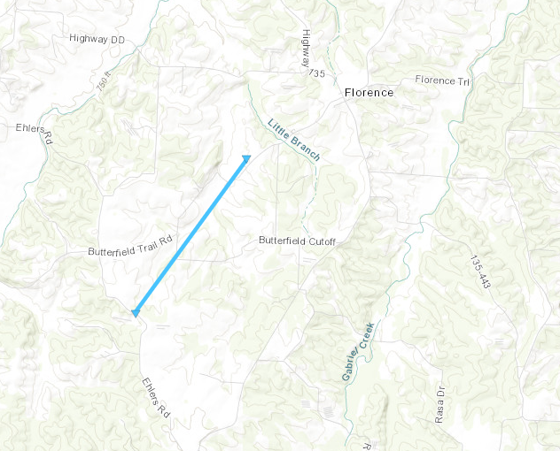
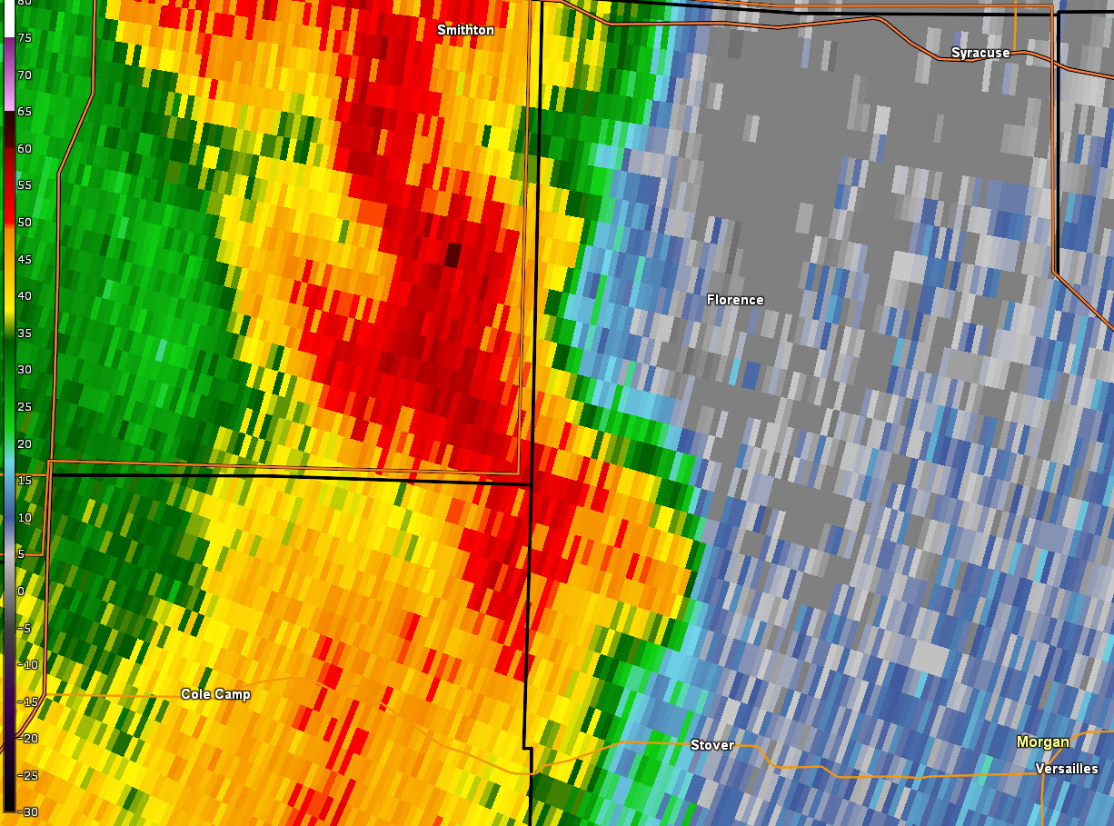
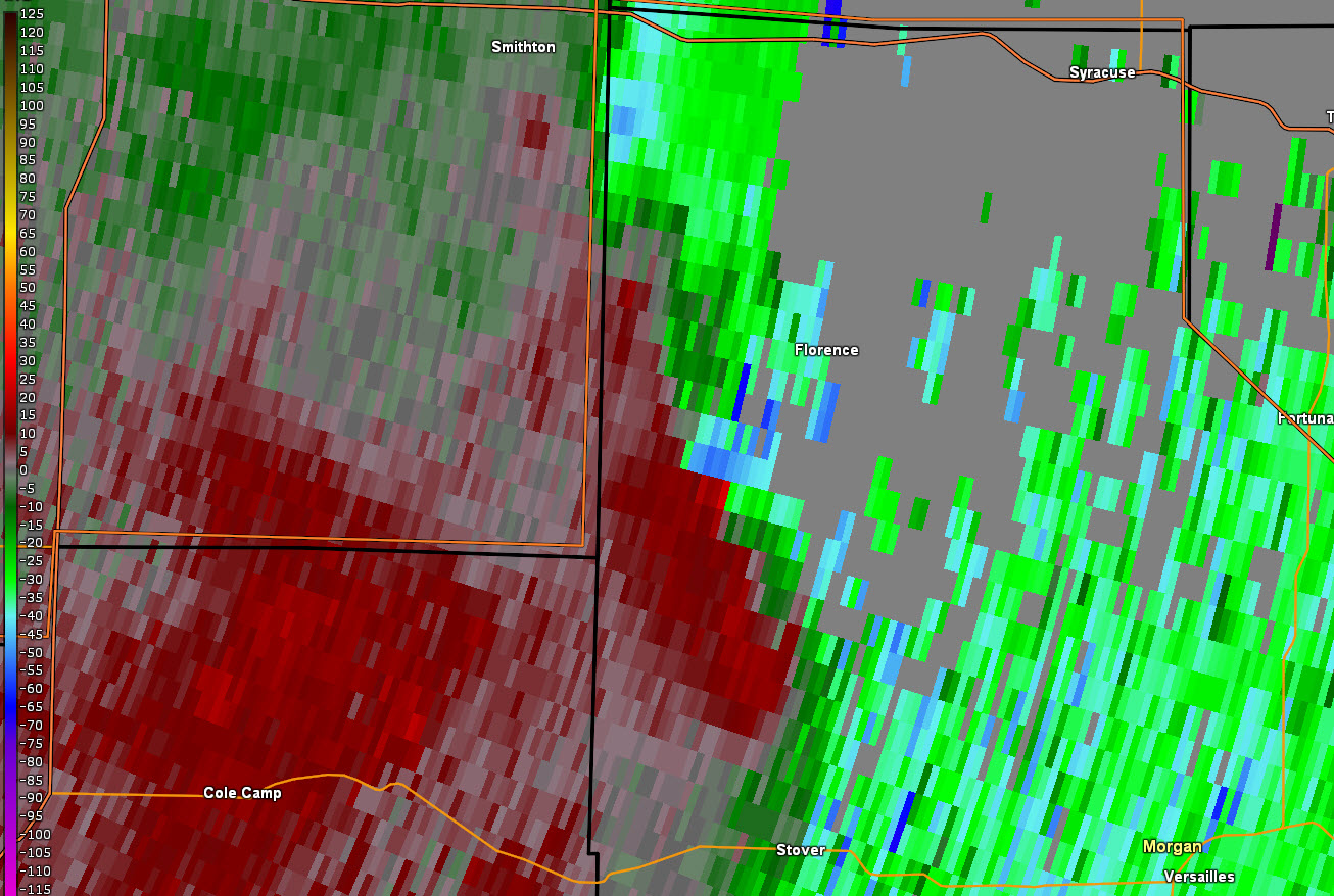
Tornado - Florence, Missouri
Morgan County
| Date |
April 27, 2024 |
| Time (Local) |
10:29pm - 10:36pm |
| EF Rating |
EF-0 |
| Est. Peak Winds |
75mph |
| Path Length |
1.99 miles |
| Max Width |
75 yards |
| Injuries/Deaths |
0/0 |
|
Summary:
An EF-0 tornado touched down to the southwest of Florence, MO in Morgan County, MO. The path length was 1.99 miles with a width of 75 yards. Trees were uprooted in a convergent manner along Ehlers Road with tree damage continuing along Butterfield Trail.
|
Track Map
Downloadable KMZ File
 |
 |
|
KEAX Radar Reflectivity
April 27, 2024
10:32 PM CDT
|
KEAX Radar Velocity
April 27, 2024
10:32 PM CDT
|
|
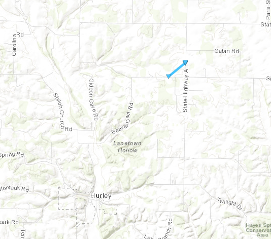
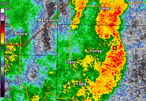
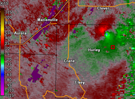
Tornado - Hurley, Missouri
Stone County
| Date |
April 28, 2024 |
| Time (Local) |
8:20pm - 8:22pm |
| EF Rating |
EF-0 |
| Est. Peak Winds |
80 mph |
| Path Length |
0.41 miles |
| Max Width |
100 yards |
| Injuries/Deaths |
0/0 |
|
Summary:
A brief, weak EF-0 tornado occurred in northern Stone county 3 miles NNE of Hurley near E Silver Lake Rd and K Highway. The path length was 0.41 miles and 100 yards wide. Maximum wind speeds of 80 mph caused trees to uproot and damage to a small barn.
|
Track Map
Downloadable KMZ File
 |
 |
 |
 |
|
KSGF Radar Reflectivity
April 28, 2024
8:22 PM CDT
|
KSGF Radar Velocity
April 28, 2024
8:22 PM CDT
|
Damage to Barn
Hurley Tornado
National Weather Service Survey
|
Tree Uprooted onto House
Hurley Tornado
National Weather Service Survey
|
|
The Enhanced Fujita (EF) Scale classifies tornadoes into the following categories:
EF0
Weak
65-85 mph |
EF1
Moderate
86-110 mph |
EF2
Significant
111-135 mph |
EF3
Severe
136-165 mph |
EF4
Extreme
166-200 mph |
EF5
Catastrophic
200+ mph |
 |
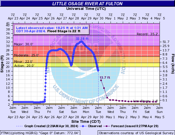
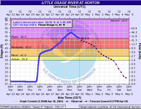
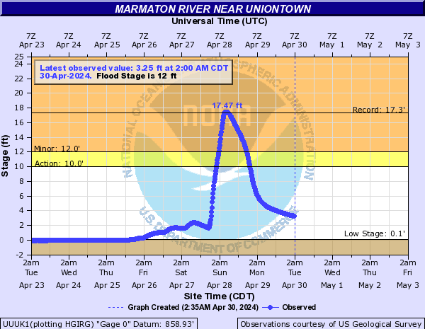
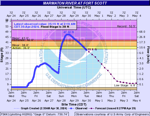
Flooding
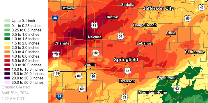
Widespread heavy rainfall over this time frame led to flash flooding of small creeks and streams and major flooding along the Marmaton and Little Osage River basins. Four day storm total rainfall amounts ranged from 1-12 inches with the highest amounts (12 inches) located across portions of Bourbon and Vernon counties.
Hydrographs
 |
 |
 |
 |
|
Little Osage River at
Fulton, Kansas
|
Little Osage River at
Horton, Missouri
|
Marmaton River near
Uniontown, Kansas
|
Marmaton River at
Fort Scott, Kansas
|
Rainfall Totals
 |
|
Total Rainfall Amounts
April 25 - April 28
|
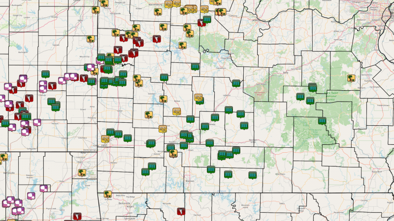
Storm Reports
Here is a map of storm reports from April 25th through April 29.


 Weather Story
 Weather Map
 Local Radar