Springfield, MO
Weather Forecast Office
 |
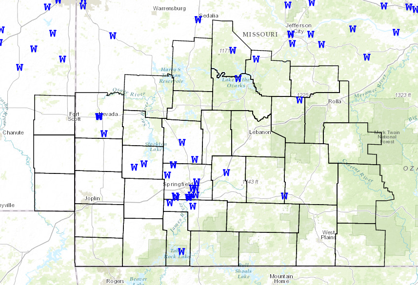
Severe Storms July 7th-8th, 2014National Weather Service, Springfield, MO |
 |
A complex of thunderstorms developed Monday evening across southeastern Nebraska and northeastern Kansas along an advancing cold front. This complex of storms then formed into a line of strong to severe thunderstorms and tracked south across the Missouri Ozarks and extreme southeastern Kansas late Monday night.
Winds with this line of storms were in the 40 to 50 mph range with isolated pockets of winds at or above 60 mph. These storms caused scattered areas of tree damage along with several reports of power outages. In addition to the wind, these storms also produced a significant amount of lightning, especially across central Missouri. Areas of central Missouri also saw rainfall amounts in the 1" to 2.5" range. Much lighter rainfall amounts occurred along and south of the U.S. 60 corridor.

Current Hazards
Experimental Graphical Hazardous Weather Outlook
Submit a storm report
Local Storm Reports
Current Conditions
Observations
Lake Levels
Snowfall Analysis
Road Conditions
Satellite
CoCoRaHS
Graphical Conditions
Precip. Analysis
Forecasts
Forecast Discussion
Fire Weather
Aviation
GIS Forecast Maps
Activity Planner
Severe Weather
Winter Weather
Hurricanes
FAA Center Weather
Space Weather
Climatology
Records and Normals
Monthly Climate Summary
Local
National
Drought
Climate Science
Astronomical Data
US Dept of Commerce
National Oceanic and Atmospheric Administration
National Weather Service
Springfield, MO
Springfield-Branson National Airport
5805 West Highway EE
Springfield, MO 65802-8430
Business: 417-863-8028 Recording: 417-869-4491
Comments? Questions? Please Contact Us.


 Weather Story
 Weather Map
 Local Radar