Springfield, MO
Weather Forecast Office
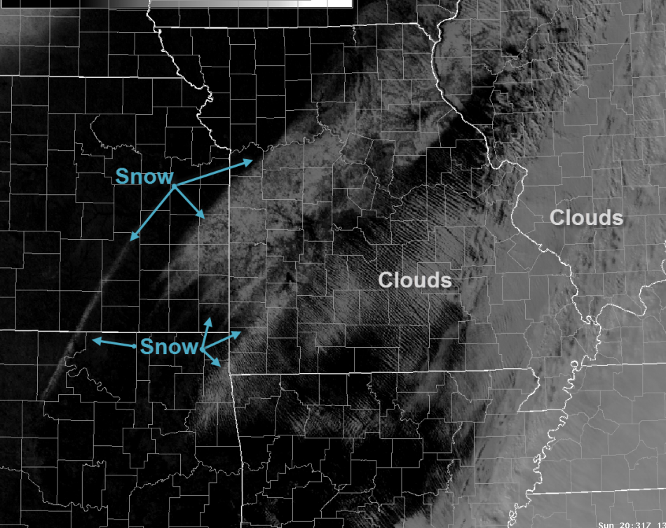
A mix of light freezing rain, sleet and snow impacted southeastern Kansas and the Missouri Ozarks Saturday, Jan. 12 through Sunday morning Jan. 13.
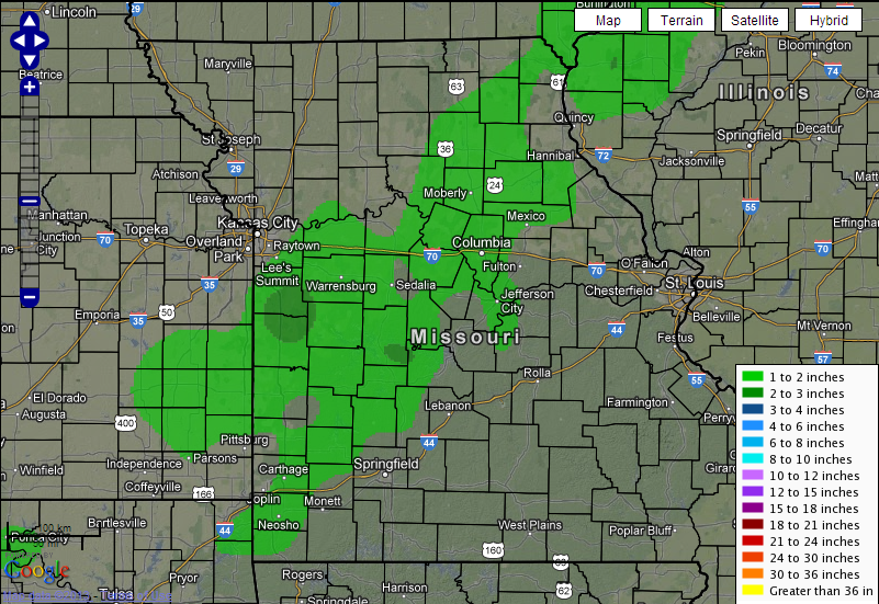
Ice accumulations ranged from a trace to near two tenths of an inch across portions of the Missouri Ozarks. Snow and sleet accumulations ranged from one to two inches generally along and west of a line from Neosho to Versailles.
Here is a satellite image depicting the location of snowfall.
Below is map depicting total snowfall from Jan. 12-13.
Current Hazards
Experimental Graphical Hazardous Weather Outlook
Submit a storm report
Local Storm Reports
Current Conditions
Observations
Lake Levels
Snowfall Analysis
Road Conditions
Satellite
CoCoRaHS
Graphical Conditions
Precip. Analysis
Forecasts
Forecast Discussion
Fire Weather
Aviation
GIS Forecast Maps
Activity Planner
Severe Weather
Winter Weather
Hurricanes
FAA Center Weather
Space Weather
Climatology
Records and Normals
Monthly Climate Summary
Local
National
Drought
Climate Science
Astronomical Data
US Dept of Commerce
National Oceanic and Atmospheric Administration
National Weather Service
Springfield, MO
Springfield-Branson National Airport
5805 West Highway EE
Springfield, MO 65802-8430
Business: 417-863-8028 Recording: 417-869-4491
Comments? Questions? Please Contact Us.


 Weather Story
 Weather Map
 Local Radar