 |
Monthly Climate Summary - January 2015National Weather Service, Springfield, MO |
 |
|
|
|
|
|
|
Monthly Climate Overview
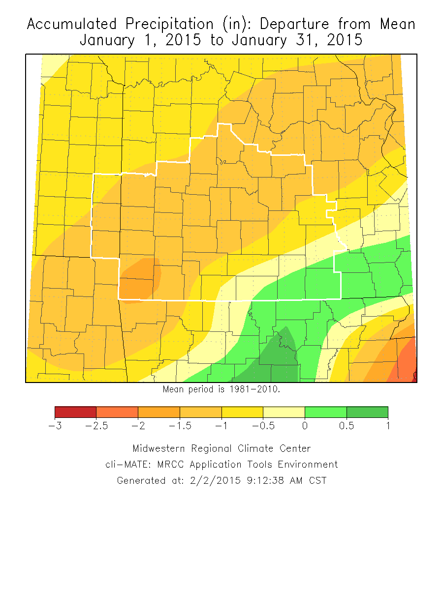
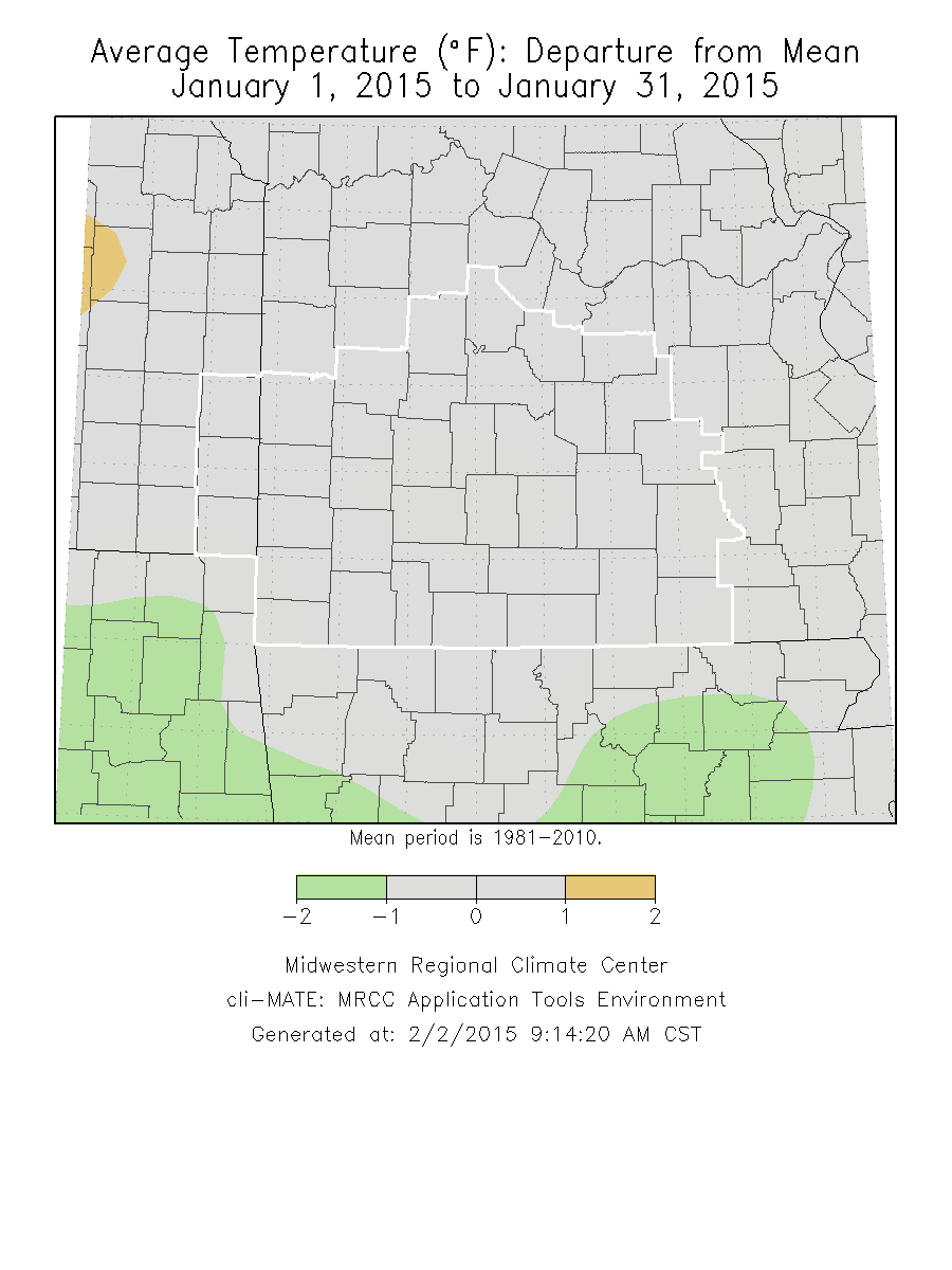
January 2015 had temperatures slightly above normal and fairly dry conditions across most of the Missouri Ozarks region into extreme southeast Kansas. The most precipitation fell across the southeastern sections of the region. Band of snow and sleet over portions of the Missouri Ozarks January 14th-15th, 2015
|
Monthly Climate Graphs
|
||||||
Monthly Climate Maps
|
Monthly Climate Records
|
|||||||||
Monthly Climate Normals
|
|||||||||||||||||||||||||||||||||||||||||||||||||||||||||||||||||||||||||||||||||||||||||||||||||||||||||
Precipitation Report
|


 Weather Story
 Weather Map
 Local Radar