 |
Monthly Climate Summary - January 2014National Weather Service, Springfield, MO |
 |
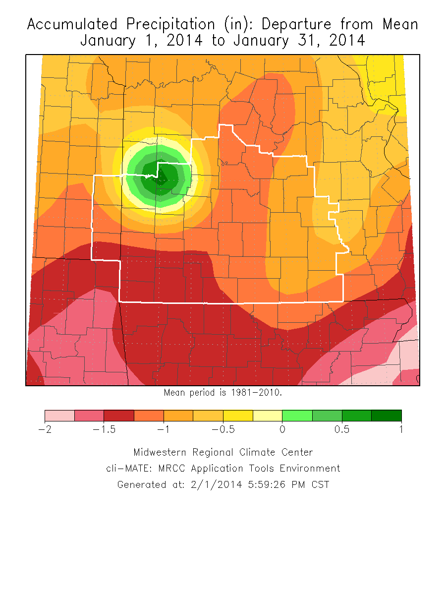
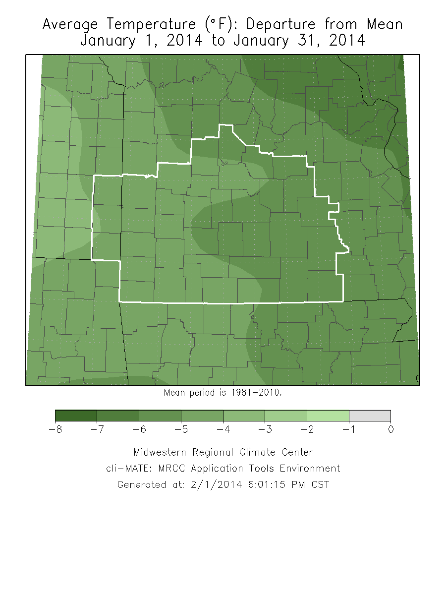
Monthly Climate OverviewJanuary 2014 was one of the colder January's on record with two stations hitting in the top 10. The upper pattern remained stagnant for most of the month, keeping a north to northwest flow aloft in place and generally dry cold fronts pushing through every couple of days. The precipitation generally occurred early on in the month with snow events on both the 1st through the 2nd and again on the 5th. Temperatures dipped well below zero in the middle of the month with one of the Arctic air masses. Heavy snow event on January 5th
|
Monthly Climate Maps
|
Monthly Climate Records
| ||||||||||||||||||||||||||
Monthly Climate Normals
| |||||||||||||||||||||||||||||||||||||||||||||||||||||||||||||||||||||||||||||||||||||||||||||||||||||||||
Precipitation ReportMonthly Data for January 2014 for Springfield, MO NWS CWA
|


 Weather Story
 Weather Map
 Local Radar