 |
Monthly Climate Summary - August 2014National Weather Service, Springfield, MO |
 |
|
|
|
|
|
|
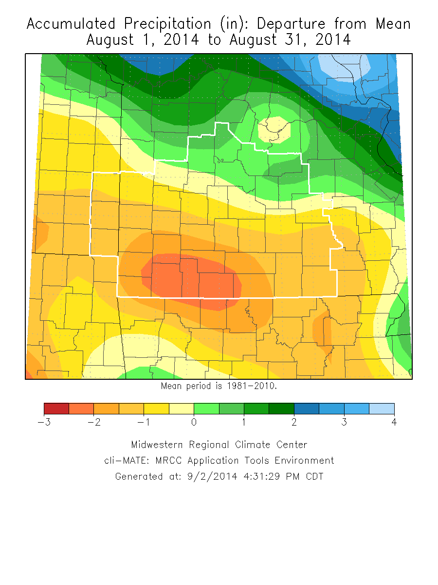
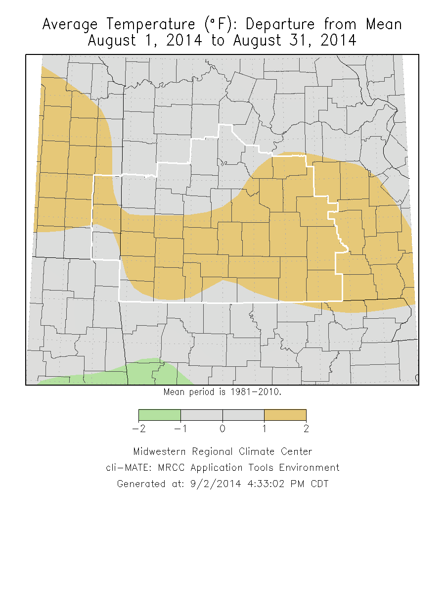
Monthly Climate OverviewWhile the first half of August 2014 started out like much of July 2014 with cooler than normal temperatures, an upper level ridge of high pressure built into the region for the later part of the month. This brought much above normal temperatures to the area with averages for the month ending up above normal. Precipitation was generally well below normal for the month across the area.
|
|
Monthly Climate Maps
|
|
Monthly Climate Records
|
|||||||||||||||||||||||
|
Monthly Climate Normals
|
|||||||||||||||||||||||||||||||||||||||||||||||||||||||||||||||||||||||||||||||||||||||||||||||||||||||||
|
Precipitation Report
|


 Weather Story
 Weather Map
 Local Radar