 |
Monthly Climate Summary - August 2013National Weather Service, Springfield, MO |
 |
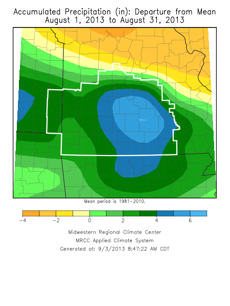
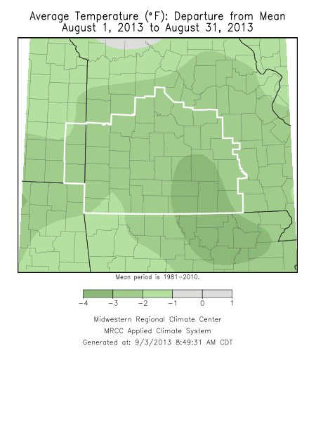
Monthly Climate OverviewDespite a lack of rainfall for the second half of August and typically normal to above normal temperatures, the month will be categorized as below normal temperatures and above to much above normal precipitation. This stems from the tremendous amount of rainfall received across the area during the first half of the month. This resulted in serious and historic flooding in parts of the Ozarks. Extreme heavy rainfall and flash flooding August 3rd - August 10th 2013
|
Monthly Climate Maps
|
Monthly Climate Records
| ||||||||||||||||||||||||||
Monthly Climate Normals
| |||||||||||||||||||||||||||||||||||||||||||||||||||||||||||||||||||||||||||||||||||||||||||||||||||||||||


 Weather Story
 Weather Map
 Local Radar