Overview
|
***All information is considered preliminary until investigations are finalized*** Damaging winds and tornadoes looked to be the main threats, as a bowing line of severe thunderstorms lifted northeast through western Minnesota into central Minnesota during the late afternoon and early evening on Memorial Day, May 30th. Numerous reports of damage were received. *Additional information will be added on this page in the coming days. |
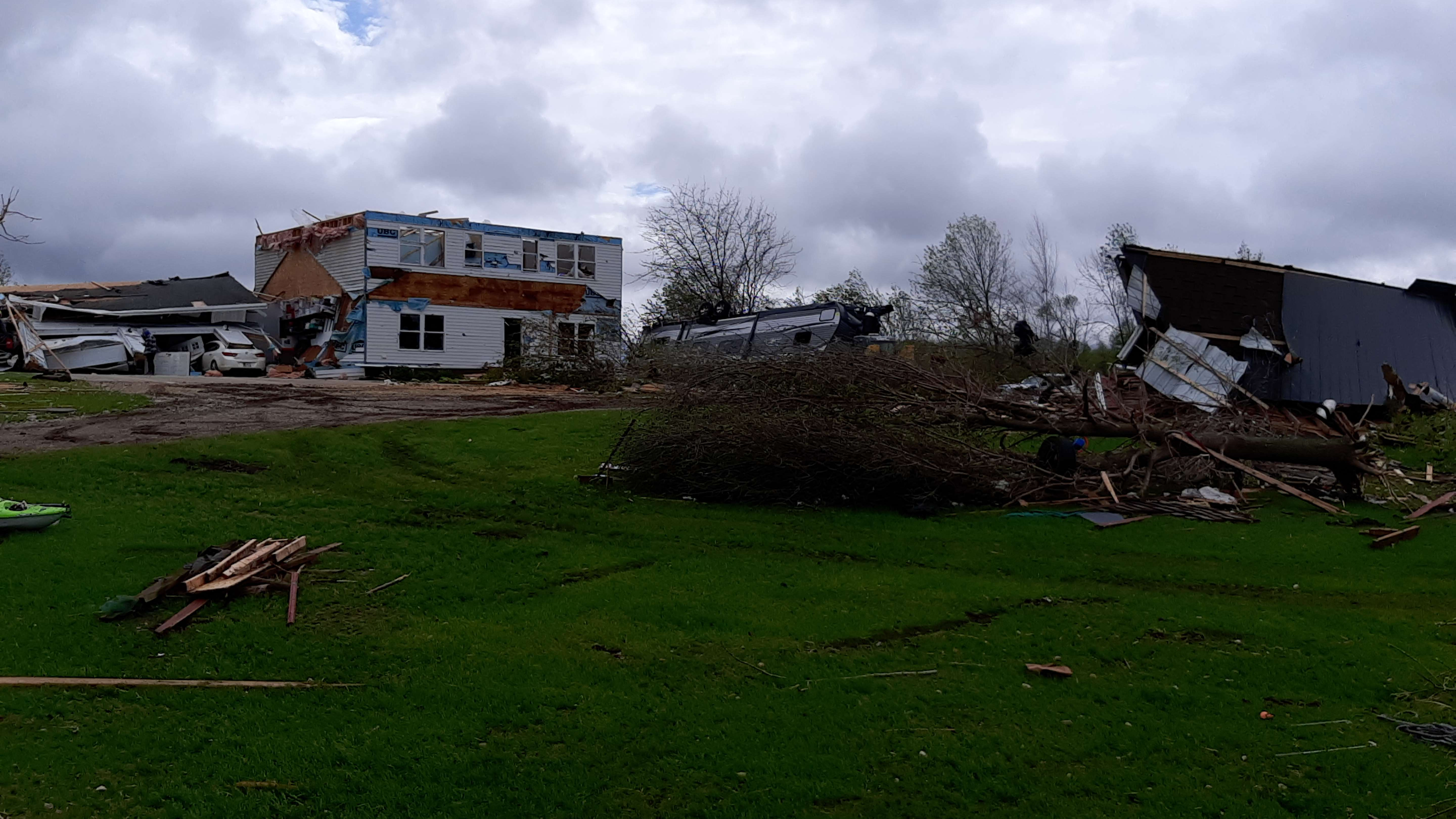
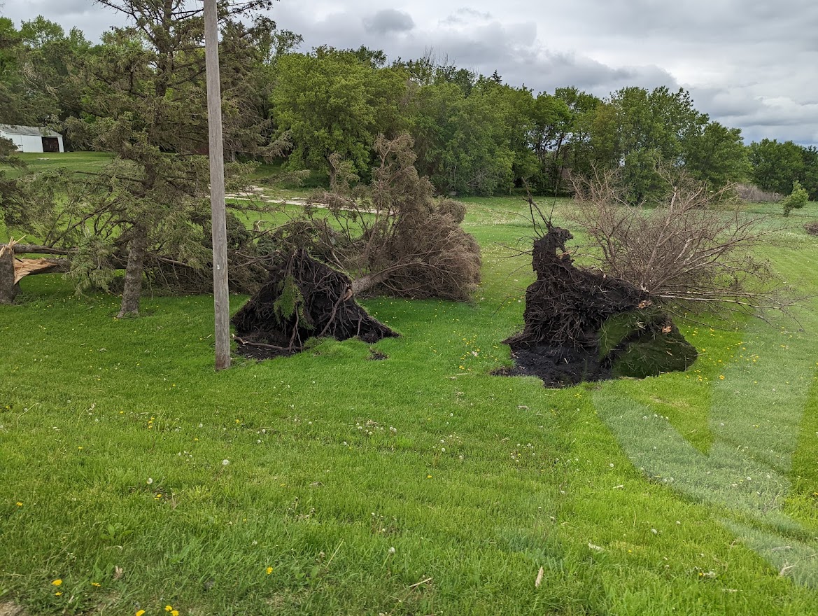
 Damage in Forada, MN |
Tornadoes:
|
Tornado #1- 3 NNW Milan, MN
Track Map
|
||||||||||||||||
|
Tornado #2- 5 SW Danvers to 7 NW Clontarf, MN
Track Map  
Downloadable KMZ File |
||||||||||||||||
|
Tornado #3- 3 N Holloway, MN
Track Map
Downloadable KMZ File |
||||||||||||||||
|
Tornado #4- Near Lake Emily, MN
Track Map
Downloadable KMZ File |
||||||||||||||||
|
Tornado #5- 4 W Starbuck, MN
Track Map
Downloadable KMZ File |
||||||||||||||||
|
Tornado #6 - Forada, MN
Track Map 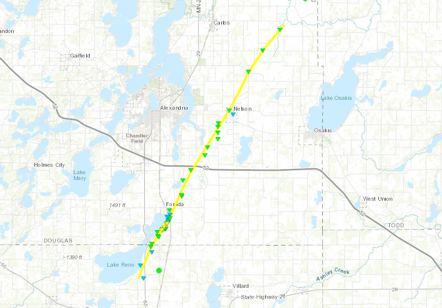
Downloadable KMZ File |
||||||||||||||||
|
Tornado #7 - Eagle Bend, MN
Track Map 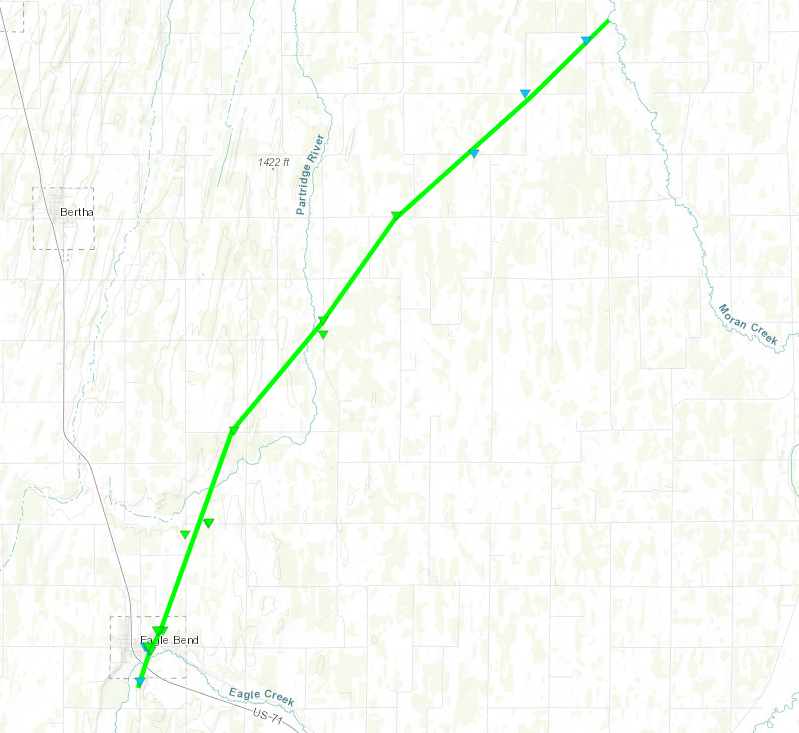
Downloadable KMZ File |
||||||||||||||||
|
Tornado #8 - Plato, MN
Track Map 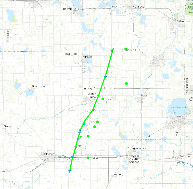
Downloadable KMZ File |
||||||||||||||||
The Enhanced Fujita (EF) Scale classifies tornadoes into the following categories:
| EF0 Weak 65-85 mph |
EF1 Moderate 86-110 mph |
EF2 Significant 111-135 mph |
EF3 Severe 136-165 mph |
EF4 Extreme 166-200 mph |
EF5 Catastrophic 200+ mph |
 |
|||||
Photos & Video
Forada, MN Tornado
 |
 |
 |
 |
| Damage in Forada |
Tree Uprooted in Forada |
Building Damage in Forada | Building Damage in Forada |
McLeod County Tornado
 |
 |
 |
 |
| Pole Barn Damage near Plato, MN | Tree Damage near Plato, MN | Extensive Tree Damage near Plato, MN | Uprooted Trees southeast of Lester Prairie, MN |
Radar
Radar imagery of confirmed tornadoes
 |
 |
 |
.png) |
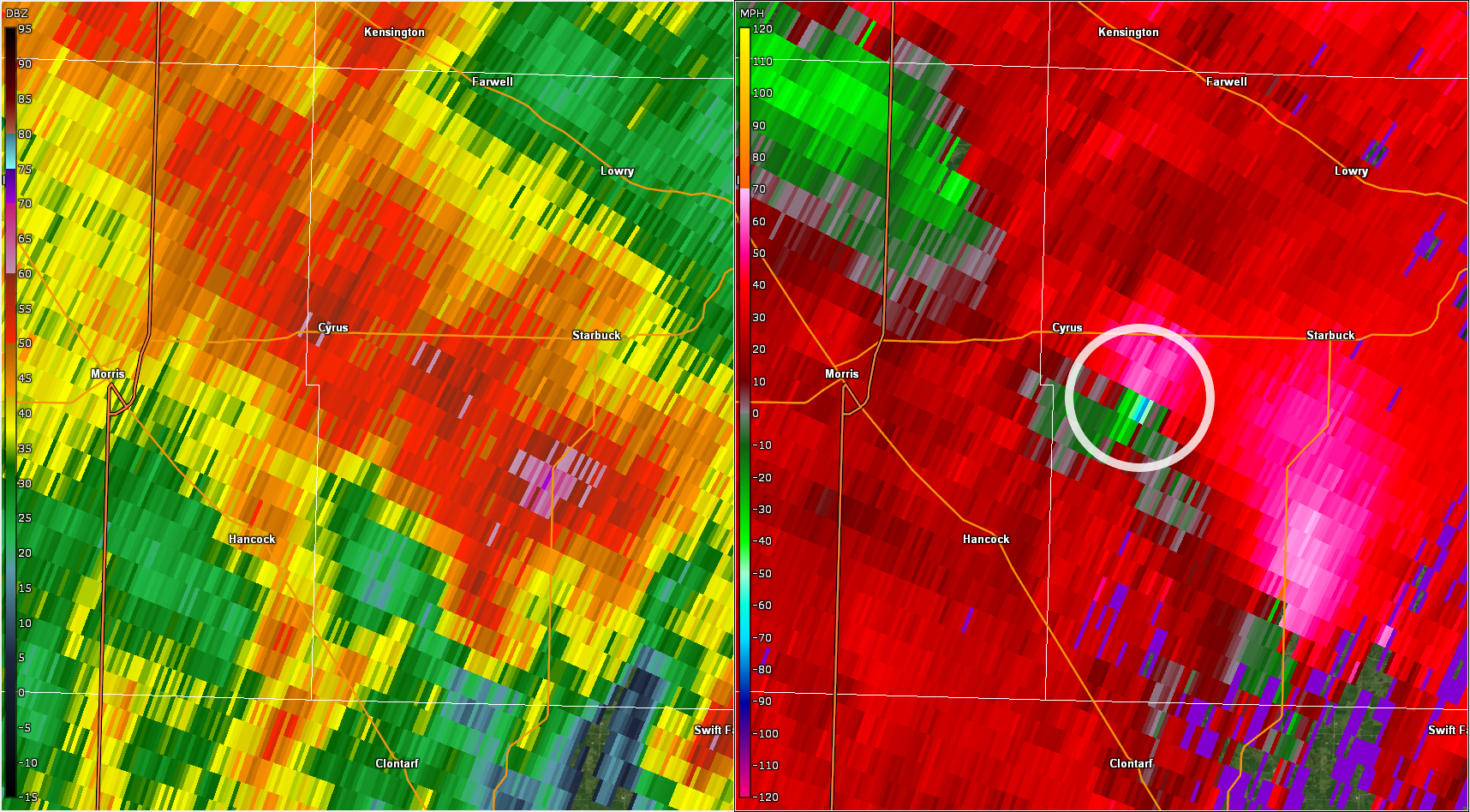
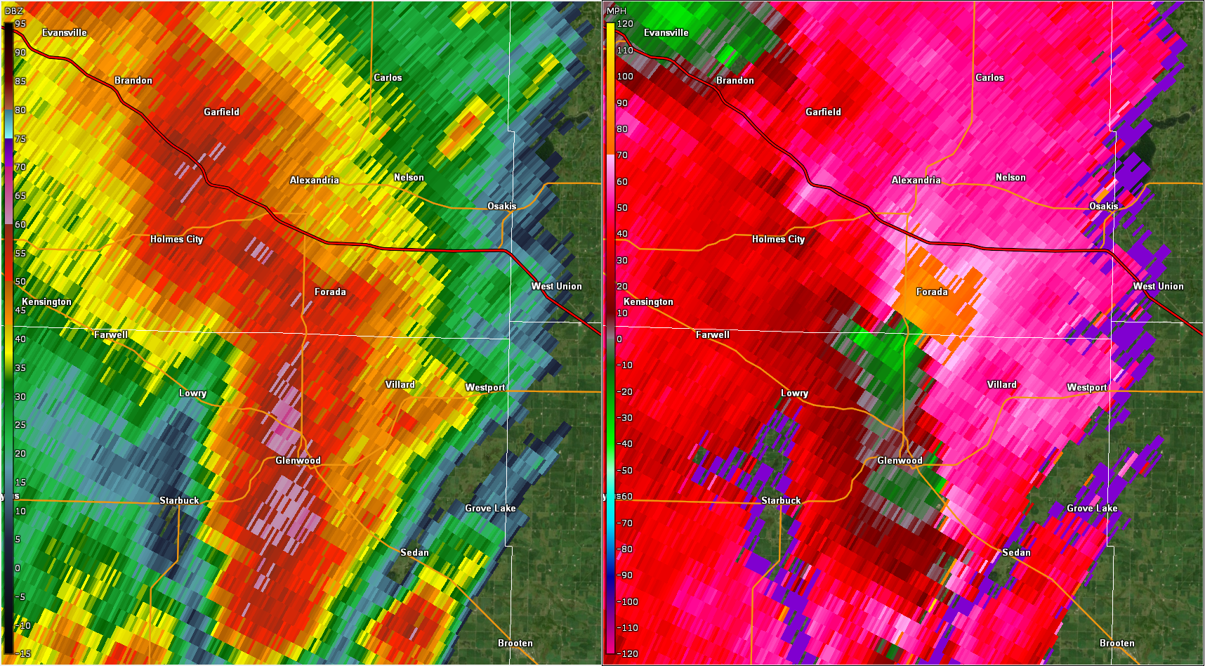
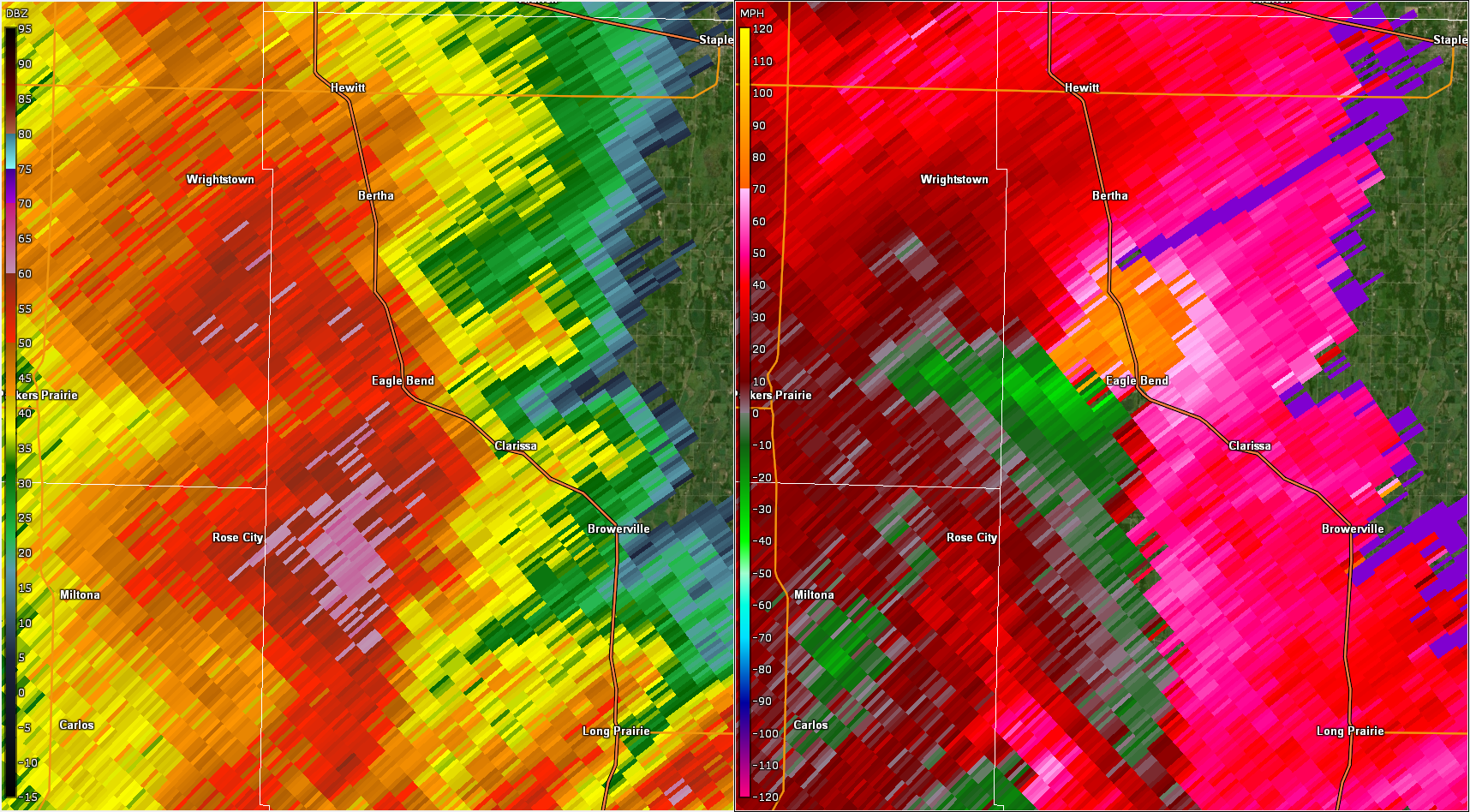
| Radar reflectivity (left) and storm relative velocity (right) at 4:07pm. Velocity shows strong rotation near Cyrus, MN. (Radar beam is at 12kft) | Radar reflectivity (left) and storm relative velocity (right) at 4:29pm. Velocity shows strong rotation approaching Forada, MN. (Radar beam is at 11kft) | Radar reflectivity (left) and storm relative velocity (right) at 5:02pm Velocity shows strong rotation near Eagle Bend, MN. (Radar beam is at 12.5kft) | Radar reflectivity (left) and storm relative velocity (right) at 6:17pm Velocity shows rotational couplet near Plato, MN. (Radar beam is at 1.5kft) |
Storm Reports
Locations of preliminary reports of severe weather across the area, including damaging straight-line winds, large hail, and tornadoes.
Find the latest reports and information for each one at this updated interactive map. 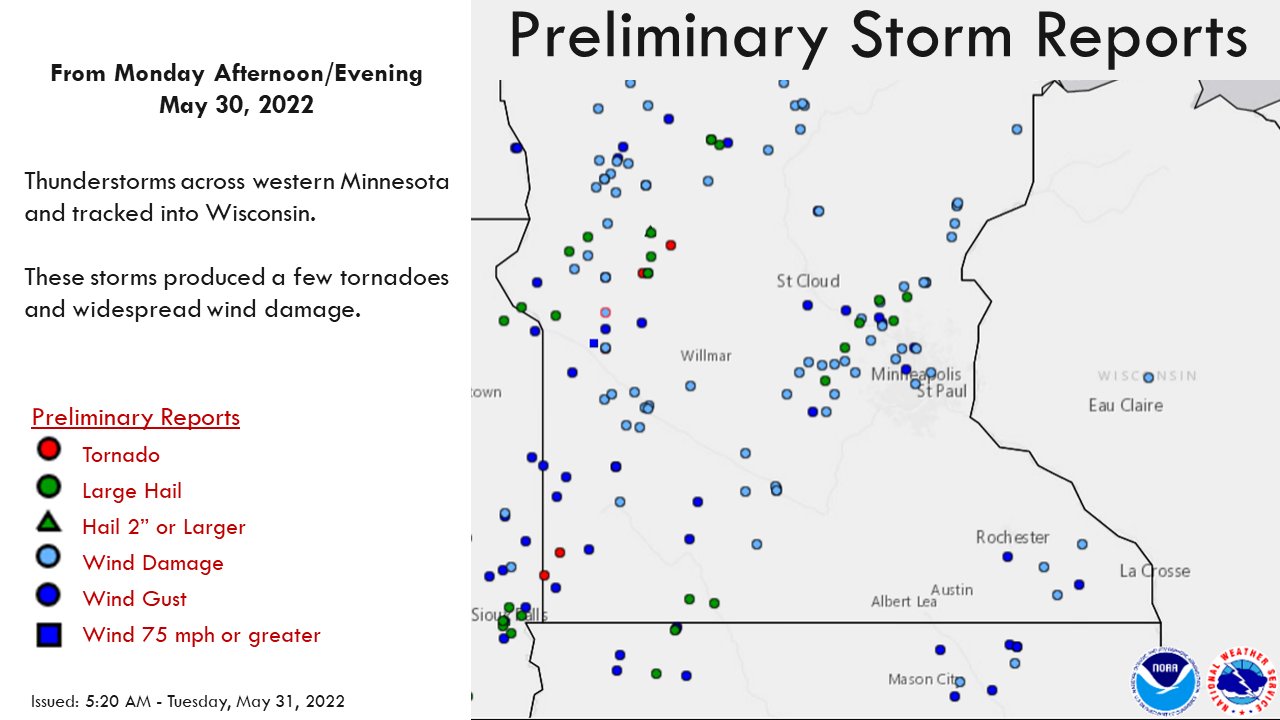
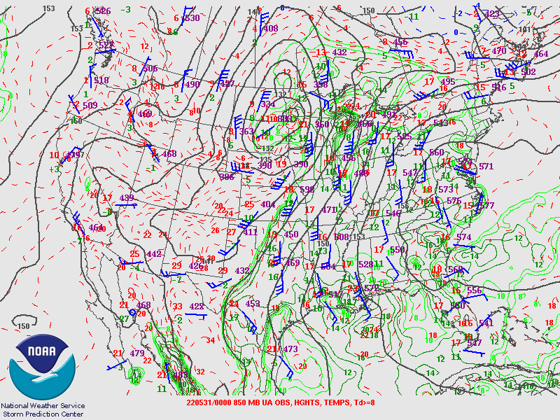
Environment
Insert synoptic summary.
 |
 |
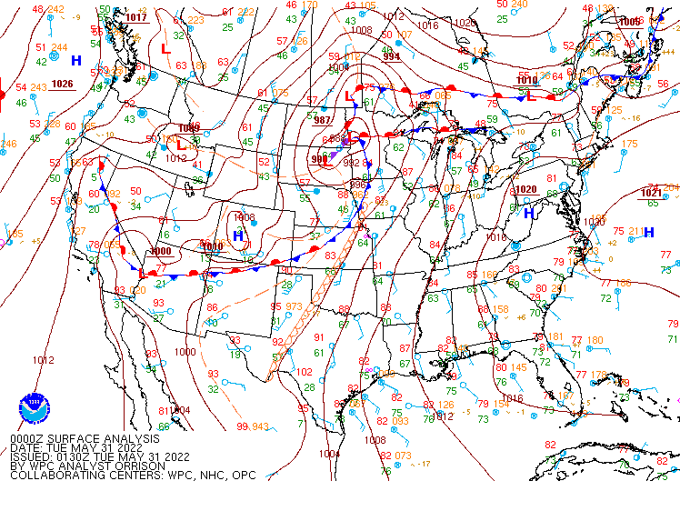 |
| 7pm 250mb map showing an amplified trough over the western CONUS. Strong synoptic-scale lift is implied over MN at the nose of the jetstreak and within the diffluence in the wind field. | 7pm 850mb map showing a deep, closed low over northwest MN. A very strong LLJ (45kt wind barb at MPX) has dragged ample moisture into the Upper Midwest. | 8:30pm surface map showing a deep surface low with a warm front extending east across MN while an arcing cold front trails south. |
Near-storm environment summary.
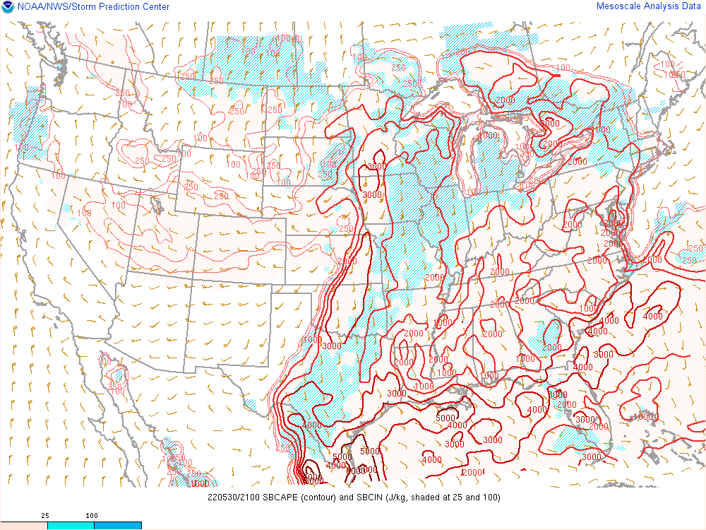 |
 |
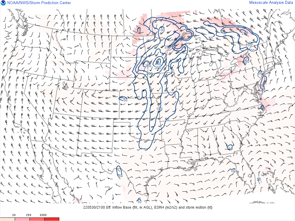 |
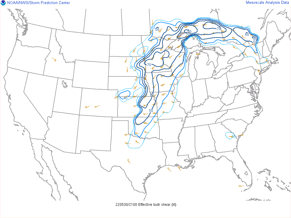
| 4pm map of surface-based CAPE. Strong instability is analyzed over southern to south-central MN with +3000 J/kg of CAPE. | 4pm map of effective bulk shear. 60 to +70 knots of shear across MN signals a very favorable environment for rotating thunderstorm updrafts. | 4pm map of effective storm relative helicity. Higher values mean a more favorable environment for faster rotating updrafts. |
Additional environmental data.
 |
 |
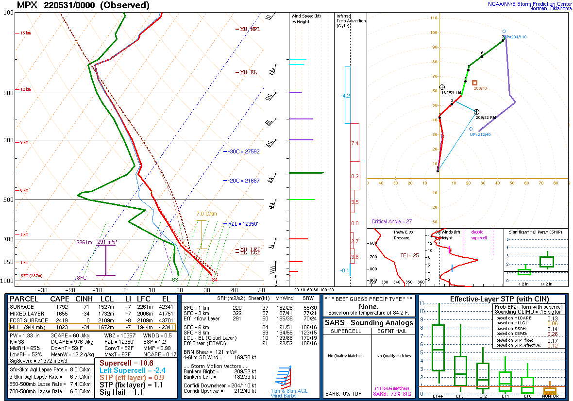 |
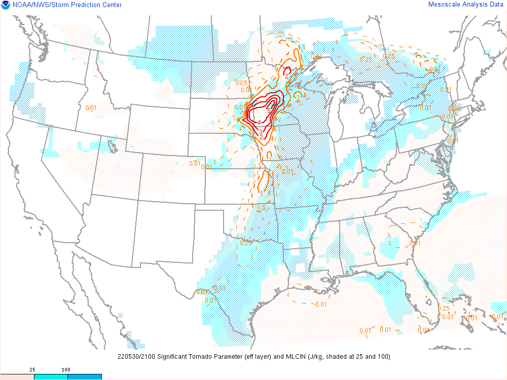
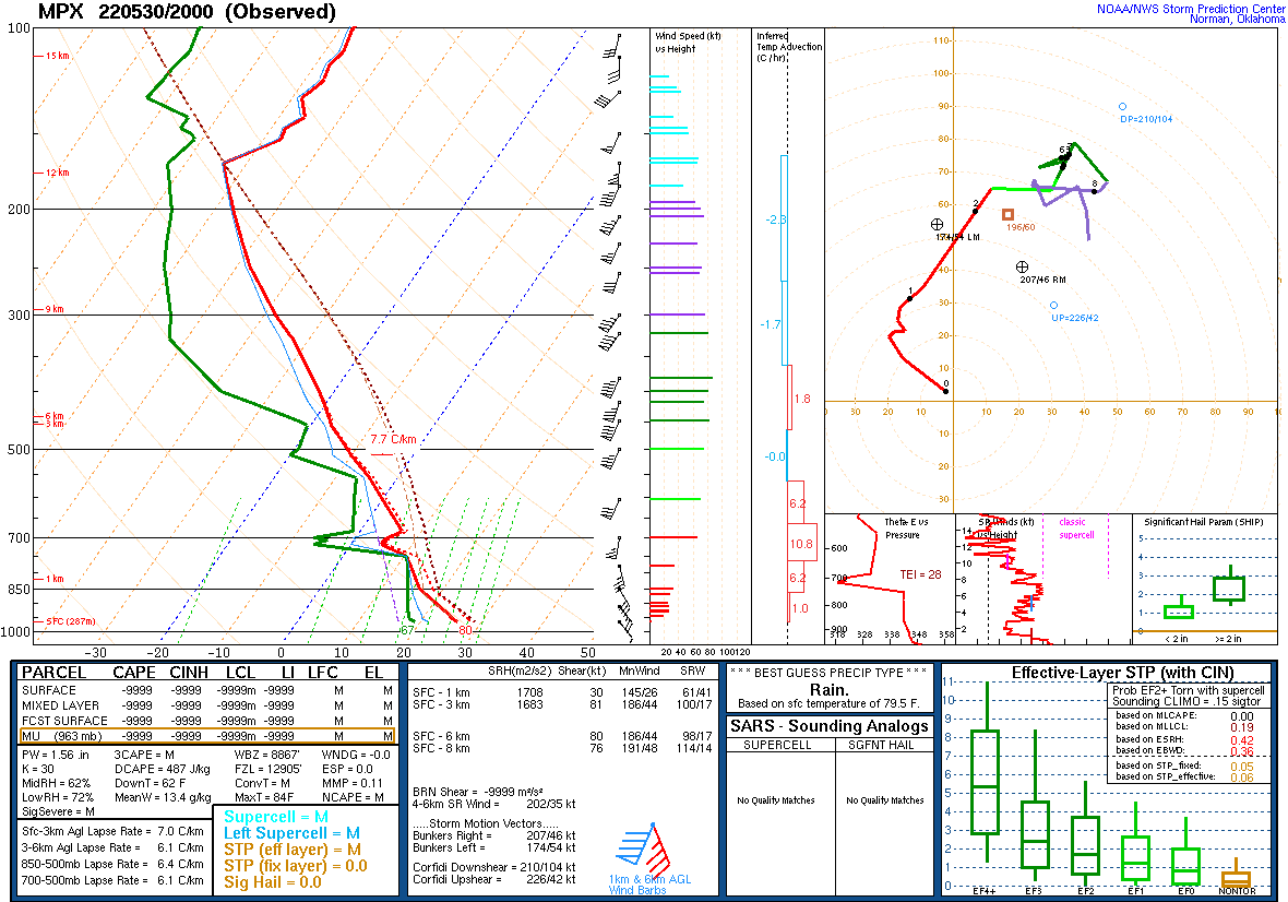
| 4pm map of the Significant Tornado Parameter showing a very favorable environment for tornadoes over western and south-central MN. | 3pm sounding from Chanhassen, MN. | 7pm sounding from Chanhassen, MN. |
 |
Media use of NWS Web News Stories is encouraged! Please acknowledge the NWS as the source of any news information accessed from this site. |
|

