Overview
|
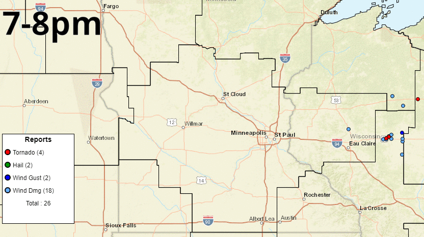
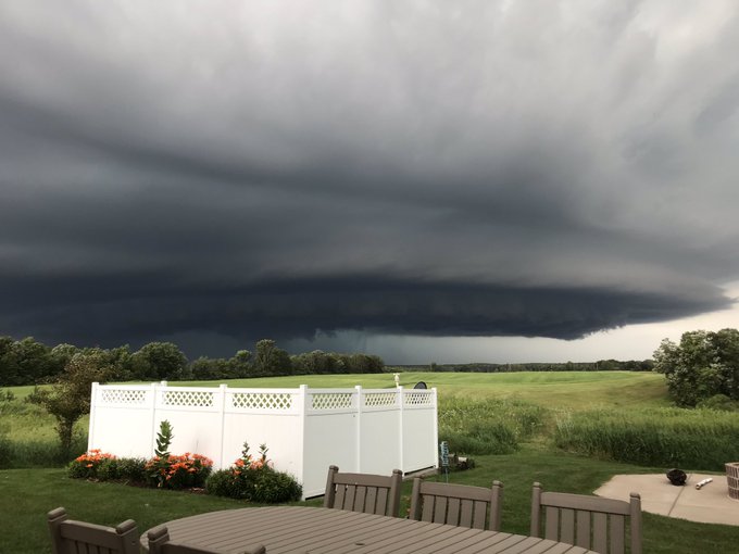
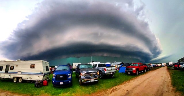
Intense severe thunderstorms produced large hail, severe winds, and two tornadoes across central Minnesota and west-central Wisconsin during the daytime hours on Friday. Discrete supercells began in west-central Minnesota and traveled eastward before eventually growing upscale into a bowing mesoscale convective system. A highly anomalous summertime environment containing both extreme thermodynamic instability and strong vertical wind shear allowed for explosive, long-lived thunderstorms. Baseball to three-inch size hail was reported across central and east-central Minnesota while wind gusts in excess of 80 mph were reported across west-central Wisconsin. Cushing, WI had a notable wind gust of 84 mph. Hourly Storm Reports
|
.gif) Radar loop of Friday, July 19, 2019 |
Tornadoes:
|
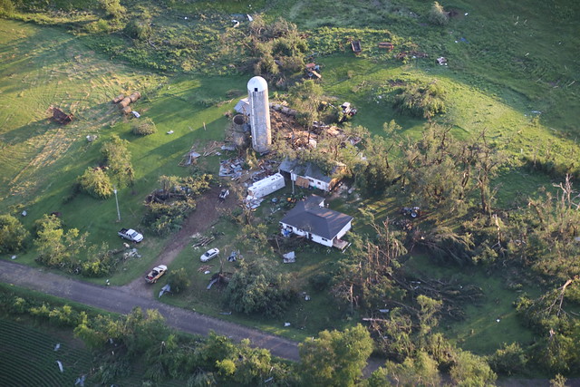
Tornado - Horseshoe Lake
Track Map 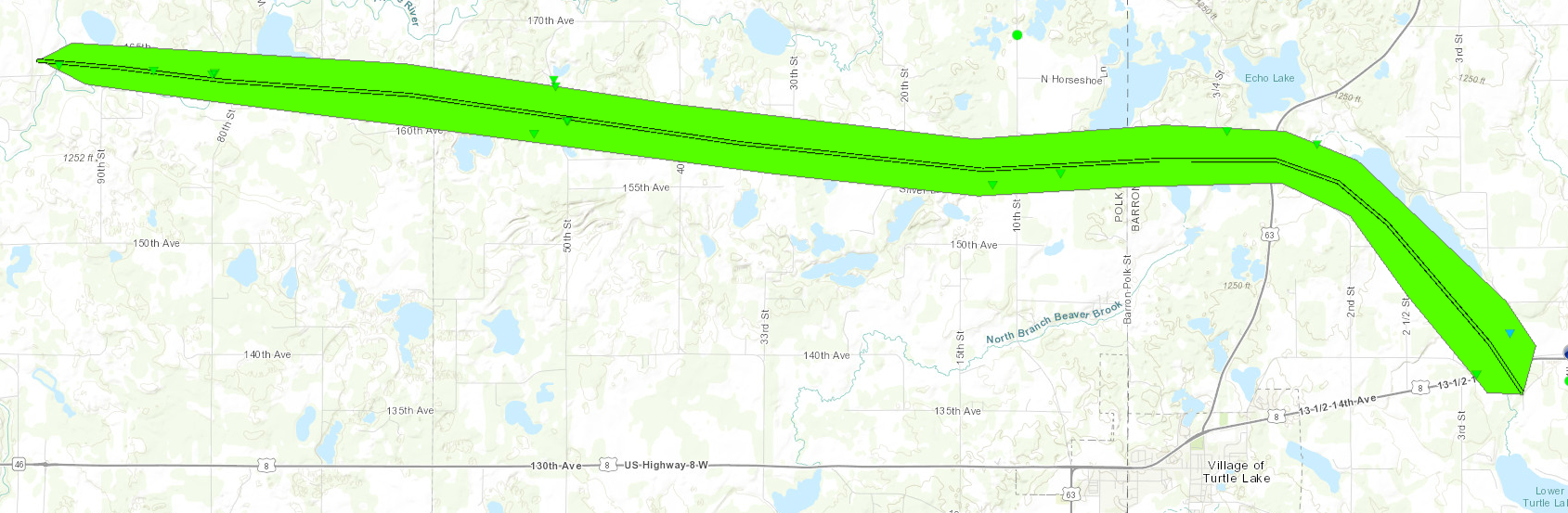 
Downloadable KMZ File |
||||||||||||||||
|
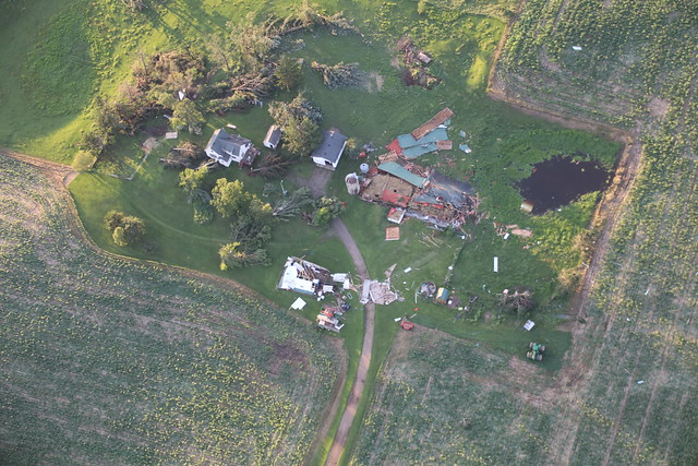
Tornado - Little Blake Lake
Track Map 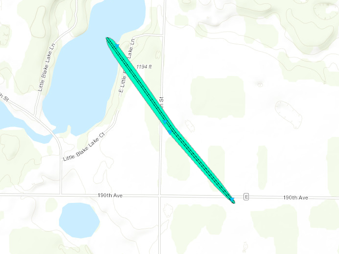
Downloadable KMZ File |
||||||||||||||||
The Enhanced Fujita (EF) Scale classifies tornadoes into the following categories:
| EF0 Weak 65-85 mph |
EF1 Moderate 86-110 mph |
EF2 Significant 111-135 mph |
EF3 Severe 136-165 mph |
EF4 Extreme 166-200 mph |
EF5 Catastrophic 200+ mph |
 |
|||||
Wind & Hail:
Wind
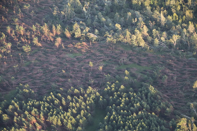
As thunderstorms congealed into a line, severe winds became the primary hazard. In addition to the two tornadoes, widespread straight line winds raked across northern and eastern Polk County and most of Barron County. Most of the damage was to trees, although some light structural damage was also noted. Trees fell toward the east southeast, which is consistent with the strong west northwest wind. Maximum wind was estimated at 90 mph given the tree damage and a measure gust of 84 mph in Cushing, WI (Polk County). The same weather station measured a sustained 73 mph wind for 5 minutes.
 |
 |
 |
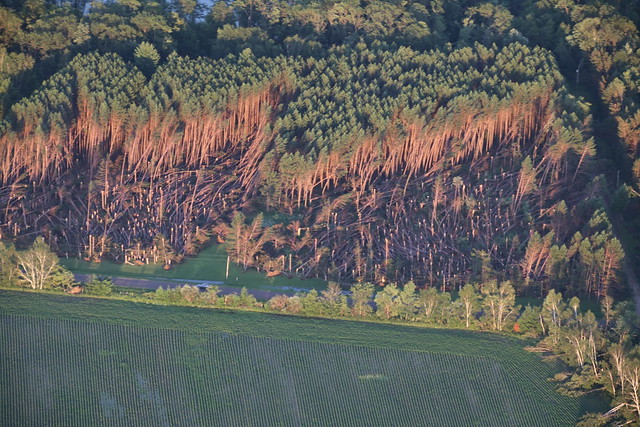 |
| Swath of blown down trees near Beaver, WI | Damage to a farm near Beaver, WI | More damage near Beaver, WI | Tree damage near Beaver, WI |
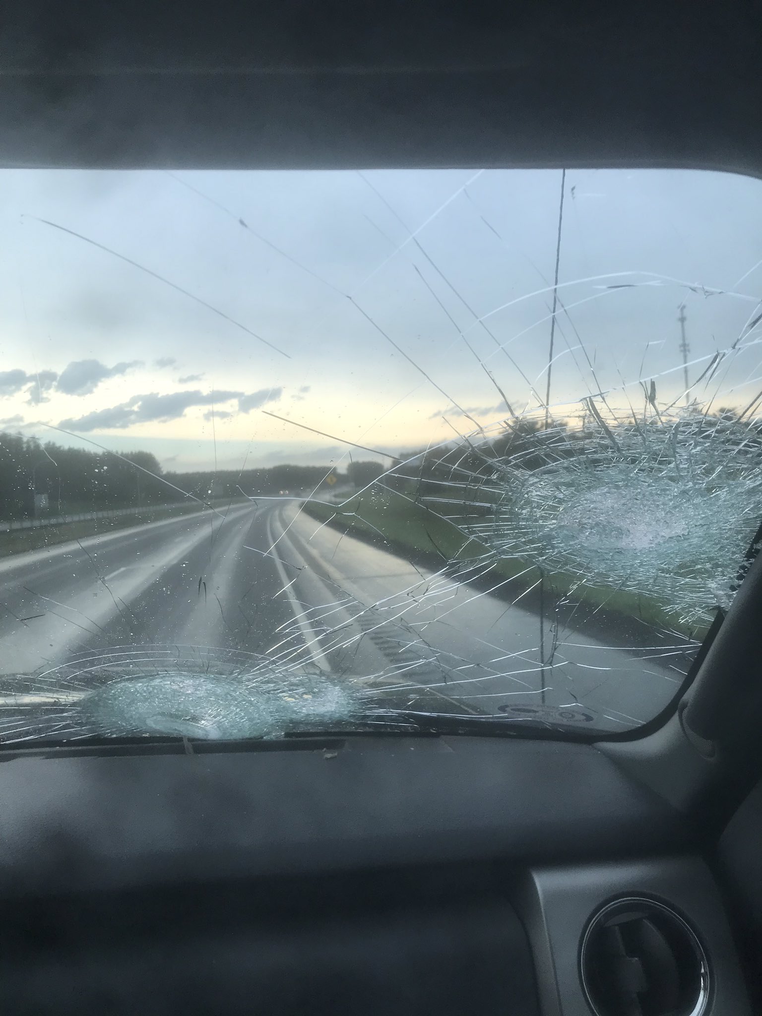
Hail
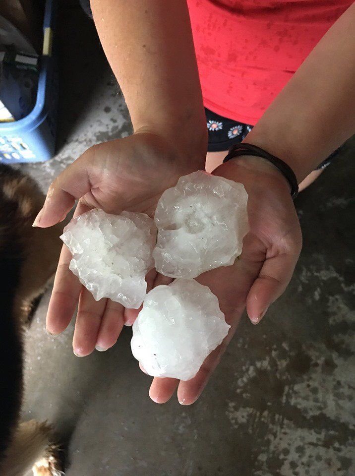
Discrete supercells were the dominant storm mode from 11am to 5pm on Friday, July 19th. While the low-levels of the atmosphere were very warm, significant hail was still able to fall to the surface before melting. This is a testament to the strength of the supercell updrafts.
 |
 |
 |
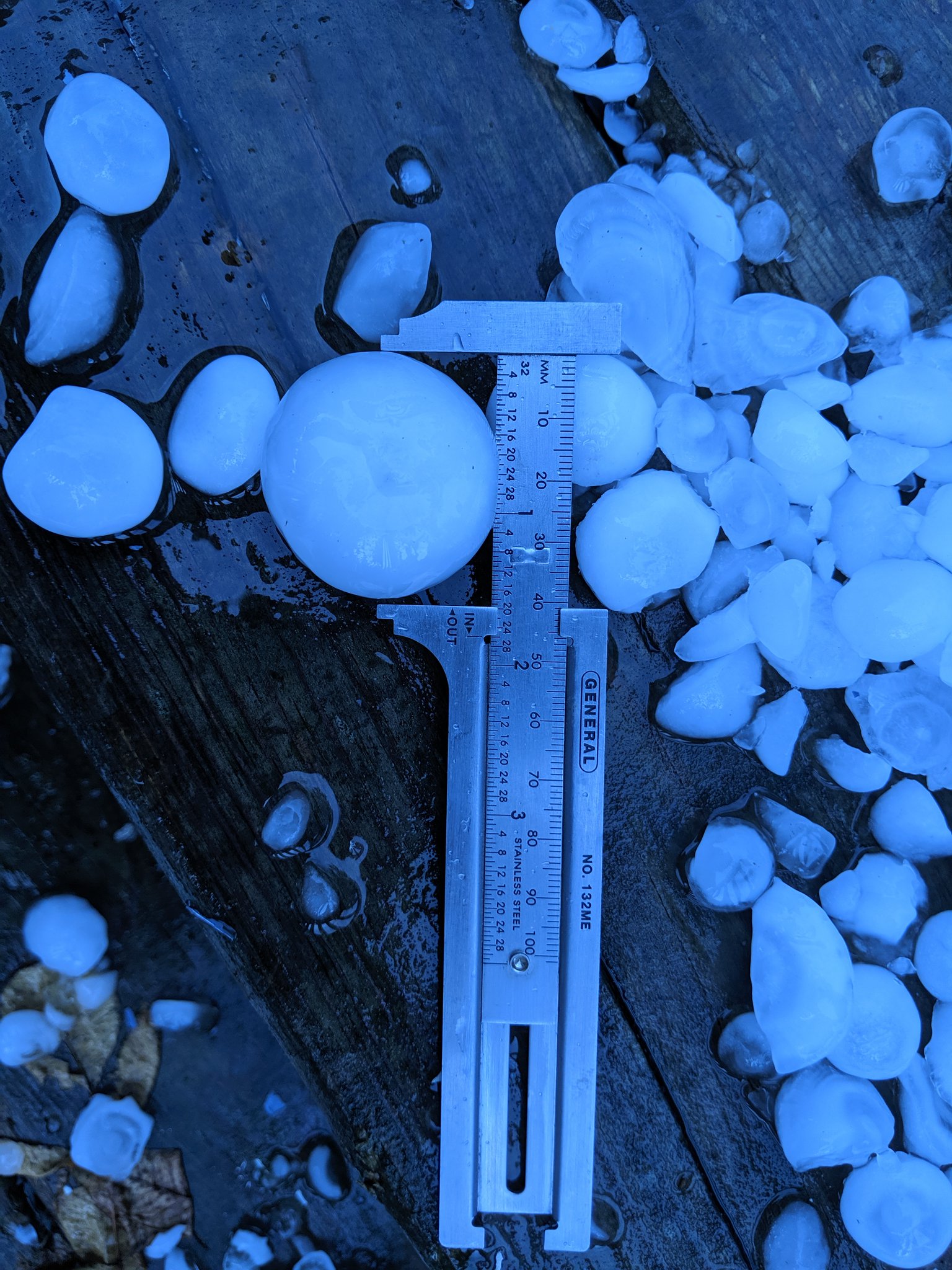 |
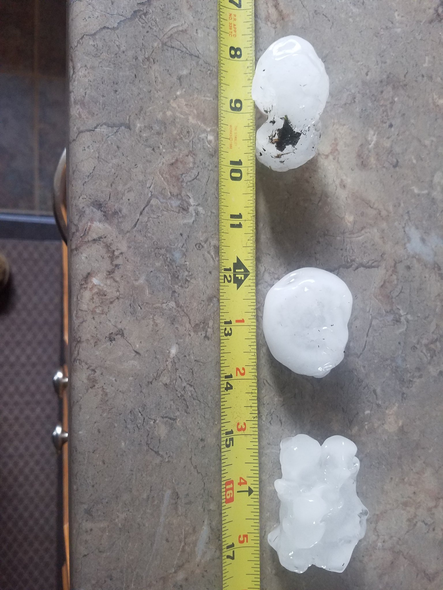
| 2.25" hail just north of Little Falls, MN (Photo taken by Julie Mushel) | Broken windshield from baseball size hail near Rock Creek, MN (Photo taken by Justin Sorensen) | 2.25" hail near Randall, MN (Photo taken by Kevin Dirks) | Golf ball size hail near Donnelly, MN (Photo taken by Alan Uphoff) |
Photos & Video
During Event
 |
 |
 |
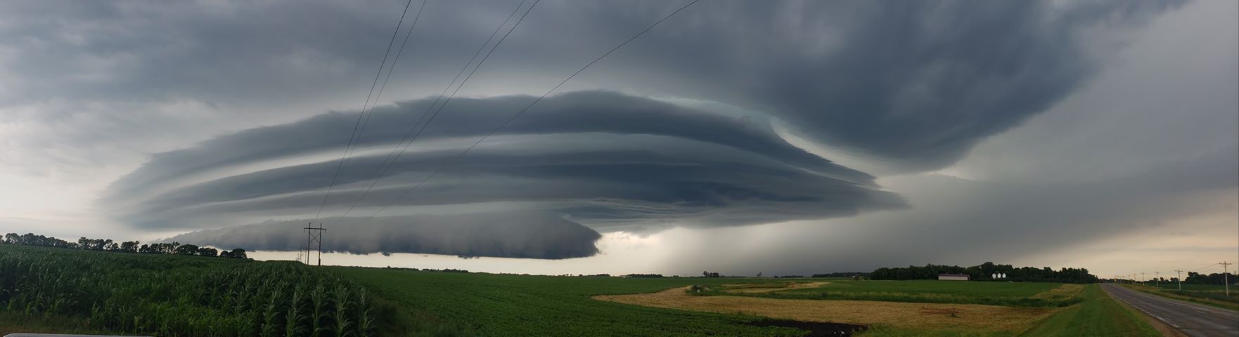
| Supercell near Alberta, MN at 11:50am (Photo taken by Eric Tomoson) | Supercell near Mora, MN at 4:02pm (Photo taken by Jordan Woods) |
Incoming storms at Rock Fest in Cadott, WI (Photo by Kaylee Pickering) |
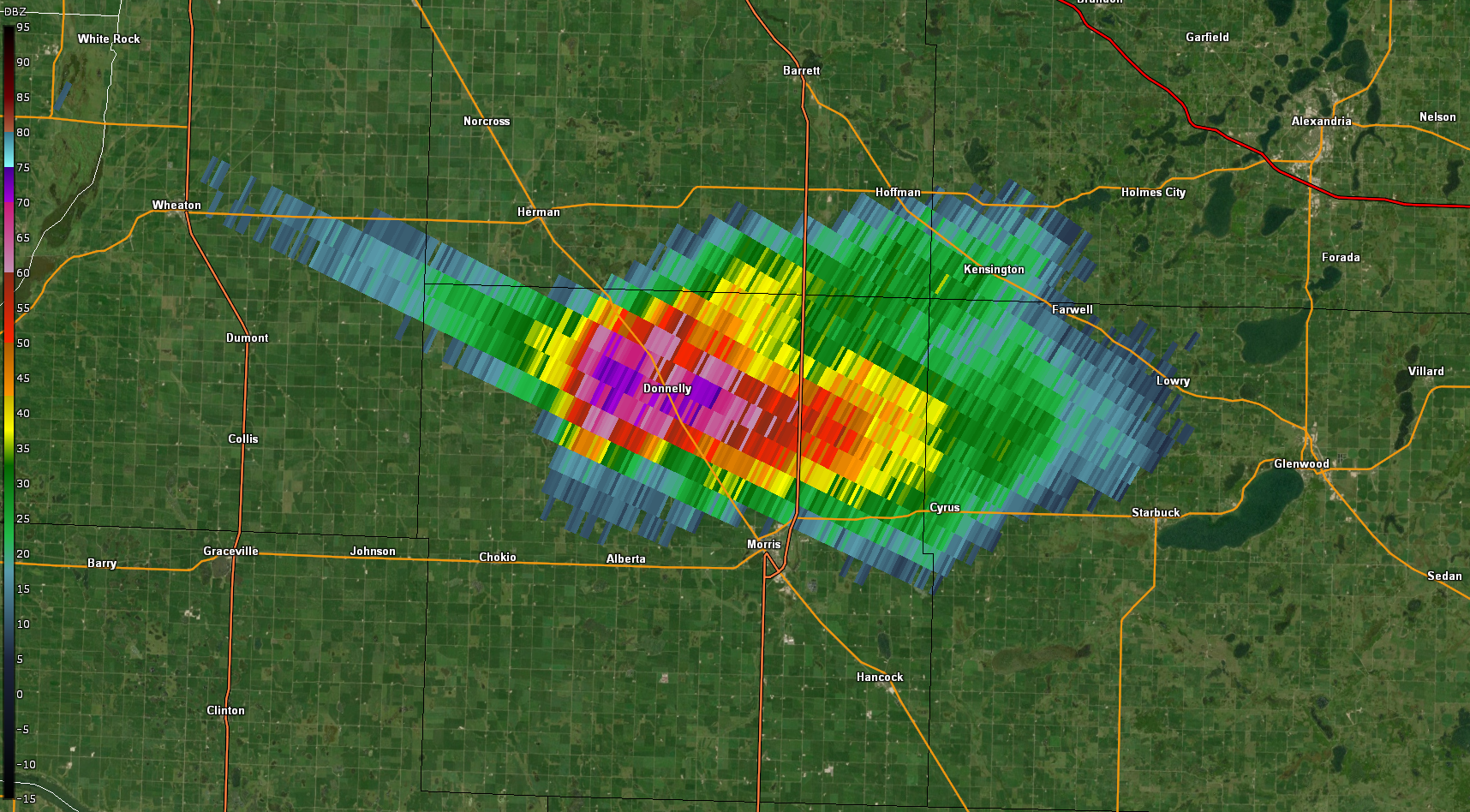
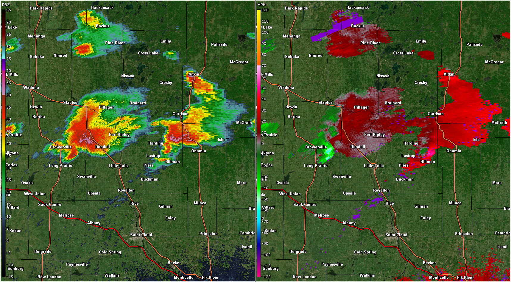
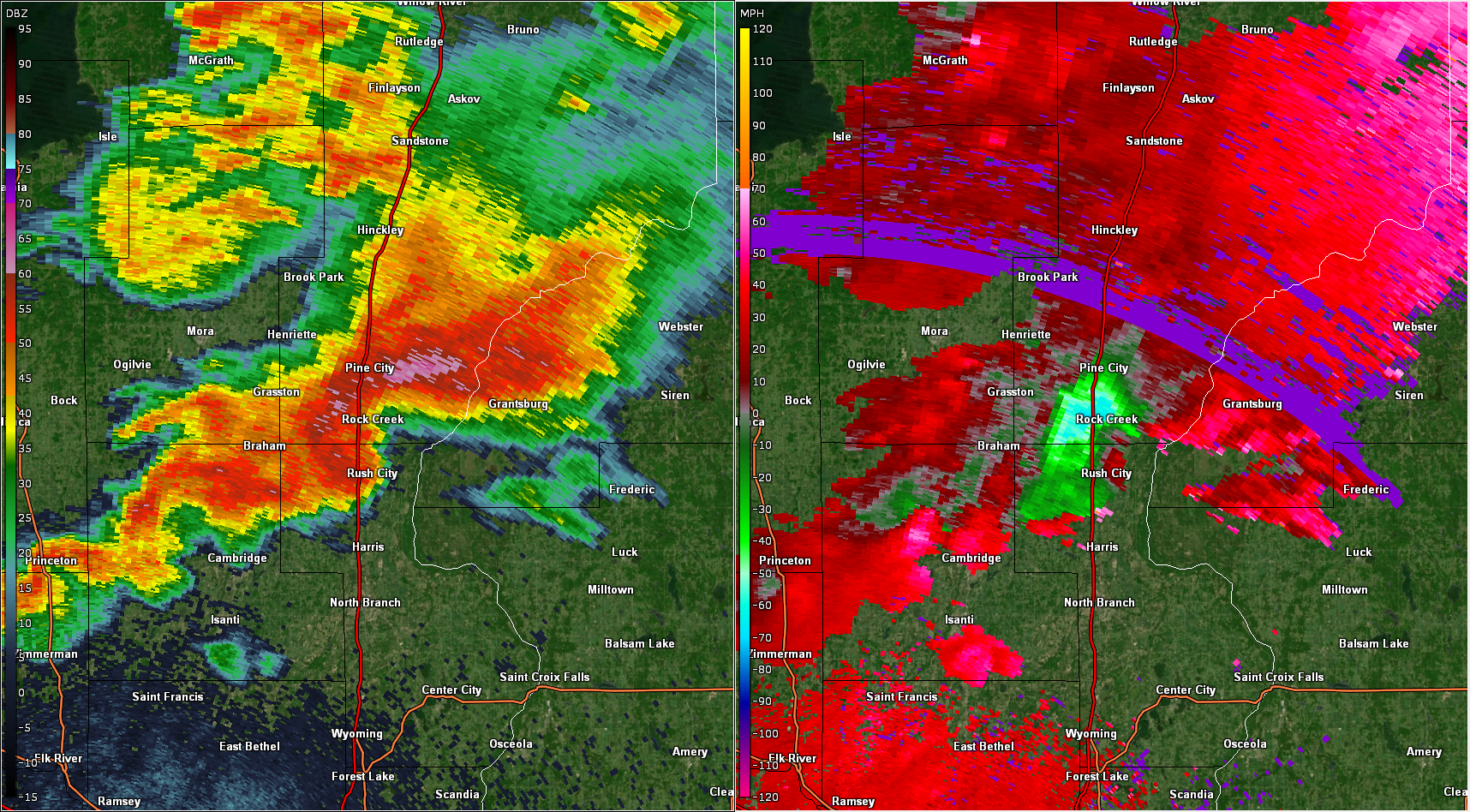
Radar
Radar Snapshots
 |
 |
 |
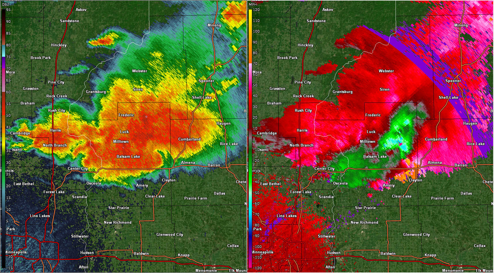 |
| Base reflectivity of supercell over Donnelly, MN at 11:52am | Base reflectivity at 2:19pm | Base reflectivity at 3:39pm | Base reflectivity at 5:34pm |
Environment
A broad shortwave trough was located over the High Plains the evening of July 19th, 2019. Unusually fast summertime upper-level flow allowed for strong low-level dynamical responses. Rich, deep moisture was advected into Minnesota and surface temperatures rose into the low-90s.
.png) |
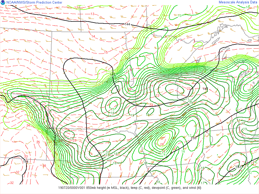 |
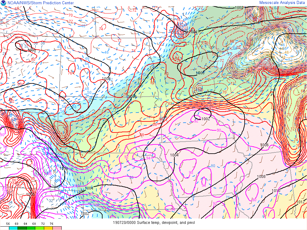 |
| July 19, 2019 7pm 300mb map | July 19, 2019 7pm 850mb map | July 19, 2019 7pm Surface map |
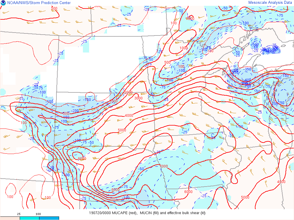
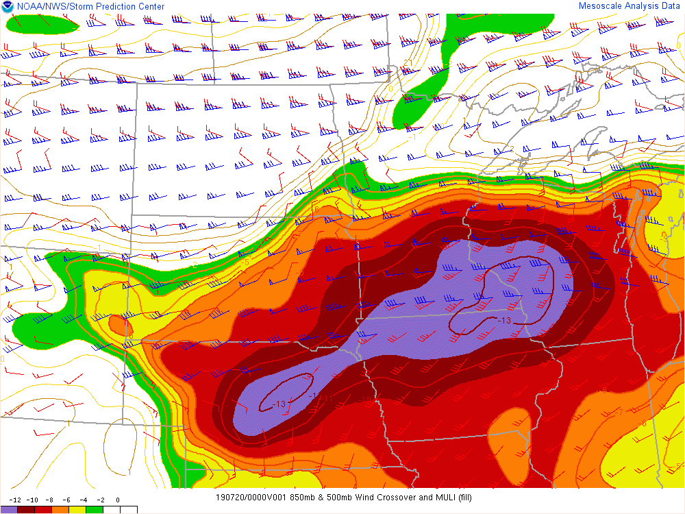
The very warm dewpoints and surface temperatures created extremely unstable air. This combined with the strong, directional vertical wind shear (from the unusually strong summertime upper-level winds) generated a very favorable environment for strong, rotating thunderstorms.
 |
 |
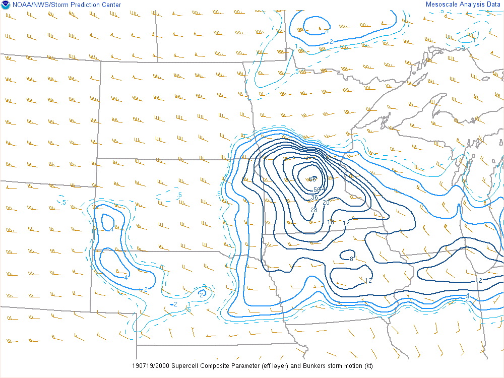 |
| July 19, 2019 7pm Most-unstable CAPE and Wind Shear map | Color-filled contours show where most unstable air is located. Red (850mb) and blue (500mb) wind barbs show where there is strong directional vertical wind shear. | July 19, 2019 3pm Supercell composite map: Values over 10 usually mean a favorable environment for supercells. A value of 66 is analyzed in central MN. |
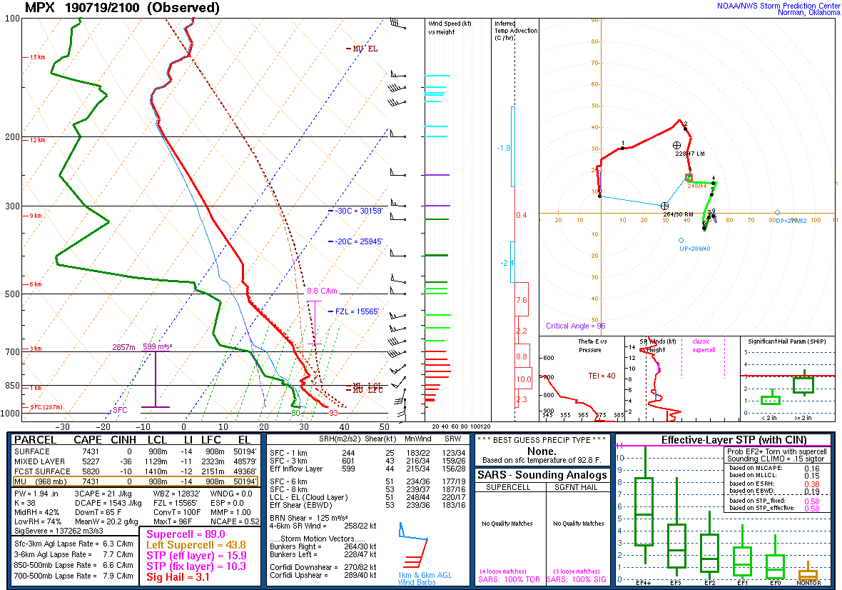
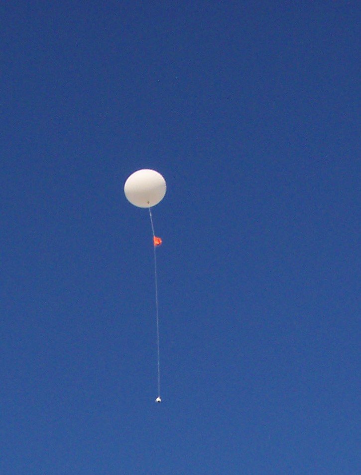
The data recorded by our 4pm weather balloon confirmed that the an extremely unstable environment was in place over Minnesota. This was likely one of the most volatile severe weather environments we've captured observations for.
 |
 |
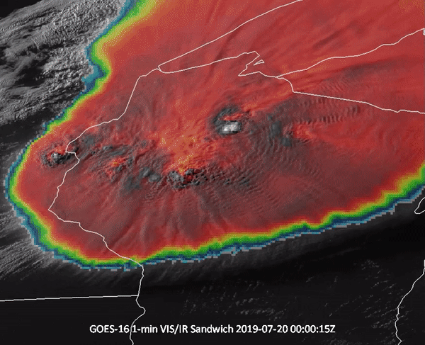 |
| July 19, 2019 4pm sounding at MPX | 4pm weather balloon being released at MPX | Visible/Infrared satellite loop |
 |
Media use of NWS Web News Stories is encouraged! Please acknowledge the NWS as the source of any news information accessed from this site. |
|