Overview
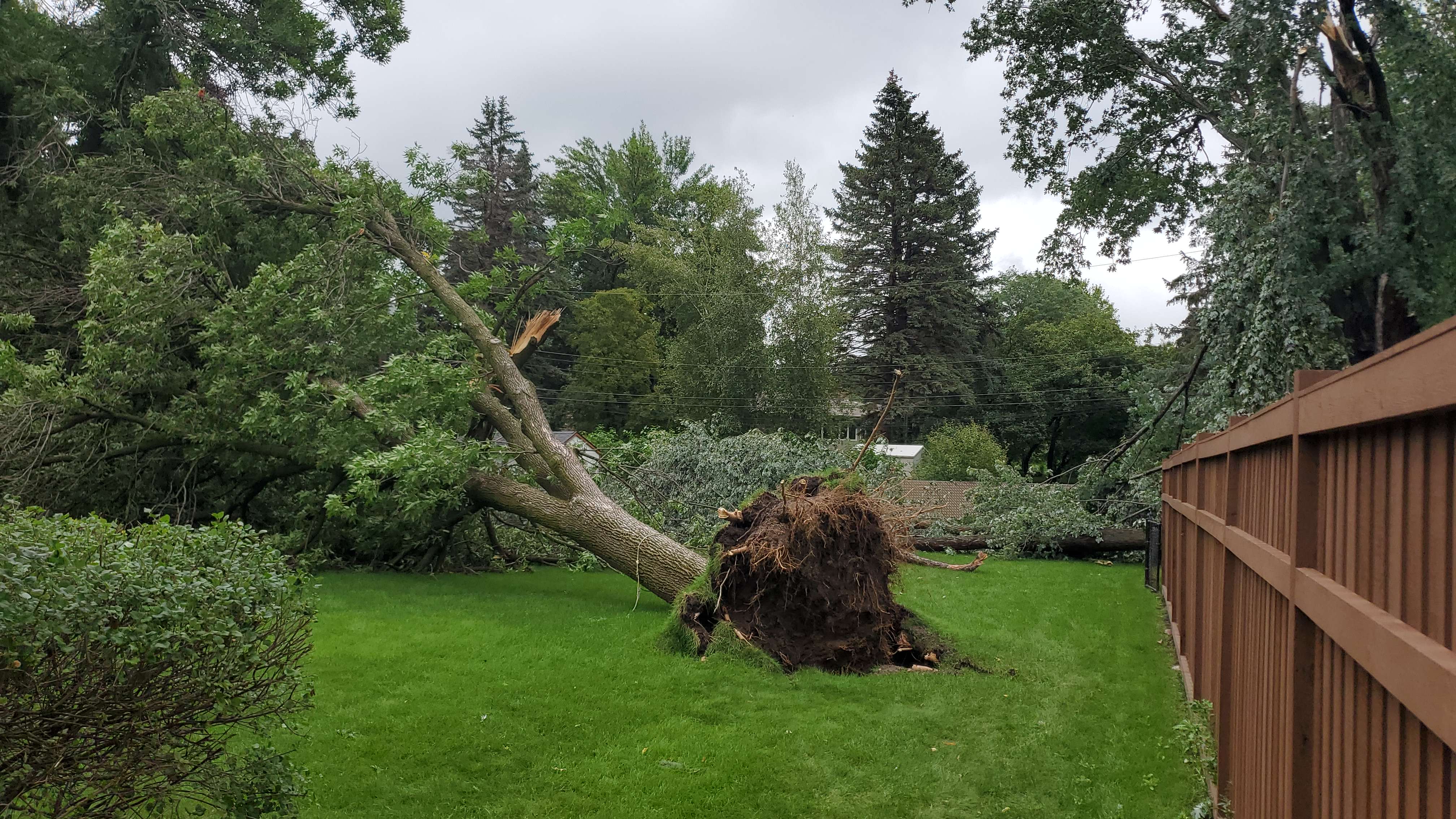
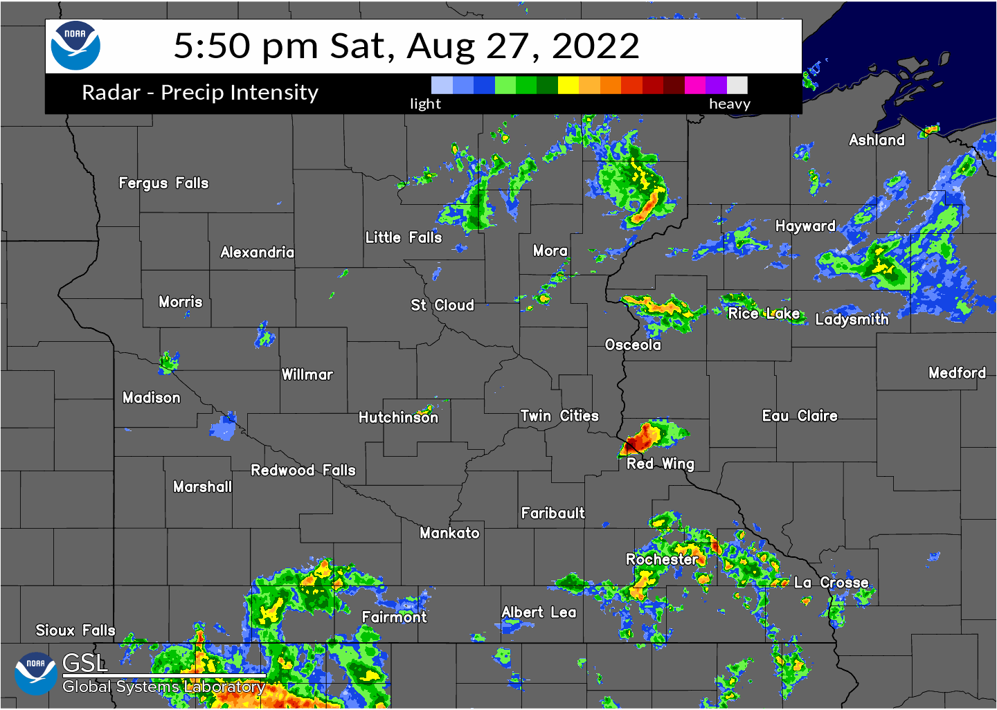
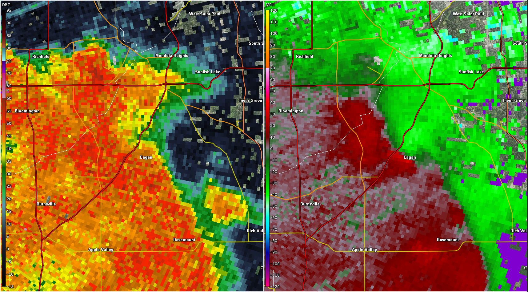
A QLCS-like line of storms quickly developed ahead of a blob of decaying convection that was moving northeast in southern MN. These new storms formed within a narrow corridor of uncapped, moderate MLCAPE with very high MLCAPE values in the lowest 3 km. While bulk shear magnitudes were borderline, the 0-3 km shear was normal to the line of storms, signaling some possibility of QLCS tornadoes. As the line of storms traveled through the Twin Cities, 5 EF0 tornadoes were confirmed in the southeast metro. Numerous trees were uprooted or broken and a few structures were damaged. Strong winds also caused damage and a 61 mph wind gust was measured at the grandstand of the Minnesota State Fair.
Tornadoes:
Tornado - Apple Valley/Burnsville
Dakota County
| Date |
August 27, 2022 |
| Time (Local) |
8:36pm |
| EF Rating |
EF-0 |
| Est. Peak Winds |
75 MPH |
| Path Length |
0.85 Miles |
| Max Width |
100 |
| Injuries/Deaths |
0/0 |
|
Summary:
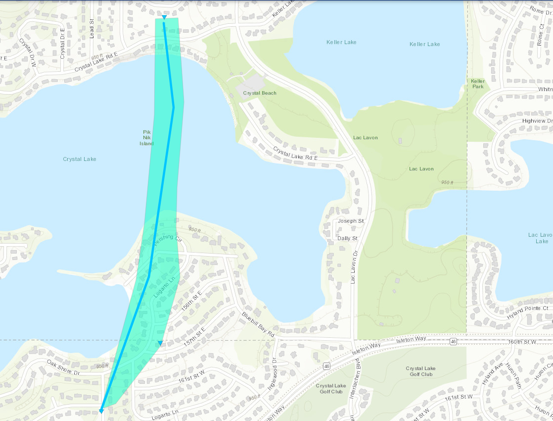
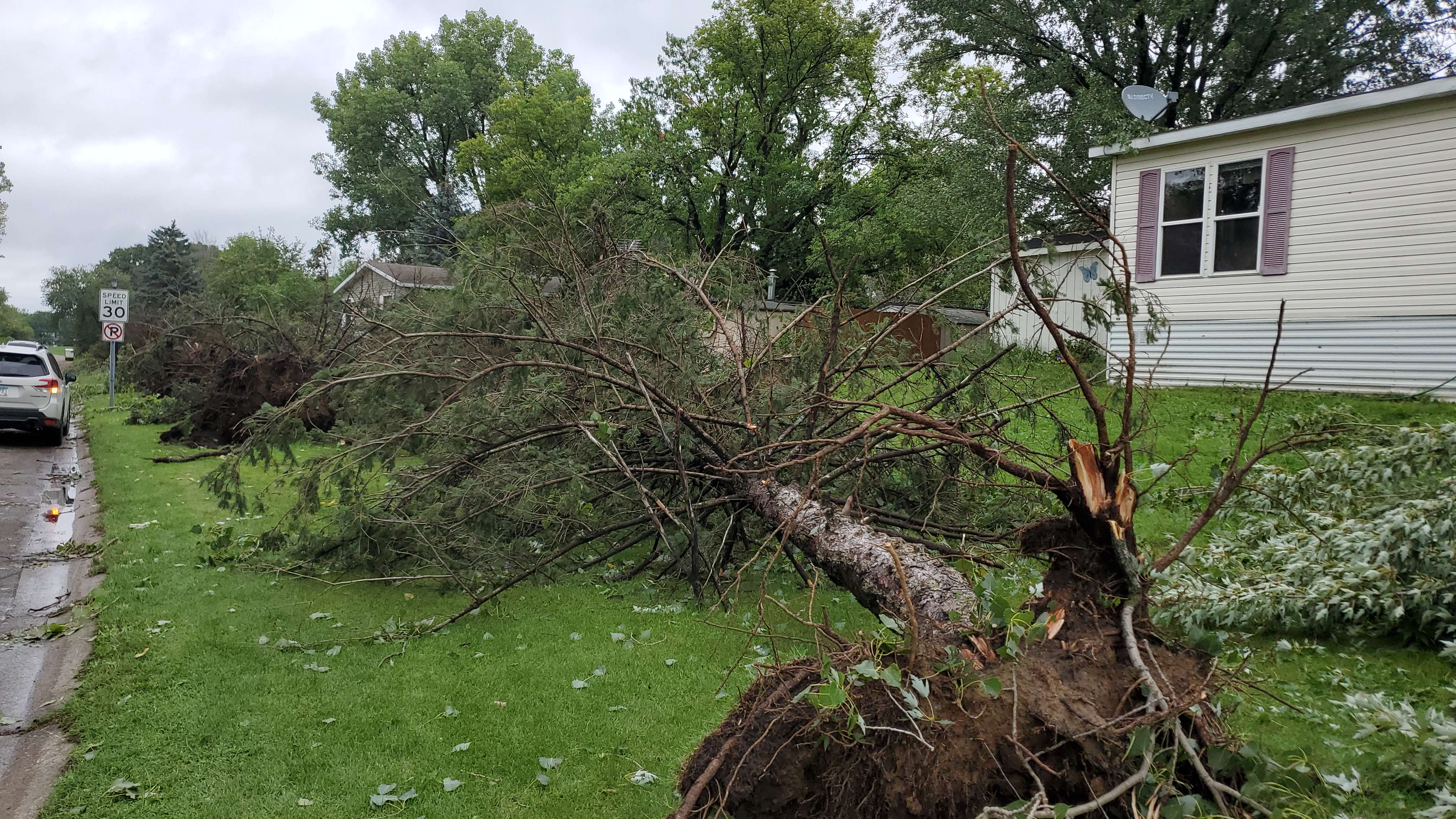
A NWS Storm Survey concluded that an EF0 tornado touched down near the intersection of Jacquara Avenue and 161st Street West, and moved north-northeast across Crystal Lake, and then lifted near Crystal Beach. Several homes had damage (mainly roof damage) which occurred as multiple large trees were either uprooted or blown down along the tornado's path. The maximum width was 100 yards with a peak wind of 75 mph.
|
Track Map
Downloadable KMZ File
|
Tornado - Apple Valley
Dakota County
| Date |
August 27, 2022 |
| Time (Local) |
8:40pm |
| EF Rating |
EF-0 |
| Est. Peak Winds |
85 MPH |
| Path Length |
0.37 Miles |
| Max Width |
100 |
| Injuries/Deaths |
0/0 |
|
Summary:
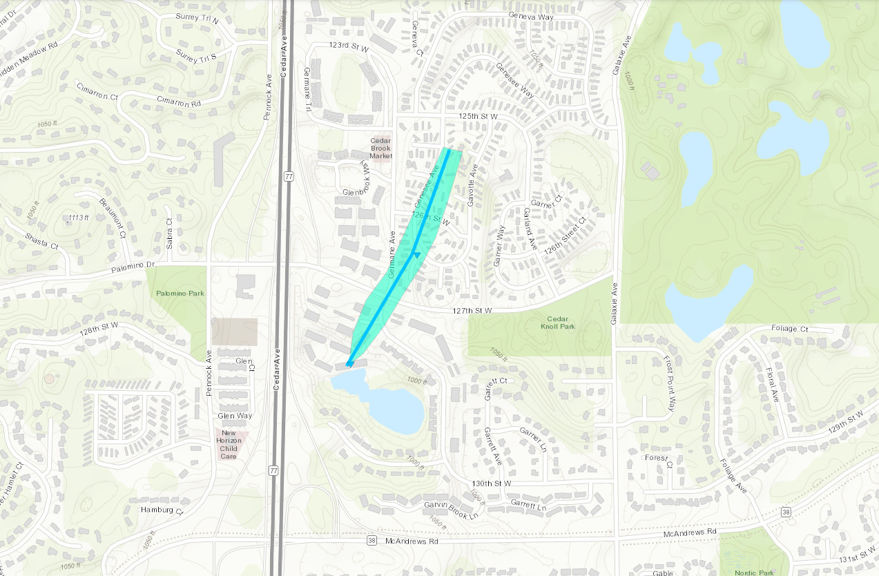
A NWS Storm Survey concluded that an EF0 tornado touched down near Germane Avenue and 128th Street, or around Hidden Ponds, and Cedar Valley Apartments and moved northeast across 127th Street West. This tornado continued to move northeast before lifting between 126th and 125th Street along Genesee Avenue. This tornado uprooted or blew down numerous large trees along its path. Structural damage (mainly roof damage) occurred to apartment complexes, mobile homes, and single family homes between 128th and 125th Street. Maximum wind speeds were 85 mph with a width of 100 yards.
|
Track Map
Downloadable KMZ File
|
Tornado - Eagan
Dakota County
| Date |
August 27, 2022 |
| Time (Local) |
8:47pm |
| EF Rating |
EF-0 |
| Est. Peak Winds |
85 MPH |
| Path Length |
0.75 Miles |
| Max Width |
150 |
| Injuries/Deaths |
0/0 |
|
Summary:
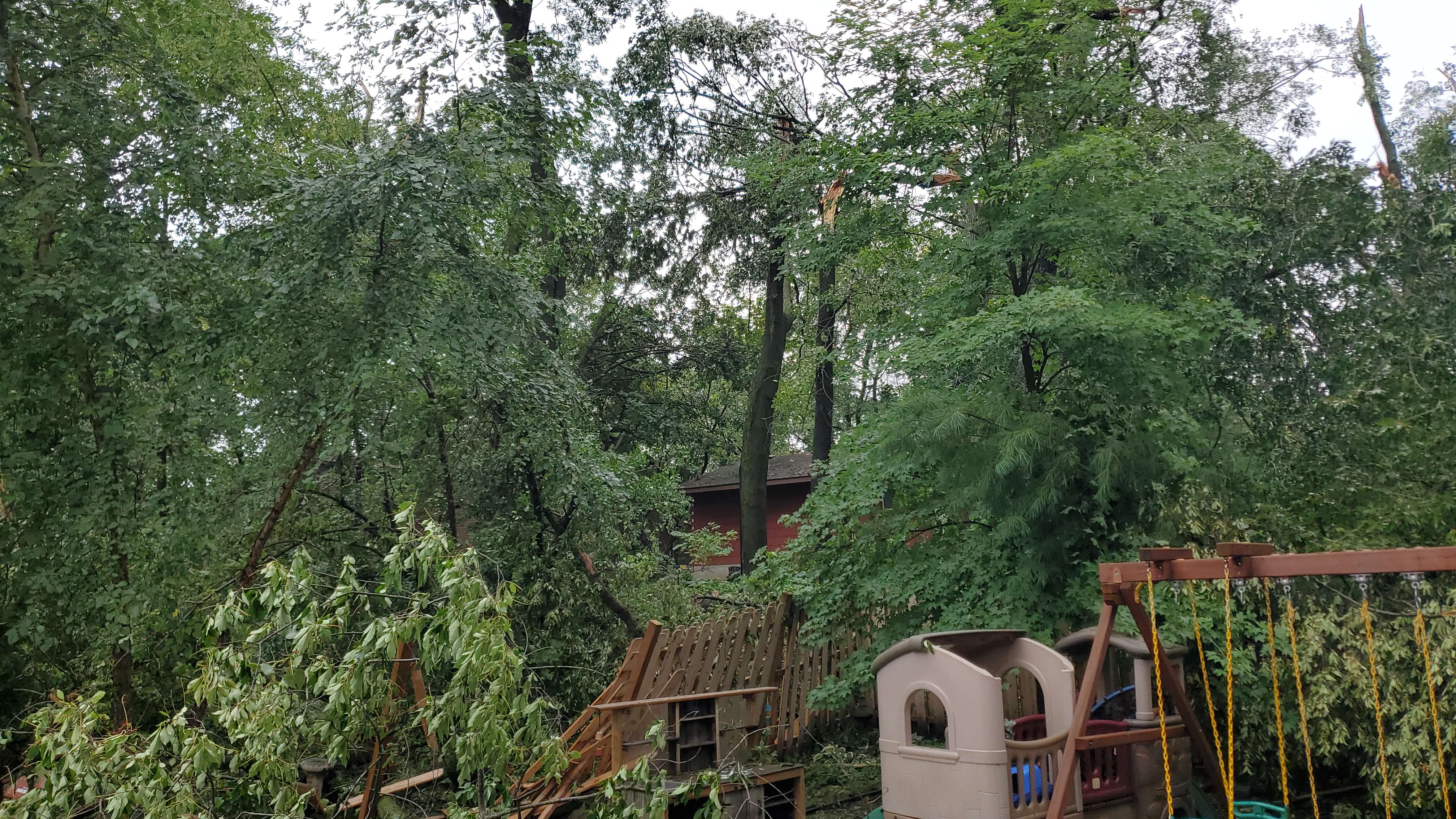
A NWS Storm Survey concluded that a brief EF0 tornado formed in a wooden area between Timbershore Lane and Tananger Circle, south of Duckwood Drive in Eagan, Minnesota. Most of the damage occurred between Timbershore Lane and Duckwood Drive before the damage path became more disorganized as the tornado lifted near Lexington, and Yankee Doodle Road where a few large pine trees were uprooted. Damage was more widespread in the wooden area where large hardwood trees were uprooted or blown down. Several of the large trees landed on roofs, sheds and fence's in this residential neighborhood. Damage indicators showed that up to 85 mph winds occurred, with a path width of 150 yards.
|
Track Map
.PNG)
Downloadable KMZ File
|
Tornado - West St. Paul
Dakota County
| Date |
August 27, 2022 |
| Time (Local) |
8:55pm |
| EF Rating |
EF-0 |
| Est. Peak Winds |
85 MPH |
| Path Length |
0.26 Miles |
| Max Width |
50
|
| Injuries/Deaths |
0/0 |
|
Summary:
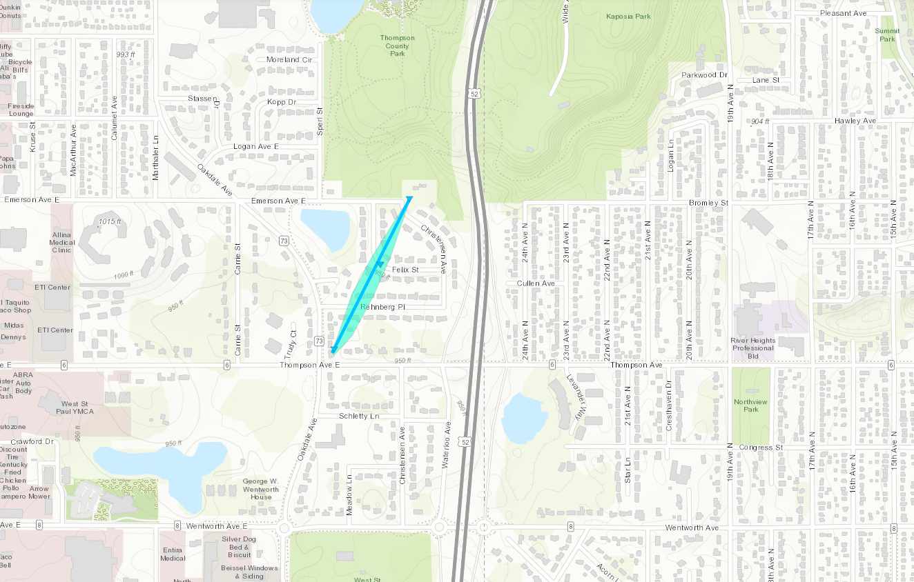
A NWS Storm Survey concluded that a brief EF0 tornado formed near Thompson Avenue East, and Oakdale Avenue and moved north-northeast across a residential neighborhood between Thompson Avenue and Christensen Avenue in West St. Paul. Several large trees were uprooted or blown down in this area with a maximum width of 50 yards, and a maximum speed of 85 mph. Most of the trees landed in open areas with little roof or property damage.
|
Track Map
Downloadable KMZ File
|
| |
Tornado - St. Paul
Ramsey County
| Date |
August 27, 2022 |
| Time (Local) |
8:59pm |
| EF Rating |
EF-0 |
| Est. Peak Winds |
75 MPH |
| Path Length |
3.46 Miles |
| Max Width |
100 |
| Injuries/Deaths |
0/0 |
|
Summary:
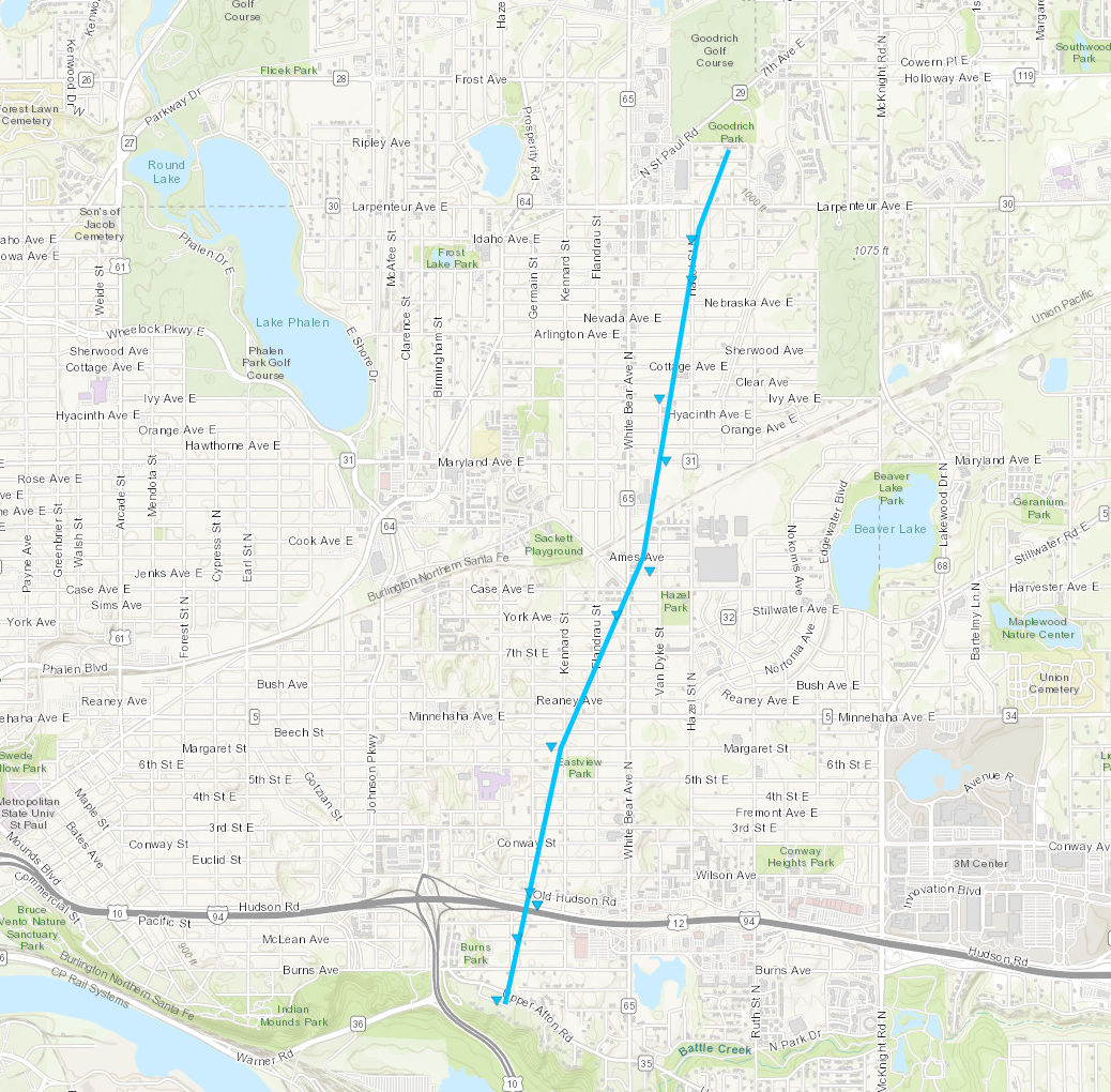
Tornado touched down just southeast of the intersection of I-94 and Highways 10/61 and moved north-northeast. It tracked just east of Harding High School, crossing White Bear Avenue near Case Avenue, and continuing beyond Larpenteur Avenue, where it dissipated near Goodrich Park in Maplewood. The tornado uprooted or broke dozens of trees, with some falling on sheds, houses, and a few vehicles.
|
Track Map
Downloadable KMZ File
|
The Enhanced Fujita (EF) Scale classifies tornadoes into the following categories:
EF0
Weak
65-85 mph |
EF1
Moderate
86-110 mph |
EF2
Significant
111-135 mph |
EF3
Severe
136-165 mph |
EF4
Extreme
166-200 mph |
EF5
Catastrophic
200+ mph |
 |
Storm Reports

(1).png)
.png)


