Overview
Widespread showers associated with an area of low pressure grew into low-topped supercells across eastern Minnesota during the afternoon as the activity encountered greater instability. Strong low level shear helped produce six tornadoes from central and east central into northwest Wisconsin. There were three EF1 tornadoes and three EF0s. To many, the Silver Lake tornado appeared stronger than an EF1, but this was likely due to the high amounts of moisture in the air which allowed the condensation funnel to grow large. Damage along its path suggested a peak wind speed of 105 mph, a high end EF1.
Tornadoes:
|
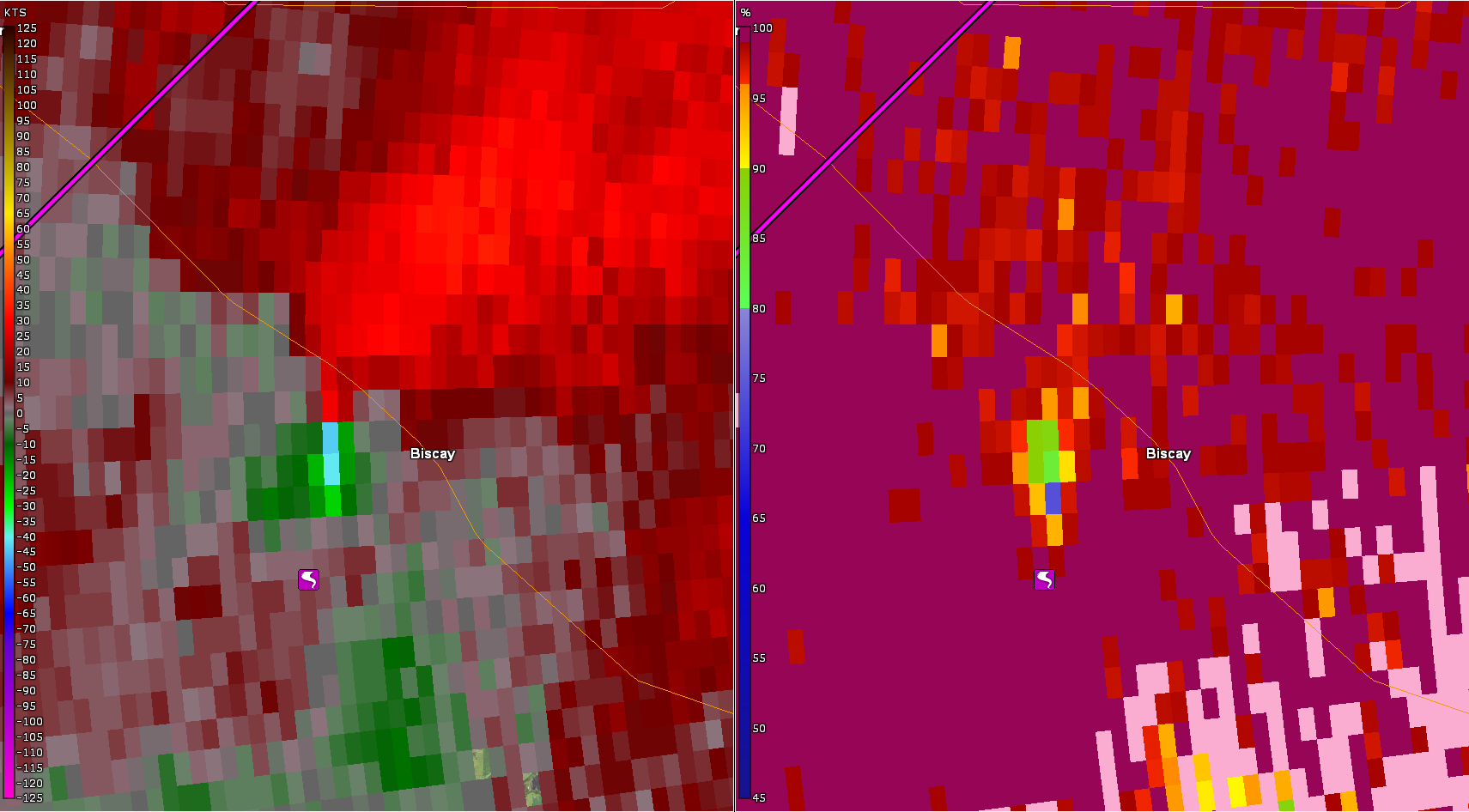
Tornado - Biscay, MN
Track Map 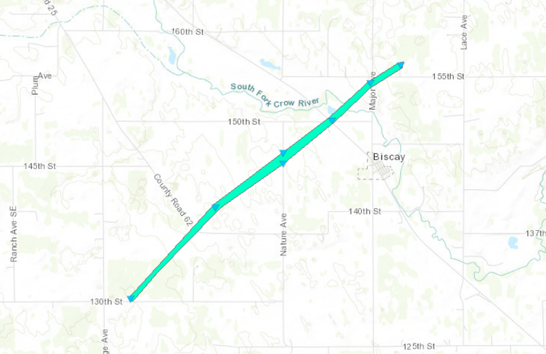 
Downloadable KMZ File |
||||||||||||||||
|
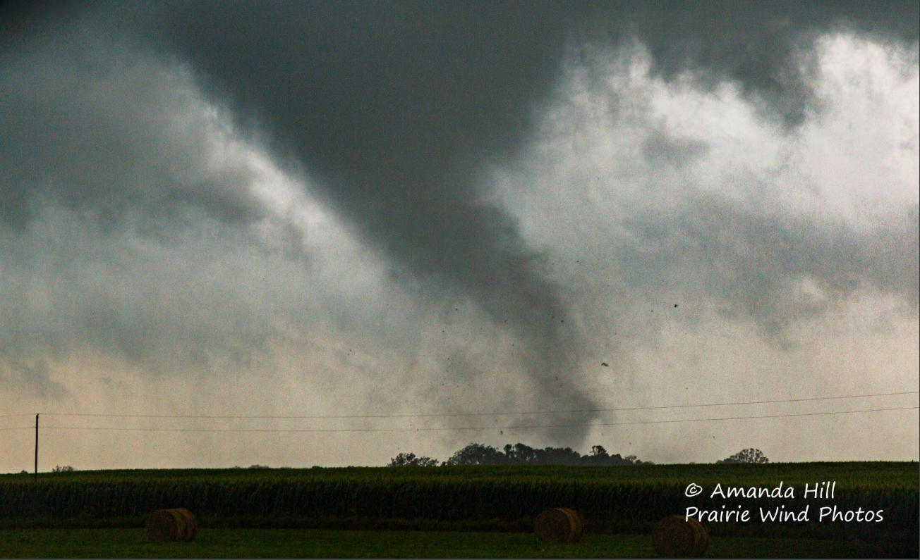
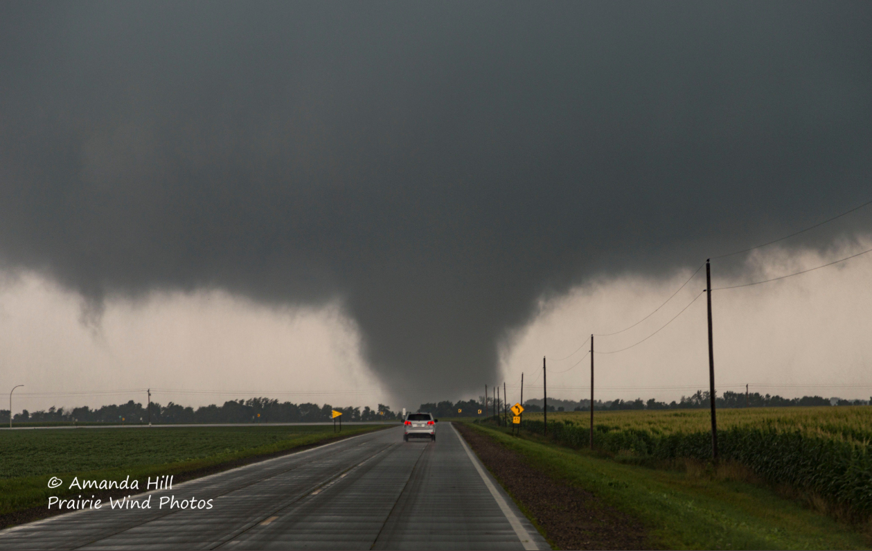
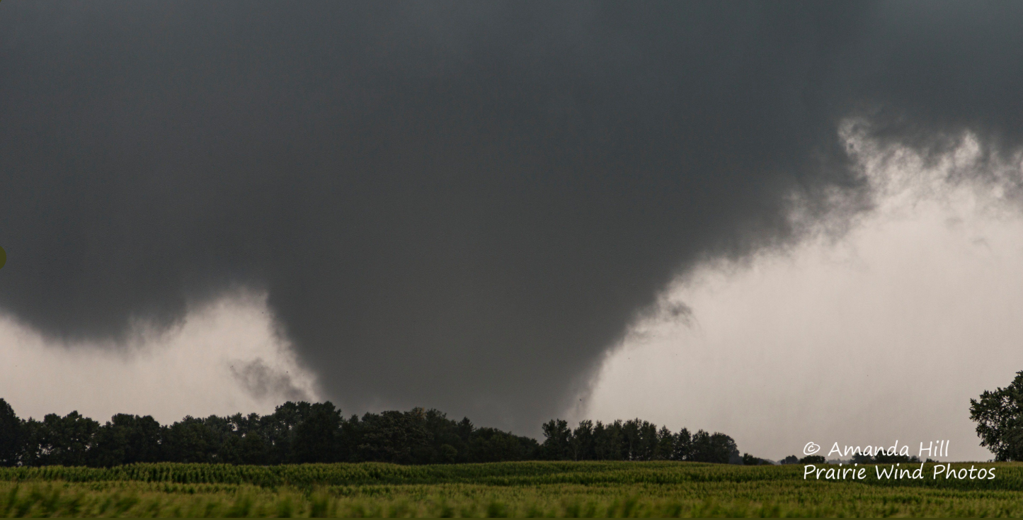
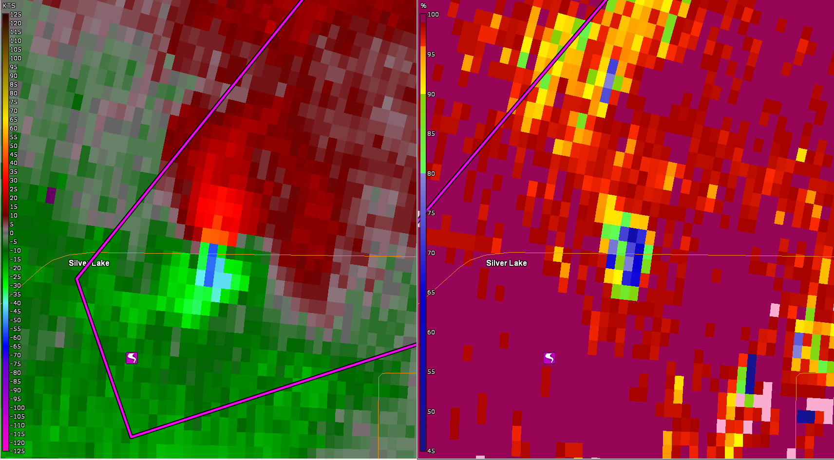
Tornado - 3 SSE Silver Lake, MN
Track Map 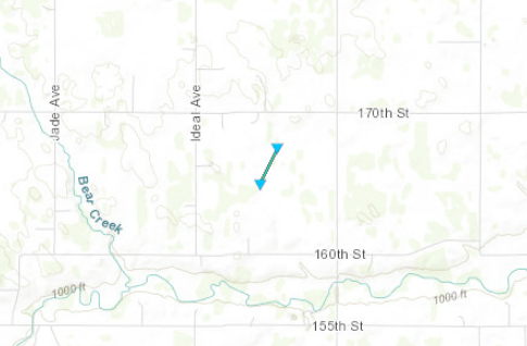
Downloadable KMZ File |
||||||||||||||||
|
Tornado - Silver Lake, MN
Track Map 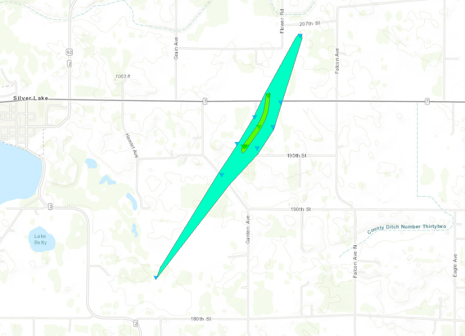
Downloadable KMZ File |
||||||||||||||||
|
Tornado - Forest Lake, Scandia, & Lindstrom, MN
Track Map .PNG/forestlakedamagefinal(1)__462x320.PNG)
Downloadable KMZ File |
||||||||||||||||
|
Tornado - Luck, WI
Track Map 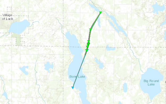
Downloadable KMZ File |
||||||||||||||||
|
Tornado - Barron, WI
Track Map 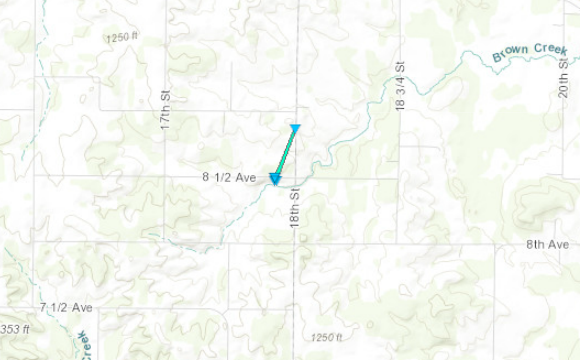
Downloadable KMZ File |
||||||||||||||||
The Enhanced Fujita (EF) Scale classifies tornadoes into the following categories:
| EF0 Weak 65-85 mph |
EF1 Moderate 86-110 mph |
EF2 Significant 111-135 mph |
EF3 Severe 136-165 mph |
EF4 Extreme 166-200 mph |
EF5 Catastrophic 200+ mph |
 |
|||||
Photos & Video
Header
 |
 |
 |
 |
| Tornado west of Biscay, MN. Photo courtesy of Amanda Hill. | Tornado east of Silver Lake, MN. Photo courtesy of Amanda Hill. | Tornado east of Silver Lake, MN. Photo courtesy of Amanda Hill. | Clear evidence of convergent damage at the beginning point of the Biscay tornado. Photo by NWS personnel. |
 |
 |
 |
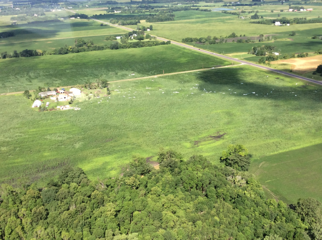 |
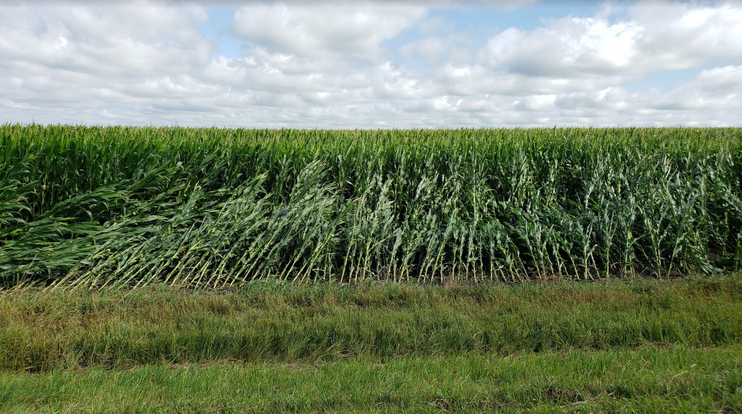
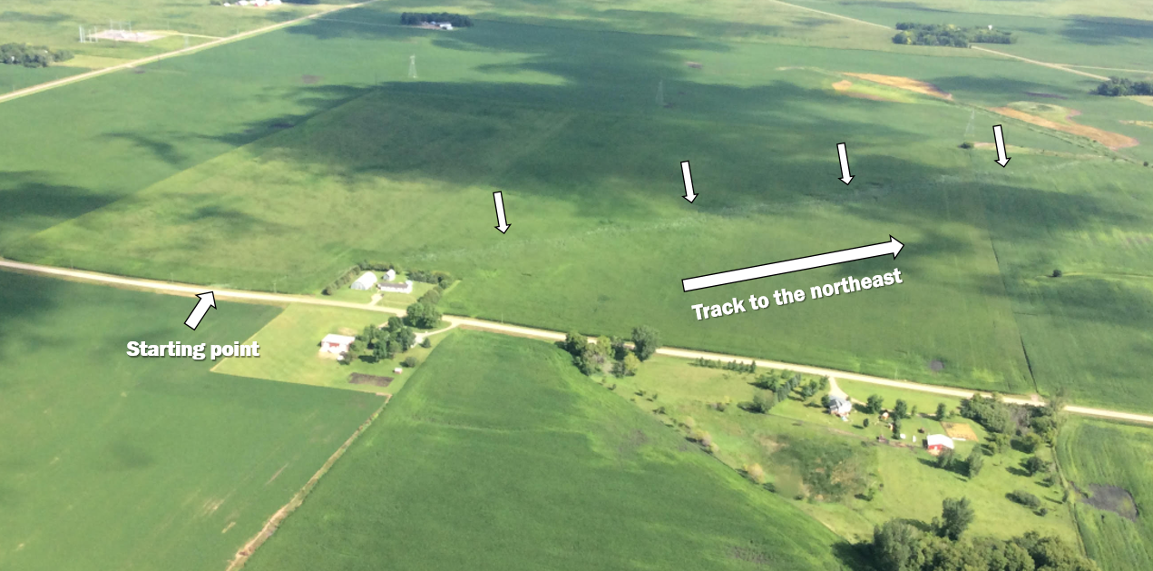
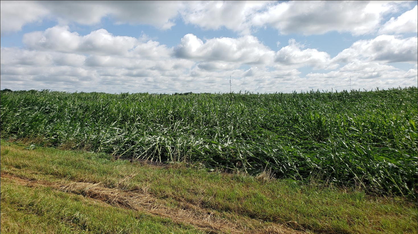
| Biscay tornado beginning point and track northeast through corn fields. Aerial photography courtesy of the Civil Air Patrol. | Tornado track through corn field. Photo by NWS personnel. | Shed destroyed by Silver Lake tornado. Photo by NWS personnel. | Silver Lake tornado damage at its widest (1/4 mile). Photo courtesy of the Civil Air Patrol. |
 |
 |
 |
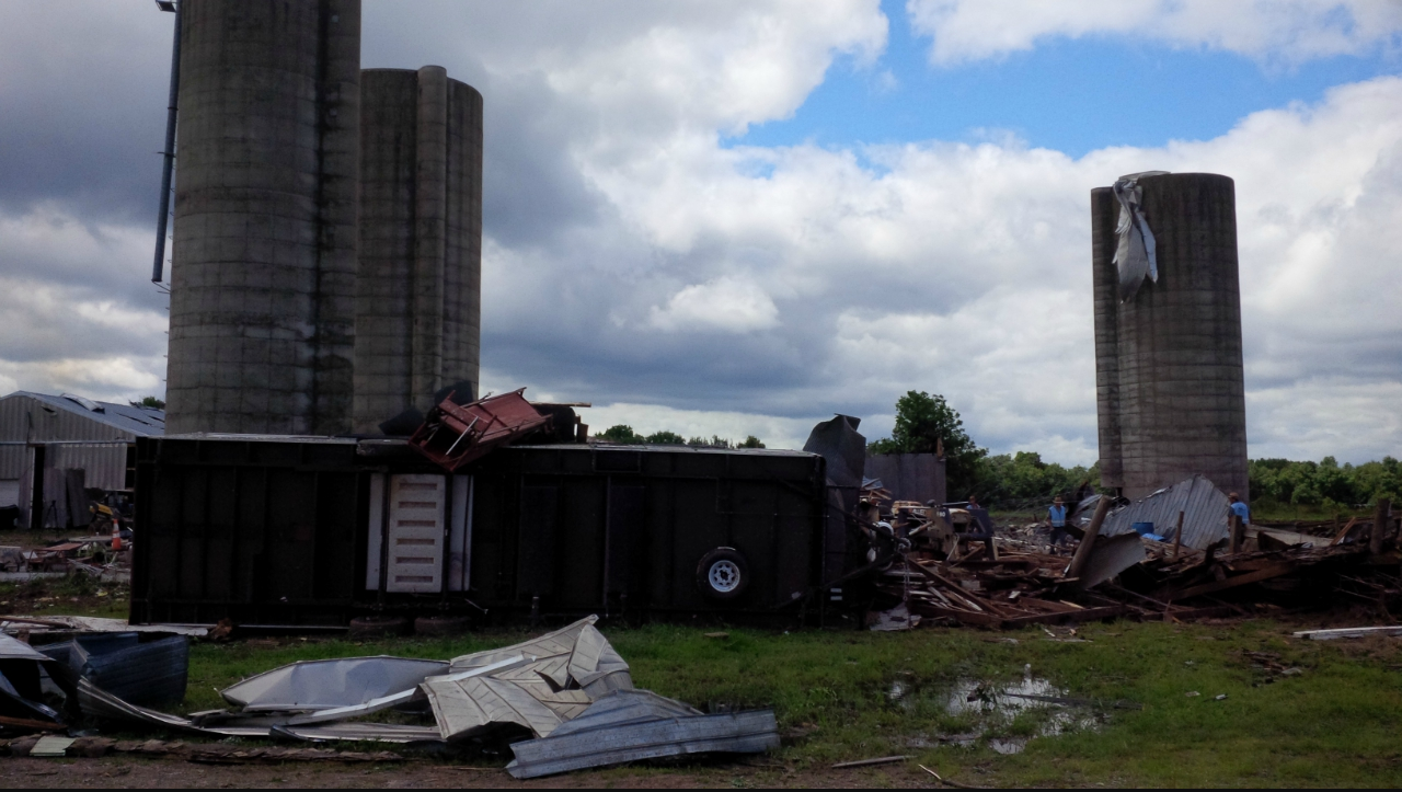 |
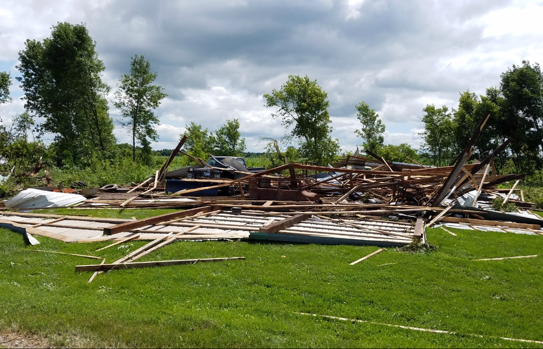
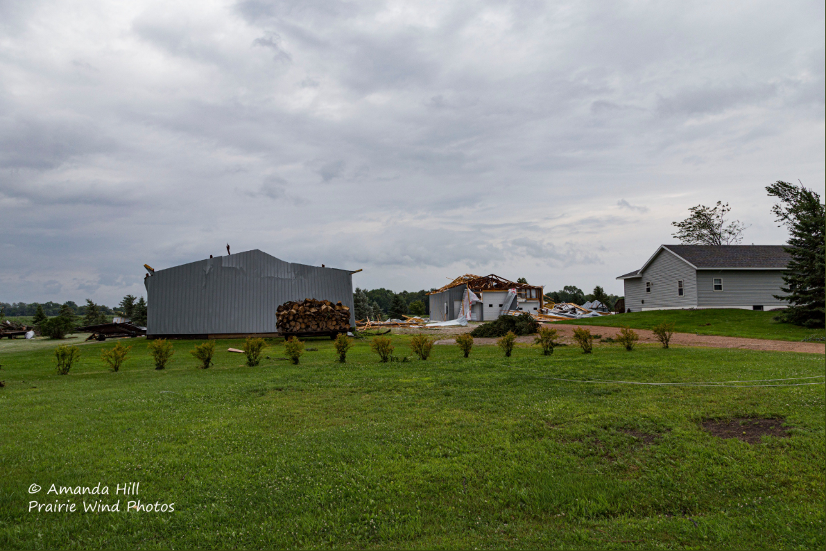
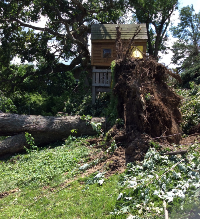
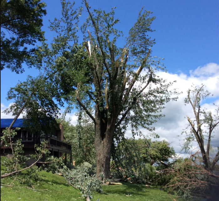
| Structural damage east of Silver Lake, MN. Photo courtesy of Amanda Hill. | Tree damage near Forest Lake, MN. Photo by NWS Personnel. | Tree damage near Forest Lake, MN. Photo by NWS Personnel. | Damage to a farm near Bone Lake, WI. Photo by NWS personnel. |
Radar
Velocity and Correlation Coefficient (CC)
 |
 |
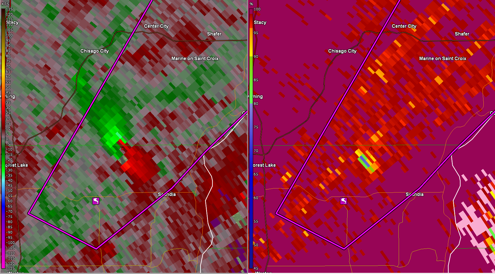 |
| Velocity (left) shows strong rotation just west of Biscay. CC (right) shows debris in the air, likely leaves and crop debris. This is a radar confirmed tornado. | Velocity (left) shows very strong rotation over Highway 7 east of Silver Lake. CC (right) shows debris in the air. This is a radar confirmed tornado. | Velocity (left) shows very strong rotation near the Washington/Chisago County border. CC (right) shows debris in the air. This is a radar confirmed tornado. |
|
Radar Loop Of Sunday Afternoon/Evening Reflectivity (Left) SRM (Right) |
||
Environment
An unusually strong shortwave trough moved across the Upper Midwest during the afternoon of Sunday, July 28th. Both the 300 MB, and 500 MB analysis indicated a strong shortwave and good upper level diffluence moving across Minnesota during the afternoon. Surface conditions indicated a weak area of low pressure across central Minnesota, with winds backing to the southeast ahead of the surface low.
 |
.PNG/500%20MB%2020z(1)__426x320.PNG) |
 |
| 300 MB Heights & Winds | 500 MB Heights & Winds | Surface Pressure, Winds, Moisture & Temperature |
Instability was not overly high, but the combination of increasing wind shear, both speed and direction, and modest instability, led to rotating storms in the afternoon. Once the storms became surface based, and winds backed to the southeast, surface helicity (similar to a spinning top which lifted in the boundary layer) increased and led to the tornadoes. One of the weather parameters that uses instability and wind shear, the Conditional Probability of Significant Tornado, showed a maximum over southeast Minnesota and west-central Wisconsin.
 |
 |
 |
| MUCAPE (Contour) MLCIN (Shaded) & Effective Bulk Shear | Supercell Composite Parameter (Eff Layer & Storm Motion) | Conditional Probability of Significant Tornado (Percentage) |
Atmospheric Sounding from 7pm July 28th
 |
||
| Chanhassen, MN Sounding |
 |
Media use of NWS Web News Stories is encouraged! Please acknowledge the NWS as the source of any news information accessed from this site. |
|

