Overview
|
A multi-round event of severe weather occurred on Monday, August 5, 2019. During the early afternoon hours, a severe thunderstorm produced very large hail (up to 4") from Watertown to Delano, Minnesota. The storm continued to produce large hail as it moved northeast through the northwest and northern portions of the Twin Cities metro. Later in the afternoon, more storms developed across central Minnesota and moved southeast. The storms were initially discrete and more severe hail was reported in the extreme northwest metro. However, as the storms congealed into a line, severe wind gusts became the primary hazard. The southern portions of the Metro took the brunt of the severe winds as damage to numerous trees occurred. |
(Loop) Base reflectivity of late afternoon line of storms. |
Hail & Wind:
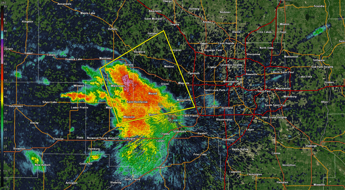
Hail
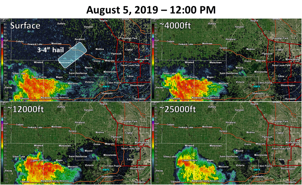
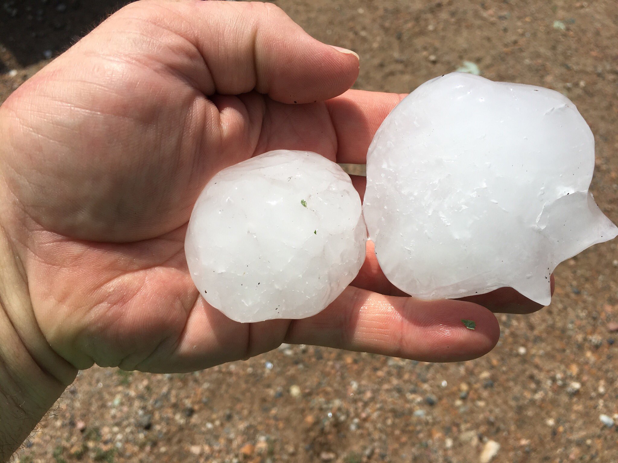
Just after the noon hour on August 5th, a thunderstorm was moving east-northeast into Carver county. As the storm neared Watertown, it rapidly intensified and produced tennis ball size hail in Watertown. The swath of very large hail continued to the northeast into the southwest outskirts of Delano, MN where hail up to 4" was verified. Portions of the northwest and northern Twin Cities metro were not spared either. 2 to 3 inch hail fell from Maple Grove to Forest Lake.
 |
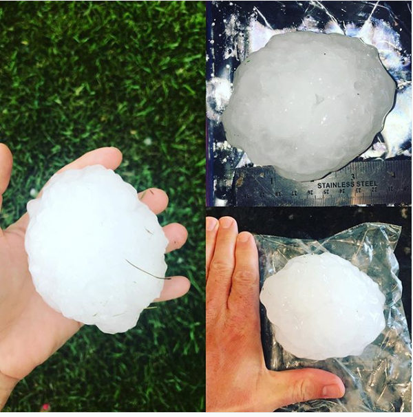 |
| Annotated base reflectivity loop of early afternoon thunderstorm that produced significant hail. | 4 inch hail that fell near Delano, MN |
Wind
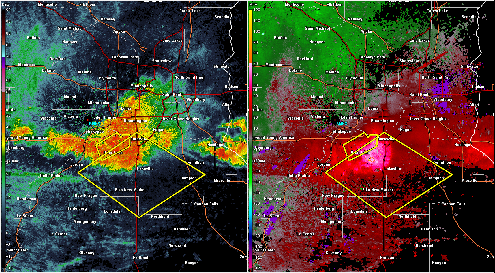
The storm that produced large hail in the northwest metro continued to move northeast, with reports of wind gusts up to 58 mph and tree damage in Blaine. The late afternoon storms caused tree damage around Savage and Burnsville around 5:00pm, and in Cannon Falls around 5:30pm.
 |
 |
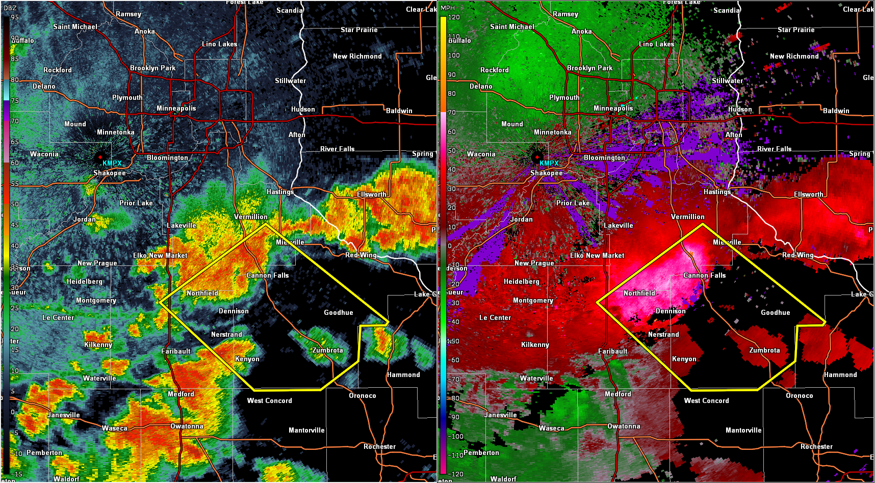 |
| Base reflectivity and velocity at 1:15pm | Base reflectivity and velocity at 4:55pm | Base reflectivity and velocity at 5:29pm |
Photos & Video
 |
 |
 |
 |
| Car damage from very large hail in Delano, MN. (Twitter) | Large hailstones that fell in Watertown, MN. (@cityofwatertown) |
Tennis ball to baseball size hail in Delano, MN. (Aaron Goodyear @acgoodyear) | Tree uprooted from high winds in Savage, MN. (Sam Gullickson @SteadyCamSam) |
Storm Reports

August 5, 2019 storm reports for MPX's forecast area.
Environment
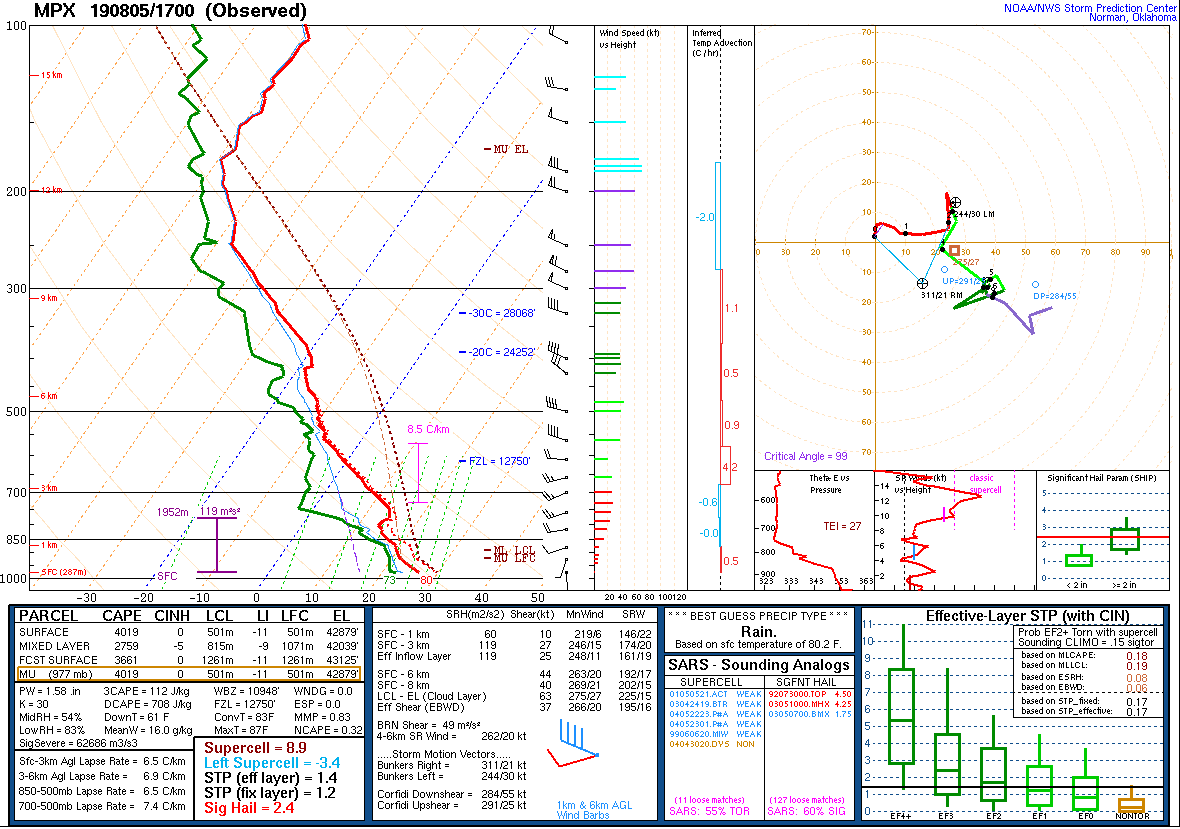
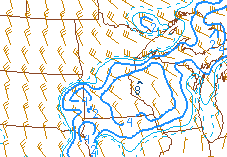
An upper-level trough was moving through the Upper Midwest on August 5, 2019. In the mid to upper-levels of the atmosphere, older air from Canada was brought down into Minnesota. This cold air over the top of warm, moist air at the surface created a very unstable environment. Atmospheric lift occurred ahead of the trough itself allowing for thunderstorms to develop.
.png) |
.png) |
.png) |
| 12pm August 5, 2019 500mb chart | 12pm August 5, 2019 Surface Analysis | 12pm August 5, 2019 Surface-based CAPE (red contours) and CIN (blue shading) |
The atmosphere in the early afternoon of August 5, 2019 was surprisingly unstable and very supportive of rotating thunderstorms (supercells). Cooler temperatures aloft and stronger wind shear allowed for explosive thunderstorm updrafts and a very favorable environment for hail growth.
 |
 |
.png) |
| August 5, 2019 12pm sounding at MPX | Supercell Composite Parameter at 12pm on August 5, 2019 showing favorable environment for supercells. | Significant Hail Parameter at 12pm on August 5, 2019 showing potential for large hail around Twin Cities. |
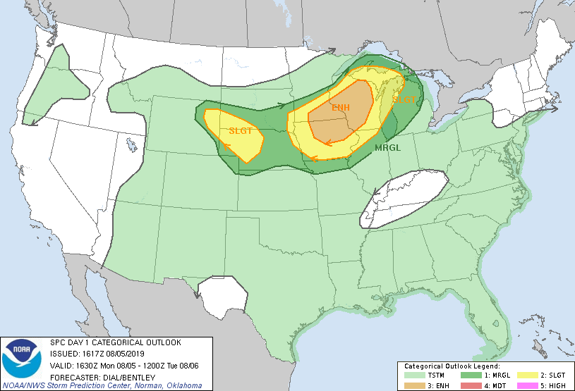
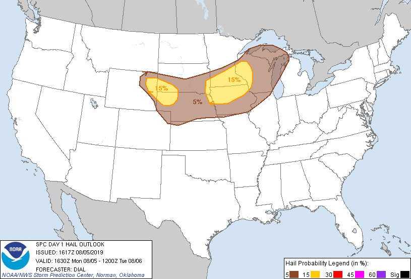
The Storm Prediction Center forecast an Enhanced risk of severe weather over southeast MN. The main severe threat was severe winds but there was a chance of large hail in eastern MN.
 |
 |
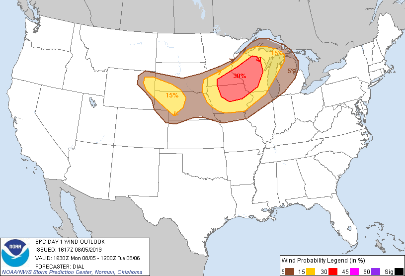 |
| SPC Day 1 Outlook | SPC Hail Outlook | SPC Wind Outlook |
 |
Media use of NWS Web News Stories is encouraged! Please acknowledge the NWS as the source of any news information accessed from this site. |
|