
Catastrophic Super Typhoon Bavi's eyewall has reached Rota and is expected to bring dangerous winds, heavy rainfall and storm surge to Guam, Rota, Tinian and Saipan. A Typhoon Warning remains in effect. Heavy to excessive rainfall will continue to bring a flooding threat from coastal Mid-Atlantic to southern New England through Monday. Read More >
Milwaukee/Sullivan, WI
Weather Forecast Office
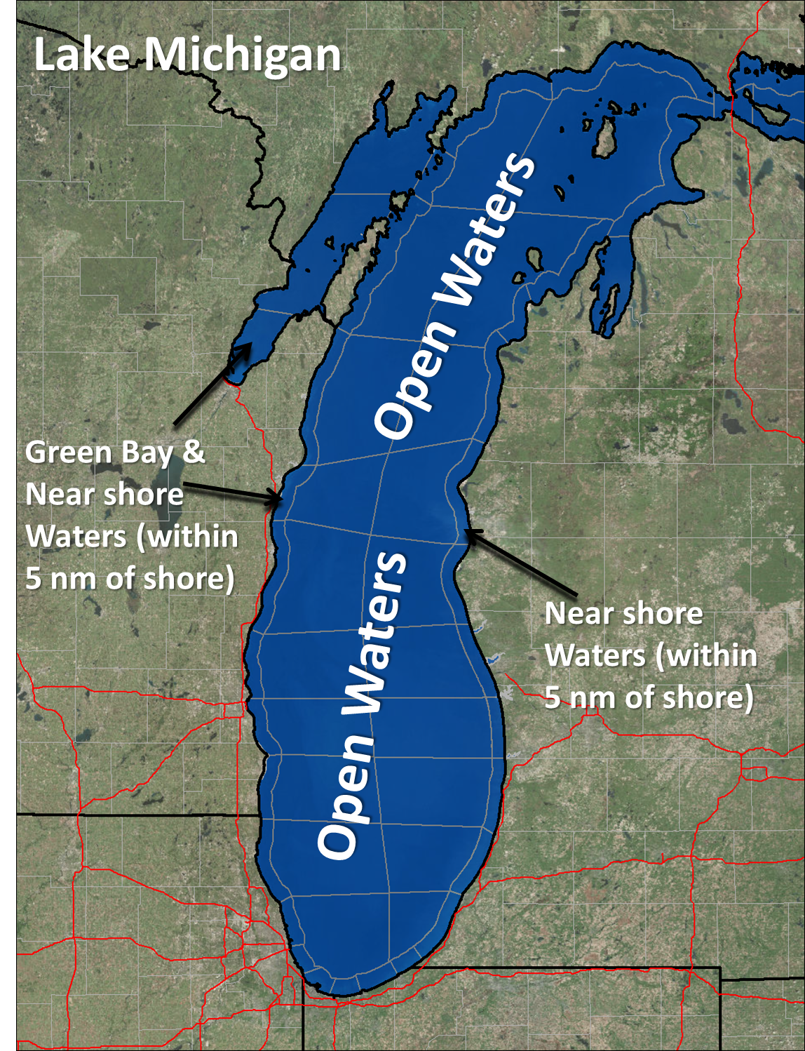
Effective Wednesday, September 19th, 2018, the preparation of the Open Lake Forecast for Lake Michigan will transfer from Weather Forecast Office (WFO) Chicago/Romeoville to WFO Milwaukee/Sullivan. The Open Lake Forecast for Lake Michigan will not change, only the issuing office and the WMO header.
The current identification header for the Open Lake Forecast for Lake Michigan is CHIGLFLM and WMO header FZUS63 KLOT. The new identification header for the Open Lake Forecast for Lake Michigan will be MKEGLFLM and WMO header FZUS63 KMKX.
Along with this change, long-fuse marine watches, warnings and advisories for the Lake Michigan Open Waters will transfer from WFO Chicago/Romeoville to WFO Milwaukee/Sullivan.
Also, the Hazardous Weather Outlook for the open waters zones on Lake Michigan will transfer to WFO Milwaukee/Sullivan. No new products will be created with these changes, but users will need to monitor the Marine Weather Warning and Hazardous Weather Outlook products from WFO Milwaukee/Sullivan to continue receiving forecast information for the Lake Michigan open waters.
The official National Weather Service change notice is located here.
Hazards
National Briefing
Hazardous Weather Outlook
Skywarn
View Local Storm Reports
Submit A Storm Report
Winter Weather
Summer Weather
Beach Hazards
Local Forecasts
Marine
Aviation
Fire
Local Text Products
Local Precip Forecast
Hourly Forecast Graphics
Forecast Discussion
Climate
Historic Events For Srn WI
Lightning Plot Archive
Daily Climate Graphics
Local Climate Products
Normals/Records MKE/MSN
CoCoRaHS
US Dept of Commerce
National Oceanic and Atmospheric Administration
National Weather Service
Milwaukee/Sullivan, WI
N3533 Hardscrabble Road
Dousman, WI 53118
262-965-2074
Comments? Questions? Please Contact Us.

