Heat expands across the Desert Southwest, Plains, Mississippi Valley and Midwest into Monday. Fire weather concerns continue for portions of the Intermountain West. Active monsoonal moisture fuels thunderstorms over the Southwest with possible flash flooding. Tropical cyclone Fausto in the Pacific, should weaken as it approaches Hawaii; Dangerous surf, swells and rip currents are expected. Read More >
|
Damaging Winds and a Couple of Brief Tornadoes Across Southern Wisconsin A cluster of strong thunderstorms evolved into a line as they tracked across southern Wisconsin on Monday, August 10th, 2020. The storms produced damaging winds and a couple of brief tornadoes. The counties hardest hit were right along the WI/IL border: Lafayette, Green, Rock, Walworth, Racine, and Kenosha Counties. These strong thunderstorms evolved from several thunderstorms over southern Minnesota and northern Iowa early on Monday into a widespread, long-lived wind storm, or "Derecho". For more information on Derechoes, check out the Storm Prediction Center Derecho Facts Page.
|
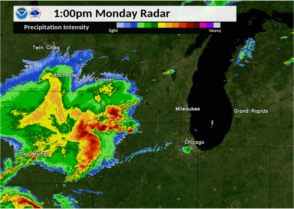 Radar Animation |
Tornadoes:
|
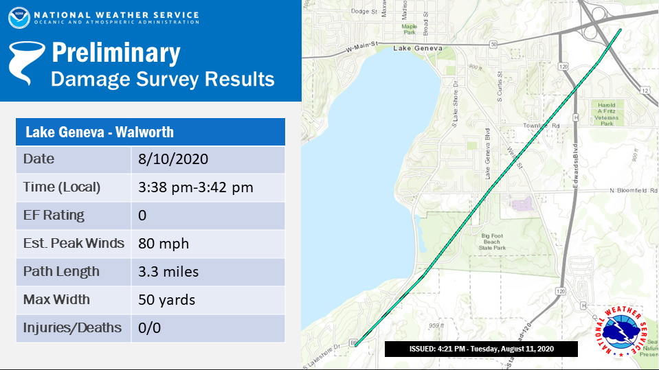
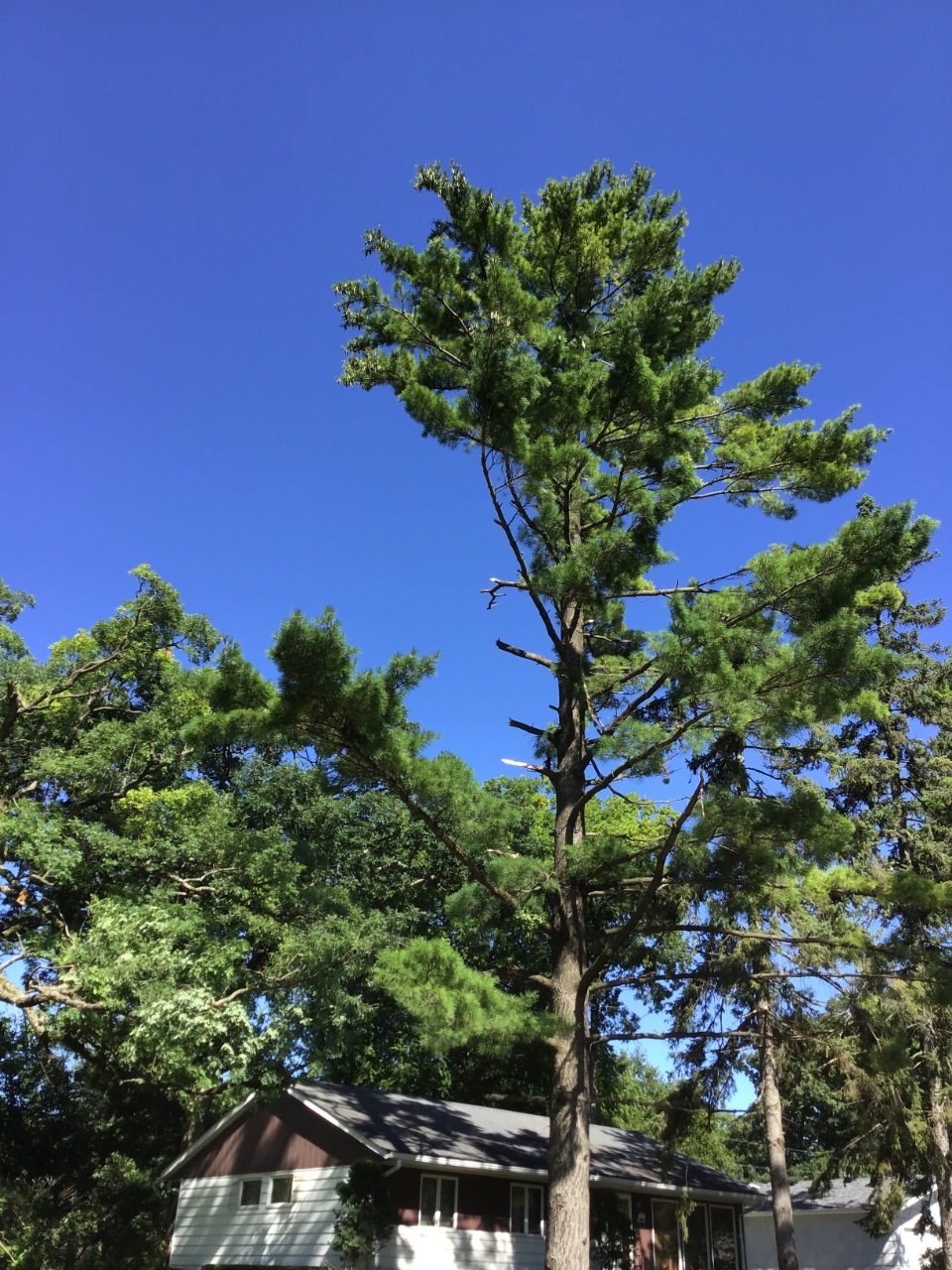
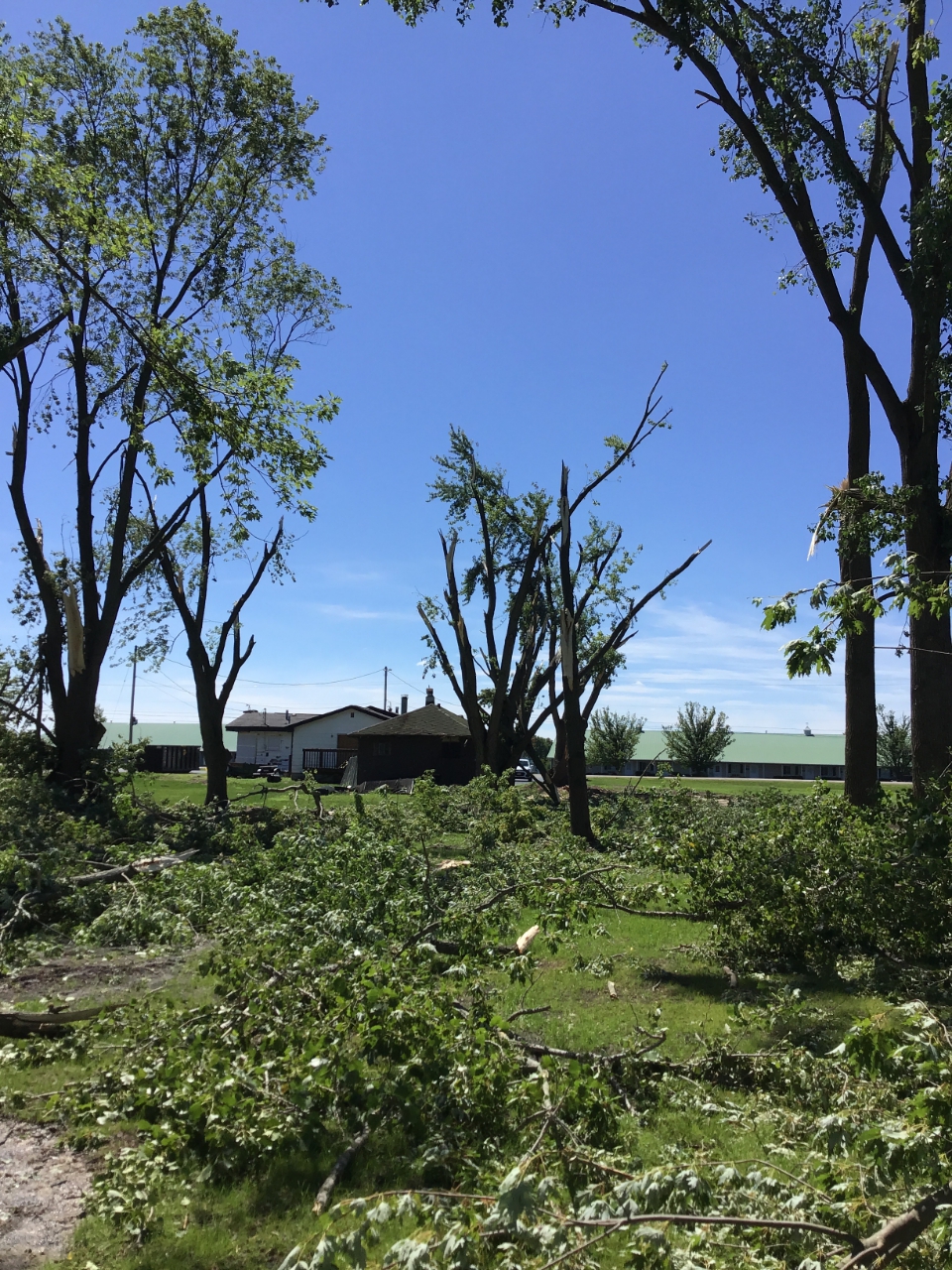
Tornado - 1 S Lake Geneva
|
||||||||||||||||
|
||||||||||||||||
|
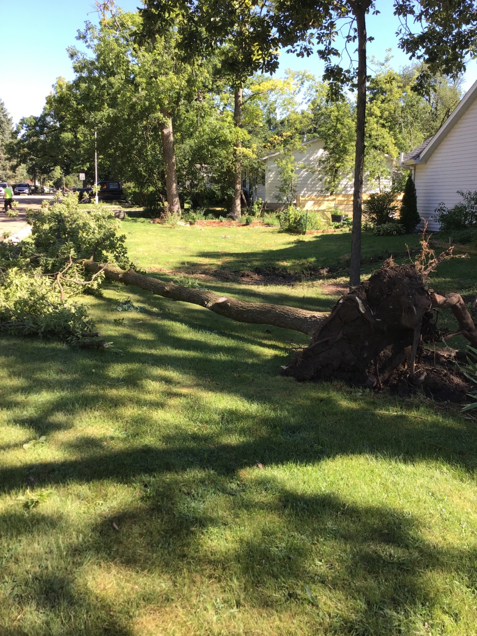
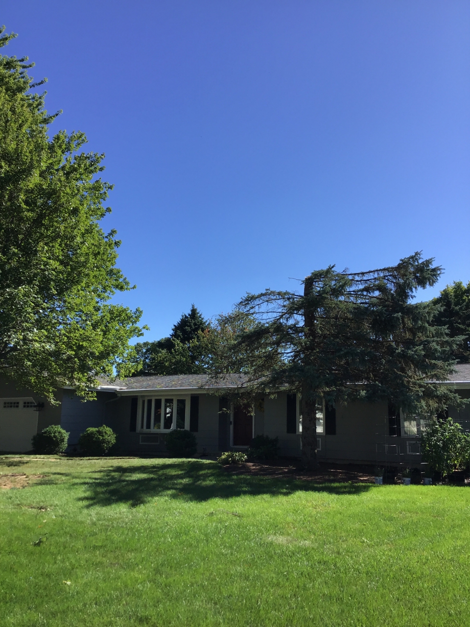
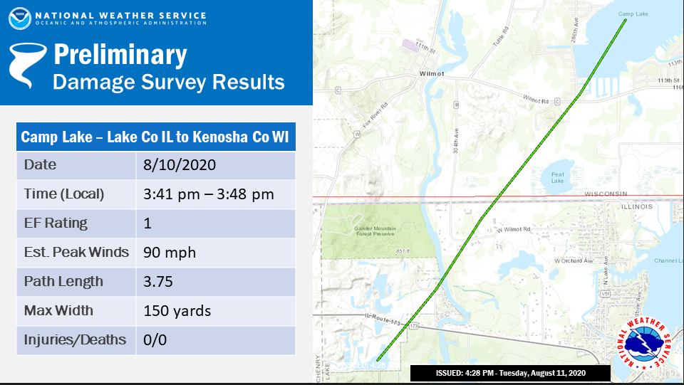
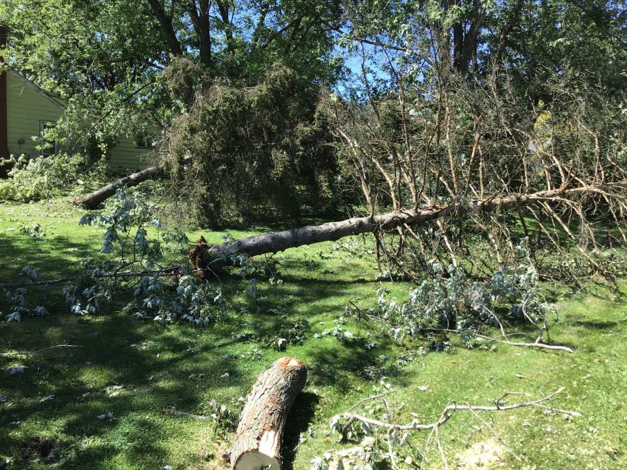
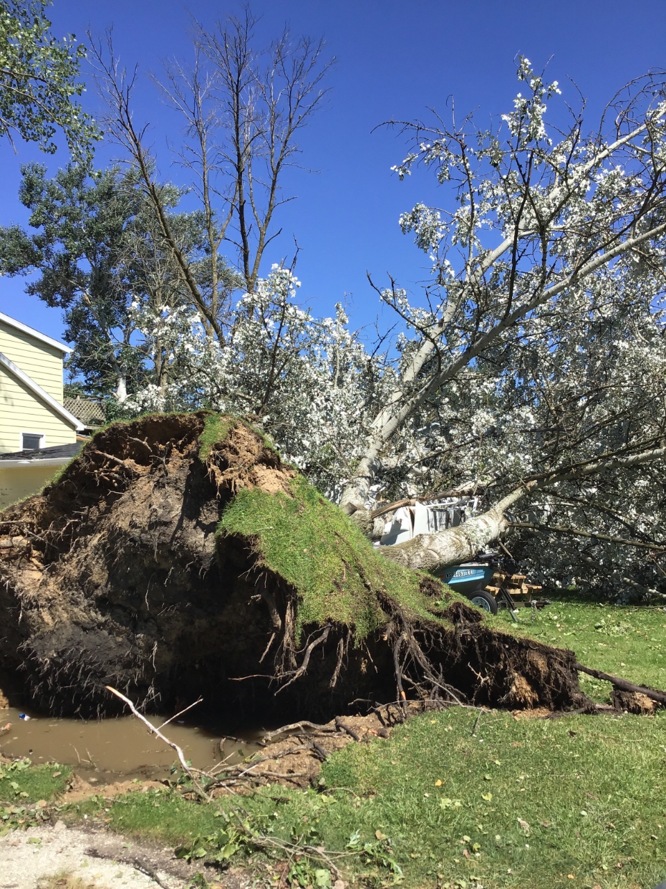
Tornado - 2 SSW Camp Lake
|
||||||||||||||||
|
||||||||||||||||
The Enhanced Fujita (EF) Scale classifies tornadoes into the following categories:
| EF0 Weak 65-85 mph |
EF1 Moderate 86-110 mph |
EF2 Significant 111-135 mph |
EF3 Severe 136-165 mph |
EF4 Extreme 166-200 mph |
EF5 Catastrophic 200+ mph |
 |
|||||
Wind:
Wind
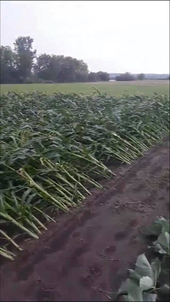
Wind damage was reported in the following areas:
Lafayette County - Belmont, Darlington, Gratiot, South Wayne
Green County - Browntown, Monroe, Juda
Walworth County - Darien, Lake Geneva, Pell Lake
Kenosha County - Camp Lake, Trevor, Paddock Lake, Kenosha
Racine County - Union Grove, Racine.
 |
 |
 |
 |
|
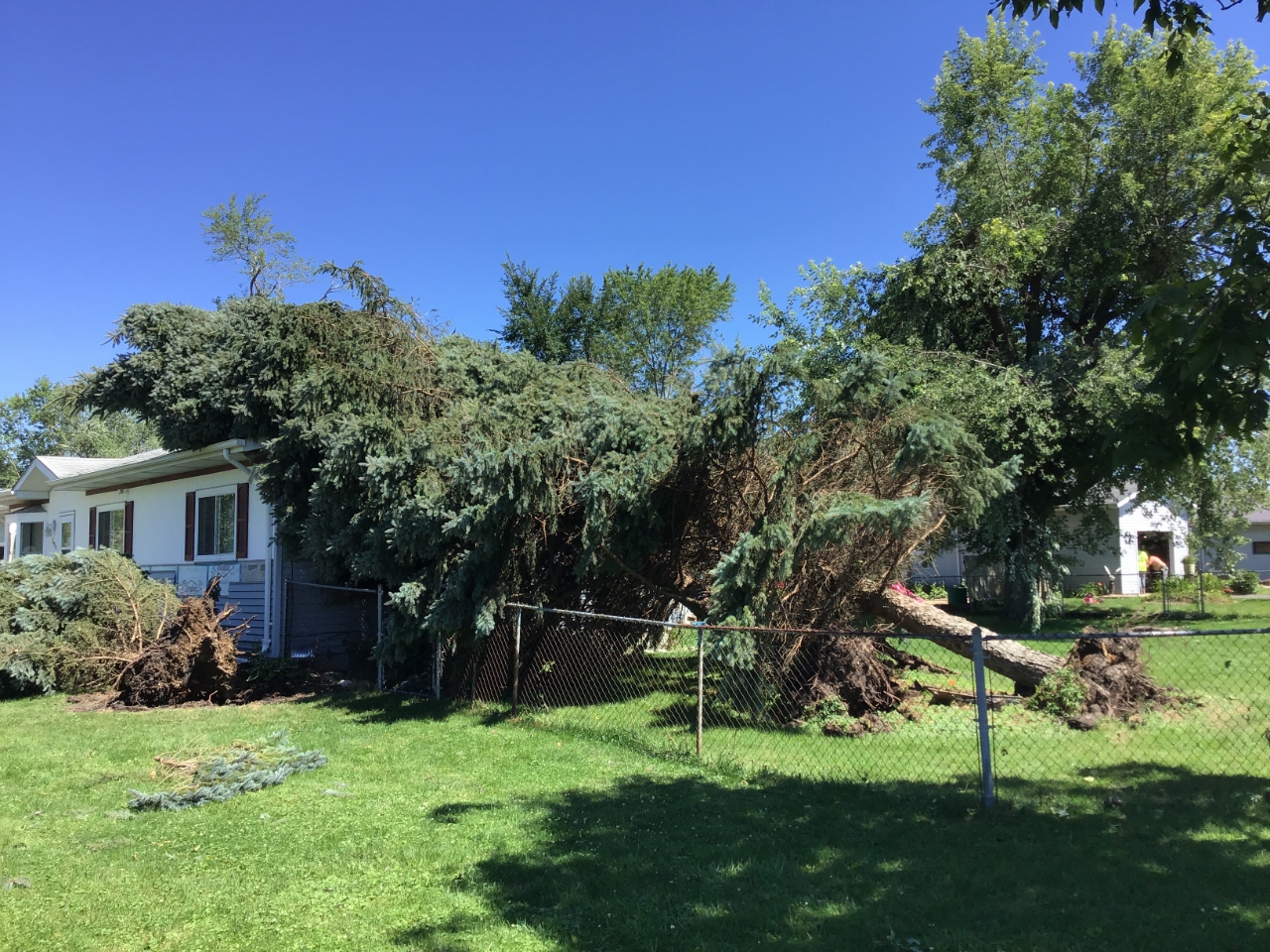
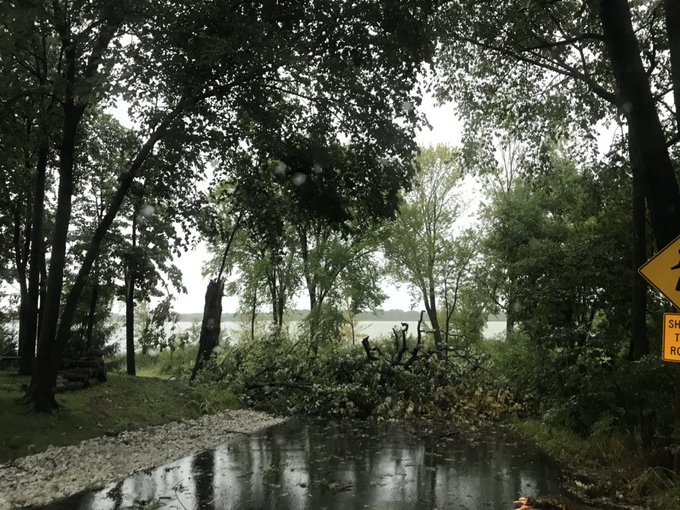
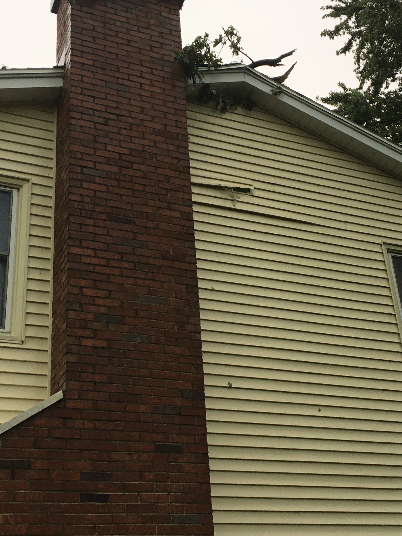
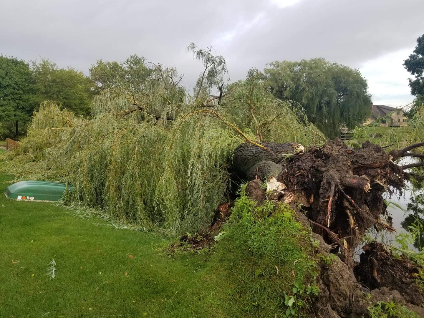
Lake Geneva (Courtesy Ryan T) |
Camp Lake (Courtesy Spencer D) |
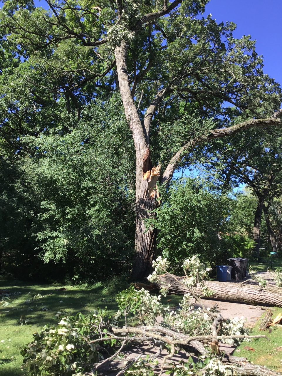
Mt. Pleasant (Courtesy Andrew M) |
Mt. Pleasant (Courtesy Andrew M) |
 |
 |
 |
 |
|
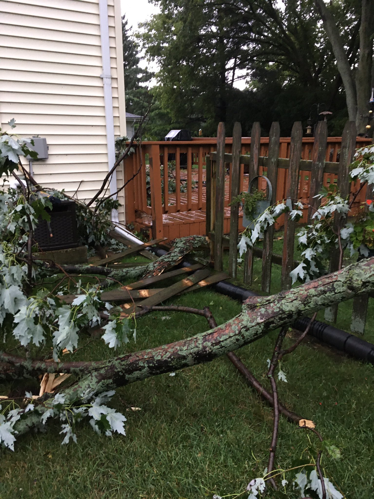
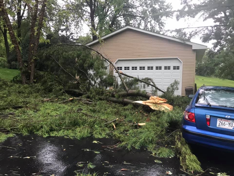
Pell Lake (Courtesy David S) |
Racine (Courtesy Susan F) |
Salem (Courtesy Sally G) |
Troy (Courtesy Melissa E) |
Hail
There was no significant hail reported with this event.
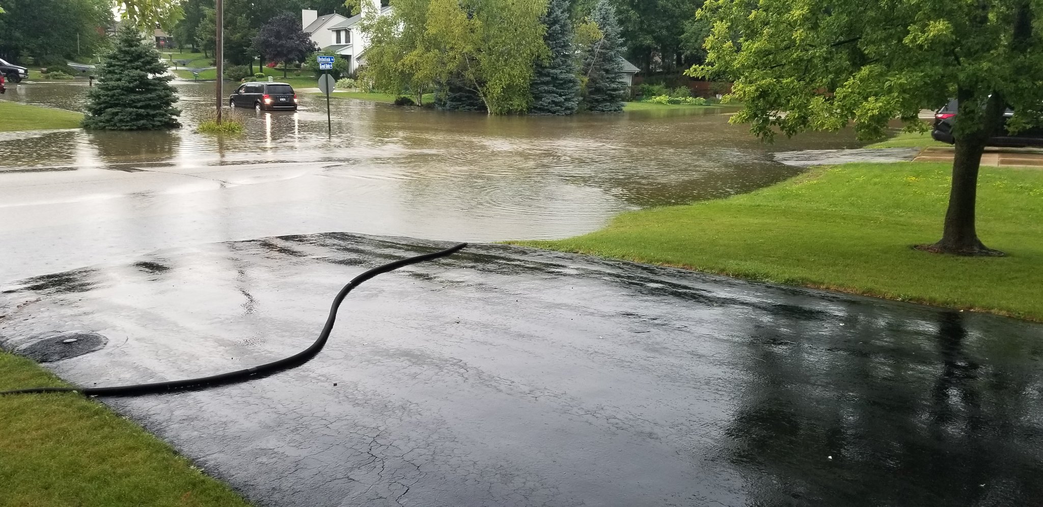
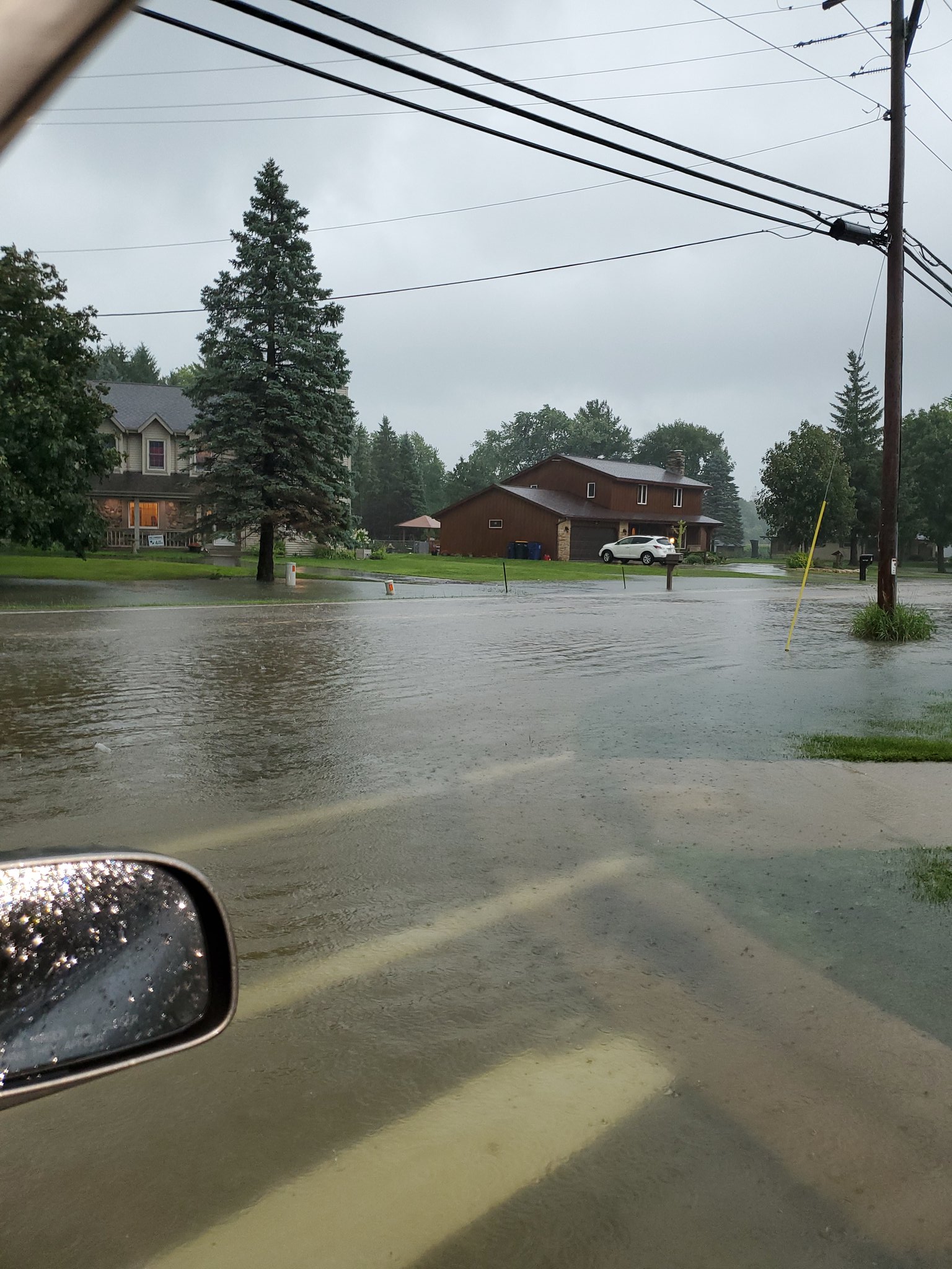
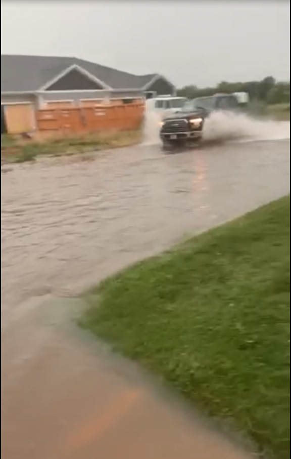
Heavy Rainfall:
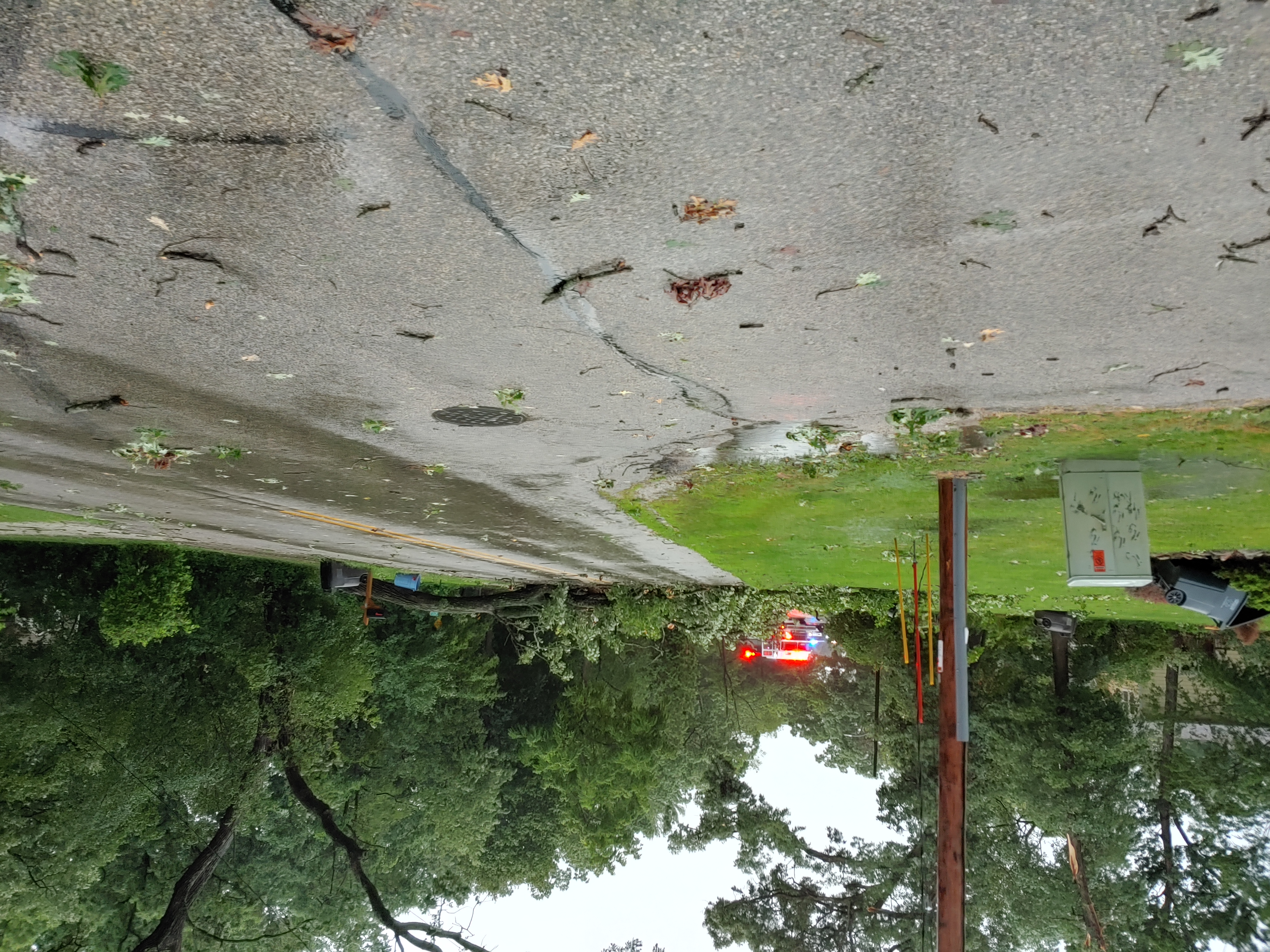
Heavy rain caused street flooding in portions of southern Wisconsin. Janesville, Elkhorn, and the greater Racine area all reported some flooding.
 |
 |
|
Caledonia
|
Oak Creek (Courtesy of Matt K) |
 |
|
|
Elkhorn (Courtesy of April W) |
Caledonia |
Storm Reports
PRELIMINARY LOCAL STORM REPORT
NATIONAL WEATHER SERVICE MILWAUKEE/SULLIVAN WI
241 PM CDT TUE AUG 11 2020

..TIME...   ...EVENT...      ...CITY LOCATION...     ...LAT.LON...
..DATE...   ....MAG....      ..COUNTY LOCATION..ST.. ...SOURCE....
            ..REMARKS..

0345 PM     TORNADO          2 SSW CAMP LAKE         42.50N 88.16W
08/10/2020                   KENOSHA            WI   NWS STORM SURVEY

            DAMAGE TO BUILDINGS AND TREES CONSISTENT
            WITH A LOW END EF-1 TORNADO OCCURRED IN
            NORTHERN ILLINOIS JUST SOUTH OF THE
            WISCONSIN STATE LINE. THIS TORNADO PROCEEDED
            NE INTO WISCONSIN TOWARDS CAMP LAKE WHERE
            MAINLY TREE DAMAGE WAS OBSERVED THAT IS
            CONSISTENT WITH AN EF-0 TORNADO AND WINDS OF
            80 MPH. THE POINT IS PLACED BETWEEN THE TWO
            CENTERS OF DAMAGE.
PRELIMINARY LOCAL STORM REPORT
NATIONAL WEATHER SERVICE MILWAUKEE/SULLIVAN WI
1030 AM CDT TUE AUG 11 2020

..TIME...   ...EVENT...      ...CITY LOCATION...     ...LAT.LON...
..DATE...   ....MAG....      ..COUNTY LOCATION..ST.. ...SOURCE....
            ..REMARKS..

0338 PM     TORNADO          1 S LAKE GENEVA         42.58N 88.43W
08/10/2020                   WALWORTH           WI   NWS STORM SURVEY

            STORM SURVEY CREW FOUND DAMAGE CONSISTENT
            WITH A HIGH END EF-0 IN LAKE GENEVA. WINDS
            UPWARDS OF 80 MPH OCCURRED AND MUCH OF THE
            DAMAGE WAS TO TREES. LARGE LIMBS AND TREE
            TRUNKS KNOCKED DOWN OR SNAPPED. TIME IS
            ESTIMATED OFF OF RADAR.
PRELIMINARY LOCAL STORM REPORT...SUMMARY
NATIONAL WEATHER SERVICE MILWAUKEE/SULLIVAN WI
922 PM CDT MON AUG 10 2020
..TIME... ...EVENT... ...CITY LOCATION... ...LAT.LON...
..DATE... ....MAG.... ..COUNTY LOCATION..ST.. ...SOURCE....
..REMARKS..
0225 PM TSTM WND GST 3 ENE MONROE 42.62N 89.59W
08/10/2020 M62 MPH GREEN WI MESONET
0220 PM TSTM WND DMG MONROE 42.60N 89.64W
08/10/2020 GREEN WI PUBLIC
SOCIAL MEDIA REPORT OF A DOWNED TREE IN
MONROE, WI. TIME ESTIMATED BASED ON RADAR.
0455 PM HEAVY RAIN KENOSHA 42.59N 87.82W
08/10/2020 E2.55 INCH KENOSHA WI PUBLIC
RAINFALL AS 4:55 PM.
0409 PM TSTM WND GST POWERS LAKE 42.54N 88.30W
08/10/2020 E60 MPH KENOSHA WI PUBLIC
0407 PM TSTM WND DMG 1 WNW KENOSHA 42.59N 87.83W
08/10/2020 KENOSHA WI PUBLIC
LARGE TREE BRANCHES DOWN IN THE CITY OF
KENOSHA. REPORT RELAYED VIA SOCIAL MEDIA.
0355 PM TSTM WND GST PADDOCK LAKE 42.58N 88.11W
08/10/2020 E70 MPH KENOSHA WI PUBLIC
0352 PM TSTM WND DMG 1 E POWERS LAKE 42.54N 88.28W
08/10/2020 KENOSHA WI PUBLIC
TREES DOWN AROUND THE INTERSECTION OF HWY Z
AND HWY P IN POWERS LAKE.
0347 PM TSTM WND DMG 1 SE CAMP LAKE 42.52N 88.14W
08/10/2020 KENOSHA WI PUBLIC
TREE SNAPPED AT LOCATION. REPORT RELAYED VIA
SOCIAL MEDIA. TIME ESTIMATED FROM RADAR.
0345 PM FLOOD 2 SSW CAMP LAKE 42.51N 88.16W
08/10/2020 KENOSHA WI PUBLIC
NUMEROUS TREES DOWN AND SNAPPED AT WILMOT
AND 286TH. REPORT RELAYED VIA SOCIAL MEDIA.
TIME ESTIMATED FROM RADAR.
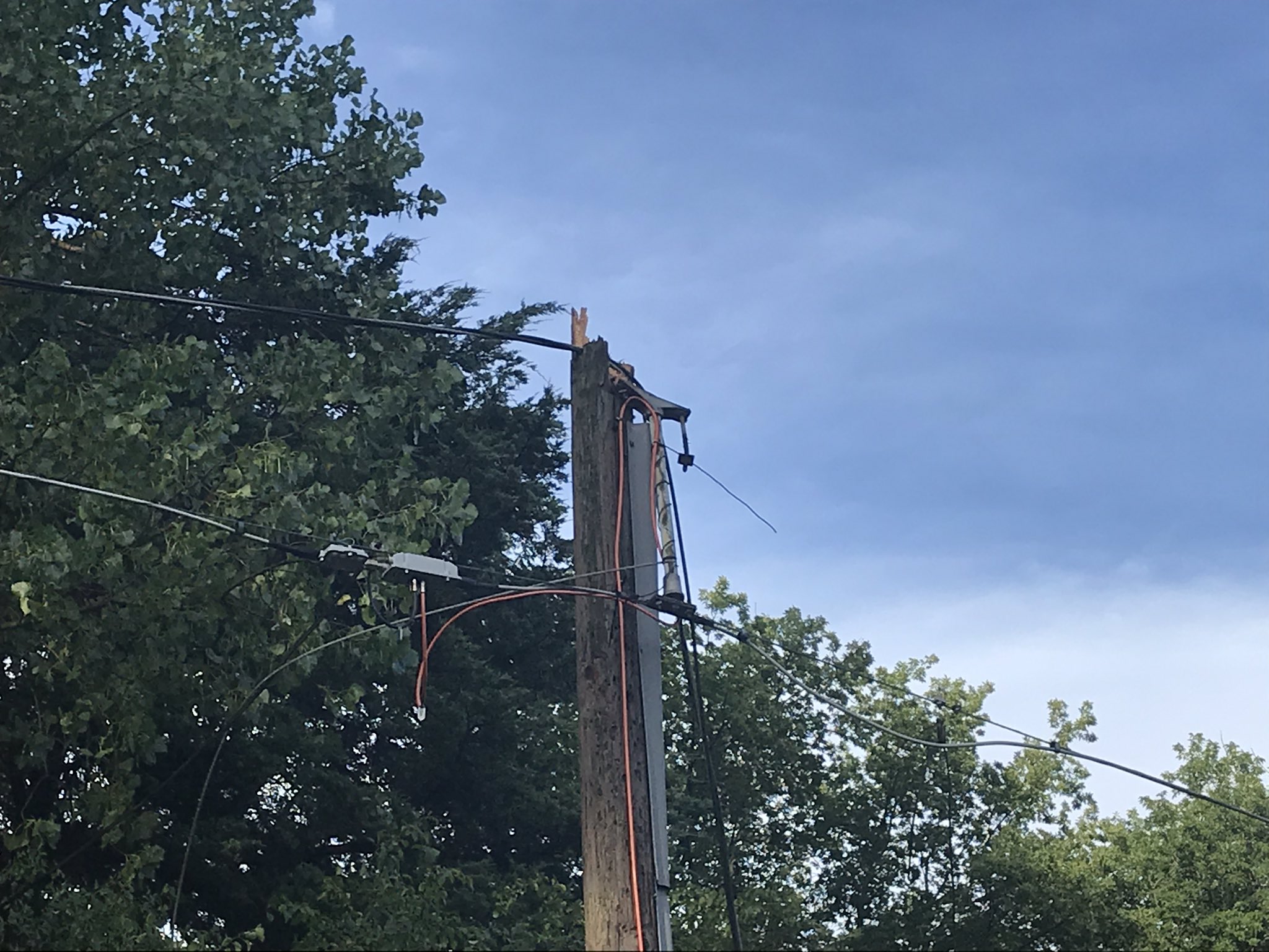
0129 PM TSTM WND DMG DARLINGTON 42.68N 90.12W
08/10/2020 LAFAYETTE WI PUBLIC
MULTIPLE REPORTS OF DOWNED POWERLINES, TREE
BRANCHES, AND A BLOWN TRANSFORMER AROUND
ALICE ST. AND GALENA ST. ON THE SOUTH SIDE
OF DARLINGTON. TIME ESTIMATED BASED ON
RADAR.
0109 PM TSTM WND DMG 2 W BELMONT 42.74N 90.38W
08/10/2020 LAFAYETTE WI PUBLIC
MULTIPLE REPORTS OF A SEMI TRUCK TIPPED OVER
ON HWY 151 BETWEEN BELMONT AND PLATTEVILLE.
TIME ESTIMATED BASED ON RADAR.
0525 PM FLOOD 2 S OAK CREEK 42.85N 87.89W
08/10/2020 MILWAUKEE WI TRAINED SPOTTER
WATER OVER THE ROAD AT THE INTERSECTION OF
ELM RD & NICHOLSON RD. IN OAK CREEK.
0513 PM FLOOD 2 ESE OAK CREEK 42.87N 87.86W
08/10/2020 MILWAUKEE WI PUBLIC
WATER ACROSS ROADWAY. REPORT RELAYED VIA
SOCIAL MEDIA.
0532 PM HEAVY RAIN 1 NNW RACINE 42.75N 87.79W
08/10/2020 M3.00 INCH RACINE WI COCORAHS
3 INCHES OF RAIN IN JUST UNDER AN HOUR WITH
STREET FLOODING.
0507 PM FLOOD 2 W FRANKSVILLE 42.76N 87.95W
08/10/2020 RACINE WI PUBLIC
WATER OVER ROADWAY ON GOLF RD.
0507 PM FLOOD 1 E FRANKSVILLE 42.76N 87.89W
08/10/2020 RACINE WI PUBLIC
CORRECTS PREVIOUS FLASH FLOOD REPORT FROM 1
E FRANKSVILLE. FLOODING ON NORTHWESTERN AVE
IN RACINE CTY.
0501 PM FLOOD 4 W FRANKSVILLE 42.76N 87.98W
08/10/2020 RACINE WI PUBLIC
FLOODING OVER ROADWAY REPORTED AT 51ST ST
AND 2 MILE ROAD IN RACINE CTY.
0500 PM TSTM WND DMG 1 N ELMWOOD PARK 42.71N 87.82W
08/10/2020 RACINE WI PUBLIC
TREE REPORTED DOWN AT LOCATION.
0455 PM TSTM WND DMG RACINE 42.73N 87.78W
08/10/2020 RACINE WI PUBLIC
REPORT RELAYED VIA SOCIAL MEDIA OF DOWNED
TREE LIMBS CAUSED BY ESTIMATED 60 MPH GUSTS.
0455 PM TSTM WND DMG 2 NNW ELMWOOD PARK 42.72N 87.84W
08/10/2020 RACINE WI TRAINED SPOTTER
LARGE TREE LIMBS DOWN AT LOCATION.
0448 PM FLOOD WATERFORD 42.76N 88.22W
08/10/2020 RACINE WI PUBLIC
FLOODING OVER INTERSECTION OF JEFFERSON ST.
AND WASHINGTON ST. IN WATERFORD.
0421 PM TSTM WND DMG NORTH BAY 42.76N 87.78W
08/10/2020 RACINE WI PUBLIC
LARGE BRANCHES DOWN. REPORT RELAYED VIA
SOCIAL MEDIA. TIME ESTIMATED FROM RADAR.
0415 PM TSTM WND DMG ELMWOOD PARK 42.69N 87.83W
08/10/2020 RACINE WI PUBLIC
LARGE TREE LIMBS DOWN AT LOCATION.
0413 PM TSTM WND DMG 2 WNW ELMWOOD PARK 42.70N 87.86W
08/10/2020 RACINE WI PUBLIC
LARGE LIMBS DOWN AND DAMAGE TO SIDING.
REPORT RELAYED VIA SOCIAL MEDIA. TIME
ESTIMATED FROM RADAR.
0413 PM TSTM WND DMG 1 SSW ELMWOOD PARK 42.68N 87.83W
08/10/2020 RACINE WI PUBLIC
TWO MATURE PINE TREES DOWN AROUND LATHROP
AVE AND FOXWOOD RD IN MT. PLEASANT. TIME
ESTIMATED BY RADAR.
0410 PM TSTM WND DMG UNION GROVE 42.68N 88.05W
08/10/2020 RACINE WI LAW ENFORCEMENT
SEVERAL REPORTS OF TREE DOWN IN UNION GROVE.
TIME ESTIMATED BY RADAR.
0230 PM TSTM WND DMG 4 W AVALON 42.63N 88.95W
08/10/2020 ROCK WI PUBLIC
TREE DOWN ACROSS ROAD AT LOCATION. REPORT
RELAYED VIA PICTURE ON SOCIAL MEDIA. TIME
ESTIMATED FROM RADAR.
0520 PM FLOOD 1 NNE ELKHORN 42.68N 88.54W
08/10/2020 WALWORTH WI PUBLIC
STREET FLOODING ON 1ST AVE IN ELKHORN. VIDEO
AND REPORT RELAYED VIA BROADCAST MEDIA.
0449 PM HEAVY RAIN 1 N ELKHORN 42.69N 88.54W
08/10/2020 M3.90 INCH WALWORTH WI PUBLIC
3.9 RAINFALL MEASURED AS OF 4:49PM.
ROADWAY FLOODING JUST WEST OF INTERSECTION
OF HWY 67 AND HIDDEN TRAIL RD.
0400 PM TSTM WND DMG ELKHORN 42.67N 88.54W
08/10/2020 WALWORTH WI 911 CALL CENTER
NUMEROUS REPORTS OF TREES, TREE LIMBS, AND
POWERLINES DOWN ACROSS WALWORTH COUNTY.
0355 PM TSTM WND DMG PELL LAKE 42.54N 88.35W
08/10/2020 WALWORTH WI TRAINED SPOTTER
REPORTS RELAYED VIA SOCIAL MEDIA OF
POWERLINES AND LARGE TREE BRANCHES DOWN WITH
ESTIMATED 70 MPH WINDS. TIME ESTIMATED BASED
ON RADAR.
0338 PM TSTM WND DMG 1 SSE LAKE GENEVA 42.57N 88.43W
08/10/2020 WALWORTH WI PUBLIC
MULTIPLE TREES DOWN ON LAKE GENEVA BLVD AND
WEST SOUTH STREET. REPORT PASSED ALONG BY
BROADCAST MEDIA. TIME ESTIMATED FROM RADAR.
0338 PM TSTM WND DMG LAKE GENEVA 42.59N 88.43W
08/10/2020 WALWORTH WI 911 CALL CENTER
MULTIPLE REPORTS OF TREES AND TREE LIMBS
DOWN IN THE CITY OF LAKE GENEVA. TIME
ESTIMATED BASED ON RADAR.
 |
Media use of NWS Web News Stories is encouraged! Please acknowledge the NWS as the source of any news information accessed from this site. |
|