
Tropical Depression Two is expected to gradually strengthen and could bring tropical storm conditions to the Florida Panhandle beginning late Monday. Areas of flash flooding will be possible through Thursday along the eastern and central Gulf Coast. Severe thunderstorms will develop and move along a cold front crossing the Upper Midwest Monday, and through the Ohio Valley/Mid-Atlantic on Tuesday. Read More >
Milwaukee/Sullivan, WI
Weather Forecast Office
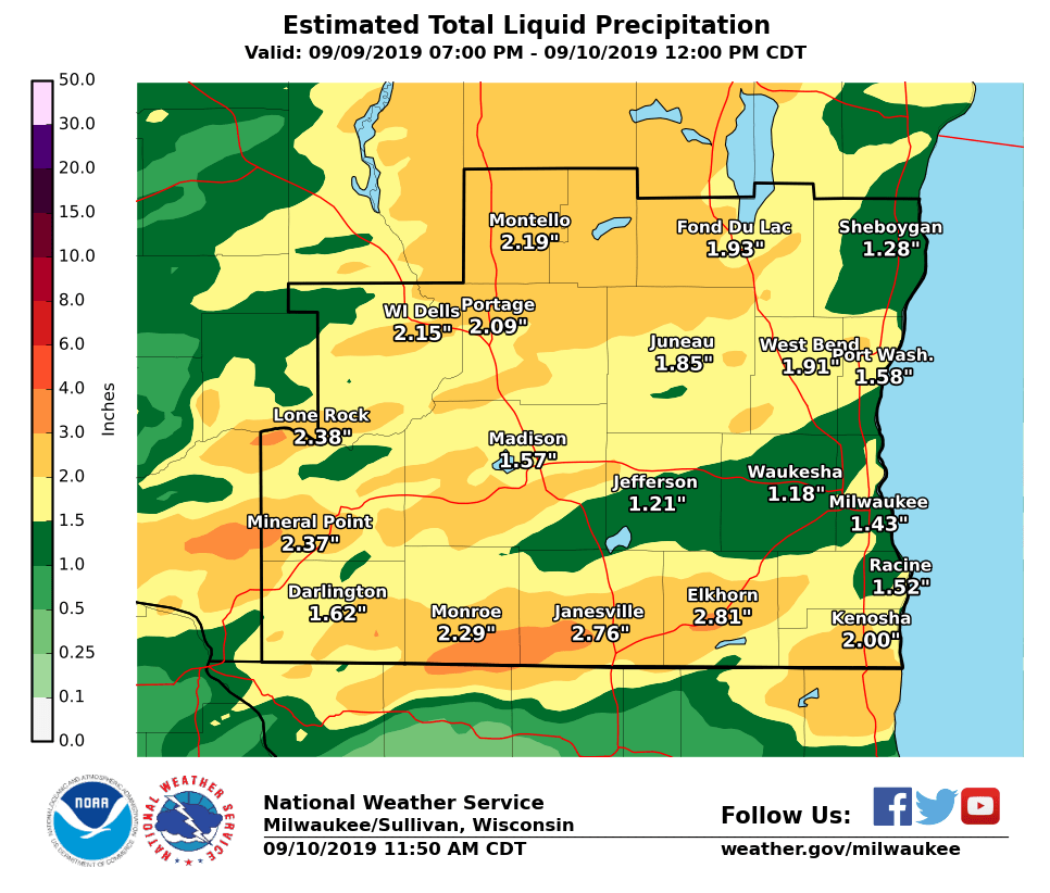
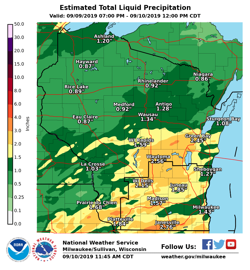
Showers and Thunderstorms moved through southern Wisconsin Monday night. Rainfall totals ranged from around an inch and a half in the Milwaukee area to over two inches toward southwest Wisconsin. Northern Wisconsin rainfall totals ranged from a half an inch to over an inch. Here is the estimate of the total liquid rainfall for our first round of showers based observations and background model data.
NWS Milwaukee/Sullivan
Patterson
Hazards
National Briefing
Hazardous Weather Outlook
Skywarn
View Local Storm Reports
Submit A Storm Report
Winter Weather
Summer Weather
Beach Hazards
Local Forecasts
Marine
Aviation
Fire
Local Text Products
Local Precip Forecast
Hourly Forecast Graphics
Forecast Discussion
Climate
Daily Climate Graphics
Local Climate Products
Normals/Records MKE/MSN
CoCoRaHS
Historic Events For Srn WI
Lightning Plot Archive
US Dept of Commerce
National Oceanic and Atmospheric Administration
National Weather Service
Milwaukee/Sullivan, WI
N3533 Hardscrabble Road
Dousman, WI 53118
262-965-2074
Comments? Questions? Please Contact Us.

